Embed Size (px)
Citation preview

Electric DistributionHighly accurate 3D positioning of
points, lines, areas and multi-feature
logging for electric utilities.
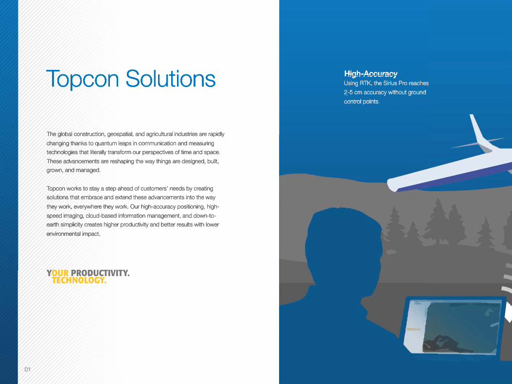
Topcon Solutions High-AccuracyUsing RTK, the Sirius Pro reaches
2-5 cm accuracy without ground
control points.
The global construction, geospatial, and agricultural industries are rapidly
changing thanks to quantum leaps in communication and measuring
technologies that literally transform our perspectives of time and space.
These advancements are reshaping the way things are designed, built,
grown, and managed.
Topcon works to stay a step ahead of customers’ needs by creating
solutions that embrace and extend these advancements into the way
they work, everywhere they work. Our high-accuracy positioning, high-
speed imaging, cloud-based information management, and down-to-
earth simplicity creates higher productivity and better results with lower
environmental impact.
Electric DistributionHighly accurate 3D positioning of
points, lines, areas and multi-feature
logging for electric utilities.
High-AccuracyElectric Distribution
High-AccuracyElectric Distribution
Using RTK, the Sirius Pro reaches Electric Distribution
Using RTK, the Sirius Pro reaches Electric DistributionHighly accurate 3D positioning of
Using RTK, the Sirius Pro reaches Highly accurate 3D positioning of
2-5 cm accuracy without ground Highly accurate 3D positioning of
2-5 cm accuracy without ground Highly accurate 3D positioning of
points, lines, areas and multi-feature 2-5 cm accuracy without ground
points, lines, areas and multi-feature control points.
points, lines, areas and multi-feature control points.
points, lines, areas and multi-feature
logging for electric utilities.control points.
logging for electric utilities.
Topcon Solutions
The global construction, geospatial, and agricultural industries are rapidly
changing thanks to quantum leaps in communication and measuring
technologies that literally transform our perspectives of time and space.
These advancements are reshaping the way things are designed, built,
grown, and managed.
Topcon works to stay a step ahead of customers’ needs by creating
solutions that embrace and extend these advancements into the way
they work, everywhere they work. Our high-accuracy positioning, high-
speed imaging, cloud-based information management, and down-to-
earth simplicity creates higher productivity and better results with lower
environmental impact.
01
UtilitiesExisting, planned and placed —
always connected to the GIS
database for accurate installation and
maintenance.
Environmental and Natural ResourcesReal-time data for up-to-the-minute en-
vironmental mapping: trees, trails, lakes,
streams, flora and fauna, wildlife, and agri-
culture applications.
Asset ManagementPlanning and managing both rural and
urban assets and infrastructure using an up-
to-date, accurate GIS database.
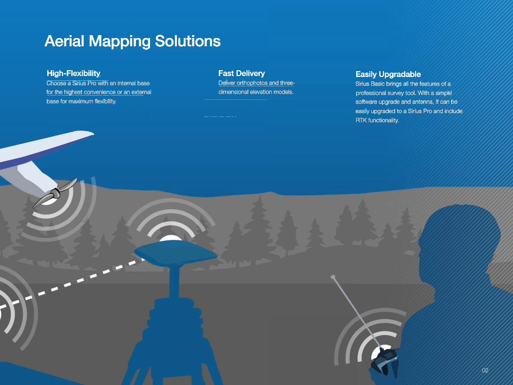
Fast DeliveryDeliver orthophotos and three-
dimensional elevation models.
High-FlexibilityChoose a Sirius Pro with an internal base
for the highest convenience or an external
base for maximum flexibility.
Easily UpgradableSirius Basic brings all the features of a
professional survey tool. With a simple
software upgrade and antenna, it can be
easily upgraded to a Sirius Pro and include
RTK functionality.
Aerial Mapping Solutions
UtilitiesExisting, planned and placed —
always connected to the GIS
database for accurate installation and
maintenance.
Environmental and Natural ResourcesReal-time data for up-to-the-minute en-
vironmental mapping: trees, trails, lakes,
streams, flora and fauna, wildlife, and agri-
culture applications.
Asset ManagementPlanning and managing both rural and
urban assets and infrastructure using an up-
to-date, accurate GIS database.
Fast DeliveryUtilitiesFast DeliveryUtilitiesDeliver orthophotos and three-
Existing, planned and placed — Deliver orthophotos and three-
Existing, planned and placed — dimensional elevation models.
Existing, planned and placed — dimensional elevation models.
Existing, planned and placed —
High-FlexibilityEnvironmental and High-FlexibilityEnvironmental and Choose a Sirius Pro with an internal base Natural ResourcesChoose a Sirius Pro with an internal base Natural Resourcesfor the highest convenience or an external Real-time data for up-to-the-minute enfor the highest convenience or an external Real-time data for up-to-the-minute enbase for maximum flexibility.Real-time data for up-to-the-minute enbase for maximum flexibility.Real-time data for up-to-the-minute en
vironmental mapping: trees, trails, lakes, base for maximum flexibility.vironmental mapping: trees, trails, lakes,
Easily UpgradableAsset ManagementEasily UpgradableAsset ManagementSirius Basic brings all the features of a Asset ManagementSirius Basic brings all the features of a Asset ManagementPlanning and managing both rural and Sirius Basic brings all the features of a Planning and managing both rural and professional survey tool. With a simple Planning and managing both rural and professional survey tool. With a simple Planning and managing both rural and
urban assets and infrastructure using an up-professional survey tool. With a simple urban assets and infrastructure using an up-software upgrade and antenna, it can be urban assets and infrastructure using an up-software upgrade and antenna, it can be urban assets and infrastructure using an up-
to-date, accurate GIS database.software upgrade and antenna, it can be to-date, accurate GIS database.easily upgraded to a Sirius Pro and include to-date, accurate GIS database.easily upgraded to a Sirius Pro and include to-date, accurate GIS database.
RTK functionality.
Aerial Mapping Solutions
02

Aerial Mapping SolutionsAerial Mapping SolutionsThe Sirius Pro delivers highly accurate aerial mapping results using GNSS-RTK. Achieving
2-5 cm accuracy without ground control points (GCP) means an increase in productivity
when compared to other solutions.
In the traditional approach, placing and measuring GCPs can account for more than
50% of the whole project time. Without enough GCPs it was hard to match the accuracy
requirements set by your customer – rendering projects uneconomical.
Instead of GCPs, Sirius Pro uses GNSS RTK in combination with precision timing
technology to determine the exact location for each of the positions at which a photo is
taken. This precise positioning technology allows the image locations to be used as the
equivalent of GCPs.
The Sirius Basic brings all advantages of the Sirius Pro, except for GNSS-RTK. A simple
upgrade is possible as soon as your business requires the increased accuracy or
productivity of the PRO.
03
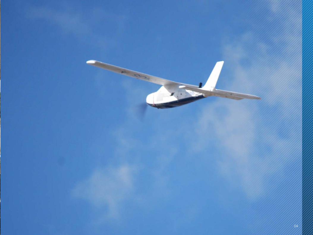
04

05
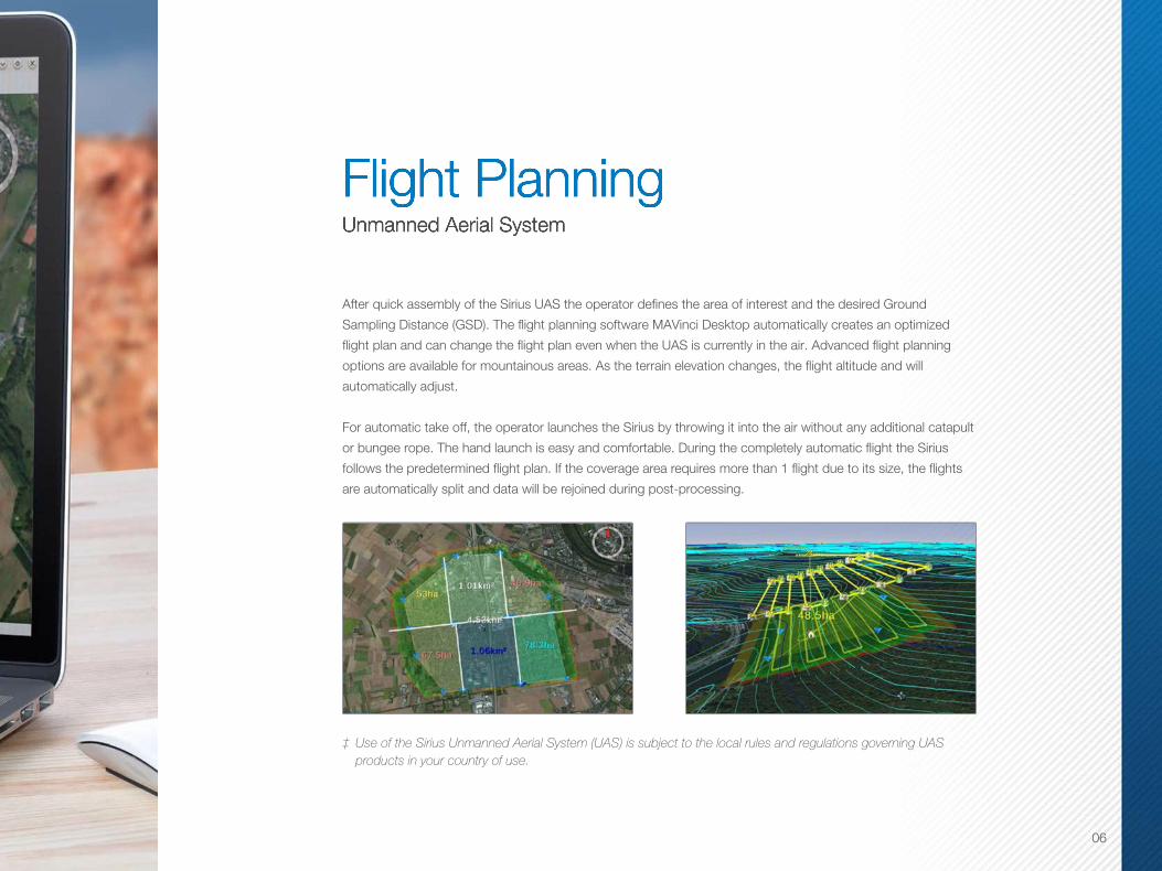
Flight PlanningUnmanned Aerial System
Flight PlanningUnmanned Aerial System
After quick assembly of the Sirius UAS the operator defines the area of interest and the desired Ground
Sampling Distance (GSD). The flight planning software MAVinci Desktop automatically creates an optimized
flight plan and can change the flight plan even when the UAS is currently in the air. Advanced flight planning
options are available for mountainous areas. As the terrain elevation changes, the flight altitude and will
automatically adjust.
For automatic take off, the operator launches the Sirius by throwing it into the air without any additional catapult
or bungee rope. The hand launch is easy and comfortable. During the completely automatic flight the Sirius
follows the predetermined flight plan. If the coverage area requires more than 1 flight due to its size, the flights
are automatically split and data will be rejoined during post-processing.
‡ Use of the Sirius Unmanned Aerial System (UAS) is subject to the local rules and regulations governing UAS products in your country of use.
06

Imaging, Landing, and Data Export Imaging, Landing, and Data ExportAerial images are taken with a 16 MP mirrorless camera and are stored automatically
on-board. The Sirius is able to land fully automatically or, if obstacles or the small size of
the area prohibit automatic landing, the operator can easily land manually with autopilot
assistance. The UAS is stabilized by the autopilot and manually controlled by simple up/
down, left/right commands. In addition an entirely manual landing is also possible.
Export the image data with MAVinci’s one-click post-processing interface. After landing
the photo log data (GPS positions and time stamps of the images etc.) will be copied
wirelessly from the Sirius to MAVinci Desktop.
Data can be exported to third-party software to generate DEMs, orthophotos, 3D models,
4D reconstruction, polygonal models and point clouds.
07
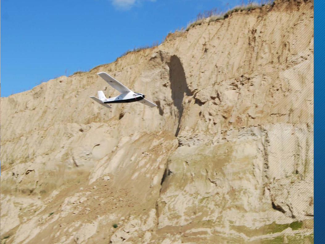
08

Sirius gets the job done when other UAS’s struggle
The Sirius Pro is the world’s first UAS with integrated GNSS
RTK. The workflow for obtaining aerial imagery has been
streamlined by eliminating the need for setting out ground
control points. Instead, the Sirius Pro places 1,000 equally
distant RTK control points in the air for accurate mapping.
• Simple automatic flight planning
• Automatic operation from take off to landing
• Autopilot assisted manual control
• Safety and emergency actions
• Fully operational up to 50-65 km/h wind
Flight Planning
Flight planning with Sirius consists of finding your mission site,
selecting your area of interest and setting your ground sampling
distance. The plan is created automatically and transmitted directly.
• Session management
• Off-line mission planning
• Forecast of the ground coverage before flying
• Advanced flight planning for mountainous areas
• Multi-flight planning for optimized coverage of large areas
MAVinc i Desktop MAVinc i Desktop
09
Workflow

1616
Image Acquisition Post Processing
Typically, 1,400 photos are taken during a photogrammetric
flight with a 3 cm GSD.
• Simple hand launch
• Automatic operation from take off to landing
• Autopilot assisted manual control
• Safety and emergency actions
• Low operation cost
A rapid data check is done in the field to confirm all areas have been
covered. After landing, the photo log data (GPS positions and time
stamps of the images, etc) will be copied wirelessly from the Sirius to
MAVinci Desktop for post processing.
• High-resolution Orthophotos and DEMs
• One click interface from MAVinci Desktop to processing software
• Connects to fully automatic standalone processing software
Si r ius / Panason ic GX1 MAVinc i Desktop
10

The Sirius UAS combines a Topcon survey grade dual
constellation GNSS receiver with a 16 MP digital camera for
ultimate accuracy and project time savings. The plane is built
of a lightweight foam material with a folding propeller for easy
transport to the project site and ultimate usability.
Flight times are up to 50 minutes and the plane has a long life
cycle of up to 200 landings. Flights can be made in almost any
weather condition and even in the rain.
Panasonic GX1
The Panasonic GX1 camera is combined with a Panasonic 14 mm
f/2.5 lens. The focal length of the lens is fixed to increase the quality of
the post-processing results. The calibration of the camera with the lens
is optional. The software allows the operator to verify the quality of the
data collected within minutes, while still in the field.
11
Planes andCameras

161612
Sirius Pro / Basic
• Advanced Flight Planning – Flight plan can automatically adapt to an elevation model.
• Cover Large Areas – Flight plan splits up automatically and rejoins for post-processing.
• Cost Efficient – More than 200 landings with one body leading to low operation costs.
• Auto or Assisted Landing – Land in areas where automatic landing is impossible. Sirius is stabilized by the autopilot and manually controlled by simple up/down, left/right commands.
• GNSS RTK – L1/L2 GPS and GLONASS with RTK for highest accuracy (Sirius Pro only).
• Excellent Result Quality – Best image quality and georeferencing accuracy.
• Weather Conditions – Operate the system with hot or cold outdoor temperatures from -20°C to 45°C and in rain.
• Fly With A Strong Wind – The UAS is fully operational with wind of up to 50 km/h (7B ft.) with gusts up to 65 km/h (8B ft.).
• Simple Hand Launch – No catapult is necessary.
• Safety – Get flight permissions in many countries.
• Cruise Speed – 65 Km/ h
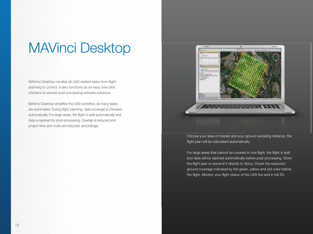
MAVinci Desktop handles all UAS related tasks from flight
planning to control. It also functions as an easy one-click
interface to several post processing sofware solutions.
MAVinci Desktop simplifies the UAS workflow, as many tasks
are automated. During flight planning, data coverage is checked
automatically. For large areas, the flight is split automatically and
data is rejoined for post-processing. Overlap is reduced and
project time and costs are reduced, accordingly.
Choose your area of interest and your ground sampling distance, the
flight plan will be calculated automatically.
For large areas that cannot be covered in one flight, the flight is split
and data will be rejoined automatically before post-processing. Store
the flight plan or transmit it directly to Sirius. Check the expected
ground coverage indicated by the green, yellow and red color before
the flight. Monitor your flight status of the UAS live and in full 3D.
13
MAVinci Desktop

161614
With MAVinci Desktop you can display small preview images of your
area of interest. You may monitor your flight live and in full 3D. The
flight plan can be changed even while the UAS is in the air. With the
quality check function, you can verify within minutes the quality of the
data set the you acquired directly on the field. This function checks
the overlap of the single images and indicates sufficient overlap with a
green color.
During the flight, MaVinci Desktop shows the status of the Sirius; RC
link state, GPS state, position of UAS and battery levels. After the flight
and post-processing is complete, import your DEM and orthophoto as
a basis for your next flight plan or for basic measurements.
Import your DEM and orthphoto after post-processing as a basis for
your next flight plan or for basic measurements. Set up display options
such as viewing contour lines, compass, scale bar, control points, and
environmental factors such as the sun, sky and stars.

15

141416
Any UAS payload should be as small and light as possible but deliver high quality
data at the same time. To this end, we incorporate the Panasonic GX1 camera
with a 16 MP live MOS sensor and a Panasonic 14 mm f/2.5 lens. The focal length
of the lens is fixed to increase the quality of the post-processing results. The
calibration of the camera with the lens is optional. Next to the visible range camera,
an NIR camera option is available. This camera provides relative NDVI: a graphical
indicator for analysis of vegetation conditions and photosynthetic capacity.
The area that can be covered during one flight with Sirius depends on the GSD. In
one 45 minute flight one can cover the following areas:
GSD AGL Side / In-Flight Overlap65 / 85% 20 / 80%
1.6 cm 54.9 m 195 ft. 0.7 km2 1.62 km2
2.6 cm 96.5 m 317 ft. 1.13 km2 2.65 km2
3.2 cm 119 m 390 ft. 1.42 km2 3.20 km2
5.0 cm 186 m 610 ft. 2.25 km2 5.12 km2
10 cm 371 m 1217 ft. 4.54 km2 9.97 km2
20 cm 743 m 2438 ft. 8.67 km2 18.20 km2
Image Acquisition

• Sirius UAS, powered by MAVinci, with MAVinci Autopilot System
• Camera kit
• Ground station
• MAVinci Desktop software
• Transport box for the UAS
Optional Accessories
• Base station kit (Sirius Pro only)
• Spare parts kit
• Training and support
* Laptop PC for field connectivity not included
17
Kit Components

18
8
9
10
11
12
13
14
1
2
3
4
5
6
7
1
2
3
4
5
6
7
89
10
11
12
13
14
Folding propeller (protection for landing)
Single battery-powered UAS
Calibrated camera with large sensor
MAVinci autopilot
Flashing lights below the wings
Detachable tail rudders
Special long-life actuator
Adaptive active cooling of autopilot electronics
Security switch for engine control
Extremely lightweight foam material
White color prevents overheating
Access to camera storage card
Electric brush-less motor
GNSS Antenna

To increase safety, the UAS performs special emergency actions
if necessary:
• In case of engine failure (e.g. low battery level):autopilot stabilizes the UAS altitude and descends.
• The operator can send a “return home“ command.The UAS will then return to the ground station.
• If GPS signal is lost the UAS will circle inwaiting position.
Airframe Hardware
Build Material Elapor
Wingspan 163 cm
Length 120 cm
Weight 2.7 kg with camera
Battery Lithium-polymer (18.5V, 30C, 5300 mAh)
Propulsion Electric brush-less 680W engine
Actuators Long life
GNSS Component
Number of Channels 226 Universal Channels
Signals Tracked GPS L1 C/A, L2C, L2 P(Y)GLONASS L1/L2Galileo E1
RTK Accuracy (Kinematic) Horizontal: 10 mm + 1.0 ppm x baselineVertical: 5 mm + 1.0 ppm x baseline
Test Data Accuracy GSD X/Y Z
Agricultural Area 1 1.6 cm 2.4 cm 3.1 cm
Stone Pit 2-3 cm 4.4 cm 0.8 cm
Agricultural Area 2 3.5 cm 5.1 cm 3.2 cm
Agricultural Area 3 10 cm 7.2 cm 8.6 cm
19
Safety andSpecifications

1616
Flight Information
Flight Time Up to 55 minutes with camera
Orthophoto Flight Altitude 59 - 750 m
Max Flight Altitude 2600 m ASL
Operators Single
Max Wind-speed Operation 50 km/h, gusts up to 65 km/h
Operating Temperatures -20ºC to 45ºC
Rain Operation Yes
Typical Cruise Speed 65 km/h
Autopilot
Automatic Navigation GPS/IMU aided, includes compass for improved navigation under strong winds
Flight Modes Automatic / Autopilot supported / Full manual
Takeoff / Landing Automatic
Landing
Methods Automatic / Autopilot supported / Full manual belly landing
Autopilot supported UAS is controlled by simple up/down, left/right commands to avoid obstacles that prohibit automatic landing
RC Links
EU / CE Regulations 2.4 GHz up to 2 km line-of-sight range
FCC / IC Regulations 2.4 GHz up to 4 km line-of-sight range
All Countries 2.4 GHz for manual backup control up to 3 km
Autopilot Security and Failsafe Features
Overheating prevention
Engine security button
Return home function
Multiple RC links
GPS tracker recovery (optional)
UAS fly-away protection
Emergency landing
UAS health data display on MAVinci Desktop
Camera (Panasonic GX1)
Mega Pixels 16
Lens Fixed focus 14 mm f/2.5
Sensor Micro four-thirds
Memory 360º
20

topcontotalcare.com
This online resource comes with real live people ready to help. Get
expert training from Topcon University’s large collection of online
materials, and expert help directly from Topcon Technical Support.
Access software and firmware updates, current publications, and
guidance from the experts at Topcon all right from your computer
or mobile device.
Please visit the TotalCare website to learn more.
TotalCare
21

22
Specifications subject to change without notice. All rights reserved. 1/14 ©2014 Topcon Corporation
The Bluetooth® word mark and logos are registered trademarks owned by Bluetooth SIG, Inc. and any use of such marks by Topcon is under license. Other trademarks and trade names are those of their respective owners.
topconpositioning.com | topcon.eu
Your local Authorized Topcon dealer is:
topconpositioning.com | topcon.eu
Your local Authorized Topcon dealer is:
topconpositioning.com | topcon.eutopconpositioning.com | topcon.eutopconpositioning.com | topcon.eutopconpositioning.com | topcon.eu
Specifications subject to change without notice. All rights reserved. 7010-2162 Rev A 9/14 ©2014 Topcon Corporation
The Bluetooth® word mark and logos are registered trademarks owned by Bluetooth SIG, Inc. and any use of such marks by Topcon is under license. Other trademarks and trade names are those of their respective owners.
Camino del Cerro 5154 - Huechuraba - Santiago de Chile www.microgeo.cl/productos/geodesia -
[email protected] - (56 2) 2658 0832