Embed Size (px)
Citation preview
John Grammer and Kevin Palmer
Tools for Topographic Cartography

Topographic Map ProductionProduce, Manage, and Share Authoritative Content
Apps
Server
Systems of Record
System of Engagement
ServicesDesktop
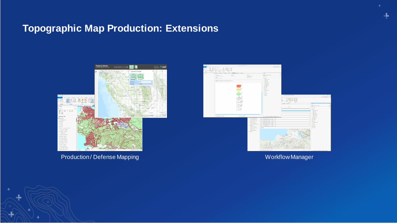
Topographic Map Production: Extensions
Production / Defense Mapping Workflow Manager

Section Subhead
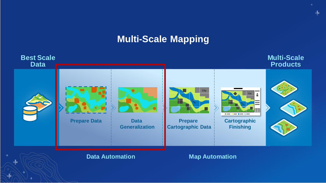
Multi-Scale Mapping
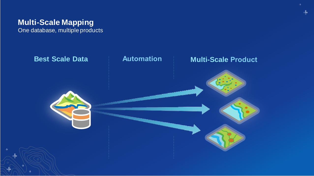
Multi-Scale Mapping
Multi-ScaleBest Scale Data
One database, multiple products
Multi-Scale Mapping
Best Scale Data
Prepare Data Data
Generalization
Prepare
Cartographic Data
Cartographic
Finishing
Multi-Scale Products
Data Automation Map Automation
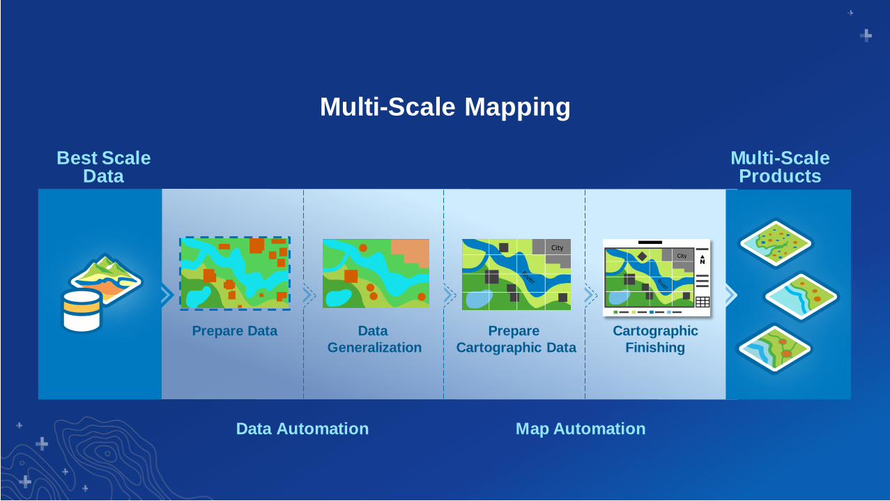
Multi-Scale Mapping
Best Scale Data
Prepare Data Data
Generalization
Prepare
Cartographic Data
Cartographic
Finishing
Multi-Scale Products
Data Automation Map Automation
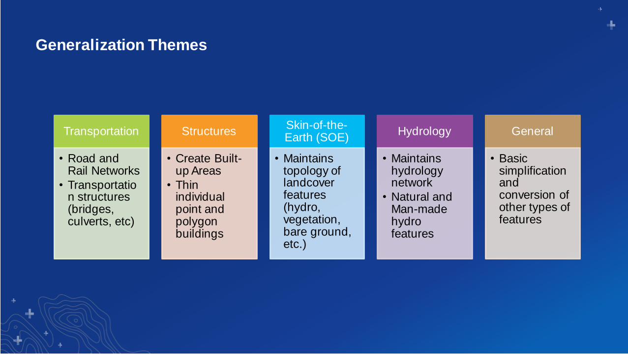
Generalization Themes
Transportation
• Road and Rail Networks
• Transportation structures (bridges, culverts, etc)
Structures
• Create Built-up Areas
• Thin individual point and polygon buildings
Skin-of-the-Earth (SOE)
• Maintains topology of landcover features (hydro, vegetation, bare ground, etc.)
Hydrology
• Maintains hydrology network
• Natural and Man-made hydro features
General
• Basic simplification and conversion of other types of features
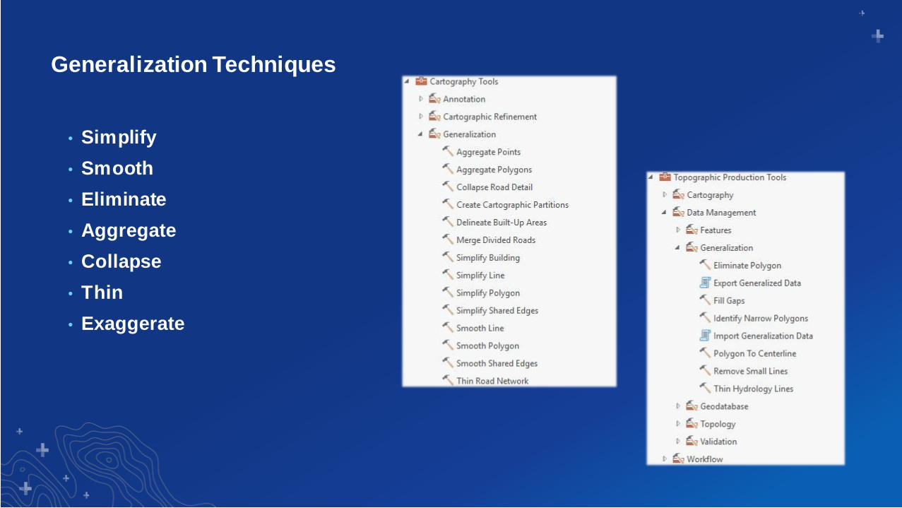
Generalization Techniques
• Simplify
• Smooth
• Eliminate
• Aggregate
• Collapse
• Thin
• Exaggerate

ArcGIS 10.x - Generalization
50K to 250K Generalization
• Output Intended for 250K Product Creation
• Stand-alone toolbox with models and scripts
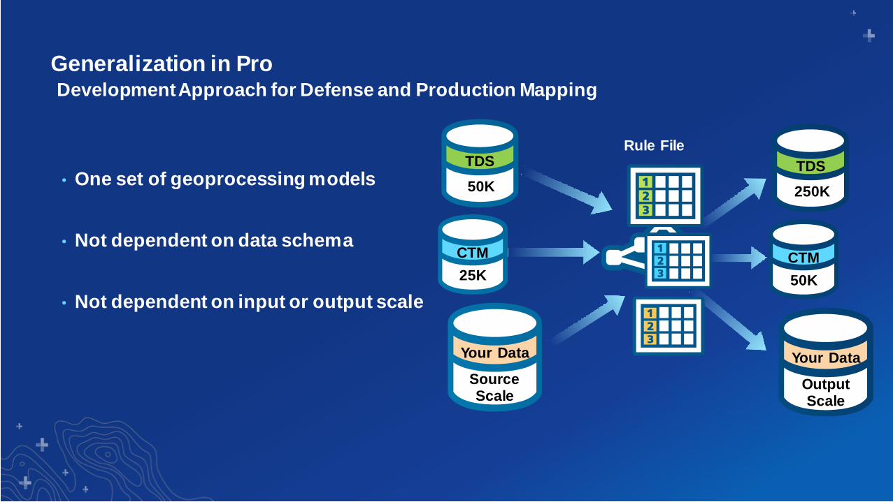
Generalization in Pro
• One set of geoprocessing models
• Not dependent on data schema
• Not dependent on input or output scale
Development Approach for Defense and Production Mapping
CTM
25K
TDS
50K
Your Data
Source Scale
CTM
50K
TDS
250K
Your Data
Output Scale
Rule File
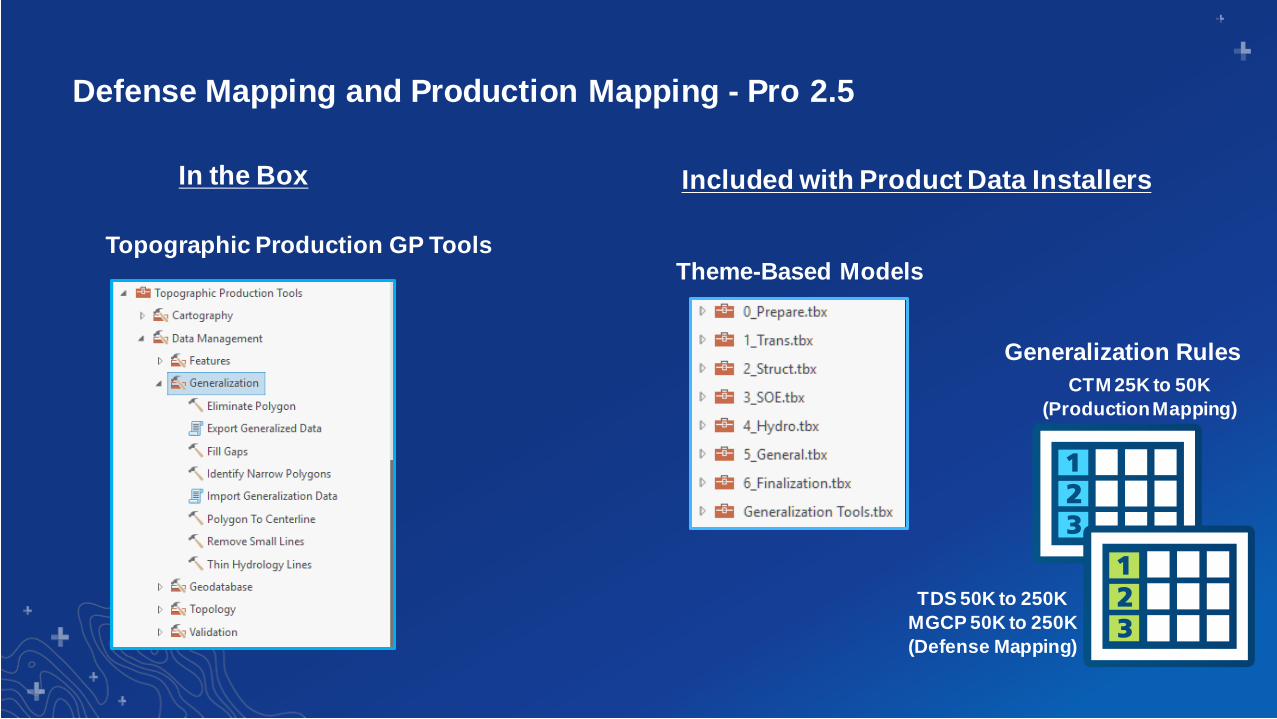
Defense Mapping and Production Mapping - Pro 2.5
Included with Product Data Installers
Generalization Rules
In the Box
Topographic Production GP ToolsTheme-Based Models
CTM 25K to 50K
(Production Mapping)
TDS 50K to 250K
MGCP 50K to 250K
(Defense Mapping)
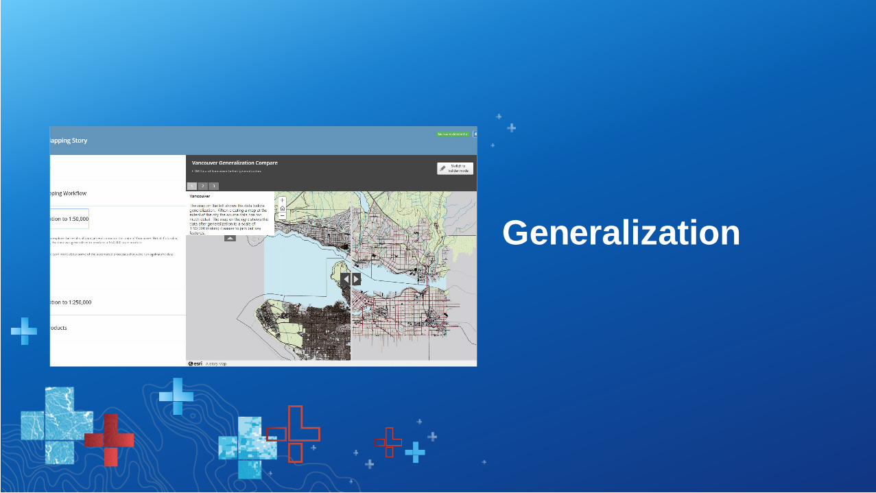
Generalization
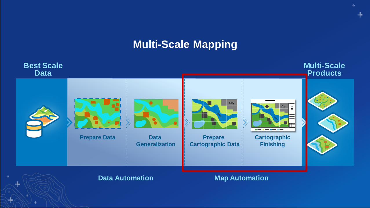
Multi-Scale Mapping
Best Scale Data
Prepare Data Data
Generalization
Prepare
Cartographic Data
Cartographic
Finishing
Multi-Scale Products
Data Automation Map Automation

Section Subhead
Map Production
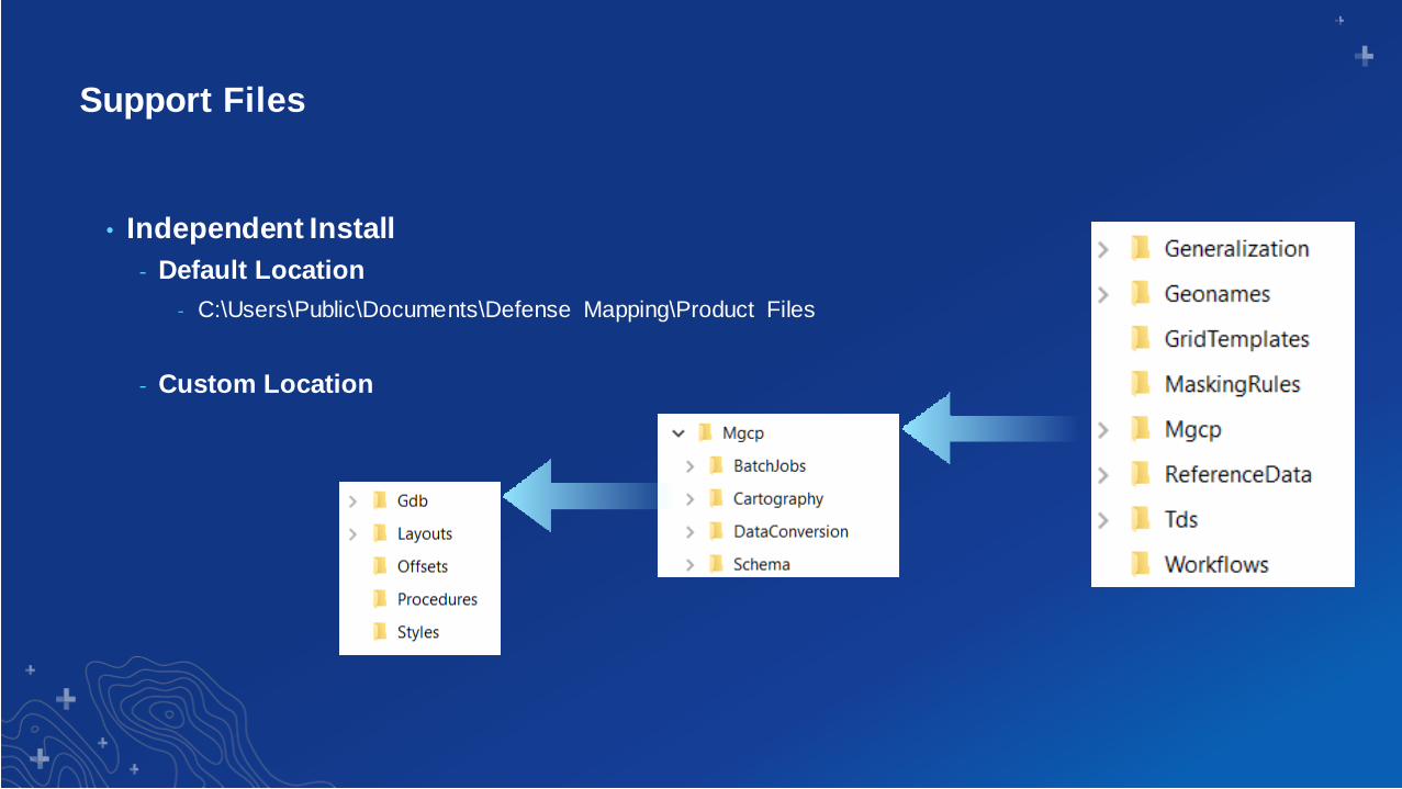
Support Files
• Independent Install
- Default Location
- C:\Users\Public\Documents\Defense Mapping\Product Files
- Custom Location
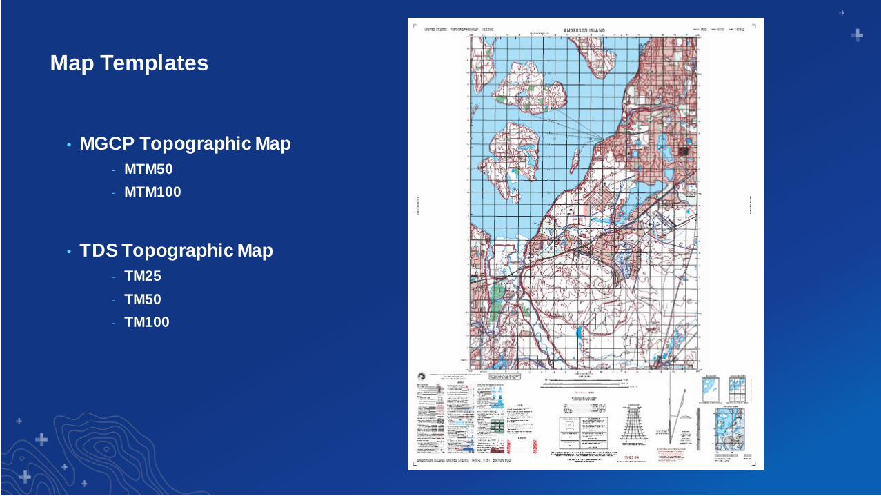
Map Templates
• MGCP Topographic Map
- MTM50
- MTM100
• TDS Topographic Map
- TM25
- TM50
- TM100
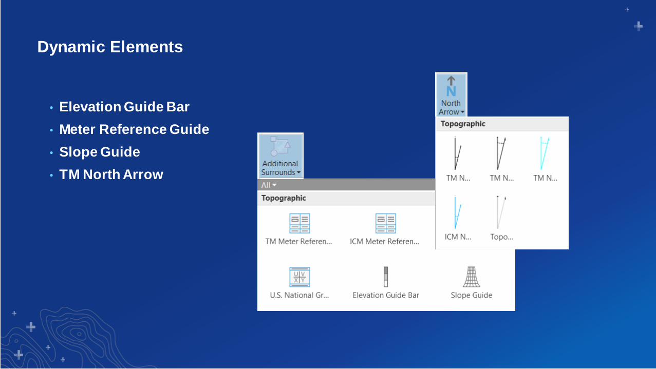
Dynamic Elements
• Elevation Guide Bar
• Meter Reference Guide
• Slope Guide
• TM North Arrow

Labels & Symbols
• Label Expressions (Python)
• Symbol Expressions (Arcade)
- Unique value renderer
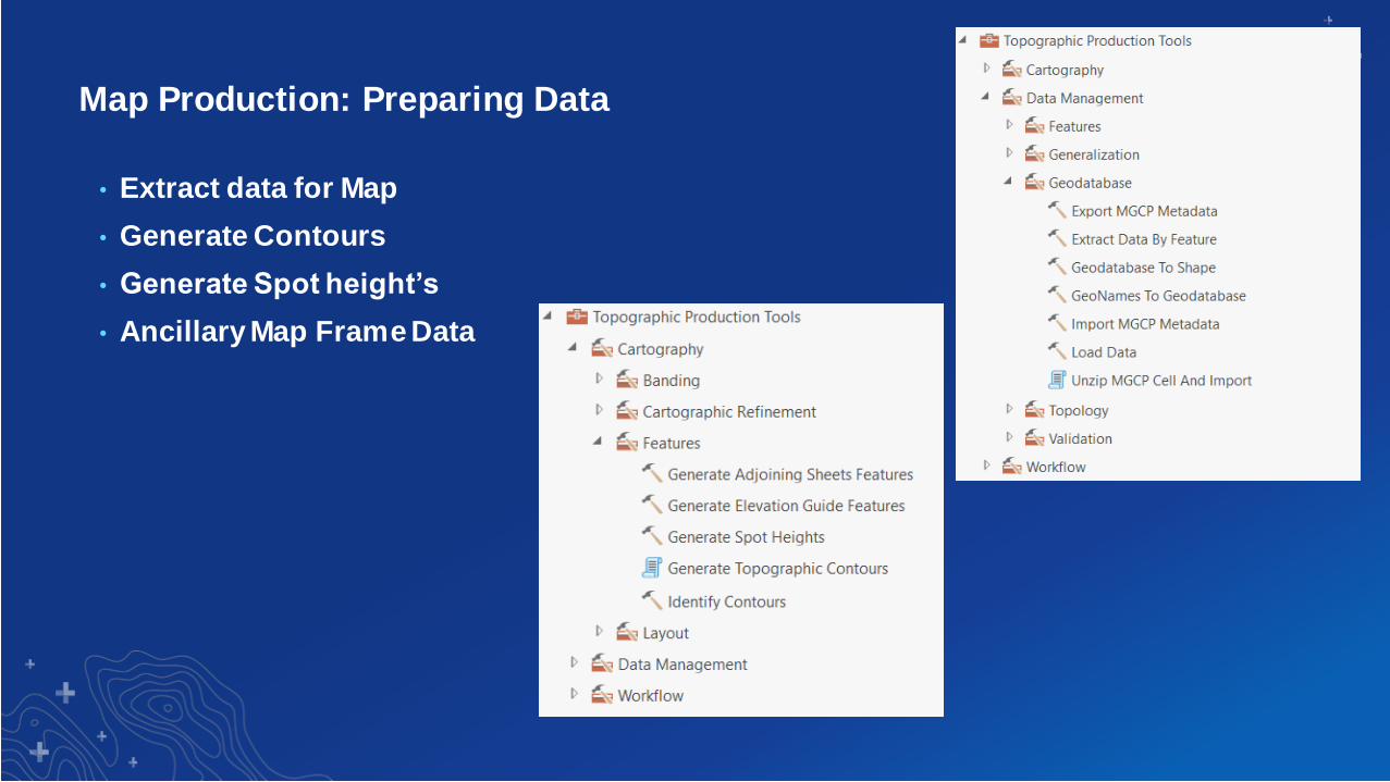
Map Production: Preparing Data
• Extract data for Map
• Generate Contours
• Generate Spot height’s
• Ancillary Map Frame Data

Map Production: Cartographic Refinement
• Feature Offsets
• Feature Thinning
• Masking from Rules
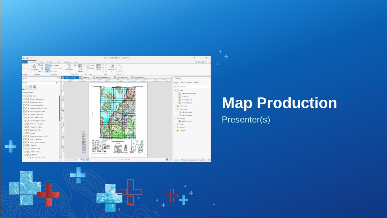
Presenter(s)
Map Production

Section Subhead
Map Production Workflows
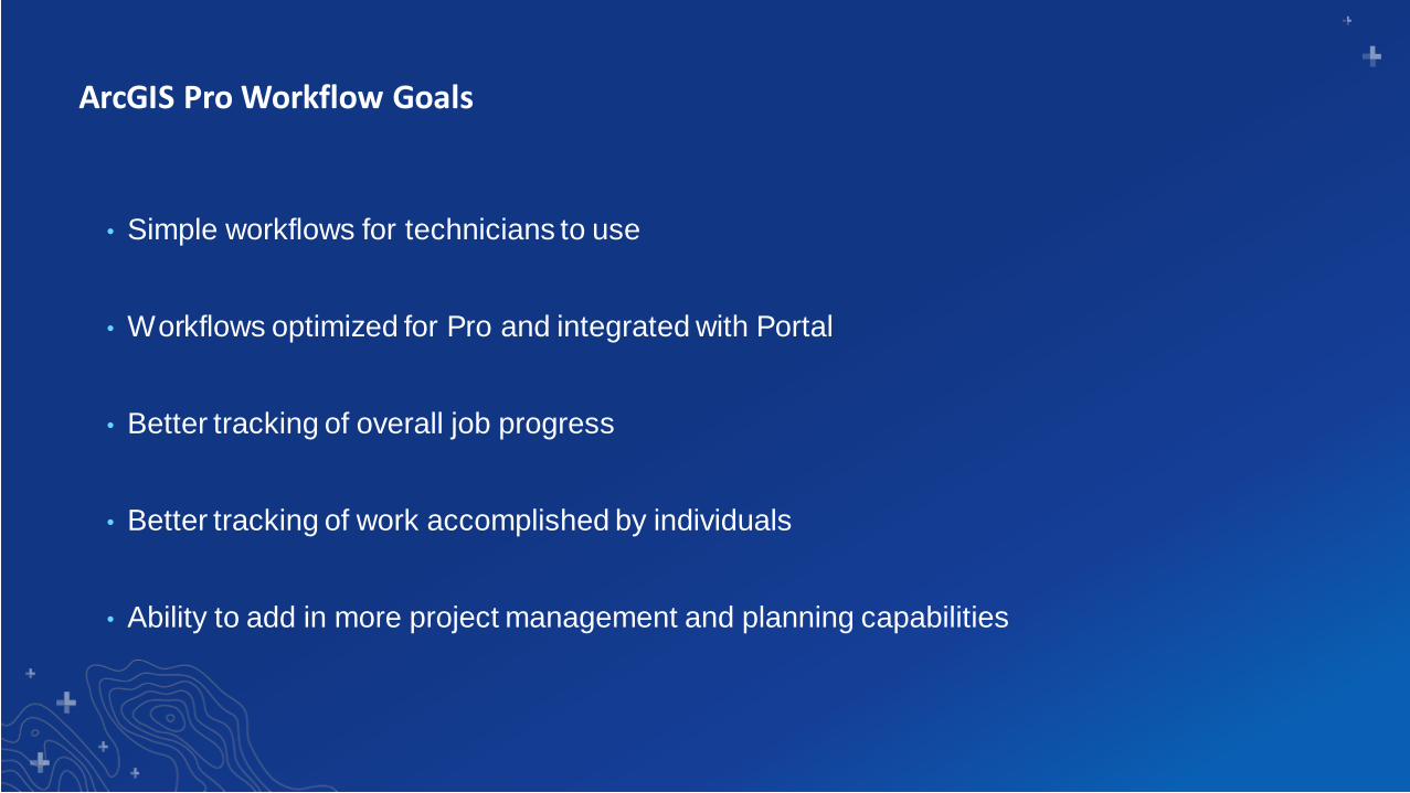
• Simple workflows for technicians to use
• Workflows optimized for Pro and integrated with Portal
• Better tracking of overall job progress
• Better tracking of work accomplished by individuals
• Ability to add in more project management and planning capabilities
ArcGIS Pro Workflow Goals

• Using workflow driven systems
- Increase productivity
- Preconfigured and repeatable processes
- Simplification and automation
- Build in quality
- Process control/configuration management
- QA/QC process enforcement
- Accountability
Production Management
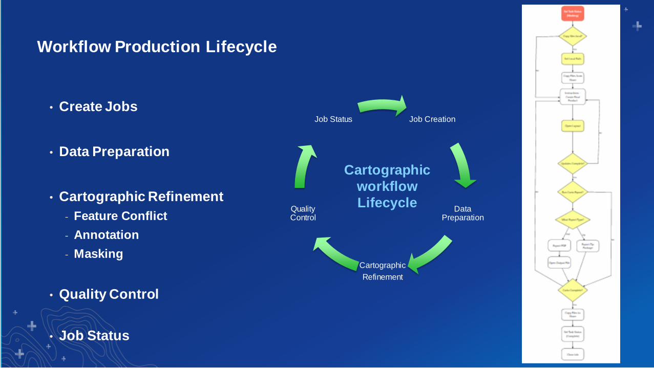
Workflow Production Lifecycle
• Create Jobs
• Data Preparation
• Cartographic Refinement
- Feature Conflict
- Annotation
- Masking
• Quality Control
• Job Status
Job Creation
Data Preparation
Cartographic
Refinement
Quality Control
Job Status
Cartographic
workflow
Lifecycle

Section Subhead
Enterprise Map Production
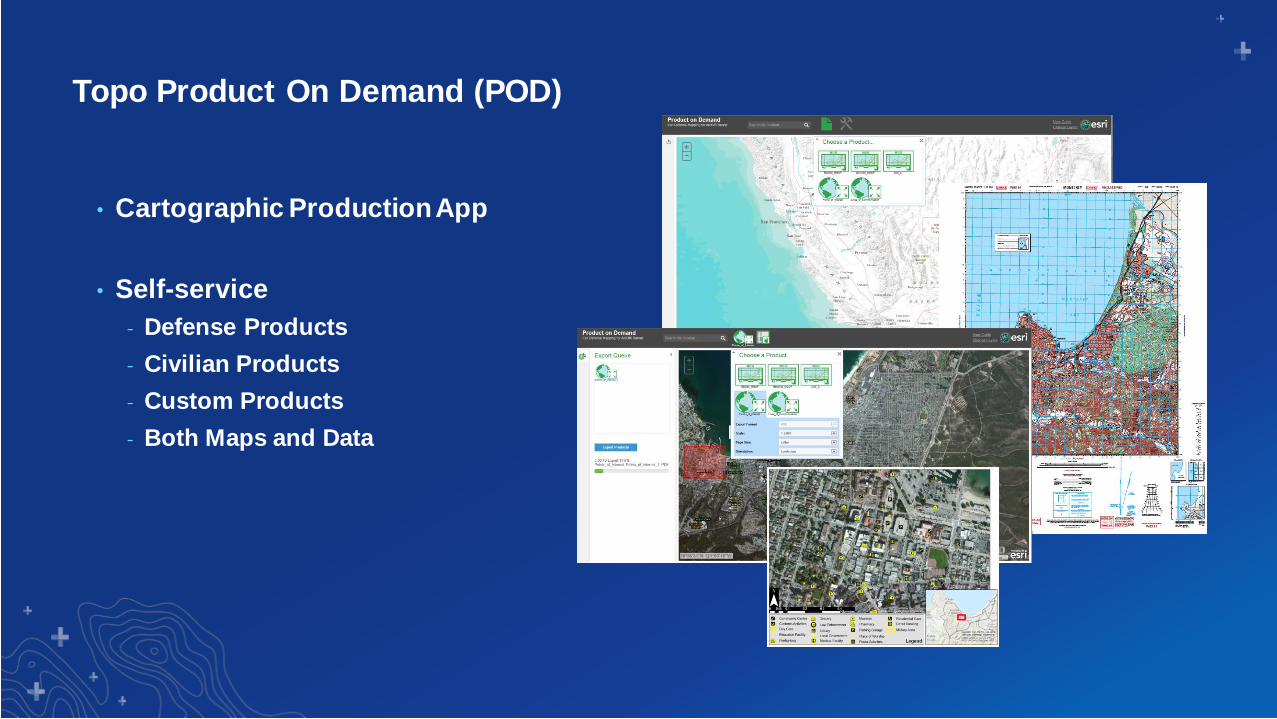
Topo Product On Demand (POD)
• Cartographic Production App
• Self-service
- Defense Products
- Civilian Products
- Custom Products
- Both Maps and Data
Presenter(s)
Product on
Demand

Section Subhead
Road Map
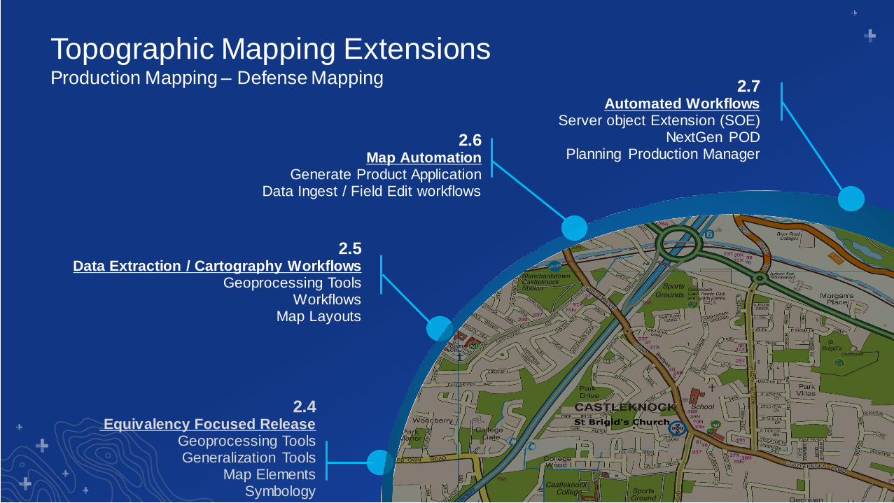
2.4Equivalency Focused Release
Geoprocessing ToolsGeneralization Tools
Map ElementsSymbology
2.5Data Extraction / Cartography Workflows
Geoprocessing ToolsWorkflows
Map Layouts
2.6Map Automation
Generate Product ApplicationData Ingest / Field Edit workflows
Topographic Mapping ExtensionsProduction Mapping – Defense Mapping 2.7
Automated WorkflowsServer object Extension (SOE)
NextGen PODPlanning Production Manager

Section Subhead
Questions?

Print Your Certificate of Attendance
Print Stations Located in 150 Concourse Lobby
Tuesday12:30 pm – 6:30 pm
Expo
Hall B
5:15 pm – 6:30 pm
Expo Social
Hall B
Wednesday10:45 am – 5:15 pm
Expo
Hall B
6:30 pm – 9:30 pm
Networking Reception
Smithsonian National Museum
of Natural History

Download the Esri
Events app and find your event
Select the session
you attended
Scroll down to
“Survey”
Log in to access the
survey
Complete the survey
and select “Submit”
Please Share Your Feedback in the App