Embed Size (px)
Citation preview

Southeast Corridor Transit StudyFinal Recommendations
December 2016

This page intentionally left blank.

Southeast Corridor Transit Study
Final Recommendations i
TABLE OF CONTENTS
1 INTRODUCTION ................................................................................................................................................................................................................................................................................................................................................................. 1 1.1 What is this Study About? ........................................................................................................................................................................................................................................................................................................................................... 1
1.2 How Does this Study Relate to Previous Plans? ........................................................................................................................................................................................................................................................................................................ 1
1.3 Is this a Rail Project or a Bus Project? ........................................................................................................................................................................................................................................................................................................................ 1
2 WHAT IS THE VISION FOR THE SOUTHEAST CORRIDOR? ........................................................................................................................................................................................................................................................................................ 2
2.1 What Are the Goals for Transit, Land Use and Mobility in the Corridor? .................................................................................................................................................................................................................................................................... 2
2.2 How Does the Southeast Corridor Fit into the Long-Range Transit Plan? ................................................................................................................................................................................................................................................................. 2
2.3 How Do the Rail and Bus Elements Complement Each Other? ................................................................................................................................................................................................................................................................................. 2
3 WHAT RAIL OPTIONS WERE CONSIDERED? ................................................................................................................................................................................................................................................................................................................ 3 3.1 Which Type of Rail Technology is Most Appropriate? ................................................................................................................................................................................................................................................................................................ 3
3.2 What Potential Rail Alignments Were Studied? .......................................................................................................................................................................................................................................................................................................... 4
4 WHAT IS THE BUS OPERATIONS STRATEGY FOR THE CORRIDOR? ....................................................................................................................................................................................................................................................................... 6 4.1 How Should Bus Service Interact with the Proposed US 74 Express Lanes? ........................................................................................................................................................................................................................................................... 6
4.2 What Bus Facilities Should Be Constructed in the Corridor? ..................................................................................................................................................................................................................................................................................... 6
4.3 How Might Bus Service Integrate with Light Rail Service? ......................................................................................................................................................................................................................................................................................... 6
5 HOW WERE THE RAIL ALIGNMENT OPTIONS ANALYZED? ....................................................................................................................................................................................................................................................................................... 7 5.1 What Evaluation Process Was Used? ........................................................................................................................................................................................................................................................................................................................ 7
5.2 What Criteria Were Used to Screen the Options? ...................................................................................................................................................................................................................................................................................................... 8
5.3 How Were the Public and Other Stakeholders Engaged? .......................................................................................................................................................................................................................................................................................... 9
6 WHAT IS THE PREFERRED RAIL ALIGNMENT? ......................................................................................................................................................................................................................................................................................................... 10
6.1 Where Would the Rail Line and Stations Be Located? ............................................................................................................................................................................................................................................................................................. 10
6.2 What Would the Rail Line Look Like? ....................................................................................................................................................................................................................................................................................................................... 11
6.3 What Would the Stations Look Like? ........................................................................................................................................................................................................................................................................................................................ 12
6.4 What Will Be the Land Use Around Stations? .......................................................................................................................................................................................................................................................................................................... 13
6.5 How Does the Silver Line Connect to Other Transit Lines in Uptown Charlotte? ..................................................................................................................................................................................................................................................... 14
6.6 What is the Rail Operations Plan? ............................................................................................................................................................................................................................................................................................................................ 15
6.7 Where Would a Maintenance Facility Be Located? .................................................................................................................................................................................................................................................................................................. 15
7 HOW CAN THE RAIL CORRIDOR BE PRESERVED FOR FUTURE IMPLEMENTATION? ......................................................................................................................................................................................................................................... 16
7.1 What Are the Next Steps Toward Project Implementation? ..................................................................................................................................................................................................................................................................................... 16
7.2 What Strategies Should Be Used to Retain the Corridor for Future Light Rail Construction? .................................................................................................................................................................................................................................. 16
8 WHERE IS MORE INFORMATION AVAILABLE? .......................................................................................................................................................................................................................................................................................................... 16

Southeast Corridor Transit Study
Final Recommendations ii
This page intentionally left blank.

Southeast Corridor Transit Study
Final Recommendations 1
1 INTRODUCTION
1.1 What is this Study About? The Metropolitan Transit Commission (MTC) directed the Charlotte Area Transit System (CATS) to conduct an Alternatives Analysis (AA) for the Southeast Corridor (LYNX Silver Line), which is a heavily traveled corridor extending approximately 13.5 miles southeast from Center City Charlotte to the Mecklenburg / Union County border. Approximately 3.5 miles of the corridor near the county line is located within the Town of Matthews; the remainder of the corridor is located within the City of Charlotte.
The primary purpose of the AA is to provide the necessary transportation and land use analysis, and public outreach to facilitate the MTC’s selection of a rail-based technology and alignment for a Locally Preferred Alternative (LPA). A secondary purpose of the AA is to provide recommendations and an operating and capital plan for bus service within the proposed express lanes on Independence Boulevard (US 74). The project study area includes Independence Boulevard and is bounded on either side generally by 7th Street/Monroe Road and portions of Central Avenue. The Study is… The Study is not…
A long-term view of a transit vision for the Southeast Corridor Intended to identify a “shovel ready” rail project
A definition of rail alignment and technology A fully detailed and designed rail project
A bus operations plan for future US 74 express lanes
A bus operations plan as a replacement for a rail project
Information to be considered in future system funding decisions Constrained by current CATS financial projections
1.2 How Does this Study Relate to Previous Plans? Fixed guideway transit has been viewed as a major component of numerous plans to reinvigorate the corridor. However, previous studies failed to gain the necessary consensus to move forward with a viable project. Several previous studies recommended the implementation of a Bus Rapid Transit (BRT) project, but additional consideration of Light Rail Transit (LRT) was also directed. Funding limitations have prevented the advancement of either option to date. Support for a new approach to transit in the corridor gained momentum as a result of several key initiatives occurring between 2009 and 2011:
The Independence Boulevard Area Plan was developed. This plan reconsidered the future role of Independence Boulevard and recommended a long-term reverse-frontage land use vision for the corridor that re-orients development away from Independence Boulevard.
• The Urban Land Institute’s Rose Center Fellowship Report recommended bus service and auto-oriented land uses along Independence Boulevard in conjunction with streetcar and community-focused development along Central Avenue (already planned) and Monroe Road (a new recommendation) within the city of Charlotte.
• The MTC elected to no longer preserve the median of Independence Boulevard for future exclusive use as a transit fixed guideway, enabling the existing Independence Busway to be converted to express lanes and extended. This decision effectively eliminated the median of Independence Boulevard as a transit guideway alignment option.
1.3 Is this a Rail Project or a Bus Project? The focus of transit investment in the corridor is no longer about “rail or bus”, but rather is centered on how a rail transit project on a new alignment can work in a complementary manner with enhanced bus services using the future US 74 express lanes. This multi-faceted transit approach, coupled with a broader perspective of the corridor itself, is viewed as the best way to address the many diverse transit needs and land use goals in the corridor.
Southeast Corridor Study Area
The focus of transit investment in the corridor is no longer about “rail or bus”; both modes will be included in the corridor solution.
FOR MORE INFORMATION, PLEASE SEE: “New Perspectives on Transit
Opportunities” brochure Opportunity Statement

Southeast Corridor Transit Study
Final Recommendations 2
2 WHAT IS THE VISION FOR THE SOUTHEAST CORRIDOR?
2.1 What Are the Goals for Transit, Land Use and Mobility in the Corridor? Silver Line goals were formed from a broader vision that sought to define the overall roles of high-capacity transit in the corridor. During the course of the study, it became clear that synergies already in place can be built upon to create a corridor vision that is truly a renewed land use and transportation vision. Rather than thinking narrowly of a light rail project in the corridor, a tremendous opportunity exists to view this project as a comprehensive mobility, land use, and quality of life approach that includes light rail as well as managed lanes, enhanced bicycle and pedestrian connections including trails, and new street connections supporting a viable land use vision.
2.2 How Does the Southeast Corridor Fit into the Long-Range Transit Plan? The recommendations that emerge from this study will form the new “Locally Preferred Alternative” that represents the proposed transit investment in the Southeast Corridor. These recommendations include the identification of the preferred rail alignment and technology, as well as the bus operations strategy for use of the future US 74 express lanes. The new recommendations will be included in the CATS 2030 Transit System Plan and will replace the previous Bus Rapid Transit proposal for the Southeast Corridor.
Recommendations to be Included in 2030 Transit System Plan:
Rail alignment and technology
Bus operations strategy using US 74 express lanes
Several opportunities to consider have emerged when viewing the Southeast Corridor from a system level:
Extending west to the Airport to create a single east-west rail corridor;
Interlining with the LYNX Blue Line to provide additional service in the Uptown core;
Connecting with the future Charlotte Gateway Station to strengthen its role as a hub; and
Creating multimodal hubs along the corridor to strengthen local bus connections with surrounding neighborhoods.
2.3 How Do the Rail and Bus Elements Complement Each Other? While bus and rail service are being proposed in the Southeast Corridor to extend from Center City Charlotte to the Mecklenburg/Union County line, these services should be designed in a way so that they are not duplicative. The bus and rail alternatives will have differing functions to provide complimenting service rather than competing. Recognizing that Independence Blvd. is primarily regionally-oriented and Monroe Road is more oriented to local access, in addition to its regional role, the roadway network functions to serve both of these roles within the same corridor. Similarly, transit should serve both of these needs as well, and the desire to offer both bus and rail service in the corridor suggest that a similar concept could apply, with bus serving one travel market and rail serving the other. Given the focus of providing bus service in the Independence Blvd. express lanes, it is logical for bus service to focus on regional commute trips with fewer stops, more peak period trips, and fast travel times. In addition, local bus connections would be made to rapid transit, which would include both the bus service operating in the express lanes and the rail service. Rail is more oriented around the connections within the corridor, not to say that passengers would not have the option to use rail to get from one end of the corridor to the other. However, it is likely that passengers using rail to get from one end of the corridor to the other would experience a longer trip time because of all the stops that will be made along the way, compared to a comparable express bus with few stops. Passengers would not be precluded from using rail to get from one end of the corridor to the other, but rail would be intended primarily to serve different trip types.
Role of Bus Regional connections; fewer stops; more commute-oriented; fast travel times; local bus connections to rapid transit
Role of Rail Connections within the corridor; many trip purposes; access to more corridor destinations balanced with reliability and efficiency
A tremendous opportunity exists to view this project as a comprehensive mobility, land use, and quality of life approach.
FOR MORE INFORMATION, PLEASE SEE: “New Perspectives on Transit
Opportunities” brochure Opportunity Statement
Southeast Corridor Transit Study
Final Recommendations 3
3 WHAT RAIL OPTIONS WERE CONSIDERED?
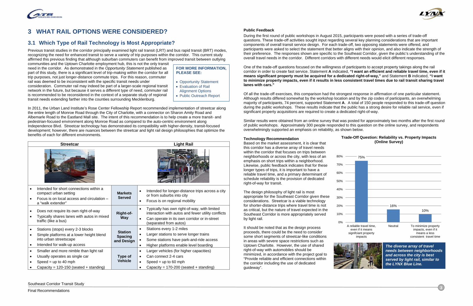
3.1 Which Type of Rail Technology is Most Appropriate? Previous transit studies in the corridor principally examined light rail transit (LRT) and bus rapid transit (BRT) modes, recognizing the need for enhanced transit to serve a variety of trip purposes within the corridor. This current study affirmed this previous finding that although suburban commuters can benefit from improved transit between outlying communities and the Uptown Charlotte employment hub, this is not the only transit need in the corridor. As demonstrated in the Opportunity Statement published as part of this study, there is a significant level of trip-making within the corridor for all trip purposes, not just longer-distance commute trips. For this reason, commuter rail was deemed to be inconsistent with the specific transit needs under consideration. Commuter rail may indeed be part of a larger-scale regional transit network in the future, but because it serves a different type of need, commuter rail is recommended to be reconsidered in the context of a separate study of regional transit needs extending farther into the counties surrounding Mecklenburg. In 2011, the Urban Land Institute’s Rose Center Fellowship Report recommended implementation of streetcar along the entire length of Monroe Road through the City of Charlotte, with a connector on Sharon Amity Road and Albemarle Road to the Eastland Mall site. The intent of this recommendation is to help create a more transit- and pedestrian-focused environment along Monroe Road as compared to the auto-centric environment along Independence Blvd. Streetcar technology has demonstrated its compatibility with higher-density, transit-focused development; however, there are nuances between the streetcar and light rail design philosophies that optimize the benefits of each for different environments.
Streetcar Light Rail
Intended for short connections within a compact urban setting
Focus is on local access and circulation – a “walk extender”
Markets Served
Intended for longer-distance trips across a city or from suburbs into city
Focus is on regional mobility
Does not require its own right-of-way Typically shares lanes with autos in mixed
traffic (like a bus)
Right-of-Way
Typically has own right-of-way, with limited interaction with autos and fewer utility conflicts
Can operate in its own corridor or in-street (separated from autos)
Stations (stops) every 2-3 blocks Simple platforms at a lower height blend
into urban streetscape Intended for walk-up access
Station Spacing
and Design
Stations every 1-2 miles Larger stations to serve longer trains Some stations have park-and-ride access Higher platforms enable level boarding
Smaller and more nimble than light rail Usually operates as single car Speed = up to 40 mph Capacity = 120-150 (seated + standing)
Type of Vehicle
Larger vehicles (for higher capacities) Can connect 2-4 cars Speed = up to 60 mph Capacity = 170-200 (seated + standing)
Public Feedback During the first round of public workshops in August 2015, participants were posed with a series of trade-off questions. These trade-off activities sought input regarding several key planning considerations that are important components of overall transit service design. For each trade-off, two opposing statements were offered, and participants were asked to select the statement that better aligns with their opinion, and also indicate the strength of their preference. The responses shown are specific to the Southeast Corridor, given the public’s understanding of the overall travel needs in the corridor. Different corridors with different needs would elicit different responses.
One of the trade-off questions focused on the willingness of participants to accept property takings along the rail corridor in order to create fast service. Statement A indicated, “I want an efficient and reliable travel time, even if it means significant property must be acquired for a dedicated right-of-way,” and Statement B indicated, “I want to minimize property impacts, even if it results in less consistent travel times due to rail transit sharing travel lanes with cars.”
Of all the trade-off exercises, this comparison had the strongest response in affirmation of one particular statement. Although results differed somewhat by the workshop location and by the zip codes of participants, an overwhelming majority of participants, 74 percent, supported Statement A. A total of 150 people responded to this trade-off question during the public workshops. These results indicate that the public has a strong desire for reliable rail service, even if significant property acquisitions are required to create a dedicated right-of-way.
Similar results were obtained from an online survey that was posted for approximately two months after the first round of public workshops. Approximately 300 people responded to this question on the online survey, and respondents overwhelmingly supported an emphasis on reliability, as shown below.
Technology Recommendation Based on the market assessment, it is clear that this corridor has a diverse array of travel needs within the corridor that focuses on trips between neighborhoods or across the city, with less of an emphasis on short trips within a neighborhood. Likewise, public feedback indicates that for these longer types of trips, it is important to have a reliable travel time, and a primary determinant of schedule reliability is the provision of dedicated right-of-way for transit. The design philosophy of light rail is most appropriate for the Southeast Corridor given these considerations. Streetcar is a viable technology for shorter-distance trips where travel time is not as critical, but the nature of travel expected in the Southeast Corridor is more appropriately served by light rail. It should be noted that as the design process proceeds, there could be the need to consider some short segments of streetcar-like conditions in areas with severe space restrictions such as Uptown Charlotte. However, the use of shared right-of-way with automobiles should be minimized, in accordance with the project goal to “Provide reliable and efficient connections within the corridor including the use of dedicated guideway”.
The diverse array of travel needs between neighborhoods and across the city is best served by light rail, similar to the LYNX Blue Line.
FOR MORE INFORMATION, PLEASE SEE: Opportunity Statement Evaluation of Rail
Alignment Options Public Outreach Report
75%
16%10%
0%
10%
20%
30%
40%
50%
60%
70%
80%
A reliable travel time,even if it means
signifciant propertyimpacts
Neutral To minimize propertyimpacts, even if it
means a lessconsistent travel time
Trade-Off Question: Reliability vs. Property Impacts (Online Survey)

Southeast Corridor Transit Study
Final Recommendations 4
3.2 What Potential Rail Alignments Were Studied? Based on feedback from the PMT, other stakeholder meetings, and from the public workshops, a “long list” of potential rail route options was identified within the corridor. Each of these options sought to address the overall vision and goals for the project. Recognizing the differing demographic and development characteristics of the corridor between Uptown Charlotte and Matthews, the corridor was subdivided into three geographic segments, or sub-areas:
“Inner Segment” is Uptown Charlotte (high-density commercial, residential, and institutional uses); “Middle Segment” is from Uptown Charlotte to Idlewild Road / Conference Drive (strip commercial development with clusters of higher density focused on existing corridors), and “Outer Segment” is from Idlewild Road / Conference Drive to Matthews (a mix of land uses and densities including the Town of Matthews).
Within each segment, various rail options were identified. During this early stage of the evaluation, the focus is on identifying benefits, impacts, and challenges within each of the three segments. The alignments within the segments generally come together in the vicinity of Charlottetowne Avenue and Meridian Place (between Idlewild Road and Conference Drive).
Conceptual Route Alternatives by Segment
CPCC Levine
FOR MORE INFORMATION, PLEASE SEE: Evaluation of Rail
Alignment Options

Southeast Corridor Transit Study
Final Recommendations 5
After the initial screening step, the most viable options within each segment were stitched together to create a series of corridor options. Using the remaining segments that emerged from the Stage 2 analysis, four potential corridor alignments stretching across both the “middle” and “outer” segments were defined to assess impacts and opportunities at a corridor level, in addition to the segment-level analysis previously conducted:
Option A: Along the side of Independence Boulevard Option B: Along the side of Independence Boulevard to Widened Monroe Road Option C: Widened Monroe Road to along the side of Independence Boulevard Option D: Widened Monroe Road
Primary Corridor Alignment Options
A. ALONG THE SIDE OF INDEPENDENCE
BOULEVARD B. ALONG THE SIDE OF INDEPENDENCE
BOULEVARD TO WIDENED MONROE C. WIDENED MONROE ROAD TO ALONG THE SIDE
OF INDEPENDENCE BOULEVARD D. WIDENED MONROE ROAD
• Light rail would operate in an exclusive guideway with adjacent multi-use path along the side of Independence Boulevard in an exclusive rail guideway between Charlottetowne Avenue and Sam Newell Road.
• East of Sam Newell Road the route would operate in its own lanes along Independence Pointe Parkway in a widened and extended roadway.
• Sam Newell design option creates a closer connection to Downtown Matthews and Novant Health.
• Light rail would operate in an exclusive guideway with adjacent multi-use path along the side of Independence Boulevard between Charlottetowne Avenue and Sharon Forest Drive.
• East of Sharon Forest Drive, the route would follow a new alignment through undeveloped property to Village Lake Drive.
• East of Village Lake Drive, the route would operate in its own lanes in the middle of a widened Monroe Road.
• The route includes a short section in Downtown Matthews where rail vehicles would share a lane with cars; the route then runs along the side of Matthews-Mint Hill Road in its own guideway.
• Creates direct connection to Downtown Matthews.
• Operates next to Independence Boulevard in an exclusive rail guideway between Charlottetowne Avenue and Briar Creek Road with an adjacent multi-use path.
• Transit guideway located in the middle of Monroe Road from Briar Creek Road to Idlewild; limits left turns for cars and limits pedestrian crossing.
• Monroe Road footprint will expand from 60 ft. wide to between 140 ft. to 175ft.
• East of Sam Newell Road, operates in its own lanes along Independence Pointe Parkway in a widened and extended roadway
• Sam Newell design option creates a closer connection to Downtown Matthews and Novant Health.
• Light rail would operate next to Independence Boulevard in an exclusive rail guideway between Charlottetowne Avenue and Sharon Forest Drive with an adjacent multi-use path.
• Transit guideway located in the middle of Monroe Road; limits left turns for cars and limits pedestrian crossing.
• Monroe Road footprint will expand from 60 ft. wide to between 140 ft. to 175ft.
• Route includes short section in Downtown Matthews where rail vehicles would share a lane with cars.

Southeast Corridor Transit Study
Final Recommendations 6
4 WHAT IS THE BUS OPERATIONS STRATEGY FOR THE CORRIDOR?
4.1 How Should Bus Service Interact with the Proposed US 74 Express Lanes?
As part of the overall study, recommendations were provided regarding the use of the proposed US 74 express lanes by various CATS routes. As part of the “Phase I” implementation of the express lanes, access to the express lanes at Sharon Forest Road is recommended in order for Route 52x to utilize them, and to provide easy access for Routes 64x and 74x to the express lanes. Route 17 would not use the express lanes while on Independence Boulevard, but rather the local lanes during Phase I.
With the completion of the Phase II express lanes (NCDOT U-2509), Routes 64x and 74x will be able to use the express lanes for longer portions of their trips in the peak direction. Route 64x will be able to use the express lanes between I-277 and a point in the vicinity of Sam Newell Road or Sardis Road North, while Route 74x will be able to use them between I-277 and I-485.
Bus Interaction with Proposed US 74 Express Lanes
4.2 What Bus Facilities Should Be Constructed in the Corridor? New park and ride facilities/transfer facilities are recommended for two locations: East WT Harris Boulevard at Independence Boulevard, and Albemarle Road at Harrisburg Road.
The East WT Harris Boulevard park and ride logically would be constructed as a part of the Phase II Express Lanes project, which will realign East WT Harris Boulevard with Village Lake Drive at Independence Boulevard. The ideal location for the park and ride would have to be determined during a subsequent design stage of this project. The park and ride would facilitate transfers between Routes 52x, 65x and 17, as well as maintain a park and ride connection for Route 65x.
The Harrisburg Road park and ride would be best located either in the existing Walmart parking lot (via a lease with the landowner) or on one of the undeveloped parcels in the Target shopping center near Circumferential Road. This park and ride would serve as an alternate parking location to the Albemarle and Lawyers Park and Ride for people who live farther out in Mecklenburg County and beyond.
Upgrades to bus stops are recommended at a number of intersections and along two corridors. Upgrades at intersections are intended to better facilitate passenger transfers between crosstown routes, radial routes, and express routes. These intersections include Eastway Drive at Central Avenue (Routes 9, 17 and 39), Wendover Road at Monroe Road (Route 27), Albemarle Road and Sharon Amity Road (Routes 29, 40x, and 46x), Idlewild Road at East WT Harris Boulevard (Routes 17 and 52x), and Sharon Lane at Monroe Road (Routes 27 and 29). Potential upgrades include bus shelters on all four corners, trash cans, route maps and route schedules. Pedestrian amenities, including crosswalks, countdown timer pedestrian signals, and protected sidewalks would also be important at these intersections in order to improve the experience for passengers walking between stops to transfer. Bus stop locations will need to be coordinated with potential rail stations in the Southeast Corridor.
Corridor stop upgrades are recommended for the Central Avenue and Albemarle Road corridors at Route 9 stops. These stops should have the CATS Sprinter branding to communicate to passengers that the limited stop Sprinter service is available at these locations. Other amenities should include shelters, trash cans, digital information display, and Sprinter route maps and schedules. Pedestrian amenities like those recommended at upgraded intersections should also be included to improve pedestrian access to these stops.
4.3 How Might Bus Service Integrate with Light Rail Service? The Silver Line will operate through the heart of the US 74 corridor, intersecting with a significant number of CATS local bus routes. There are significant opportunities to expand transfer opportunities at several of the planned light rail stations to the proposed bus transit services. It should be noted that the light rail alignment used as the basis for this analysis is at a planning level and specific station sites have not yet been defined. Specific bus routing concepts will be reviewed and confirmed as the light rail alignment is refined and the station sites are located.
FOR MORE INFORMATION, PLEASE SEE: Bus Operations Plan
FOR MORE INFORMATION, PLEASE SEE: Bus / Rail Integration
Concepts

Southeast Corridor Transit Study
Final Recommendations 7
5 HOW WERE THE RAIL ALIGNMENT OPTIONS ANALYZED?
5.1 What Evaluation Process Was Used? Options for the rail element of the Southeast Corridor were defined based on an overall transit, mobility, and land use vision for the corridor, supported by a series of targeted goals. The general alignment options were then evaluated in detail to identify the benefits and impacts of each option, with the ultimate intent of identifying a single preferred rail alignment in the corridor. A five-stage evaluation process was used to identify and assess a wide range of segments and then aggregate the individual segments into various corridor route options. Following iterative additional analysis, the corridor options were narrowed and refined to produce a preferred rail alignment.
General Alignment Evaluation Framework
FOR MORE INFORMATION, PLEASE SEE: Evaluation of Rail
Alignment Options
Southeast Corridor Transit Study
Final Recommendations 8
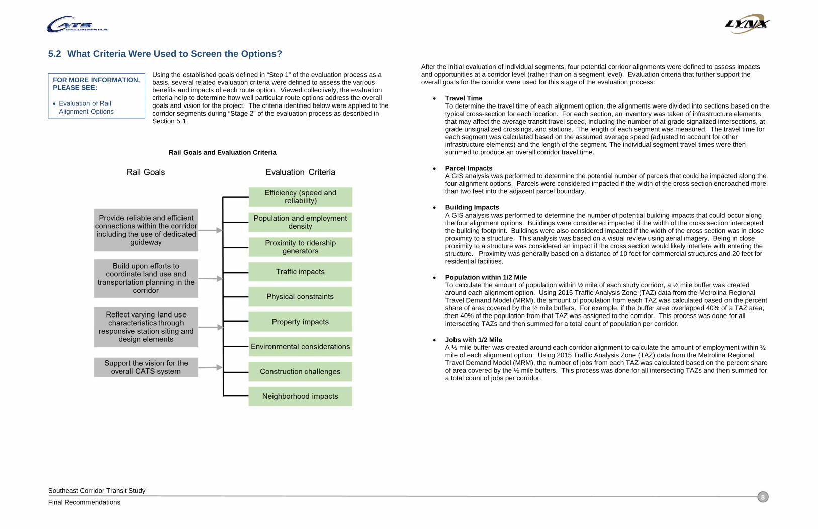
5.2 What Criteria Were Used to Screen the Options?
Using the established goals defined in “Step 1” of the evaluation process as a basis, several related evaluation criteria were defined to assess the various benefits and impacts of each route option. Viewed collectively, the evaluation criteria help to determine how well particular route options address the overall goals and vision for the project. The criteria identified below were applied to the corridor segments during “Stage 2” of the evaluation process as described in Section 5.1.
Rail Goals and Evaluation Criteria
After the initial evaluation of individual segments, four potential corridor alignments were defined to assess impacts and opportunities at a corridor level (rather than on a segment level). Evaluation criteria that further support the overall goals for the corridor were used for this stage of the evaluation process:
Travel Time To determine the travel time of each alignment option, the alignments were divided into sections based on the typical cross-section for each location. For each section, an inventory was taken of infrastructure elements that may affect the average transit travel speed, including the number of at-grade signalized intersections, at-grade unsignalized crossings, and stations. The length of each segment was measured. The travel time for each segment was calculated based on the assumed average speed (adjusted to account for other infrastructure elements) and the length of the segment. The individual segment travel times were then summed to produce an overall corridor travel time.
Parcel Impacts A GIS analysis was performed to determine the potential number of parcels that could be impacted along the four alignment options. Parcels were considered impacted if the width of the cross section encroached more than two feet into the adjacent parcel boundary.
Building Impacts A GIS analysis was performed to determine the number of potential building impacts that could occur along the four alignment options. Buildings were considered impacted if the width of the cross section intercepted the building footprint. Buildings were also considered impacted if the width of the cross section was in close proximity to a structure. This analysis was based on a visual review using aerial imagery. Being in close proximity to a structure was considered an impact if the cross section would likely interfere with entering the structure. Proximity was generally based on a distance of 10 feet for commercial structures and 20 feet for residential facilities.
Population within 1/2 Mile To calculate the amount of population within ½ mile of each study corridor, a ½ mile buffer was created around each alignment option. Using 2015 Traffic Analysis Zone (TAZ) data from the Metrolina Regional Travel Demand Model (MRM), the amount of population from each TAZ was calculated based on the percent share of area covered by the ½ mile buffers. For example, if the buffer area overlapped 40% of a TAZ area, then 40% of the population from that TAZ was assigned to the corridor. This process was done for all intersecting TAZs and then summed for a total count of population per corridor.
Jobs with 1/2 Mile A ½ mile buffer was created around each corridor alignment to calculate the amount of employment within ½ mile of each alignment option. Using 2015 Traffic Analysis Zone (TAZ) data from the Metrolina Regional Travel Demand Model (MRM), the number of jobs from each TAZ was calculated based on the percent share of area covered by the ½ mile buffers. This process was done for all intersecting TAZs and then summed for a total count of jobs per corridor.
FOR MORE INFORMATION, PLEASE SEE: Evaluation of Rail
Alignment Options
Southeast Corridor Transit Study
Final Recommendations 9
5.3 How Were the Public and Other Stakeholders Engaged?
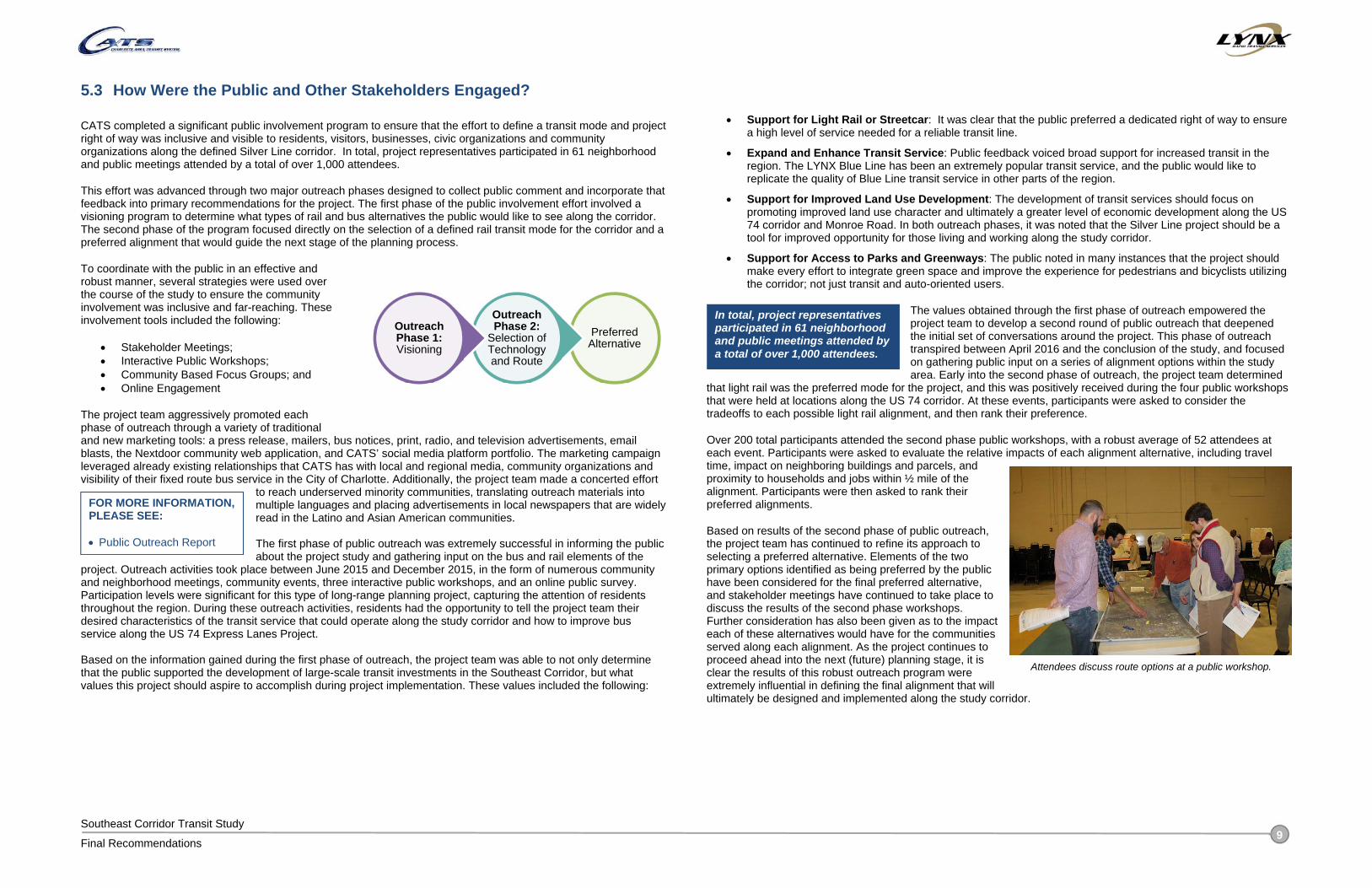
CATS completed a significant public involvement program to ensure that the effort to define a transit mode and project right of way was inclusive and visible to residents, visitors, businesses, civic organizations and community organizations along the defined Silver Line corridor. In total, project representatives participated in 61 neighborhood and public meetings attended by a total of over 1,000 attendees.
This effort was advanced through two major outreach phases designed to collect public comment and incorporate that feedback into primary recommendations for the project. The first phase of the public involvement effort involved a visioning program to determine what types of rail and bus alternatives the public would like to see along the corridor. The second phase of the program focused directly on the selection of a defined rail transit mode for the corridor and a preferred alignment that would guide the next stage of the planning process.
To coordinate with the public in an effective and robust manner, several strategies were used over the course of the study to ensure the community involvement was inclusive and far-reaching. These involvement tools included the following:
Stakeholder Meetings; Interactive Public Workshops; Community Based Focus Groups; and Online Engagement
The project team aggressively promoted each phase of outreach through a variety of traditional and new marketing tools: a press release, mailers, bus notices, print, radio, and television advertisements, email blasts, the Nextdoor community web application, and CATS’ social media platform portfolio. The marketing campaign leveraged already existing relationships that CATS has with local and regional media, community organizations and visibility of their fixed route bus service in the City of Charlotte. Additionally, the project team made a concerted effort
to reach underserved minority communities, translating outreach materials into multiple languages and placing advertisements in local newspapers that are widely read in the Latino and Asian American communities. The first phase of public outreach was extremely successful in informing the public about the project study and gathering input on the bus and rail elements of the
project. Outreach activities took place between June 2015 and December 2015, in the form of numerous community and neighborhood meetings, community events, three interactive public workshops, and an online public survey. Participation levels were significant for this type of long-range planning project, capturing the attention of residents throughout the region. During these outreach activities, residents had the opportunity to tell the project team their desired characteristics of the transit service that could operate along the study corridor and how to improve bus service along the US 74 Express Lanes Project. Based on the information gained during the first phase of outreach, the project team was able to not only determine that the public supported the development of large-scale transit investments in the Southeast Corridor, but what values this project should aspire to accomplish during project implementation. These values included the following:
Support for Light Rail or Streetcar: It was clear that the public preferred a dedicated right of way to ensure a high level of service needed for a reliable transit line.
Expand and Enhance Transit Service: Public feedback voiced broad support for increased transit in the region. The LYNX Blue Line has been an extremely popular transit service, and the public would like to replicate the quality of Blue Line transit service in other parts of the region.
Support for Improved Land Use Development: The development of transit services should focus on promoting improved land use character and ultimately a greater level of economic development along the US 74 corridor and Monroe Road. In both outreach phases, it was noted that the Silver Line project should be a tool for improved opportunity for those living and working along the study corridor.
Support for Access to Parks and Greenways: The public noted in many instances that the project should make every effort to integrate green space and improve the experience for pedestrians and bicyclists utilizing the corridor; not just transit and auto-oriented users.
The values obtained through the first phase of outreach empowered the project team to develop a second round of public outreach that deepened the initial set of conversations around the project. This phase of outreach transpired between April 2016 and the conclusion of the study, and focused on gathering public input on a series of alignment options within the study area. Early into the second phase of outreach, the project team determined
that light rail was the preferred mode for the project, and this was positively received during the four public workshops that were held at locations along the US 74 corridor. At these events, participants were asked to consider the tradeoffs to each possible light rail alignment, and then rank their preference.
Over 200 total participants attended the second phase public workshops, with a robust average of 52 attendees at each event. Participants were asked to evaluate the relative impacts of each alignment alternative, including travel time, impact on neighboring buildings and parcels, and proximity to households and jobs within ½ mile of the alignment. Participants were then asked to rank their preferred alignments.
Based on results of the second phase of public outreach, the project team has continued to refine its approach to selecting a preferred alternative. Elements of the two primary options identified as being preferred by the public have been considered for the final preferred alternative, and stakeholder meetings have continued to take place to discuss the results of the second phase workshops. Further consideration has also been given as to the impact each of these alternatives would have for the communities served along each alignment. As the project continues to proceed ahead into the next (future) planning stage, it is clear the results of this robust outreach program were extremely influential in defining the final alignment that will ultimately be designed and implemented along the study corridor.
Preferred Alternative
Outreach Phase 2:
Selection of Technology and Route
Outreach Phase 1:Visioning
Attendees discuss route options at a public workshop.
FOR MORE INFORMATION, PLEASE SEE: Public Outreach Report
In total, project representatives participated in 61 neighborhood and public meetings attended by a total of over 1,000 attendees.

Southeast Corridor Transit Study
Final Recommendations 10
6 WHAT IS THE PREFERRED RAIL ALIGNMENT?
6.1 Where Would the Rail Line and Stations Be Located? The preferred alignment represents the single route that will serve as the “locally preferred alternative” for the rail component of the Silver Line project. The identification of this corridor resulted from a significant outreach effort to the public and corridor stakeholders, along with a collaborative working relationship between CATS, the City of Charlotte, and the Town of Matthews to identify a preferred route that meets each agency’s goals.
Additional corridor refinement will occur during subsequent environmental analyses and advanced design phases; however, designation of a single corridor allows for a more specific and targeted corridor preservation program. The designation of the preferred alignment also offers more certainty with regard to the desired transit outcome than has been generated in previous planning efforts for this corridor.
The preferred alignment is a variation of “Corridor Option B” that accesses Monroe Road in Matthews, but connects between Sam Newell Road and Monroe Road via a new alignment in the vicinity of Industrial Drive. This routing allows for close access to Downtown Matthews while not traversing the heart of Downtown.
Preferred Rail Alignment
FOR MORE INFORMATION, PLEASE SEE: Evaluation of Rail
Alignment Options Rail Station Locations and
Typologies Rail Alignment Conceptual
Design

Southeast Corridor Transit Study
Final Recommendations 11
6.2 What Would the Rail Line Look Like? The preferred alignment will use exclusive guideway, noting that short sections of shared-lane operation may be required in constrained areas such as Uptown Charlotte based on site-specific design requirements. As such, rail would primarily operate in its own lane either in the median or along the side of the roadway. The following sample visualizations illustrate examples of the proposed alignment at specific locations.
Side-running light rail alignment with new frontage road and multi-use path Independence Blvd. East of Wendover Road (Looking East)
Side-running light rail alignment Independence Blvd. Near The Plaza (Looking East)
FOR MORE INFORMATION, PLEASE SEE: Evaluation of Rail
Alignment Options Rail Alignment Conceptual
Design

Southeast Corridor Transit Study
Final Recommendations 12
6.3 What Would the Stations Look Like? Scale, density, population, and land uses are factors considered for the development of station area plans for each of the stations along the corridor. To better identify the unique needs of each station, Station Area Typologies were developed for this study to describe conditions and functions, envision future possibilities, guide policy and/or prioritize investments, and measure change over time. Within the Southeast Corridor, five station area typologies have been identified and each is unique to the transit areas it serves:
Center City
Urban Neighborhood (Central, CPCC, Pecan, Morningside, Village Lake, Downtown Matthews / Hospital)
Transit Neighborhood (Amity Gardens, Sharon Amity, Galleria, Matthews Township Parkway)
Destination (Coliseum / Ovens, Sportsplex)
Regional Hub (Conference, CPCC Levine)
Transit Station Typologies
FOR MORE INFORMATION, PLEASE SEE: Rail Station Locations and
Typologies
Southeast Corridor Transit Study
Final Recommendations 13
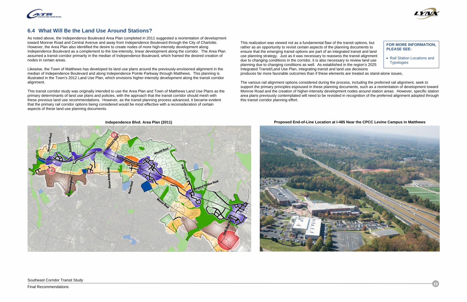
6.4 What Will Be the Land Use Around Stations? As noted above, the Independence Boulevard Area Plan completed in 2011 suggested a reorientation of development toward Monroe Road and Central Avenue and away from Independence Boulevard through the City of Charlotte. However, the Area Plan also identified the desire to create nodes of more high-intensity development along Independence Boulevard as a complement to the low-intensity, linear development along the corridor. The Area Plan assumed a transit corridor primarily in the median of Independence Boulevard, which framed the desired creation of nodes in certain areas.
Likewise, the Town of Matthews has developed its land use plans around the previously-envisioned alignment in the median of Independence Boulevard and along Independence Pointe Parkway through Matthews. This planning is illustrated in the Town’s 2012 Land Use Plan, which envisions higher-intensity development along the transit corridor alignment.
This transit corridor study was originally intended to use the Area Plan and Town of Matthews Land Use Plans as the primary determinants of land use plans and policies, with the approach that the transit corridor should mesh with these previous land use recommendations. However, as the transit planning process advanced, it became evident that the primary rail corridor options being considered would be most effective with a reconsideration of certain aspects of these land use planning documents.
This realization was viewed not as a fundamental flaw of the transit options, but rather as an opportunity to revisit certain aspects of the planning documents to ensure that the emerging transit options are part of an integrated transit and land use planning strategy. Just as it was necessary to reassess the transit alignment due to changing conditions in the corridor, it is also necessary to review land use planning due to changing conditions as well. As established in the region’s 2025 Integrated Transit/Land Use Plan, integrating transit and land use decisions produces far more favorable outcomes than if these elements are treated as stand-alone issues.
The various rail alignment options considered during the process, including the preferred rail alignment, seek to support the primary principles espoused in these planning documents, such as a reorientation of development toward Monroe Road and the creation of higher-intensity development nodes around station areas. However, specific station area plans previously contemplated will need to be revisited in recognition of the preferred alignment adopted through this transit corridor planning effort.
Independence Blvd. Area Plan (2011)
FOR MORE INFORMATION, PLEASE SEE: Rail Station Locations and
Typologies
Proposed End-of-Line Location at I-485 Near the CPCC Levine Campus in Matthews

Southeast Corridor Transit Study
Final Recommendations 14
6.5 How Does the Silver Line Connect to Other Transit Lines in Uptown Charlotte? The Silver Line corridor has the opportunity to support other CATS initiatives, such as connecting to Gateway Station and extending to the west, or interlining with LYNX Blue Line. It is difficult to select a single preferred option in Uptown, since the location and timing of these other initiatives are unknown. Given that a goal of this study is to support the vision for the overall CATS system, advancing the various options in Uptown Charlotte provides the
greatest flexibility to compliment other initiatives as projects moves forward. Stakeholders were supportive of the concept of viewing the Silver Line as part of a longer east-west rail corridor across Mecklenburg County that would connect Uptown Charlotte, Matthews, and Charlotte-Douglas International Airport. Such a corridor would be primed for future extensions east into Union County or west into Gaston County. The Uptown Charlotte options identified for further consideration are illustrated below.
Alignment Option Description
1 12th to Gateway Station
The rail alignment would operate in its own right-of-way generally between 12th Street and I-277, crossing under I-277 at the CSX railroad underpass. The alignment would operate in-street along Smith Street to the future Gateway Station area.
Direct connection to Gateway Station and LYNX Blue Line. Supports development and connectivity efforts at Gateway Station area. Access to LYNX Blue Line would be through a transfer. Does not go through the heart of Uptown. Potential to extend to the west.
12th to Blue Line Extension (BLE)
The rail alignment would operate in its own right-of-way generally between 12th Street and I-277, connecting directly onto Blue Line Extension tracks at 12th Street.
Direct connection to the LYNX Blue Line. Connection to the Charlotte Transportation Center via Blue Line. Does not access Gateway Station. Potential to extend to the west.
3 Trade (Interline with Gold Line)
Silver Line trains would share tracks with CityLYNX Gold Line streetcars through Uptown Charlotte.
Direct connection to the Charlotte Transportation Center and heart of Uptown Charlotte. Sharing tracks would make efficient use of rail infrastructure that is already in place;
however, the Trade Street alignment has more frequent stops and is inconsistent with the desired characteristics of the Silver Line to facilitate quicker trips over longer distances.
Enhancing the prioritization of transit on Trade Street (for example, with a dedicated transit lane) would improve the travel speeds of rail vehicles on Trade Street.
Could extend to Gateway Station and beyond to the west.
4 Stonewall to Gateway Station
Creates a new rail alignment that connects to the Blue Line on the south side of Uptown at Stonewall Station.
The rail alignment would travel along Charlottetowne Avenue, then along Stonewall Street where it would operate in-street for a short distance before turning north on Graham Street.
Provides connection to Gateway Station. Mixed traffic decreases reliability. Special events at Bank of America Stadium may impact reliability.
5 Stonewall to Carson
Creates a new rail alignment that connects to the Blue Line on the south side of Uptown at Carson Station.
The rail alignment would travel along Charlottetowne Avenue., then along Stonewall Street before turning south at South Boulevard, where it would cross I-277.
Silver Line trains would not necessarily connect onto the Blue Line alignment; instead, the Silver Line could continue westward.
Does not connect to Gateway Station. Mixed traffic decreases reliability.
6 I-277 to Carson
Creates a new rail alignment that would connect to the Blue Line in the South End area near the Carson Station.
The rail alignment would travel along Charlottetowne Avenue., then could travel along Stonewall Street or in a new guideway along the south side of I-277, before operating in-street along Carson Street.
Creation of a new alignment in the vicinity of I-277 is likely to require acquisition of existing properties.
Silver Line trains would not necessarily connect onto the Blue Line alignment; instead, the Silver Line could continue westward.
FOR MORE INFORMATION, PLEASE SEE: Evaluation of Rail
Alignment Options
Uptown Charlotte Rail Alignment Options

Southeast Corridor Transit Study
Final Recommendations 15
6.6 What is the Rail Operations Plan? At the Alternatives Analysis level, a conceptual rail operating plan is based on assumed operating speeds for light rail that vary according to the type of alignment design that would be implemented in different segments along the corridor. A more detailed operating plan linked to specific design speeds along various segments would be developed as part of future design phases. The following speed assumptions were made for the Silver Line rail alignment options: For side-running sections, the maximum speed generally ranges from 50-55 miles per hour (mph). The average
speed may be lower to account for delays through intersections and station areas. For median-running sections, the maximum speed generally would be the same as the speed limit of the adjoining
road. The average speed may be lower to account for slight delays through intersections, though signal priority is assumed.
For mixed-traffic situations, the maximum speed generally would be 15-25 mph and would operate with the flow of traffic. At this time, the only mixed-traffic segments being considered are various options in Uptown Charlotte.
The dwell time at stations is assumed to be approximately 30 seconds (15 seconds for actual dwell time including doors opening and closing and an additional 15 seconds for deceleration and acceleration entering and exiting the station).
To determine the travel time of each alignment option, the alignments were divided into segments based on the typical cross-section. For each segment, an inventory was taken of infrastructure elements that may reduce the average travel speed, including the number of at-grade signalized intersections, at-grade unsignalized crossings, and stations. The length of each segment was measured. The travel time for each segment was calculated based on the assumed average speed (adjusted to account for other infrastructure elements) and the length of the segment. The individual segment travel times were then summed to produce an overall corridor travel time. For the preferred alignment, an overall travel time of 31-35 minutes is projected. The actual travel time is dependent on the route that is ultimately selected through Uptown Charlotte.
Similar to the LYNX Blue Line, it is anticipated that Silver Line trains would operate with a 10 minute headway during the commute peak periods and every 15 minutes during the midday off-peak periods, with reduced headways on the weekends and evenings. It is assumed that each train would consist of three vehicles. Three-car trains will ultimately be operated on the LYNX Blue Line / Blue Line Extension, so
for conceptual planning purposes, a similar operations plan is assumed for the Silver Line. As planning and design progresses, a more detailed operations plan based on the projected ridership and capacity requirements will need to be developed to confirm the appropriate number of vehicles required for each train. Based on the travel time and route length estimates and an assumed frequency of service, the number of trains (consists) required to provide service for each alignment option was calculated. Given the number of trains required, the number of individual vehicles that are necessary can then be calculated, based on an assumption of three vehicles per train.
6.7 Where Would a Maintenance Facility Be Located? The recommended light rail project will require a facility for the maintenance and storage of light rail vehicles. The existing and under-construction maintenance facilities for the Blue Line Extension do not have the capacity to serve Silver Line rail vehicles. In addition, given the scale of the Silver Line project, the associated rail maintenance facility will need to be a “heavy” maintenance facility that can accommodate all levels of maintenance that can be expected throughout the vehicle life cycle. It is possible that such a maintenance facility could serve needs associated with
Blue Line vehicles as well, provided that a track connection is provided between the Blue Line and the Silver Line alignments.
A range of diverse sites was identified, but the sites evaluated are not necessarily inclusive of all possible sites. For example, other options may emerge if the Southeast Corridor (Silver Line) is ultimately connected as a single rail alignment with the West Corridor. In this case, potential maintenance facility sites in the
West Corridor could serve the extended Silver Line alignment.
The highest-ranking site of those evaluated is at the Matthews end-of-line near the CPCC Levine Campus. This site provides a strong location that meets all of the requirements while providing unique advantages such as an opportunity to develop a training program with the adjacent CPCC Levine campus. However, as future planning progresses for a Silver Line extension into the West Corridor, additional maintenance facility site options within the West Corridor may emerge. Depending on the ultimate implementation phasing of the Silver Line project, a site in the West Corridor may be preferable. These options underscore the need to consider requirements at a system-wide level rather than for individual transit projects. Such an approach could help realize significant operational efficiencies and synergies that would otherwise be unattainable with a more narrow corridor-centric approach.
Active Consists Required for 10 Minute Headway (maximum anticipated frequency)
9
Number of Vehicles per Consist 3 Total Active Vehicles 27 Spares (20% of active fleet) 6 Total Vehicles Required 33
FOR MORE INFORMATION, PLEASE SEE: Rail Operations Plan
FOR MORE INFORMATION, PLEASE SEE: Vehicle Maintenance
Facility Site Options
For the preferred alignment, an overall travel time of 31-35 minutes is projected.
Rail Vehicle Requirements for Preferred Alignment
Potential vehicle maintenance facility site near CPCC Levine Campus
Southeast Corridor Transit Study
Final Recommendations 16
7 HOW CAN THE RAIL CORRIDOR BE PRESERVED FOR FUTURE IMPLEMENTATION?
7.1 What Are the Next Steps Toward Project Implementation? As noted earlier, the Silver Line is envisioned as part of a longer east-west corridor across Mecklenburg County. However, it is difficult to select a single preferred alignment option in Uptown Charlotte, due to uncertainty in the route location extending west of Uptown toward Charlotte-Douglas International Airport. To establish a preferred alignment for the entire east-west corridor, additional study needs to be performed to define a preferred alignment in the West Corridor between Uptown Charlotte and the Airport area, along with the connection through Uptown Charlotte. After these alignments have been identified, the entire corridor can be denoted as the “Silver Line”, providing a comprehensive east-west connection much like the north-south connection that will be created with the opening of the Blue Line Extension in 2017.
After a comparable level of planning analysis has been completed for the portions of the Silver Line through Uptown Charlotte and extending to the west, planning and design work can then be advanced for the entire corridor. Conducting the required environmental analyses and advancing the design development will produce a more precise estimate of the project’s implementation costs, and will also prepare the project for entry into the project development process for possible federal funding assistance.
7.2 What Strategies Should Be Used to Retain the Corridor for Future Light Rail Construction?
One of the major challenges with future light rail project implementation is that the pace of development in Charlotte and Matthews continually changes the implementation opportunities that are available. As development and redevelopment occurs, the number of viable alignment options will continue to decrease. This is a particular challenge in Uptown Charlotte, where property and building values severely restrict the available right-of-way options. For this reason, efforts to identify and reserve the rail alignment through Uptown Charlotte should proceed quickly.
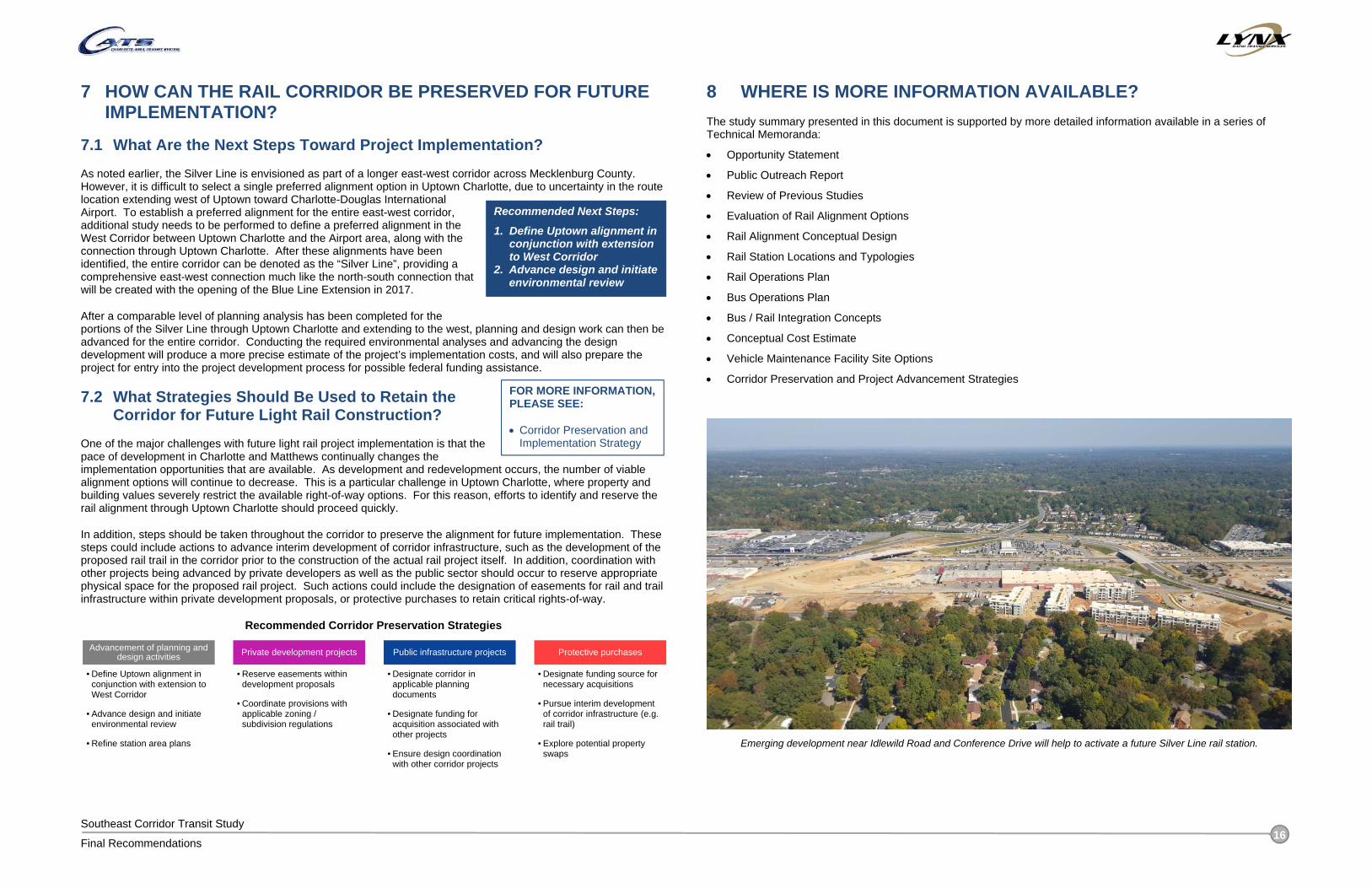
In addition, steps should be taken throughout the corridor to preserve the alignment for future implementation. These steps could include actions to advance interim development of corridor infrastructure, such as the development of the proposed rail trail in the corridor prior to the construction of the actual rail project itself. In addition, coordination with other projects being advanced by private developers as well as the public sector should occur to reserve appropriate physical space for the proposed rail project. Such actions could include the designation of easements for rail and trail infrastructure within private development proposals, or protective purchases to retain critical rights-of-way.
Recommended Corridor Preservation Strategies
8 WHERE IS MORE INFORMATION AVAILABLE? The study summary presented in this document is supported by more detailed information available in a series of Technical Memoranda:
Opportunity Statement
Public Outreach Report
Review of Previous Studies
Evaluation of Rail Alignment Options
Rail Alignment Conceptual Design
Rail Station Locations and Typologies
Rail Operations Plan
Bus Operations Plan
Bus / Rail Integration Concepts
Conceptual Cost Estimate
Vehicle Maintenance Facility Site Options
Corridor Preservation and Project Advancement Strategies
Advancement of planning and design activities
• Define Uptown alignment in conjunction with extension to West Corridor
• Advance design and initiate environmental review
• Refine station area plans
Private development projects
• Reserve easements within development proposals
• Coordinate provisions with applicable zoning / subdivision regulations
Public infrastructure projects
• Designate corridor in applicable planning documents
• Designate funding for acquisition associated with other projects
• Ensure design coordination with other corridor projects
Protective purchases
• Designate funding source for necessary acquisitions
• Pursue interim development of corridor infrastructure (e.g. rail trail)
• Explore potential property swaps
FOR MORE INFORMATION, PLEASE SEE: Corridor Preservation and
Implementation Strategy
Emerging development near Idlewild Road and Conference Drive will help to activate a future Silver Line rail station.
Recommended Next Steps:
1. Define Uptown alignment in conjunction with extension to West Corridor
2. Advance design and initiate environmental review