Embed Size (px)
Citation preview

How Location inteLLigence ReveaLs oppoRtunity in Big Data
The Power of Place
in association witH:

IntroductIon .........................................................................................................................................................................2
PART I: ThRee APPlIcATIons foR locATIon DATA .......................................................................................4
1. EnrIchIng BusInEss data ..................................................................................................................................5
2. analyzIng BusInEss data ................................................................................................................................8
3. VIsualIzIng BusInEss data ............................................................................................................................. 11
PART II: how locATIon fuels InnovATIon .................................................................................................... 14
1. locatIon-BasEd sErVIcEs .............................................................................................................................. 15
2. BusInEss dEcIsIon MakIng ............................................................................................................................ 16
3. MarkEtIng and adVErtIsIng ...................................................................................................................... 17
conclusIon ............................................................................................................................................................................ 19
acknowlEdgMEnts ........................................................................................................................................................20
conTenTs

2 | The Power of Place
the story that most, if not all, businesses today are grappling with
—the explosive growth of big data: how to harness it, how to store
it and how to use it to support meaningful and effective decision
making—is by now a well-known one. collectively, enterprises are
acknowledging the fact and value of big data and the requirement of
advanced analytics to parse it for actionable business insight. what’s
less well-known is the value of location data and the intelligence that
geospatial analysis can provide business decision makers, beyond
those that are gIs (geographic information system) professionals.
with smartphone penetration rates on the rise in emerging and advanced econo-mies alike,1 the proliferation of location infrastructure such as RFID, beacons, GPS and cell towers, as well as the Internet of Things tipped to go mainstream within a few years, location data is already and will continue to be a growing
component of all business data. However, rather than adding to the complexity of the data landscape, location has the power to bring order to it.
“The real strength of location data is that it becomes a common link between seemingly disconnected silos of business data,” says Nigel Lester, managing director for Pitney Bowes in the Australia-New Zealand region. “Data that doesn’t seem to have any obvious rela-tionship can be contextualized by location. It could be your customer locations versus your competitor’s locations—data sets with no obvious link, but if you start to geo-enrich them, you may find that relationships begin to emerge and you’ll be able to build out a more holis-tic and valuable view of your customers.”
There’s a huge opportunity to exploit that data to create competitive advantage and make better, more actionable business decisions. And that’s what the power of place really is: a way to reveal relationships between data sets that might not have otherwise been obvi-ous or easy to ascertain and, through location analytics, arrive at the kind of insights that get reflected in the bottom line. Organizations today are using location-based data and ana-lytics to do just that in a number of ways, from reducing costs through augmenting address
1 Poushter, J. (2016, february 22). Smartphone ownership and Internet Usage continues to climb in emerging economies. retrieved october 11, 2016, from http://www.pewglobal.org/2016/02/22/smartphone-ownership-and-internet-usage-continues-to-climb-in-emerging-economies/
InTroducTIon
coPyrIghT © 2016 Forbes InsIghts | 3
The real
strength of location
data is that it becomes
a common link
between seemingly
disconnected silos
of business data.”
— nigel lester Managing director anz, Pitney Bowes
verification to improving customer experiences with in-store location technology, and enhancing civic and community engagement in local government with spatial analysis software.
With major business intelligence platforms, like IBM Cognos, now packaging location analytics and data as part of their offerings, it signals that location intelligence has moved into the mainstream enterprise technology landscape. But businesses looking for deeper, cus-tomizable functionality will still need to turn to specialized vendors for advanced spatial analytics and additional data sets such as demograph-ics. Fortunately, changes in the technology over recent years means that spatial mapping and analysis software is becoming more user-friendly, moving out of the sole domain of GIS professionals and into the realm of everyday users. “You’re now beyond that walled garden of the GIS department,” says Clarence Hempfield, vice president, product manage-ment—Location Intelligence at Pitney Bowes. “The volume and variety of data has increased because you’re now not just dealing with geospatial information, but you need to blend it with the more traditional business data in order to unlock business value. And depending on the use case and required service level agreements, this data mashup can require flexibility and performance to meet the business requirement.”
Drawing on research and interviews with experts, industry profession-als and real-world use cases, this report explores the power of location data for businesses. The paper is split into two main parts: the first deals with the main applications of location data itself—enriching, analyzing and visualizing business data—interspersed with use cases that illustrate those applications. The second part focuses on the ways location data can drive innovation, with a particular focus on marketing and advertising. And finally, we provide recommendations at the end of this paper for those businesses looking to embark on their own location data initiatives. We hope you find it instructive.

4 | The Power of Place
paRt i
Three aPPlIcaTIons for
locaTIon daTa

coPyrIghT © 2016 Forbes InsIghts | 5
geo-enrichment joins the geocoded data point with authoritative attributes to present a more detailed understanding of it. In insurance, for example, geo-enrichment often involves
appending critical information about the attributes of a property address, including the type and number of buildings on a particular parcel of land, the property age, construction, residential or commercial usage, sale values and more—and then applying a confidence code to that data.
“Raw data is in itself useful for analytics…but it’s much more meaningful if we can augment it with other data—that’s the geo-enrichment part,” says Joe Francica, Pitney Bowes’ managing director for geospa-tial industry solutions. He gives an example: raw data on pollution in a city could be monitored and analyzed against demographic information, such as the density of vehicles—which may be a factor in causing the pol-lution. In addition, recognizing the location of health problems associated with pollution allows city gov-ernment leaders to not only monitor the pollution and take steps to mitigate it, but also to automate mobile air quality alerts when certain conditions are met. “Now it becomes a much more complete circle between moni-toring pollution and informing the public.…So that’s what geo-enrichment means. It’s the integration of authoritative data from government and other sources with new, location-based data like those from sensors.”
Other kinds of geo-enriched data sets might include global streets or boundaries, points of interest (airports, parking, recreation, transport hubs, natural features, etc.), demographics, income and purchasing power, or risk and natural hazard information. While businesses might conceivably collate their own data sets in some cases, Richard Rollins, Pitney Bowes’ global product marketing manager for location intelligence, points out
it would be a massive undertaking, requiring that com-pany to amass its own sets of street data, zip code and/or post code boundaries, potentially internationally, along with other types of data sets and the necessary licensing agreements, and to verify both the provenance of that data and its veracity. So many businesses are choos-ing to buy data sets instead, and location intelligence vendors are differentiating themselves on the strength of the geo-enriched data products they offer, and the breadth, depth and quality of each.
enrIchInG BusIness daTa1location data is a fundamental element for enriching business data. It starts with
geocoding, the process of deriving latitude and longitude coordinates from an address.
then, geo-enrichment can occur.
usE casE | InsuranceAccurately geocoding location data can be the difference between a property being improperly designated inside or outside a flood zone. That’s a difference that could come down to a few hundred feet but have huge cost implica-tions, either because the insurer undercharges on a policy and is exposed to greater risk than it had estimated, or because it overcharges a customer and subsequently loses that business to a more accurately priced competitor.
usE casE | financial servicesGeo-enriching customer profiles and accounts is increas-ingly being used in the financial sector, where regulations designed to prevent fraud and money laundering require institutions to properly understand the links between dif-ferent accounts and identify potentially fraudulent behavior. This can be done by locating customers and transactions, incidents and areas of risk, and identifying geographic rela-tionships between accounts.

6 | The Power of Place
company founder and ceo, richard white, explains that, for customers operating within the supply chain, there are a number of pain points around international addressing and participant
identification that may seem small but can cause big problems which add up to a lot of wasted money down the road. one of those is that global addresses aren’t standardized across borders. “In asia, typically addresses
have evolved to be blocks and buildings, and in most western countries it’s street and street number,” white says. “But even within the western bloc, standards vary widely. So it’s not uncommon for data entry in one coun-try to input pickup and delivery addresses incorrectly, causing futile trips, customs holds, compliance failures, unwanted costs and delays—and in some cases substan-tial fines and the loss of trading rights.”
To mitigate these issues, wiseTech has created a full suite of participant identification, deduplication and data enrichment tools across its global platform. By integrat-ing address validation and geocoding technology with its own proprietary algorithms and data sources, the car-gowise one global platform allows formatting, cleans-ing, correction and validation of addresses so they can be the base for many functional improvements such as local pickup and delivery, participant identification and deduplication. regardless of how unfamiliar the input operator is with the participant and the address structure cargowise one is able to cleanse and normalize the data to be accurate and useful. among other features, cargo-wise one appends a geocode to the participant address,
cAse sTuDy
wIsEtEch gloBal: address ValIdaTIon and GeocodInG helP
BrInG cerTaInTy To GloBal loGIsTIcs
Wisetech is a leading provider of logistics execution software to more than 6,000
corporations across 125 countries. Its flagship software platform, cargowise one,
allows logistics service providers to facilitate the movement of goods by executing
highly complex logistics transactions throughout the supply chain while managing
their operations on a single global database across multiple users, functions, countries,
languages and currencies.

coPyrIghT © 2016 Forbes InsIghts | 7
pinpointing physical locations on a map to allow for more precise route plan-ning and optimization. “These capabilities mean we have a very powerful way of helping our customer, the logistics service provider, to identify par-ticipants and address-match with a high degree of certainty. The result is fast and highly accurate cleansing and matching of addresses—the removal of false positives and false negatives.” white says.
This kind of participant identification and data enrichment has major ben-efits for logistics providers. one is the obvious savings in time and money associated with reducing incorrect data entry, duplication of master data, errors, futile trips, lengthy holds or penalties in border processing—all of which can quickly add up. “These capabilities significantly improve the sup-ply chain,” white says, “because we’re removing whole swaths of human error and risks and giving people better, accurate, complete and enriched data.” another benefit is that by removing duplication and enriching the master data for each participant in the supply chain, cargowise one removes a major pain point that causes errors, confusion and customer frustration. That’s important because—aside from the fact that duplicate accounts are costly, frustrating and create work—there are very real risks and penalties involved if they result in incorrect customs entries or trading with denied parties or embargoed goods. Trade with such “denied parties” (those designated by various government agencies as being associated with terrorism, illegal weapons or drug trading) is an uncommon but poten-tially prohibitive error to make. cargowise one can help ensure shippers and logistics providers don’t inadvertently engage in trade with these par-ties. “By converting government agency lists on denied parties to validated address components, our technology means that if you have an actual denied party, you can locate them much more easily and avoid illegal trade, meaning you’re better able to protect your own business and that of your customers,” white says.
Thanks to this combination of validation and geocoding, along with wiseTech’s own participant identification, deduplication and data enrich-ment algorithms, white says cargowise one is able to solve major data entry problems associated with address verification, on a global scale and in real time. and although address verification is a small, but ultimately incredibly beneficial, part of the cargowise one platform, white says it is a point of dif-ferentiation with its competitors. “Nobody else in our space is providing the level of integrated and powerful participant identification, deduplication and data enrichment on a global basis,” he says. “we are not aware of another system with anything close to this, not even within shooting distance.”
nobody else
in our space is
providing the level
of integrated and
powerful participant
identification,
deduplication and
data enrichment on
a global basis.”
— Richard white company Founder and cEo, wisetech global
cAse sTuDy

8 | The Power of Place
analyZInG BusIness daTa2location is an intrinsic component of nearly all data about physical objects. Every physical
entity exists somewhere in space and time and, consequently, there is often something
to be learned by analyzing those locations in conjunction with other data sets.
s Pitney Bowes’ Nigel Lester says, location is a “common key” to link between different data sets, revealing a previously unseen or
unknowable relationship. For example, it could link the relationship between a hur-ricane’s path and intensity with the number of claims adjusters an insurance company should dispatch, or between customer drive-time to a store and its sales targets. The power of location analytics is in unlocking these relationships in a way that can be used to support better decision making.
“The products and services that people consume are in part influenced by geo-demographic information,” Hempfield says in an illustrative example. “So the best-in-class organizations are using location-based insights to not only influence the location of stores or an asset, but also to under-stand what products and services they may offer that ultimately help them become more relevant to their customer base and generate more-profitable customer relationships.”
Location analytics can enhance other types of analytics a business is already performing, resulting in greater value. In our interview, Forrester analyst Rowan Curran (p. 9) underscores this point, mentioning that one of the major takeaways from his research into the location intelligence technology space was that greater value was created by those businesses that were able to link geospatial analysis with other types of analytics and data.
usE casE | Retail Retailers that use interior Bluetooth Low Energy Beacons, RFID or Wi-Fi in combination with a mobile loyalty app may be able to analyze customer shopping behavior in-store, and as a result optimize store layout or inventory. The data could also be used to automate the delivery of in-store mobile offers rel-evant to the customer’s past shopping history or the department the cus-tomer is visiting. This kind of customer engagement at the point of purchase can increase purchases and store loyalty when offers are served at the right time.

coPyrIghT © 2016 Forbes InsIghts | 9
thE ForrEstEr waVE: GeosPaTIal analyTIcs Tools
and PlaTforms, Q3 2016
Forrester is a global technology market research firm, and its wave reports have become keenly watched releases on emerging and estab-lished technologies and the leading vendors in those spaces. The com-pany recently released the wave for geospatial tools and platforms,
including Pitney Bowes as a leader in its assessment [http://www.pitney-bowes.com/us/forrester/namespbleader]. we spoke to the report’s author, forrester analyst rowan curran, for more about the wave and its criteria, as well as his thoughts on the importance of location intelligence tools for busi-ness. The following conversation has been edited for length and clarity.
for those that might not be familiar with forrester’s wave reports, could you tell us what they are and what their purpose is? The wave is basically our really deep dive vendor research into a particular technology space for a particular set of client needs. In this case, it’s geospa-tial tools and platforms. Just to give you some analogous ones, we also have the predictive analytics platforms wave, which I also co-author, as well as the streaming analytics wave, and the search analysis discover wave. really, it’s intended to look at the set of vendors that we feel are the furthest forward in the space and assess them all relative to each other, based on a set of scoring criteria with weightings according to user needs. Then basically put that out there so people can start developing their short list and have some guidance into how they should make their technology sourcing.
why was now the right time to look into location intelligence and geospatial tools for the wave? our research is driven in combination by both what we see as analysts in the market and what we see as the trends and what is becoming important to our clients—as well as what our clients are actually asking us for explicitly. In late 2014 and early 2015, we had an increasingly large spike of client requests around how to leverage geospatial data. we realized the space had matured a lot and the use of geospatial data had expanded far beyond the traditional base in gIS [geographic Information Systems] platforms. we had really identified it as an expanding area of interest to our clients as well as being more deeply relevant to some of the more advanced analytics that we had covered already,
The folks
who are able to link
geospatial analysis with
other types of analysis
are really the ones who
are able to provide the
broadest value sets to
their customers.”
— Rowan curran analyst, Forrester
Q&A

10 | The Power of Place
so at that point we decided we needed to really drill down in the space to help our clients understand it better.
what were some of the big takeaways or surprises for you from putting the geospatial wave together? one of the biggest takeaways for me was that the folks who are able to link geospatial analysis with other types of analysis—standard predictive and machine learning along with integrating, say, text analytics or other types of advanced analytics—were really the ones who are able to provide the broadest value sets to their customers, and especially ones who are really able to meet the scalability needs of the data sizes and also [the] amount of requests that they were getting.
you can create a visualization with some drill-downs on some geospatial data, but if you can’t actually serve increasingly the hundreds and maybe thousands of users within your organization within a timely fashion, it’s just not nearly as worth it for folks to invest.
on the surprising side was more around the amount of augmenting data. So being able to provide additional data sets, contacts, things like that to the analysis, which were provided directly by the vendors or, actually, by a number of ancillary companies. a lot of the differentiation in advanced analytics, in general, as well as in geospa-tial analysis specifically over the past couple of years, has really been around the algorithms and the tooling, and how quickly and efficiently you can build these models—so to see differentiation based upon what data was being brought to the table with these platforms was refreshing.
I would say one of the most surprising things to me about the wave research itself…was the role that open source plays in location intelligence. I look at a lot of open source analytic systems in other areas of my research, and I’d
started to look at it in the geospatial space—what I found there was that while there are a lot of great projects for visualizing or mapping data, there are not a lot of great projects at the enterprise level that can do a lot of the spatial analysis itself. There was no real, brilliant, open source project that was able to deploy enterprise scale for geospatial analysis that I encountered.
why do you think location intelligence is so important for businesses today? [There’s a commonly cited statistic] pointing out that 80% of business data has a location component. while I think that may have been a little bit of an overestimate in the past, I actually think that now it is an underestima-tion of how much enterprise data has a location compo-nent, or can have a location component inferred from it in some way.
The Internet revolution basically gave you access to tons and tons of people’s locations through IP addresses, then the mobile revolution basically gave you immediate access to people’s location all the time because we’re all carrying around these trackers with multiple sources of location on them. I think that’s a really important part of this—it’s not just about gPS anymore. It’s a combination of gPS, wi-fi, Bluetooth low-energy and then increasingly other meth-ods of collecting location. Beyond that, we’re moving into a time when many, many more devices beyond our mobile phones are connected to the Internet, and that creates a whole other vector for actually exploiting location data. additionally, we’re able to use other types of analytics to tangentially get at location [like] text analytics on a tweet that might not have a geotag on it.
getting at these tangentially as well as the much broader capability to exploit the explicit location information within all these embedded devices in software, I think, is really what is absolutely fascinating about this current moment.
Q&A

coPyrIghT © 2016 Forbes InsIghts | 11
Importantly also, as our 2014 white paper, “The Eureka Moment,”2 noted, maps are widely recognized and understood—even by non-technical professionals—which helps make the data represented more accessible and understood by those who might make use of it.
Our case study with Torfaen Borough Council (p. 12) demonstrates one way in which visualizing data around location can support bet-ter decision making and engagement with citizens, while helping keep costs down by reducing call center demands. The interview revealed that the council is able to represent information about planned changes that would impact roads, schools, parking and other public spaces, on interactive maps hosted on its website. As a consequence, GIS Officer Donna Edwards-John says public engagement with consultations has improved as people are better informed as to how proposed changes would affect them.
2 Brendish, l. (2014). “The eureka Moment: location Intelligence and competitive Insight” [white paper, sponsored by Pitney Bowes]. New york, Ny. forbes Insights.
location helps us visualize business data in familiar
ways—typically with maps. unlike traditional business
analytics, which tends to present results in spreadsheets,
pie charts and bar graphs, maps allow businesses to
see the underlying proximity relationships and trends in
their data.
VIsualIZInG BusIness daTa3Geoassurance
when it comes to the in-depth property reports that ralph Kephart’s los angeles, california-based geoassurance produces
for homeowners, cutting through the legalese to provide an at-a-glance assessment is key to his success. That’s because, as Kephart, presi-dent of geoassurance, points out, buying and selling a property is already a process bogged down by documents. The reports he produces are legally required by california law to disclose proximity to natural hazards like flood and landslide zones, earthquake faults and even mines—but he can quickly communicate this information using maps to visually represent the size and proximity of hazards in the vicin-ity. The geospatial mapping software Kephart uses to produce these reports has been instru-mental in helping him manage the multiple and differing data sets from state, local and federal authorities, and the maps he can produce for his customers as a result help provide them that at-a-glance assessment they need.
DoerS, USerS aND VIewerSPitney Bowes’ Joe Francica breaks down the three main sets of spatial analysis users.
DoerS—gIS professionals; those trained in geospatial analysis whose job entails creating maps and reports on a daily basis.
USerS—These are business professionals who use location-based data as part of their job, although not necessarily daily. They use it to analyze data and augment their analyses as well as produce reports based on some level of understanding of geospatial information.
VIewerS—a catch-all for almost everyone else who may use mobile mapping apps and web mapping portals. Viewers primarily rely on location data for visualization rather than in analysis.

12 | The Power of Place
set in the heart of southern wales, Torfaen county Borough council is a small local authority serving around 91,000 residents. The district is a mix of old and new—there are the industrial-era mining
towns as well as the fast-growing cwmbran, a planned “new town” community established after world war II. like many local authorities in the U.K., Torfaen has faced severe budget cutbacks, placing pressure on it to work smarter to continue to deliver services while increasing transparency with the public. “But we do seem to be struggling on through and soldiering on,” says Donna edwards-John, Torfaen’s gIS offi-cer. “There’s still the same work to be done, and we’ve still got a lot of residents we need to support.”
one key strategy in helping to make Torfaen’s budget stretch is in its mapping system, which it originally implemented in 2004 and has been growing and evolving since. In its current iteration, Torfaen has enter-prise-level spatial analysis software that can both handle its internal requirements as well as allowing residents to self-serve information on planning applications, consents, outages and neighborhood services.
for residents, the software allows quick access to information with geographic relevance, including
school catchment areas, outages, road closures, ameni-ties, and public planning and consultations. That helps reduce administrative costs associated with in-person and phone inquiries. It’s also helped increase civic engage-ment, edwards-John says, as residents can quickly and easily see where and how proposed changes would affect them, and combined with links the council makes avail-able to further information, residents are ultimately more informed and engaged in the process. The difference was made apparent in a recent travel consultation, in which other local authorities involved produced static PDf maps
torFaEn county Borough councIl: helPInG ImProVe communITy enGaGemenT
and oPeraTIonal effecTIVeness wITh
locaTIon InTellIGence
cAse sTuDy

coPyrIghT © 2016 Forbes InsIghts | 13
and Torfaen provided residents with information on affected routes mapped down to a household level on its website. That scalability and level of detail, edwards-John says, has led to much better-informed residents and more consultation feedback than a 1:25,000-scale PDf map would have.
Internally, the software has also had numerous benefits. for one, it has vastly improved productivity. The gIS department is small in Torfaen: it all falls to edwards-John and gIS officer Julia evans to hold it down. with a previ-ous open source system, the two were often stuck with time-consuming file uploads that could take as much as seven hours to complete, or taking an hour to train new users on the system. Now files take seconds to upload, and edwards-John says the software is so intuitive that users pick it up with-out needing to be trained. Between the two of them, edwards-John says, it is easy to administrate the software’s 300 users and their varying levels of access as well as access for the public.
Many of those internal users are officers that spend a lot of time on the road assessing highways, drainage and environmental issues. edwards-John says it’s important for those officers to be able to identify if an issue, say a washed out curb, is within the council’s boundaries before they requisition money for repair. Using smartphones to access the spatial mapping software in the field has not only increased the ease and sped up the time to make those deci-sions, but it’s cut down on mileage claims as officers no longer need to make roundtrips to look at the relevant maps.
Torfaen augments its own data with data from partner agencies like the police, fire service and local health authorities to better understand its constituency and plan appropriately. This comes into play in a couple of ways with respect to location. one is in taking live birth data and projecting student numbers over the short- and long-term, from nursery school through primary and secondary education. That data, as well as information on new housing developments, is mapped to the household level to help the council plan future resource alloca-tion for education, which is in turn fed into its official 21st century School Plan.
Partner data also comes into play in emergency planning, where edwards-John says information on vulnerable residents with dialysis or oxygen needs is kept—very securely—so that those people can be accounted for in the event of severe weather or evacuations. There’s also work to begin shortly in collaboration with police to map crime and antisocial behavior in a way that can perhaps inform future council planning.
It’s also
helped increase civic
engagement as
residents can quickly
and easily see where
and how proposed
changes would affect
them, and combined
with links the council
makes available to
further information,
residents are ultimately
more informed and
engaged in the
process.”
— Donna edwards-John gIs officer, torfaen county Borough council
cAse sTuDy
how locaTIon fuels InnoVaTIon
14 | The Power of Place
paRt ii

coPyrIghT © 2016 Forbes InsIghts | 15
For example, in our case study with WiseTech (p. 6-7), we saw that the address verification component of the software platform, although just one element of its global logistics platform,
was a legitimate point of difference with its competi-tors. Additionally, recent technological advances have seen the number of ways businesses can collect loca-tion data proliferate. Between GPS, cell towers, Wi-Fi, RFID, Bluetooth Low Energy Beacons and sensors and even VLC (visible light communication), there are an increasing number of ways that businesses can determine the position of customers and objects both indoors and out.
Both these factors—changing market dynamics and increased technological capabilities—act together to create an environment where location data and its usage are fueling innovation and creating oppor-tunities. We see that happening in three main areas: location-based services, business decision making, and marketing and advertising.
Recent technological
advances have seen
the number of
ways businesses
can collect location
data proliferate.
In an environment where businesses tend to compete less on product and price and
more on the customer value they can provide, location data and analysis can provide an
important way to differentiate and establish competitive advantage.

16 | The Power of Place
location data is fueling innovation, somewhat unsurprisingly perhaps, in services that are
particularly location-aware. uber and waze are prime examples of this, where accurate
location and routing are fundamental to the value they provide to users.
Perhaps a more creative example is a solution developed by Y&R in Dubai to combat traf-fic jams in India. India’s many traffic jams cost the country $10.8 billion every year and are
often caused by the prevalence of cows, sacred in India, allowed to roam the streets freely. Y&R took the cause—cows—and turned them into a solution. The fact is that while the cows cause many of the traffic jams, they’re also the first to find shortcuts out of the snarls—informa-tion that could come in useful for commuters. So Y&R put special collars on the cows, fitted with solar-powered
recycled smartphones that could relay GPS positioning for each of the sacred beasts. The result was something like a cow-powered Waze app called Traffic Gaaye—real-time cow-related traffic jam info was relayed to app users, while the back-alley paths that the cows navigated around the jams could be used to route drivers also.
Use of the Traffic Gaaye app resulted in an average of 15 minutes’ travel time saved, reducing fuel con-sumption and pollution levels at peak travel times. It’s little wonder the effort was named a finalist in the pres-tigious Cannes Lions awards in 2016.
locaTIon-Based serVIces1
use of the
Traffic Gaaye
app resulted in
an average of 15
minutes’ travel
time saved,
reducing fuel
consumption
and pollution
levels at peak
travel times.

coPyrIghT © 2016 Forbes InsIghts | 17
Much of the usage around location data and analytics
comes down to helping businesses make smarter, more
actionable decisions, whether that’s around risk exposure
and underwriting, service delivery or marketing.
BusIness decIsIon maKInG2 The amount of
location data being
generated and stored in
data warehouses is now
recognized as a
valuable asset that is
fundamental to
business analytics and
decision making.” — Joe francica
Managing director for geospatial Industry solutions, Pitney Bowes
In one real-world example, Domino’s Australia assessed location to help it make better decisions and automate others, including where to locate new franchises and close underperforming stores, the best route to delivery once an order was placed, and order assignment—
sending online and mobile orders to the best franchise operation for the destination.
Domino’s Australia also used geo-enriched data about its franchise locations to help potential franchisees make better decisions about where to buy. Every franchise was designated as either a bronze, sil-ver or gold-tier location and priced accordingly. However, the company wasn’t effectively communicating the difference in value with higher-cost tiers, and most franchisees bought in at lower-tier, lower-priced locations. That changed after the company enriched each location’s data with relevant socio-demographics, customer catchment zones and other information that better articulated the value of a particular location. Now, as a consequence of their better understanding, most franchisees decide to buy in at the higher tiers, equating to better overall returns for the chain.

18 | The Power of Place
combining location with the highly address-able nature of mobile devices does open up a lot of potential, however. Location analysis on transaction histories or customer profiles
can help build out better understanding of target audiences, enhancing the elusive single view of the customer that so many marketers are pursuing.
Location analytics has relevance throughout the entire customer life cycle and can bring the function-ality of web analytics to the real world. “With the proliferation of location-aware consumer devices—such as smartphones, wearables and even connected cars—location analytics can bring the kind of con-sumer analytics we’ve become accustomed to in the online world to the physical world, designing, mea-suring and managing customer experience,” notes Bill Borrelle, Pitney Bowes’ senior vice president of brand strategy and integrated marketing communi-cations. “Businesses are now able to capture location
data on customers in physical venues at an unprece-dented scale.” Borrelle wrote further on the topic in a recent opinion piece published in AdWeek, “The Where Factor: How Location Data Offers a New Marketing Edge.”
marKeTInG & adVerTIsInG3there’s a lot to gain from location data and analytics for marketing professionals, even
beyond location-based mobile advertising, which is a frequently mentioned usage.
usE casE | location-aware mobile messaging Hyperlocal-targeted mobile messages and offers can be delivered using loca-tion as a context, ensuring consumers are well placed to take advantage of an offer in the moment it is deliv-ered. We are already seeing payment processers, ad-tech platforms and retailers collaborate on such efforts.
usE casE | customer experienceGuest experiences can be managed in large venues, like stadiums or resorts, or to improve experiences in airports and travel. Way-finding, ordering and even queue management for in-demand services like restrooms or drinks can all be enhanced with loca-tion data and analysis.
usE casE | Retail In-store location technology like bea-cons or RFID can be used to identify high value customers (through loyalty apps on their phones) and notify sales staff so that the customer’s experience is assured to be a good one.
The “Where” Factor EQUATION
What If?Your Customer’s
Location
What If?The “Where”
Factor
What If?Location
Data Sets
The “where” factor eQuATIon
coPyrIghT © 2016 Forbes InsIghts | 19
cAse sTuDIes
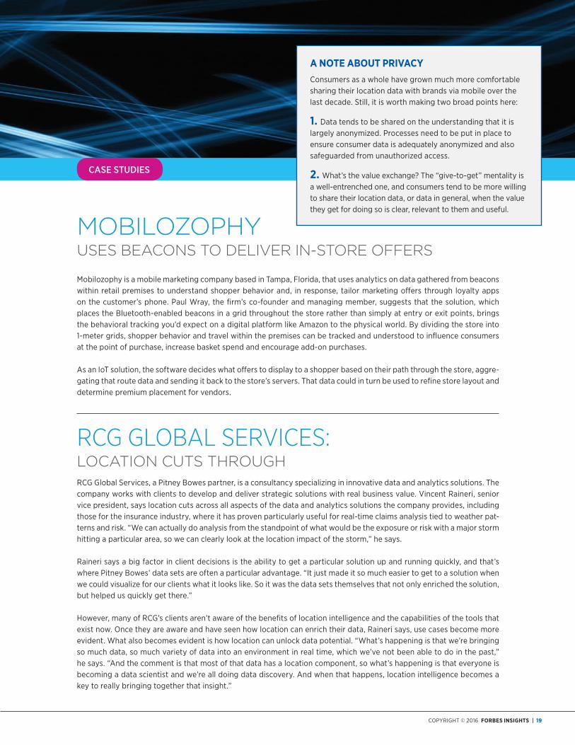
moBIloZoPhy
uses Beacons To delIVer In-sTore offers
Mobilozophy is a mobile marketing company based in Tampa, florida, that uses analytics on data gathered from beacons within retail premises to understand shopper behavior and, in response, tailor marketing offers through loyalty apps on the customer’s phone. Paul wray, the firm’s co-founder and managing member, suggests that the solution, which places the Bluetooth-enabled beacons in a grid throughout the store rather than simply at entry or exit points, brings the behavioral tracking you’d expect on a digital platform like amazon to the physical world. By dividing the store into 1-meter grids, shopper behavior and travel within the premises can be tracked and understood to influence consumers at the point of purchase, increase basket spend and encourage add-on purchases.
as an IoT solution, the software decides what offers to display to a shopper based on their path through the store, aggre-gating that route data and sending it back to the store’s servers. That data could in turn be used to refine store layout and determine premium placement for vendors.
rcg gloBal sErVIcEs: locaTIon cuTs ThrouGhrcg global Services, a Pitney Bowes partner, is a consultancy specializing in innovative data and analytics solutions. The company works with clients to develop and deliver strategic solutions with real business value. Vincent raineri, senior vice president, says location cuts across all aspects of the data and analytics solutions the company provides, including those for the insurance industry, where it has proven particularly useful for real-time claims analysis tied to weather pat-terns and risk. “we can actually do analysis from the standpoint of what would be the exposure or risk with a major storm hitting a particular area, so we can clearly look at the location impact of the storm,” he says.
raineri says a big factor in client decisions is the ability to get a particular solution up and running quickly, and that’s where Pitney Bowes’ data sets are often a particular advantage. “It just made it so much easier to get to a solution when we could visualize for our clients what it looks like. So it was the data sets themselves that not only enriched the solution, but helped us quickly get there.”
however, many of rcg’s clients aren’t aware of the benefits of location intelligence and the capabilities of the tools that exist now. once they are aware and have seen how location can enrich their data, raineri says, use cases become more evident. what also becomes evident is how location can unlock data potential. “what’s happening is that we’re bringing so much data, so much variety of data into an environment in real time, which we’ve not been able to do in the past,” he says. “and the comment is that most of that data has a location component, so what’s happening is that everyone is becoming a data scientist and we’re all doing data discovery. and when that happens, location intelligence becomes a key to really bringing together that insight.”
A note About PrIvAcyconsumers as a whole have grown much more comfortable sharing their location data with brands via mobile over the last decade. Still, it is worth making two broad points here:
1. Data tends to be shared on the understanding that it is largely anonymized. Processes need to be put in place to ensure consumer data is adequately anonymized and also safeguarded from unauthorized access.
2. what’s the value exchange? The “give-to-get” mentality is a well-entrenched one, and consumers tend to be more willing to share their location data, or data in general, when the value they get for doing so is clear, relevant to them and useful.
20 | The Power of Place
the arrival of big data has already proven the importance
of analytics to business; what executives are still largely
unaware of is the commensurate importance of location
data and analytics. however, with large business
intelligence vendors beginning to package location
intelligence and data into their platforms, as well as
Forrester’s wave report on geospatial tools and platforms,
location intelligence has moved into the “must-have” column.
pplication developers are looking to add loca-tion-awareness to the software and apps they design, while geocoding and enrichment allow businesses to enhance the data they
already rely upon to reveal further insights and support better decision making. Early adopter businesses are creating innovative use cases with location intelligence across a number of industries, particularly in insurance, retail and logistics.
Organizations looking to add location data or analyt-ics to their own capabilities should begin by considering the following recommendations.
start thinking spatially—Think about how place and location matter within your organization and how answering where things are might help you bet-ter understand business problems you face. There’s a lot of spatial data that organizations already rely on every day, so understanding how and where it impacts you is an important first step.
Perform Data Due Diligence—To take full advan-tage of location intelligence, organizations require solid internal data management and governance. Understand what data you already own, how location
can enhance it, and what steps are necessary to ensure the integrity of it.
near enough is not Always good enough—As with any other data that a business relies upon, precision and data provenance matter with location data. It may be vital to understand, for example, precisely where a particular building is for risk assessment or emergency services, and that there may be financial consequences—or worse—to getting that information wrong.
Partner Wisely—Location intelligence vendors need to be assessed not just for the technology platforms and support they provide but for the quality and depth of the data sets they offer. As Forrester’s Rowan Curran points out, vendors are differentiating themselves on the data and analytics they bring to the table. The right data sets, with the required industry and boundary specificity and right balance between local depth and global breadth, can help solutions get up and running much more quickly, allowing returns on investment to be realized much sooner.
For more information about Pitney Bowes, the Craftsmen of Commerce, visit: pitneybowes.com/us/location-intelligence.
conclusIon

acKnowledGmenTs
Forbes Insights and Pitney Bowes would like to thank the
following individuals for their time and expertise:
bill borrelle, Senior Vice President of Brand Strategy and Integrated Marketing communications, Pitney Bowes
rowan curran, analyst, forrester
Donna edwards-John, gIS officer, Torfaen county Borough council
Joe Francica, Managing Director for geospatial Industry Solutions, Pitney Bowes
clarence hempfield, Vice President, Product Management – location Intelligence, Pitney Bowes
ralph Kephart, President, geoassurance
nigel Lester, Managing Director aNZ, Pitney Bowes
vincent raineri, Senior Vice President, rcg global Services
richard rollins, Director of Product Marketing – location Intelligence, Pitney Bowes
richard White, founder and ceo, wiseTech global

499 Washington Blvd., Jersey City, NJ 07310 | 212.366.8890 | www.forbes.com/forbesinsights
aBout FoRBes insigHtsforbes Insights is the strategic research and thought leadership practice of forbes Media, a global media, branding and technology company whose combined platforms reach nearly 75 million business decision makers worldwide on a monthly basis. By leveraging proprietary databases of senior-level executives in the forbes community, forbes Insights conducts research on a wide range of topics to position brands as thought leaders and drive stakeholder engagement. research findings are delivered through a variety of digital, print and live executions, and amplified across forbes’ social and media platforms.
foRbes InsIGhTs
bruce Rogers, chief Insights officererika Maguire, director of ProgramsAndrea nishi, Project Manager
eDIToRIAl
Kasia wandycz Moreno, director hugo s. Moreno, director lynda brendish, report author Kari Pagnano, designer
ReseARch
Ross Gagnon, director Kimberly Kurata, senior analyst sara chin, research analyst
sAles
north America brian Mcleod, commercial director [email protected] Matthew Muszala, Manager william Thompson, Manager
eMeA Tibor fuchsel, Manager
APAc serene lee, Executive director