Embed Size (px)
Citation preview

The MedWet Web Information System: The MedWet Web Information System: An SDI applicationAn SDI application
Lena S. Hatziiordanou / Greek Biotope Wetland Centre (EKBY)
Panagiotis T. Katsaros / Department of Informatics, AUTH
MedWet/Codde Workshop
EKBY, 2 April 2006
MedWet/Codde Workshop
EKBY, 2 April 2006

The MedWet Web Information System: An SDI applicationLena S. Hatziiordanou / Greek Biotope Wetland Centre (EKBY)Panagiotis T. Katsaros / Department of Informatics, AUTH
MedWet / CODDE Workshop. “Enrichment of the MedWet Inventory Method: Exploring applications of RS techniques and of SDI”
• SDI concepts
• European requirements on SDI defined through the INSPIRE initiative
• The MedWet Web Information System
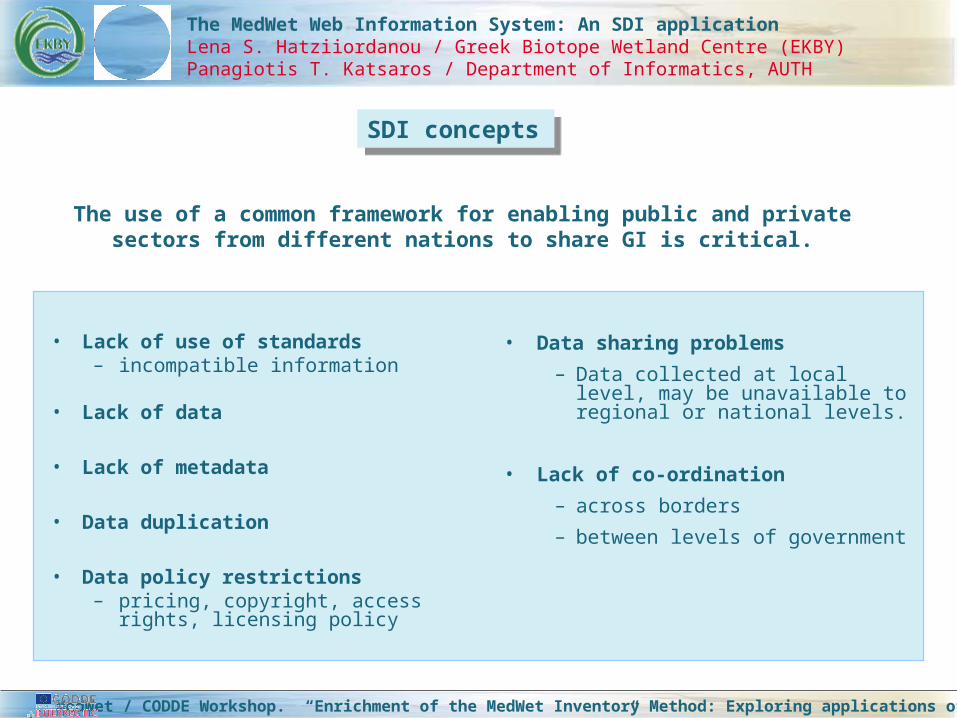
• Lack of use of standards– incompatible information
• Lack of data
• Lack of metadata
• Data duplication
• Data policy restrictions– pricing, copyright, access
rights, licensing policy
The MedWet Web Information System: An SDI applicationLena S. Hatziiordanou / Greek Biotope Wetland Centre (EKBY)Panagiotis T. Katsaros / Department of Informatics, AUTH
MedWet / CODDE Workshop. “Enrichment of the MedWet Inventory Method: Exploring applications of RS techniques and of SDI”
• Data sharing problems
– Data collected at local level, may be unavailable to regional or national levels.
• Lack of co-ordination
– across borders
– between levels of government
SDI conceptsSDI concepts
The use of a common framework for enabling public and private sectors from different nations to share GI is critical.

The MedWet Web Information System: An SDI applicationLena S. Hatziiordanou / Greek Biotope Wetland Centre (EKBY)Panagiotis T. Katsaros / Department of Informatics, AUTH
MedWet / CODDE Workshop. “Enrichment of the MedWet Inventory Method: Exploring applications of RS techniques and of SDI”
The term Spatial Data Infrastructure (SDI) was affiliated to denote:
Mid-90s:
The global community realised the benefit of using common standards and data interoperability:
to reduce costs and duplication of efforts in collecting and archiving spatial data.
a collection of technologies, policies, standards and institutional
arrangements that facilitates access to spatial data.

The MedWet Web Information System: An SDI applicationLena S. Hatziiordanou / Greek Biotope Wetland Centre (EKBY)Panagiotis T. Katsaros / Department of Informatics, AUTH
MedWet / CODDE Workshop. “Enrichment of the MedWet Inventory Method: Exploring applications of RS techniques and of SDI”
• SDI concepts
• European requirements on SDI defined through the INSPIRE initiative
• The MedWet Web Information System

The MedWet Web Information System: An SDI applicationLena S. Hatziiordanou / Greek Biotope Wetland Centre (EKBY)Panagiotis T. Katsaros / Department of Informatics, AUTH
MedWet / CODDE Workshop. “Enrichment of the MedWet Inventory Method: Exploring applications of RS techniques and of SDI”
Objective:
To make available relevant, harmonised and quality
geographic information to support the formulation,
implementation, monitoring and evaluation of Community
policies with a territorial dimension or impact. http://inspire.jrc.it
Sharing of environmental spatial data sets
Target users: Policy-makers, planners and managers at European, national and local level.
Multi level SDI implementation in the European Union.
European requirements on SDI defined through the INSPIRE initiative

The MedWet Web Information System: An SDI applicationLena S. Hatziiordanou / Greek Biotope Wetland Centre (EKBY)Panagiotis T. Katsaros / Department of Informatics, AUTH
MedWet / CODDE Workshop. “Enrichment of the MedWet Inventory Method: Exploring applications of RS techniques and of SDI”
INSPIRE seeks to associate organisations-networks that have developed partnerships on data exchange – sharing - specifications to the development of the INSPIRE Implementing Rules (IR).
Spatial Data Interest Communities (SDIC):
a) provide knowledge required for drafting, reviewing & testing the INSPIRE IR;
b) propose experts that constitute the INSPIRE Drafting Teams;
c) submit reference material;
d) are organised by regional, societal and thematic sector;
e) can cooperate with other SDIs on drafting IR for spatial data sets in which they have common interests.
Spatial Data Interest Communities SDICs:

The MedWet Web Information System: An SDI applicationLena S. Hatziiordanou / Greek Biotope Wetland Centre (EKBY)Panagiotis T. Katsaros / Department of Informatics, AUTH
MedWet / CODDE Workshop. “Enrichment of the MedWet Inventory Method: Exploring applications of RS techniques and of SDI”
• establish a network of services that allows to search for, view and access spatial data from an internet Geoportal;
• make their spatial data sets and services interoperable in accordance with the adopted IR;
• produce data catalogues and metadata;
• make spatial data accessible to the public;
• remove obstacles for the sharing of spatial data between public authorities.
The proposed directive requires Member States to take the following measures:

The MedWet Web Information System: An SDI applicationLena S. Hatziiordanou / Greek Biotope Wetland Centre (EKBY)Panagiotis T. Katsaros / Department of Informatics, AUTH
MedWet / CODDE Workshop. “Enrichment of the MedWet Inventory Method: Exploring applications of RS techniques and of SDI”
The EU Geoportal will provide on-line access to collections of spatial data and services.
http://eu-geoportal.jrc.it/
- Will not store/maintain data
- Will provide facilities & links to the necessary servers.
Community Geo-Portal

The MedWet Web Information System: An SDI applicationLena S. Hatziiordanou / Greek Biotope Wetland Centre (EKBY)Panagiotis T. Katsaros / Department of Informatics, AUTH
MedWet / CODDE Workshop. “Enrichment of the MedWet Inventory Method: Exploring applications of RS techniques and of SDI”
Provide reference material; provide feedbackon wetland data of the Mediterranean region;
get involved in developing Implementing rules.
Share experience acquired through CODDE & previous projects (i.e. SUDOE); review theINSPIRE Implementing Rules; Create a linkageto the Community Geoportal.
Diffuse the INSPIRE requirements in the MDW web information system, addressing stakeholders to work in compliance with the European SDI standards through raising awareness and capacity building.
Discussion: How MedWet could actively participate in INSPIRE?Discussion: How MedWet could actively participate in INSPIRE?
Register as a thematic SDIC
Register as a project
Develop a project

The MedWet Web Information System: An SDI applicationLena S. Hatziiordanou / Greek Biotope Wetland Centre (EKBY)Panagiotis T. Katsaros / Department of Informatics, AUTH
MedWet / CODDE Workshop. “Enrichment of the MedWet Inventory Method: Exploring applications of RS techniques and of SDI”
• SDI concepts
• European requirements on SDI defined through the INSPIRE initiative
• The MedWet Web Information System

The MedWet Web Information System: An SDI applicationLena Hatziiordanou / Greek Biotope Wetland Centre (EKBY)Panagiotis Katsaros / Department of Informatics, AUTH
The MedWet Desktop inventory system
Features: Wetlands inventory system, GIS subsystem
Current implementation status:
- Desktop application in use
MedWet / CODDE Workshop. “Enrichment of the MedWet Inventory Method: Exploring applications of RS techniques and of SDI”
The Med Web Desktop Inventory system

The MedWet Web Information System: An SDI applicationLena Hatziiordanou / Greek Biotope Wetland Centre (EKBY)Panagiotis Katsaros / Department of Informatics, AUTH
The MedWet Web Application (INTERREG IIIC SUDOE)
Features: Descriptive data entry and reporting functions, Web Mapping system
Current implementation status:
- Web application in use
MedWet / CODDE Workshop. “Enrichment of the MedWet Inventory Method: Exploring applications of RS techniques and of SDI”
The Med Web Web Application

The MedWet Web Information System: An SDI applicationLena Hatziiordanou / Greek Biotope Wetland Centre (EKBY)Panagiotis Katsaros / Department of Informatics, AUTH
The MedWet Web Information System (INTERREG IIIC CODDE)
Features:
- Role based access control
- Additional data entry functionality (new data sheets)
- Advanced analysis, querying and reporting functionality
- Spatial Data Infrastructure perspective
Current implementation status:
- expected in February 2007
MedWet / CODDE Workshop. “Enrichment of the MedWet Inventory Method: Exploring applications of RS techniques and of SDI”
The Med Web Web Information System

The MedWet Web Information System: An SDI applicationLena Hatziiordanou / Greek Biotope Wetland Centre (EKBY)Panagiotis Katsaros / Department of Informatics, AUTH
The MedWet Web Information System Architecture
Data Storage Layer:
Microsoft SQL Server
Application Layer:
MapServer (University of Minnesota)
Web Mapping functions: ESRI Arc SDE
Analysis & reporting: search, export, print & report functions
various formats (pdf, doc, txt etc) – Crystal Reports
Representation Layer:
Interface: php web pages & Spatial Data interface subsystem
MedWet / CODDE Workshop. “Enrichment of the MedWet Inventory Method: Exploring applications of RS techniques and of SDI”
R ep resen ta tio n L a y er
A p p lica tio n L a y er
D a ta S to ra g e L a y er
C o n n ectio n P o in t
S y stem la y ersSystem Architecture

The MedWet Web Information System: An SDI applicationLena Hatziiordanou / Greek Biotope Wetland Centre (EKBY)Panagiotis Katsaros / Department of Informatics, AUTH
The MedWet SDI perspective
MedWet SDI will be something more than a typical web-based database:
- will host geographic data and their attributes
- will publish sufficient documentation (metadata) for the provided data
- will provide advanced tools for discovering, visualizing and analyzing the data
(advanced Web mapping functionality and catalogues)
MedWet SDI dual role perspective:
- provider of wetland spatial data
- user of other’s spatial data
MedWet / CODDE Workshop. “Enrichment of the MedWet Inventory Method: Exploring applications of RS techniques and of SDI”
The MedWet SDI perspective

The MedWet Web Information System: An SDI applicationLena Hatziiordanou / Greek Biotope Wetland Centre (EKBY)Panagiotis Katsaros / Department of Informatics, AUTH
The MedWet SDI perspective
An overview of standard compliance issues & technical solutions that ensure interoperability (the ability to combine information from different systems):
- core data
- formalization of packages of information that are being exchanged
- feature catalogues
- metadata
- geospatial data catalogues
- geospatial data visualisation -- Web mapping
MedWet / CODDE Workshop. “Enrichment of the MedWet Inventory Method: Exploring applications of RS techniques and of SDI”
The MedWet SDI perspective

The MedWet Web Information System: An SDI applicationLena Hatziiordanou / Greek Biotope Wetland Centre (EKBY)Panagiotis Katsaros / Department of Informatics, AUTH
The MedWet SDI perspective
CORE DATA a set of geographical information that is a sufficient reference for most geo-located data (georeference system, coastlines, rivers)
(Related GSDI initiative: the Global Map initiative)
FORMALIZE THE PACKAGES OF INFORMATION THAT ARE BEING EXCHANGEDtechnical solution: to encode the MedWet application schema using
GML (Geography Markup Language)
(Related standard: ISO 19109)
FEATURE CATALOGUESDescriptions of spatial phenomena found in some or all the MedWet countries (e.g. the concept of ‘city’ or ‘mountain area’ can vary considerably from one country to another).
Structures used to store the meaning, representation and relationships of concepts or things in the real world (Related standard: ISO 19110)
MedWet / CODDE Workshop. “Enrichment of the MedWet Inventory Method: Exploring applications of RS techniques and of SDI”
The MedWet SDI perspective
The MedWet Web Information System: An SDI applicationLena Hatziiordanou / Greek Biotope Wetland Centre (EKBY)Panagiotis Katsaros / Department of Informatics, AUTH
The MedWet SDI perspective
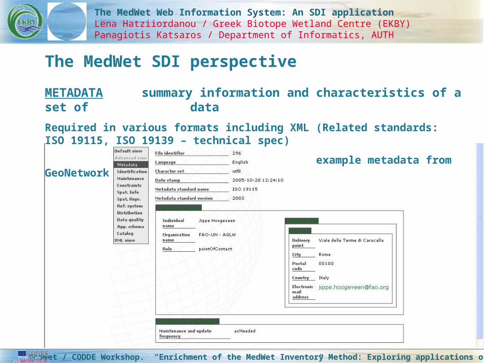
METADATA summary information and characteristics of a set of data
Required in various formats including XML (Related standards: ISO 19115, ISO 19139 – technical spec)
example metadata from GeoNetwork
MedWet / CODDE Workshop. “Enrichment of the MedWet Inventory Method: Exploring applications of RS techniques and of SDI”
The MedWet SDI perspective

The MedWet Web Information System: An SDI applicationLena Hatziiordanou / Greek Biotope Wetland Centre (EKBY)Panagiotis Katsaros / Department of Informatics, AUTH
The MedWet SDI perspective
GEOSPATIAL DATA CATALOGUE
A Catalogue Gateway allows users to query collections of geospatial information through their metadata descriptions. The catalogue server will register service metadata with one more global directories of catalogue servers.
(Related standards: ISO 23950 Search and Retrieve Protocol, OpenGIS Consortium Catalogue Services Specification. Tech. Solution: re-utilize or adapt existing software)
GEOSPATIAL DATA VISUALISATION
Data visualization by mapping on the Web. It is important to be able to discover Web mapping services through online directories that serve both spatial data (through metadata) and service information.
(Related standards: Open GIS Web Map Service specification, Open GIS Catalogue Services specification)
MedWet / CODDE Workshop. “Enrichment of the MedWet Inventory Method: Exploring applications of RS techniques and of SDI”
The MedWet SDI perspective

The MedWet Web Information System: An SDI applicationLena Hatziiordanou / Greek Biotope Wetland Centre (EKBY)Panagiotis Katsaros / Department of Informatics, AUTH
The MedWet SDI perspective
Web Mapping
MedWet / CODDE Workshop. “Enrichment of the MedWet Inventory Method: Exploring applications of RS techniques and of SDI”
The MedWet SDI perspective

The MedWet Web Information System: The MedWet Web Information System: An SDI applicationAn SDI application
Lena S. Hatziiordanou / Greek Biotope Wetland Centre (EKBY)
Panagiotis T. Katsaros / Department of Informatics, AUTH
MedWet/Codde Workshop
EKBY, 2 April 2006
MedWet/Codde Workshop
EKBY, 2 April 2006