Embed Size (px)
Citation preview
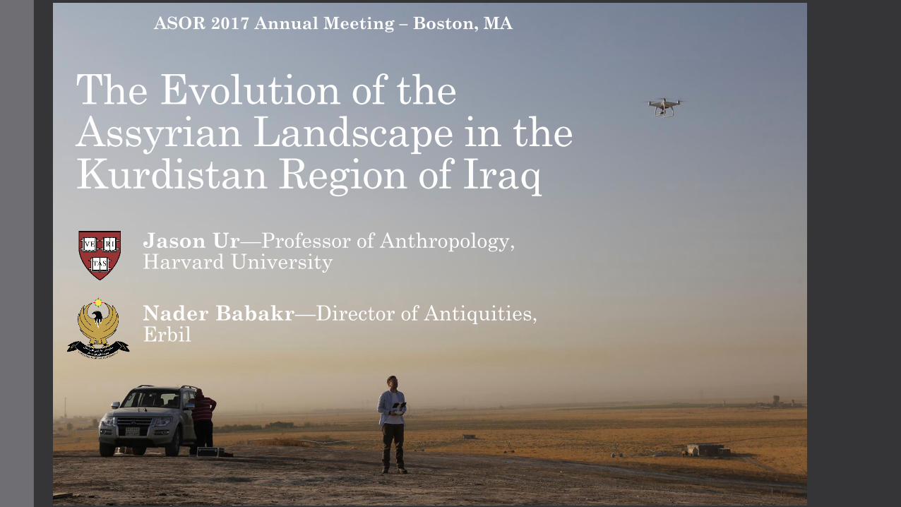
The Evolution of the Assyrian Landscape in the Kurdistan Region of Iraq
Jason Ur—Professor of Anthropology, Harvard University
ASOR 2017 Annual Meeting – Boston, MA
Nader Babakr—Director of Antiquities, Erbil
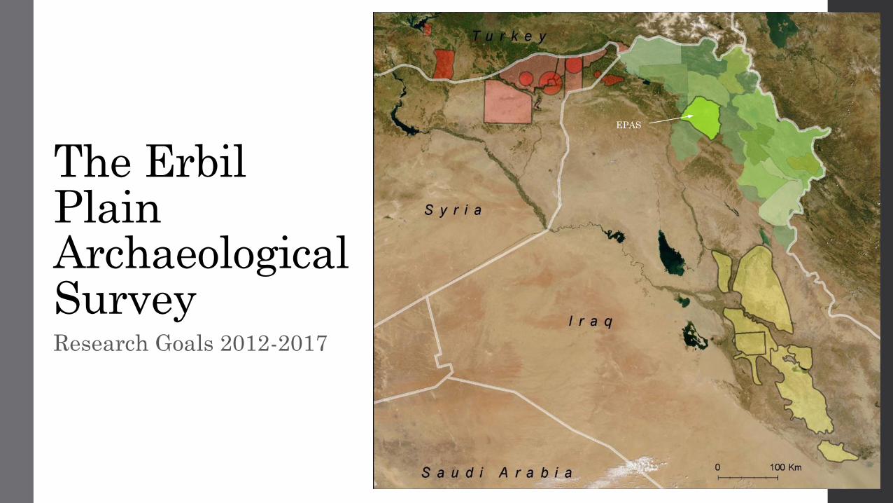
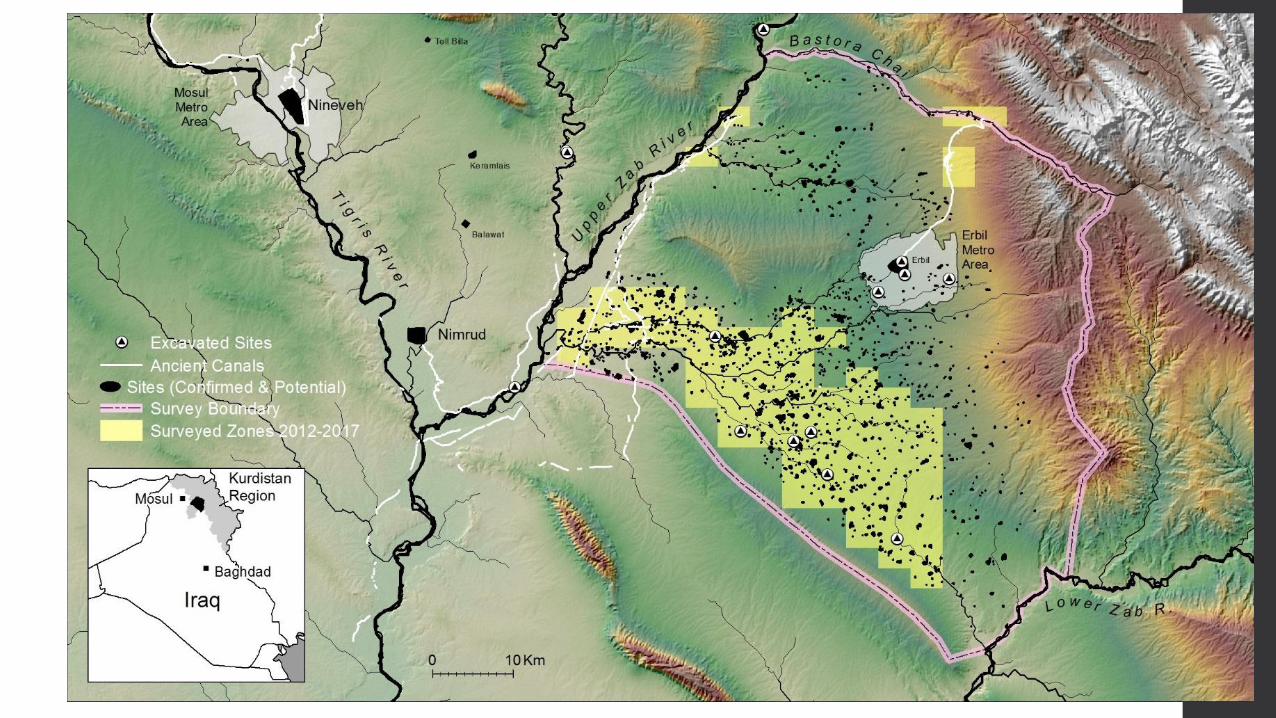
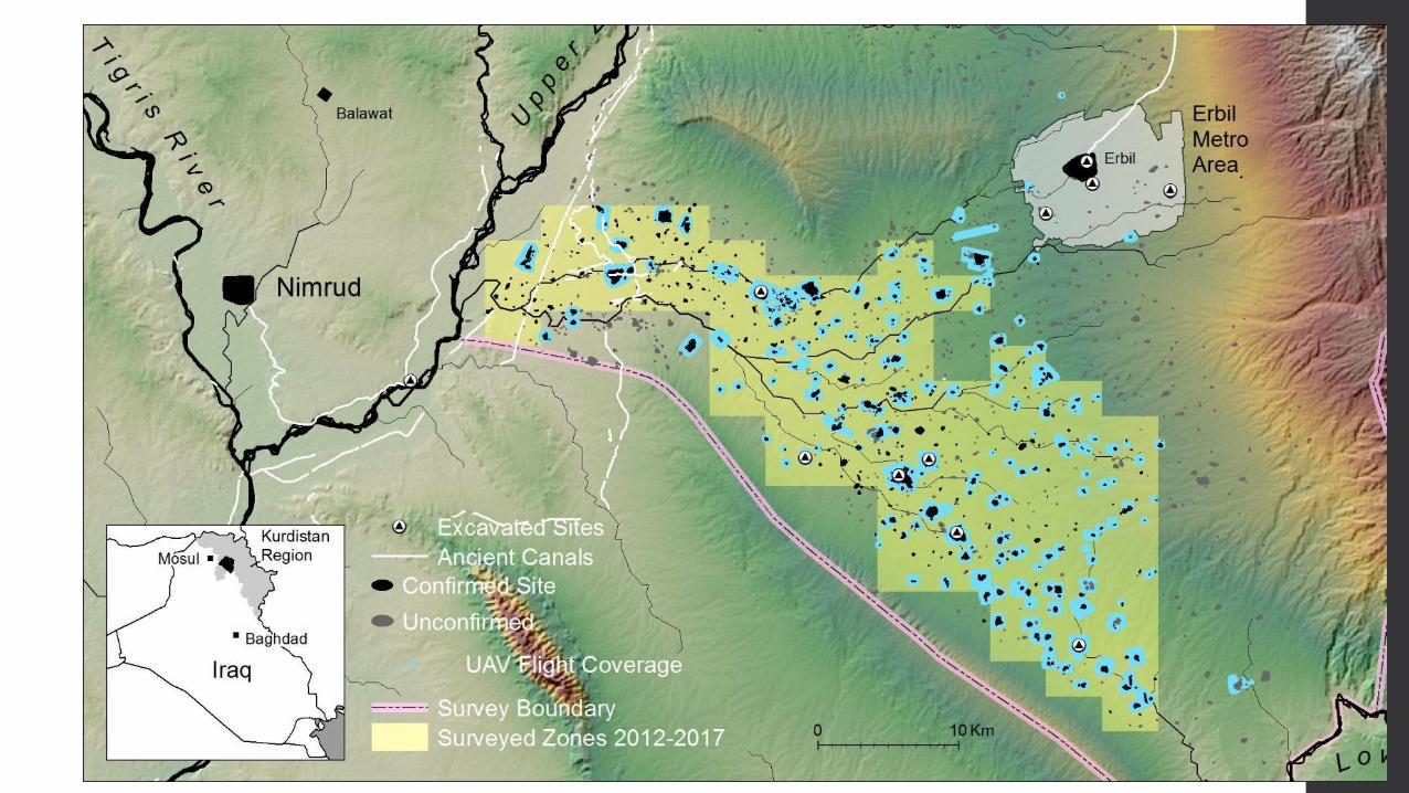
The Erbil Plain Archaeological Survey Research Goals 2012-2017
EPAS
Bandwai Canal
Uskof Canal
Kisiri Canal
Nineveh
Khorsabad
al-Shallalat
Dam
Faida Canal
Jerwan
Aqueduct
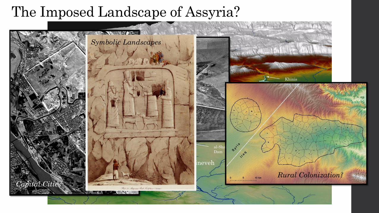
The Imposed Landscape of Assyria?
Maltai Canal
Khinis
Reliefs
Hydraulic Engineering
Rural Colonization?
Capital Cities
Symbolic Landscapes

Field & Lab Methods
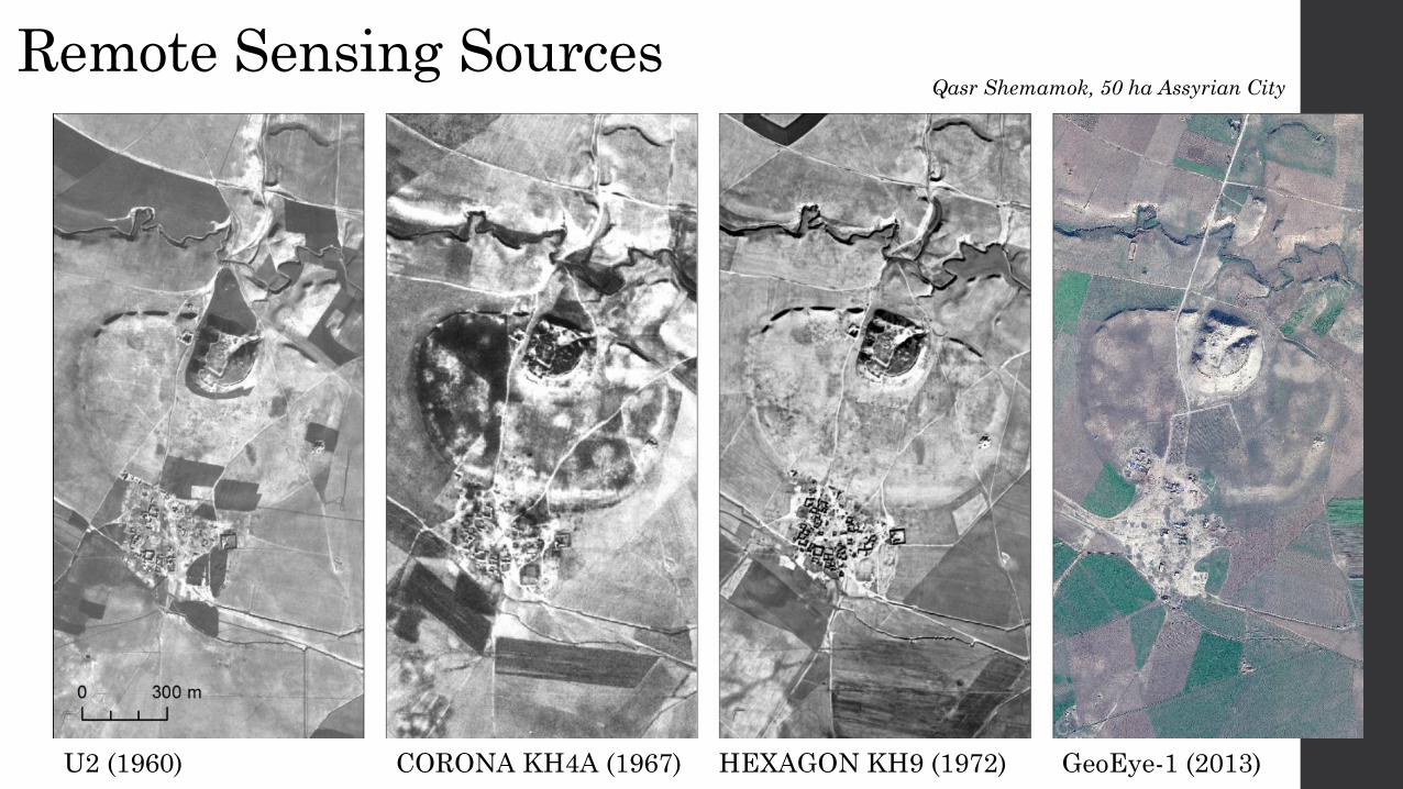
Remote Sensing Sources
U2 (1960) CORONA KH4A (1967) HEXAGON KH9 (1972) GeoEye-1 (2013)
Qasr Shemamok, 50 ha Assyrian City

The “Drone Revolution” in Archaeology
Surface Collection at Site 437 Qushtapa
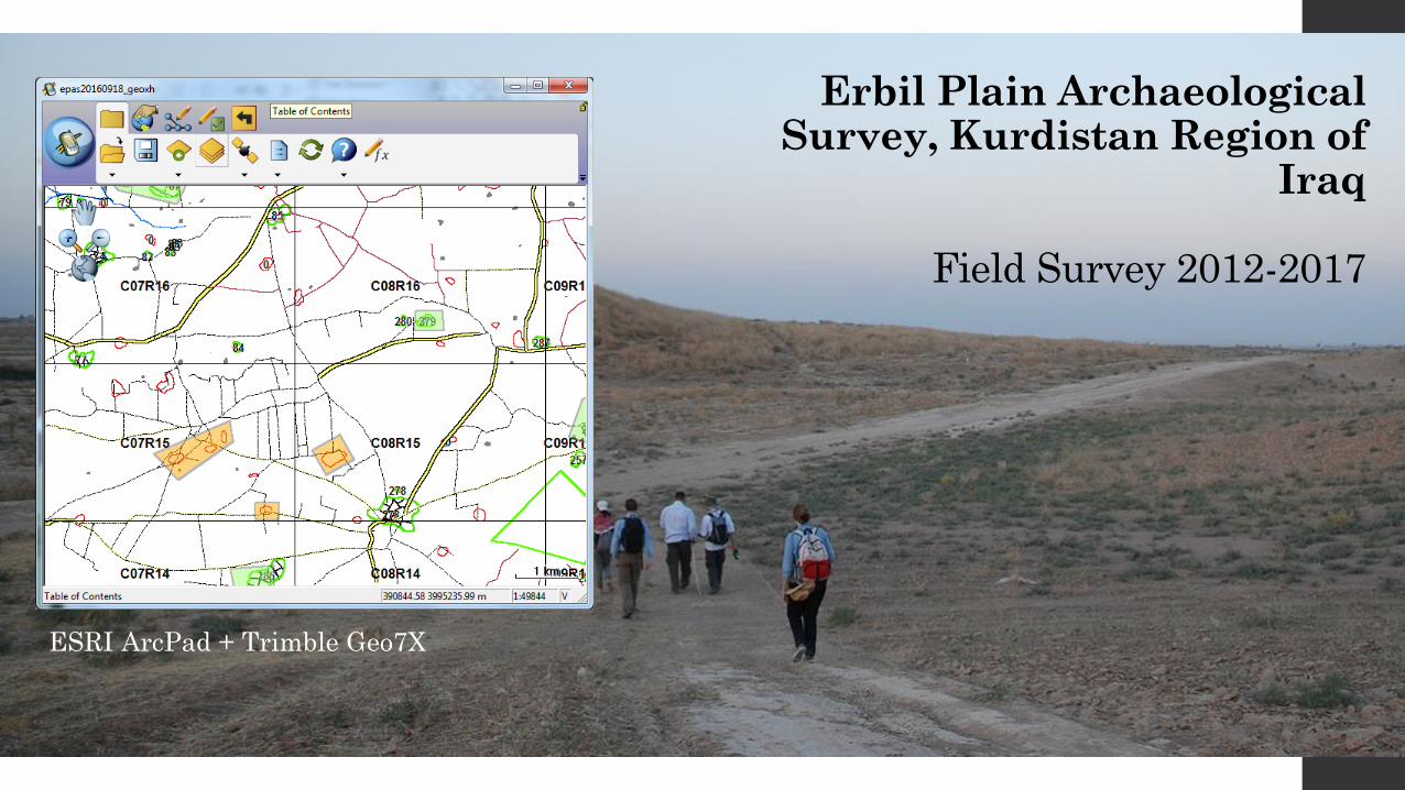
Erbil Plain Archaeological Survey, Kurdistan Region of
Iraq
Field Survey 2012-2017
ESRI ArcPad + Trimble Geo7X
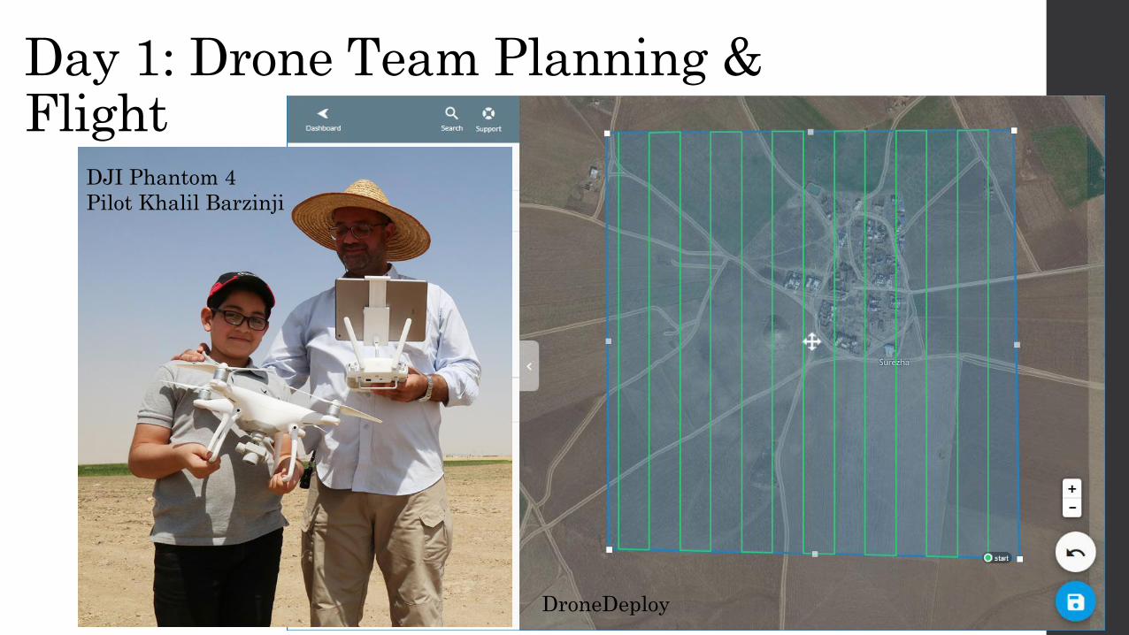
Day 1: Drone Team Planning & Flight
DroneDeploy
DJI Phantom 4
Pilot Khalil Barzinji
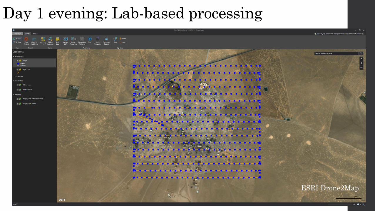
Day 1 evening: Lab-based processing
ESRI Drone2Map
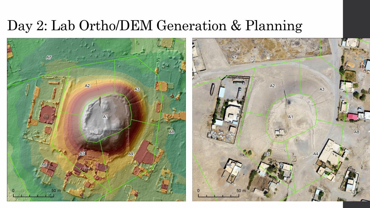
Day 2: Lab Ortho/DEM Generation & Planning
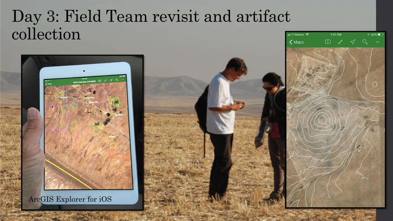
Day 3: Field Team revisit and artifact collection
ArcGIS Explorer for iOS
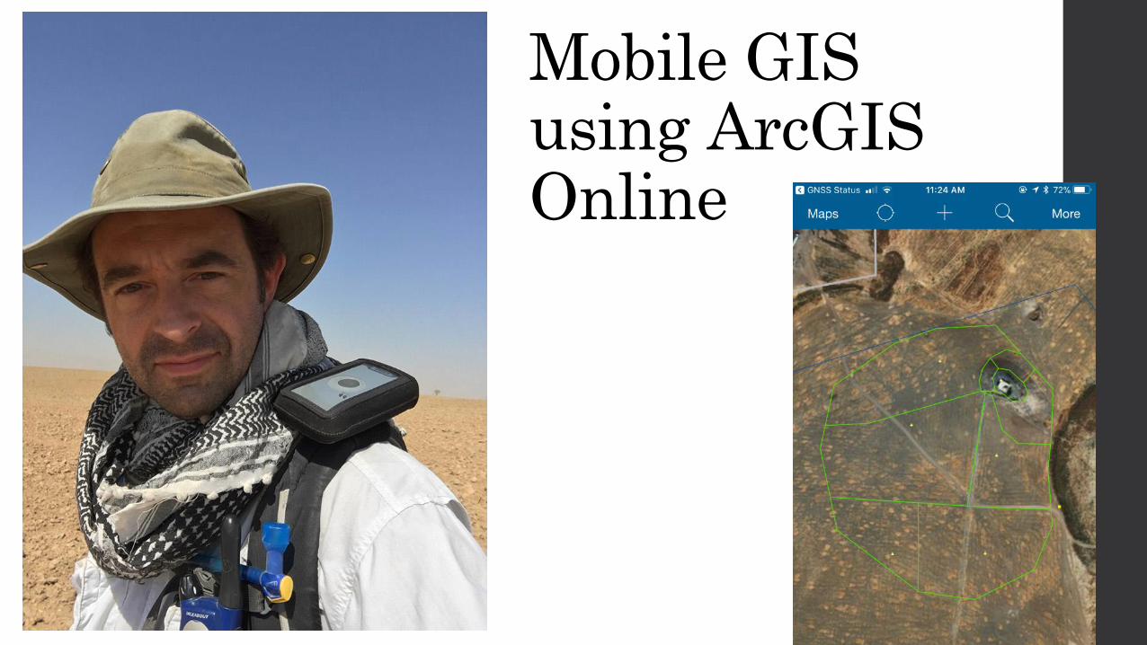
Mobile GIS using ArcGIS Online
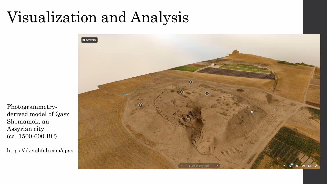
Visualization and Analysis
Photogrammetry-
derived model of Qasr
Shemamok, an
Assyrian city
(ca. 1500-600 BC)
https://sketchfab.com/epas
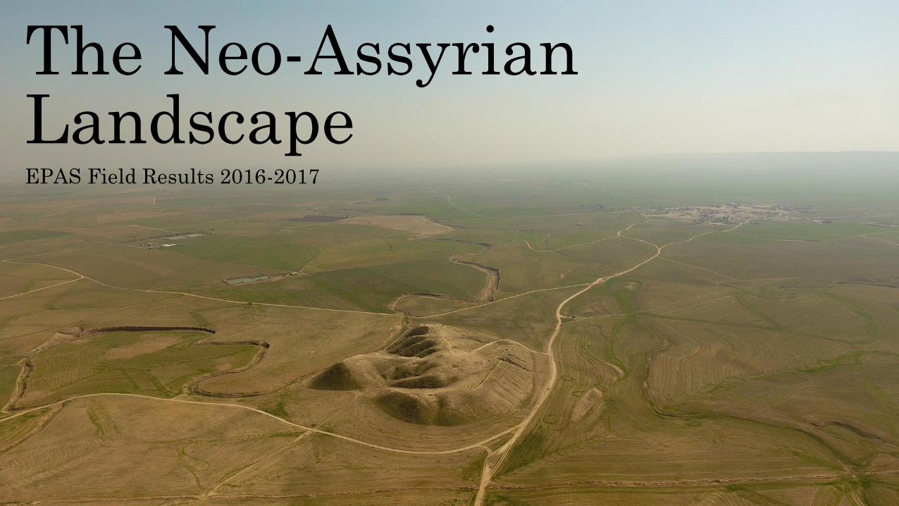
The Neo-Assyrian Landscape EPAS Field Results 2016-2017
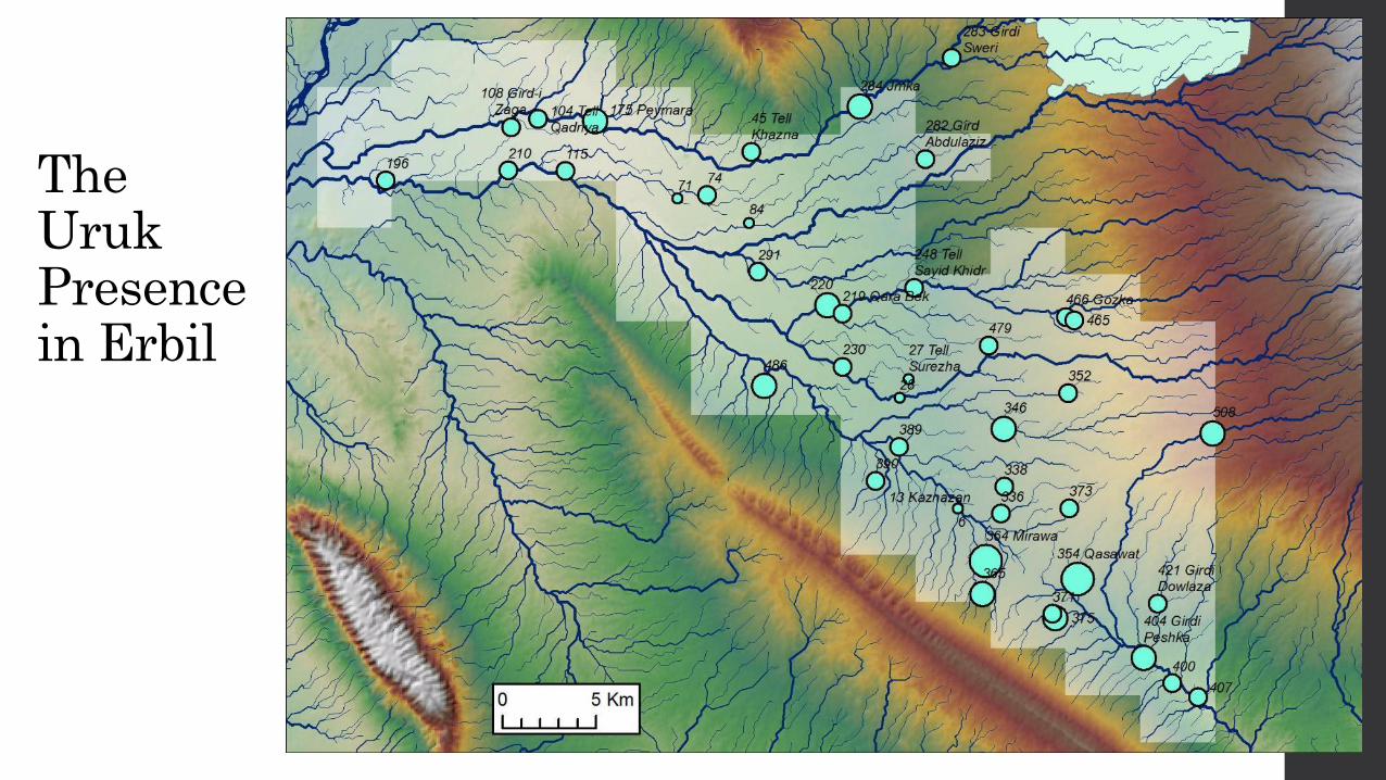
The Uruk Presence in Erbil
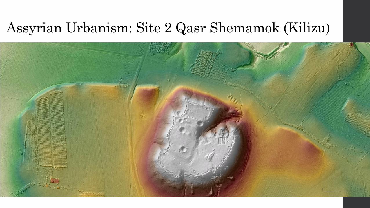
Assyrian Urbanism: Site 2 Qasr Shemamok (Kilizu)
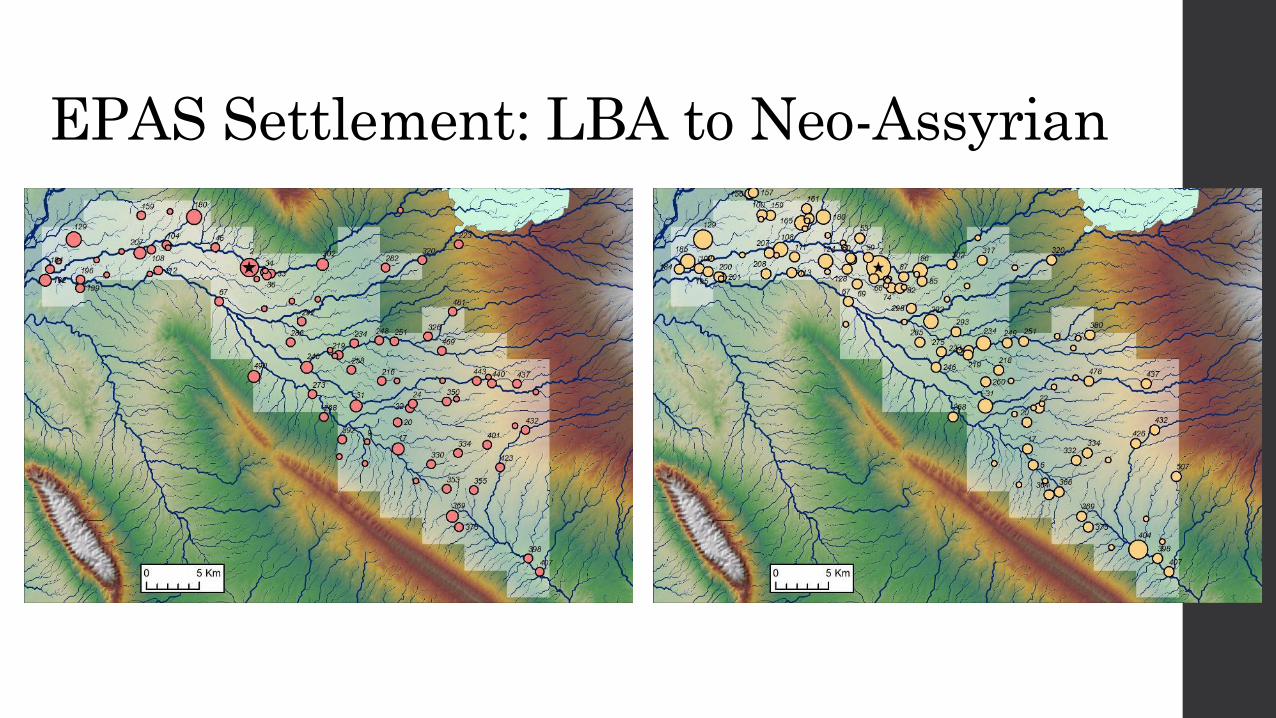
EPAS Settlement: LBA to Neo-Assyrian
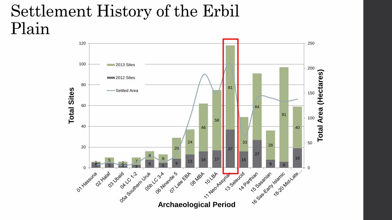
5 5 4 3 8 5
9 13 16 17
37
16
27
8 6
19 1
5 2 7
8 8
20
24
46
58
81
33
64
28
91
40
0
50
100
150
200
250
0
20
40
60
80
100
120
To
tal A
rea (
Hecta
res)
To
tal S
ites
Archaeological Period
2013 Sites
2012 Sites
Settled Area
Settlement History of the Erbil Plain
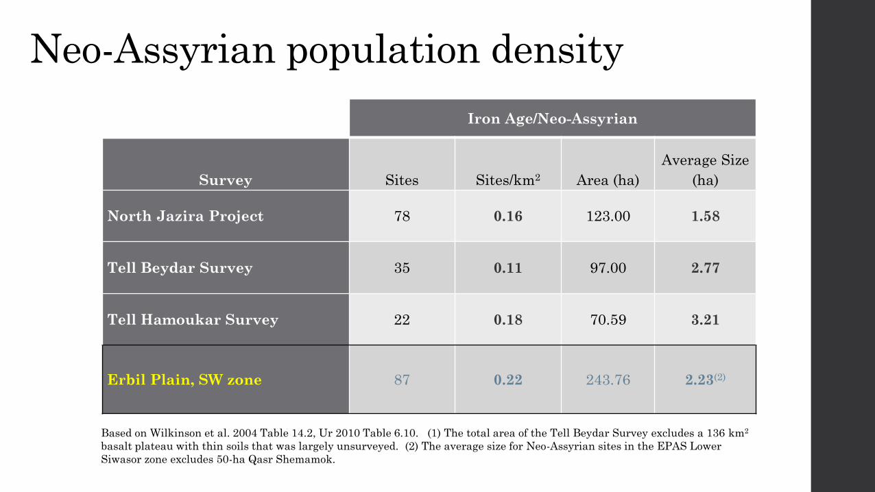
Neo-Assyrian population density
Iron Age/Neo-Assyrian
Survey Sites Sites/km2 Area (ha)
Average Size
(ha)
North Jazira Project 78 0.16 123.00 1.58
Tell Beydar Survey 35 0.11 97.00 2.77
Tell Hamoukar Survey 22 0.18 70.59 3.21
Erbil Plain, SW zone 87 0.22 243.76 2.23(2)
Based on Wilkinson et al. 2004 Table 14.2, Ur 2010 Table 6.10. (1) The total area of the Tell Beydar Survey excludes a 136 km2
basalt plateau with thin soils that was largely unsurveyed. (2) The average size for Neo-Assyrian sites in the EPAS Lower
Siwasor zone excludes 50-ha Qasr Shemamok.
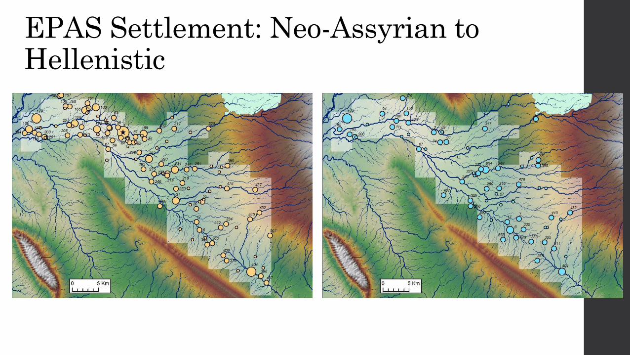
EPAS Settlement: Neo-Assyrian to Hellenistic
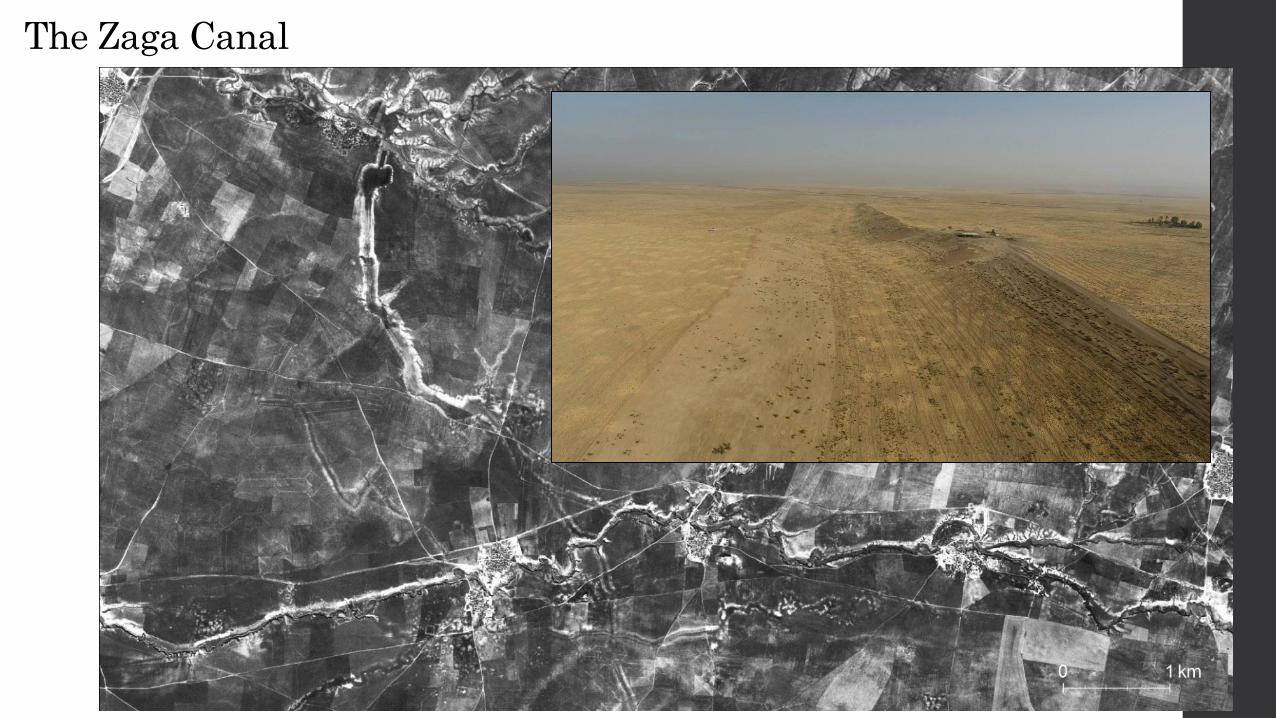
The Zaga Canal
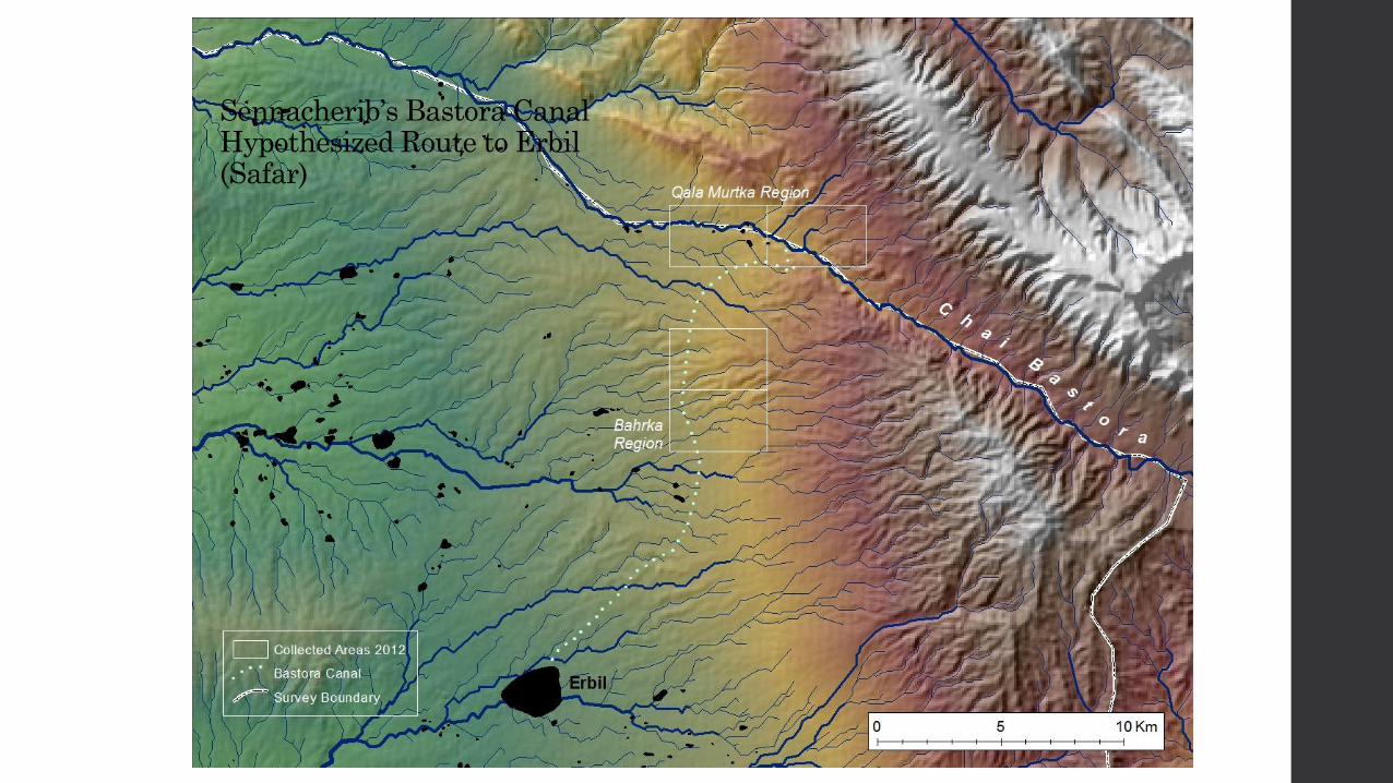
Sennacherib’s Bastora Canal Hypothesized Route to Erbil (Safar)
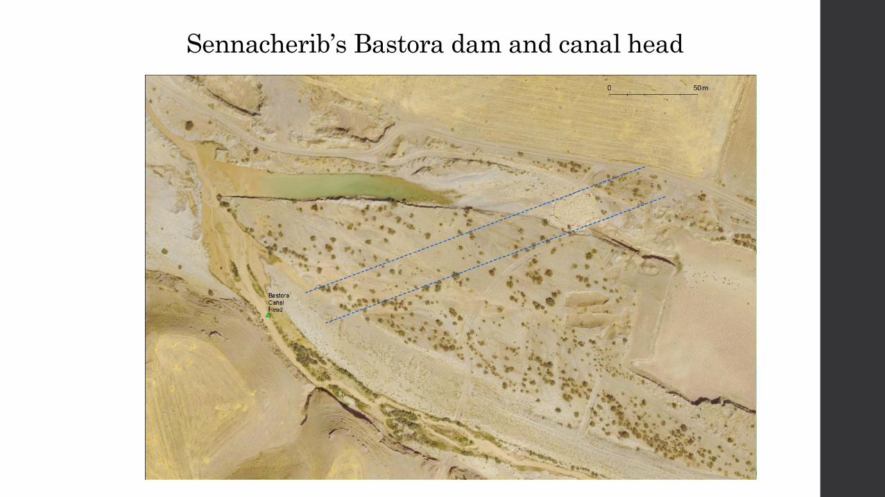
Sennacherib’s Bastora dam and canal head
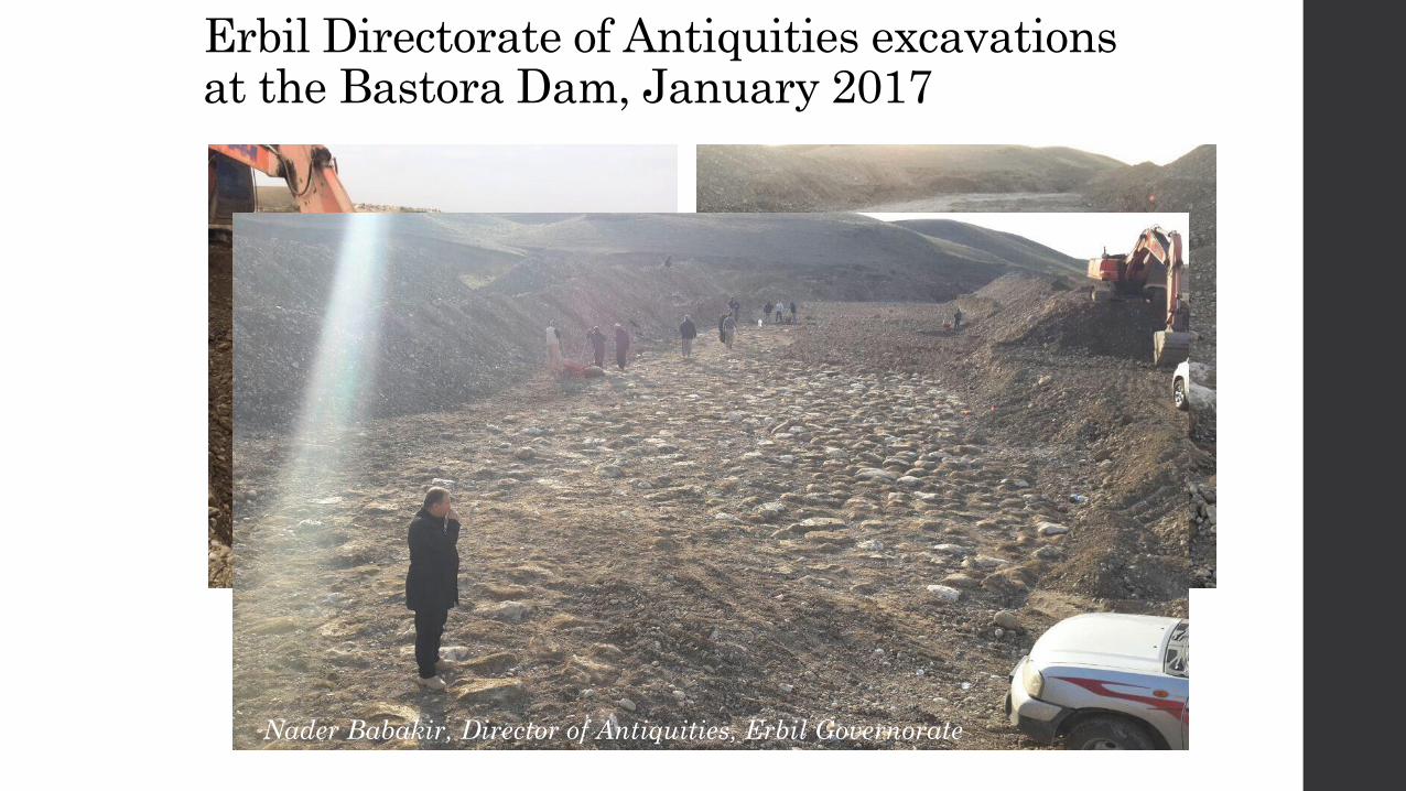
Erbil Directorate of Antiquities excavations at the Bastora Dam, January 2017
Nader Babakir, Director of Antiquities, Erbil Governorate
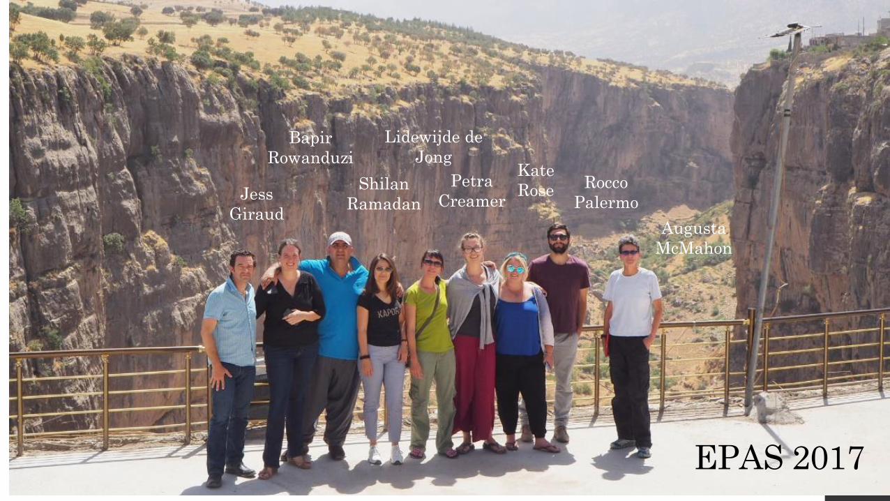
EPAS 2017
Jess
Giraud
Bapir
Rowanduzi
Shilan
Ramadan
Lidewijde de
Jong Kate
Rose Rocco
Palermo
Augusta
McMahon
Petra
Creamer
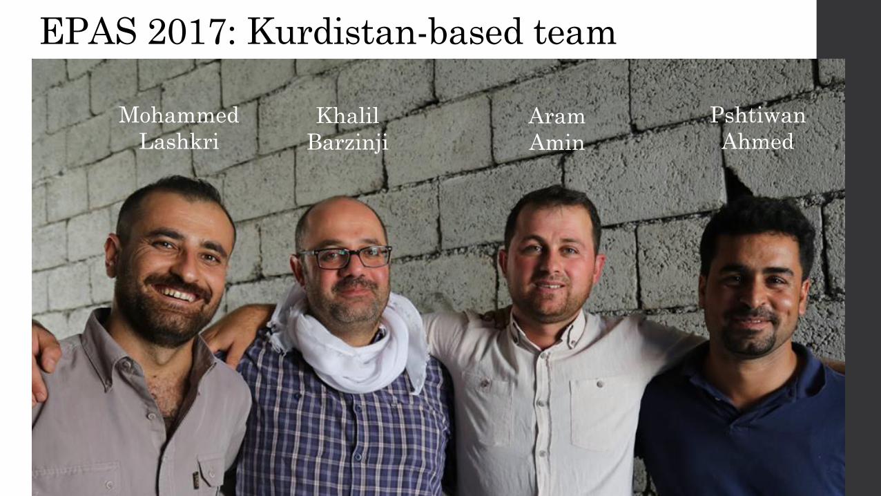
EPAS 2017: Kurdistan-based team
Mohammed
Lashkri
Khalil
Barzinji
Aram
Amin
Pshtiwan
Ahmed

Kurdistan Regional Government, Iraq • General Directorate of Antiquities
• Directorate of Antiquities, Erbil Governorate
• KRG Representation in Washington DC
• State Board of Antiquities and Heritage, Baghdad
Harvard University
Faculty of Arts & Sciences
American School of Prehistoric Research
Acknowledgements
Funding provided by The National Science Foundation, the
National Geographic Society, Dumbarton Oaks, Harvard
University Faculty of Arts & Sciences, and the American
School of Prehistoric Research, and the ASOR Committee
on Mesopotamian Civilization.