Embed Size (px)
Citation preview

2
Merthyr Mawr (2) is an idyllic little settlement,as picturesque as they come, with an outstandingcollection of thatched dwellings beautifully positioned around an old Village Green.Surrounded by meadows and woodlands, theAncient Church (3), which dates back to the middle of the 19th Century, was built on anancient site. Indeed stones have been found dating from the 5th Century suggesting there wasan important Christian cemetery here.
Candleston Castle (4), once a 14th century fortified mansion house, is situated on the edgeof the Sahara-like dunes of Merthyr Mawr Warren.It is now an Ivy covered ruin that was once thecentre point of the village of Treganlaw (Welshfor: The town of a hundred hands), which hasbeen buried beneath the ever shifting sands ofMerthyr Mawr Warren.
Merthyr Mawr Warren(5) was once a part of thelargest sand dune complexin Britain stretching alongthe coast to Briton Ferry.The warren is an importantwildlife habitat and a siteof scientific interest,which shelters a rich variety of plants.
Follow the road until you see a public footpathsign on your right hand side.
Choice: At this point you can take the road tothe left which is a link to the Heritage Coast Walkand Candleston Castle.
To continue on the Bridgend Circular Walk follow the footpath over the stone stile throughthe wooded area, over a wooden stile (which iswaymarked) and across a field to another stonestile opposite Home Farm. After this stile turnleft and follow the waymarking posts situated inthe verges on the minor road. When you reachthe top of the incline on the road you will note apublic footpath sign.
Choice: at this point if you want to get toBridgend Town Centre on the River Ogmore &
4
1 3
Introduction
This leaflet describes a 9km (5 miles) sectionof the Bridgend Circular Walk. You should be ableto complete this section of the walk in 3 hoursbut allow more time if you are thinking of visitingsome of the sites identified in the leaflet or yousimply want to enjoy the countryside. The villages of Laleston, Pen-y-fai and Sarn haveeverything that you will need by way of facilities.
For convenience the directions below are written with Merthyr Mawr as the starting point(for this section of the walk). You could, however, equally well start from Sarn Park & Rideor any point along the route and, if travelling inthe opposite direction, simply reverse all thedirections.
If you wish to visit Ogmore Castle (1) andCastle Tea Rooms leave the car park by means ofthe swing bridge. Then follow an ancient trackand cross the River Ewenny via the steppingstones. However, you must take care as the tidescan be exceptionally dangerous as they changevery quickly and you could be isolated on thewrong side of the river. It is easy to see why theNormans built a castle here as it commands astrategic position on the River Ewenny.
To begin this section of the walk, from the carpark near the swing bridge in Merthyr Mawr –walk back towards the village green along theroad. When you get to the green follow the roadto the left and continue walking along it with thechurch on your right hand side.
Merthyr Mawr Bridgend Station Walk follow theroad to the right and continue for a short distance until you see a stone stile in front ofyou. Go over the stone stile keeping thehedgerow and wall on your right hand side. Whenyou have reached the stile opposite the entranceto Llanerch Home follow the road to the rightand take either of the signposted foopaths oneither side of the New Inn Bridge.
New Inn Bridge (6) was built in the 15thCentury. The holes in the parapets were wherefarmers once pushed reluctant sheep into theRiver Ogmore for a seasonal dip! At the side ofthe bridge there once stood an Inn where theLandLord would rob and murder travellers enroute to St. David’s shrine.
To continue on the Bridgend Circular Walk follow the footpath as signed along the roughtrack towards Whitney Farm. Before reachingthe farm take the waymarked footpath on theright hand side which leads through a smallwooded area to a wooden stile. Follow the foot-path along the field edge as waymarked on thestile with the hedgerow on your right hand side.Please note that the four fields on this section ofroute often contain cattle and other stock. Youcan help by reporting loose dogs or other prob-lems affecting stock to the farmer at WhitneyFarm. At the end of the field there is a woodenstile with an adjoining field gate. Cross this stileand follow the waymarks to a metal field gate.Go through the gate and the footpath continuesto the stone stile with the hedgerow on your lefthand side.
Cross the A48 (however take care as the traffic is usually travelling at high speeds).Follow the tarmac path and go over the stonestile. Cross the field to another stone stile andin the next field follow the well worn path tothe waymarking post at the end of the field.Take the field to the left and continue until youreach a stone stile. Go straight ahead after thestile and you will then be on High Street in the
village of Laleston.As well as being able to find most of the facil-
ities you will need the Village of Laleston also hassome interesting features.
The medieval Church of St.David (7) is locatedin the centre of the village. It sits on a slight riseabove High Street and is listed Grade 1. Parts ofthe church date back to the 13th and 14thCenturies. The church currently has four bellshanging in the tower. The oldest one was cast ata Bristol foundry in 1380 and has an inscriptionthat reads "Sancte Michael, ora pro nobis".Translated this means "St. Michael pray for us".
Situated on High Street in Laleston are also thefollowing points of interest:
The Milepost (8), which is Grade 2 listed, is agood example of an elaborately detailed cast ironmilepost. It is situated opposite the MackworthArms and was one of a series of cast-iron mile-posts erected in the 1830’s for the BridgendTurpike Trust. The Road itself was first turnpikedin 1764.
The Great House (9) is a listed Grade 2* build-ing. It is an Elizabethan manor house with partsof the building dating back to 1586. The buildingis considered to be an important survival of a larger early post medieval house. It is now a hoteland restaurant.
On High Street you will also find TheOystercatcher Public House (10), Village FarmHouse (11) and Horeb Chapel (12) all of which areGrade 2 listed.
Until 1928 when mains water became availablein the village The Well (13), which is situated offWell Street, was the main source of water.
When you reach High Street turn left and youwill note waymarks on a lighting column on theopposite side of the road. Walk between housenumbers 41 and 43 High Street and follow thelane for approximately 30 metres. At this pointon your right hand-side you will note an old concrete public footpath sign about 2ft high,
(SECTION 1)
1/2
SteppingStones
Link toHeritage Coast
Walk
Continuation ofthe BridgendCircular Walk See leaflet 3
Link toBridgend
station walk
Celtic Trail Continuation ofBridgend Circular
WalkSee leaflet 2
Celtic Trail route spur
to Bridgend
Car Park
HomeFarm
CandlestonCastle
MerthyrMawr Warren
New InnBridge
Broadlands
Cefn Glas
Bryntirion
Swing Bridge
Bridgend Circular Walk
Link to other walks
River
Railway
Roads
Built up areas
OgmoreCastle
OgmoreRiver
EwennyRiver
Church
WhitneyFarm
Merthyr Mawr
15
4
32
A48
Laleston(Trelales)
Llangewydd Road
Court Colman
Farm
CourtColman
M4
NorthLodge
Church of
St DavidHorebChapel
TheOystercatcher
Village FarmHouse
The Great House
TheWell
Milepost
CourtColman
ChurchLodge
Churchof AllSaints
Postoffice
VillageShop
Sarn Park& Ride
Children’sPlay Area
MIlepostMarker Glan Rhyd
Railway Viaduct
ToBridgend
PenycaeLane
SchoolLodge
ThePheasant
Pen-y-fai
Sarn
Aberkenfig
98 7 10 11 12
13
14
15
16
17
1819
Bridgend
RoadA4063
Nantffornwg
6
The Bridgend Circular WalkSection 1
KEY
8
765
9
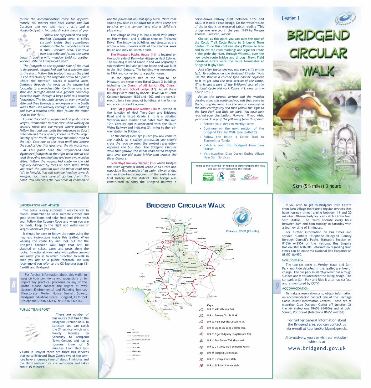
BRIDGEND CIRCULAR WALK
KEY
Basic route
Diverted/alternative routes
Link to other walks and trails
Railway line
Built up area
M4 Motorway
Road network
River
6
7
8
9
10
Key:-
Link to Vale Millenium Trail.
Link to Ewenny Circular Walk.
Link to Nant Bryn-glas Circular Walk.
Link to Sky to Sea Long Distance Trail.
Link to Ogwr Ridgeway Long Distance Trail.
Link to Sarn Station Walk (Proposed).
Link to C4 C/way and Community Routes.
Link to Bridgend Station Walk.
Link to Heritage Coast Walk.
Link to St. Brides Circular Walk.
1
2
3
4
5
Distance: 32KM (20 miles)
follow the accommodation track for approxi-mately 100 metres past Rock House and ElmCottages and you will note a stile and a signposted public footpath directly ahead of you.
Follow the signposted and way-marked footpath over 6 stilesthrough fields that sometimescontain cattle to a wooden stile ina small wooded area. Continueover this stile and follow the worn
track through a wild meadow field to anotherwooden stile on Llangewydd Road.
The footpath on the opposite side of the roadis signposted, waymarked and has a wooden stileat the start. Follow this footpath across the fieldin the direction of the waymark arrow to a pointwhere the footpath enters a wooded area.Continue through the wood on the waymarkedfootpath to a wooden stile. Continue over thestile and straight ahead in a general northerlydirection again through a large field to a woodenfootbridge. The footpath carries on over a woodenstile and then through an underpass on the SouthWales Main Line Railway through a small holdingand over a wooden stile, then follow the minorroad to the right.
Follow the road as waymarked on posts in theverges. (Remember to take care when walking oncountry roads and use verges where possible.)Follow the road past both the entrances to CourtColeman and the property known as North Lodge.Shortly after North Lodge take the minor road tothe left. Continue on this road until just beforethe road bridge that goes over the M4 Motorway.
At this point take the waymarked and signposted footpath on the right hand side of theroad through a smallholding and over two woodenstiles. Follow the waymarked route on the oldhighway bounded by trees on both sides. Whenyou reach the junction with the minor road turnleft to Penyfai. You will then be heading towardsPenyfai. You have several options from thispoint. You can cross the two areas of common or
use the pavement on Heol Tyn y Garn. (Note thatshould you wish to sit down for a while there arebenches on the common and also a children’splay area).
The village of Pen-y-fai has a small Post Officeon Pen-yr-Heol, and a village shop on TreharneDrive. The following buildings and structures arewithin a few minutes walk of the Circular WalkRoute and may be worth a visit.
The Pheasant Public House (14) is located onthe south side of Pen-y-fai village on Heol Eglwys.The building is listed Grade 2 and was originally a sub-medieval hall and parlour house and was builtin the 16th Century. The building was modernisedin 1967 and converted to a public house.
On the opposite side of the road to ThePheasant are three more listed Grade 2 buildingsincluding the Church of All Saints (15), ChurchLodge (16 and School Lodge (17). All of theseBuildings were built by Robert Llewellyn of CourtColeman between 1898 and 1903 and are consid-ered to be a fine group of buildings at the formerentrance to Court Coleman.
The Tyn-y-garn Mile Marker (18) is located atthe junction of Heol Tyn-y-Garn and BridgendRoad and is listed Grade 2. It is a detailedVictorian mile marker that dates from the mid19th Century and is associated with the SouthWales Railway and indicates 2 miles to the rail-way station in Bridgend.
At the end of Heol Tyn y Garn you will come tothe A4063. As a safety precaution you shouldcross the road by using the central reservationopposite the bus stop. The Bridgend CircularWalk then follows the minor road called Penycaelane over the old stone bridge that crosses theRiver Ogmore.
Glan Rhyd Railway Viaduct (19) which bridgesthe River Ogmore is listed Grade 2* as a rare andespecially fine example of an early railway bridgeand an important component of the early indus-trial history of the district. The bridge was constructed to carry the Bridgend Railway, a
horse-drawn railway built between 1827 and1830. It is now a road bridge. On the western sideof the bridge is an engraved tablet reading "Thisbridge was erected in the year 1829 by MorganThomas, Laleston, Mason".
Choice: at this point you can take the spur ofthe Celtic Trail Cycle Route to Bridgend TownCentre. To do this continue along Pen-y-cae laneand follow the road markings and signs for route4 alongside the river, through Wildmill, over thenew cycle route bridge and through Trews Fieldindustrial estate until the route terminates atBridgend Rugby Club.
Just after the bridge you will see a stile on theleft. To continue on the Bridgend Circular Walk use the stile or a chicane type barrier adjacentto it to get onto the next section of the route.(This is also a part of the Bridgend spur of theNational Cycle Network Route 4 known as theCeltic Trail.)
Follow the tarmac surface and the woodendecking along this route and you will then come tothe Sarn Bypass Road. Use the Toucan Crossing onthe dual carriageway and then follow the signs tothe Sarn Park and Ride car park. You have nowreached your destination. However, if you wish,you could do any of the following from this point:
• Retrace your steps to Merthyr Mawr• Continue on the next section of the
Bridgend Circular Walk (See leaflet 2)• Follow the Route 4 Celtic Trail to
Blackmill or Tondu • Catch a train into Bridgend from Sarn
Station• Visit McArthur Glen Design Outlet Village
Near Sarn Services
Information and Advice
The going is easy although it may be wet inplaces. Remember to wear suitable clothes andgood shoes/boots and take food and drink withyou. Follow the Country Code and when you areon roads, keep to the right and make use ofverges whenever you can.
It should be easy to follow the route using themap and instructions inside this leaflet. Whenwalking the route try and look out for theBridgend Circular Walk logo that will be situated on stiles, gates and posts along theroute. Directional waymarks with yellow arrowswill assist you as to which direction to walk inonce you are on a public footpath. We also recommend you refer to the OS Explorer Map 151Cardiff and Bridgend.
For further information about this walk, topass on your comments and suggestions or toreport any practical problems on any of thepaths please contact the Rights of WaySection, Environmental and Planning ServicesDirectorate, Morien House Bennett Street,Bridgend Industrial Estate, Bridgend, CF31 3SH(telephone 01656 642537 or 01656 642516).
Public Transport
There are number ofbus routes that link to theBridgend Circular Walk. InLaleston you can catchthe X1 service which runshourly Monday toSaturday to BridgendTown Centre, and has ajourney time of 5 minutes. From Heol Tyn-
y-Garn in Penyfai there are three bus servicesthat go to Bridgend Town Centre two of the serv-ices have a journey time of about 7 minutes andthe third service runs via Sainsburys and takesabout 15 minutes.
If you wish to get to Bridgend Town Centrefrom Sarn Village there are 6 regular services thathave journey times ranging between 11 and 20minutes. Alternatively you can catch a train fromSarn Station. The trains operate every hourbetween 8am and 8pm Monday to Saturday witha journey time of 8 minutes.
For further information on bus times and service numbers telephone Bridgend CountyBorough Council’s Public Transport Section on01656 642559 or the National Bus Enquiry line on 0870 6082608. Information regarding traintimes can be made via National Rail Enquiries on08457 484950.
Car Parking
The two car parks at Merthyr Mawr and SarnPark and Ride detailed in this leaflet are free ofcharge. The car park in Merthyr Mawr has a roughsurface and is situated near the swing bridge. Thecar park at Sarn Park and Ride is a tarmac surfaceand is monitored by CCTV.
Accommodation
To make a reservation or to obtain informationon accommodation contact one of the HeritageCoast Tourist Information Centres. These are atMcArthur Glen Designer Outlet off Junction 36the M4 (telephone 01656 654906) and at JohnStreet, Porthcawl (telephone 01656 643182).
For further general information about the Bridgend area you can contact us
via e-mail at [email protected].
Alternatively, you can visit our website -which is at
www.bridgend.gov.uk
1/4
CYNGOR CEFN GWLAD
CYMRU
COUNTYSIDECOUNCIL
FOR WALES
Thanks to the following for helping to either prepare the walkand text or for sponsoring the leaflet:
9km (51/2 miles) 3 hours
Leaflet 1

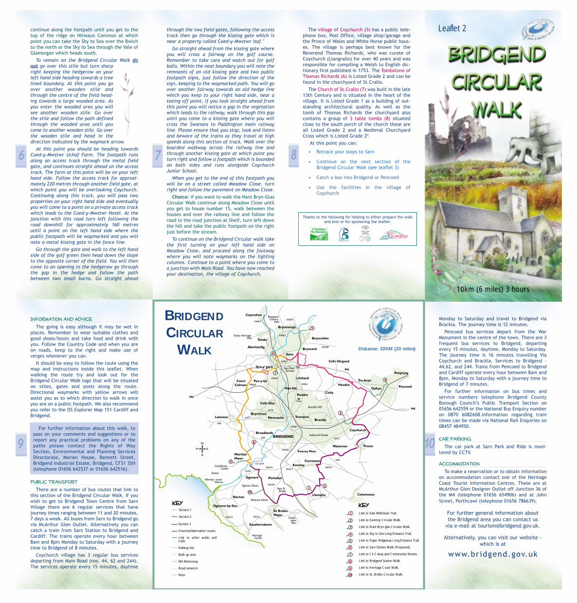
The Bridgend Circular WalkSection 2
Litchard
Brackla
Brackla
Pencoed
Penyfai
Junction 36 M4
M4
Church of St Bride
(Llanantffraid)
Tourist informationoffice
Church of St Mary
CoityCastle
Old Pump House
St Crallo’sChurch
Covered Reservoir
Parc Prison Bryn Awel
Dan-y-BrynDyfryn Awel
Pant-y-Pwllau
Bridgend Circular Walk
Link to other walks
River
Railway
Roads
Built up areas
KEY
Sarn Park& Ride
Link to
Celtic Trail
Link toPencoed town
and Sky to Sea long
distance trail
Continuation ofthe Bridgend
Circular Walk seeleaflet 3
Continuation ofthe Bridgend
Circular Walk seeleaflet 1
Link to the NantBrynglas Circular
Walk
Sarn
Coity
Coychurch
1 Coity Wallia
Common
Coity Wallia
Common
Giblet Farm
Hendre Farm
New Hendre Farm
Coed-y-Mwster Uchaf Farm
Coed-y-Mwster Hotel
Hendre Road
MainRoad
Heol Las
2 3 4
5Tombstone of Thomas Richards
Golfcourse
Golfcourse
7
86
i
RiverO
gmore
Swansea-Paddington main
line
A473
left hand side of the road under the railwaybridge. Follow the pavement up Sarn Hill untilyou come to a turning on your right hand side, atthis point cross the road and you will see thestreet name plate for Sarn Hill. Continue alongthis road and look out for the Bridgend CircularWalk logo and waymarkers on the lighting columnsalong Sarn Hill.
When you get to the junction with BryncochRoad turn right and follow the pavement until onthe left hand side of the road you see a junctioninto a street called Bryncwils. Cross the road atthis point and walk straight ahead through themetal kissing gate where the footpath is sign-posted. Continue straight ahead along a roughaccess track to a wooden stile and field gate.Follow the track across the Coity Wallia Commonuntil you see a wooden stile within the fence linestraight ahead of you. Go over the stile but Takecare! as there is only a small grass vergebetween the stile and the road.
Cross the road at this point and turn right following the pavement along which you willnote the occasional waymarks either on lightingcolumns, traffic sign poles or on wooden way-marking posts. Continue on the pavement until
you see an access track on your left-hand side, leading to an old pumphouse where you will also see a foot-path sign at the top of the track.Should you wish to take a rest at thispoint there is a bench near the pumphouse where you can sit and look over
towards Sarn.However, should you wish to continue on the
walk go over the wooden stile and follow thewell defined track alongside the fence line.Continue on this track with the fence line onyour right hand side until you get to a pointwhere you will see a mobile phone mast and awall which surrounds a covered a reservoir. Atthis point take the wider track to your left handside. Follow this track which will eventually
1
Introduction
This leaflet describes a 10km (6 Miles) section ofthe Bridgend Circular Walk. You should be able tocomplete this section of the walk in 3 hours butallow more time if you are thinking of visitingsome of the sites identified in the leaflet or if yousimply want to enjoy the countryside. The villages of Sarn and Coychurch have most of thethings you will need by way of facilities as hasPencoed Town.
For convenience purposes the directions beloware written with Sarn Park and Ride as the start-ing point for this section of the walk. You could,however, equally well start from Coychurch orany point along the route, and if travelling in theopposite direction simply reverse all the direc-tions.
Before starting the walk from Sarn if you wishto visit the Church of St Bride (1) (Llansantffraid)then leave the park and ride car park and walkalong Heol Persondy for a short distance and thechurch will be on your right hand side. TheChurch is listed grade 2 as a much restoredMedieval Parish Church which originates from the14th or 15th Century and was heavily restored byG.E.Halliday in 1896. The sundial in the porch of the church dates from 1762 and within thechurchyard there are several tombs and monuments that are also Listed Grade 2.
To begin this section of the walk from the SarnPark and Ride car park follow the footway on the
bring you back towards the fence line, at whichpoint you will note a metal public footpath signahead of you, walk towards this sign where youwill come to the road that crosses the common.
At this point cross the road onto the pavementon the opposite side and turn right, follow thepavement over the M4 motorway bridge until youcome to a public footpath which is signed on yourleft hand side. Turn left and follow the footpathalong the access track for approximately 75metres then follow the waymarked footpath onyour left hand side across the common runningalongside the motorway fencing. Continue on thefootpath until it bears right onto a wider trackpast the property known as Bryn-Awel.
Continue on the access track until you get to apoint near Rose Cottage where a waymark indicates that you take the grass track to yourright hand side. Follow the footpath along thegrass track for a short distance until you come toa tarmac surface near properties known as Dan-y-Bryn and Dyffryn Awel. At this point followthe track to your left hand side and continuealong it until you come to a cattle grid. Continuethrough the kissing gate along the tarmac track known as Pant-y-Pwllau to it’s junctionwith Heol Las.
Choice: at this point turn right and follow theroad into the village of Coity.
The village of Coity (2) issituated two miles northeastof Bridgend, having at its cen-tre the extensive 12thCentury ruin of Coity Castle.Immediately to the east ofthe castle is the 14th CenturyChurch of St.Mary. You will also find a shop and apub in the village.
Coity Castle (3) is Listed Grade 1 as an importantexample of medieval defensive architecture inWales. The castle was founded in the early 12thCentury and was probably built by Sir Guilbert deTurbeville a descendant of Payn de Turbeville who
(SECTION 2)
2 3 4
was given the lordship of Coity for his part in theconquest of Glamorgan. In 1404 it became "themost talked about place" in the country when itwas besieged by Owain Glyndwr. At the time itwas the only place in South Wales still loyal toKing Henry IV. The castle was still partly inhabiteduntil the early 18thCentury, however, it waslargely in ruins by the mid18th Century.
The Church of St Mary(4) is Grade 1 listed andwas built in the early 14thCentury, possibly on thesite of an earlier church. On the tower of thechurch you will see some particularly ugly gargoyles. The east window of the church depictsChrist rescuing Peter from the Sea, Christ rescu-ing the woman with an issue of blood, andDoubting Thomas. The church’s most celebratedrelic is an oak chest with carvings depicting thePassion of Christ.
To continue on the Bridgend Circular Walkcross the road and continue straight ahead onthe public footpath which runs along the track.Please note that most of the fields on the routefrom this point to Coed-y-Mwstwr Uchaf Farmoften contain cattle and sheep. You can help byreporting loose dogs or other problems affectingstock to the farmer. Go through the field gateand continue on the track over a wooden stilealongside a cattle grid to a point just before theaccess track which leads up to Giblet Farm.Follow the path to the right hand side as indicated by the waymarking post and continueto follow the path with the fence line andhedgerow on your right hand side.
Walk through this first large field until youcome to another field gate, go through the fieldgate and straight ahead, towards the woodedarea. Follow the well defined path through thewooded area where you will see a stile in thehedgerow on your left hand side. Go over the
5
stile and follow the direction of the waymarkarrow across the field heading towards a metalkissing gate. Go through the kissing gate andthen follow the access track that leads out ontoHendre Road.
At the junction with Hendre Road turn left andwalk along the road, you may note wooden way-mark posts with the Bridgend Circular Walk logoand waymarking discs. Continue along HendreRoad until you come to a cross roads and take theroad to the right hand side. A property known asHendre Farm will be on your right hand side.Continue along the highway until a point whereyou will see a public footpath sign on your lefthand side.
At this point there is a field gate, go throughthe field gate and continue with the hedgerowon your left hand side. You will be heading downa slope until a point where the field narrows considerably, at which point you will come toanother field gate, go through the gate and headto the bottom of the motorway embankmentwhere at the next field boundary you will see awooden stile in the left hand corner of the field.Go over the stile and keeping the fence line closeto your left hand side follow the field edge pathup a slight incline. Continue through this fieldfor some distance until you get to a hedgedboundary straight ahead of you with a stile in theleft hand corner.
Choice: at this point you can continue straightahead over the stile on this footpath though thesubway under the M4 Motorway, then across theplaying fields along Woodland Avenue to the junctionwith Hendre Road turn right and continue alongHendre Road over the railway crossing. You arenow in the Town of Pencoed where you will findall of the facilities you will need. From the play-ing fields you can also access the Sky to Sea longDistance Trail by walking along Llwyn Gwern thenright on Hendre Road then left along HeolWastadwaun for 560 metres then take the sign-posted footpath on the right hand side and
BRIDGEND
CIRCULAR
WALK
Section 3
Diverted/alternative routes
Link to other walks andtrails
Railway line
Built up area
M4 Motorway
Road network
River
Link to Vale Millenium Trail.
Link to Ewenny Circular Walk.
Link to Nant Bryn-glas Circular Walk.
Link to Sky to Sea Long Distance Trail.
Link to Ogwr Ridgeway Long Distance Trail.
Link to Sarn Station Walk (Proposed).
Link to C4 C/way and Community Routes.
Link to Bridgend Station Walk.
Link to Heritage Coast Walk.
Link to St. Brides Circular Walk.
1
2
3
4
5
6
7
8
9
10
Distance: 32KM (20 miles)
continue along the footpath until you get to thetop of the ridge on Hirwaun Common at whichpoint you can take the Sky to Sea over the Bwlchto the north or the Sky to Sea through the Vale ofGlamorgan which heads south.
To remain on the Bridgend Circular Walk donot go over this stile but turn sharpright keeping the hedgerow on yourleft hand side heading towards a treelined boundary. At this point you goover another wooden stile andthrough the centre of the field head-ing towards a large wooded area. Asyou enter the wooded area you willsee another wooden stile. Go overthe stile and follow the path definedthrough the wooded area until youcome to another wooden stile. Go overthe wooden stile and head in thedirection indicated by the waymark arrow.
At this point you should be heading towardsCoed-y-Mwstwr Uchaf Farm. The footpath runsalong an access track through the metal fieldgate, and continues straight ahead on the accesstrack. The farm at this point will be on your lefthand side. Follow the access track for approxi-mately 220 metres through another field gate, atwhich point you will be overlooking Coychurch.Continuing along this track, you will pass twoproperties on your right hand side and eventuallyyou will come to a point on a private access trackwhich leads to the Coed-y-Mwstwr Hotel. At thejunction with this road turn left following theroad downhill for approximately 160 metresuntil a point on the left hand side where thepublic footpath will be waymarked and you willnote a metal kissing gate in the fence line.
Go through the gate and walk to the left handside of the golf green then head down the slopeto the opposite corner of the field. You will thencome to an opening in the hedgerow go throughthe gap in the hedge and follow the pathbetween two small barns. Go straight ahead
through the two field gates, following the accesstrack then go through the kissing gate which isnear a property called Coed-y-Mwstwr Isaf."
Go straight ahead from the kissing gate whereyou will cross a fairway on the golf course.Remember to take care and watch out for golfballs. Within the next boundary you will note theremnants of an old kissing gate and two publicfootpath signs, just follow the direction of thesign, keeping to the waymarked path. You will goover another fairway towards an old hedge linewhich you keep to your right hand side, near ateeing off point, if you look straight ahead fromthis point you will notice a gap in the vegetationwhich leads to the railway, walk through this gapuntil you come to a kissing gate where you willcross the Swansea to Paddington main railwayline. Please ensure that you stop, look and listenand beware of the trains as they travel at highspeeds along this section of track. Walk over theboarded walkway across the railway line andthrough another kissing gate at which point youturn right and follow a footpath which is boundedon both sides and runs alongside CoychurchJunior School.
When you get to the end of this footpath youwill be on a street called Meadow Close, turnright and follow the pavement on Meadow Close.
Choice: if you want to walk the Nant Bryn-GlasCircular Walk continue along Meadow Close untilyou get to house number 15, walk between thehouses and over the railway line and follow theroad to the road junction at Shelf, turn left downthe hill and take the public footpath on the rightjust before the stream.
To continue on the Bridgend Circular walk takethe first turning on your left hand side onMeadow Close, and proceed along the footwaywhere you will note waymarks on the lightingcolumns. Continue to a point where you come toa junction with Main Road. You have now reachedyour destination, the village of Coychurch.
The village of Coychurch (5) has a public tele-phone box, Post Office, village shop/garage andthe Prince of Wales and White Horse public hous-es. The village is perhaps best known for theReverend Thomas Richards, who was curate ofCoychurch (Llangrallo) for over 40 years and wasresponsible for compiling a Welsh to English dic-tionary first published in 1753. The Tombstone ofThomas Richards (6) is Listed Grade 2 and can befound in the churchyard of St.Crallo.
The Church of St.Crallo (7) was built in the late13th Century and is situated in the heart of thevillage. It is Listed Grade 1 as a building of out-standing architectural quality. As well as thetomb of Thomas Richards the churchyard alsocontains a group of 3 table tombs (8) situatedclose to the south porch of the church these areall Listed Grade 2 and a Medieval ChurchyardCross which is Listed Grade 2*.
At this point you can:
• Retrace your steps to Sarn
• Continue on the next section of theBridgend Circular Walk (see leaflet 3)
• Catch a bus into Bridgend or Pencoed
• Use the facilities in the village ofCoychurch
CYNGOR CEFN GWLAD
CYMRU
COUNTYSIDECOUNCIL
FOR WALES
Thanks to the following for helping to either prepare the walkand text or for sponsoring the leaflet:
10km (6 miles) 3 hours
Leaflet 2
Information and Advice
The going is easy although it may be wet inplaces. Remember to wear suitable clothes andgood shoes/boots and take food and drink withyou. Follow the Country Code and when you areon roads, keep to the right and make use ofverges whenever you can.
It should be easy to follow the route using themap and instructions inside this leaflet. Whenwalking the route try and look out for theBridgend Circular Walk logo that will be situatedon stiles, gates and posts along the route.Directional waymarks with yellow arrows willassist you as to which direction to walk in onceyou are on a public footpath. We also recommendyou refer to the OS Explorer Map 151 Cardiff andBridgend.
For further information about this walk, topass on your comments and suggestions or toreport any practical problems on any of thepaths please contact the Rights of WaySection, Environmental and Planning ServicesDirectorate, Morien House, Bennett Street,Bridgend Industrial Estate, Bridgend, CF31 3SH(telephone 01656 642537 or 01656 642516).
Public Transport
There are a number of bus routes that link tothis section of the Bridgend Circular Walk. If youwish to get to Bridgend Town Centre from SarnVillage there are 6 regular services that havejourney times ranging between 11 and 20 minutes,7 days a week. All buses from Sarn to Bridgend govia McArthur Glen Outlet. Alternatively you cancatch a train from Sarn Station to Bridgend andCardiff. The trains operate every hour between8am and 8pm Monday to Saturday with a journeytime to Bridgend of 8 minutes.
Coychurch village has 3 regular bus servicesdeparting from Main Road (nos. 44, 62 and 244).The services operate every 15 minutes, daytime
6 7 8
9 10
Monday to Saturday and travel to Bridgend viaBrackla. The journey time is 12 minutes.
Pencoed bus services depart from the WarMonument in the centre of the town. There are 3frequent bus services to Bridgend, departingevery 15 minutes, daytime, Monday to Saturday.The journey time is 16 minutes travelling ViaCoychurch and Brackla. Services to Bridgend –44,62, and 244. Trains from Pencoed to Bridgendand Cardiff operate every hour between 8am and8pm, Monday to Saturday with a journey time toBridgend of 7 minutes.
For further information on bus times and service numbers telephone Bridgend CountyBorough Council’s Public Transport Section on01656 642559 or the National Bus Enquiry numberon 0870 6082608.Information regarding traintimes can be made via National Rail Enquiries on08457 484950.
Car Parking
The car park at Sarn Park and Ride is moni-tored by CCTV.
Accommodation
To make a reservation or to obtain informationon accommodation contact one of the HeritageCoast Tourist Information Centres. These are atMcArthur Glen Designer Outlet off Junction 36 ofthe M4 (telephone 01656 654906) and at JohnStreet, Porthcawl (telephone 01656 786639).
For further general information about the Bridgend area you can contact us
via e-mail at [email protected].
Alternatively, you can visit our website -which is at
www.bridgend.gov.uk
KKeeyy KKeeyySection 1
Section 2

wooden deck board heading for the large riverbridge in front of you. Go over the bridge and con-tinue straight ahead until you reach a woodedarea, walk through the wooded area where youwill note an old derelict farmhouse. The footpaththen goes through two field gates and comes outon a country road. To continue the walk, turn left and walk along theroad until you come to a road junction. At thejunction turn right past Ty Candy Farm and walkalong the road for approximately 500 metres untilyou come to a property known as Tyn y Caeau. Atthis point you will note a wooden footpath sign onyour right hand side, go through the double fieldgate (remember to close the field gate behind you)and head in the direction of the way-marks across2 fields and over 2 wooden stiles. Once you havegone over the second stile head towards the wood-en signpost near the road, turn left and follow thepavement. You are now entering the village ofTreoes on a street called Glan-y-Nant. In the centre of the village of Treoes you will finda number of Grade 2 Listed buildings including TheStar Inn PH (3), which is a characterful villagehouse with a thatched roof. Some parts of thebuilding date from the mid to late 17th Century.Opposite The Star Inn is Treoes Farmhouse alsoGrade 2 Listed as an early to mid 19th CenturyFarmhouse, which is unaltered.Continue along Glan-y-Nant then take the streeton your right hand side called Parc Newydd. Keepwalking along Parc Newydd and then turn left pastthe property known as Old Barn. Continue alongthis road past the property known as Ty Deri atwhich point the footpath follows a rough accesstrack for some distance to a point where a fieldgate will be straight in front of you. Go through the field gate and continue almoststraight ahead until you see a wooden footbridgeover Brocastle Brook, go over the two woodenstiles at either end of the footbridge and turn rightfollowing the waymark arrow until you come toanother wooden footbridge across another brook.Go over both stiles on this footbridge and thenturn right heading towards the Ford Motor factory.Climb over the wooden stile in the fence line and
1
Introduction
This leaflet describes a 13 Km (8 Mile) section ofthe Bridgend Circular Walk. You should be able tocomplete this section of the walk in 4 hours butallow more time if you are thinking of visiting someof the sites identified in this leaflet or if you simplywant to enjoy the countryside. The villages ofCoychurch, and St. Brides Major have most of thethings you will need by way of facilities.For convenience purposes the directions below arewritten with the village of Coychurch as the start-ing point for this section of the walk. You couldhowever equally start from Merthyr Mawr or anypoint along the route, and if travelling in the opposite direction simply reverse all the directions.Before starting the walk from Coychurch you couldvisit the Church of St. Crallo (1) and the Tombstoneof Thomas Richards (2) which can be found in thechurchyard. Further details on these sites of interest can be found in Bridgend Circular Walkleaflet (2).To begin this section of the walk leave the MainRoad in Coychurch Village and follow the roadbetween the properties known as Isfryn andCoychurch Cottage. Then take the public footpathon your left which runs between Nos. 28 and 29 St.
Mary’s View, walk across the roadand follow the signposted foot-path between Nos. 22 and 23 St.Mary’s View. Cross over the stonestile onto the verge of the A473.Take care when crossing this dualcarriageway and follow the way-
marked tarmac path across the central reserva-tion. Use the steps and follow the waymarked foot-path over a stone stile and a wooden stile and continue across the field. Pass through three kissing gates to a point where you come to a smallwooded area. Go over another stone stile and follow the well-defined path through the woodsand through the metal kissing gate. Follow thewaymarks across the first small field and over the
turn left. Follow this public footpath, which isbounded on one side by a hedgerow and post andwire fence and the other by the security fence ofthe Ford factory. Continue along the footpath for800 metres until a point where you come to awooden stile. Go over the wooden stile and up aset of concrete steps. At the top of the steps turnright and follow the stone dust path along theverge of the A48 until you get to a wooden signpost which is waymarked across the road. Take carewhen you are crossing the road and use the centralreservation.Follow the stone dust path which is waymarked into the Bridgend Golf Complex. Fromhere go over a wooden stile and follow the tarmacaccess track until you see a gap in the hedgerowwhere there are the remnants of an old stile, gothrough the gap and head towards a steel stilewhich is situated in the boundary of a footballfield, go over the steel stile and across the footballpitches to a point where you will see a tall metalgate in the hedgerow near the road. Go throughthis gate and turn right along Corntown Roadtowards the village of Corntown, using the grassverge for a short distance then the pavement. The Nant Baptismal Pool (4) in Corntown was onceused for baptising people. However, it is thoughtthat the last baptism was per-formed here at the turn of the 20thCentury. More recently it has beenused for watering cattle. The poolis fed by groundwater and over-flows into "The Nant", which even-tually flows through the ground ofthe Ewenny Priory and into the Ewenny River.In the village there are also some Grade 2 Listedbuildings which include Corntown Court which has17th or 18th Century origins and Corntown Farmwhich has 14th Century origins and is an importantfrontage in the centre of Corntown Village.Choice: At this point continue along CorntownRoad to a point where there is a footpath on yourright hand side which leads to the grounds ofEwenny Priory (5) or just continue along the roadfor approximately 1km which will bring you into the
Leaflet 3 (Vale SECTION)
2 3 4
Village of Ewenny. There is also a link to theEwenny Circular Walk.Ewenny is a unique rural village just south ofBridgend situated on the edge of the Ewenny River.In the village you will find a grocery store, a craftshop and café. The highlight of the village is the Ewenny Priory andChurch. In 1141 the Church of St. Michael became thebeginning of the Benedictine priory of Ewennygranted to the Abbey of St. Peter at Gloucestertogether with the churches of St. Bride’s Major, St. Michael at Colwinston and the Manor at Lampha.The Priory and church was founded by Normannobleman, Maurice de Londres and is widelyregarded as one of the finest fortified religiousbuildings in Britain. The village of Ewenny is alsohome to Ewenny Pottery founded in 1610 and stillworked by the same family. It is the oldest workingpottery in Wales.To continue on the Bridgend Circular walk - Shortlyafter entering Corntown take the turning on yourleft hand side signed for Heol y Cawl and Nant Lias.You will also note a wooden footpath sign pointingup the track towards Corntown Farm. This track issteep in places. When you get to the gates ofCorntown Farm you will note a wooden stile onyour right hand side. Go over the wooden stileturn left and follow the field edge path. Followthe path into the corner of the field where theroute turns right and the field edge path continuesagain with the boundary on your left hand side.You will come to a point where on your left handside there is a wooden stile and a double field gateeither go over the stile or, if the field gate is open,go through the double field gate. At this point, if you wish to stop and take a breath,on a clear day the view is quite spectacular and youshould be able to see Bridgend Town and beyond.Continue straight ahead from the wooden stile anddouble field gates and follow the field edge pathwith a dry stone wall on your left-hand side.Thiseventually turns into a hedgerow. Keeping thehedgerow on your left hand side continue along thefootpath until you note a wooden way-mark postwith a way-mark arrow indicating that you bear
5
right, continue along the field edge path through afield gate out onto the road where the footpath issign posted in the verge. Turn right at this point and follow the road whichis known as Tair Croes, until you note a public bridleway signpost on your left hand side. Continuealong the bridleway, which is bounded on bothsides for a short distance before it runs into anopen field. Keeping the field boundary on your lefthand side continue along the field edge bridlewaythrough the wooded area (please note that the surface of this section of path can be wet at times,so wear suitable footwear). As you come out ofthe wooded area follow the direction of the way-mark arrow and keeping the field edge on your lefthand side continue along the bridleway to a pointwhere you go through a small copse area onto atrack that widens and terminates on the road. Choice: At this point you can also take the ValeMillennium Trail which is waymarked.To continue on the Bridgend Circular Walk cross theroad and proceed straight ahead along the tarmaclane until you come to a ford. Use the steppingstones over the Afon Alun, then walk along the bridleway on your right hand side. Continue alongthe bridleway for a short distance, through a fieldgate and under the viaduct. Immediately after therailway viaduct turn left through the bridlewaygate and follow the track for a short distance. Keeping the fence line on your left hand side go upthe steep embankment where you will see a way-mark post with the Bridgend Circular Walk logo infront of you (Note: this section of route is verysteep). Approximately 30 metres up the steepembankment turn right where you will see adefined track: this section of the route is alsoquite steep so take care when walking. Follow the route through the gorse and brackenuntil you come to the wide open track on top of theOld Castle Down Common. Turn right at this pointand follow the well defined and waymarked bri-dleway until you get to a point where you will notean old dry stone wall. Proceed straight ahead withthe wall on your left hand side until the wall ends.Turn left at this point and follow the well-definedpath. Continue along the route until you come to a
The Bridgend Circular WalkVale Section (3)
Bridgend Circular Walk
Link to other walks
River
Railway
Roads
Built up areas
KEY
4
5
12
3
7
6
89
10
Ty CandyFarm
Star Inn
Continuation ofBridgend Circular Walk
see leaflet 1
Coychurch
TreoesFord
MotorFactory
Corntown
BracklaBridgend
Ewenny
Merthyr Mawr
A48
A48
St Brides Major
Continuationof Bridgend Circular Walk
see leaflet 2
Link to St Brides Circular Walk
Link toVale
MilleniumTrail
Link toEwennyCircular
Walk
Link to EwennyCircular Walk
A473
Ewenny River
Brocastle Brook
Nant Baptismal
Pool
CorntownFarm
FlemingstoneIron Age Fort
Ogmore Castle
Ogmore Farm
Pelican Inn
PantQuarry
SteppingStones
Croes Antoni
Church of St Brides Major
The Butler Tomb
Ewenny Prioryand Church
(founded 1141)
Ford
RailwayViaduct
Heol yCawl
Tair CroesHeol y Millwyr
Ewenny River
Ogmore DownCommon
Old Castle DownCommon
To Ewenny
All maps in this series are based upon Ordnance Survey maps.© Crown copyright. All rights reserved. (Bridgend County Borough Council) (licence no. 100023405, 2004).
SteppingStones
Afon Alun

BRIDGEND
CIRCULAR
WALK
Section 3
Diverted/alternative routes
Link to other walks andtrails
Railway line
Built up area
M4 Motorway
Road network
River
Link to Vale Millenium Trail.
Link to Ewenny Circular Walk.
Link to Nant Bryn-glas Circular Walk.
Link to Sky to Sea Long Distance Trail.
Link to Ogwr Ridgeway Long Distance Trail.
Link to Sarn Station Walk (Proposed).
Link to C4 C/way and Community Routes.
Link to Bridgend Station Walk.
Link to Heritage Coast Walk.
Link to St. Brides Circular Walk.
1
2
3
4
5
6
7
8
9
10
Distance: 32KM (20 miles)
property known as Brynawel House. The bridlewaycontinues along a rough access track for a short dis-tance until a point where you will note a woodenwaymark post on your right hand side. Follow thedirection of the arrow on the post and continueuntil you come to an opening where you will see awaymark post in front of you. At this point turnright and walk for a short distance until you cometo the road that leads into the village of St. BridesMajor. To go into St. Brides Major turn left and go over thecattle grid. The village will have most of the facil-ities that you will need.The parish Church of St. Bride’s Major (6) was builtin the 12th Century and is dedicated to St. Bride(an abbreviated form of St. Bridget) a 5th CenturyIrish Saint. The Church hasmany interesting featuresand is well worth a visit.The most interesting feature of the church is anincised sepulchral slab orcoffin-lid beneath the alterwhere it was placed in 1854. The engraving on itshows Johan le Botiler (Butler) of Dunraven. On theNorth side of the church is a window containing afine tomb chest (The Butler Tomb) which datesfrom around 1540. The Churchyard Cross rests on apedestal on 5 steps, which are indented and worn,caused it is said, by pilgrims kneeling in prayer.To continue on the Bridgend Circular Walk cross theroad and follow the direction of the arrow on thesignpost along the tarmac track which runs up anincline. When you get to the top of the track takethe bridleway that is waymarked with the BridgendCircular Walk logo across the Ogmore DownCommon. Continue on the bridleway for a shortdistance until you come to an opening, at whichpoint turn right and follow the route on the widetrack in the direction of the wooden telegraphpoles. Pant Quarry will be on your right hand side,it is fenced off and you will see notices saying‘Keep Out’. Continue along the wide track over thecommon. At this point the bridleway follows a section of what was an old Norman military road,Heol y Millwyr, (the road of the soldiers), which
was used by troops commuting to garrison OgmoreCastle below. In the other direction the road wasprobably used via the Croes Antoni to the Normancastle at Castle Upon-Alun. Croes Antoni (7) can befound just to the north west of St. Brides church.The remains of this stone cross incorporate a cupshaped depression which used to be filled with holywater for use by pilgrims arriving at the Church ofSt. Bride’s.Without deviating from the wide grass track con-tinue straight ahead where you will noteSoutherndown Golf Course on your left hand side.Follow the telegraph poles (one of which has aBridgend Circular Walk waymark on it) until theroute becomes bounded on both sides. Continue toa point where there are two routes ahead of youand a field gate on your right hand side. Take thelower route, again following the line of telegraphpoles. At this point if you look up to your right youwill note the remains of the Flemington Iron AgeFort (8), this is less well known than the one on thecliffs at Dunraven, and it occupies the high groundabove the best water supply in the whole area.Go through the wooden field gate and follow thesection of bridleway that is bounded on both sidesby dry stone walls. Continue until you will comeout on the road near the Schwyll Pumping Station.At this point turn left and follow the pavement.Choice: • If you wish you could visit Ogmore Castle (9) and
Castle Tea Rooms. Ogmore Castle was built duringthe conquest of the South Wales Coast, theNormans built 3 Castles at Ogmore, Newcastleand Coity (see leaflet 2 for information on CoityCastle). William de Londres built Ogmore Castleas early as 1116 on the South bank of the EwennyRiver where it commands a strategic position. TheCastle was not completed in one period, onebuilding was added in Tudor times, and was keptin repair until the 19th century as a court of justice, a prison and also to receive court fees,rents and other dues.
• Or spend some time at the ancient Pelican Inn (10) overlooking the castle.
• After visiting Ogmore Castle cross the RiverEwenny via the stepping-stones to return toMerthyr Mawr. However, you must take care as thetides can be exceptionally dangerous as theychange very quickly and you could be isolated onthe wrong side of the river. Story has it that thesestones were built for the convenience of a lovestricken girl who lived in Ogmore Castle. Her loverlived across the river at Merthyr Mawr and theirtryst was impeded by tides and floods. The stepping-stones enabled them to meet each other andthey married in July 1233. The bridegroom wasWilliam de Breose.
• Ogmore Farm situated next to the Castle is one ofthe oldest established working farms inGlamorgan although the present farmhouse datesfrom the 17th Century a lease of the farm isknown to one John Walsh as long ago as 1490.
Just before you get to a cattle grid cross the roadyou will note a Merthyr Mawr Coastal Path way-mark arrow embedded on an old stone. Walkthrough the kissing gate along the tarmac footpathand over the bridge across the River Ewenny. Fromthe bridge continue straight ahead across the fieldtowards the stone stile heading towards the swingbridge. Go over the stone stile, turn right, acrossthe swing bridge which spans the River Ogmore,you have now reached the car park in MerthyrMawr and reached your destination of MerthyrMawr Village. Merthyr Mawr Village is an idyllic little settlement,as picturesque as they come, with an outstandingcollection of Thatched Dwellings beautifully positioned around an old Village Green.
13km (8 miles) 4 hours
Leaflet 3
At this point you can:• Continue on the next section of the Bridgend
Circular Walk (see leaflet 1)• Or retrace your steps to Coychurch
Information and AdvicE
The going is generally easy although a few sectionsof the route are steep and may also be wet inplaces. Remember to wear suitable clothes andgood shoes/boots and take food and drink with you.Follow the Countryside Code and when you are onroads, keep to the right and make use of vergeswhenever you can.It should be easy to follow the route using the mapand instructions inside this leaflet. When walkingthe route try and look out for the Bridgend CircularWalk logo that will be situated on stiles, gates andposts along the route. Directional waymarks withyellow and blue arrows will assist you as to whichdirection to walk in once you are on a public foot-path or bridleway. We also recommend you refer tothe OS Explorer Map 151 Cardiff and Bridgend. For further information about this walk, to pass onyour comments and suggestions or to report anypractical problems on footpaths in the BridgendArea please contact the Rights of Way Section,Environmental and Planning Services Directorate,Morien House Bennett Street, Bridgend IndustrialEstate, Bridgend, CF31 3SH (telephone 01656642537 or 01656 642516). For any practical prob-lems on the section of route in the Vale ofGlamorgan area contact the Rights of Way Officeron 01446 704810.
Public Transport
There are number of bus routes that link to thissection of the Bridgend Circular WalkCoychurch village has 3 regular bus services depart-ing from Main Road 44, 62 and 244. The servicesoperate every 15 minutes, daytime Monday toSaturday and travel to Bridgend via Brackla theJourney time is 12 minutes.If you wish to get to or from St. Brides Major thereare 2 services to chose from. The 145 - Bridgendand Llantwit Major via Ogmore-by-sea every hour ineach direction, Monday to Saturday and 6 services
6 7 8
9 10
on a Sunday. Please note; the 145 departs from outside the Farmers Arms PH. The 146 service travels between Bridgend and Cardiff Wales Airport3 times a day, Monday to Saturday.The journey timefrom St. Brides Major to Bridgend is 16 minutes.Corntown is linked to Bridgend and Cowbridge withthe V4 service. There are 5 services in eachdirectioN, Monday to Saturday. Journey time toBridgend and Cowbridge is 15 minutes. Ewenny is serviced by bus services 145, 146 and V4. There is one bus service linking Treoes to Bridgendand Cowbridge. It operates 5 times a day, Mondayto Saturday. Journey time to Bridgend is 10 minutesand to Cowbridge 30 minutes.For further information on bus times and servicenumbers telephone Bridgend County BoroughCouncil’s, Public Transport Section on 01656 642559or The Vale of Glamorgan Public Transport Sectionon 01446 704687 or the National Bus Enquiry number on 0870 6082608.
Car Parking
The car park at Merthyr Mawr is a rough surface situated on the bank of the River Ogmore near theswing bridge.
Accommodation
To make a reservation or to obtain information onaccommodation contact one of the Heritage CoastTourist Information Centres. These are at McArthurGlen Designer Outlet off Junction 36 of the M4(telephone 01656 654906) and at John Street,Porthcawl (telephone 01656 786639) or LlantwitMajor Visitor Centre (telephone 01446 796086).For further general information about the Bridgendarea you can contact us via e-mail at
[email protected] for information on the Vale of Glamorgan areacontact
[email protected], you can visit us at
www.bridgend.gov.uk
KKeeyy KKeeyySection 1
Section 2
Thanks to the following for helping to either prepare the walkand text or for sponsoring the leaflet:
BCBC design@bridgend: 01656 651005e.mail: [email protected]


