Embed Size (px)
Citation preview

Multidisciplinary Investigations at P.O.W. Camp 198, Bridgend, S.
Wales: Site of a Mass Escape in March 1945
L. Rees-Hughes1, J.K. Pringle1*, N. Russill2, K.D. Wisniewski1, P. Doyle3
1School of Geography, Geology and the Environment, Keele University, Keele,
Staffordshire ST5 5BG, U.K.
Email: [email protected] ; [email protected]
Twitter: @LReesHughes; @milgeol; @Kris_Forensics
JP ORCiD: 0000-0002-0009-361X
2TerraDat UK Ltd, Unit 1, Link Trade Park, Penarth Road, Cardiff, CF11 8TQ, U.K.
Email: [email protected]
Twitter: @nickruss
3Department of Earth Sciences, University College London, Gower Street, London,
WCIE 6BT, U.K.
Email: [email protected]
Twitter: @profpeterdoyle
*Jamie Pringle
School of Geography, Geology & the Environment, Keele University, Keele,
Staffordshire ST5 5BG, U.K
Email: [email protected]
Phone Number: +44 (0)1782 733163
Word count: 7,918
1
2
3
4
5
6
7
8
9
10
11
12
13
14
15
16
17
18
19
20
21
22
23

Multidisciplinary Investigations at P.O.W. Camp 198, Bridgend, S.
Wales: Site of a Mass Escape in March 1945
The largest escape of German Prisoner of War (P.O.W.) in WW2 was in March
1945 from Camp 198, situated in Bridgend, South Wales, UK. Since camp
closure the site has become derelict, and has not been scientifically investigated.
This paper reports on the search to locate the P.O.W. escape tunnel that was dug
from Hut 9. This hut remains in remarkable condition, with numerous P.O.W.
graffiti still present. Also preserved is a prisoner-constructed false wall in a
shower room behind which excavated material was hidden, though the tunnel
entrance itself has been concreted over. Near-surface geophysics and ground-
based LiDAR were used to locate the tunnel. Mid-frequency GPR surveys were
judged optimal, with magnetometry least useful due to the above-ground metal
objects. Archaeological excavations discovered the intact tunnel and bed-board
shoring. With Allied P.O.W. escape camp attempts well documented, this
investigation provides valuable insight into German escape efforts.
Keywords: geophysics, Prisoner-of-War, archaeology, World War II, Escape,
German, South Wales
24
25
26
27
28
29
30
31
32
33
34
35
36
37
38
39
40
41
42
43
44

INTRODUCTION
The last twenty years or so has seen the development of the conflict archaeology
and the application of scientific principles to the investigation of sites of battle (see
Pollard and Freeman, 2001, and Scott et al., 2007 for overviews, see also Gaffney et
al., 2004; Passmore and Harrison 2008; Saunders, 2011;, 2014; Saey et al., 2016), as
well as the investigation of the infrastructure and fortifications of war, including
trenches, dug-outs, foxholes and tunnels (see, for example, Rosenbaum and Rose, 1992;
Doyle et al. 2001, 2002, 2005; Everett et al. 2006; De Meyer and Pype, 2007; Brown
and Osgood 2009; Masters and Stichelbaut, 2009; Banks, 2014; Banks and Pollard,
2014; Doyle 2015, 2017), hospitals, airfields and logistics (e.g. Dobinson et al. 1997;
Schofield, 2001; Passmore et al. 2013; Capps Tunwell et al. 2015) and Prisoner of War
(P.O.W.) sites (e.g. Moore 2006; Doyle et al. 2007, 2010, 2013; Pringle et al. 2007;
Doyle 2011; Early 2013; Mytum and Carr, 2013; Schneider 2013). These
investigations include investigative archaeology, geophysical surveys as well as the
consideration of landscape and topography in relation to battle that has emphasised a
growing importance of conflict archaeology and of scientific interpretation informing
the understanding of such events.
As part of the investigations of wartime sites, near-surface, multi-technique
geophysical surveys have become increasingly popular (see, for example, Gaffney et al.
2004; Everett et al. 2006; Pringle et al. 2007; Fernandez-Alvarez et al. 2016), due to
their capability to characterise sites rapidly, as well as pinpointing key buried areas of
interest for subsequent intrusive investigations.
A developing area of interest in conflict archaeology has been the location and
characterising of P.O.W. camp escape tunnels, as part of a wider interest in the study of
P.O.W. camps (e.g. see Carr & Mytum, 2012 and Mytum and Carr, 2013).
45
46
47
48
49
50
51
52
53
54
55
56
57
58
59
60
61
62
63
64
65
66
67
68
69

Underground tunnelling has been a popular method for prisoners to escape confinement
for centuries, and particularly so during the two world wars, both of which saw mass
internment on a scale not seen before (see, for example, Barbour, 1944; Evans, 1945;
Crawley, 1956; Schneck, 1998; Moore, 2006; Doyle 2008, 2011). Such camp escape
attempts, whilst mostly unsuccessful (WW2 P.O.W. documented tunnel escapes are
summarised in Table 1), were high profile and of great interest to the general public
with a large number of accounts published both during and after conflict (Williams
1945, 1949, 1951; Hargest 1946, Brickhill, 1952; Reid 1952, 1956; Burt and Leasor
1956; Rogers 1986) with, arguably the so-called ‘Great Escape’ of 77 Allied P.O.W.
airforce officers in 1944 being the most famous (Brickhill, 1952).
There were generally two types of escape tunnels: (1) relatively short tunnels,
excavated quickly to enable small numbers of prisoners to go under camp perimeter
fences and escape, and which entailed relatively little work, but which were generally
poorly concealed (see Doyle, 2011); and, (2) relatively long tunnels that were
meticulously planned, engineered and operated by highly organised and expertly-trained
personnel, for example, the well-known WW2 allied 1944 ‘Great Escape’ (see
Brickhill, 1952; Burgess 1990; Doyle et al. 2007, 2010, 2013; Pringle et al. 2007) and
the escape from Colditz Castle (Reid, 1952,1953; Eggers, 1961; Rogers 1986; Doyle,
2011).
Whilst there have been a number of multidisciplinary scientific site
investigations undertaken on WW2 Allied P.O.W. escape attempts (see Doyle et al.
2007, 2010, 2013; Pringle et al., 2007; Doyle, 2011), there have been few studies of
Axis P.O.W. escape attempts (Table 1). Though there have been some recent studies of
German P.O.W. camps in Allied countries (e.g. see Early 2013; Schneider 2013;
Zimmermann, 2015), in general there has been low level of perception that Axis troops,
70
71
72
73
74
75
76
77
78
79
80
81
82
83
84
85
86
87
88
89
90
91
92
93
94

in common with other captives, also attempted to escape, with the single most
documented example being the escape of Franz von Werra from captivity in Canada
(Burt and Lessor, 1956). This is surprising as there were an estimated 3.6M German
soldiers captured during WW2, and there were over 1,026 individual P.O.W. camps in
the United Kingdom alone (Jackson, 2010).
This paper describes a multidisciplinary investigation of a mass escape of
P.O.W.s from one such WW2 camp in the United Kingdom, namely Camp 198 situated
in Bridgend, South Wales, UK (Fig. 1 and GoogleEarth™ KML file in Supplementary
data). Eighty-three German P.O.W.s are known to have escaped from Camp 198 on 10
March 1945, employing a tunnel dug from Hut 9 that went under the perimeter fence.
The aims of this paper are to: 1, document the multidisciplinary site
investigations carried out at Camp 198; 2, to evidence the techniques and procedures
used to locate and characterise the escape tunnel; and, 3, to compare the escape attempt
of March 1945 to other documented 20th Century P.O.W. escape attempts.
Figure 1. Here
Table 1. Here
95
96
97
98
99
100
101
102
103
104
105
106
107
108
109
110
111
112
113

CAMP 198 BACKGROUND
The site did not become P.O.W Camp 198 until 1944. It had initially been
constructed in 1938 to provide workers’ housing for the nearby Waterton Royal
Ordnance Factory, before being used to accommodate US troops of the 109th Infantry
Regiment shortly before the 1944 invasion of Normandy (Williams, 1976). However,
following the D-Day invasion, large numbers of German troops were captured, resulting
in a requisite need for an increased number of P.O.W. camps to house them. In 1944
the site was established as Camp 198, initially to contain low-ranking German and
Italian soldiers captured earlier in the war, but in November 1944, 1,600 German
Officers arrived and were interned here (Williams, 1976; Phillips, 2006). Once fully
established and secured, it became a high-security camp (Fig. 2).
Camp security measures were generally poor, however; there was a lack of both
sentry towers and perimeter fence lighting, and this provided good cover for escape
tunnels to be constructed. A German escape organisation was quickly set up after
prisoner arrival, with any P.O.W.s with experience in mining identified (Williams,
1976). Prisoners also petitioned for an extension to their exercise area, with the
intention of gaining areas to conceal excavated material. A hand-excavated escape
tunnel was first constructed in Hut 16, but this tunnel was found during a hut inspection
(in some ways similar to the discovery of tunnel ‘Tom’ of ‘The Great Escape’ fame, see
Brickhill, 1952 for more information). As such, a second tunnel was started in Hut 9
(Room 3), which was adjacent to the perimeter fence (see Fig. 2 for locations). On the
night of 10 March 1945, 83 German P.O.W.s successfully achieved a mass break out via
an escape tunnel. Despite having a greater number of escapers that the Allied ‘Great
Escape’ from Stalag Luft III of the previous year, this German attempt has had very
114
115
116
117
118
119
120
121
122
123
124
125
126
127
128
129
130
131
132
133
134
135
136
137
138

little exposure to date, presumably due to the fact that it was on Allied soil. As with
many P.O.W. escape attempts, the escapers employed great ingenuity in their onwards
journey. Notably, one stole a car and managed to reach Birmingham, before being
captured. Following the escape, the local Police, Home Guard, Army and Air force
were mobilised; none of the 83 escaped P.O.W.s managed to successfully escape, so-
called ‘home runs’ by the Allies.
After the escapers had been recaptured, Camp 198 was closed, and its 1,600
P.O.W.s were transferred to Camp 181 in Worksop, Nottinghamshire, UK. Camp 198
was subsequently renamed Special Camp XI and used to house high-ranking German
Officers after the end of the War before eventually being closed in May 1948 (Williams,
1976).
Figure 2. Here
SITE CONDITION AND HUT 9
After the camp was finally abandoned in 1948, it fell into disrepair. It is
therefore fortunate that Hut 9, the scene of the escape survived. Currently, the site of
the camp is overgrown, now comprising mostly a wasteland that has not been
developed, much like Stalag Luft III, the site of ‘The Great Escape in 1944 (see Doyle
et al. 2007, 2013; Pringle et al. 2007). An early investigation of the site was carried out
in the 1970s by Cardiff University, which found that it was becoming dilapidated and
vandalised (Fig. 2). They also investigated the tunnel exit location.
By the 1990s, the site was deemed a safety hazard by the local Borough Council
with 32 of the 33 prisoner Huts were demolished, with the exception of Hut 9 (Fig. 2).
139
140
141
142
143
144
145
146
147
148
149
150
151
152
153
154
155
156
157
158
159
160
161
162

The larger site is now being reforested, with the exception of Hut 9 which has been left
intact, and with a 3-m-high perimeter fence erected around it. The hut itself is used
sporadically for ‘wartime weekends’ and educational purposes (Fig. 3). Unfortunately,
due to the afforestation, some saplings and other vegetation have grown over the
suspected tunnel location, which has made site investigation difficult (Fig. 3c).
Desktop studies indicated that the local geology of the site was the Jurassic Blue
Lias Formation, comprising a bedrock of interbedded limestone and mudstone, overlain
by Devensian glacio-fluvial sand and gravel soils. Field samples obtained onsite during
soil auger trial investigations to 0.75 m depth, revealed that the surface soils actually
comprised a silty clay loam, with a ~10 cm thick, black (Munsell soil colour chart:
7.5YR/5/1), organic-rich ‘O’ horizon, a ~15 cm thick, silty, grey (7.5YR/7/2) ‘A’
horizon with coal fragments, and a ~40 cm thick, dark (2.5 YR/5/4), hard clay-rich ‘B’
horizon. The P.O.W. tunnel was excavated in these silty clay loam soils which were
quite different to the sandy soils encountered in the Allied P.O.W. ‘Great Escape’ (see
Williams, 1949; Brickhill, 1952; Doyle et al., 2010).
Figure 3. Here
An initial site investigation was undertaken within Hut 9 in 2013. Many
prisoner hand-drawn graffiti on camp the hut walls had been lost during the camp
demolition, but specific graffiti examples, typically poetry, scenes depicting the
prisoners’ home, or of loved ones (Fig. 4) have been removed from other Huts and
stored within Hut 9. Most of the huts had the same layout, a central corridor running
between 12 prisoners’ rooms on either side, each containing bunk beds, and a central
163
164
165
166
167
168
169
170
171
172
173
174
175
176
177
178
179
180
181
182
183
184
185
186

shower block (Fig. 5).
Williams (1976) has stated that the tunnel entrance was initiated in Room 3 of
Hut 9. Removal and disposal of spoil has long been a problem for P.O.W. tunnellers
(see Doyle 2011). One possible approach is the dispersion and mixing of excavated
soils with surface soils in gardens and recreational areas. For the Allied ‘Great
Escapers’ of Stalag Luft III, the surface soils were distinctly darker than those of a
depth, so mixing had to be thorough (see Williams, 1949; Brickhill, 1952; Doyle et al.,
2010). The German prisoners as Camp 198 experienced similar problems, and it is
known that they initially took advantage of garden plots and the wider camp grounds to
get rid of tunnel-excavated material; however, it was soon realised that camp guards
would notice the appearance of this extra material (Williams, 1949). Therefore, the
prisoners constructed an ingenious false wall in the shower room in Hut 9, providing a
means of housing most of this hand-excavated soil, which was hauled from the tunnel
on a makeshift skip, before being deposited in the newly created cavity. The camp
guards never discovered this.
The fake wall remains and excavated material were still present onsite (Fig. 5).
However, the tunnel entry point within Room 3 had been filled and concreted over in
1945 (Fig. 5). Since the initial investigations, protected Lesser Horseshoe and Brown
Long-eared bat species have established themselves in Hut 9; and as such, further
investigations within the hut were not permitted.
Figure 4. Here
Figure 5. Here
187
188
189
190
191
192
193
194
195
196
197
198
199
200
201
202
203
204
205
206
207
208
209
210

NEAR-SURFACE GEOPHYSICAL SURVEYS
Although the P.O.W. escape tunnel entrance location in Room 3 was known,
there was some uncertainty on the orientation and exit location of the tunnel, as well as
its general condition – given its 70-year age. As discussed above, non-invasive surface
geophysical techniques have previously been successful in conflict archaeology sites
(e.g. Masters & Stichelhaut, 2009; Banks, 2014), though used more sporadically in
detecting P.O.W. escape tunnels (although see Pringle et al. 2007; Doyle, 2011). In
theory, basic 2D geophysical survey line profiles across a presumed tunnel area should
have allowed its location to be determined (Fig. 6). However, the site and its vicinity
was challenging. As well the presence of a 3-m-high metallic fence, and numerous
surface scattered metallic objects in the survey area, it also contained a significant
quantity of immature saplings and other vegetation (Fig. 3c), which, due to the
presence of the protected bat population, could not be removed prior to fieldwork.
Figure 6. Here
Ground Penetrating Radar Surveys
GPR surveys are the most popular geophysical technique used in archaeology, as
they can detect buried objects up to 10 m below ground level in ideal conditions (see
Sarris et al. 2013; Dick et al. 2015). In 2016, following initial onsite testing of the GPR
PulseEKKO™ 1000 system using available 225 MHz, 450 MHz and 900 MHz
frequency antennae, 225 MHz frequency, fixed-offset antennae were used to acquire 11
profiles at approximately 1 m intervals (Fig 6). Trace spacings were 0.1 m, using a 120
ns time window and 32 repeat ‘stacks’ at each trace position. However, profiles at 10 m
and 12 m away from Hut 9 could not be collected due to the metal presence and original
211
212
213
214
215
216
217
218
219
220
221
222
223
224
225
226
227
228
229
230
231
232
233
234

barbed wire fences. Standard sequential data processing steps were applied to each 2D
profile, namely: 1, first break arrival picking and flattening to time-zero; 2, AGC; 3,
dewow filters to optimise the image quality; before, 4, conversion from Two-Way Time
(ns) to Depth (m) using an average site velocity of 0.07 m/ns determined from analysis
of hyperbolic reflection events (see Milsom & Eriksen, 2011 for background).
GPR results show a consistent, low amplitude, hyperbolic reflection event on 2D
GPR profiles up to ~7 m away from Hut 9, though farther away from the Hut this could
not be discerned (see Fig. 7). GPR time-slices generated of the dataset did not result in
any improvements in target detection from the 2D profiles.
Figure 7. Here
Magnetic Gradiometry Surveys
Magnetic surveys are common in archaeological site investigations (see Masters
and Stichelbaut, 2009; Lowe, 2012; Fassbinder, 2015). Metal objects were common
components of Red Cross Parcels, in the form of tins and other containers, and are often
found in 20th Century P.O.W. sites (e.g. see Doyle et al. 2013; Early 2013). Such items
were very often fashioned into useful items, cooking utensils, containers and similar
(see Doyle 2012 for Allied examples), though obtaining metal tools and other escape
aids would have been difficult, though not unknown (see Reid, 1952; Phillips, 2006).
In any case, it is likely that the site would contain a variety of mundane metallic objects.
In 2016, following onsite calibration in a magnetically quiet area of the site, a
Geoscan™ FM18 magnetic gradiometer was used to acquire gradient data at 0.1 m
sample position intervals over the 11 available survey line (Fig. 6). Standardised
sequential data processing steps were applied to each profile: 1, removal of anomalous
data points due to acquisition issues termed ‘despiking’; and, 2, detrending to remove
longer wavelength site trends in the data (see Milsom & Eriksen, 2011 for background).
235
236
237
238
239
240
241
242
243
244
245
246
247
248
249
250
251
252
253
254
255
256
257
258
259

However, results showed most lines did not gain collectable data due to the
numerous above-ground metallic debris present, and what was collectable, did not show
significant variation across survey profile lines (Fig. 8). Combining profiles into a
mapview contoured plot did not improve the interpretation from 2D profiles alone.
Figure 8. Here
Bulk-Ground Electrical Resistivity Surveys
Bulk ground electrical resistivity methods have also been commonly used in
archaeological investigations (see Thacker and Ellwood, 2002; Terron et al., 2015).
Although depth dependent on probe spacings, generally the method is cheap, easily
manoeuvrable, and data are collected rapidly (see Milsom & Eriksen, 2011 for details).
In 2016, after testing with different probe spacings, a Geoscan™ RM15-D
Resistivity Meter, using a parallel twin probe array setting, was used with a probe
separation of 0.5m at 0.10 m sample position intervals over the 11 available survey lines
(Fig. 6). Standardised sequential data processing steps were applied to each profile by:
1, conversion of resistance to apparent resistivity measurements; 2,removal of
anomalous data points due to acquisition issues termed ‘despiking’; and finally, 3,
detrending to remove longer wavelength site trends in the data (see Milsom & Eriksen,
2011 for background).
Results found both isolated apparent resistance lows and highs, compared to
background values, in survey in-lines (Fig. 9). Combining profiles into a mapview
colour contoured digital surface showed these discrepancies (Fig. 10).
Figure 9. Here
Figure 10. Here
260
261
262
263
264
265
266
267
268
269
270
271
272
273
274
275
276
277
278
279
280
281
282
283

Ground-based LiDAR surveys
Air-based Light Detection And Ranging (LiDAR) surveys of archaeological
sites have become more common as archaeological tools in the 21st Century (see, for
example, Johnson & Ouimet, 2014), with ground-based LiDAR surveys being used (for
example, Entwistle et al. 2009). Importantly outputs from such surveys produce
spatially accurate datasets of sites which can be analysed later, for example,
archaeological feature dimensions and ‘birds eye’ site views as well as allowing
integration of other datasets (see Sarris et al. 2013).
The Camp 198 site was scanned in 2013, using a Faro™ 3D Laser Scanning
system, both outside and inside Hut 9 at various locations to allow a 3D dataset of the
site to be generated (Fig. 11). It was important to have multiple scan positions to allow
overlap of the resulting single data scans to be merged, to avoid any potential data gaps
due to any obscuring objects. A digital fly-through of this dataset is provided in the
Supplementary data. The area above the tunnel was also scanned in multiple positions
in 2016 (Fig. 11), using a RiScan™ VZ400i (Fig. 5d), when the geophysical dataset was
collected.
LiDAR data also needed to be processed, the simple workflow being: 1, each
respective scan position dataset imported into data processing software before; 2,
erroneous individual data points removed; 3, manual spatial positioning of each data
scan point cloud relative to each other before; 4, multi-station adjustment to improve the
respective merged datapoint position accuracy; 5, finalised merged dataset has each data
point RGB coloured from digital camera images before; finally, 6, digital screen grabs
acquired and digital fly-through paths generated and animations generated.
Figure 11. Here
284
285
286
287
288
289
290
291
292
293
294
295
296
297
298
299
300
301
302
303
304
305
306
307
308

ARCHAEOLOGICAL INVESTIGATIONS
Careful intrusive investigations were undertaken outside Hut 9 in 2013, with
mechanical excavation over the presumed tunnel location. The still-intact tunnel was
found at a depth of ~1.5 m bgl. The soil profile here mirrored what was found by the
soil augers, consisting of a silty clay loam, although some pebble-sized stones were also
present in the deeper horizons (Fig. 12). The tunnel dimensions were ~0.8 m by 0.8 m
and exhibited what looked like sawn-off wooden bed legs, each sited at ~0.3 m intervals
as both vertical wall and roof supports (Fig. 12). The tunnel itself was only intact for ~
6 m from Hut 9 before it was full of soil, presumably back-filled after the escape tunnel
was found. This was LiDAR scanned in 2013 (Fig. 11b). A GoPro video along this
tunnel is available as a Supplementary file as is a ground-based LiDAR digital fly-
through animation.
Figure 12. Here
309
310
311
312
313
314
315
316
317
318
319
320
321
322
323

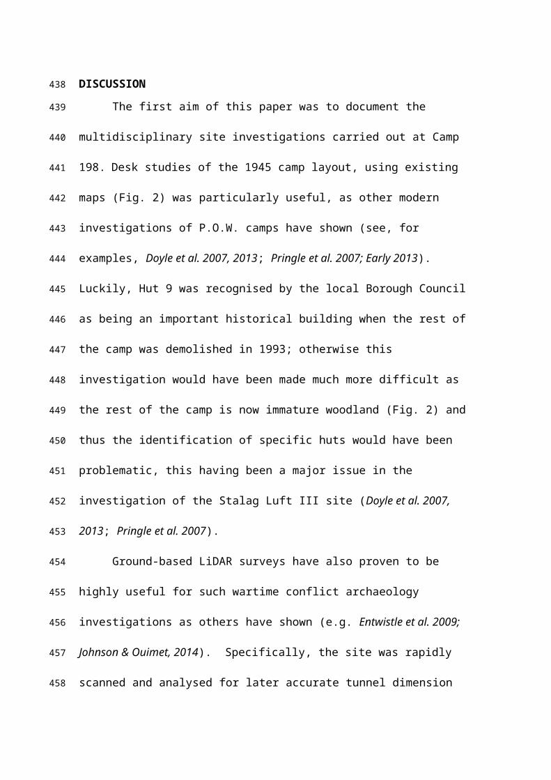
DISCUSSION
The first aim of this paper was to document the multidisciplinary site
investigations carried out at Camp 198. Desk studies of the 1945 camp layout, using
existing maps (Fig. 2) was particularly useful, as other modern investigations of P.O.W.
camps have shown (see, for examples, Doyle et al. 2007, 2013; Pringle et al. 2007;
Early 2013). Luckily, Hut 9 was recognised by the local Borough Council as being an
important historical building when the rest of the camp was demolished in 1993;
otherwise this investigation would have been made much more difficult as the rest of
the camp is now immature woodland (Fig. 2) and thus the identification of specific huts
would have been problematic, this having been a major issue in the investigation of the
Stalag Luft III site (Doyle et al. 2007, 2013; Pringle et al. 2007).
Ground-based LiDAR surveys have also proven to be highly useful for such
wartime conflict archaeology investigations as others have shown (e.g. Entwistle et al.
2009; Johnson & Ouimet, 2014). Specifically, the site was rapidly scanned and
analysed for later accurate tunnel dimension measurements, later interrogations from
various angles, used to integrate different data types and, for this investigation where
there was limited time onsite, to minimally disturb the Hut 9 protected bat population.
Non-invasive, surface geophysical methods were also found to be highly useful
in both the general characterization of the site, and specifically to locate and
characterize near-surface buried objects, in this case the P.O.W. escape tunnel, which
mirrors other researchers’ findings (e.g. Pringle et al. 2007).
The second aim of this paper was to evidence the location and characterising of
the P.O.W. escape tunnel. As discussed, this was a multidisciplinary research effort,
which combined the desk study (see Williams, 1976; Phillips, 2006), with modern non-
invasive geophysical and ground-based LiDAR surveys. A phased approach was
324
325
326
327
328
329
330
331
332
333
334
335
336
337
338
339
340
341
342
343
344
345
346
347
348

followed (as best practice indicates, see, for example, Pringle et al. 2012), from desk
study to initial site reconnaissance to determine likely areas of investigation and the
major site soil type(s), before surveying, and trial profiles collecting different
geophysical technique datasets, then revisiting using determined optimum survey
technique(s) and equipment configurations. For example, the GPR 225 MHz frequency
antennae were judged optimal, this mid-range frequency having been shown by other
studies to detect buried archaeological objects buried at least 1 m depth bgl (see Dick et
al. 2015). Electrical resistivity survey equipment was judged to be optimally set up
with a dipole-dipole 0.5 m probe separation; this is the conventional probe configuration
for shallow level investigations (see Milsom & Eriksen, 2011; Dick et al. 2015).
As well as locating the P.O.W. escape tunnel position, the geophysical results
could even differentiate where the tunnel was still intact or whether it had been filled,
indicated particularly by GPR hyperbolic reflection amplitudes being less strong (Fig.
7), and also where the electrical resistivity profiles went from an apparent resistivity low
to a resistivity high, with respect to background values (cf. Fig. 9-10). The magnetic
gradiometry results were judged the least useful, due to the large amount of above-
ground metallic debris present onsite which interfered with the geophysical results.
This has also been shown by other wartime site investigators (see, for example, Everett
et al., 2006; Pringle et al., 2007). Figure 13 summarises the geophysical results.
Figure 13. Here
The escape tunnel was also archaeologically investigated by a mechanical digger
~1 m south of Hut 9 (Fig. 12), which confirmed the geophysical survey data
interpretation. It was discovered ~1.5 m bgl within a silty-clay loam with isolated
pebbles present. It was found to be filled at both ends, with a ~5 m long section intact
which had a ~0.8 m x ~0.8 m square gallery section (Fig. 12). Wooden wall and roof
349
350
351
352
353
354
355
356
357
358
359
360
361
362
363
364
365
366
367
368
369370
371
372
373
374

supports were observed still present in relatively good condition, at intervals of ~0.3 m
(Fig. 12). Once documented, the entrance was then carefully refilled again.
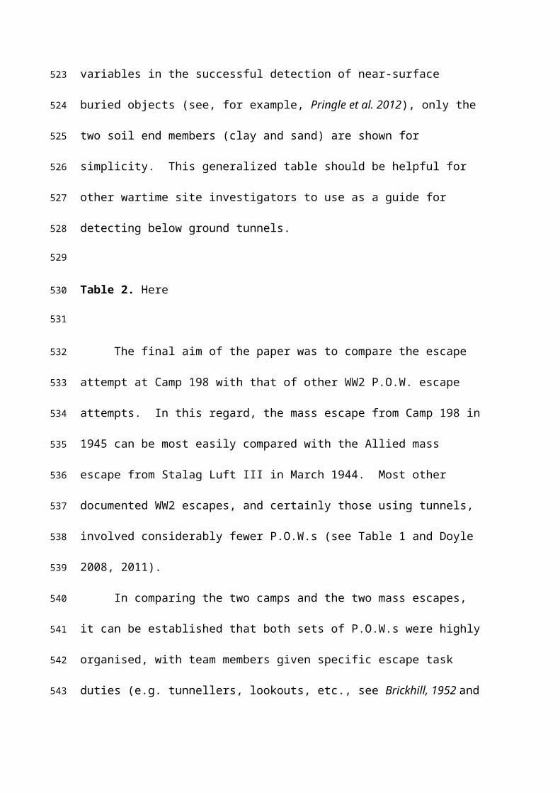
On the basis of this investigation and others presented here and in the literature, a
generalised table (Table 2) has been generated to indicate the potential of search
technique(s) success for military tunnels, assuming optimum equipment
manufacturer/configurations, etc. Whilst soil types have been found to be one of the
most important variables in the successful detection of near-surface buried objects (see,
for example, Pringle et al. 2012), only the two soil end members (clay and sand) are
shown for simplicity. This generalized table should be helpful for other wartime site
investigators to use as a guide for detecting below ground tunnels.
Table 2. Here
The final aim of the paper was to compare the escape attempt at Camp 198 with
that of other WW2 P.O.W. escape attempts. In this regard, the mass escape from Camp
198 in 1945 can be most easily compared with the Allied mass escape from Stalag Luft
III in March 1944. Most other documented WW2 escapes, and certainly those using
tunnels, involved considerably fewer P.O.W.s (see Table 1 and Doyle 2008, 2011).
In comparing the two camps and the two mass escapes, it can be established that
both sets of P.O.W.s were highly organised, with team members given specific escape
task duties (e.g. tunnellers, lookouts, etc., see Brickhill, 1952 and Williams, 1976 for
respective escape information). Both sets of escapers hand-excavated the tunnel using
prisoner-made tools, and used Hut material to provide tunnel support to prevent cave-
ins. In addition, both involved highly inventive with soil disposal, Allied P.O.W.s
depositing their soil in gardens and Huts, Axis P.O.W.s depositing soil behind a fake
375
376
377
378
379
380
381
382
383
384
385
386
387
388
389
390
391
392
393
394
395
396
397
398
399

wall in an unused Hut Room. Attention to detail in this manner was a requirement, as
differences in soil colour and texture were likely to be spotted and to cause alarm (see
Williams, 1949; Brickhill, 1952; Doyle et al., 2010; Doyle, 2011). In both cases, the
escape tunnels were supported by necessity by wooden frames, the wood stolen from
the camp itself – either using bed boards (at Stalag Luft III) or legs (at Camp 198). The
use of these materials may have dictated the size of the galleries in both camps.
In the end, a similar number of P.O.W.s managed to escape at night from the
respective camps through their hand-excavated tunnels dug under perimeter fences. In
both cases, most P.O.W.s were also rapidly recaptured with significant efforts on the
part of the respective searching forces, (though it should be noted that there was no
mass reprisal executions following the escape at Camp 198, in direct contrast to the
events at Stalag Luft III).
However, there are differences. The Allied P.O.W.s escape tunnel was
significantly longer (102 m versus 13 m respectively), it was dug deeper, (bgl 10 m
versus 0.8 m – 1.5 m respectively), and took longer – a year to complete as camp guards
were more vigilant and used a variety of escape detection devices (guard towers with
floodlights, dogs and listening devices – see Brickhill, 1952). The Allied P.O.W.s also
managed to escape a much further distance than their Axis counterparts (averages of
470 km versus 44 km respectively) and with three documented success escapes, though
this has much to do with the fact that the UK is an island. Eastern Germany was also
significantly less populated at the time of the Allied P.O.W. escape than South Wales
was for the Axis forces to escape detection. It is known that the Allied P.O.W.s had a
more highly sophisticated operation enabling convincingly forged documents than the
Axis prisoners had, meaning it was less possible for them to pass through manned check
points. Finally, the Allied P.O.W.s also deliberately conserved and made escape
400
401
402
403
404
405
406
407
408
409
410
411
412
413
414
415
416
417
418
419
420
421
422
423
424

material (e.g. food, compasses, escape maps, etc.) that would have significantly aided
their escapes.
Although difficult prove at this point, there is some documented anecdotal
evidence that suggests contrasts between the Allies and Axis P.O.W.s in their
determination to both escape and succeed in escaping, at least at this stage in the war.
Phillips (2006) recounts that four escapees recaptured in Glais, South Wales, stated:
“Like so many before them, when caught they gave up without a struggle…when the
police arrived John Hopkins was still smiling at how one of the German described the
whole adventure. ‘It had been a good sport’”. This contrasts with Burgess’ (1990)
report of the recaptured Group Captain Harry Day who said “And if you want to know
why we escape: we prefer death to the dishonour of sitting around passively as
prisoners. Do you understand that?”
425
426
427
428
429
430
431
432
433
434
435
436
437

CONCLUSIONS
On the night of the 10/11 March 1945 in WW2, 83 Axis P.O.W.s successfully
escaped from Camp 198 in Bridgend, South Wales through a hand-excavated tunnel dug
from Hut 9 underneath the perimeter fence. All 83 P.O.Ws were eventually recaptured
and the Camp was closed due to this escape, although high ranking Axis officers where
held there after WW2 before the camp was permanently closed in 1948. Since then the
camp has been disused and was finally mostly demolished in 1993, though Hut 9, the
scene of the escape, has been preserved.
Despite being a difficult site with dense vegetation cover and considerable
disturbance, our multidisciplinary investigation of Camp 198 proved to be successful in
identifying and characterising the Axis P.O.W. efforts to conduct a successful mass
outbreak in March 1945 by 83 German P.O.Ws.
A desktop study found a 1945 map showing the camp layout with Hut 9.located.
Initial onsite investigations in 2013 located the entrance to the escape tunnel in Room 3,
which was concreted over. P.O.W. hand-drawn graffiti and drawings showed P.O.W.
contemporary thoughts at this time. A false wall in the shower block had been made by
P.O.W.s to hide the excavated tunnel material, remnants of which were still in place. A
ground-based LiDAR survey also surveyed Hut 9 and the surrounding area.
A 2016 study then collected near-surface geophysical datasets, namely GPR,
electrical resistivity and magnetic gradiometry surveys, finding the potential escape
tunnel location and characterising whether it was intact or collapsed. This was
subsequently confirmed by careful archaeological intrusive investigations.
The tunnel itself was hand-excavated through the silty-clay loam, and was at 0.8
m depth below Room 3 and around 1.5 m bgl at the 13 m tunnel extent beyond the camp
perimeter fence. Only the first 6 m of tunnel is still intact. Wooden wall and roof
438
439
440
441
442
443
444
445
446
447
448
449
450
451
452
453
454
455
456
457
458
459
460
461
462

supports, possibly from bunk beds and chair legs, were regularly placed throughout the
investigated part of the tunnel.
This study has added significant new knowledge and information on WW2 Axis
P.O.W escape attempts, with the first full scale investigation of an Axis escape tunnel,
its excavation, dimensions and other characteristics, as well as innovative excavated soil
disposal methods. More widely, the study has also provided further evidence of the
potential of near-surface geophysical and LiDAR surveys to both detect and
characterise historic military tunnels in a range of environments. The tunnel and the
surrounding area will now become a listed National monument and be conserved for
future generations.
GEOLOCATION INFORMATION
The study area has the following co-ordinates: 51º29’40”N,3º35’08”W. A
GoogleEarth™ KML location file is also included as Supplementary Data.
ACKNOWLEDGEMENTS
Claire Hamm, Wendy Gardner, Robert Jones, Sue Tomlinson and Matthew
Harries of Bridgend County Borough Council and Rory McLaggan of Methyr Mawr
Estates are thanked for allowing site access. Brett Exton, Richard Williams, Alun Issac,
Peter Phillips and Steve J Plummer are acknowledged for historical advice. Ralf
Halama of Keele University is thanked for P.O.W. graffiti text translation and research.
A SRIF3 equipment bid and a Keele University Faculty of Natural Science equipment
463
464
465
466
467
468
469
470
471
472
473
474
475
476
477
478
479
480
481
482
483
484
485
486

grant funded the geophysics and LiDAR surveying equipment respectively used in this
study.
FUNDING DETAILS
No funding has been obtained for this study.
DISCLOSURE STATEMENT
There is no financial interest or benefit that has arisen from the direct applications of
this research.
SUPPLEMENTARY FILES
1. GoogleEarth™ KML site location file.
2. Digital fly-through of the 2013 ground-based LiDAR scan dataset.
3. GoPro digital animated footage through the discovered P.O.W. escape tunnel.
These files are available on figshare: https://figshare.com/s/ad3d7436ba661edf0db6
DOI:10.6084/m9.figshare.c.3676951
Retrieved: 19 58, Jan 29, 2017 (GMT)
487
488
489
490
491
492
493
494
495
496
497
498
499500
501
502
503
504
505
506
507
508
509

BIOGRAPHICAL NOTE
Luis Rees-Hughes has a BSc Hons. Degree in Geoscience (2015) and a MSc in
Geoscience Research (2016) with Distinction from Keele University.
Jamie K. Pringle is a Senior Lecturer in Geosciences at Keele University, having held
previous positions at Liverpool University and Reynolds Geo-Science Ltd. He obtained
a PhD from Heriot-Watt University (2003) and a BSc Hons. in Geology from Royal
Holloway University of London (1996). Jamie has worked on various military and
historical scientific investigations, the most high profile being a site investigation of the
‘Great Escape’ of WW2 Allied P.O.W.s in 1944 in Sagan, Western Poland.
Nick Russill is Co-Director of Terradat Ltd. and an Honorary Lecturer at Cardiff
University. He holds a BSc Hons. Degree in Exploration & Mining Geology from
Cardiff University (1992). He has regularly been the geophysics expert on Time Team.
Kris Wisniewski is a Teaching Fellow at Keele University, having a PhD in Forensic
Science, and is an experienced site investigator in various forensic and archaeological
investigations.
Peter Doyle is Visiting Professor at University College London, Secretary of the All
Party Parliamentary War Heritage Group and is a geologist specialising in battlefield
terrain from the late nineteenth century onwards. A regular contributor to TV
documentaries, Peter was also a visiting lecturer on military geology at the United
States Military Academy, West Point, in 2007 and 2014. His many contributions
510
511
512
513
514
515
516
517
518
519
520
521
522
523
524
525
526
527
528
529
530
531
532
533
534
include multidisciplinary studies of trenches, terrain and military tunnels of both world
wars, and he has a special interest in PoW camps, leading the investigations at Stalag
Luft III in 2003.
535
536
537

REFERENCES:
Banks, I. 2014. Digging in the dark: the underground war on the Western Front, Journal
of Conflict Archaeology, 9, 156-176.
Banks, I., Pollard, T. 2014. Beyond recall: searching for the remains of a British secret
weapon of World War I, Journal of Conflict Archaeology, 9, 119-155.
Barbour, N. 1944. Prisoner of War. George G. Harrap, London
Brickhill, P. 1952. The Great Escape, Faber & Faber, London.
Brown, M., Osgood, R. 2009. Digging up Plugstreet. Haynes, Yeovil.
Burgess, A. 1990. The Longest Tunnel, Bloomsbury Publishing Limited, London.
Burt, K, Leasor, J. 1956. The One That Got Away, Collins & Michael Joseph, London.
Capps Tunwell, D, Passmore, D, Harrison, S. 2015. Landscape archaeology of World
War Two German logistics depots in the Fort domaniale des Andaines,
Normandy, France, Historical Archaeology, 19, 233-261.
Capps Tunwell, D, Passmore, D, Harrison, S. 2016. Second World War bomb craters
and the archaeology of Allied air attacks in the forests of the Normandie-Maine
National Park, NW France, Journal of Field Archaeology, 41, 312-330.
Carr, G., Mytum, H. (eds) 2012. Cultural Heritage and Prisoners of War. Routledge,
London.
Chisholm, B., & Gutsche, A. 1998. Superior: Under the Shadow of the Gods, Lynx
Images.
538
539
540
541
542
543
544
545
546
547
548
549
550
551
552
553
554
555
556
557
558
559
560
561
562
563
564
565
566
567
568
569

Crawley, A. 1956. Escape from Germany: a history of R.A.F. escapes during the War,
Collins Clear-Type Press, London.
Dick, HC, Pringle, JK, Sloane, B, Carver, J, Haffenden, A, Porter, S, Wisniewski, K,
Roberts, D, Cassidy, NJ. 2015. Detecting and characterising of Black Death
burials by multi-proxy geophysical methods, Journal of Archaeological Science,
59, 132-141.
De Meyer, M., Pype, P. 2007. Scars of the Great War (Western Flanders, Belgium). In
Scott, D. et al. (eds) Fields of Conflict, Volume 2. Praeger, Westport, pp. 359–382.
Dobinson, C, Lake, J, Schofield, A. 1997. Monuments of war: defining England’s 20th-
century defence heritage, Antiquity, 71, 288-299.
Doyle, P. 2008. Prisoner of War in Germany, 1939–1945. Shire, Oxford.
Doyle, P. 2011. Geology of World War II Allied Prisoner of War escape tunnels,
International Handbook of Military Geography, 2, 144-156.
Doyle, P. 2012. Necessity, the mother of invention: ingenuity in German Prisoner of
War Camps, 275–290, In: Carr, G., Mytum, H. (eds) 2012. Cultural Heritage
and Prisoners of War. Routledge, London.
Doyle, P. 2015. Examples of the geo-archaeology of trench warfare in Flanders. In:
Willig, D., (ed.) 2015 Militärhistorisch-Kriegsgeologischer Reisefüher zum
Wytschaete-Bogen (Messines Ridge) bei Ypern (Belgien).
Geoinformationsdiesnt der Bundeswehr, Schiftenreihe, 4, 193–202.
Doyle, P. 2017. Men, mud and mining. Military Geology and Trench Warfare on the
Western Front, 1914–1918. Uniform Press, London.
Doyle, P., Babits, LE, Pringle, JK, 2007. ‘For you the war is over’: finding the great
escape tunnels at Stalag Luft III, 398–416, In: Scott, D., Babits, L.E., Hecker, C.
570
571
572
573
574
575
576
577
578
579
580
581
582
583
584
585
586
587
588
589
590
591
592
593
594
595
596
597
598
599
600
601
602

(eds) Fields of Conflict. Battlefield Archaeology from the Roman Emopire to
the Korean War. Praeger, Westport
Doyle, P., Babits, LE, Pringle, JK. 2010. Yellow sands and penguins: the soils of ‘The
Great Escape’, 417–429, In: Lander, ER, Feller, C. (eds) Soils and Culture.
Springer, Dordecht.
Doyle, P., Barton, P., Vandewalle, J. 2005. Archaeology of a Great War dugout:
Beecham Farm, Passchendaele, Belgium, Journal of Conflict Archaeology, 1,
xxx_xxx.
Doyle, P, Barton, P, Rosenbaum, MS, Vandewalle, J, Jacobs, K. 2002.
Geoenvironmental implications of military mining in Flanders, Belgium, 1914-
1917, Environmental Geology, 43, 57–71.
Doyle, P., Bostyn, F., Barton, P., Vandewalle, J. 2001. The underground war, 1914-18:
geology of the Beecham Dugout, Passchendaele, Belgium. Proceedings of the
Geologists’ Association, 112, 263-274.
Doyle, P., Pringle, J., Babits, L. 2013. Stalag Luft III: The Archaeology of an Escapers’
Camp, 129–144, In: Mytum, H., Carr, G. (eds) Prisoners of War. Archaeology,
Memory and Heritage of 19th- and 20th-Century Mass Internment. Springer,
Dordrecht
Duncan, M. 1974. Underground from Posen, New English Library, Los Angeles, USA.
Durnford, H.G. 1940. The Tunnellers of Holzminden. Penguin, Harmondsworth
Early, R. 2013. Excavating the World War II Prisoner of War Camp at La Glacerie,
Cherbourg, Normany, 95–116, In: Mytum, H., Carr, G. (eds) Prisoners of War.
Archaeology, Memory and Heritage of 19th- and 20th-Century Mass Internment.
Springer, Dordrecht
603
604
605
606
607
608
609
610
611
612
613
614
615
616
617
618
619
620
621
622
623
624
625
626
627
628
629
630
631
632
633
634
Eggers, R. 1961. Colditz: The German Story, Robert Hale, London
Entwistle, JA, McCaffrey, KJW, Abrahams, PW. 2009. Three-dimensional
visualisation: the application of terrestrial laser scanning in the investigation of
historical Scottish farming townships, Journal of Archaeological Science, 36,
860-886.
Evans, AJ, 1945. Escape and Liberation 1940–1945. Hodder & Stoughton, London
Everett, ME, Pierce, CJ, Warden, RR, Dickson, DR, Butt RA, Bradford, JC. 2006.
Geophysical Investigation of the June 6th 1944 D-Day invasion site at Pointe du
Hoc, Normandy, France, Near Surface Geophysics, 4, 289-304.
Fancy, J. 2010. Tunnelling to Freedom: The Story of the World’s Most Persistent
Escaper, Aurum Press, London.
Fassbinder, JWE. 2015. Seeing beneath the farmland, steppe and desert soil: magnetic
prospecting and soil magnetism, Journal of Archaeological Science, 56, 85-95.
Fernandez-Alvarez, J-P, Rubio-Melendi, D, Martinez-Velasco, A, Pringle, JK, Aguilera,
D. 2016. Discovery of a mass grave from the Spanish Civil War using GPR and
forensic archaeology, Forensic Science International, 267, e10-e17.
Gaffney, C, Gater, J, Saunders, T, Adcock, J. 2004. D-Day: geophysical investigation of
a World War II German site in Normandy, France, Archaeological Prospection,
11, 121-128.
Geck, S. 2008. Dulag Luft / Auswertestelle West: Vernehmungslager Der Luftwaffe
Fuer Westalliierte Kriegsgefangene Im Zweiten Weltkrieg, Internationaler
Verlag Der Wissenschaften, Berne, Switzerland.
Hanson, N. 2011. Escape from Germany, The greatest POW break-out of the First
World War, Transworld Publishers, London.
635
636
637
638
639
640
641
642
643
644
645
646
647
648
649
650
651
652
653
654
655
656
657
658
659
660
661
662
663
664
665
666
667
668

Hargest, J. 1946. Farewell Campo 12, Michael Joseph, London.
Jackson, S. 2010. Churchill's unexpected guests: Prisoners of War in Britain in World
War II, The History Press, Stroud.
Johnson, KM, Ouimet, WB. 2014. Rediscovering the lost archaeological landscape of
southern New England using airborne light detection and ranging (LiDAR),
Journal of Archaeological Science, 43, 9-20.
Lowe, KM. 2012. Review of Geophysical Applications, Australian Archaeology, 74,
71-84.
Masters, P, Stichelbaut, B. 2009. From the Air to Beneath the Soil-Revealing and
Mapping Great War Trenches at Ploegsteert (Comines-Warneton), Belgium,
Archaeological Prospection 16, 279-285.
Milsom, J, Eriksen, A. 2011. Field Geophysics (Geological Field Guide) 4th Edition,
Wiley-Blackwell Publishers, Oxford.
Moore, JH. 2006. The Faustball Tunnel: German POWs in America and their Great
Escape, Naval Institute Press, Maryland.
Mytum, H., Carr, G. (eds) 2013. Prisoners of War. Archaeology, Memory and Heritage
of 19th- and 20th-Century Mass Internment. Springer, Dordrecht
Passmore, D, Harrison, S. 2008. Landscapes of the Battle of the Bulge: WW2 field
fortifications in the Ardennes forests of Belgium, Journal of Conflict
Archaeology, 4, 87–107.
Passmore, D, Capps Tunwell, D, Harrison, S. 2013. Landscapes of logistics: the
archaeology and geography of WW2 German military supply depots in central
Normandy, NW France, Journal of Conflict Archaeology, 8, 165–192.
669
670
671
672
673
674
675
676
677
678
679
680
681
682
683
684
685
686
687
688
689
690
691
692
693
694
695
696
697
698
699
700
701
702

Passmore, D, Harrison, S. 2014. Second World War conflict archaeology in the forests
of north-west Europe, Antiquity, 88, 1275-1290.
Phillips, P. 2006. The German Great Escape (The Story of Island Farm), Poetry Wales
Press Ltd., Bridgend.
Plummer, SJ. 2015. The Greatest Escape, Lulu Self Publishers, North Carolina.
Pollard, T. 2014. Taking the hill: archaeological survey and exaction of German
communication trenches on the summit of Mont St. Quentin, Journal of Conflict
Archaeology, 9, 177-197.
Pollard, A., Freeman, P. (eds) 2001. Fields of Conflict. British Archaeological
Association, Oxford.
Pringle, JK, Doyle, P, Babits, LE. 2007. Multidisciplinary investigations at Stalag Luft
III Allied Prisoner-of-war Camps: The Site of the 1944 “Great Escape”, Zagan,
Western Poland. Geoarchaeology, 22, 729-746.
Pringle, JK, Ruffell, A, Jervis, JR, Donnelly, L, McKinley, J, Hansen, J, Morgan, R,
Pirrie, D, Harrison, M. 2012. The use of geoscience methods for terrestrial
forensic searches, Earth Science Reviews, 114, 108-123.
Reid, P. 1952. The Colditz Story, Hodder & Stoughton. London.
Reid, P. 1953. The Latter Days. Hodder & Stoughton Publishers.
Rogers, J. 1986. Tunnelling into Colditz. A Mining Engineer in Captivity. Robert Hale,
London
Rosenbaum, MH, Rose, EPF. 1992. Geology and military tunnels, Geology Today, 8,
92-98.
703
704
705
706
707
708
709
710
711
712
713
714
715
716
717
718
719
720
721
722
723
724
725
726
727
728
729
730
731
732
733
734
735

Saey, T, Note, N, Gheyle, W, Stichelhaut, B, Bourgeois, J, Van Eetvalde, V,
Meirvenne, M. 2016. EMI as a non-invasive technique to account for the
interaction between WW1 relicts and the soil environment at the Western Front.
Geoderma, 265, 39-52.
Sarris, A, Papadopoulos, N, Agapiou, A, Salvi, MC, Hadjimitsis, DG, Parkinson, WA,
Yerkes, RW, Gyucha, A, Duffy, PR. 2013. Integration of geophysical surveys,
ground hyperspectral measurements, aerial and satellite imagery for
archaeological prospection of prehistoric sites: the case study of Vészto-Mágor
Tell, Hungary, Journal of Archaeological Science, 40, 1464-1470.
Saunders, N.J. 2011. Killing Time. Archaeology and the First World War. The History
Press, Stroud.
Schneck, WC. 1998. The Origins of Military Mines: Part I, Engineer Bulletin, 1-5.
Schneider, V. 2013. American, British and French PoW Camps in Normany, France
(1944–1948). Which role for archaeology in the memorial process? 117–128, In:
Mytum, H., Carr, G. (eds) Prisoners of War. Archaeology, Memory and
Heritage of 19th- and 20th-Century Mass Internment. Springer, Dordrecht
Schofield, J. 2001. D-Day sites in England: an assessment, Antiquity, 75, 77-83.
Scott, D., Babits, LE., Hecker, C. (eds) 2007. Fields of Conflict. Battlefield
Archaeology from the Roman Emopire to the Korean War. Praeger, Westport
Thacker, PT, Ellwood, BB. 2002. Detecting paleolithic activity areas through electrical
resistivity survey: an assessment from Vale de Obidos, Portugal, Journal of
Archaeological Science, 29, 563-570.
Terron, JM, Mayoral, V, Salgado, JA, Antonio, Galea, FA, Perez, VH, Odriozola, C,
Mateos, P, Pizzo, A. 2015. Use of soil apparent electrical resistivity contact
736
737
738
739
740
741
742
743
744
745
746
747
748
749
750
751
752
753
754
755
756
757
758
759
760
761
762
763
764
765
766
767

sensors for the extensive study of archaeological sites, Archaeological
Prospection, 22, 269-281.
Williams, E. 1945. Goon in the Block, Jonathan Cape, London.
Williams, E. 1949. The Wooden Horse, Collins, London.
Williams, E. 1951. The Tunnel, Collins, London.
Williams, H. 1976. Come Out Wherever You Are, Quartet Books Ltd., London.
Zimmermann, ER. 2015. The Little Third Reich on Lake Superior: A History of
Canadian Interment Camp R, University of Alberta Press.
768
769
770
771
772
773
774
775
776
777
778
779
780
781

FIGURE CAPTIONS:
Figure 1. Location map of WW2 Axis P.O.W. Camp 198, Bridgend, South Wales, with
UK location (inset). Map courtesy of EDINA™ DigiMap (2016).
Figure 2. 1945 plan of Axis Special Camp XI that was P.O.W. Camp 198 (see key for
detail and Fig. 1 for location), with locations shown, with (inset) photograph circa. 1975
taken onsite with main Huts still intact (Hut 9 in foreground), courtesy of Alun Isaac
(Cardiff University).
Figure 3. (A) Annotated site map, showing camp entrance, boundary (see Fig. 2), and
Hut 9 and tunnel location (red line). Courtesy of 2013 GoogleEarth™. (B) Hut 9
photograph (taken from replica watch tower) and approximate tunnel location marked.
(C) Site photograph of approximate tunnel location (red line), with some geophysical
survey profiles (tapes). (D) Replica guard tower present on SE corner (in fact none
were present during the POW camp existence) with ground-based LiDAR survey
instrument visible.
Figure 4. Example of Axis hand-drawn graffiti on camp Hut walls, some of which
were saved and remain in Hut 9. (A) City shields of Fürth (Bavaria) and Elbing (East
Prussia now Poland). (B) un-identified fishing boat. (C) rural German? Scene. (D)
unflattering sketch of camp guard with ‘POW porridge’ inscribed on bucket. (E) one of
less saucy female sketches. (F) one of the inscriptions, this loosely based on Ferdinand
Freiligra’s 1845 German poem, who was a champion of freedom and civil liberties;
‘Love as long as you can love, love as long as you may, the time will come, the day will
come, when you will stand at graves and mourn’.
782
783
784
785
786
787
788
789
790
791
792
793
794
795
796
797
798
799
800
801
802
803
804
805
806
807
808

Figure 5. Hut 9 photographs. (A) The main corridor running along Hut 9 with P.O.W.
rooms either side. (B) Shower room with prisoner-made fake wall which was used to
hide excavated tunnel material. (C) Room 3 where the tunnel entrance was located. (A)
and (B) courtesy of Hut 9 preservation group.
Figure 6. Mapview plan of the suspected P.O.W. escape tunnel area, showing above
ground objects of interest, numbered rooms within Hut 9, the 2D geophysical survey
line (1-13) positions and the presumed tunnel exit location.
Figure 7. Some GPR 2D processed interpreted profiles acquired over the presumed
tunnel location at: (A) 1 m; (B) 5 m and; (C) 11 m from Hut 9 (see Fig. 6 for location).
Figure 8. Selected magnetic gradiometry 2D processed interpreted profiles acquired
over the presumed tunnel location at: (A) 1 m, (B) 5 m from Hut 9 (see Fig. 6 for
location).
Figure 9. Selected electrical resistivity 2D processed interpreted profiles acquired over
the presumed tunnel location at: (A) 3 m; (B) 5 m and; (C) 11 m from Hut 9 (see Fig. 6
for location).
Figure 10. Mapview of the coloured digital contoured surface generated from the 2D
apparent resistivity 2D profiles (see Fig. 6 for location).
Figure 11. Digital screen-grabs of ground-based LiDAR datasets acquired onsite. (A)
Surface dataset showing approximate tunnel position. (B) Tunnel dataset with merged
Hut, room and tunnel scans shown. See supplementary data for digital fly-throughs.
809
810
811
812
813
814
815
816
817
818
819
820
821
822
823
824
825
826
827
828
829
830
831
832
833
834

Figure 12. Image taken south-eastwards of the P.O.W. hand-excavated discovered
tunnel from Hut 9. Note the wooden supports and large pebbles present in the overlying
soil which would have made excavated soil disposal difficult.
Figure 13. Graphical mapview summary of the near-surface geophysical and
archaeological excavation findings (see key and text for details).
835
836
837
838
839
840
841
842

TABLE CAPTIONS
Table 1. List of documented WW2 P.O.W. escapes. An estimated 328 escaped with 13
reaching friendly territory (‘home runs’).
Table 2. Generalised table to indicate potential of search technique(s) success for
military tunnels assuming optimum equipment configurations and significant-sized
target. Key: Good; Medium and; Poor chance of detection success. After
Pringle et al. (2012).
843
844
845
846
847
848
849
850
851
852