Embed Size (px)
Citation preview

1
TERMS OF REFERENCE
CONSULTING ENGINEERING SERVICES
FOR THE DESIGN, CONSTRUCTION AND ENVIRONMENTAL ASSESSMENTS (AS REQUIRED) FOR:
A. SPEEDVALE AVENUE RECONSTRUCTION INCLUDING REPLACEMENT OF THE SPEED RIVER BRIDGE;
B. STEVENSON STREET RECONSTRUCTION INCLUDING A STORMWATER DETENTION
FACILITY;
C. NISKA ROAD RECONSTRUCTION INCLUDING REPLACEMENT OF NISKA ROAD BRIDGE
The City of Guelph Engineering Services Division is seeking submissions from the pre-qualified Engineering Consultants from contract # 12-161 to provide engineering services for three separate consulting assignments:
• Speedvale Avenue Reconstruction from Manhattan Court to Woolwich Street, including a replacement of the bridge over the Speed River • Stevenson Street from Elizabeth Street to Eramosa Road, including a proposed stormwater detention facility in Green Meadows Park • Niska Road improvements from Downey Road to the City limits, including a replacement of the bridge over the Speed River.
The consultant(s) are to confirm and provide engineering services for (a) Municipal Class Environmental Assessment (EA) for undertaking improvements to Speedvale Avenue Bridge replacement, Green Meadows Park SWM Facility and Niska Road improvements and Bridge replacement; (b) the design and construction of improvements identified through the EA; (c) the design and construction of off-site road/intersection/watermain/sewermain improvements such as identified in the scope of works, which are not part of the EA; and (d) providing information to appropriate agencies and authorities, and obtaining all necessary reviews and approvals for the project. BACKGROUND Stevenson Street Stevenson Street from Elizabeth Street to Eramosa Road is a 4 lane arterial road with sidewalks on both sides of the street. The underground infrastructure along Stevenson Street from Elizabeth Street to Cassino Avenue includes 300mm or smaller sewers, a 100mm to 150mm local distribution watermain and a 600mm transmission watermain. The transmission watermain runs the length of this project, will not be replaced and MUST be protected during

2
construction as it is the main water feed to the north end of the City. The underground infrastructure from Cassino Avenue to Bennett Avenue includes a larger 1650mm storm sewer and the same watermains and sanitary sewer as the Elizabeth Street to Cassino Avenue section. The Bennett Avenue to Eramosa Avenue section includes a 975mm storm sewer and the same watermains and sanitary sewer as the Elizabeth Street to Cassino Avenue section. The distribution watermains range in size from 100mm to 250mm. City staff will model the local distribution watermain to determine the proposed sizing and this information will be forwarded to the consultant. The storm and sanitary sewer systems have several locations where the existing pipes cut across private property and in some cases under privately owned dwellings. The City will be interested in reviewing options for re-routing the pipe network around the private property. The existing storm sewer from the intersection of Skov Crescent and Eramosa Road extends under the mall at 297 Eramosa Road to Erin Avenue. The City would like to review options for extending the storm sewer along Stevenson Street and Eramosa Road to the Skov Crescent intersection to divert this flow around the private property. The other two addresses where the sewers cross private property are 248 Stevenson Street and 111 Stevenson Street. The existing conditions are shown on the drawings included in the details on the City’s “Bids & Tenders” web page. In 2011, the City completed a Stormwater Management Master Plan (Master Plan) (http://www.guelph.ca/living.cfm?itemid=76969&smocid=2078) to develop a long-term plan for the safe and effective management of stormwater runoff from urban areas while improving the ecosystem health and ecological sustainability of the Eramosa and Speed Rivers and their tributaries. The Master Plan recommended a number of stormwater management projects that address water quality, protection of the natural environment and areas of the City prone to frequent flooding. Among the list of recommended projects, the Green Meadows Flood Protection Facility was identified in the City’s Master Plan as a high priority project to deal with flooding within the drainage area. The location of the proposed Green Meadows Facility is presented on Drawing J3 (see Stormwater Management Master Plan). Green Meadow Flood Protection Facility The Green Meadows Flood Protection Facility is proposed to be located within the Green Meadows Park on Stevenson Street south on Eramosa Road. In order to minimize upgrades to existing downstream trunk storm sewers’ between Green Meadows Park and Grange Street, peak flows would need to be attenuated by a new facility. In addition, without upstream flow attenuation, further upgrades would be required downstream of Grange Street, which would also do nothing to limit flows to flood-prone areas downstream. As such, the implementation of a flood protection facility in Green Meadows Park is considered fundamental to the upgrade strategy within the network. The preliminary concept design is presented in Drawing L12. (see Stormwater Management Master Plan).

3
The preliminary design involves placing a restrictor within the storm sewer system along Stevenson Street, with an overflow to direct higher flows towards the proposed surface facility. Controlled outflow from the facility would then combine with flow through the restrictor into the existing trunk sewer downstream along Stevenson Street. Shallow storm sewer grades along Stevenson Street complicate the design, which causes the need for the restrictor, as well as a height offset for the inlet pipe. This allows for sufficient grade through the facility, and also ensures that flow within the trunk sewer on Stevenson Street does not backflow into the proposed facility via the facility’s outlet pipe. The concept for the surface water storage area has been based on realistic grading, and incorporating buffers from adjacent properties, the proposed relocation playground area and a vehicle access route/trailway, while providing sufficient storage to attenuate the 5 year event at depths below Ministry of Environment (MOE) recommended values. The potential also exists to use portions of the remaining areas of the park for storage under more formative storm events (such as the 100 year event), however this would need to be assessed further and confirmed. Speedvale Avenue Speedvale Avenue from Manhattan Court to Woolwich Street is a narrow 4 lane arterial road with sidewalk on both sides of the street. There are also hydro poles close to the back of curb on both the north and south sides of Speedvale Avenue. This section of Speedvale Avenue will be widened to match the sections of Speedvale Avenue east of Stevenson Street, i.e. 4 lanes with bicycle lanes and sidewalks on either side of the road. To allow for the widening, Guelph Hydro will be required to relocate their plant prior to construction and the consultant should allow one construction season for Hydro to perform this work. The storm sewer from Manhattan Court to the Speed River is a 1500mm to 1650mm sewer. The storm sewer was installed in 1969 and the City does not have any records of the condition of this sewer. The existing watermain is a local distribution main and is 150mm in size. The existing sanitary sewer is 300mm in size. The consultant will need to review the recommendations of the City’s Water and Wastewater Servicing Master Plan to determine what upgrades are required to the existing watermain and sanitary sewer main systems. The existing intersections at Metcalfe Street and Delhi Street do not have left turn lanes on Speedvale Avenue. City staff will review the traffic data to determine if left turn lanes are required and forward this information to the consultant. The existing Speedvale Avenue bridge is a rigid frame bridge that was constructed in 1950 and widened in 1974. The bridge has a 300mm asbestos cement sanitary sewer attached to the deck and the existing watermain crosses the river at this location, however, the location of the watermain is not known. There is an existing gas main attached to the north side of the bridge. Niska Road Niska Road is a collector road that runs east-west from the City limits to Downey Road, with a posted speed limit of 50 km/hr. It has a rural cross-section with one travel lane in each direction and narrow gravel shoulders.

4
Niska Road crosses the Speed River just west of the City limits. The existing bridge is an old Bailey bridge that was erected in 1974. The bridge is a single lane bridge accommodating two directions of traffic and operating under a 5-tonne load restriction. The bridge needs replacement and the proposed new bridge will be a two-lane bridge with one travel lane in each direction. Cross-section will include sidewalks and bike lanes on both sides. The study scope will also include improvements to the intersection of Downey Road and Niska Road. SCOPE OF CONSULTING ASSIGNMENT A) Municipal Class EA Stevenson Street To conduct a Municipal Class Environmental Assessment (EA) for the proposed construction of the Green Meadows Flood Protection Facility. It is expected that a Schedule B Environmental Assessment process is required for this undertaking. Given that the proposed facility is located in a public park, and adjacent to residential properties, public input would be highly important and necessary in ensuring that any facility design adequately addresses all concerns. In addition, consultation with the City of Guelph’s Park Planning & Development Group is of key importance in order to balance stormwater management requirements with any potential loss of recreational area, and in order to ensure compatibility with the City of Guelph’s Trail Master Plan, and any Park Master Plans, if they exist. Opportunities for naturalization and enhanced trail routes should be explored in any retrofit. Likewise, opportunities for bi-level stormwater management facilities should be considered in this regard (ie underground storage for minor events, storm surface storage for major storm events). Speedvale Avenue and Niska Road To conduct a Municipal Class Environmental Assessment (EA) for the proposed replacement to Speedvale Avenue and Niska Road bridges. The EA for each project should evaluate alternatives for the types of replacement structures, i.e. semi integral abutments, arch culvert, arch span, etc. as well as vertical alignment of the roadway over the bridge with consideration for impacts to property access and the rail crossing at Speedvale Avenue. Backwater analysis for each type of structure will be required. Additionally, consultations with GRCA, MNR and Transport Canada will be required to address the implications for the proposed bridges. The consultant should include widening for both bridges to allow for sidewalks and bicycle lanes on both sides of the Speedvale Avenue and

5
Niska Road bridges. Niska Road bridge will also be widened to accommodate 2 lanes of vehicle traffic. Although the EA for the replacement of the Speedvale Avenue bridge would fall under Schedule A+ category and will be documented as a Schedule A+, this undertaking will be performed as a Schedule B, including the consultation with the public to evaluate the alternative replacement structure. The EA for the replacement of the Niska Road bridge would fall under Schedule B category. The EA will include consultation with the public to evaluate the alternative replacement structure. Public consultation for the EA will include discussions with property owners with access to Speedvale Avenue and Niska Road, neighbourhood groups, and Public Information Centre. Input to public consultation will be provided by City staff. The EA consultant will provide technical advice, prepare material for consultation and participate in meetings. B) Design and Construction of Replacement Bridges Along with, completing the EA requirements, undertake the following:
1) Conduct all necessary pre-engineering surveys and investigations;
2) Prepare a preliminary design and report for Speedvale Avenue and Niska Road improvements, including all underground services (storm, sanitary & water) and the bridge over the Speed River, identifying property requirements and impacts, and preliminary cost estimate;
3) Provide for all utilities co-ordination, support and relocation requirement; including
layout of pole locations;
4) Prepare a design for the electrical works related to lighting on the Speedvale Avenue bridge including the heat tracing for any sanitary sewer or watermain attached to the underside of the bridge;
5) Review opportunities for trail connections from adjacent lands/parks through the EA
process;
6) Prepare detailed design, drawings, specifications, approvals with regulatory agencies, other contract documents, and final cost estimate; and
7) Provide technical support during the tender process, and following contract award
provide general contract administration and resident inspection services including materials testing, until the completion of works and contract.
8) Public Open House prior to construction
6
C) Design and Construction of Stormwater Management Facility Along with, completing the EA requirements, undertake the following:
1) Conduct all necessary pre-engineering surveys and investigations;
2) Prepare a preliminary design and report for the stormwater management facility in Green Meadows Park, including all underground services (storm, sanitary & water) and the associated landscaping around the proposed facility, identifying property requirements and impacts, and preliminary cost estimate;
3) Determine a location for the playground equipment which must be relocated due to
the storm water management facility;
4) Liaise with Parks Planning and Planning staff on design of landscaping, playground equipment and walking trails. A landscape architect will be required as part of the project team;
5) Provide for all utilities co-ordination, support and relocation requirement; including
layout of pole locations;
6) Prepare detailed design, drawings, specifications, approvals with regulatory agencies, other contract documents, and final cost estimate;
7) Provide technical support during the tender process, and following contract award
provide general contract administration and resident inspection services including material, until the completion of works and contract;
8) Public Open House prior to construction.
D) Design and Construction of Roads and Intersection Improvements The design and construction of the road and intersection improvements will be separate from the EA undertakings (in paragraphs A), B) and C)). The road and intersection improvements include: Stevenson Street
1) Replacement of the watermain, sanitary sewer and storm sewer including service laterals;
2) Revision of the pavement width from 4 vehicle lanes to 1 lane each direction, centre turn lane and bicycle lanes on both sides of Stevenson Street;
3) Intersection improvements at Grange Road and Stevenson Street; 4) Investigation of alternative routing for the storm sewer around private property;

7
5) Construction of sidewalks where sidewalks currently do not exist; 6) Co-ordination of upgrades to independent utility companies’ plant (Guelph Hydro,
Union Gas, Bell, Rogers, etc.); 7) Assessment and upgrades to existing retaining walls as required; 8) Note that review/approval by rail agencies will be required at the Stevenson Street
CN rail crossing; 9) Utility locates to the level of Subsurface Utility Engineering (SUE) Quality Level B, i.e.
locates for the entire length of the project, must be obtained and added to the base plan survey;
10) Consultant will be responsible for the design of any intersections, however, City staff will design the traffic signals.
Speedvale Avenue
1) Replacement of the watermain, sanitary sewer and storm sewer including service laterals
2) Widening of Speedvale Avenue from Manhattan Court to Woolwich Street to include bicycle lanes on each side of Speedvale Avenue
3) Intersection improvements at Speedvale Avenue and Metcalfe Street 4) Intersection improvements at Speedvale Avenue and Delhi Street 5) Replacement of the pedestrian crossing signals west of the Fire Station 6) Condition assessment and recommendations for the existing storm sewer on
Speedvale Avenue 7) Coordination of the road widening with independent utility companies (Guelph
Hydro, Union Gas, Bell, Rogers, etc.) 8) Utility locates to the level of Subsurface Utility Engineering (SUE) Quality Level B, i.e.
locates for the entire length of the project, must be obtained and added to the base plan survey.
9) Consultant will be responsible for the design of any intersections, however, City staff will design the traffic signals.
Niska Road
1) Widening of Niska Road from Ptarmigan Drive to the City limits 2) Recommendations for trail connections to the proposed bridge 3) Utility locates to the level of Subsurface Utility Engineering (SUE) Quality Level B, i.e.
locates for the entire length of the project, must be obtained and added to the base plan survey.
4) Coordination of the Niska Road/Downey Road intersection improvements with independent utility companies (Guelph Hydro, Union Gas, Bell, Rogers, etc.)
5) Design of intersection improvements at Downey Road, including proposing alternatives to the public during the EA process for the installation of a roundabout or traffic signals;
6) Consultant will be responsible for the design of the Downey Road intersection, however, if traffic signals are to be installed City staff will design the traffic signals.
8
E) Consultations and Approvals At every stage of the assignment, provide notifications, carry out consultations, submit technical documentation and secure approvals as required from appropriate railway owners/operators, review agencies, and approval authorities, including CNR, GEXR/Rail America, GRCA, MOE, and MNR and any other agency whose review and/or approval will be required to complete the project. F) Project Management A Project Team will be established soon after the selection of the Consultant. The team will include City staff, Developer’s representatives and other project consultants. The selected Engineering Consultant will be responsible for scheduling Project Team meetings to report on progress, discuss issues and costs, make recommendations and implement decisions as appropriate. CONSULTING SERVICES TO BE PROVIDED The Consultant’s work plan and upset limits should make allowance for the services and deliverables as outlined below, taking into account specific inputs by City staff and/or other consultants involved in the development process: Completion of Environmental Assessment Requirement City Staff Input:
Provide all existing background information in both digital (where possible) and hard copy format
Notice of Study Commencement
Problem Identification / Need and Justification
Public consultation including PIC notification
Report to Committee/Council
Notice of Completion
Address Part II Order Requests, if any EA Consultant Responsibilities
Study Initiation
Provide technical advice regarding City and Development inputs
Identify and Evaluate Alternative Solutions (primarily in regard to vertical alignment)
Select Preferred Solution
Identify mitigation measures and address property access issues
Agency Consultation as required
Public Information Centre preparation and attendance
ESR documentation and filing

9
Design & Construction Preliminary Engineering
Prepare submission to appropriate authorities including but not limited to GEXR/Rail America, MOE and GRCA.
Prepare terms of reference for and supervise geotechnical investigations. Geotechnical Sub-consultant shall be retained by the Consultant and not the City. Reference City’s standards for Geotechnical Consulting Services (included in the documentation).
Provide 10 sets of Drawings for City design review Detailed Engineering
Carry out final design for the roadway, bridge structures, SWM Facility underground services and intersections excluding the traffic signals.
Prepare contract drawings and specifications.
Provide 10 sets of Drawings for City design review
Obtain all necessary approvals. Tendering for Construction
Prepare and print tender documents (5 complete sets).
Provide electronic copies of all tender documents.
Provide technical advice to bidders during tendering process.
Assist in the review of tenders and recommendation for contract award.
Public Information Centre prior to construction, reference City’s standards for open house presentation (included in the documentation).
Construction Administration
Provide contract administration and site supervisory services to ensure that the work including correction of deficiencies is performed by the contractor in compliance with the contract documents and the appropriate codes.
Provide 15 sets of Drawings and Specifications for construction, including 6 sets of half size drawings (11”x17”).
Co-ordinate utilities relocation.
Prepare progress (and final) quantity reports and payment certificates.
Prepare “as built” drawings for the project. Reference City’s minimum standards for As-Builts drawings (included in the documentation).
Road and Intersection Improvements
• Design and Approvals • Tendering for Construction • Construction Administration
10
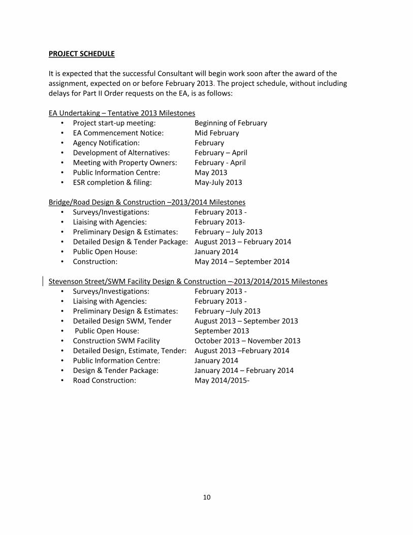
PROJECT SCHEDULE It is expected that the successful Consultant will begin work soon after the award of the assignment, expected on or before February 2013. The project schedule, without including delays for Part II Order requests on the EA, is as follows: EA Undertaking – Tentative 2013 Milestones
• Project start-up meeting: Beginning of February • EA Commencement Notice: Mid February • Agency Notification: February • Development of Alternatives: February – April • Meeting with Property Owners: February - April • Public Information Centre: May 2013 • ESR completion & filing: May-July 2013
Bridge/Road Design & Construction –2013/2014 Milestones
• Surveys/Investigations: February 2013 - • Liaising with Agencies: February 2013- • Preliminary Design & Estimates: February – July 2013 • Detailed Design & Tender Package: August 2013 – February 2014 • Public Open House: January 2014 • Construction: May 2014 – September 2014
Stevenson Street/SWM Facility Design & Construction – 2013/2014/2015 Milestones
• Surveys/Investigations: February 2013 - • Liaising with Agencies: February 2013 - • Preliminary Design & Estimates: February –July 2013 • Detailed Design SWM, Tender August 2013 – September 2013 • Public Open House: September 2013 • Construction SWM Facility October 2013 – November 2013 • Detailed Design, Estimate, Tender: August 2013 –February 2014 • Public Information Centre: January 2014 • Design & Tender Package: January 2014 – February 2014 • Road Construction: May 2014/2015-
11
ENGINEERING SERVICES MINIMUM STANDARDS FOR AS-BUILT DRAWINGS
INTRODUCTION
“As-built” drawings constitute the approved engineering and landscape drawings that have been revised to include “as-built” conditions. The “as-built” drawings shall be submitted to the City for the City’s permanent records upon completion of construction and prior to the end of the contractor’s warranty period. As-built information and drawings for municipal infrastructure shall be submitted to the satisfaction of the Engineering Services Department. The “as-built” revisions shall be based upon an “as-built” survey of all the services and works.
DRAWING REQUIREMENTS
The drawings must indicate the following information:
• Service connections – location (swing ties) and invert at the property line; • “As-built” drawing notation (shown in revision column with date); • All construction notes shall be revised to the past tense; • Limit of construction (differentiate using line weights, line types, etc.); • Date of installation of assets; • Material including class, diameter and length, grades and inverts for all pipes and
manholes; • Actual material and bedding of assets labeled in profile; • Municipal Address numbers and street names; • True north and construction north indicators; • All property lines, right-of-way lines and easements; • All street trees, sidewalks and driveways, street sign symbols and other street
related features; • Drawings scale (typically 1:250 horizontally and 1:25 vertically); • All elevations shall be geodetic. • City Drawing Reference numbers as provided by Engineering Services staff. • Refer to the Engineering Services Drafting Standards Manual for further Record/ As-
built drawing requirements. SUBMISSION REQUIREMENTS
The “as-built” submission shall consist of:
• One (1) CD of digital submission (Preferred format is PDF and a copy of the AutoCAD drawing file in the latest version of Civil 3D);

12
• 2 sets of hardcopies.
• One (1) transmittal per submission.
ACCEPTANCE OF “AS-BUILT” DRAWINGS
The City will review each submitted drawing. Drawings shall be revised if discrepancies are found or insufficient details are provided. Prior to assumption of the plan, a complete set of hardcopy shall be submitted along with the digital files (see submission requirements).

13
ENGINEERING SERVICES MINIMUM STANDARDS FOR OPEN HOUSE PRIOR TO CONSTRUCTION
Public Information Centre – Required Displays and Information General
Directional Signage into Building
Sign in Sheets (pens, paper)
Information Package – comment sheet attached Display Boards
StandardWelcome board
Purpose of the PIC
Background to the project
Scope of the project
Drawings – Mounted on hard surface of suitable size
• Coloured plan view (min 1:500 scale for very large projects, preferable 1:250 Scale) of the project showing the proposed final surface works with mounted photographs of each building and roadway
• Highlighted locations of: road widenings, new or wider sidewalk, bikeways, grading impacts, streetscape issues, trees (with colour used to indicate those impacted and those not impacted by the project), etc.
• Tree inventory drawing to include: o -assessment of each tree with impacts in Chart form o -replanting program as needed
Other Information
• Typical Road Cross-sections indicating existing and proposed
• Parking restrictions identified, existing or proposed
• Traffic Data, if applicable
• Cross-sections at each driveway available for viewing
• “What to expect during Construction" – Garbage/Recycling collection
• Staging Drawing and Preliminary Schedule
• Identification of Council Approval date
• Detour Plan, if required
• Arborist Report

14
ENGINEERING SERVICES GEOTECHNICAL CONSULTING SERVICES TERMS OF REFERENCE
INTRODUCTION/PURPOSE
The City of Guelph is seeking the services of a Geotechnical Consulting Engineering firm(s) or consortia of firms to provide Geotechnical services for the proposed Reconstruction. Replacement of underground/surface infrastructure:
The Geotechnical services includes the determination/confirmation of subsurface soil and groundwater conditions and based on that information, prepare an engineering report with geotechnical recommendations pertaining to excavation and dewatering, pipe bedding, trench backfill, and pavement reconstruction for this project. During the field investigation, the consultant is to visually examine the potential for contaminated or unsuitable materials and conduct further testing/chemical analysis as required to determine the removal and disposal requirements of the material during construction. The geotechnical consultant shall:
a) Determine the number and location of boreholes to reasonably reflect existing sub-surface conditions.
b) Provide Phase 1 ESA, note cost of the Phase 1 ESA shall be included in the quoted price.
c) Conduct Phase 2 ESA study based on Phase 1, note cost of the Phase 2 ESA shall be extra to the quoted price.
d) Material testing should be for MOE Table 1 and 2. Regardless of the recommendations of the Phase 1 ESA, a minimum of 2 samples shall be sent for analysis based upon MOE Table 1 and 2 parameters.
e) Coordinate utility locates for the entire length of the project.
f) Identify all borehole locations to be superimposed on design drawings provided by the consultant.
g) Provide traffic control in accordance with Book 7 of the Ontario Traffic Manual.
h) Complete necessary field investigations/testing to prepare an engineering report with recommendations/ test data dewatering and pertaining to excavations, pipe bedding, ground water control, trench backfill, roadway construction, pavement structure and compaction requirements.
i) Provide treatment recommendation for water disposal, test wells, monitoring wells and piezometers to determine pumping rates in support of PTTW.

15
j) Consultants review and complete hydrology report preparation to support PTTW application including meeting with MOE staff.
k) Consultants to provide Toxicity characteristic leaching procedure (TCLP) analysis for material disposal.
1) Identification of the presence of any potential contaminated or unsuitable material and recommendations with regard to further testing including applicable chemical testing. Please note that this type of issue would be considered unforeseen and a reasonable cost for testing would be considered.
Final Documentation
1) Three (3) hard copies of the completed geotechnical investigation report for each
road section.
2) One (1) digital copy of each completed geotechnical investigation report in PDF
format to be provided on a CD at the end of the project.
3) One (1) digital copy of the completed geotechnical investigation report in PDF
format to be provided on a CD prior to the tender.
The Geotechnical report shall include:
• An introduction and background to include a description of the existing road section
under investigation.
• A description of the investigation procedure and fieldwork.
• Subsurface conditions, including existing pavement structure, fill materials, topsoil,
laboratory testing and groundwater.
• Borehole log sheets undertaken on roads and shoulders, where available.
• Borehole location plans.
• Grain Size Distribution consisting of grain size analysis tests, and where applicable,
particle size (hydrometer) tests. Grain Size distribution shall be plotted against upper
and lower band limits for various material such as Granular A and B, in accordance with
Ontario Provincial Standards (OPS) materials.
• Based on the testing results, the report shall provide a recommendation relating to the
suitability of the in-situ material being used for Granular A and B.
• Standard Proctor Moisture Density Test Results.
• Discussion and recommendations, when applicable, for excavation and dewatering,
bedding for storm sewers, ground water control, trench backfill, roadway construction,
pavement materials, thicknesses, and compaction requirements.
The geotechnical report shall be appended to the construction tender