Embed Size (px)
Citation preview

Task Order Schedule
# Deliverable/Milestone Lead Due Date*1. NTP from BATA N/A May 20142. PSR Complete Chadi Chazbek December 20143. PA/ED Complete Chadi Chazbek September 20154. Final Design Completion and R/W
CertificationChadi Chazbek June 2016
5. Advertise and Award Project Chadi Chazbek November 2016*Assumes PSR/PDS and PA/ED phases begin at the same time (May 2014) and PA/ED and PS&E phase overlap by four months (Design at Risk).
Detailed Description of Work
Consultant shall provide planning, design, and environmental services to the Bay Area Toll Authority (BATA) for completing a Streamlined PSR/PDS, PEAR and the Project Approval/Environmental Document (PA/ED) for the I-580 Shoulder Running Lane and Bi-directional Bike Lane Project (Project) on the Richmond San Rafael Bridge in Marin and Contra Costa counties.
Project DescriptionThe I-580 Shoulder Running Lane and Bi-directional Bike Lane Project proposes to convert the existing right shoulder along Eastbound I-580 to a travel lane during the PM peak hours from the Sir Francis Drake On-Ramp to the Marine Street off-ramp. The total length of this project is approximately 6.16 miles (MRN PM 3.5 to CC PM 5.14).
The proposed shoulder running lane (also referred to as hard shoulder running or temporary shoulder use) is an Advanced Traffic Management System (ATMS) strategy currently used on several European and U.S. freeways to manage peak period capacity and reduce travel time. Shoulder running lanes allow vehicles to use either the right or left shoulder lanes under pre-determined traffic conditions or when conditions warrant and can be portrayed to users through fixed roadside signage or variable message signs located on gantries above travel lanes.
The proposed bi-directional bike lane on the upper deck of the RSR bridge using the right shoulder would connect bike paths from Contra Costa to Marin. Bike lane would start at the toll plaza on the Contra Costa side and end at San Quentin/Main St off-ramp on the Marin side. The bike lane on the bridge deck will be behind either a moveable or a permanent barrier.
The project includes the following elements:
BATA/HNTBTask Order #1-14
Page 5
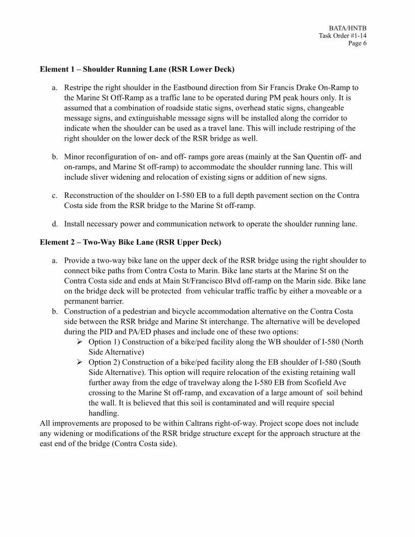
Element 1 – Shoulder Running Lane (RSR Lower Deck)
a. Restripe the right shoulder in the Eastbound direction from Sir Francis Drake On-Ramp to the Marine St Off-Ramp as a traffic lane to be operated during PM peak hours only. It is assumed that a combination of roadside static signs, overhead static signs, changeable message signs, and extinguishable message signs will be installed along the corridor to indicate when the shoulder can be used as a travel lane. This will include restriping of the right shoulder on the lower deck of the RSR bridge as well.
b. Minor reconfiguration of on- and off- ramps gore areas (mainly at the San Quentin off- and on-ramps, and Marine St off-ramp) to accommodate the shoulder running lane. This will include sliver widening and relocation of existing signs or addition of new signs.
c. Reconstruction of the shoulder on I-580 EB to a full depth pavement section on the Contra Costa side from the RSR bridge to the Marine St off-ramp.
d. Install necessary power and communication network to operate the shoulder running lane.
Element 2 – Two-Way Bike Lane (RSR Upper Deck)
a. Provide a two-way bike lane on the upper deck of the RSR bridge using the right shoulder to connect bike paths from Contra Costa to Marin. Bike lane starts at the Marine St on the Contra Costa side and ends at Main St/Francisco Blvd off-ramp on the Marin side. Bike lane on the bridge deck will be protected from vehicular traffic traffic by either a moveable or a permanent barrier.
b. Construction of a pedestrian and bicycle accommodation alternative on the Contra Costa side between the RSR bridge and Marine St interchange. The alternative will be developed during the PID and PA/ED phases and include one of these two options:
! Option 1) Construction of a bike/ped facility along the WB shoulder of I-580 (North Side Alternative)
! Option 2) Construction of a bike/ped facility along the EB shoulder of I-580 (South Side Alternative). This option will require relocation of the existing retaining wall further away from the edge of travelway along the I-580 EB from Scofield Ave crossing to the Marine St off-ramp, and excavation of a large amount of soil behind the wall. It is believed that this soil is contaminated and will require special handling.
All improvements are proposed to be within Caltrans right-of-way. Project scope does not include any widening or modifications of the RSR bridge structure except for the approach structure at the east end of the bridge (Contra Costa side).
BATA/HNTBTask Order #1-14
Page 6

PHASE I – PROJECT STUDY REPORT/PROJECT DEVELOPMENT STUDY
Task 1.0 Project Management Consultant shall provide project management for each task for the entire duration of the PSR/PDS phase. Management activities will consist of administration, coordination, attending meetings and quality control as stated in the following:
1.1 Conduct Project Management and Control • Supervise, coordinate and monitor activities and product development for
conformance with Caltrans and BATA standards and policies.• Assure compliance with other codes and standards as acceptable to Caltrans and
approved by BATA • Prior to start of any work, Consultant shall interface with Caltrans staff to assure
format consistency of all Deliverable(s).• Coordinate in-house design staff and subconsultants to assure free and timely flow of
information for each task activity. • Maintain Project files in accordance with Caltrans' Uniform Filing System. • Not perform any extra work without prior written authorization from BATA.• Coordinate the planning and design effort with project development team and the
following:! BATA! Caltrans. ! Transportation Authority of Marin (TAM), Contra Costa Transportation
Authority (CCTA), and the various cities along the corridor! Utility Companies.! Local Cities and Counties! Chevron
• Prepare a detailed Critical Path Method (CPM) schedule and submit an updated electronic file schedule on a monthly basis.
• Prepare and maintain a Data Request Log. • Prepare and maintain a Submittals Registry including scheduled and actual submittal
dates, review periods and receipt of comments,• Prepare and submit monthly invoices with progress reports. • Establish and implement a quality control procedure for planning and design
activities, perform in-house quality control reviews for each task, and submit deliverables to BATA for review in accordance with the approved schedule.
1.2 Conduct Project AdministrationConsultant shall perform the following project administrative duties:
BATA/HNTBTask Order #1-14
Page 7

• Prepare and submit monthly progress reports that will identify work performed on each task the preceding month. Percent complete compared to percentages billed for each task will be shown.
• Prepare a monthly summary of total charges made to each task. This summary shall present the contract budget for each task, reallocated budget amounts, prior billing amount, current billing, total billed to date, and a total percent billed to date.
• Provide a summary table indicating the amount of firm participation each month based upon current billing and total billed to date.
• Provide a monthly invoice by task that will present charges by staff member at agreed to hourly rates, expense charges, and subconsultant charges. Support documentation for Consultant direct expenses and subconsultant charges will be attached.
1.3 Develop & maintain a Quality Management Plan Consultant shall develop a quality management plan to establish Quality Control / Quality Assurance (QC/QA) plans and procedures and conduct independent Quality Review of reports, plans, specifications, estimate and design documents. Consultant shall perform the following:
• Assure promulgation to BATA, TAM and CCTA, and Caltrans of and strict adherence to the Quality Management Plan in the conduct of the work. Subconsultants can either subscribe to Consultant’s Quality Management Plan or have their own QC/QA Plan approved by BATA.
• Convene and document quality reviews, and make findings and corrective actions available for BATA’s review. Documentation of compliance with Project Management Plan is provided to BATA upon request or during project audits.
• Assure quality control procedures are strictly adhered to and properly documented throughout the entire course of the work.
• Assure widest dissemination of information to all affected disciplines and individuals.
• Perform a thorough review and verification of corrections by an Independent Reviewer.
• Documentation of compliance with Project QA/QC plan is provided to BATA upon request or during project audits.
• Consultant conducts periodic reviews / audits to verify compliance to above requirements.
• Take corrective actions to rectify findings of non-compliance by a QA/QC audit.
1.4 Provide agency coordination Consultant shall perform coordination with Agencies as required for project development. Coordinate planning and design effort with team members, including the following:
! Caltrans! Affected utility companies ! TAM
BATA/HNTBTask Order #1-14
Page 8

! CCTA! FHWA! Environmental resource agencies (as required)! San Francisco Bay Conservation and Development Commission (BCDC)! Various cities along the corridor! Bicycle Coalitions and Advisory Groups! Private property owners such as Chevron
Agency coordination tasks include holding one-on-one discussions or meetings with those agencies, seeking input on proposed alternatives and designs, defining impacts and developing mitigation plans, investigating regulatory requirements and expectations of stakeholders for the PA/ED and design phases, and evaluating implementation plans.
1.5 Prepare for and attend meetingsConsultant shall:
• Hold design coordination meetings with in-house design team and subconsultants.• Conduct Monthly Project Development Team (PDT) meetings. Consultant shall
arrange meetings, provide discussion material, and prepare minutes (up to 18 meetings assumed). It is assumed that meetings will be held at Caltrans District 4 offices.
• Conduct bi-weekly project coordination conference calls (up to 34 conference calls)• Conduct as needed coordination meetings with BATA, Caltrans, and other agencies
to resolve technical issues (up to 18 meetings assumed).• Conduct milestone update meetings with BATA’s board and internal committees and
Caltrans’s executive level meeting (Up to 18 meetings assumed).
Consultant shall prepare and submit meeting agenda, prepare and distribute draft meeting minutes within ten (10) working days after each meeting allowing two weeks for receipt of any comments. Prepare and distribute final meeting minutes incorporating relevant comments received on draft meeting minutes. Consultant shall prepare and submit of copies of Submittals Register, Data Request Log, and Schedule updates at each PDT meeting.
1.6 Risk Management Plan (RMP)Consultant shall prepare a risk management plan per Caltrans guidelines and using Caltrans template. Consultant shall meet on a quarterly basis with Caltrans, BATA, and other major stakeholders staff to update the RMP. The most current RMP will be attached to the draft and final PSR/PDS.
1.7 Cooperative AgreementsConsultant shall assist BATA to prepare drafts of all Cooperative Agreements needed for the Project that will be reviewed by Caltrans' Project Development. Final Cooperative Agreements will be
BATA/HNTBTask Order #1-14
Page 9

prepared based on a consensus reaching process between BATA and Caltrans. It is assumed that these Cooperative Agreements will cover the PSR/PDS and PA/ED phases of the project.
Task 1.0 Deliverables• Detailed CPM design schedule with monthly updates• Meeting agendas and draft/final meeting minutes• Data Request Log• Submittal Registry• Invoices and progress reports• Quality Management Plan (QMP)• Cooperative Agreement review comments and suggested edits• Risk Management Plan
Task 2.0 Prepare PID Attachments
2.1 Data Collection and ReviewConsultant shall review additional information regarding the proposed project provided by BATA and other agencies and consultants. In addition, previously collected data will be reviewed and utilized. Specifically, Consultant shall:
• Obtain and review additional information from projects within the study vicinity. The purpose of this review is to identify issues impacting project costs.
• Conduct environmental research and review.
2.2 Preliminary Geometrics
2.2.1 Conceptual AlternativesBased on the analysis efforts that have been undertaken in the previous phases of the project, and based on discussions with Caltrans, BATA, TAM, and CCTA, the project will be developed to a Project Study Report/Project Development Study Report (PSR/PDS) level.
2.2.2 Bike Lane AlternativesThe scope of this project assumes the following alternatives for the bike lane:
East of Richmond San Rafael Bridge Toll Plazaa) Bikes will continue to be allowed on the shoulder of the eastbound direction of I-580 from
the RSR bridge to the Marine St off-ramp during the hours when the shoulder running lane is not in operation.
b) A shuttle will be provided to transfer bicyclists in the eastbound direction from the RSR bridge to the Marine St off-ramp when the shoulder running lane is in operation.
c) Consultant shall evaluate widening the freeway in the westbound direction to accommodate a two-way bike lane from the existing bike lane at Marine St/I-580 WB on-ramp to the proposed upper deck bike lane on the RSR Bridge. This will include widening of the
BATA/HNTBTask Order #1-14
Page 10

Scofield Avenue overcrossing. If consensus is reached to include this concept into the preferred project alternative, this two-way bike lane will replace the shuttle concept and the bikes on shoulder in the eastbound direction.
d) No build Alternative.
West of Richmond San Rafael Bridge Toll Plaza
a) The build alternative will include allowing the bicycles on the upper deck of the RSR Bridge from the toll plaza to the San Quentin off-ramp. The bike lane will be behind either a moveable or permanent barrier using the right shoulder.
b)No build Alternative.
2.2.3 Alternatives DevelopmentDuring the PSR/PDS phase, Consultant shall develop the agreed upon alternative for the project with the ultimate goal of project approval. The project will be developed to produce preliminary striping plans, approximately 15% geometric horizontal and vertical design at any locations requiring geometric modification, utility base maps with key conflicts identified (if any), design exceptions identified, preliminary right-of-way needs identified, 30% level typical cross sections, and cost estimates.
In addition, Consultant shall conceptually evaluate a “full standard” alternative that meets Caltrans design standards and prepare a conceptual cost estimate for such alternative and briefly describe the right of way and environmental impacts associated with this alternative. It is assumed that developing detailed geometric plans for this alternative will not be required and therefore are not included in this scope of work.
2.3 Geometric Approval DrawingsDetailed geometrics of the preferred build alternative will be developed. Geometric refinements will be investigated to assess if any non-standard features can be eliminated. Consultant shall prepare the Caltrans DIB 78 Design Checklist for the Development of Geometric Plans.
2.4 Design ExceptionsOnce the layout of the conceptual striping plans been reviewed and agreed to, the design will be compared against the Caltrans Highway Design Standards. An analysis will be conducted with Caltrans District 4 design staff and HQ geometricians. A short memo describing those Design exceptions and the associated justification will be prepared to facilitate Caltrans review of the proposed geometry. Development of a complete design exception fact sheet that documents all the design exceptions within the project limit will occur during the PA/ED phase.
2.5 Conceptual Signing and Striping PlanConsultant shall prepare a conceptual signing and striping plan for Caltrans review. The purpose of this task is to establish a general understanding of how the shoulder running lane will be signed and
BATA/HNTBTask Order #1-14
Page 11

striped to meet Caltrans standards and define costs associated with the installation of overhead static signs, changeable message signs, and extinguishable message signs as well as power and communication network.
2.6 Six-Page Cost EstimateConsultant shall prepare a six-page cost estimate in Caltrans format for the build alternatives (preferred build alternative and the full standard alternative). This estimate will include costs associated with both the shoulder running lane and the bike lane. Operational costs will include costs to open and close the shoulder running lane, operate the bike shuttle (if included in the project), and moving the barrier on the upper deck if a moveable barrier option is selected. The cost estimate will be developed to provide a detailed breakdown of the capital civil work, including power and communication costs for the Electronic signage. It would also include the cost of support needed for the PA/ED, PS&E and construction phase of the project.
2.7 Storm Water Data ReportThe PID-level Preliminary Storm Water Data Report (SWDR) will provide the initial documentation of potential water quality impacts to receiving water bodies and anticipated Best Management Practices (BMPs) to minimize or mitigate these potential water quality impacts. The Preliminary SWDR identifies the Project’s receiving water bodies and describes the existing water quality limitations. In addition, the Preliminary SWDR describes the general geotechnical conditions of the Project area for identification of BMPs that may be required.
The report will provide an understanding of potential impacts that result from the disturbed soil area created by the Project, in addition to potential downstream impacts and water quality impacts related to the increase in impervious area created by the Project. The feasibility of appropriate treatment BMPs will be documented in the Preliminary SWDR. One reconnaissance level survey of the Project Area will be conducted for the Preliminary SWDR.
2.8 Preliminary Floodplain Study Technical MemorandumConsultant shall perform a preliminary floodplain risk assessment to evaluate the potential floodplain impacts from the proposed project elements, potential mitigation measures, and whether any hydromodification analysis will be required. Consultant shall prepare a Floodplain Study Technical Memorandum to document the project impacts and mitigation. Consultant shall rely on the Federal Emergency Management Agency (FEMA) and other available information to perform our floodplain risk assessment. No detailed hydrologic and hydraulic analyses will be performed for this phase of the Project study. It is assumed that a reconnaissance level survey of the Project Area is sufficient for the stage of the Project.
2.9 Preliminary Water Quality Assessment Technical MemorandumConsultant shall prepare a Preliminary Water Quality Assessment Technical Memorandum to document the existing current and upcoming laws that relate to water quality, conditions of the watershed, existing drainage, and water quality objectives for the receiving waters. In order to
BATA/HNTBTask Order #1-14
Page 12

provide information on existing physical and regulatory environment, Consultant shall conduct a reconnaissance-level survey of the Project Area to document land use, geography, and topography of the area. Consultant shall also research beneficial uses for potentially affected waters, monitoring data from other agencies, and potential sources of pollutants. Consultant shall document the preliminary water quality assessment for the proposed project elements. The Water Quality Assessment will be done for both elements.
2.10 Initial Site Assessment (ISA)Consultant shall prepare an ISA to document the potential for hazardous material contamination within a 1-mile of the project site and to determine whether a Preliminary Site Investigation (and associated hazmat testing) is required in a later development phase for the Project.
The ISA study will identify potential hazardous waste sites and evaluate environmental factors that may have impacted the soil groundwater quality within the project limits. The study will include data collection, documents research including historical land use based on study of aerial photographs and other relevant documents, and field reconnaissance. The data research will be ordered from Environmental Data Research Inc. (EDR Inc.) for the proposed project. No field exploration and/or testing are included in this phase of the work. This ISA will be prepared in accordance with the document Preparation Guidelines for ISA Checklist for Hazardous Waste, prepared by Caltrans and dated 07/01/1999. The regulatory environment for hazardous materials, including regulatory agency framework and the DTSC/Caltrans Aerially Deposited Lead Variance, shall be described. It is not anticipated that the ISA will need to address any work on the RSR Bridge as that was recently seismically retrofitted and there should be enough documentation to utilize to support the environmental clearance of this project.
Assumptions: Based on the description of the project it is assumed that no new right of way is required for this project except for an easement from Chevron. A visual reconnaissance of the study limits will be performed to verify that the right-of-way directly adjacent to the freeway (where limited project construction activities might occur) does not contain any obvious signs of use that might be associated with contamination or hazardous materials. It is not anticipated that any sites will be identified that require additional investigation. The Caltrans ISA checklist will be completed, and a report prepared that summarizes the assessment steps and findings.
2.11 Preliminary Environmental Analysis Report (PEAR)A Preliminary Environmental Analysis Report (PEAR) will be prepared as an attachment to the PSR/PDS. The PEAR presents a first level general assessment of environmental constraints that might affect project design, alternatives, and environmental clearance and permitting. The following PEAR tasks will be performed:
BATA/HNTBTask Order #1-14
Page 13

2.11.1 Prepare Technical Studies and Conduct Field VisitTechnical studies will be limited to a review of background information and record searches, a reconnaissance or “Windshield Survey” of the project area within the limits of the potential alternatives, and preparation of brief memoranda to support the PEAR document. The following technical memoranda will be prepared to support the PEAR documentation:
• Noise and Air Quality: The noise and air quality studies needed for the PA/ED phase will be identified in the PEAR based on a brief summary of the existing setting, the proximity of potential sensitive receptors, and current regulatory requirements.
• Biological Resources: Records of known species in the project area will be obtained through a search of location specific GIS data found in the California Natural Diversity Database (CNDDB). A brief summary memorandum of the setting and potential for presence/absence of sensitive species and habitats will be prepared, focusing on potential work in drainages and culverts, and any work in existing vegetated areas. Anticipated regulatory agency permits or consultation tasks will also be identified in this memorandum. Floodplains and Water Quality: Existing reports and/or FEMA floodplain mapping will be reviewed and applicable studies, permits, and requirements will be identified. A findings memorandum will be prepared that summarizes hydrology and water quality considerations including required future studies, and agency coordination.
• Cultural Resources: A cultural resources record search will be requested from the Northwest Information Center of the California Historical Resources Information System (CHRIS), administered by Sonoma State University, Rohnert Park. The search results will include a review of site records, survey reports, National and California register listings, as well as other relevant documents, based on a study area that encompasses the project corridor plus a one-quarter-mile buffer. The records search will include any built environmental resources immediately adjacent to the I-580 right-of-way, but not within the greater quarter-mile buffer. The findings of this record search will be summarized in a brief memorandum with recommendations for future required studies in the PA/ED phase of the project.
• Paleontological Resources: The potential is low for paleontological resources because the abutments at each end of the bridge were built within fill material and deep excavation is only proposed for sign foundations. Soil types from previous reporting and geologic maps of the area will be evaluated to determine if there are any soil types within the depth of proposed excavation that could contain fossil resources.
• Hazardous Materials: An ISA Report will be prepared to document the potential for hazardous material contamination in the project vicinity and to determine whether a Preliminary Site Investigation is required in a later development phase for the project.
BATA/HNTBTask Order #1-14
Page 14

• Community Resources, Land Use, and Scenic/Visual Resources: Because the project would occur within the existing right of way, it is not anticipated that these resources will be affected. The PEAR will evaluate and confirm this assumption.
2.11.2 PEAR DocumentationThe PEAR document will include a preliminary project statement of Purpose and Need, narrative description of the project alternatives, and will list the technical studies and recommendations for subsequent work needed in the PA/ED stage of project development. It will include recommendations on the type of environmental document for National Environmental Policy Act (NEPA) and California Environmental Quality Act (CEQA) compliance, and specific regulatory and permit requirements as well as an estimate of the costs and anticipated schedule for environmental clearance. Preliminary mitigation and avoidance measures will be identified for the final design and construction phase and these costs will be estimated for inclusion in the PSR/PDS.
Consultant shall prepare the PEAR form and will conduct quality control reviews of all environmental technical reports from subconsultants prior to submittal to BATA. Submittals will be revised based on one round of comments from BATA and one round from Caltrans.
2.12 Right-of-Way Data SheetsRight of Way data sheets will be prepared for each alternative under consideration in the PSR/PDS. The data sheets will follow the current format established by Caltrans, identifying utility relocations and property acquisitions, including approximated temporary easements. An administrative draft data sheet will be prepared for each alternative for review by Caltrans and BATA prior to submission of the draft PSR/PDS. The data sheets will then be updated for the Draft PSR/PDS and for the Final PSR/PDS based on comments from the agencies mentioned.
2.13 Traffic Support for PSR/PDS PhaseTo support the PSR/PDS, Consultant shall prepare a Traffic Engineering Performance Assessment (TEPA). This assessment will be limited to readily available information and data, and macro-level analysis and evaluation. This effort will produce preliminary traffic engineering findings and estimates to inform and advise the Project Development Team. For the PSR/PDS, the assessment will summarize:
• Existing operating conditions and accident characteristics based on available data and information;
• Forecasted travel demands and growth as documented in prior studies or readily available travel demand model runs;
• The potential project scope of work and features (including traffic control, operational, management and safety devices, systems and features);
• Potential performance benefits and deficiencies; and • The scope and magnitude of traffic engineering work (traffic forecasting, modeling,
analysis and evaluation) to be performed during the PA/ED phase.
BATA/HNTBTask Order #1-14
Page 15

.14 Viable Alternative SelectionConsultant shall prepare an alternative comparison and alternative summary for each alternative studied to provide BATA with tools to uniformly assess various alternatives. Consultant shall also summarize how each alternative ranks relative to other alternatives in a decision matrix or matrices to facilitate BATA and stakeholder selection of alternatives for documentation in the PSR/PDS.
Task 2.0 Deliverables:• Preliminary Geometrics• Geometric Approval Drawings• Design Exceptions• Conceptual Signing and Striping Plan• Six-Page Cost Estimate• Storm Water Data Report• Preliminary Floodplain Study Technical Memorandum• Preliminary Water Quality Assessment Technical Memorandum• Initial Site Assessment• Preliminary Environmental Analysis Report (PEAR)• Right-of-Way Data Sheets• Traffic Engineering Performance Assessment (TEPA)• Alternative Summary• Alternative Comparison Summary • Decision Matrix / Matrices
Task 3.0 Project Study Report/Project Development StudyConsultant shall work with BATA and Caltrans to produce and obtain approval of the PSR/PDS document. Two Build Alternatives (One preferred and one “full-standard” alternative) and one No-Build Alternative will be identified in the PSR/PDS leading to the selection of the “preferred” alternative to be carried forward into the Project Report/Environmental Document phase. The PSR/PDS will follow the format and content requirements of the streamlined PSR/PDS as defined in Caltrans’ Project Development Procedures Manual (PDPM), Appendix S.
The following clarifies specific areas of work involved in the PSR/PDS preparation, including supplemental items of work required. As defined in Caltrans’ guidelines, the following attachments will be prepared and submitted with each PSR/PDS:
• Location Map (8 ! x 11)• Striping/Geometric Plans• Typical Cross Sections• Environmental Documentation (PEAR)• Preliminary Project Cost Estimate• Executed Pre-Approved Cooperative Agreement (by others)• R/W Data Sheet• Design Scoping Index
BATA/HNTBTask Order #1-14
Page 16

• Stormwater Documentation• Transportation Planning Scoping Information Sheet• Traffic Engineering Performance Assessment• Survey Needs Questionnaire• Quality Management Plan• Risk Register• Division of Engineering Services Scoping Checklist
3.1 Prepare Administrative Draft PSR/PDSConsultant shall prepare and assemble an Administrative draft PSR/PDS for review by BATA. Five (5) copies of the draft PSR/PDS will be delivered for this purpose.
3.2 Prepare Draft PSR/PDSConsultant shall prepare and assemble a draft PSR/PDS for review by BATA, TAM and Caltrans. Forty (40) copies of the draft PSR/PDS will be delivered for this purpose.
3.3 Response to CommentsUpon receipt of comments on the draft PSR/PDS from BATA and Caltrans, Consultant shall work with BATA, Caltrans, TAM, and CCTA staff to respond to the comments and resolve issues. It is anticipated that up to three meetings with BATA and Caltrans staff will be required to resolve these comments. Consultant shall prepare a response to comments matrix and document the final disposition for each comment at the end of this review process with Caltrans.
3.4 Prepare Final Project Study Report/Project Development Study (PSR/PDS)Upon receipt of comments on the Draft Report from the reviewing agencies, Consultant shall meet with the BATA staff to understand comments and resolve issues. Consultant shall then update and assemble the final PSR/PDS for approval by BATA and Caltrans. Three (3) copies of the final PSR/PDS will be prepared for distribution at this time.
Task 3.0 Deliverables:• Draft PSR/PDS Storm Water Data Report (PDF and 3 hard copies)• Final PSR/PDS Storm Water Data Report (PDF and 5 hard copies)• Preliminary Floodplain Study Technical Memorandum• Preliminary Water Quality Assessment Technical Memorandum• Design Exception “Fatal Flaw” Analysis Documentation• Draft and Final Preliminary Environmental Analysis Report (PEAR)• Six-Page Cost Estimate• Draft PSR/PDS (10 copies)• Final PSR/PDS (3 copies)• PSR/PDS attachments• Conceptual Signing and Striping Plans• Right of Way Data Sheet
BATA/HNTBTask Order #1-14
Page 17

PHASE II – PROJECT APPROVAL AND ENVIRONMENTAL DOCUMENT
Assumptions:For scope of services of this task, the following assumptions were made:
• Based on the description of the project it is assumed that no new right of way is required for this project.
• One No-Build Alternative and One Build Alternative will be developed and evaluated through the PA/ED phase leading to an approved build alternative at the end of the environmental evaluation process
• The type of document that will be prepared for this project is an Initial Study-Mitigated Negative Declaration (IS/MND) under CEQA and Categorical Exclusion (CE) document under NEPA requirements.
• The PA/ED phase scope of work and its associated cost estimate is based on completing a IS/MND-CE and does not include obtaining regulatory agency or other permits required for construction.
• The PA/ED phase scope of work and its associated cost estimate is based on the assumptions and understanding of the level of effort and required documentation for each of the environmental technical studies and reports detailed below. If additional studies are required in any technical area, a budget and scope amendment will be required.
• Currently, this project is not listed in either the TIP 2013 or the RTP - Plan Bay Area 2040. In order to demonstrate regional air quality conformity, a TIP/RTP amendment would need to be processed prior to approval of the environmental document.
• A PM2.5 conformity analysis report would be necessary for the project. However, a quantitative PM2.5 Hot Spot analysis (i.e., emission and dispersion modeling) would not be required.
• Scope does not include additional cultural resource documentation or field identification efforts, Environmentally Sensitive Area/Archaeological Monitoring Area action plans, Phase-II evaluation of archaeological resources for National Register eligibility, or Phase-III data recovery. Each would be conducted under a separate proposal and budget.
• Consultant assumes the preparation of two draft APE maps. Additional drafts and/or changes to the APE after the start of the inventory may result in additional costs.
• This scope assumes that no Historical Resources Evaluation Report (HRER) will be required for this project.
• No hazardous material testing is included in this scope or work. Caltrans/BATA will provide Foundation Reports and Materials Reports from their project files.
BATA/HNTBTask Order #1-14
Page 18

• Based on the Caltrans Visual Impact Assessment Guide checklist and experience with Caltrans on other projects, the project will not require a full Visual Impact Assessment that includes visual simulations.
• Environmental consultants will conduct pedestrian surveys of those portions of the project area where ground surface/sub-surface disturbance may occur, but will not walk the length of the bridge. BATA will provide all necessary permits and address all access issues to the project area. Consultant shall prepare permit applications that are signature ready for BATA.
• Each of the draft environmental technical reports will undergo one round of edits with the Local Agency, and two rounds with Caltrans. Three paper copies each of the draft and final reports will be produced for Caltrans.
• Environmental technical specialists will attend up to two project meetings with Caltrans, as necessary. Biological resources specialists will attend up to four (4) coordination meetings with Caltrans and/or other consulting agencies. Environmental technical specialists will also participate in up to four (4) conference calls with the BATA and Project Development Team staff, as necessary.
Task 4.0 Preliminary Engineering Preliminary engineering activities shall consist of the following:
4.1 Base MappingPreparation of base mapping in English units is a critical path activity since the Caltrans process typically takes 8 to 9 months to complete. Consultant shall prepare topographic mapping in accordance with current Caltrans photogrammetric procedures (i.e., Step “A+B+C” method.). A proposed flight plan shall be developed and the location of flight markers shall be submitted to Caltrans for approval (Step A). Ground control surveys shall be performed to lay flight markers and tie them into the state coordinate system (English). Results of the ground control (GPS) survey shall be documented in a Survey Report and submitted to Caltrans for approval (Step B). The site shall then be flown and ground control used to triangulate the mapping models. Caltrans approval of the triangulation calculations completes Step C and preparation of topographic mapping can commence. Mapping shall be prepared in MicroStation format, consistent with Caltrans drafting standards at a map scale of 1”=50’. The project area to be mapped is estimated to 7.5 miles along I-580, with a 600’ swath width centered along I-580 centerline. Color orthographic photos will also be prepared for presentations and development of technical studies.
4.2 Site VisitsConsultant shall conduct site visits and field reviews to verify existing geometric features, structures, drainage, signage, striping, and other features. Consultant shall document the conditions observed during these site visits through photos, field notes, and field measurements. A total of 8 site visits are included in this scope.
BATA/HNTBTask Order #1-14
Page 19

4.3 Refine Design Alternatives Consultant shall refine preliminary geometrics for the proposed improvements using the updated topographic base mapping and investigate design variations to achieve the most cost-effective solution with the least impact on environmentally sensitive areas and minimize the widening footprint of the project. The design variations shall be analyzed to qualitatively compare cost, traffic operations, safety, design exceptions, environmental impacts, right of way and utility relocation requirements. The findings shall be presented to BATA, Caltrans and stakeholders for review and to reach consensus on the Project Alternative. This task is anticipated to be an iterative process. Consultant shall develop preliminary layout plans for the Build Alternative that indicates lane, shoulder, horizontal control, structure locations and right of way requirements in MicroStation (English Units) format. Typical cross sections and roadway profiles of new and modified alignments shall also be developed.
4.4 Prepare/Update General Arrangement Drawings (GAD)Consultant shall further develop the additional geometric refinements and alternative analysis from what was completed during the PSR/PDS phase. These geometric refinements will be necessary for obtaining Caltrans approval of the geometric design drawings and the design exceptions fact sheets. Consultant shall hold additional GAD review meetings with Caltrans and prepare three additional submittals of the geometric approval drawings before submitting the fact sheets.
4.5 Design Exceptions Fact SheetsDetailed geometrics of the preferred build alternative will be developed in sufficient detail to assess if any non-standard features can be eliminated. Once preliminary concurrence on the preferred build alternative geometrics is obtained from Caltrans, design exceptions for non-standard features that require preparation of a Mandatory and/or Advisory Fact Sheet will be documented by the Consultant in draft Fact Sheets. Coordination meetings with Caltrans Geometricians will be held to discuss non-standard features prior to submittal of the Fact Sheets. Subsequent to coordination meetings, Fact Sheets will be updated and submitted to Caltrans HQ geometrician and Caltrans District 4 for review and comment, together with the Draft PR. Consultant shall address any comments on the draft Fact Sheets and submit final Fact Sheets for Caltrans approval, prior to submittal of the Final PR. Two draft and two final fact sheets submittals are included in this scope.
In addition, Consultant shall prepare a draft Ramp Metering Fact Sheet (RAFS) to document the exceptions associated with Caltrans ramp metering policy. A draft RMFS will be prepared and submitted to Caltrans, comments addressed, and a final RMFS will be submitted once agreement on the response to the comments has been obtained. Two draft and two final fact sheets submittals are included in this scope.
4.6 Preliminary Cost EstimateConsultant shall prepare preliminary cost estimate to provide and assess construction, and utility relocation costs to establish funding boundaries for the project. Costs will be based on mapping and
BATA/HNTBTask Order #1-14
Page 20

design data developed by previous studies and individual cost items quantified. Existing and proposed ground surfaces shall be modeled to enable earthwork quantities to be approximated. Potential cost saving measures, and utility relocation alternatives shall be investigated.The preliminary cost estimate will be in English units and presented in the Caltrans 6-page format. Consultant shall update the operational costs prepared during the PID phase based on the most current alternative selected and include these operational costs in the 6-page estimate.
4.7 Utility Coordination Existing utility information shall be requested from utility operators within the project vicinity. Consultant shall document the existing utility information on a color-coded utility tracking drawing and document it by owner, type, size, voltage and material in a utility tracking table and on plan sheets. No potholing or field survey is proposed to confirm utility location records under this task.BATA shall be the point of contact with private utility companies and for the preparation of agreements. Consultant shall provide support as needed, including but not limited to: Preparing submittal memos, drafting agreements, creating/updating contact lists and attending coordination meetings.
Consultant shall develop existing utility mapping for the project area, identify utilities that potentially conflict with the proposed improvements, and develop relocation plans for conflicting utilities.
Consultant shall:• Obtain utility as-built maps • Field review and update as-built utility information • Prepare existing utility base mapping• Identify potential utility conflicts and preliminary major utility relocation
requirements • Develop preliminary utility relocation plans that will be used as the basis of
discussions with the affected utility owners.
The utility base mapping will be in English units. It is assumed that final utility relocation plans will be prepared by each of the affected utility owners.
4.8 Prepare Utility Policy Variance Report (UPVR)Consultant shall prepare the UPVR document and prepare its supporting documents (utility plans, alternative relocation plans, access exhibits, and alternative relocation cost estimates) for the facilities that do not meet the Caltrans Utility Policy. Consultant shall respond to Caltrans comments and make revisions to the document. The UPVR should include documentation of the longitudinal utilities encroachment. Two rounds of Caltrans reviews of the UPVR are assumed.
BATA/HNTBTask Order #1-14
Page 21

4.9 Traffic AnalysisConsultant shall provide travel forecasting and traffic operational analysis services to support the PSR/PDS and PA/ED phases. This will include preparation of a Traffic Operations Analysis Report (TOAR).
The following scope of work and associated budget assumes the following:
Eastbound Shoulder Running Lane• Proposed restriping of the right shoulder in the eastbound direction on I-580 from
the Sir Francis Drake Boulevard On-Ramp to the Marine Street Off-Ramp as a traffic lane to be operated during the weekday PM peak period only.
• Analysis will be conducted for the eastbound weekday PM peak period only. • In addition to existing conditions, analysis will be conducted for two future horizon
years: opening day (2015) and design year (2035).• The study/analysis area will include the eastbound segment of I-580 from the US
101 junction in San Rafael to just east of the Harbour Way interchange in Richmond. The analysis network will include all eastbound on and off ramps within these limits. These limits will be reviewed and accepted by Caltrans prior to conducting the technical analysis.
• A macroscopic simulation model will be developed using VISSIM and used for the operational analysis of eastbound I-580 and the local arterials serving eastbound traffic including: Sir Francis Drake Boulevard back to the US 101 interchange and the Main Street, Richmond Parkway, Canal Boulevard, and Harbour Way interchanges including one local intersection to either side of each interchange. The model will encompass the entire study freeway segment and will include the freeway mainline and all ramps. Should Caltrans prefer, FREQ with Synchro software packages can be substituted for VISSIM software.
• The VISSIM model will cover the 5-hour weekday PM (3:00 PM to 8:00 PM) peak period in either 1-hour or 30-minute time slices.
• The Existing Conditions model will be calibrated to observed 2014 conditions. The model’s throughput volumes will be calibrated to within Caltrans Guidelines for simulation models. Queues will also be compared visually.
• Ramp metering, where applicable, will be simulated using a simplified, fixed rate approach.
• For the TOAR, two alternatives (No Build and Build) will be analyzed.
Westbound Bike Path and RSR Bridge• The proposed westbound bike path will be a separate path that uses the existing
shoulder across the bridge. The scope is predicated on the number of vehicle lanes/geometries not changing on westbound I-580 including the toll plaza approach, the
BATA/HNTBTask Order #1-14
Page 22

toll plaza, the merge between the booths and the bridge, as well as across the bridge and west through the Sir Francis Drake Boulevard interchange.
• Analysis will be conducted for the westbound weekday AM peak period only. • In addition to existing conditions, analysis will be conducted for two future horizon
years: opening day (2015) and design year (2035).• The study/analysis area will include the westbound segment of I-580 approaching
the Toll Plaza, through the Toll Plaza and across the bridge to the Main Street (i.e., San Quentin interchange).
• A deterministic model will be developed using spreadsheets to establish delay and extent of queues and used for the operational analysis of westbound I-580. The model will encompass the entire study segment and will include the freeway mainline and the toll plaza area as well as local interchange ramps if necessary. A deterministic model is being proposed under the assumption that the westbound I-580 vehicle lane geometries will not change with the project.
• The deterministic model will cover the 4-hour weekday AM (6:00 AM to 10:00 AM) peak period.
• The Existing Conditions model will be calibrated to observed 2014 conditions. The model’s throughput volumes and delay through the toll plaza will be calibrated to within Caltrans Guidelines. Queues will also be compared visually.
• For the TOAR, two alternatives (No Build and Build) will be analyzed.
Subtask 4.9.1 – Meetings/Project ManagementConsultant shall perform the following activities under this task:
• Coordinate activities with other consultant team members, as well as with stakeholder agencies, including BATA, TAM, CCTA, Caltrans, the City of San Rafael and the City of Richmond, as necessary.
• Prepare for and attend project meetings including:! Up to 6 regular monthly PDT meetings.! Up to 4 additional technical or consultant team coordination
meetings. As appropriate, these meetings may include representatives from BATA, the City of San Rafael, TAM, Caltrans and other agencies.
• Prepare monthly invoice by task with support documentation for direct expenses and vendor charges.
• Prepare monthly progress reports that will identify work performed on each task during the reporting period, problems encountered and their disposition, and work products completed and distributed, and meetings attended.
Consultant’s Project Manager shall maintain regular communications with the traffic subconsultant throughout the duration of this study.
BATA/HNTBTask Order #1-14
Page 23

Subtask 4.9.2 – Confirm Operational Analysis and Forecasting MethodologyIn consultation with BATA, TAM, Caltrans and Consultant, the traffic subconsultant will confirm the traffic operational analysis and forecasting methodology. This will include confirming the specific scope of the analysis, and the tools or models to be used. With respect to the overall analysis methodology the specific analysis processes and procedures to be addressed in this subtask include:
• Establish a data collection plan• Confirm Horizon Years (opening year and 20-year);• Define Future Year Baseline Network assumptions, including those related to
mainline lanes and ramp metering;• Confirm analysis network and boundaries for operational analysis modeling;• Confirm forecast modeling tool (TAM model, MTC model, CCTA model)• Confirm analysis methodology/tools (for micro-simulation (VISSIM) and
deterministic (spreadsheets) models;• Confirm operational model calibration/validation requirements; and• Review Measures of Effectiveness (MOEs).
A critical element of this task will be determining which available travel demand forecasting model will be used for this effort. There are three travel demand models available for use on this project: the TAM Model, CCTA model, or the BATA regional Model. Consultant will conduct an independent assessment of these models and help BATA determine which best fits the needs of this effort. This assessment will take into consideration various characteristics of the two models including: network detail and zonal structure within the study area, year for which the model is validated, available data for forecast year, land use projections used, when the model was last updated, etc. Refinements to each model that may be necessary or beneficial will be identified. As it is expected that each model will have its positives, the selection of the best model will involve tradeoffs between and balancing of different factors. Consultant shall work closely with BATA, TAM and other stakeholders, notably Caltrans as they will ultimately need to approve the forecasts, in conducting this evaluation.
Consultant shall summarize the traffic operational analysis and forecasting methodology in a Technical Memorandum.
Subtask 4.9.3 – Define Existing ConditionsConsultant shall prepare a summary of existing traffic operating conditions within the study area during the weekday PM peak for eastbound and the weekday AM peak for westbound. This subtask is comprised of the following:
• Compile background data – Consultant shall compile available traffic information related to the study corridor from existing sources. Relevant information may include traffic
BATA/HNTBTask Order #1-14
Page 24

volumes, congestion patterns, travel times and speeds, HOV usage, truck volumes, collision rates, and metering rates. Existing sources may include Caltrans Traffic Census, PeMS, HOV Lane Report, Truck Volume Book, TASAS accident database, HiCOMP Report, Caltrans and BATA tach run data, and other recent regional and local studies.
• Collect Field Data – Consultant shall collect supplemental data to fill any gaps in the information available from existing sources. For the purposes of this scope and budget, the following data collection activities have been assumed:
! Weekday 72-hour directional counts at the boundaries of the freeway study segment.
! 72-hour counts on all eastbound ramps within the study area.! Toll Plaza traffic counts, provided by others, for one month.! PM (3:00 PM to 8:00 PM) peak period travel time runs on
eastbound I-580 between US 101 and the Canal Boulevard interchanges during the same days that traffic counts are being collected. The exact limits of the runs will be adjusted to reflect the extent of existing queues.
! PM (3:00 PM to 8:00 PM) peak period travel time runs on eastbound Sir Francis Drake Boulevard between US 101 and I-580 during the same days that traffic counts are being collected. The exact limits of the runs will be adjusted to reflect the extent of existing queues.
! AM (6:00 AM to 10:00 AM) peak period travel time runs on westbound I-580 between the Canal Boulevard and Main Street interchanges during the same days that traffic counts are being collected. The exact limits of the runs will be adjusted to reflect the extent of existing queues.
! PM peak period (4:00 PM to 7:00 PM) intersection counts (one day) at up to six intersections on Sir Francis Drake Boulevard and 16 other intersections to be determined through site investigations.
• Conduct Field Reviews – Consultant shall conduct extensive study area field reconnaissance visits during the PM peak analysis period for eastbound and AM peak analysis period for westbound. The purpose of these field reviews is to verify field conditions (e.g. lane geometrics, traffic control, ITS/TOS elements, and signing), and ensure an in-depth of understanding key operational issues, bottleneck locations and existing queues, and traffic flow patterns
• Develop Traffic Demand Estimates – Traffic counts and observations of bottlenecks and queuing will be used to estimate a set of balanced, hourly travel demand volumes for both the eastbound PM peak period study corridor and the westbound AM peak period study corridor.• Prepare Data Collection Summary and Demand Volume Technical Memorandum –
Consultant shall summarize the data collection and present the demand volume
BATA/HNTBTask Order #1-14
Page 25
hourly estimates for review and approval prior to performing the Existing Conditions Analysis.
• Develop Existing Conditions eastbound PM Peak VISSIM Model – Using the data compiled or collected in this task, Consultant shall develop a PM peak simulation model and then use these models to generate existing year MOEs.
• Develop Existing Conditions westbound AM Peak Deterministic Model – Using the data compiled or collected in this task, Consultant shall develop a AM peak deterministic model and then use the model to generate existing year MOEs.
• Prepare Existing Conditions Technical Memorandum – Consultant shall summarize the data collection, VISSIM model calibration/validation, deterministic model calibration/validation, and existing traffic operations as part of the Existing Conditions Technical Memorandum.
Subtask 4.9.4 – Develop Traffic ForecastsFor this subtask, Consultant shall perform the necessary traffic forecasting activities and develop the set of travel demand forecasts for the expected opening year (2015) and the proposed design year (2035) for the No Build and Build alternatives.
The exact approach in conducting this task will depend upon which travel demand model is selected for use in Subtask 4.9.2. However, regardless of which model is selected, the specific activities to be performed include:
• Document study area model validation – Consultant shall run the base year model and compare outputs to observed conditions within the study area. These results will be documented in a memorandum for submittal to and acceptance by Caltrans.
• Code alternative networks – Consultant shall identify any model network modifications necessary to reflect the assumed future No Build (assumed baseline improvements) and proposed Build alternatives. These proposed modifications will be submitted to BATA for concurrence prior to any modifications being made to the model.
• Conduct future year model runs and review model outputs – Once the necessary model network modifications are made, Consultant shall run the future year PM peak models for the No Build and Build alternatives. Consultant shall review the demand forecasts for reasonableness with respect to growth levels and the re-distribution of traffic under the Build alternatives. Prior to proceeding with the next step, Consultant shall review the forecasts with BATA and TAM staff.
• Perform post-processing adjustments – Outputs from the TDM will not be used directly in the operational analysis. Instead, changes in the demand between the base and horizon year TDM models will added to existing traffic demands. A critical element of this process will be “balancing” of the forecasts to provide reasonable consistency in the traffic demand flows between adjacent facilities (i.e., balancing the departing demands at one interchange and approach demands at a downstream interchange).
BATA/HNTBTask Order #1-14
Page 26

• Forecast technical memorandum – The future year traffic demands for each alternative will be documented in a Technical Memorandum. This memo will include methodology for adjusting the model output. This memorandum will be submitted to TAM and Caltrans for review and acceptance.
Subtask 4.9.5– Conduct Future Year Operational AnalysisConsultant shall use the VISSIM and deterministic models to evaluate the No Build and the proposed Build alternative, to determine future (2015 and 2035) traffic operations. These models will build off of the existing conditions models developed in Subtask 4.9.3, and will incorporate the baseline roadway improvements identified in Subtask 4.9.2 and the traffic demand forecasts developed in Task 4.9.4. Specific steps in this subtask include:
• Define Build alternative designs – Consultant shall work with BATA, TAM and Caltrans to define the alternative Build design to the level of detail needed to support the simulation modeling.
• Code future year No Build models – This step will involve modifying the existing conditions models to incorporate the baseline roadway improvements and future year traffic demand forecasts.
• Code future year Build models – The No Build models will be modified to reflect Build design. The model demand inputs will also be modified, as necessary, to reflect Build conditions.
• Conduct model runs – Once the models have been updated, they will be run and checked for reasonableness. As necessary, adjustments to the model inputs or parameters will be made.
• Present preliminary results – Preliminary results will be presented to BATA, TAM, and Caltrans for review and acceptance. Based on any comments received, refinements will be made.
• Generate 2015 and 2035 Analysis MOEs – The refined models will be re-run and a full set of MOEs generated.
• Document analysis results – Consultant shall summarize the 2015 and 2035 traffic analysis for inclusion in the TOAR (Subtask 4.9.7).
Subtask 4.9.6 – Support Preparation of Traffic Safety Analysis Report (TSAR)Consistent with current Caltrans procedures, it is assumed that a stand-alone TSAR will be prepared by Caltrans. Consultant shall provide Caltrans with the applicable traffic data, existing roadway conditions and proposed geometric improvements for their use in preparing this TSAR. It is assumed that the scope of this report is to utilize the available accident data and provide a safety analysis of the existing conditions.
Subtask 4.9.7 – Prepare Traffic Operations Analysis ReportConsultant shall prepare a TOAR summarizing the traffic operational analysis results for the I-580 EB Shoulder Running Lane and WB bike path projects. A separate TOAR will be prepared for each element allowing flexibility for project delivery. This task will involve documentation of the results
BATA/HNTBTask Order #1-14
Page 27

from Subtasks 4.9.2 through 4.9.6. At a minimum, the TOAR will have the sections identified below and all the informational memorandums, technical memorandums, and backup calculations included in Appendices.
• Introduction• Existing Traffic Conditions• Future Traffic Forecasts for 2015 and 2035• Future Traffic Operations for 2015 and 2035 under No Build and Build• Recommendations
Consultant shall prepare an administrative draft report for review by BATA, TAM, and CCTA. Consultant shall meet with BATA, TAM, and CCTA to discuss the administrative draft report, will address all written comments, and prepare a draft report for submittal to Caltrans. Consultant shall meet with BATA, TAM, CCTA, and Caltrans, as necessary, to discuss the draft report, address all written comments, and prepare the Final I-580 EB Shoulder Running Lane TOAR and the Final I-580 WB Bike Path TOAR for approval by Caltrans. Consultant shall submit both hard and electronic copies of the final report and Appendices.
Subtask 4.9.8 – PA/ED SupportIt is assumed that all of the traffic operational analysis will have been completed prior tasks and culminate in the preparation of the TOAR, but that some re-packaging or refinement of the material will be necessary for the purposes of the PR and/or ED. Consultant shall modify this material into a format suitable for inclusion with these documents. Consultant shall have traffic subconsultant respond to comments received on the draft documents related to traffic operations. This task also involves coordinating with and providing traffic-related information to team members in support of the evaluation of other environmental elements such as noise and air quality. As part of this effort, Consultant and traffic subconsultant shall participate in up to four (4) meetings related to the ED with other team members and stakeholders. These may include a combination of technical meetings with other team members and agency stakeholders, public scoping meetings, and public hearings.
Subtask 4.9.9 – Traffic Operations “non-recurring incidents” for westbound Bike Path on BridgeIn addition to establishing the impact of the westbound Bike Path on AM peak period operations, Consultant shall review INRIX data to identify non-recurring incidents on westbound I-580 across the bridge and obtain from Caltrans incident reports including time and duration. Consultant shall summarize the incidents and identify using deterministic tools the level of delay and extent of congestion associated with a typical incident as well as the likely number of incidents during peak periods of congestion. Consultant shall then use the deterministic model to establish the level of impact from non-recurring incidents when the shoulder is unavailable for breakdowns and other temporary conditions. The results will be documented in a technical memorandum for use by others in a preparation of the Traffic Safety Analysis Report.
BATA/HNTBTask Order #1-14
Page 28

Subtask 4.9.10 – Westbound Bike Path on BridgeConsultant shall review the 2007 Draft PSR and 2012 report to identify updates required and gaps in documentation necessary for project approval. Consultant shall provide relevant updates to design guidelines and criteria based on 2014 best practices, including Accommodating Bicyclists and Pedestrian at Interchanges (forthcoming ITE best practice), and conduct several site visits with agency and stakeholder representatives to discuss path routing, alignment, and design. Specific stakeholder outreach will at a minimum include the Marin County Bicycle Coalition, East Bay Bicycle Coalition, Trail for Richmond Action Committee (TRAC), City of Richmond, and other relevant advocacy groups. Consultant shall assist in an iterative review process of design concepts. Consultant shall document work in a technical memorandum supporting the PSR/PDS and the Project Report.
Task 4.0 Deliverables:• Base Mapping (Aerial Ortho-imagery and topographic mapping)• Photos of existing features as needed• Refined Geometric Design Plans (pdf and 3 hard copies)• Draft and Final Advisory and Mandatory Fact Sheets (pdf and 3 hard copies)• Draft and Final Ramp Metering Fact Sheets (pdf and 3 hard copies)• Preliminary cost estimate (pdf and 3 hard copies)• Utility Maps (pdf and 3 hard copies)• UPVR (pdf and 3 hard copies)• Existing Conditions Report (pdf and 3 hard copies) • Existing Conditions (Base Year) Model Validation Technical Memorandum (pdf and
3 hard copies)• Draft and Final Traffic Demand Forecast Technical Memorandum (pdf and 3 hard
copies).• Materials for the Traffic Safety Analysis Report• Draft I-580 EB Shoulder Running Lane TOAR (pdf and 3 hard copies)• Draft I-580 WB Bike Lane TOAR (pdf and 3 hard copies)• Final I-580 EB Shoulder Running Lane TOAR (pdf and 3 hard copies)• Final I-580 WB Bike Lane TOAR (pdf and 3 hard copies)• Draft and Final TEPA (pdf and 3 hard copies).• Traffic operational analysis material for PR and ED.• Responses to traffic comments received on the draft PR and ED.
Task 5.0 Environmental Studies
5.1 Air QualityConsultant will prepare an air quality technical report using the Caltrans format and would address the FHWA/Caltrans requirements and well as local CEQA criteria. The technical report will include the following discussions and analyses:
BATA/HNTBTask Order #1-14
Page 29

• Setting. Base line conditions that describe meteorology/climate of the project area, existing air quality conditions, federal, state and local air quality rules and regulations, and approved air quality plans. Air pollutants and their effect on human health would also be described.
• Regional Air Quality Impacts. Identify State Implementation Plan (SIP) conformity requirements for the project and develop conformity language suitable for the air quality analysis. This would include participation in consultation with BATA, TAM, CCTA, and Caltrans regarding project inclusion in the latest transportation plans and programs.
• Carbon Monoxide (CO) Hot Spot Analysis. Hot Spot CO analysis based on the CO protocol developed by UC Davis. Locations would include receptors nearest the freeway and selected intersections.
• Assess Project GHG Emissions. Project and no project emissions would be computed and evaluated based on current State and local guidance. The effect of transportation control measures in reducing project emissions would be described.
• Mobile Source Air Toxics. Use the FHWA guidance and UC Davis procedures to assess and calculate MSAT emissions from the project.
• PM2.5 Analysis. PM2.5 would be analyzed based on the latest FHWA Guidance.• Construction Air Quality Impacts. Construction air quality impacts would be
addressed qualitatively, focusing on identifying appropriate control measures to reduce PM10 from dust generation.
5.2 Noise Per the Caltrans’ Traffic Noise Analysis Protocol (dated May 2011), the addition of new travel lanes would require an evaluation of noise impacts along the entire project limits and reasonable and feasible noise abatement under FHWA and Caltrans requirements. A traffic noise study shall be conducted in accordance with the Traffic Noise Analysis Protocol developed by Caltrans. The protocol requires identification of noise impacts at different types of activity areas affected by the project. The noise study would address both the State and Federal noise abatement criteria and evaluate noise impacts in accordance with CEQA pursuant to policies set forth in the local General Plans. The following tasks would be conducted to prepare the noise study
• Identify Potential Sensitive Receptors: Based on aerial images and a field visit, potential sensitive receptors for noise impacts will be identified and mapped
• Measure Existing Noise Levels: Existing noise levels would be monitored at representative receiver locations along the study area to quantify existing worst-hour noise levels and to provide data for model calibration purposes. Noise measurements shall be made at a rate of approximately six representative locations per mile on the non-bridge portions of the project limits. No noise measurements would be made on the bridge itself.
• Model Future Noise Levels: Modeling would be required to calculate noise levels throughout the project corridor using FHWA’s Traffic Noise Model (TNM) would be used to calculate existing noise levels and predict future noise levels with and
BATA/HNTBTask Order #1-14
Page 30

without the project. The model would be calibrated to measured noise and traffic conditions and then used to predict existing and future noise levels. Traffic noise modeling would be conducted in accordance with the Caltrans recommended procedures.
• Noise Barrier Feasibility and Reasonableness: If noise impacts are identified, noise abatement would be considered for feasibility (to substantially reduce noise levels at sensitive receptors) and reasonableness (based on the estimated cost to provide this reduction). This information will be used to assist the project engineer in the preparation of the Noise Analysis Decision Report (NADR).
• Construction Noise: Construction noise would be predicted using methods outlined in the Protocol that utilize the Roadway Construction Noise Model.
5.3 Biological AssessmentConsultant shall prepare a Biological Assessment (BA) Report for the proposed Project based on templates and guidance available from U.S. Fish and Wildlife Service (USFWS). The BA will summarize the results of a field survey and analysis of potential impacts on biological resources focusing on special-status wildlife and plant species. If listed species or suitable habitats for listed species are identified on the Project site, this report will also include recommendations for avoidance and measures to reduce impacts. This task includes the following subtasks:
5.3.1 Online Research, Technical Assistance, and Data Collection Consultant shall request records from the official US Fish and Wildlife Service’s Species List, the CNDDB, California Native Plant Society (CNPS) and other online searches as needed. If necessary, technical assistance will be obtained from U.S. Fish and Wildlife Services and California Department of Fish and Wildlife. After reviewing existing literature and pertinent environmental documents, Consultant will prepare a list of potential sensitive resources that are likely to occur within the Project Biological Study Area (BSA).
5.3.2 Agency CoordinationThe potential impacts to the waters of the San Francisco Bay (i.e. falling debris, construction related materials, hazardous material spills) from Element 2 of the Project Description (regarding the configuration of a two-way bike lane on the upper deck of the RSR bridge) could require consultation with National Oceanic and Atmospheric Administration (NOAA) Fisheries because the San Francisco Bay is designated as essential fish habitat. Also the San Francisco Bay is within the jurisdiction of the San Francisco Bay Conservation and Development Commission, therefore if any such impacts are anticipated, consultation would be required.
BATA/HNTBTask Order #1-14
Page 31

5.3.3 Field Surveys Consultant shall prepare a list of potential sensitive resources that are likely to occur within the Project BSA. After review of the list with the District Biologist, Consultant shall conduct field surveys to determine the Project’s level of impacts.
Field surveys will include the following:! Reconnaissance for potential wetlands ! Habitat for California red-legged frog (CRLF) may be present
in aquatic environments in and adjacent to the study area limits. Initially a CRLF Site Assessment would be performed and documented in accordance with the USFWS 2005 Revised Guidance on Site Assessments and Field Surveys for the California red-legged frog. This document would be submitted to the USFWS for review.
! There are a few CNDDB records for special-status plant species in the vicinity of the Project area; therefore, preliminary botanical surveys would be conducted in order to rule out the presence of protected plants.
! Habitat for nesting birds and special-status bats would be identified in field and mapped so that mitigation measures such as pre-construction nesting bird surveys and roosting bats could be included in the environmental documents.
! Salt marsh harvest mouse (SMHM) is known to occur in a salt marsh situated on the east side of the Interstate 580 northbound lane adjacent to Shoreline Parkway. No surveys would be required; however, the extent of tidal influence in the Project area should be mapped so that the appropriate avoidance and minimization mitigation measure can be included in the environmental documents.
5.3.4 Mapping and Figures Consultant shall provide mapping and supporting figures as required to supplement analysis provided in the BA. The following maps will be produced:
• CNDDB results• Nesting bird and special-status bat habitat• SMHM is known to occur in a salt marsh situated on the east side of the Interstate
580 northbound lane adjacent to Shoreline Parkway. No surveys would be required; however, the extent of tidal influence in the Project area should be mapped so that the appropriate avoidance and minimization mitigation measure can be included in the environmental documents.
BATA/HNTBTask Order #1-14
Page 32

Assumptions:•No protocol-level surveys are included in this scope. If Caltrans or the USFWS
decides protocol-level surveys are required, an additional scope and budget would be needed.
•Not more than 2 agency consultation meetings would be required.
5.4 Natural Environment Study (NES)A NES describes the existing biological environment and how the Project alternatives affect that environment. The NES summarizes technical documents (e.g., focused species studies, wetland assessments, biological assessments, etc.) related to effects on biological resources in the BSA for use in the environmental document. Consultant shall prepare the NES using the standard Caltrans format posted at the time of NTP on the Caltrans Standard Environmental Reference forms and templates web page.
5.5 Jurisdictional DeterminationConsultant shall conduct a site reconnaissance for potential wetlands and identify areas that contain potential jurisdictional wetlands, using the guidelines provided by the appropriate USACE Wetland Delineation Manual and Regional Supplement (Arid West or Western Mountains, Valleys, and Coast).
Consultant shall prepare a preliminary wetland delineation report with mapping and supporting figures as required by the USACE’s guidance. Consultant shall produce a draft version of the Wetland Delineation Report using the templates and guidance provided by the Wetland Delineation Manual and Regional Supplement.
Assumptions:This does not include field review with the regulatory agency representative to determine the presence of regulatory waters nor revisions based on regulatory agency review.
5.6 Storm Water Data ReportConsultant shall update the PSR/PDS SWDR to the PA/ED level. The PA/ED-level Storm Water Data Report will summarize the Project impacts to water quality, general mitigation measures, and recommended treatment BMPs. The potential locations of treatment BMPs will be identified to determine Project site and right-of-way limitations. Our study will address only the impacts from the highway improvements, and we will utilize Caltrans standard checklists. Consultant shall also address the need for erosion control measures.
5.7 Water Quality AssessmentIn order to provide the existing physical and regulatory environment information for the water quality section of the Project Report and Environmental Document, Consultant will: identify and describe the current and upcoming laws that relate to water quality; describe the beneficial uses; discuss water quality objectives; collect and present any monitoring data from other agencies; list
BATA/HNTBTask Order #1-14
Page 33

potential sources of pollutants, and describe the watershed, existing drainage and hydrologic conditions. Consultant shall evaluate the water quality impacts for the proposed alignment and recommend possible mitigation measures to reduce the adverse impacts to water quality. Consultant shall propose conceptual design BMPs that meet the criteria set by the San Francisco Bay Regional Water Quality Control Board. Consultant shall document the preliminary findings in the Water Quality Assessment Report, which will follow Caltrans’ guidelines and requirements.
5.8 Location Hydraulic StudyConsultant shall prepare a Location Hydraulic Study Report to summarize the floodplain impacts and recommendations on potential mitigation measures. The study will evaluate potential changes in floodplain hydraulics due to the proposed highway improvements. The Location Hydraulic Study Report will be prepared in accordance with Caltrans guidelines and requirements as published on the date of the notice-to-proceed.
5.9 Cultural ResourcesSix tasks comprise the cultural resources inventory: development of an Area of Potential Effects (APE); literature and documentary research; Native American consultation; assessment of the potential for buried archaeological resources; pedestrian survey of the project area; and preparation of an Archaeological Survey Report (ASR) and a Historic Properties Survey Report (HPSR).
Subtask 5.9.1 – Development of the APEConsultant shall prepare maps showing the archaeological and historic APEs in consultation with project development team members, Caltrans, and BATA. The archaeological APE will include all areas subject to ground disturbance, including access roads or staging locations that are being constructed or improved by the project. It will also include the full boundaries of any cultural sites identified within the APE.
Subtask 5.9.2 – Records Search and Literature ReviewConsultant shall request a records search including a review of site records, survey reports, National and California register listings, as well as other relevant documents from the Northwest Information Center of the California Historical Resources Information System, administered by Sonoma State University, Rohnert Park. The area of study will be the APE plus a one-quarter-mile buffer. The review will provide information on whether any portions of the project area have been recently surveyed, and whether any previously recorded resources exist within the study area. The records search will include any built environmental resources immediately adjacent to the I-580 right-of-way, but not within the greater quarter-mile buffer.
Subtask 5.9.3 – Native American ConsultationConsultant shall conduct all necessary consultation with the Native American Heritage Commission and all Native American groups/interested parties identified by the Commission, including letters and maps describing the project, and follow-up calls.
BATA/HNTBTask Order #1-14
Page 34

Subtask 5.9.4 – Field SurveyConsultant shall survey those portions of the project area that have the potential to affect the ground surface/sub-surface. The survey will consist of a crew of two archaeologists (Field Director and one Technician) and will cover all safely accessible portions of the APE. The survey will be conducted by walking transects no greater than 15 meters apart, including the eastbound and westbound approaches to the Richmond-San Rafael bridge, on- and off-ramp gore areas, construction lay-down areas, and all other areas which may encounter ground-disturbing activities. The field crew will also examine any exposed soils along the project area for evidence of cultural materials. The crew will record any undocumented resources; revisit and, if necessary, update any previously recorded resources in the project area; and use GPS equipment for precise locational mapping. Resources will be recorded on Department of Parks and Recreation 523 Forms. This pedestrian field survey does not include a survey on the bridge itself.
Pedestrian survey methods are often ineffective for identifying the location of buried archaeological resources – sites buried by naturally deposited sediments or deposits of artificial fill. As such, Consultant shall also review geologic maps of the area to review landforms changes and determine potential sensitivity for buried resources within the project area.
Subtask 5.9.5 –Archaeological Survey Report (ASR) and Historic Property Survey Report (HPSR)Consultant shall prepare an ASR to Caltrans standards (i.e., Caltrans Environmental Handbook Volume 2 for Cultural Resources). The report will develop environmental and cultural contexts for the project region; records search findings, consultation efforts with the Heritage Commission and local Native American groups/individuals; and field methods and results. In addition, Consultant shall complete an HPSR that summarizes study findings including developing the historic context (Mission period, early settlement) and addressing historic-era archaeological resources, if present.
Subtask 5.9.6 – Historic Resources and Historic-era Archaeological ResourcesConsultant shall provide services regarding historic resources for project in compliance with Section 106 of the National Historic Preservation Act and the California Environmental Quality Act (CEQA). Consultant shall conduct research and prepare a historical background write-up for potential historic archaeological resources to incorporate into the Historic Property Survey Reports (HPSR) for the project. Caltrans previously determined that the Richmond-San Rafael Bridge, built in 1956, was not eligible for listing in the National Register of Historic Places and no Historical Resources Evaluation Report (HRER) will be required for either element of this project. It is assumed that no fieldwork associated with the historic-era archaeological resources will be required.
Consultant shall help prepare report sections following Caltrans’ guidelines set forth in the Standard Environmental Reference (SER), Volume 2, Cultural Resources Procedures, and the procedures set forth in the “First Amended Programmatic Agreement Among the Federal Highway Administration,
BATA/HNTBTask Order #1-14
Page 35

the Advisory Council on Historic Preservation, the California State Historic Preservation Officer, and the California Department of Transportation Regarding Compliance with Section 106 of the National Historic Preservation Act as it Pertains to the Administration of the Federal-Aid Highway Program in California,” (2014) (Section 106 PA).
Assumptions: • The cultural resources inventory should proceed only when the APE is well defined to avoid
the need for additional time and costs to address APE changes after the cultural study has begun (or been completed).
• This scope assumes that no Historical Resources Evaluation Report (HRER) will be required for either element of this project. Each element will proceed simultaneously so that similar efforts for each ASR/HPSR may be combined (e.g., fieldwork, records search, Native American consultation).
• The work delineated in the cost estimate for this scope entails background research and inventory (Phase I). It does not include Extended Phase I identification efforts, Environmentally Sensitive Area/Archaeological Monitoring Area action plans, Phase II evaluation of archaeological resources for National Register eligibility, or Phase III data recovery.
• Two surface sites are estimated. If additional sites are encountered, the budget/schedule may need to be revised.
• BATA shall provide all necessary permits and address all access issues to the project area. Cultural resource specialists will not require access the bridge deck itself and will not walk the length of the bridge.
5.10 PaleontologyConsultant shall prepare a Paleontological Identification Report (PIR; Caltrans format) for the ground portions of the project only (excluding the bridge portion) for both elements in one combined report. All work will follow the guidance of SER Volume 1, Chapter 8. The first step will be to accept the environmental footprint as the Project Study Area. Consultant shall then map the project on geology base and request a record search from the Museum of Paleontology for known fossils within one mile of the project. Background research on the rock units within the project will be performed to provide context. The PIR will include all results, analysis of the project impacts and recommendations.
5.11 Initial Site AssessmentDuring the PAED phase, the results of the ISA conducted for the PEAR will be used to document potential hazardous materials in the project vicinity. If the ISA identifies potential contaminants within the project area that could affect the projects construction staff, schedule, and costs, additional hazardous material testing, treatment, protection, or remediation may be warranted. These will be included as Avoidance and/or Mitigation Measures in the IS/EA, as appropriate.
BATA/HNTBTask Order #1-14
Page 36

5.12 Preliminary Geotechnical ReportConsultant shall prepare a Preliminary Geotechnical Report (PGR) that will discuss the potential geotechnical/geologic impacts related to the project including but not limited to slope stability, geology, seismic impacts, erosion, and groundwater conditions for the proposed project. The geotechnical issues relevant to the proposed project will be presented in a qualitative manner with no specific design recommendations. The project site issues such as geotechnical conditions, faulting, seismic shaking, and liquefaction potential are provided for inclusion in the overall project report and environmental document technical studies.
It is assumed that construction of the shoulder running lane and the bike lane will require replacing the existing outside shoulder on I-580 eastbound for the project segments within the Contra Costa County jurisdiction (an approximate length of 3,200 feet with a new structural pavement section). This scope assumes the replaced shoulder will not infringe onto existing cut slopes; therefore, slope stability and retaining walls are not a concern.Specific tasks and/or work items:
•Review as-built data including Log of Test Borings (LOTBs), laboratory soil test results, Foundation Reports, Materials Reports, if available.
•Prepare a PGR.•Perform seismic study including evaluation of ground motion, soil liquefaction,
surface fault rupture potential, and address the potential for seismic settlement.•Support Preliminary Engineering efforts in estimating rigid, as well as flexible,
pavement structural sections;•Discuss construction considerations for the proposed roadway widening and sign
structures.
5.13 Visual Impact AnalysisThe proposed overhead signage and shoulder running lane equipment will be in a corridor with mostly industrial or commercial setting that already has freeway features and signs. I-580 in the study area is not a designated California scenic highway, but several segments within the project limits are identified on the Caltrans Landscaped Freeways list. The project may remove vegetation or landscaping. Consultant shall prepare an abbreviated Visual Impact Assessment to support the environmental document. The Visual Impact Assessment will include mapping of conceptual overhead signage and gantries, barrier on upper deck (if part of the project), representative photographs, and descriptions of types and areas of potentially affected landscaping and trees. Consultant shall also meet with the Caltrans Landscape Architect if needed to discuss the specific project changes. It is assumed that visual simulations will not be required.
5.14 Other Technical IssuesWith the limited nature of the project improvements, it is assumed that there is no potential for presence or impacts to:
BATA/HNTBTask Order #1-14
Page 37

•Community or land use resources (i.e., relocation, circulation, growth, Environmental Justice, community access or division, etc.).
•Sensitive receptors for vibration related to construction or project operation. •Geologic resources or hazards.
These subjects will be briefly noted in the IS, and a statement made as to why they are not present or affected by the project.
Task 5.0 Deliverables:•Draft Air Quality Report, A Mobile Air Toxics Report, and a PM2.5 Consultation
Documentation and Conformity Checklist (PDF and 3 hard copies)•Final Air Quality Report, A Mobile Air Toxics Report, and a PM2.5 Consultation
Documentation and Conformity Checklist (PDF and 3 hard copies)•Draft noise study report (PDF and 3 hard copies)•Final noise study report (PDF and 3 hard copies)•Draft Biological Assessment Report (PDF and 3 hard copies)•Final Biological Assessment Report (PDF and 3 hard copies)•Draft Natural Environmental Study (PDF and 3 hard copies)•Final Natural Environmental Study (PDF and 3 hard copies)•Draft Wetland Delineation Report (PDF and 3 hard copies)•Final Wetland Delineation Report (PDF and 3 hard copies)•Draft PA/ED Storm Water Data Report (PDF and 3 hard copies)•Final PA/ED Storm Water Data Report (PDF and 3 hard copies)•Draft Water Quality Assessment Report (PDF and 3 hard copies)•Final Water Quality Assessment Report (PDF and 3 hard copies)•Draft Location Hydraulic Study Report (PDF and 3 hard copies)•Final Location Hydraulic Study Report (PDF and 3 hard copies)•Draft APE, ASR, and HPSR (PDF and 3 hard copies)•Final APE, ASR, and HPSR (PDF and 3 hard copies)•Draft Paleontology Identification Report (PDF and 3 hard copies)•Final Paleontology Identification Report (PDF and 3 hard copies)•Draft Initial Site Assessment Report (PDF and 3 hard copies)•Final Initial Site Assessment Report (PDF and 3 hard copies)•Draft Preliminary Geotechnical Report (PDF and 3 hard copies)•Final Preliminary Geotechnical Report (PDF and 3 hard copies)•Draft Visual Impact Assessment (PDF and 3 hard copies)•Final Visual Impact Assessment (PDF and 3 hard copies)
BATA/HNTBTask Order #1-14
Page 38

Task 6.0 Project Report/Project Approval
6.1 Preliminary Right-of-Way RequirementsIt is assumed that no widening outside State Right of Way (except within Chevron Property for bike path) will be needed for this project. Consultant shall coordinate right-of-way requirements for the preferred build alternative and prepare the Right of Way Data Sheet per the above assumption. A certified R/W professional will prepare the R/W Cost Estimate and the R/W Data Sheet to be included in the PR.
6.2 Preliminary Stage Construction / Traffic HandlingConsultant shall prepare conceptual plans outlining the stage construction and traffic handling requirements to verify that the project is constructible, that traffic impacts are minimized, and public safety is not compromised. Roadway improvements will be coordinated with existing facilities to assess whether detours are needed to construct the improvements. Consultant shall assist Caltrans to prepare a Transportation Management Plan (TMP) Data Sheet for inclusion with the PR.
6.3 Landscape Concept PlanConsultant shall prepare a conceptual landscape plan for the project in coordination with BATA, TAM, CCTA, Caltrans and other affected stakeholders. Proposed trees shall be located individually and identified by name. Proposed shrubs shall be shown in massed formations, and ground covers shall be identified with textured pattern. A plant list shall be provided listing possible materials from which the final selection shall be made. The task shall include preparation of landscape concept based upon goals determined through meetings with the stakeholders, based upon knowledge of Caltrans design criteria, and based upon previously approved concepts in the project area. Consideration of recycled water or domestic water for irrigation supply shall also be considered. Proposed development along the corridor shall be coordinated with the landscape concept. A landscape consultant/arborist shall be consulted to verify that plant selections are suitable for climate and soil conditions. The concept shall be presented in graphic format and colored. With comments received, a final concept shall be prepared and in color. The total number of concepts with the initial and revised plans shall be two. A preliminary construction cost estimate shall be prepared. Electrical engineering/planning and irrigation design/planning are not included.
6.4 Highway Plan SheetsConsultant shall prepare a set of highway plan sheets for inclusion in the Project Report:
These plans will include: ! Proposed roadway improvements and pavement delineation! Right of way lines with access control and access locations! Layout lines! Existing utility and drainage facilities and conceptual relocations! Typical cross sections
BATA/HNTBTask Order #1-14
Page 39

! Roadway Profile and Superelevation Diagram ! Signing Concept Plans
6.5 Value AnalysisValue Analysis or Value Engineering will be performed by independent specialists retained by BATA. The purpose of the Value Analysis will be to improve quality and identify the most cost effective design approach of the project. Consultant shall support Value Analysis by attending up to two meetings, providing five sets of plans and incorporating agreed upon comments into the next phase of the final design process.
6.6 Constructability ReviewConsultant will participate in a Constructability Review prior to approval of the draft PR and the circulation of the environmental document. It is assumed that BATA will provide a representative to conduct the Constructability Review. Consultant will coordinate the Constructability Review meetings. Consultant will adequately address the comments generated by the review including providing explanation for comments not incorporated into the design.
6.7 Life Cycle Cost AnalysisConsultant shall prepare the pavement strategy checklist and coordinate with Caltrans to establish the parameters to be used for preparing the LCCA. Consultant shall document the assumptions in a Life Cycle Cost Analysis (LCCA) Approach Memo prior to submitting the LCCA Report. Consultant shall prepare the LCCA report based on the revised design footprint, pavement strategy memo, and direction from Caltrans Materials. Consultant shall address BATA and Caltrans comments on the document and obtain final approval.
It is assumed that the LCCA will include analysis of one flexible and one rigid pavement structural section that will be evaluated for a 20-year and a 40-year design life. A total of three coordination meetings are included in this scope. Consultant shall prepare the draft LCCA, respond to comments, and prepare the final LCCA.
6.8 Noise Abatement Decision ReportConsultant shall review the results of the noise analysis documented in the noise study report and document the final decisions regarding the construction of new wall or modification of existing soundwalls walls in a Noise Abatement Decision Report. The NADR should be prepared following the current Caltrans format. One draft and one final submittal are assumed.
6.9 Advance Planning Study/Structural AnalysisConsultant shall prepare the Advanced Planning Studies (APS) for the following:
1) Widening of the Scofield Ave bridge either to the North or South Side of the bridge. 2) Widening approximately 1000’ of the eastern end of the RSR bridge (Richmond touchdown)
to accommodate the bi-directional bike lane.
BATA/HNTBTask Order #1-14
Page 40

The APS will be prepared in Caltrans format using Caltrans Office of Special Funded Project (OSFP) Memo 3-2 and Caltrans Memos to Designers (MTD) 1-8. The Design Memo will have sufficient information that can be used in developing a preliminary construction cost estimate. No quantitative seismic analysis will be performed on the existing bridges, including the Richmond-San Rafael Bridge. The APS will include plans, design memo and cost estimate for each structure.
Consultant shall provide the following services:
For the eastbound PM peak shoulder running lane:!Conduct Data collection and review of available bridge plans and as-built
drawings!Conduct ‘Windshield Survey’ type site visit!Conduct Preliminary review of existing bridge superstructures!Conduct Preliminary ‘fatal flaw’ type review of typical bridge superstructures to
evaluate if the existing bridge superstructures are capable of carrying a third lane of eastbound traffic
!Attend one coordination meeting!Prepare Narrative of structural findings related to the Eastbound PM Peak Hour
Lane and recommendations for further areas of study for inclusion in the project report
For the bike lane accommodation on the Contra Costa side: !Conduct data collection and review of available bridge plans and as-built drawings!Conduct evaluation of widening options, including cantilevering a bike lane off the
existing structure !Attend one coordination meeting!Conduct one site visit with Chevron!Prepare APS drawing and square foot estimate for new widening
For the bike lane on upper deck:!Conduct data collection and review of available bridge plans and as-built drawings!Conduct evaluation of widening options of the eastern end of the bridge !Review of recommended barrier types/systems for providing separation between
vehicles and bicyclists in the 2007 PSR!Review possible modifications needed for outside railings!Confirm findings from APS prepared with the previous PSR!Attend one coordination meeting!Prepare an APS that covers the new widening of the bridge eastern section!Prepare a separate narrative of structural findings (in the form of a technical
memo) related to the addition of a bike lane and potential impacts to the bridge and recommendations for further areas of study for inclusion in the Project Report
BATA/HNTBTask Order #1-14
Page 41

Assumptions:•The APS scope does not include preparing an APS for reconstruction of the
retaining walls along Eastbound I-580 on the Contra Costa side. If the final selected alternative would require reconstruction of any of these walls, a separate scope and fee estimate for preparing the necessary APS and Structure Preliminary Geotechnical Report (SPGR) would be provided. It is also assumed that APSs will not be needed for other standard retaining walls or culvert extensions.
•All shoulder running lane overhead signs will be post mounted and no signs will be placed on the Overcrossings.
•Design of overhead sign structures will meet the criteria established in the Caltrans Standard Plans and additional structural design work is not required.
•The only widening of the RSR Bridge that would be required is the widening of approximately 1000’ of the eastern end of the bridge to accommodate the bi-directional bike lane. No additional widening or modification of the truss or the trestle section of the RSR Bridge is required.
6.10 Structure Preliminary Geotechnical Report An SPGR will be prepared to assist Structure Design in the preparation of an Advanced Planning Study for widening of the Scofield Ave bridge. The SPGR will provide an overview of the existing foundations, site geology, seismicity, and, preliminary recommendations regarding feasible foundation types. Recommendations made in the SPGR will be general in nature. This task includes typical fieldwork such as a brief site visit but does not include detailed field investigations.The SPGR will also present an order of magnitude of the anticipated field and laboratory program envisioned to facilitate the development of Preliminary Foundation Reports and Foundation Reports at the next phase of the project.
6.11 Draft and Final Project ReportConsultant will prepare a draft PR that documents the need for the Project, summarizes key points from the draft environmental studies, and summarizes scope, cost, schedule and overall impacts to enable an informed decision to be made to proceed toward Draft Initial Study/Environmental Assessment (Draft IS/EA) circulation and project approval. Following circulation of the draft IS/EA, consideration of public comments, and the selection of the preferred build alternative, the Consultant will revise the draft PR. The Final Initial Study/Environmental Assessment (Final IS/EA) is then approved; to reach environmental clearance. Consultant shall then submit the final PR to Caltrans for Project approval.
Task 6.0 Deliverables•R/W Data Sheet•Staging concept plan or details•Draft and Final Landscape Concept Plans (5 copies)
BATA/HNTBTask Order #1-14
Page 42

•Input to TMP Data Sheet prepared by Caltrans•Highway Plan Sheets•Life Cycle Cost Analysis Approach Memo•Draft and Final LCCA Report (5 copies)•Draft and Final NADR (PDF and 5 copies each)•Draft and Final Advance Planning Study (PDF and 5 copies each)•Draft and Final Structure Preliminary Geotechnical Report (PDF and 5 copies each)•First Administrative Draft PR (30 copies)•Second Administrative Draft PR (30 copies)•Public Circulation Draft PR (30 copies)•First Administrative Draft Final PR (30 copies)•Final PR (15 copies)•Written responses to comments•Support Value Analysis Team and provide necessary information•Review Value Analysis Report and provide comments/responses
Task 7.0 – Draft Initial Study/Categorical ExclusionIt is assumed that the appropriate environmental clearance document would be a CE under NEPA and an IS-MND under CEQA for each Element based on these technical studies.
7.1 – NEPA DocumentationFor NEPA, the Categorical Exclusion Checklist will be filled out and appropriate technical reports referenced. A draft version would be provided to Caltrans for review.
7.2 – CEQA Documentation For CEQA, the Draft Initial Study (IS) will be completed using the CEQA Checklist annotated with summaries of pertinent technical information along with references to all appropriate technical studies completed under Task 5. A draft Mitigated Negative Declaration (MND) form will also be prepared and submitted to Caltrans for review. The IS and MND will be revised based on one round of comments from Caltrans and comments and responses will be tracked using a comment/response matrix that will be submitted with the revised Draft IS/MND. Following Caltrans approval of the Initial Study and proposed Negative Declaration, the environmental document will be prepared for circulation. Once the Draft Project Report is approved by Caltrans, the Initial Study-Proposed MND will be circulated for the public review period (a minimum of 30 days). A Notice of Completion (NOC) will be prepared and delivered to the State Clearinghouse. A Notice of Availability (NOA) will also be prepared and posted in one local newspaper to start the public review period.
Upon completion of the public review period, responses to all comment letters received will be prepared. Additions and other modifications to the text shall be clearly identified using specific font styles and marked with a vertical line on the outside margin for review purposes. CEQA does not require public circulation of the MND. However, Caltrans recommends that copies of the Final
BATA/HNTBTask Order #1-14
Page 43

IS-MND be made available to individuals, agencies and others that commented so they are informed of the disposition of their comments. A Notice of Determination (NOD) of the MND (CEQA requirement) will be prepared and filed with the State Clearinghouse.
Task 7.0 Deliverables: •A first, second, and third administrative draft of the IS-MND. Up to 15 copies of
each administrative draft will be provided for distribution to Caltrans District 4 and BATA. Comments will be provided to Consultant in writing, and Consultant shall address comments and provide a tracking matrix listing how responses were addressed. An electronic, word-format copy of the admin draft environmental document as well as all technical studies will be provided to BATA.
•For Public Review Distribution of the IS-MND: Up to 75 paper copies and 100 electronic discs of the public IS-MND. BATA will be responsible for the mailing list used for this project, and will mail and distribute announcements for the meeting, and availability of the environmental document for review. BATA and Caltrans will arrange to post the IS-MND on their websites. BATA will send IS-MND copies to the nearest libraries and to the State Clearinghouse. A map print and up to 8 poster informational boards will be made by Consultant. Caltrans and BATA staff will host and run the public meeting.
•A first, second, and third Final IS-MND. Up to 15 copies of each “pre-final” document will be provided for distribution to Caltrans District 4 and BATA. Comments will be provided to Consultant in writing, and Consultant shall address comments and provide a tracking matrix listing how responses were addressed.
•Up to 30 copies of the “Final” approved IS-MND. •Completed Caltrans Environmental Commitment record form.
Task 8.0 – Permits and AgreementsConsultant shall assist BATA in preparing permit applications from regulatory agencies and third-party utility owners. Consultant shall work with BATA’s Utility Coordination Services Consultant to obtain permits to make the final connections to power and communication sources necessary to operate the shoulder running lane.
Task 9.0 – Public OutreachConsultant shall conduct outreach throughout this phase of the project to keep the public informed of current project status, involve key stakeholders, educate the public on the benefits of the proposed project, and fulfill CEQA/NEPA requirements for public outreach. Before outreach begins, Consultant shall draft a brief communications plan that will outline key stakeholders that may require specific outreach (such as the City of Richmond, the City of San Rafael, the East Bay Bicycle Coalition, the Marin County Bicycle Coalition, Chevron, San Quentin State Prison, Contra Costa Transportation Authority and the Transportation Authority of Marin). The plan will also
BATA/HNTBTask Order #1-14
Page 44
develop key messaging during outreach, such as the use of shoulder running lanes and the benefits of bicycle pedestrian access on the Richmond-San Rafael Bridge.
Outreach will include the production of one fact sheet (to be updated quarterly) that explains the scope, timeline, cost, and benefits of the project. Consultant shall assist with stakeholder meetings to involve key stakeholders in the process, which will include creating a stakeholder list, email invitations for meetings, and production of meetings materials. Consultant shall also host public meetings as needed to comply with CEQA/NEPA standards (we anticipate up to two public meetings during this phase of the project). Tasks would include drafting and sending mailed and emailed invitations to the public meetings, advertising in local newspapers, drafting a press release to be sent by the project sponsor, assisting with the creation of a Microsoft Powerpoint presentation, drafting and producing exhibit boards (up to 20), producing meeting materials, and writing a summary report after the meeting. This will also involve creation of an online version of the public meeting, for people to access meeting documents and provide comments online if they cannot attend a meeting in person.
Task 10.0 – PS&E CoordinationConsultant shall assist BATA and its staff during the PS&E phase by responding to questions and updating the environmental document on an as-needed basis up to the budgeted amount for this task.
BATA/HNTBTask Order #1-14
Page 45