Embed Size (px)
Citation preview
City of Dripping Springs TCSS
1
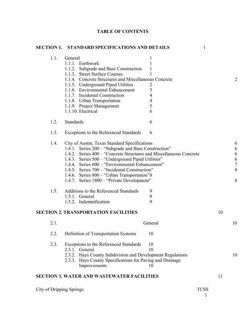
TABLE OF CONTENTS SECTION 1. STANDARD SPECIFICATIONS AND DETAILS 1
1.1. General 1 1.1.1. Earthwork 1 1.1.2. Subgrade and Base Construction 1 1.1.3. Street Surface Courses 1 1.1.4. Concrete Structures and Miscellaneous Concrete 2 1.1.5. Underground Piped Utilities 2 1.1.6. Environmental Enhancement 3 1.1.7. Incidental Construction 4 1.1.8. Urban Transportation 4 1.1.9. Project Management 5 1.1.10. Electrical 6
1.2. Standards 6
1.3. Exceptions to the Referenced Standards 6
1.4. City of Austin, Texas Standard Specifications 6 1.4.1. Series 200 – “Subgrade and Base Construction” 6 1.4.2. Series 400 – “Concrete Structures and Miscellaneous Concrete 6 1.4.3. Series 500 – “Underground Piped Utilities” 6 1.4.4. Series 600 – “Environmental Enhancement” 7 1.4.5. Series 700 – “Incidental Construction” 8 1.4.6. Series 800 – “Urban Transportation” 8 1.4.7. Series 1800 – “Private Development” 8
1.5. Additions to the Referenced Standards 9 1.5.1. General 9 1.5.2. Indemnification 9
SECTION 2. TRANSPORTATION FACILITIES 10
2.1. General 10 2.2. Definition of Transportation Systems 10 2.3. Exceptions to the Referenced Standards 10
2.3.1. General 10 2.3.2. Hays County Subdivision and Development Regulations 10 2.3.3. Hays County Specifications for Paving and Drainage
Improvements 10 SECTION 3. WATER AND WASTEWATER FACILITIES 11
City of Dripping Springs TCSS
2
3.1. General 11
3.2. Exceptions to the Referenced Standards 11
SECTION 4. DRAINAGE FACILITIES 12
4.1. General 12
4.2. Definition of Drainage Facilities and Systems 12 4.3. Exceptions to the Referenced Standards 12
4.3.1. General 12 4.3.2. City of Austin, Texas Drainage Criteria Manual 12 4.3.3. City of Austin, Texas Standard Specifications 13
SECTION 5. ENVIRONMENT 14 5.1. General 14 5.2. Definition of Environmental Facilities and Systems 14 5.3. Exceptions to the Referenced Standards 14
5.3.1. General 14 5.3.2. City of Austin, Texas Environmental Criteria Manual 14 5.3.3. City of Austin, Texas Standard Specifications 17 5.3.4. Calculation of the Impervious Cover allowance for Isolation of
Roof Runoff and Irrigation 17
SECTION 6. BUILDINGS 20
6.1. General 20
6.2. Exceptions to the Referenced Standards 20
SECTION 7. ENGINEERING SUBMITTALS 21
7.1. Licensed Engineer Requirements 21 7.1.1. General 21 7.1.2. “Issued for Review” 21 7.1.3. “Issued for Construction”, “Issued for Permitting”, “Issued for
Platting” 21 7.1.4. Licensed Engineer Sealed Documents 21
7.2. Content of Engineering Submittals 24 7.2.1. Non-Residential Building Plan Requirements 24 7.2.2. Drainage 24 7.2.3. Transportation 28 7.2.4. Utilities 33

City of Dripping Springs TCSS
3
7.2.5. Water Quality Management 40
SECTION 8. SITE PLAN REQUIREMENTS 46
8.1. Cover Sheet 46 8.2. Notes 46
8.3. Approval Blocks 46
8.4. Base Information 46
8.5. Additional Requirements 50
8.5.1. Compatibility Standards 50 8.5.2. Off-Site Parking 50
8.6. Drainage Plan 51 8.7. Construction Details 52
8.8. Environmental Site Plan and Report Submittal Information 53
8.9. Engineer’s Summary Letter 61
SECTION 9. DRAINAGE AND WATER QUALITY CONTROL DESIGN AND CONSTRUCTION ENVIRONMENT COMPATIBILITY REQUIREMENTS 63
9.1. General 63 9.2. Compatibility Design Standards 63
9.2.1. General 63 9.2.2. Drainage Control 63 9.2.3. Water Quality Controls 64
SECTION 10. NON-POINT SOURCE POLLUTION CONTROL MANAGEMENT PERFORMANCE STANDARDS 66
10.1. Removal of Annual Pollutant Load 66 10.1.1. For development not using on-site irrigation with treated
wastewater effluent 66 10.1.2. For development using on-site irrigation with treated wastewater
effluent or with septic system effluent 66 10.1.3. Background and Developed Sites Pollutant Concentrations and
Pollutant Loads 67 10.1.4. Water Quality Volume 67 10.1.5. Impervious Cover 67 10.1.6. Impervious Cover Allowances 68 10.1.7. Critical Water Quality Zones (CWQZ) 69

City of Dripping Springs TCSS
4
10.1.8. Critical Environmental Features (CEF) 69 10.1.9. Overlapping Critical Water Quality Zones 69
10.2. Impervious Cover 70
10.2.1. The following shall be considered as impervious cover 70 10.2.2. The following will not be considered as impervious cover 70 10.2.3. The following shall not be included in the total site area against
which the allowable impervious cover percentage limit is applied 70 10.2.4. Restrictions 71
10.3. Critical Water Quality Zones (CWQZ) 71
10.3.1. All development activities, including temporary construction activities and landscaping activities, shall be restricted from the CWQZ, except the following development activities may be allowed if approved by the City 71
10.3.2. All utilities, other than wastewater shall be located outside the CWQZ except for crossings 71
10.3.3. All water quality control discharges and stormwater discharges onto a CWQZ shall 71
10.4. Overland Flow 72
10.5. Infiltration 72
10.6. Steep Slopes 72
10.7. Vegetation 73
10.8. Water Quality Controls (WQC) 73
10.9. Erosion Control Requirements 75
10.10. Isolation of Roof Runoff and Irrigation 76
10.11. Erosion Hazard Setbacks 77
10.12. Non-Residential and Multi-Family Permanent Construction 77
10.13. Residential Lots with a Building Permit 77

City of Dripping Springs TCSS
5
SECTION 1. STANDARD SPECIFICATIONS AND DETAILS
1.1. General
These Standard Specifications and Details shall govern the following construction activities within the incorporated limits and the ETJ of the City of Dripping Springs.
1.1.1. Earthwork
(a) Preparing Right of Way (b) Clearing and Grubbing (c) Removing Concrete (d) Street Excavation (e) Excavation (f) Channel Excavation (g) Borrow (h) Embankment
1.1.2. Subgrade and Base Construction
(a) Subgrade Preparation (b) Hydrated Lime and Lime Slurry
(c) Lime Treatment for Materials In Place
(d) Portland Cement Treatment for Materials In Place
(e) Asphalt Stabilized Base
(f) Flexible Base
(g) Recycling Existing Aggregate
(h) Sprinkling for Dust Control
(i) Rolling (Flat Wheel)
(j) Rolling (Pneumatic Tire)
(k) Rolling (Tamping)
(l) Proof Rolling
(m) Termite Control

City of Dripping Springs TCSS
6
1.1.3. Street Surface Courses
(a) Asphalts, Oils and Emulsions
(b) Aggregates for Surface Treatments
(c) Prime Coat
(d) Tack Coat
(e) Emulsified Asphalt Treatment
(f) Emulsified Asphalt Repaving
(g) Seal Coat
(h) Rubber Asphalt Joint and Crack Sealant
(i) Milling Asphaltic Concrete Pavement and Non-Portland Cement Concrete Bases
(j) Polymerized Asphalt Interlayer Seal
(k) Two-Course Surface Treatment
(l) Hot Mix Asphaltic Concrete Pavement
(m) Paving Fabric
(n) Heating, Scarifying and Repaving
(o) Recycling Agent
(p) Concrete Pavement
(q) Concrete Pavers
(r) Concrete Pavers for Sidewalk Ramps
1.1.4. Concrete Structures and Miscellaneous Concrete
(a) Structural Excavation and Backfill
(b) Controlled Low Strength Material
(c) Concrete for Structures

City of Dripping Springs TCSS
7
(d) Pneumatically Placed Concrete
(e) Concrete Admixtures
(f) Reinforcing Steel
(g) Fibrous Concrete
(h) Concrete Joint Materials
(i) Membrane Curing
(j) Concrete Structures
(k) Surface Finishes for Concrete
(l) Concrete Retaining Walls
(m) Waterstops
(n) Drill Shaft Foundations
(o) Prestressed Concrete Planks
(p) Prestressed Concrete Structures
(q) Concrete Curb and Gutter
(r) Machine Laid Curb and Gutter
(s) Concrete Sidewalks
(t) Concrete Driveways
(u) Concrete Medians and Islands
(v) Concrete Steps
(w) Concrete Valley Gutters
(x) Elastomeric Materials
(y) Parking Lot Bumper Curbs
(z) Trash and Litter Coffins
(aa) Curb Cuts for Sidewalk Ramps and Driveways

City of Dripping Springs TCSS
8
1.1.5. Underground Piped Utilities
8. Jacking and Boring Pipe
9. Tunneling
10. Frames, Grates, Rings and Covers
11. Adjusting Structures
12. Concrete Encasement and Encasement Pipe
13. Manholes
14. Bulkheads
15. Miscellaneous Structures and Appurtenances
16. Trench Safety Systems
17. Pipe
18. Water Valves
19. Pipe Underdrains
20. Structural Plate Structures
21. Concrete Box Culverts
22. Riprap for Slope Protection
23. Concrete Retards
24. Gabians and Revet Mattresses
1.1.6. Environmental Enhancement
(a) Salvaging and Placing Topsoil
(b) Sodding for Erosion Control
(c) Seeding for Erosion Control
(d) Soil Retention Blanket
(e) Fertilizer

City of Dripping Springs TCSS
9
(f) Slopes Stabilization
(g) Planting
(h) Preservation of Trees and Other Vegetation
(i) Filter Fabric
(j) Diversion
(k) Diversion Dike
(l) Dry Stack Rock Wall
(m) Earth Outlet Sediment Trap
(n) Grade Stabilization Structure
(o) Grass-Lined Swale
(p) Grass-Lined Swale with Stone Center
(q) Sediment Containment Dikes
(r) Brush Berm Barrier for Erosion Control
(s) Interceptor Dike
(t) Interceptor Swale
(u) Storm Inlet Sediment Trap
(v) Land grading
(w) Level Spreader
(x) Perimeter Dike
(y) Perimeter Swale
(z) Pipe Slope Drain
(aa) Pipe Outlet Sediment Trap
(bb) Rock Berm
(cc) Mortared Rock Wall

City of Dripping Springs TCSS
10
(dd) Stabilized Construction Entrance
(ee) Silt Fence
(ff) Stone Outlet Structure
(gg) Stone Outlet Sediment Trap
(hh) Tied Precast Concrete Revetment
1.1.7. Incidental Construction
(a) Mobilization
(b) Fencing
(c) Removing and Relocating Existing Fences
(d) Fencing for Excavations
(e) Metal Beam Guard Railing
(f) Removing and Relocating Existing Metal Beam Guard Railing
(g) Bridge and Culvert Railing
(h) Metal for Structures
(i) Steel Structures
(j) Paint and Painting
(k) Structural Welding
(l) Survey Markers
1.1.8. Urban Transportation
(a) Construction Detours
(b) Capital Improvement Project Signs
(c) Barricades, Signs and Traffic Handling
(d) Traffic Signs
(e) Street Name Signs
City of Dripping Springs TCSS
11
(f) Pull Boxes
(g) Ducts
(h) Pavement Marking Paint
(i) Thermoplastic Pavement Markings
(j) Temporary Removable Pavement Markings
(k) Reflectorized Pavement Markers
(l) Abbreviated Pavement Markings
(m) Non-Reflectorized Traffic Buttons
(n) Jiggle Bar Tile
(o) Epoxy Adhesive
(p) Work Zone Pavement Markings
(q) Reflectorized Pavement Markings
(r) Prefabricated Pavement Markings
(s) Raised Pavement Markings
(t) Eliminating Existing Pavement Markings and Markers
(u) Pavement Surface Preparation for Markings
1.1.9. Project Management
(a) The Owner/Developer - Engineer Relationship
(b) The Owner/Developer's Duty and Superintendence
(c) Authority and Duties of the Inspector
(d) Pre-Construction Conference
(e) On-Site Pre-Construction Meeting
(f) Communications
(g) Inspection Notifications

City of Dripping Springs TCSS
12
(h) Lines and Grades
(i) Construction Drawings
(j) Shop Drawings and Submittals
(k) Preliminary Approval
(l) Defects and Their Remedies
(m) Initial Determinations
(n) Objections
(o) Keeping Construction Documents Accessible
(p) Adequacy of Design and Construction
(q) Materials and Workmanship
(r) Testing of Materials
(s) Sidewalks Variance
(t) License Agreements
(u) Street Signs
(v) Laws and Ordinances
(w) Watershed Violations
(x) Protection and Preservation of Primitive Rights and Antiquities
(y) General Environmental Protection
(z) Force Majeure
(aa) Safety Precautions and Programs
(bb) Safety of Persons and Property
(cc) Protection of Adjoining Property
(dd) Public Safety and Convenience

City of Dripping Springs TCSS
13
(ee) Location and Protection of Utilities
(ff) Public Right Of Way Cut Permits
(gg) Cuts in Unaccepted Public Right of Way
(hh) Substantial Completion
(ii) Final Inspection
(jj) Acceptance by the City of Dripping Springs
(kk) Guarantee Against Defective Work
(ll) Warranty Bond
(mm) Warranty Bond Release
(nn) Venue
(oo) Cumulative Remedies
(pp) Severability
1.1.10. Electrical
(a) Wiring
(b) Light Standard Foundations
1.2. Standards
The construction of improvements listed in Section 1.1. shall comply with the following standards, which are incorporated herein by references and which are modified herein:
City of Austin, Texas Standard Specifications, latest edition. City of Austin, Texas Standard Details, latest edition.
1.3. Exceptions to the Referenced Standards
The following exceptions shall apply to the referenced standards. All provisions and standards of the City of Dripping Springs Code of Ordinances shall be applicable and shall govern if there is a conflict with the Standards referenced in Section 1.1. above.

City of Dripping Springs TCSS
14
1.4. City of Austin Texas Standard Specifications
9. Series 200 - "Subgrade and Base Construction"
(a) Item 201 S “Subgrade Preparation”
(1) Section 201 S.2 “Construction Methods”. All testing shall be performed by an independent testing laboratory acceptable to the City, and provided and paid for by the owner.
10. Series 400 - "Concrete Structures and Miscellaneous Concrete
(a) Item 410. "Concrete Structures"
(1) Section 410.2 "Materials", Subsection 410.21 "Placing Survey Monuments". Owner's contractor shall provide and install all survey monuments at the owner's expense.
11. Series 500 - Underground Piped Utilities
(a) Item 502 "Tunneling"
(1) Section 502.4 "Construction Methods", Subsection (3). Blasting shall not be allowed within the jurisdictional boundaries of the City without the expressed, written consent of the City Council.
(b) Item 510 “Pipe”
(1) Section 510.3 (24) "Water System Connection"
i. Owner's contractor shall be responsible for timely scheduling of connections to the water system.
ii. The City will not make the pressure tap.
iii. During the pressure tap, an inspector from the provider of the water or wastewater utility system shall be present during the entire tap operation. The owner's contractor shall be responsible for the timely coordination and modifications.

City of Dripping Springs TCSS
15
(2) Section 510.3 (26) "Quality Testing for Installed Pipe"
i. Wastewater pipe installed within the
jurisdictional boundaries of the City of Dripping Springs shall be tested by the owner for exfiltration or infiltration, as described in this section.
ii. The provisions required for testing within the Edwards Aquifer Recharge Zone or Edwards Aquifer Contributing Zone shall also apply to all improvements within the jurisdictional boundaries of the City of Dripping Springs.
(3) Section 510.3 (27) “Pressure Pipe Hydrostatic
Testing”. Owner's contractor shall perform all pressure testing and leakage testing.
(4) Section 510.3 (28) "Service Charges for Testing".
This section does not apply.
(5) Section 510.3 (29) "Disinfection of Potable Water Lines". Owner's contractor shall perform all disinfection work and testing, subject to the approval of the owner/operator of the water system.
12. Series 600 - Environmental Enhancement
(a) Item 602S "Sodding for Erosion Control".
(1) Section 602S.3 "Materials". Type (s) of grasses
shall also comply with the provisions of the City of Dripping Springs Code of Ordinances for landscaping.
(2) Section 604S.4 "Construction Methods". Native Grass seeding shall be required.
(b) Item 6065 "Fertilizer". Fertilizer shall also comply with the
provisions of the City of Dripping Springs Code of Ordinances for landscaping.
(c) Item 608 "Planting". Planting shall also comply with the provisions of the City of Dripping Springs Code of Ordinances for landscaping.
13. Series 700 - "Incidental Construction"

City of Dripping Springs TCSS
16
(a) Item 725 "Survey Markers". The owner's contractor shall provide and install all survey markers at the owner's expense.
14. Series 800 - "Urban Transportation"
(a) Item 802 "Capital Improvement Project Signs". All CIP projects within the jurisdictional boundaries of the City of Dripping Springs shall provide signs in accordance with this item.
(b) Item 825 "Street Name Signs". Street name signs shall also comply with the provisions of the City of Dripping Springs Code of Ordinances for signs.
15. Series 1800 - "Private Development"
(a) Section 1802S "Definition of Terms".
9. "The City" or "The City of Austin" shall be construed to mean the City of Dripping Springs.
10. "The Director" shall be construed to mean the City Administrator or his/her duly authorized representative.
11. "The Construction Engineer" shall be construed to mean the City Engineer or his/her duly authorized representative.
12. "The Development Permit" shall be construed to mean the Site Development Permit or the Building Permit.
13. "The Managing Department" shall be construed to mean the City Administrator or his/her duly authorized representative.
14. "The Inspector" shall be construed to mean the City Inspector or his/her duly authorized representative.
(b) Section 1803S.9 "Construction Drawings". The second
paragraph does not apply. (c) Section 1803S.14 "Objections". This section does not apply. (d) Section 1804S.4 "Testing of Materials". All testing shall be
performed by an independent certified testing laboratory, approved by the City, and provided and paid for by the owner.
(e) Section 1804S.7 "Street Signs". Owner/developer shall provide
and install all signs. (f) Section 1804S.10 "Contractor's License". This section does not
apply.

City of Dripping Springs TCSS
17
(g) Section 1805S.5 "Location and Protection of Utilities". The second paragraph does not apply.
(h) Section 1805S.6 "Public Right of Way Cut Permits". The
second paragraph does not apply.
1.5. Additions to the Referenced Standards
1.5.1. General
The following provisions shall be added to the referenced standards.
1.5.2. Indemnification
Neither the City nor its agents, employees or consultants shall be responsible for the means, methods, techniques, sequences or procedures of construction selected by the owner or the owner's contractor, or any safety precautions and programs relating in any way to the condition of the premises, the work of the owner's contractor or any subcontractor.
Neither the City nor its agents, employees or consultants shall be responsible for the acts of omissions of any person (except its own employees or agents or consultants) at the Project site or otherwise performing any of the work of the Project.

City of Dripping Springs TCSS
18
SECTION 2. TRANSPORTATION FACILITIES
2.1. General
The design and construction of transportation facilities and systems within the incorporated limits and the ETJ of the City shall comply with the following standards, which are incorporated herein by reference and which are modified herein:
Hays County Subdivision and Development Regulations, latest version. Hays County Specifications for Paving and Drainage Improvements.
2.2. Definition of Transportation Systems
Transportation systems shall include streets, traffic impact analysis, pavement design, sidewalks and curb ramps, driveways, clear zones and guard fences, bikeways, traffic control and parking lot layouts.
2.3. Exceptions to the Referenced Standards
2.3.1. General
(a) The following exceptions shall apply to the referenced
standards. (b) All references to Hays County shall be construed to mean the
City of Dripping Springs. (c) All provisions and standards of the City of Dripping Springs
Code of Ordinances shall be applicable and shall govern if there is a conflict with the standards referenced in Section 2.1.0.
2.3.2. Hays County Subdivision and Development Regulations
The road standards for the City of Dripping Springs, TX will be governed by Table 7.3, Summary of Hays County Road Standards.
2.3.3. Hays County Specifications for Paving and Drainage Improvements
(a) The road construction specifications for the City of Dripping
Springs, TX will be governed by Hays County Specifications for Paving and Drainage Improvements.
(b) Engineers are encouraged to utilize City of Austin Standards
for construction specifications and details not found in the Hays County Specifications.

City of Dripping Springs TCSS
19
SECTION 3. WATER AND WASTEWATER FACILITIES
3.1. General
The design and construction of water and wastewater facilities (not including On-Site Sewage Facilities) within the incorporated limits and the ETJ of the City of Dripping Springs shall comply with the service provider requirements. The design and construction of On-Site Sewage Facilities (OSSF) within the incorporated limits and the ETJ of the City of Dripping Springs, shall utilize the following standards, which are incorporated herein by reference and which are modified herein: Order Adopting Rules of Hays County, Texas for On-Site Sewage Facilities.
The Rules ("Design Criteria for On-Site Sewage Facilities," Texas Administrative Code 30 TAC 285.1-285.91) promulgated by the Texas Commission on Environmental Quality for on-site sewage systems.
3.2. Exceptions to the Referenced Standards
All references to Hays County shall be construed to mean the City of Dripping Springs. All provisions and standards of the City of Dripping Springs Code of Ordinances shall be applicable and shall govern if there is a conflict with the standards referenced in Section 3.1.
City of Dripping Springs TCSS
20
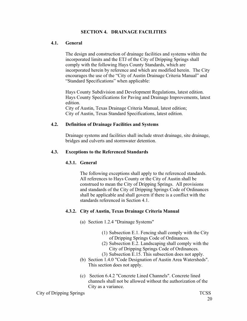
SECTION 4. DRAINAGE FACILITIES
4.1. General
The design and construction of drainage facilities and systems within the incorporated limits and the ETJ of the City of Dripping Springs shall comply with the following Hays County Standards, which are incorporated herein by reference and which are modified herein. The City encourages the use of the “City of Austin Drainage Criteria Manual” and “Standard Specifications” when applicable:
Hays County Subdivision and Development Regulations, latest edition. Hays County Specifications for Paving and Drainage Improvements, latest edition. City of Austin, Texas Drainage Criteria Manual, latest edition; City of Austin, Texas Standard Specifications, latest edition.
4.2. Definition of Drainage Facilities and Systems
Drainage systems and facilities shall include street drainage, site drainage, bridges and culverts and stormwater detention.
4.3. Exceptions to the Referenced Standards
4.3.1. General
The following exceptions shall apply to the referenced standards. All references to Hays County or the City of Austin shall be construed to mean the City of Dripping Springs. All provisions and standards of the City of Dripping Springs Code of Ordinances shall be applicable and shall govern if there is a conflict with the standards referenced in Section 4.1.
4.3.2. City of Austin, Texas Drainage Criteria Manual
(a) Section 1.2.4 "Drainage Systems"
(1) Subsection E.1. Fencing shall comply with the City of Dripping Springs Code of Ordinances.
(2) Subsection E.2. Landscaping shall comply with the City of Dripping Springs Code of Ordinances.
(3) Subsection E.15. This subsection does not apply. (b) Section 1.4.0 "Code Designation of Austin Area Watersheds".
This section does not apply. (c) Section 6.4.2 "Concrete Lined Channels". Concrete lined
channels shall not be allowed without the authorization of the City as a variance.

City of Dripping Springs TCSS
21
(d) Section 8.2.0 "Regional Stormwater Management Program".
This section does not apply. (e) Section8.3.4 "Safety Criteria for SWM Ponds".
(1) In addition to the criteria given in this section, SWM ponds shall also comply with all applicable dam safety standards of the Texas Commission on Environmental Quality.
(2) Subsection H. Discharges shall be conveyed in open channels, changing from concentrated to sheet flow as quickly as possible.
(f) Appendix D. "Regional Stormwater Management Participation
Fees". This appendix does not apply.
4.3.3. City of Austin, Texas Standard Specifications
The exceptions to the City of Austin's standard specifications with respect to drainage facilities and systems are given in Section 1 of this TCSS Manual.

City of Dripping Springs TCSS
22
SECTION 5. ENVIRONMENT
5.1. General
The environmental assessments and the design and construction of environmental facilities and systems within the incorporated limits and the ETJ of the City of Dripping Springs shall comply with the following standards, which are incorporated herein by reference and which are modified herein:
City of Austin, Texas Environmental Criteria Manual, Section 1 "Water Quality Management", latest edition; City of Austin, Texas Standard Specifications, latest edition;
5.2. Definition of Environmental Facilities and Systems
Environmental facilities and systems shall include environmental assessments, water quality controls, temporary erosion and sedimentation controls, permanent erosion and sedimentation controls, and on-site irrigation with wastewater effluent.
5.3. Exceptions to the Referenced Standards
10.3.4. General
(a) The following exceptions shall apply to the referenced standards.
(b) All references to the City of Austin shall be construed to mean
the City of Dripping Springs. (c) All provisions and standards of the City of Dripping Springs
Code of Ordinances shall be applicable and shall govern if there is a conflict with the standards referenced in Section 5.1.
10.3.5. City of Austin, Texas Environmental Criteria Manual, Section
1.
(a) Section 1.2.1 "Fiscal Security". Fiscal security shall be determined by the owner's consulting engineer in accordance with Subsection (c).
(b) Section 1.2.3.1. "Submittal Requirements for Projects in the
Barton Springs Zone". This section does not apply. (c) Subsection A, “Application of SOS Ordinance”. This
Subsection does not apply.

City of Dripping Springs TCSS
23
(d) Section 1.2.3.2. "General Rules" (1) Subsection G. "Operating Permits"
i) Annual operating permits shall be required
for all water quality controls. ii) "Commercial" shall be construed to mean
"non-residential". iii) The City will not operate or maintain water
quality controls.
(e) Section 1.2.3.3. "Site Management". This section does not apply.
(f) Section 1.4.1.1. "City of Austin Erosion and Sediment Control
Policy".
(1) Subsection D. "Ordinance Authority". This section does not apply.
(g) Section 1.4.4 "Vegetative Practice". Vegetative types for
erosion and sedimentation control shall comply with the City of Dripping Springs Code of Ordinances.
(h) Section 1.5.0 "Revegetation Criteria". Revegetation types shall
comply with the City of Dripping Springs Code of Ordinances. (i) Section 1.6.0 "Design Guidelines for Water Quality Controls".
(1) Section 1.6.1. "Introduction". "Commercial" shall
be construed to mean "non-residential" (2) Section 1.6.3. "Maintenance and Construction
Responsibilities".
i) Subsection A. "Maintenance Responsibilities". Owner/developer shall maintain all water quality controls.
ii) Subsection B. "Maintenance Design Requirements".
Fencing and barriers shall comply with the City of Dripping Springs Code of Ordinances.
(3) Section 1.6.8 "Rules to Implement On-Site Control of the Two-Year Storm ". All development shall be subject to the two-year storm runoff control requirements of this section.

City of Dripping Springs TCSS
24
(4) Section 1.6.9.2 "Pollution Prevention Measures".
i) Subsection B through Subsection F.
These subsections do not apply. (5) Section 1.6.9.3 "Control Measure Design".
i) Subsection A. "Baseline Pollutant Load
Calculations". Baseline pollutant loads shall be calculated for all areas which are to be developed for the pollutants listed in the City of Dripping Springs Code of Ordinances.
(6) Table 1-9 "Runoff Coefficient Table". The runoff
values for the "NonRecharge Zone Runoff' shall be used.
(7) Table 1-10 "Baseline Pollutant Concentrations and
Unit Area Loads for Undeveloped Sites". Oil and Grease pollutant concentrations shall be added to Table 1-10 and shall be 0 mg/l.
(8) Table 1-11 "Standard Pollutant Concentrations for
Developed Sites".
i) "Commercial" shall be construed to mean `non-residential".
ii) Oil and Grease pollutant concentration shall be added to Table 111 and shall be 5 mg/1 for all conditions. The load calculation for oil and grease under developed conditions shall represent only the paved surfaces of the development and is not required to include rooftops.
(j) Section 1.7.0 "Floodplain Modification Criteria".
(1) Section 1.7.1 "Introduction". These guidelines apply only to development proposed in a floodplain or in a critical water quality zone.
(2) Section 1.7.3 "Application of Guidelines". These
guidelines apply to the development of all floodplains and critical water quality zones located within the jurisdictional boundaries of the City.

City of Dripping Springs TCSS
25
(3) Section 1.7.4 "Appeals". This section does not apply.
(k) Section 1.8.0. "Impervious Cover Calculation Criteria".
(1) Section 1.8.1 "Calculations"
i) Subsection A. Impervious cover calculations shall include all swimming pool surface areas and sidewalks.
ii) Subsection D. Maximum pavement width for imperious cover calculations shall be 30 feet.
iii) Subsection E. Maximum pavement width for impervious cover calculation shall be 30 feet.
(2) Section 1.8.2. "Construction on Slopes"
i) Subsection A. This subsection does not apply. ii) Subsection B.
Building and parking areas may be constructed on slopes in excess of 15 percent, subject to the requirements of Subsection B.2 through B.6.
Subsection B.1. This subsection does not apply.
Subsection B.2. This subsection applies to development on slopes in excess of 15 percent.
Subsection B.3. This subsection applies to development on slopes in excess of 15 percent.
(l) Section 1.9.0 "Need for Water Quality Controls". This section does not apply.
(m) Section 1.10.0 "Point Recharge Identification Criteria". This
section does not apply.
10.3.6. City of Austin, Texas Standard Specifications.
The exceptions of the City of Austin's Standard Specifications with respect to environmental controls are given in Section 1.00 of this TCSS Manual.
10.3.7. Calculation of the Impervious Cover Allowance for Isolation of Roof Runoff and Irrigation
(a) General

City of Dripping Springs TCSS
26
This section provides guidelines and example calculations for determining the impervious cover allowance if roof runoff is isolated, treated as a water quality control, and used for on-site irrigation.
(b) Guidelines and Example Calculations
(1) Example:
i) Non-residential development ii) 3-acres lot (130,680 square feet) iii) Roof area of 40,000 square feet iv) Requesting total impervious cover of 58,000
square feet (44.4% impervious cover) v) Requesting the use of isolation and treatment
and irrigation of roof runoff for the 40,000 \ square feet of roof area.
(2) Calculate the background TSS pollutant load for the
roof area.
i) Roof area = 40,000 ft2 = 0.9183 acres ii) TSS background pollutant load = 55 x 0.049 x
32.5 x 0.2267 x 0.9183 = 18.23 lbs/yr
(3) Calculate the total TSS pollutant load for the roof area. Example:
2. TSS total pollutant load = 110 x 0.248 x 32.5 x
0.2267 x 0.9183 = 184.57 lbs/yr
(4) Calculate the 95% TSS pollutant removal requirement.
i) TSS pollutant caused by development = 184.57
-18.23 = 166.34 ii) 95% removal = 0.95 x 166.34 = 158.03 lbs/yr
(5) Compare the 95% removal requirement against the pollutant removal capacity of the rainwater collection/irrigation system:
i) 1. If the capacity of the proposed system does
not exceed the 95% removal requirement, then zero impervious cover allowance is allowable.
ii) 2. If the capacity of the proposed system exceeds the 95% removal requirement, then

City of Dripping Springs TCSS
27
proceed with the following calculations to determine the allowable allowance.
Example: In this case the capacity of the proposed system is being calculated, which will then be used in selection of the appropriate system that meets the capacity requirement.
(6) Calculate the allowable pollutant removal capacity of the system, which will be the lesser value of the following:
i) 1. Rated pollutant removal capacity of the
proposed system minus the 95% removal requirement; or
ii) 2. Baseline pollutant load plus 5% of the TSS pollutant load caused by development.
Example: The system capacity to be selected must at least be capable of removing the baseline pollutant load plus 5% of the TSS pollutant load caused by development.
Minimum System Capacity = 18.23 + (0.05 x 166.34) = 26.55 lbs/yr
(7) Calculate the developed impervious surface area that would contribute a TSS pollutant load equivalent to the minimum system capacity.
Example: 26.55 = 110 x 0.248 x 32.5 x 0.2267 x area
area= 0.1321 acres= 5,754 ft2
(8) Calculate the impervious cover allowance, which will be the lesser of: i) The equivalent impervious surface area times
50%; or ii) Site area times 5%.
Example:
Equivalent impervious surface area times 50%
0.50 x 5,754 ft2 = 2,877 ft2
Site area times 5%
0.05 x 130,680 ft2 = 6,534 ft2

City of Dripping Springs TCSS
28
Maximum allowable increase in impervious cover = 2,877 ft2

City of Dripping Springs TCSS
29
SECTION 6. BUILDINGS
6.1. General
Building construction within the incorporated limits of the City and within its ETJ, as applicable, shall comply with the following standards, which are incorporated herein by reference and which are modified herein:
International Building Code, International Conference of Building Officials, latest edition.
International Fire Code, International Conference of Building Officials, latest edition.
International Residential Code, International Conference of Building Officials, latest edition.
International Mechanical Code, International Conference of Building Officials, latest edition.
International Plumbing Code, International Conference of Building Officials, latest edition.
ICC Electrical Code, International Conference of Building Officials, latest edition.
National Electrical Code, NFPA, latest edition.
6.2. Exceptions to the Referenced Standards
All provisions and standards of the City of Dripping Springs Code of Ordinances shall be applicable and shall govern if there is a conflict with the standards referenced in Section 6.1.

City of Dripping Springs TCSS
30
SECTION 7. ENGINEERING SUBMITTALS
7.1. Licensed Engineer Requirements
7.1.1. General
(a) All engineering plans, documents, specifications and reports which are required as a condition of the City's review and approval shall be prepared in accordance with the Texas Engineering Practice Act and Rules Concerning the Practice of Engineering and Professional Engineering Licensure.
(b) The City Administrator or City Engineer may waive any items
listed in this section for any submittal.
7.1.2. "Issued for Review"
All engineering plans, documents, specifications and reports submitted for the City's review shall identify the purpose of the engineering document and shall be labeled as "Issued for Review" and shall contain the licensed engineer's preliminary seal, in accordance with the requirements of the Texas Engineering Practice Act.
7.1.3. "Issued for Construction", "Issued for Permitting", "Issued for Platting".
All engineering plans, documents, specifications and reports which have undergone review by the City and have been modified or corrected by the applicant's licensed engineer, shall be resubmitted to the City in its final form, labeled with the appropriate use for which the documents are being released and shall contain the final seal of the licensed engineer, in accordance with the requirements of the Texas Engineering Practice Act.
7.1.4. Licensed Engineer Sealed Documents
The following documents shall be sealed by a licensed engineer:
(a) Buildings
(1) Building plans and specifications for work performed in any building or portion thereof in excess of 5000 square feet, except plans and specifications are not required to be sealed for construction of or modifications to a single family dwelling;

City of Dripping Springs TCSS
31
(2) Repair or replacement of stairways when structural elements or fire restrictive assemblies are affected by the stairway construction or when the building construction is required to be designed by a licensed engineer;
(3) Installation plans and specifications of roof trusses; (4) Building plans and specifications of roof drainage
systems when the building construction is required to be designed by a licensed engineer;
(5) Building plans and specifications of guard rails
when the building construction is required to be designed by a licensed engineer;
(6) All building plans and specifications required to be
sealed in compliance with the Americans with Disabilities Act.
(b) Drainage
(1) Engineering reports of analyses, assessments and designs of: i) Drainage computations and storm flow analysis, ii) Delineations of the fully developed floodplain, iii) Street drainage design analysis, iv) Storm inlet design analysis, v) Storm drain design analysis, vi) Open channel design analysis, vii) Culvert and bridge design analysis, viii) Stormwater management pond design
analysis, ix) Stormwater management pond maintenance
requirements. x) Roof runoff collection systems.
(2) Building and site development plans and specifications for:
i) Street drainage, ii) Storm inlets, iii) Storm drains, iv) Open channels, v) Culverts and bridges, vi) Stormwater management ponds, vii) Stormwater management pond maintenance
requirements. viii) Roof runoff collection systems.

City of Dripping Springs TCSS
32
(3) Engineering documents as part of submitted
requirements for:
i) Application for Conditional Letter of Map Revision (CLOMR) or for Conditional Letter of Map Amendment (CLOMA),
ii) Application for Section 404 Permit.
(c) Water Quality Management (1) Engineering reports of analyses, assessments and
designs of
i) Opinion of probable construction cost for fiscal security,
ii) Water Quality Control Plan and Engineering Report,
iii) Maintenance plans for water quality controls, iv) Water quality control phasing plan, v) Erosion and Sedimentation Control Engineering
Report, vi) Water quality controls design analysis, vii) Land application of treated wastewater effluent
design analysis, viii) Roof runoff collection and treatment
systems.
(2) Building and Site Development Plans and Specifications for:
i) Water quality controls, ii) Maintenance requirements for water quality
controls, iii) Erosion and sedimentation controls, d) Re-
vegetation, iv) Land application of treated wastewater effluent. v) Roof runoff collection and treatment systems.
(3) Engineering documents as part of submittal requirements for:
i) Application for NPS Pollution Control Permit, ii) Application for NPS Pollution Control Annual
Operating Permit
(d) Transportation

City of Dripping Springs TCSS
33
(1) Engineering reports of analyses, assessments and design of
6. Traffic Impact Analysis and Parking Analysis, 7. Pavement design analysis, 8. Geometric layout of streets, parking lots,
driveways, ramps, sidewalks, bicycle paths, 9. Traffic control analysis.
(2) Building and Site Development Plans and Specifications for:
i) Pavement, ii) Curbs and ramps, iii) Driveways within right-of-ways, iv) Streets, parking lots, clear zones, driveways,
bikeways, ramps, v) Traffic control analysis.
(3) Engineering documents as part of submittal requirements for:
i) Application for TXDOT approval of
construction within its right-of-way, ii) Application for Hays County approval by
construction within its right-of-way, iii) Application for City of Dripping Springs
approval of construction within its right-of-way, iv) Application for street cut permit.
7.2. Content of Engineering Submittals
7.2.1. Non-Residential Building Plan Requirements
(a) Complete construction plans including:
(1) Structural; (2) Architectural; (3) Mechanical; (4) Electrical; (5) Plumbing; (6) Utility site plan;

City of Dripping Springs TCSS
34
(7) Civil site plan; (8) Fire safety improvements; (9) Underground storage tanks and dispensers.
(b) Building specifications (c) Energy calculations (d) Water and wastewater tap approval (e) Health department approval (f) Industrial waste approval
7.2.2. Drainage
(a) CLOMR or CLOMA: (1) The Federal Emergency Management Agency
(FEMA) maintains Flood Insurance Rate Maps (FIRM's) that depict floodplain and floodway boundaries. The floodplain and floodway boundaries depicted on FIRM's are based on existing conditions of development in the contributing area.
(2) FEMA reviews and approves or denies all revisions
or amendments to FIRM's. FEMA revises or amends FIRM's by approval of a Letter of Map Amendment or Letter of Map Revision. These documents are referred to collectively as a Letter of Map Change (LOMC). FEMA establishes the process and fees necessary for review of an application for a LOMC.
(3) FEMA reviews the impact of proposed site
developments and offers or denies conditional assurance that a FIRM may be changed by the proposed development. FEMA offers this assurance by a Conditional Letter of Map Amendment (CLOMA) or Conditional Letter of Map Revision (CLOMR). These documents are referred to collectively as a Conditional Letter of Map Change (CLOMC). The CLOMC is a conditional statement that the FIRM may be changed if (1) the development is constructed as proposed in the CLOMC application, and if (2) a

City of Dripping Springs TCSS
35
complete LOMC is submitted after construction of the proposed development.
(b) Stormflow Analysis - Provide documentation of conformance
with the standards for:
(1) Fully developed watershed conditions; (2) Flow reduction benefits of upstream detention
ponds; (3) Method of stormflow analysis; (4) Rainfall and runoff parameters and coefficients; (5) Drainage area delineations; (6) Peak flow calculations.
(c) Street flow Analysis - Provide documentation of conformance with the standards for:
3. 25-year and 100-year peak flows and velocities
analyses; 4. Delineation of ponding areas; 5. Street cross flow calculations; 6. Flow through intersections; 7. Spread of water in gutters and right-of-ways;
(d) Inlets - Provide documentation of conformance with the standards for:
(1) Storm inlet hydraulic capacity; (2) Storm inlet hydraulic head; (3) Inlet system layout.
(e) Storm Drains - Provide documentation of conformance with the standards for:
(1) 25-year and 100-year peak flows and velocities
analyses;

City of Dripping Springs TCSS
36
(2) Culvert pipe, junction and outlet sizing analyses; (3) Hydraulic gradient and velocities.
(f) Open Channels - Provide documentation of conformance with the standards for:
(1) Uniform flow calculations; (2) Gradually varied flow calculations; (3) Rapidly varied flow calculations; (4) Manning's roughness coefficients; (5) Design for channels, including velocity, roughness
coefficient, slope, side slopes, curvature, bottom width, and freeboard;
(6) Design analysis for channel drop structure including
approach configuration, chute configuration, and downstream apron configuration;
(7) Design analysis for energy dissipators, (8) Meanders.
(g) Culverts - Provide documentation of conformance with the standards for:
(1) Design analysis for entrance conditions; (2) Discharge velocities analysis; (3) Selection of culvert size and flow classification,
including inlet control conditions, outlet control conditions;
(4) Headwater conditions; (5) Tailwater conditions; (6) Type of flow for bridge design; (7) Hydraulic conditions for bridge design; (8) Selection of bridge size.

City of Dripping Springs TCSS
37
(h) Stormwater Management Ponds - Provide documentation of conformance with the standards for:
(1) 2-, 10-, 25-year and 100-year storm runoff analysis
for: pre-developed and post development conditions;
(2) Dam safety analysis as required by the TCEQ; (3) Hydrograph routing, peak velocity calculations, and
peak pond level calculations; (4) Outlet structure design analysis; (5) Detention storage calculations.
(i) Stormwater Management Concept Plan - The Concept Plan for drainage shall show the following:
(1) Project name and address; (2) Vicinity map; (3) Site Boundary
(4) General Site Layout; (5) Existing and proposed drainage area boundaries for
all discharge points from the site; (6) Discharges and velocities at each discharge point
for the 2-, 10-, 25- and 100-year storm events for existing and ultimate development conditions;
(7) Existing and developed land use; (8) Existing and developed time of concentration flow
paths; (9) SCS soil types and hydrologic soil groups; (10) Proposed drainage and stormwater
management improvements; (11) Calculations demonstrating the adequacy of
the intervening system to convey the fully developed 100-year storm from the entire drainage area;

City of Dripping Springs TCSS
38
(12) All backup calculations and summaries of the computer models.
7.2.3. Transportation
10.1.10. Geometric Design Criteria - Provide documentation of conformance with the standards for:
(1) Grades; (2) Vertical alignment; (3) Vertical curves; (4) Horizontal radii; (5) Intersection design, including vertical alignment,
horizontal alignment, radii, centerline offsets; (6) Drainage structures; (7) Sight distance; (8) Median and median breaks; (9) Tapers; (10) Turn lanes and channelization; (11) Environmental considerations, including
setbacks and water quality controls. 10.1.11. Classification Design Criteria - Provide
documentation of conformance with the standards for:
(1) Identification of functional characteristics; (2) Identification of ROW widths; paving sections;
design speed; typical length of street; typical spacing of cross streets; minimum centerline radius.
10.1.12. Traffic Impact Analysis (TIA) - Provide
documentation of conformance with the standard for:
(1) Determination of the study area of the TIA;
i) Study area, ii) Target year for project build-out.

City of Dripping Springs TCSS
39
(2) Trip Generation
i) Proposed land use or zoning category for each tract,
ii) Generation rates based on proposed land use intensity (if known) or most intense use permitted for daily and peak hour.
(3) Trip Distribution
i) Percentages for directional distribution, ii) Sources of information.
(4) Traffic Assignment
i) Roadway network in the study area, ii) Access points and driveways.
(5) Traffic Forecast
i) Existing 24-hour peak traffic, including copies of field data,
ii) Assumptions on annual growth rate or other source of future background traffic at time of build-out.
(6) Capacity Analysis for Street Intersections
i) Intersection/roadway geometry (existing and proposed),
ii) Traffic control (signalized or unsignalized), iii) Traffic characteristics (turn movements, percent
trucks),
(7) Traffic Impact Assessment i) Impacts expressed in quantitative terms, ii) Adverse impacts which cannot be avoided, iii) Transit issues (if applicable).
(8) Recommendations
i) Roadway improvements, ii) Traffic operation modifications, iii) Limitation of land use intensity.
(9) Certification Statements
City of Dripping Springs TCSS
40
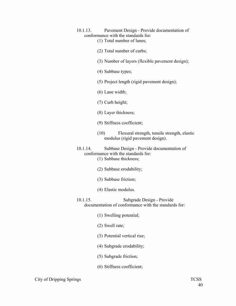
10.1.13. Pavement Design - Provide documentation of conformance with the standards for:
(1) Total number of lanes; (2) Total number of curbs; (3) Number of layers (flexible pavement design);
(4) Subbase types; (5) Project length (rigid pavement design); (6) Lane width; (7) Curb height; (8) Layer thickness; (9) Stiffness coefficient; (10) Flexural strength, tensile strength, elastic
modulus (rigid pavement design).
10.1.14. Subbase Design - Provide documentation of conformance with the standards for:
(1) Subbase thickness; (2) Subbase erodability; (3) Subbase friction; (4) Elastic modulus.
10.1.15. Subgrade Design - Provide documentation of conformance with the standards for:
(1) Swelling potential; (2) Swell rate; (3) Potential vertical rise; (4) Subgrade erodability;
(5) Subgrade friction; (6) Stiffness coefficient;
City of Dripping Springs TCSS
41
(7) Subgrade k-value
10.1.16. Clear Zone Design - Provide documentation of conformance with the standards for:
(1) Definition of design speeds;
(2) Definition of required setbacks;
(3) Landscaping placement within medians;
(4) Line of sight at intersections;
10.1.17. Bikeway Design - Provide documentation of conformance with the standards for:
(1) Design speed;
(2) Curvature design;
(3) Grade design;
(4) Ramps detail;
(5) Intersections and crossings details;
(6) Drainage grates details.
10.1.18. Application for Street Cut Permit
(1) Traffic Control Plan
10.1.19. Application for Temporary Use of Right-of-Way
(1) Traffic Control Plan
10.1.20. Traffic Control Plan - Provide documentation of conformance with the standards for:
(1) Activity location, right-of-way and curb lines of the
street sought to be closed or blocked; (2) Areas of the street to be closed or blocked;
(3) Proposed detour routes;
(4) Location and type of all barricades, signals, signs, cones and other warning devices;

City of Dripping Springs TCSS
42
(5) The times of the day and total number of days the
street will be blocked; (6) Property access for public, private and emergency
traffic;
(7) Trench coverings.
10.1.21. Parking Lot Design: Provide documentation of conformance with standards for:
(1) Parking space ratio and total required parking;
(2) Parking space layout, including angle of parking (degrees); width of stall; depth of stall 90 degrees to aisle; width of aisle; width of stall parallel to aisle; module width;
(3) Layout of overall parking lot; circulation corridors
and aisles; end islands; entrance drives; loading spaces;
(4) Turning zones;
(5) Handicapped parking;
(6) Vertical clearances;
(7) Fire zones;
(8) Pavement design for parking, loading, aisles, solid waste storage, and driveways;
(9) Safety barriers;
(10) Pedestrian, cyclists and motorists internal
circulation;
(11) Queing space layout;
(12) Drainage control;
(13) Water quality controls;
(14) Compact parking;
City of Dripping Springs TCSS
43
(15) Pedestrian linkages;
(16) Reserved spaces;
(17) Fees and access controls;
(18) Peak hour parking demand.
7.2.4. Utilities
(a) Electrical Utilities - Provide documentation of conformance with the standards for:
(1) Service conductors, service conduits, service
disconnect;
(2) Color coding of service conductors;
(3) Delineations of septic and drain field systems and swimming pools with respect to service boxes, pull boxes, transformers, secondary risers, power poles, service conduits, and metering equipment;
(4) Temporary service requirements;
(5) Grounding systems;
(6) Overhead secondary installations from overhead distribution systems;
(7) Underground secondary installations from overhead
distribution systems; (8) Underground primary and secondary installations
from underground distribution systems; (9) Wiring installations;
(10) Utilization equipment;
(11) Power production interface;
(12) Meters and metering equipment;
(13) Transformer vaults;
(14) Street lights.

City of Dripping Springs TCSS
44
(b) Building and Site Development Plans and Specifications for Water and Wastewater Utilities - General Requirements
(1) Approved easements and/or permits for right-of-
way and crossings; (2) Date of plans and revisions;
(3) North arrow and scale;
i) Plan view horizontal scale: 1" = 100', 50', 40', or 20',
ii) Vertical scale: 1" = 10', 5', 4' or 2'
(4) General location map; (5) Construction notes and specifications; (6) Subdivision file number, and all required permit
numbers; (7) Volume and page of recorded easement and of any
temporary working space; (8) Filed preliminary plat and final plat; (9) Size, pipe material and location of main with
respect to the easements; (10) Property lines and dimensions, legal
description, lot and block numbers, right-of-way dimensions, curb and sidewalk locations and street names;
(11) Location, size and material of all existing
water and wastewater mains, lines and services and direction of flow in the wastewater mains;
(12) Location, size and description of other utilities where they may conflict with water or wastewater mains or other service lines;
(13) Curve data for roads, property lines, and
water and wastewater lines; (14) Street address for all existing structures
shown on the lots where the structures are located.
(c) Water System Construction Plans

City of Dripping Springs TCSS
45
(1) Stations of all proposed connections to existing or
proposed water mains; (2) For proposed connections to water mains or
facilities to be constructed by others, identification of the project by name, the design engineer, and the service extension number;
(3) Station numbers for mains 12" or larger, identified
for beginning points, points of curvature, points of tangent, points of reverse curve, points of intersection, valves, fire hydrants, other appurtenances and grade breaks;
(4) Station number for mains 12" or larger, identified
where they cross any other utility; (5) Details of appurtenances and structural details and
structural dimensions; (6) Location of all existing and proposed water
services, water mains, valves and fire hydrants;
(7) 100-year floodplain limits and water quality buffer zone limits;
(8) Reference noting the field book notes for the
original survey; (9) Profile view for all water mains 12" in diameter and
larger, including: existing ground profile and proposed street finish grade or subgrade, station numbers and elevations of all utility crossings; station numbers and soil geology information at stream crossings to evaluate the need for special surface restoration; identification of pipe size, percent grade and pipe material to be used; station numbers and elevations for starting points, ending points, point of intersection, grade breaks, valves, fire hydrants, air release valves, pressure/flow regulating valves, and at intermediate points every 100 feet;
(10) Excavation layouts (permanent or temporary) for excavations exceeding five (5) feet in depth.

City of Dripping Springs TCSS
46
(d) Building and Site Development Plans and Specifications for Wastewater Systems
(1) Station numbers at all proposed connections to
existing or proposed wastewater mains; (2) For proposed connections to wastewater mains or
facilities to be constructed by others, identification of the project name, the design engineer and the service extension number;
(3) The location, alignment and structural features of
the wastewater main, including manholes and concrete retards, if applicable;
(4) Station number for beginning points, ending points,
points of curvature, points of tangent, points of reverse curve, points of intersection, manholes, clean-outs and other appurtenances;
(5) Details of all required appurtenances; (6) Location of all existing and proposed wastewater
services, mains and manholes; (7) 100-year floodplain limits and water quality buffer
zone limits; (8) A reference noting the field book notes for the
original survey; (9) Profile view for all wastewater mains including: the
existing ground profile and proposed street finish grade or subgrade or finish grade if not under pavement; station numbers and elevations of all utility crossings; station numbers and soil geology information of stream crossings to evaluate the need for special surface restoration; identification of the pipe size, percent grade and pipe material to be used, station numbers and elevations for starting points, ending points, points of intersection, grade breaks, manholes, clean-outs, and at intermediate points every 100 feet;
(10) Elevation on the profile showing finish floor
elevations of all existing structures the flow line elevation of the plumbing for active septic tank or other disposal system where it exits from the

City of Dripping Springs TCSS
47
structure; and ground elevation at the middle of each adjacent vacant lot to ensure gravity service is possible from the lot to the main in the future;
(11) Excavation layouts (permanent and temporary) for excavations exceeding five (5) feet in depth.
(e) Water System Design Report - Provide documentation of
conformance with the standards for:
(1) Size and capacity determination including average day demand; peak day demand; peak hour demand; maximum static pressure; normal operating pressure; and emergency fire flow demand;
(2) Storage requirements; (3) Sizing of water mains; (4) Looped system design; (5) Identification of piping materials and
appurtenances; (6) Depth of cover; (7) Drain valve locations; (8) Gate valve locations and backflow preventor
locations for fire lines; (9) Air/vacuum release valve locations; (10) Identification of locations and types of
valves including fire hydrant lead valves, shut outs valves, dead end valves; branch line separation valves; intersection valves with fire hydrants; main line valve between fire hydrants; valves at critical shut off locations;
(11) Fire hydrants; (12) Conflict relocations; (13) Permit requirements.
(f) Wastewater System Design Report: Provide documentation of conformance with the standards for:

City of Dripping Springs TCSS
48
(1) Determination of wastewater flow including
residential flow; nonresidential flow, inflow and infiltration; peak day weather flow; peak wet weather flow; minimum flow;
(2) Determination of pipe size, including capacity and
velocity analysis; (3) Determination of pipe grade; (4) Identification of materials and appurtenances; (5) Location of wastewater main; (6) Separation distances; (7) Steep grades; (8) Depth of cover; (9) Turbulence; (10) Manholes, including locations; spacing;
covers; corrosion prevention; ventilation; (11) Inverted siphons; (12) Service lines, including sizes; grades; grades
breaks; (13) Conflict relocations; (14) Permit requirements.
(g) Wastewater Lift Station Design Report - Provide documentation of conformance with the standards for:
(1) Site location; (2) Flow development including maximum wet weather
flow (design flow); maximum dry weather flow, average dry weather flow; minimum dry weather flow;
(3) Wet well design including storage volume; pump
cycle time; "pump on" and "pump off' levels;

City of Dripping Springs TCSS
49
(4) High and low level alarm system; (5) Wet well detention time; (6) Static head; (7) Net positive suction head; (8) Suction piping design; (9) Force main design; (10) Odor control; (11) Air release valves; (12) Sulfide generation control; (13) Head loss curves; (14) Buoyancy potential; (15) Water hammer; (16) Suction specific speed; (17) Stiffness ratio; (18) Energy calculations; (19) Sump design; (20) Station design including monorails; ceiling
space and clearances; air conditioning; voltage starters; high efficiency frames; electrically powered personnel lift; entrance hatches; gate valve operators; potable water supply; back up power source with looped service or diesel generator; flow meters;
(21) Construction specifications; (22) Permit requirements.
(h) Low Pressure Wastewater Service Design Report - Provide documentation of conformance with the standards for:
City of Dripping Springs TCSS
50
(1) Calculation of flows using the Lift Station Criteria, disregarding the infiltration /inflow component;
(2) Gravity flow analysis; (3) Connection details to gravity main or lift station; (4) Cleanout and valve assembly details; (5) Low pressure discharge line size; (6) Separation between lower pressure sewer line and
water lines; (7) Depth of cover; (8) Grinder pump facility details; (9) Private septic tank effluent pump facility details; (10) Permit requirements.
(i) Building and Site Development Plans and Specifications for Utility Construction in Public Right-of-Way
9. Excavation plans; 10. Jacking and boring details; 11. Shoring and steel plate details; 12. Signs, barricades and warning devices details; 13. Backfill of excavated areas detail; 14. Utility adjustment details; 15. Restoration details of excavated areas including
permanent pavement repairs, curb and gutter repairs; sidewalk repairs.
7.2.5. Water Quality Management
(a) Fiscal Security - Provide documentation of conformance with the standards for:
(1) Opinion of probable construction cost for:

City of Dripping Springs TCSS
51
i) Temporary erosion and sedimentation controls, ii) Permanent erosion and sedimentation controls, iii) Water quality controls.
(b) Building and Site Development Plans and Specifications for the Water Quality Control Plan.
(1) Location of proposed water quality controls; (2) Type of water quality control; (3) Monitoring sites for the control; (4) Delineation of water quality and access easements
or lots; (5) Delineation of areas for irrigation in conjunction
with retention and irrigation water quality control; (6) Construction details and specifications of proposed
water quality controls; (7) Sequencing of the construction project; (8) Temporary erosion and sedimentation control plan; (9) Impervious cover calculations; (10) Maintenance requirements.
(c) Water Quality Control Engineering Report - Provide documentation of conformance with the standards for:
(1) The methodology and water quality control strategy
proposed to achieve the target pollutant concentrations;
(2) Calculations illustrating the undeveloped and
developed pollutant concentrations and loads expected for the proposed development;
(3) Calculations illustrating expected pollutant
concentration reductions for the proposed controls; (4) Permit requirements.

City of Dripping Springs TCSS
52
(d) Water Quality Phasing Plan (with the Water Quality Engineering Report) - Provide documentation of conformance with the standards for:
(1) Delineation of each phase of water quality control
construction; (2) Water quality engineering information necessary to
construct the proposed development for each phase of development.
(e) NPS Annual Operating Permit Application
(1) Delineation of the number and location and type of each water quality control;
(2) Water quality report; (3) Maintenance plan for all required water quality
controls; (4) Concurrence letter certifying that the engineer has
inspected the control and that it is operating as designed.
(f) Erosion and Sedimentation Control Engineering Report -
Provide documentation of conformance with the standards for:
(1) Drainage control analysis; (2) Sedimentation control and filtration analysis; (3) 2-year frequency flood peak flow and velocity for
temporary control; (4) 25-year and 100-year frequency flood peak flows
and velocities for permanent controls; (5) Identification of drainage patterns and disturbed
areas; (6) Identification of drainage control points; (7) Identification of the function of the controls,
including diversion, flow spreading, detention/filtration, and detention/sedimentation;
(8) Selection of control devices;

City of Dripping Springs TCSS
53
(9) Design computation for flow through barriers;
diversion, interceptor and perimeter dikes; interceptor and perimeter swales; stone outlet structures; rock berms; silt fences; sediment filter dikes; sediment basins; sediment traps; stabilized construction entrances; pipe slope drains;
(10) Design computations for permanent controls
including diversions; grasslined swales; level spreaders; stone riprap; gabions; subsurface drains; land grading; grade stabilization structures, paved chutes, and paved flumes;
(11) Vegetative and re-vegetative practices; (12) Permit requirements.
(g) Building and Site Development Plans and Specifications for the Erosion and Sedimentation Control Plan.
(1) Detailed sequence of development showing phases
of construction and at what time and what specific controls are required during each phase of the development;
(2) Schematic representation of each control measure
for each phase of construction, with adequate specifications and details for the controls;
(3) For detention/filtration control devices, a summary
of calculations for runoff from the 2-year storm, including runoff flow rate and assumed flow capacity for each barrier;
(4) Approved areas for materials and equipment storage
and staging, construction traffic, parking, vehicular maintenance, concrete truck washing, and, if appropriate, vehicle washing;
(5) Temporary spoils storage areas, including size, time
of use, and ultimate re-vegetation schedules; (6) On-site permanent spoils disposal areas, including
size, depth of fill and re-vegetation procedures; (7) Contour maps, showing lightly dashed lines for
existing contours and solid lines for proposed

City of Dripping Springs TCSS
54
contours, with each having a contour interval of two (2) feet;
(8) A map of suitable scale on which are indicated all
contributing drainage subareas both on and off-site; (9) Re-vegetation plans for all disturbed areas including
topsoil requirements; seed, sod, and mulch type and rate of application; watering requirements, application technique; maintenance requirements for each specific area, delineation of temporary and permanent vegetation; clear definition of criteria to be utilized in determining when acceptable re-vegetation has taken place;
(10) Delineation of specific areas where specified
slope stabilization techniques are to be utilized and the extent of stabilization to be achieved; and all detention, sedimentation, or sedimentation/filtration ponds;
(11) The identity, address and phone number of
the owner, the owner's engineer, and the designated representative(s) of the owner who will be responsible for the maintenance of the controls and who can authorize appropriate changes to the control plan, if it is discovered to be inadequate;
(12) Dust control.
(h) Building and Site Development Plans and Specifications for the Re-Vegetation Plan for Erosion and Sedimentation Control
(1) Description of vegetation currently existing within
the limits of the development; (2) Description of vegetative cover to be installed,
including temporary and permanent vegetative covers;
(3) Results of analysis of available soil nutrients (N, P,
K, Zn, Mn, Cu, and S) for materials proposed for use as topsoil and a discussion of nutrient amendments required to support the proposed vegetative cover;
(4) Specifications of re-vegetation, including site
preparation; soil nutrient amendments; seed bed
City of Dripping Springs TCSS
55
preparation; seeding rates and composition; mulching rates and composition;
(5) Specifications of re-vegetation using transplanted
live plant materials, including site preparation; soil nutrient amendments; preparation of substrate; transplanting rates and composition; mulching rates and composition;
(6) Maintenance plan for re-vegetation areas including
irrigation, replanting of bare areas; erosion control, fertilizer application; weed control.
(i) Water Quality Control Design Report (as part of the Water
Quality Engineering Report) - Provide documentation of conformance with the standards for:
(1) Delineation of contributing and non-contributing
areas to the water quality volume; (2) Water quality volume calculations; (3) 25-year and 100-year floods peak flows rates and
routing through water quality ponds; (4) Maintenance design requirements; (5) Selection criteria for type of water quality controls; (6) Design calculations for sizing water quality
controls; (7) Calculation of pollutant removal efficiencies; (8) 2-year flood detention analysis; (9) Calculations of baseline pollutant loads; (10) Calculations of developed condition
pollutant loads; (11) Calculations of requirements for reductions
in pollutant loading; (12) Evaluation of the water quality controls to
meet the required pollutant reduction; (13) Calculation of pollutant removal efficiencies

City of Dripping Springs TCSS
56
(j) Plan for Land Application of Treated Wastewater Effluent -
Provide documentation of conformance with the standards for:
(1) Determination of Depth of Effective Soil;
i) General soil survey, ii) Detailed soil survey.
(2) Calculation of living unit equivalents; (3) Delineation of irrigation areas; (4) Delineation of slopes in excess of 15 percent
gradient; (5) Delineation of critical environmental features and
water quality buffer zones and easements; (6) Delineation of the 100-year floodplain; (7) Irrigation system details.

City of Dripping Springs TCSS
57
SECTION 8. SITE PLAN REQUIREMENTS
8.1. Cover Sheets (Show the following)
Date of submittal;
Project title and street address;
Property owner, address, telephone number;
Designer(s) company name, address, telephone number (include same for Planner, Architect, Landscape Architect, and Engineer);
Name of watershed and classification;
Indicate by note if any part of the project is within a 100-year floodplain or within a critical water quality zone;
Legal description of property by lot, block and subdivision name, or by metes and bounds, if recorded, indicate the book and page number;
Site location that clearly indicates the precise location of the tract (4" x 4" minimum size).
8.2. Notes
Standard Notes
8.3. Approval Blocks
Approval Block for TxDOT, if part of the project is within their ROW;
Approval Block for Hays County, if part of the project is within the County ROW;
Approval Block for the City of Dripping Springs;
Approval blocks for the utility providers; and
Approval block for the fire department.
8.4. Base Information (The following information shall be included on each site plan)
Project title; North arrow;

City of Dripping Springs TCSS
58
Engineering scale shall be 1" = 10', 1"=20', 1" = 30', or 1" = 40'; if the project is too large, 1" = 50', with detail at 1" = 20'; Designer(s) company name, address, and telephone number (seal and signature of the engineer preparing plans, and the date the plans were sealed by the engineer); Boundary lines with bearings and dimensions; City incorporated limit line and ETJ limit line; Street Address; Show natural topography of the site and land located within 100 feet of the site, at two-foot elevation intervals with a maximum 100-foot horizontal interval distance between lines; Existing and proposed streets, alleys and private drives adjacent to and within property including median cuts; existing, dedicated right-of-way should be indicated next to street name; proposed right-of-way and all pavement widths; All existing and future dedicated easements; Location of all existing and proposed electric utility facilities on the site and adjacent right-of-ways; Exact locations and types of all utility lines, underground and overhead, existing and proposed; Location of all proposed and existing structures to remain; indicate any demolitions by dashed footprint; Boundary of all zoning districts on or near the site; all existing adjoining land uses; Location of all buildings within 50 feet of site; Finished floor elevations; Show limits of construction, including access drives; In tabular form, indicate the following information concerning the site within the City limits:
5. Total area of site; 6. Total impervious cover; 7. Total impervious cover allowed; 8. Percentage of site covered by impervious cover.

City of Dripping Springs TCSS
59
Show dimensions to the nearest one-half foot of all existing and proposed buildings; Show location of parking lots and vehicle use areas, landscape islands, peninsulas, and medians; amenities, walls, fences, sidewalks, and all other land improvements; Label all roadways, drives, overpasses, bridges, culverts, and decorative pavers and identify as designed to support the loads imposed by heavy fire department apparatus; The locations, types and limits of existing site improvements to be retained (structures, parking lots, planted areas, etc.); The location of 25-year and 100-year floodplains, water quality buffer zones, storm sewers, and easements and centerline of existing watercourses, drainage features; note on the cover sheet if a 100-year plain or water quality buffer zone exists on site; If not on central sewer system, delineate drain field; Location of all existing and proposed fire hydrants, including all existing public fire hydrants located within 500 feet of property boundaries; Existing or proposed garbage pickup location(s) if dumpsters are proposed; In tabular form indicate the following information for each building:
4. Proposed use and the square footage for each use within each structure on the site;
5. Number of stories; 6. Actual height (nearest one-half foot); 7. Finished floor elevation(s); 8. Foundation type; 9. Total square footage, for building and for each floor; 10. Type of restaurant (drive-in/fast food, limited, general), type of
office (administrative and business, medical, professional), number of rooms for hotels or similar facilities, number of employees, and/or number of children for proposed school and day care services, if applicable;

City of Dripping Springs TCSS
60
11. Number of residential use types and sizes, if applicable; 12. Amenities, such as swimming pool, patio, etc.
Distances between buildings, building setbacks and front street, side street, interior and rear yards; tie buildings to site in two different directions; show all structural connections between buildings such as overhead walkways, landings, or roof attachments; Widths of all unobstructed access roadways with appropriate finished grades, widths, lengths, turnarounds, and turning radii (T-section, hammerhead, cul-de-sac); All frontage roads, intersections, entrance/exit ramps, and driveways abutting and adjacent to subject property within 300 feet of side property lines (or indicate that there are none); Texas Department of Transportation or Hays County centerline stationing if driveway connection to State or County highway is proposed; All driveway dimensions and design specifications; dimension driveway widths, driveway curb return radii, and profiles of finished grades; number on site plan when there are several proposed driveway approaches; Proposed operation of driveways on site plan (i.e. one-way or two-way operation), identifying and labeling all physical barriers to vehicular access; On undivided roadways, show existing driveways on opposite side of street within 120 feet of site driveways, or indicate in a note if there are none; Physical obstructions (utility poles, trees, storm sewer inlets, etc.) in right-of-way which could affect sidewalk/driveway locations; Dimensions of vertical clearance within fire lanes, including tree limbs, for all driveways and internal circulation areas on site, where overhead clearance is restricted; All off-street parking; number of required and provided parking spaces including location, number and type (standard, compact, handicapped) of actual parking spaces; dimension parking stall depth and width; stall angle, aisle width, and width on internal driveways; number each parking space; show structural supports, turning radii, circulation, and ramp grades in parking garages; identify number and location of compact spaces; Handicapped parking spaces meeting Site standards;

City of Dripping Springs TCSS
61
Accessible route of travel connecting all accessible elements and spaces on the site that can be negotiated by a person using a wheelchair and is usable by persons with other disabilities (indicated by dotted lines, a shading pattern or other identifiable legend); Note on the plan indicating that each compact parking space must be identified by a sign stating "small car only" and signs posted on site directing motorists to such spaces; Off-street loading spaces, if required; Location and type of bicycle parking; Queue spaces or queuing areas for drive-through uses; Location and width of sidewalks; The location and design of all pedestrian sidewalks ramps related to the construction of this site;
8.5. Additional Requirements (if applicable)
8.5.1. Compatibility Standards
(a) Land use map showing all land uses adjacent to or across the street from the subject tract.
(b) Building elevations with architectural elements; architectural
elements such as windows, roofs, doors, exterior materials, or other design elements which will demonstrate that the proposed building(s) will by sympathetic to structures on adjoining properties
(c) Setbacks, when adjacent to residential uses or zoning; (d) Intensive recreational uses such as swimming pools,
playgrounds, tennis courts, etc. (e) Cross-section(s), giving a horizontal view of all structures and
the proposed height of each structure to scale
8.5.2. Off-Site Parking (The following information is required when a project is requesting off-site parking)
(a) Location of all sidewalk pedestrian ramps between the off-site
parking and the public entrances of the use, if handicapped spaces are located off-site;

City of Dripping Springs TCSS
62
(b) Legal and practical walking distance between the nearest off-site parking space and the nearest pubic entrance of use;
(c) Note on the plan indicating that signage will be provided as
required in accordance with the sign ordinance of the City of Dripping Springs Code of Ordinances.; one sign at the off-site parking facility indicating the property or use which it serves, and one sign on the use site indicating location of the off-site parking;
(d) Note on the plan indicating days and hours of operation for the
proposed use and the uses from which spaces are being leased;
8.6. Drainage Plan (In addition to the Base information, sufficient information to reflect the existing conditions just prior to the proposed development are to be shown, but not limited to the following)
Legible licensed engineer's seal, signature, and date; Drainage area map including contributing drainage areas to storm sewer and/or inlet tie-ons; Drainage area maps for the offsite contributing areas passing through site existing impervious cover, including buildings and surrounding information: structures, drainage release points, etc.; Direction, location, and quantity of peak 2-, 25-, and 100-year flood flows from off-site in existing conditions. Indicate 2-, 25- and 100-year flows from off-site in existing condition; Delineation of the fully developed 2-, 25- and 100- year floodplains, or, if applicable, a note stating that no 100-year floodplain exists on the site existing storm sewer systems on site or adjacent streets; Delineation of the centerline of waterways, and the average water surface elevation of lakes, ponds, and springs contours at two-foot intervals; Sufficient information to reflect the fully developed conditions of the proposal is to be shown, but not limited to, the following:
(a) Developed drainage areas and proposed grading with two-foot contours;
(b) Curbs, retaining walls, and other structures indicate elevations
at critical points on driveways, curbs, etc.; (c) Overflow points and control elevations;

City of Dripping Springs TCSS
63
(d) Construction details for control devises, curbs, walls, channel,
swales, etc.; (e) Direction of flow from building roofs and outlet locations; and (f) Direction of flow from gutters; pass through flow rates, if any; (g) Shade in limits of ponding at overflow elevation and give
cubic feet of storage at the maximum storage elevation overflow points and control elevations for overflow structures;
(h) Action and direction of unrestricted flow from site, if any, with
calculations; (i) Storm drainage profiles and plans (swales, channels, pipes,
culverts, ...) including % grade, HGL 25, HGL 100, Q 25, Q100, V 25, V 100, depth of flow 25 and 100, and Manning's Roughness coefficients ("n" values);
(j) Hydrographs or hydrologic tabulation for proposed 25-year
peak-flow rate and two-year peak flow rate; (k) Hydrologic summary of existing and proposed conditions in
tabular form: (1) Area of each drainage area; (2) Time of concentration; (3) Distance of flow where the time of concentration is
measured; (4) Slope of site where the time of concentration is
measured; (5) C 25 and C 100 values; (6) Required storage volumes for up to 100-year storm.
(l) Calculations and formulas for discharge or control structures
(for 2-, 5-, 10-, 25-, 50-, and 100-year storms), pipes, inlets, etc. Discharge pipes should not be less than six inches. In the event that less than six inches must be used, every effort should be made to mitigate the "clogging" potential. Direction of flow must be at an angle less than 45 degrees with the curb line. Discharge across a sidewalk area will not be allowed. A

City of Dripping Springs TCSS
64
channel section can be used under the sidewalk area, provided it is covered and the outlet device utilizes sheet flow methods.
(m) Location and limits of filtration/sedimentation pond, details
and design information and calculations.
8.7. Construction Details (The following items or notes should be shown)
Include in the construction detail sheets any required structural walls, inlets, sedimentation/filtration and detention inlet and outlet controls, etc.;
Show adequate dimensions, layout details, and general notes adjacent to all details;
Include traffic control plan when working in street;
If driveways are proposed, a City standard driveway detail shall be shown to be constructed.
8.8. Environmental Site Plan and Report Submittal Information (This document establishes submittal requirements for all environmental ordinances)
A professional engineer's seal, signature, and statement certifying that the plan is complete, correct, and in compliance with the City of Dripping Springs Code of Ordinances is required for all projects.
An introduction which states project acreage, watershed, a description of proposed development, a description of project phasing, if phasing is proposed;
An explanation of and documentation for any special exception or waiver claimed;
Drainage area map showing the location of all waterways within the tract or which impact the tract, the location of the 100-year floodplain, the area and acreage of upstream drainage, and the location of the critical water quality zone;
Discussion of the following issues, if applicable to the project:
Proposed and existing drainage patterns;
Proposed method of treating both quantity and quality of stormwater runoff;
Proposed extent of floodplain modification, if applicable;
City of Dripping Springs TCSS
65
Critical Environmental Features within the project and known features within 150 feet of the project;
Discuss all proposed variances and provide letter of variance request addressing proposed Findings of Fact;
Requests for consideration of alternatives to the water quality requirements of the City of Dripping Springs Code of Ordinances. These shall include any written request for consideration of an alternative or innovative water quality control which differs from the standards of the City, and information to demonstrate that the propose control provide an equivalent level of water quality as the standard controls;
Description and location of any known Underground Storage Tanks within the project boundary;
Irrevocable proof of fiscal security for erosion and sedimentation controls and water quality controls;
Explanation of spoil disposal locations or driveway alignments;
Existing and proposed drainage patterns;
Proposed cut and fill greater than four feet;
Proposed impervious cover and net site area information;
The methodology and water quality control strategy proposed to achieve the target pollutant load reductions;
Calculations illustrating the target pollutant loads expected for the proposed development with an accompanying explanation of how these figures were derived;
Calculations illustrating expected pollutant load reductions for the controls proposed with an accompanying explanation of how these figures were derived;
Special conditions approved by the City for installation or maintenance of proposed water quality controls used to achieve the target pollutant load reductions.
Cover Sheet:
(a) Provide a cover sheet which contains the following information:
(1) Name of project;

City of Dripping Springs TCSS
66
(2) Watershed name; (3) Application submittal date; (4) Statement where site is located; (5) Statement whether an operating permit for water
quality controls is required; (b) Erosion and Sedimentation Control and Tree Protection Plan
This plan must be on a separate page labeled "Erosion and Sedimentation Control and Tree Protection Plan". This plan must be a topographic map with two-foot contour intervals, at a scale of 1 "=50 feet or less, and sealed by a Professional Engineer. Symbols used to show controls must be clear and distinctive. The plan must contain the following information:
(1) Location and type of all proposed temporary erosion controls on a plan view with existing topographic information;
(2) Contributing drainage area information for all
erosion controls; (3) Location and type of all permanent erosion and
sedimentation controls, permanent water quality controls, and flood controls;
(4) Existing and proposed grade(s); (5) Finished floor elevation(s); (6) All proposed development including all utilities
proposed to be part of development permit; (7) Contractor staging area(s) and vehicular use area(s); (8) Location of existing or proposed water quality or
detention controls; (9) Temporary or permanent spoils storage areas;
include size, time of use, and ultimate restoration schedules;
(10) All waterways within the tract or which
impact the tract and the location of the 2-, 25- and

City of Dripping Springs TCSS
67
100-year floodplains and the area of upstream drainage;
(11) Location of Critical Water Quality Zone
(CWQZ); (12) All proposed floodplain improvements; (13) Location of known Underground Storage
Tanks; (14) Location of all Critical Environmental
Features and their required setbacks; (15) Detailed sequence of construction schedule
including which phases of construction will be done at which time. Include specific erosion and sedimentation controls and tree protection measures for each phase development. Include the required pre-construction meeting. (may be located on the general notes sheet);
(16) Limit of construction line encompassing all
areas to be disturbed, enclosing all areas of natural vegetation on the site which are to be left undisturbed;
(17) Specific locations where special slope
stabilization techniques are to be utilized and the extent of slope stabilization to take place and the technique used. (may be located in the general notes sheet);
(18) Restoration plans for all disturbed areas on
the site; (19) Standard Erosion Control Notes. (may be
located in the general notes sheet); (20) Trees are to be represented by circles using
the formula of one foot of radius for every one inch of trunk diameter. Unbroken circles indicate trees which are to remain. Dashed circles indicate trees proposed for removal;
(21) Location of tree protection fencing;

City of Dripping Springs TCSS
68
(22) Standard Notes for Trees and Natural Area Protection. (may be located on general notes sheet);
(23) Areas of cut and/or fill greater than four
feet; (24) Location of all wastewater irrigation areas; (25) Downstream buffer zones; (26) The location of wastewater treatment plants
and all irrigation fields, if applicable; (27) The erosion control plan must show all
water quality controls, and associated appurtenances to scale;
(28) Sequence of Construction. (may be located
on general notes sheet).
(c) Water Quality and Drainage Control Plan (1) Water Quality Plan and Drainage Area Map
i) Water quality plan containing information on water quality controls and 2-year detention. The plan shall consist of an overall plan view of the proposed project and shall contain, at a minimum, the information listed below. Additional information may be necessary to demonstrate compliance with code requirements.
ii) The plan must be a topographic map with two-foot contour intervals, at a scale of 1 "=100 feet or less, and shall be sealed by a Professional Engineer with experience in water quality design, and shall contain the following information:
Drainage area to each water quality control and size of drainage in acres;
Proposed grading plan including:
- arrows indicated the direction of flow,
- storm sewer lines and inlets,

City of Dripping Springs TCSS
69
- method used to divert stormwater around site,
- creeks, open drainageways within property;
Location of existing and proposed water quality and detention basin;
Location of discharge from water quality and detention basins;
Location of maintenance access roads for drainage structures;
Drainage and water quality easements;
Location of all Critical Water Quality Zones and the 100year floodplain adjacent to the water quality control, and flood surface elevation of the waterways;
Demonstrate that 2 year detention is not required, or provide calculations for two year detention:
- pre-development stormwater run-off flow rates,
- developed stormwater run-off flow rates,
- discharge flow rates of detention pond(s),
- volume required in detention basin,
- maximum water surface elevation for the two-year storm,
- detail on outflow device used for detention pond,
- detention pond detail with dimensions and elevations as needed for construction,

City of Dripping Springs TCSS
70
- other information as necessary to demonstrate compliance with the applicable ordinance.
(d) Water Quality Control Plan(s)
All applications for development shall include a water quality control plan. This water quality control plan must be a construction plan sheet or sheets designed as the "Water Quality Control Plan" and sealed by a Registered, Professional Engineer with experience in water quality design. The plan shall include the following:
(1) The location of proposed water quality controls, as described in the Project Report, which are necessary to meet the pollutant reduction requirements, indicating whether or not the design is a structural control;
(2) Details of proposed water quality controls
referenced specifically to the water quality methodology contained in the Water Quality Report (These details may be provided on a separate plan sheet, if necessary, with appropriate references and cross-sections provides on the Water Quality Control Plan);
(3) Impervious cover calculations based on site area,
and within the drainage area to the control; (4) Specific notes that address the following
requirements: (may be located on general notes sheet)
Maintenance measures and the appropriate enforcement mechanisms used (covenants, restrictions, etc);
(e) Landscape Plan Requirements (The following items should be indicated on the plan)
(1) Location, diameter, type and crown size of all
existing trees of 6" caliper trunk, measured 4-1/2 feet above the ground, or larger on the site, or any critical root zones that extend on to the site;

City of Dripping Springs TCSS
71
(2) Solid circle depicting critical root zones for trees to be preserved; dashed circle depicting critical root zone of trees to be removed;
(3) Landscape islands, peninsulas, or medians; (4) Graphic delineation of the street yard; (5) Method of buffering; (6) Compatibility screening if to be accomplished with
vegetation; (7) Method and location of protective barriers (i.e.
curbs, bollards, wheel stops, etc.); (8) Irrigation notes; (9) Specific location, species size (height and caliper)
and quantities of new trees; (10) Specific location, species, container size and
spacing of new shrubs, ground covers, and grasses; (11) Planting details for and/or specifications for
installation of new plant materials; (12) Landscape calculations; (13) Specific location, species, and size and
caliper inches required of replacement trees (if required). Graphically distinguish from other required trees;
(14) Graphic delineation and methods used to
insure the protection of undisturbed natural area; (15) Medians between parking bays containing
native vegetation massing; (16) Methods to provide revegetation of
disturbed natural areas, if necessary; (17) Methods used to provide screening of
parking areas, water quality basins and visible areas of cut;
(18) The seal and certification of a professional
landscape architect or architect. (required for

City of Dripping Springs TCSS
72
projects 1 acre or more) or an engineer or full time building designer (only for projects less than 1 acre) that the plan meets the requirements of the City of Dripping Springs Code of Ordinances.
(f) Slope Map and Topographic Map
Submit a slope and topographic map drawn at the same scale as the erosion control and tree protection plan for all sites. The plan shall depict slopes of 015%,15-25%, and over 25%. Slopes shall be calculated based on two foot contour intervals. If there are no slopes greater than 15%, all required information below may be shown on the Erosion and Sedimentation Control Plan. Include the following information on this sheet:
(1) All development or improvements to the site, including adequate building sites exclusive or any required setbacks and easements;
(2) Site Area information. Impervious cover shall
include both existing and proposed, given in acreage and as a percentage of the Site Plan;
(3) Calculations of land area in acres for each slope
class and each water quality zone within the development. The location, type, acreage, and percentage of impervious cover, including both existing and proposed for each slope category and totals;
(4) The location of proposed temporary and permanent
spoil disposal sites; (5) Transfer of Development Intensity information; (6) Location of all septic drain fields and wastewater
irrigation areas; (7) Downstream buffer zones; (8) Location of the 100-year floodplain and the Critical
Water Quality Zone. (g) Environmental Assessment Report
(1) Vegetative Element

City of Dripping Springs TCSS
73
i) Tree survey; ii) Vegetative survey for all non-residential and
multi-family sites which shows approximate location of and identifies all significant vegetation on the site;
iii) A discussion explaining how the design of the plan preserves, to the greatest extent reasonable, any significant trees and vegetation on the site and provides maximum erosion control and overland flow benefits from the vegetation.
(2) Geologic Element to Include:
i) Description of all Critical Environmental
Features with a reference to the topographic map which identifies their location and proposed means for protection of such areas;
ii) General description of topography, soils, and geology of the site.
(3) Wastewater Element
Environmental justification for sewer line
locations in Critical Water Quality Zones, if applicable, and a description of the construction techniques and standards for proposed wastewater lines;
A description of wastewater disposal systems to be used;
A description of any proposed on-site collection and treatment systems, treatments levels, and impact on receiving watercourses;
Information on proposed onsite wastewater treatment levels and status of Texas Natural Resources Conservation Commission Permit;
Information on the soils; Calculations to demonstrate that the wastewater
irrigation limitations have been met, if applicable.
8.9. Engineer's Summary Letter
No construction plan will be accepted unless accompanied by a summary letter signed and sealed by the same registered Texas professional engineer who sealed the construction plans. The summary letter should describe the proposed development and might include, but not limited to, the following:
City of Dripping Springs TCSS
74
(a) Acreage to be developed; (b) Watershed in which project is located; (c) Type of development; (d) Explanation of any proposed project phasing; (e) Methods to be used for handling stormwater runoff, i.e.,
drainage easements, channels, curb inlets, storm sewers, detention, sedimentation and filtration ponds, water quality control methods, etc.;
(f) Effect the proposed development will have on existing and
future drainage systems in the area and on the natural and traditional character of the land and waterways;
(g) Justification for exception from Non-Point Source Pollution
Control Regulations.

City of Dripping Springs TCSS
75
SECTION 9. DRAINAGE AND WATER QUALITY CONTROL DESIGN AND CONSTRUCTION ENVIRONMENT COMPATIBILITY REQUIREMENTS
9.1. General Drainage control structures and water quality control structures constructed within the incorporated limits and within the ETJ of the City of Dripping Springs must consider the layout and appearance of the controls as an integral part of the design. The controls must generally blend with the natural surroundings to maintain the natural appearance of the City's environmental features. The protection of existing trees and natural vegetation shall be maximized during development of the controls.
9.2. Compatibility Design Standards
9.2.1. General
The following design and construction standards for drainage and for water quality controls shall be incorporated into the design and construction standards required in this TCSS Manual.
9.2.2. Drainage Controls (a) The use of open channel swales in lieu of trapezoidal channels
shall be used to the maximum extent practical; however, the two-year peak flood flow shall be conveyed in open channel swales. Swales shall have the following configurations:
(1) Side slopes no steeper than 1 vertical to 6
horizontal; (2) Bottom widths which result in the two-year peak
velocity of less than 2 feet per second. (b) Open channels shall incorporate meanders to the maximum
extent practical; however, the two-year peak flood flow shall be conveyed in a channel with the following meander configurations:
(1) Channel sinuosity shall exceed 1.50, where
sinuosity is the length between two points on the channel (along the channel thalweg), following the channel, divided by the straight-line distance between the two points;
(2) The angle between the channel centerline and the
valley axis is less than 90 degrees;

City of Dripping Springs TCSS
76
(3) Sinusoidal curvature patterns may be regular or irregular;
(4) The ratio of the design radius of curvature to the
channel width shall be between 1.5 and 4.5. (c) Open channels shall incorporate water quality control features
and erosion control features, including: (1) Natural vegetative buffer filter strips; (2) Natural stone revetments along the toe of channels
in the zone below normal water levels and up to at least the peak two-year flood discharge level, unless peak discharges at the 25-year and 100-year floods require a different system for erosion and scour protection;
(3) The splash zones of the channels shall incorporate
bioengineering techniques including brush mattresses, brush layering, vegetative geogrids, dormant post methods, dormant cuttings, dormant root pads, and grass-like plants;
(4) The bank zone of the channels shall incorporate
bioengineering techniques including the same techniques required in the splash zone if the flow velocity exceeds 8 feet per second, native grasses with geotextile brush matting stabilization;
(d) The general surfaces of all reinforced concrete drainage
structures and of nonreinforced mass concrete shall be faced with a masonry layer consisting of mortared native stone.
9.2.3. Water Quality Controls
(a) Earthen Detention or Detention Structures
(1) Side slopes shall be not steeper than 1 vertical to 3
horizontal; (2) Surfaces shall be stabilized with erosion control,
natural vegetation; (3) Pond layout shall follow the contours of the natural
grades;

City of Dripping Springs TCSS
77
(4) Erosion control measures shall comply with the same erosion control measures as required for open channels;
(b) Concrete Structures
All concrete structures above permanent pool levels and above ground line and above backfill grade line shall be faced with a masonry layer consisting of mortared native stone.

City of Dripping Springs TCSS
78
SECTION 10. NON-POINT SOURCE POLLUTION CONTROL MANAGEMENT PERFORMANCE STANDARDS
Except as otherwise provided in this section, all development subject to this Manual shall achieve the following performance standards. 10.1. Removal of Annual Pollutant Load
10.1.1. For development not using on-site irrigation with treated
wastewater effluent:
Total Suspended Solids (TSS) 95% removal
Total Phosphorus (TP) 95% removal
Oil and Grease (O&G) 95% removal
10.1.2. For development using on-site irrigation with
treated wastewater effluent or with septic system effluent:
Total Suspended Solids (TSS) 95% removal
Total Phosphorus (TP) 95% removal
Total Nitrogen (TN) 95% removal
Chemical Oxygen Demand (COD) 95% removal

City of Dripping Springs TCSS
79
Biochemical Oxygen Demand (BOD) 95% removal
(vi) Fecal Coliform (FC) 95% removal
(vii) Fecal Strepticocci (FS) 95% removal
(viii)Total Organic Carbon (TOC) 95% removal
10.1.3. Background and Developed Sites Pollutant
Concentrations and Pollutant Loads:
(a) Background pollutant concentrations shall be as defined below:
Background pollutant load is the amount of pollution in stormwater runoff that is discharged from a site before development. The background pollutant load is calculated by multiplying the drainage area of the site by the annual runoff coefficient by the background stormwater pollution concentrations. The annual runoff coefficient for background conditions is 0.049. The background stormwater pollution concentrations are as follows:
[Frame1] (b) Standard pollutant concentrations for developed sites shall be
as defined in the TCSS Manual. (c) Calculation of annual pollutant loading shall comply with the
criteria given in the TCSS Manual.
10.1.4. Water Quality Volume
The minimum volume of stormwater runoff for water quality control shall be the first one-half (0.5") inch of runoff plus an

City of Dripping Springs TCSS
80
additional one-tenth (0.1") inch for each ten percentage point increase of the gross impervious cover over twenty percent (20%) of the contributing drainage area to the water quality control. Water quality volume shall be calculated in accordance with the TCSS Manual.
10.1.5. Impervious Cover
Impervious cover limits in this section are expressed as percentage of the total site area. Impervious cover shall not exceed the following:
(A) Single-family residential use 20%
(B) Multi-family residential use and non-residential use
40%
10.1.6. Impervious Cover Allowances:
(a) General - The impervious cover limits above may be increased by the following amounts under the following conditions, if approved by the City:
(1) Isolation of Roof Runoff and Irrigation (for all
development uses). The maximum impervious cover limits may be increased up to five (5) percentage points if roof runoff is isolated, treated and used for irrigation.
(2) Water Quality Controls (for single-family residential use only). The maximum impervious cover limit may be increased up to twenty (20) percentage points if appropriate water quality controls are provided in accordance with this section.
(3) Transfer of Development Intensity: multi-family residential use and nonresidential use.
i) An applicant who complies with a
provision of this subsection qualifies for the development intensity transfer:

City of Dripping Springs TCSS
81
For each three (3) acres of land that an applicant leaves undeveloped and undisturbed in an area zoned by the City for nonresidential use, and does not include impervious calculations elsewhere, the applicant may transfer up to one (1) acre of impervious cover, but in no case shall the maximum impervious cover limit be increased by more than ten (10) percentage points; or
For each six (6) acres of land that an applicant leaves undeveloped and undisturbed in an area zoned by the City for residential use and does not include impervious calculations elsewhere, the applicant may transfer up to one (1) acre of impervious cover, but in no case shall the maximum impervious cover limit be increased by more than ten (10) percentage points; or
For each six (6) acres of land that an applicant leaves undeveloped and undisturbed in the ETJ of the City and does not include its impervious calculations elsewhere, the applicant may transfer up to one (1) acre of impervious cover, but in no case shall the maximum impervious cover limit be increased by more than ten (10) percentage points.
ii) An applicant who qualifies for a development density transfer must comply with the following requirements to effect the transfer:
• the transferring tract and the receiving tract must be located within the corporate limits or the ETJ of the City, and
• the transferring tract does not include a water quality buffer zone or critical environmental feature, and

City of Dripping Springs TCSS
82
• the receiving tract must comply with the water quality control standards of this article, and
• the transferring and the receiving tracts must be concurrently platted and must transfer development intensity at that time, and
• the development intensity transfer must be noted on the plats of the transferring and receiving tracts, and
• a restrictive covenant must be filed in the deed records, approved by the City, that runs with the transferring tract and describes the development intensity transfer.
10.1.7. Critical Water Quality Zones (CWQZ)
A critical water quality zone is established along each waterway as follows:
(a) Upland Waterways: The CWQZ shall extend a minimum of
eighty-five feet (85') from the outer limit of the peak two-year flood level paralleling each side of the waterway. The CWQZ shall parallel all reaches of each waterway with at least thirty (30) acres of contributing drainage area.
(b) Onion Creek, Little Barton Creek, Barton Creek: The CWQZ shall extend a minimum of three hundred feet (300') from the outer limit of the peak two-year flood level, paralleling each side of the waterway.
(c) The two-year peak flood level shall be calculated in accordance with the TCSS Manual.
10.1.8. Critical Environmental Features (CEF):
The CWQZ shall extend a minimum of eighty-five feet (85') around the outside periphery of natural springs, natural recharge features, and wetlands.
10.1.9. Overlapping Critical Water Quality Zones:
If two (2) or more CWQZ's overlap, then the widest zone shall be established.

City of Dripping Springs TCSS
83
10.2. Impervious Cover
Although a certain percentage of impervious cover is discussed and designated within this article, nothing in this article shall release a person from meeting the requirements of the zoning and landscape provisions of the City of Dripping Springs, Texas Code of Ordinances. Impervious cover shall include all man-made improvements which prevent the infiltration of water into the natural soil, or prevent the migration of the infiltration as base flow. 10.2.1. The following shall be considered as impervious cover:
(a) Roads, pavements, and driveways, except as provided in subsection (c) of this section;
(b) Parking areas;
(c) Buildings;
(d) Pedestrian walkways and sidewalks;
(e) Concrete, asphalt, masonry, surfaces areas, and paving stone surfaced areas;
(f) Swimming pool water surface area;
(g) Densely compacted natural soils or fills which result in a coefficient of permeability less than 1x10⁻⁶ cm/sec;
(h) All existing man-made impervious surfaces prior to development;
(i) Water quality and stormwater detention basins lined with impermeable materials;
(j) Stormwater drainage conveyance structures lined with impermeable materials;
(k) Interlocking or "permeable pavers";
(l) Fifty percent (50%) of the horizontal surface area of an uncovered deck that has drainage spaces between the deck boards that is located over a pervious surface;
10.2.2. The following will not be considered as impervious cover:

City of Dripping Springs TCSS
84
(a) Existing roads adjacent to the development and not constructed as part of the development at an earlier phase;
(b) Naturally occurring impervious features, such as rock out crops;
(c) Landscaped areas and areas remaining in their natural state;
(d) Water quality controls and stormwater detention basins not lined with impermeable materials.
(e) Stormwater drainage conveyance structures not lined with impermeable materials.
10.2.3. The following shall not be included in the total site area against which the allowable impervious cover percentage limit is applied:
(a) Critical Water Quality Zones;
(b) Critical Environmental Features.
10.2.4. Restrictions:
(a) Impervious cover shall not be constructed downstream of water quality controls;
(b) Impervious cover shall not be constructed within Critical Water Quality Zones;
(c) Impervious cover shall not be constructed within the areas designated for on-site irrigation for treated wastewater effluent disposal.
10.3. Critical Water Quality Zones (CWQZ)
10.3.1. All development activities, including temporary construction activities and landscaping activities, shall be restricted from the CWQZ, except the following development activities may be allowed if approved by the City:
(a) Roadway and driveway crossings;
(b) Hike and bike trails in accordance with the Comprehensive Plan;
(c) Maintenance and restoration of natural vegetation;
City of Dripping Springs TCSS
85
(d) Water quality control monitoring devices;
(e) Removal of trash, debris, pollutants;
(f) Utilities, as subject to the restrictions of subsection (b) of this section;
(g) Fences that do not obstruct flood flows;
(h) Public and private parks and open space, with development in the parks and open space limited to hiking, jogging, or walking trails, and excludes stables and corrals for animals
(i) Private drives to allow access to property not otherwise accessible.
10.3.2. All utilities, other than wastewater shall be located outside the CWQZ except for crossings.
Wastewater lift stations shall be located outside the CWQZ. On-site wastewater disposal system shall be located outside the CWQZ. Wastewater trunk lines and lateral lines shall be located outside the CWQZ to the maximum extent practical except for crossings. In no case shall any wastewater line be located less than one hundred feet (100') from the center line of Little Barton Creek or Barton Creek or fifty feet (50') from the center line of an upland waterway except for crossing, unless approved by the City, and unless the applicant has shown that installation outside of this zone is physically prohibitive or environmentally unsound. All wastewater trunk lines located in the CWQZ shall meet design standards and construction specifications of testing to a zero (0) leakage allowable.
10.3.3. All water quality control discharges and stormwater
discharges onto a CWQZ shall:
7. have diffused, sheet flow;
8. have peak velocities of less than five (5) fps at the 2-year design storm.
10.4. Overland Flow
10.4.1. No untreated stormwater runoff from developed land shall be allowed to flow over critical environmental features that are recharge structures.

City of Dripping Springs TCSS
86
10.4.2. To the maximum extent practical, all roof runoff from non-residential buildings shall have down spouts disconnected from the site stormwater drainage system.
10.4.3. To the maximum extent practical, all stormwater drainage shall be
treated using overland flow methods to a vegetated buffer. The vegetated buffer shall be designed in accordance with the TCSS Manual.
10.4.4. Drainage patterns shall be designed to the maximum extent
practical to prevent erosion, maintain and recharge of local seeps and springs, and attenuate the harm of contaminants collected and transported by stormwater. Overland sheet flow and natural drainage features and patterns shall be maintained to the maximum extent practical, depending on volumes and velocities of runoff for the development, as opposed to concentrating flows in storm sewers and drainage ditches.
10.4.5. Construction of enclosed storm sewers and impervious channel
linings are permitted only when the City, on the basis of competent engineering evidence from the applicant, concludes that such storm sewers or impervious linings are protective of water quality.
10.4.6. If storm sewers are deemed necessary as specified above, the
applicant shall design the stormwater drainage system to mitigate its impact on water quality by using structural devices or other methods to prevent erosion and dissipate discharges from outlets wherever practicable, and by directing discharges to maximize overland flow through buffer zones or grass line swales.
10.4.7. Overland flow facilities for the stormwater drainage system shall
be designed in accordance with the criteria of the TCSS Manual.
10.5. Infiltration
10.5.1. To the maximum extent practical, water quality controls shall be designed to restore the infiltration capacity of pre-development conditions. Infiltration BMP's shall be designed in accordance with the TCSS Manual.
10.5.2. Infiltration systems shall be designed and located to avoid impacts
to existing springs and recharge structures.
10.6. Steep Slopes 10.6.1. To the maximum extent practical, non-residential construction
shall be limited to those areas with pre-development natural grades of less than twenty-five percent (25%).

City of Dripping Springs TCSS
87
10.6.2. Erosion control, terracing and water quality control BMP's shall be
designed in accordance with the TCSS Manual. 10.6.3. A cut or fill with a finished gradient steeper than thirty-three
percent (33%) shall be stabilized with a permanent structure.
10.7. Vegetation
10.7.1. To the maximum extent practical, landscape shall be preserved in its natural state and shall comply with the requirements of the zoning ordinance of the City.
10.7.2. To the maximum extent practical, xeriscape and low maintenance
vegetation shall be included in all non-residential development and shall be provided in accordance with the TCSS Manual.
10.7.3. To the maximum extent practical, the use of herbicides, pesticides
and fertilizers shall be minimized. 10.7.4. A pesticide and fertilizer management plan shall be submitted
providing information regarding proper use, storage, and disposal of pesticides and fertilizers. The plan shall indicate likely pesticides and fertilizers to be used. The plan shall include two lists of pesticides and fertilizers: (1) those which, due to their chemical characteristics, potentially contribute significantly to water quality degradation; (2) those which, due to the chemical characteristics, potentially would result in minimal water quality degradation.
10.7.5. An Integrated Pest Management (IPM) Plan shall be submitted in
accordance with the TCSS Manual. 10.7.6. Vegetative BMP's, such as vegetative filter strips, shall be
designed in accordance with the TCSS Manual.
10.8. Water Quality Controls (WQC)
10.8.1. Water quality controls (WQC) are required for all new impervious cover development as follows:
(a) Multi-family residential development, non-residential development, and all subdivision development: Water quality controls shall be sized for the entire contributing drainage area that contains development if:
i) the new development contains impervious cover; or

City of Dripping Springs TCSS
88
ii) the re-development increases the total impervious cover to exceed 40 percent.
(b) Single-family residential development (not part of a subdivision development): Water quality controls shall be sized for the entire contributing drainage area that contains development if:
i) the new development contains total impervious cover in excess of twenty percent (20%); or
ii) the re-development increases the total impervious cover to exceed twenty percent (20%).
10.8.2. The volume of runoff (water quality volume) to be captured,
isolated, and treated by each WQC shall be as required in 10.1.0 (b). Each WQC shall be sized for the contributing drainage area only to that WQC.
10.8.3. Vegetated filter strips shall be used to the maximum extent
practical for the treatment of stormwater runoff. Additional structural WQC's shall be provided where a vegetated filter strip alone is not sufficient to reduce developed condition pollutant loads to the levels required in this section.
10.8.4. Pollutant loads from all developed areas shall be considered when
determining the level of treatment needed to comply with these regulations. Developed areas requiring treatment shall include the total contributing drainage area with:
(a) areas of impervious cover;
(b) lawns using pesticides, herbicides or fertilizers;
(c) landscaping using pesticides, herbicides or fertilizers;
(d) gardens using pesticides, herbicides or fertilizers;
(e) golf courses and play fields using pesticides, herbicides or fertilizers;
(f) areas of on-site spray irrigation with wastewater effluent;
10.8.5. The following areas shall not require water quality treatment:
(a) The full area of existing natural areas or restored natural areas which are restricted from development and pesticides, herbicide, or fertilizer application through a plat note or

City of Dripping Springs TCSS
89
restrictive covenant and the runoff from which is routed around the WQC. The drainage areas of unrouted runoff from natural areas which blend with the runoff from the developed areas shall be included in the water quality volume calculations.
(b) One half (1/2) of the area using landscaping with vegetation that requires no irrigation, pesticide, herbicide, or fertilizer applications.
(c) The full area of the WQC structure.
(d) Swimming pools which do not discharge its filter backwash into the stormwater drainage system.
(e) Impervious surface areas used for stormwater collection and on-site irrigation.
(f) The full area of off-site drainage areas and the runoff from which is routed around the WQC. Unrouted runoff from off-site areas shall be included in the sizing of the WQC. The drainage areas of unrouted runoff from off-site areas which blend with the runoff from the developed areas shall be included in the water quality volume calculations.
10.8.6. Removal efficiencies for WQC's shall be as established in the TCSS Manual or must be approved by the City based on reports or studies contained in engineering or scientific literature. The efficiency of a second or later WQC in a series shall be reduced by five percentage points for each subsequent WQC in series, except the design of the first WQC in series after a vegetative filter strip shall be based upon the full rated efficiency.
10.8.7. WQC for oil and grease treatment shall be sized only for the
surface area of paving. 10.8.8. The maximum drainage area for a single WQC shall be fifty (50)
acres. 10.8.9. The design of WQC's shall be in accordance with the TCSS
Manual.
10.9. Erosion Control Requirements
10.9.1. This article shall apply regardless of whether an applicant is required to obtain a permit from the City in order to conduct such land disturbing or construction activity.
City of Dripping Springs TCSS
90
10.9.2. Off-Site Borrow, Spoil and Staging Areas: Where applicable, off-site borrow areas, spoil areas and construction staging areas shall be considered as part of the project site and shall be governed by this article.
10.9.3. Related Land Areas: The erosion control requirements of this
article shall apply to all related land areas. Additionally, when land disturbing activity occurs on a project, all disturbed land areas related to the project shall have permanent erosion control established before final occupancy of structures located thereon or final acceptance of the subdivision may be obtained. This section applies whether or not a building permit is required.
10.9.4. BMP's: For erosion and sediment control during construction,
BMP's shall comply with the TCSS Manual. 10.9.5. Design of Permanent BMP's: For erosion and sediment control,
design of permanent BMP's shall be in accordance with the TCSS Manual.
10.9.6. Peak Runoff Rate: The peak runoff rate for developed conditions
shall not exceed the peak runoff rate for pre-development conditions for the two-year storm event. Peak runoff rate calculations shall comply with the criteria given in the TCSS Manual.
10.10. Isolation of Roof Runoff and Irrigation
10.10.1. If roof runoff is isolated from the site stormwater collection system and is used for irrigation, the system shall comply with the following requirements:
(a) The system shall comply with the pollutant removal
requirements of this section; (b) No reduction in the water quality volume will be allowed as a
result of choosing this method of pollution reduction; (c) Roof runoff shall be collected and routed to a separate storage
area distinct from that which collects and treats other stormwater runoff;
(d) The roof runoff system shall provide for the collection of no less than the required water quality volume. Harvesting and storage of additional runoff in excess of the minimum required water quality volume for on-site irrigation is allowable;
(e) Roof runoff in excess of the minimum required water quality volume may be routed to detention facilities or discharged to a water quality control;
(f) The system shall be designed to accept the water quality volume within seventy-two (72) hours after the end of the

City of Dripping Springs TCSS
91
rainfall event and to detain and treat the water quality volume in accordance with the water quality control requirements of this article. For the purpose of this requirement, individual storm events shall be separated by seventy-two (72) hours with no more than a trace of rainfall;
(g) The collected water may be used to irrigate landscaped or natural areas on the site. Irrigation systems shall be designed in accordance with standard irrigation practices considering such factors as soil type slope, and vegetation and must be approved by the City.
10.10.2. The impervious area of the roof that is used for isolation and
water quality control treatment of the roof runoff may be used for the impervious cover allowance, allowed by 10.1.0, subject to the following restrictions:
10.2.5. TSS pollutant removal from the roof's stormwater runoff
that is isolated shall exceed the pollutant removal requirements of 10.1.0, but in no case shall the total TSS pollutant removal by the system exceed the total TSS load of pollutants from the impervious roof surface, including background TSS pollutant loads and development-caused TSS pollutant loads; and
10.2.6. The excess TSS pollutant removal shall be equated to a surface area of impervious cover that would contribute an amount of TSS pollutants equivalent to the excess TSS pollutant removed; and
10.2.7. The maximum allowable impervious cover allowance shall be the lesser of the following:
i) The impervious surface area that does not increase the total
impervious surface for the contributing drainage area by more than five (5) percentage points; or
ii) The impervious surface area that is equal to fifty percent (50%) of the equivalent impervious surface area determined in subsection (b)(2) of this section.
10.11. Erosion Hazard Setbacks
Erosion hazard setback determinations shall be made for every stream in which natural channels and waterways are to be preserved. Natural channel banks will be protected by use of the determined setbacks unless a plan to stabilize and protect stream banks is approved by the City. Where setbacks are used for erosion protection, no building, fence, wall, deck, swimming pool or other structure shall be located, constructed or maintained within the area encompassing the setback.
Erosion hazard setbacks shall be utilized to provide stream bank protection for the major waterways within the City which are to be maintained as

City of Dripping Springs TCSS
92
natural floodplains. These major waterways are Onion Creek, Little Barton Creek and Barton Creek. Erosion setbacks may also be required for other waterways within the City where a future determination is made that the waterway shall be maintained as a natural floodplain. The setback requirement for each waterway shall be determined as described in the TCSS Manual.
10.12. Non-Residential and Multi-Family Permanent Construction
When construction or land disturbing activities are conducted as part of a Non-Residential or Multi-Family construction project in the incorporated limits or in the ETJ of the City, as part of the application for a building permit or a site development permit, the developer shall submit an erosion control plan to the City for approval. Permanent erosion control shall be established prior to the occupancy of any non-residential or multi-family structure. Phased occupancy will be allowed only when there are no outstanding erosion control violations for the project for which the request is made.
10.13. Residential Lots with a Building Permit
When land disturbing activities are conducted on a residential lot for which a building permit must be issued, the builder shall comply with the following:
10.13.1. Erosion Control Plan: Prior to approval of a building permit for a residential lot by the City, the builder obtaining the building permit shall submit an erosion control plan for approval by the City. No inspection may be performed on a project until a City-approved erosion control plan is implemented.
10.13.2. City Inspection: The City shall inspect the erosion control
devices located at a site for compliance with the approved erosion control plan submitted for such site. If a builder fails to implement or maintain erosion control devices as specified in the approved erosion control plan, the City shall provide such party with written notice of noncompliance identifying the nature of such noncompliance.
10.13.3. Correction Period: The builder shall have twenty-four (24)
hours to bring the erosion control devices into compliance with the intent of the approved erosion control plan for the site where the violation occurred. Modifications to the approved erosion control plan may be required to maintain all sediment on-site. Correction shall include sediment clean-up, erosion control device repair, erosion control device maintenance, and installation of additional erosion control devices to prevent re-

City of Dripping Springs TCSS
93
occurrence of the violation. The 24-hour cure period may be extended for inclement weather or other factors at the discretion of the building official.
10.13.4. Extension/Stop Work Order: If the intent of the approved
control plan, which is maintaining sediment on-site, is not met, then the builder shall take action within twenty-four (24) hours to control soil eroding from the site and clean up any sediment and shall have one week to submit a new erosion control plan. Work may continue during the review period. Implementation of this plan will be required within twenty-four (24) hours of plan approval by the City. If no plan is submitted within one week, then construction activities shall be halted until a new plan is submitted and approved.
10.13.5. City Re-inspection: At the end of the 24-hour correction
period, the City shall re-inspect the site and may assess a re-inspection fee. If at the time of such re-inspection, the erosion control devices at the site have not been brought into compliance with the approved erosion control plan, the City may issue a stop work order and issue a citation for each violation of the City's erosion control requirements. When a stop work order has been issued, a re-inspection fee shall be assessed. To obtain a re-inspection for removal of the stop work order, a request must be submitted and a re-inspection fee, as set by the City, shall be paid.
10.13.6. Removal of Erosion Control Devices: Upon issuance of a
certificate of occupancy or upon establishing permanent ground cover on a lot, all temporary erosion control devices shall be removed.