Embed Size (px)
Citation preview

SYRACUSE CITYSyracuse City Council Work Session Notice *Continuation*
December 11, 2018 – immediately following the City Council business
meeting, which begins at 7:00 p.m.
City Council Conference Room
Municipal Building, 1979 W. 1900 S.
d. Review of certified annexation petition submitted by C.W. Land for property located at approximately 2600 W.3000 S. (15 min.)
~~~~~ In compliance with the Americans Disabilities Act, persons needing auxiliary communicative aids and services for this meeting should contact the City
Offices at 801-825-1477 at least 48 hours in advance of the meeting.
CERTIFICATE OF POSTING The undersigned, duly appointed City Recorder, does hereby certify that the above notice and agenda was posted within the Syracuse City limits on this 7th day of December, 2018 at Syracuse City Hall on the City Hall Notice Board and at http://www.syracuseut.com/. A copy was also provided to the Standard-Examiner on December 7, 2018.
CASSIE Z. BROWN, MMC SYRACUSE CITY RECORDER

Agenda Item "d" Proposed Annexation by C.W. Land, located
COUNCIL AGENDA December 11, 2018
Summary
The city has received a request to annex 9.51 acres from developers C.W. Land. The property is located approximately 2600 W 3000 S (Gentile St.) west of the public works offices. The land is owned by the LDS church. The annexation is limited to a portion of a larger parcel. A representative from the church has signed the petition.
The property is being actively farmed and is also partly left undeveloped. There is no public road access to the proprty. Utilities would come from the north from Syracuse Meadows subdivision or from the east from Still Water subdivision. It is anticipated that the proerty would be developed in conjunction with the Clark family property to the north also known as 'Shoreline'
The annexation petition was accepted by the City Council on October 9th after which the application certification process began. The certification process involves notifying the affected stakeholders including the sewer district, school district, Davis County, and the mosquito abatement district. The process also includes a comment waiting period. Once the period is over, the City Council is clear to approve the annexation via ordinance should it choose to do so, after recieving a recommendation by the Planning Commission.
Attached in the presentation is the city's adopted annexation policy plan. The plan lays out 9 criteria for annexation. If the proposed annexation is developed as proposed, in a cohesive master planned development, the criteria for development would be satisfied. As a stand alone property, the development potential is premature but together with the surrounding properties, both north and south, should provide the needed transportation and utility infrastrtucture to support development and provide needed housing options to our residents.
With this motion, the Planning Commission needs to provide a recommendation for the zoning that will be applied to the property upon annexation. The General Plan map is R-1 and therefore is recommended that this property be assigned the R-1 zone upon annexation.
The Planning Commission voted on November 6 to recommend approval of this item with a R-1 zoning. After the City Council reviews this item in a work session, the item will go to avoting meeting where the annexation could be approved by ordinance.
approximately 2600 W 3000 S (Gentile St.)

PROJECTLOCATION
2700 S
GENTILE ST
3000
W
2000
W
BLUFF RD
VICINITY MAP
N0
°1
1'1
3"E
16
0.0
2
S89°48'47"E
10.00
N0
°1
1'1
3"E
10
0.0
0
N89°40'13"W
10.10
N0°19'47"E
39.75
N0
°1
1'1
3"E
23
0.0
5
N89°48'47"W
18.24
N0
°1
3'1
3"E
13
0.0
0
S89°40'19"E
643.90
S0
°1
1'3
1"W
65
9.8
3
N89°40'06"W
625.68
CORPORATION OF THEPRESIDING BISHOP OF
THE CHURCH OFJESUS CHRIST OF
LATTER-DAY SAINTS12-103-0021
A. KELLY GREEN &CAROLYN C. GREEN
TRUST DATED12-103-0041
BRENT S. COOK &JUDY K. COOK
12-103-0040
DALE D. CLARK &RUTH E. CLARK
12-103-0058
DALE D. CLARK &RUTH E. CLARK
12-103-0058
CORPORATION OF THE
PRESIDING BISHOP OF
THE CHURCH OF
JESUS CHRIST OF
LATTER-DAY SAINTS
12-103-0021
AREA OF ANNEXATION
9.51± ACRES
1 inch = ft.( IN FEET )
GRAPHIC SCALE
100
___________________FEE $ COUNTY RECORDER
___________________________________
RECORDED #______________________STATE OF UTAH, COUNTY OF DAVISRECORDED AND FILED AT THE REQUEST OF __________________________________________
DATE_____________ TIME _________________ BOOK ____________ PAGE ____________
SYRACUSE CITY ENGINEER
FOCUSãENGINEERING AND SURVEYING, LLC
32 WEST CENTER STREETMIDVALE, UTAH 84047 PH: (801) 352-0075
www.focusutah.com
SURVEYOR'S CERTIFICATEI, Spencer W. Llewelyn, do hereby certify that I am a Professional Land Surveyor, and that I holdCertificate No. 10516507 in accordance with Title 58, Chapter 22 of Utah State Code. I furthercertify that this Plat is a true and accurate map of the tract of land to be annexed into Syracuse City,Utah.
Spencer W. Llewelyn DateProfessional Land SurveyorCertificate No. 10516507
BOUNDARY DESCRIPTION
SYRACUSE CITY APPROVAL
I HEREBY CERTIFY THAT THE REQUIREMENTS OF ALL APPLICABLE STATUSES ANDORDINANCES PREREQUISITE TO APPROVAL BY THE CITY ENGINEER OF THEFOREGOING PLAT AND DEDICATIONS HAVE BEEN COMPLIED WITH.
________________________________ ________________________________DATE CITY ENGINEER
I, CERTIFY THAT I AM THE DULY APPROVED QUALIFIED AND ACTING CITYRECORDER OF SYRACUSE CITY, A MUNICIPAL CORPORATION OF UTAH, AND THATTHE FOREGOING PLAT OF LANDS SOUGHT TO BE ANNEXED TO SAID CITY, WITH APETITION OF THE MAJORITY OF THE PROPERTY OWNERS OF THE REAL PROPERTYEMBRACED THEREIN FOR SUCH ANNEXATION WERE FILED IN MY OFFICE ON THE_________ DAY OF _____________________, 2016 THAT THE QUESTION OF SUCHANNEXATION WAS DULY SUBMITTED TO AND VOTED ON BY THE CITY COUNCILOF SYRACUSE CITY AT IT'S MEETING CONVENED AND HELD ON THE_______________ DAY OF ___________________, 2016. THAT ON SUCH VOTE MORETHAN TWO THIRDS OF ALL MEMBERS OF SAID COUNCIL VOTED IN FAVOR OF SAIDANNEXATION; AND THAT THE FOREGOING PLAT IS THE PLAT REFERRED TO INSYRACUSE CITY ORDINANCE NO. ______________________ DULY ORDAINED BY SAIDCOUNCIL ON _____________ DAY OF ____________________, 2016, DECLARING SAIDANNEXATION.
WITNESS MY HAND AND SEAL THIS _________ DAY OF ___________________________,2016
________________________________ ________________________________SYRACUSE CITY RECORDER SYRACUSE CITY MAYOR
DAVIS COUNTY SURVEYORTHIS PLAT IS HEREBY APPROVED AS A FINAL LOCAL ENTITY PLAT AS REQUIREDBY UTAH CODE 17-23-20 APPROVED THIS _____ DAY OF ____________________, 2016.
___________________________________DAVIS COUNTY SURVEYOR
PLAN OF ANNEXATIONINTO
THE CORPORATE LIMITS OF SYRACUSE CITYLOCATED IN THE SE1/4 & SW1/4 OF SECTION 21, T4N, R2W, SLB&M
SYRACUSE CITY,DAVIS COUNTY, UTAH
A portion of the NW1/4 of Section 21, Township 4 North, Range 2 West, Salt Lake Base &Meridian, located in Syracuse City, Utah, more particularly described as follows:
Beginning at the Center 1/4 Corner of Section 21, T4N, R2W, SLB&M; thence N89°40'06"Walong the 1/4 Section line 625.68 feet; thence N00°11'13"E 160.02 feet; thence S89°48'47"E 10.00feet; thence N00°11'13"E 100.00 feet; thence N89°40'13"W 10.10 feet; thence N00°19'47"E 39.75feet; thence N00°11'13"E 230.05 feet; thence N89°48'47"W 18.24 feet; thence N00°13'13"E 130.00feet to the 1/64th Section line; thence S89°40'19"E along the 1/64th Section line 643.90 feet to the1/4 Section line; thence S00°11'31"W along the 1/4 Section line 659.83 feet to the point ofbeginning.
Contains: 9.51 acres+/-
NORTH 1/4 CORNER OF
SECTION 21, T4N, R2W, SLB&M
3" DAVIS COUNTY MONUMENT
16
21
CENTER 1/4 CORNER OF
SECTION 21, T4N, R2W, SLB&M
2.5" DAVIS COUNTY MONUMENT
WEST 1/4 CORNER OF
SECTION 21, T4N, R2W, SLB&M
3" DAVIS COUNTY MONUMENT
20 21
NORTHWEST CORNER OF
SECTION 21, T4N, R2W, SLB&M
3" DAVIS COUNTY MONUMENT
NORTH 1/4 CORNER OF
SECTION 21, T4N, R2W, SLB&M
3" DAVIS COUNTY MONUMENT
CENTER 1/4 CORNER OF
SECTION 21, T4N, R2W, SLB&M
2.5" DAVIS COUNTY MONUMENT
WEST 1/4 CORNER OF
SECTION 21, T4N, R2W, SLB&M
3" DAVIS COUNTY MONUMENT
NORTHEAST CORNER OF
SECTION 21, T4N, R2W, SLB&M
3" DAVIS COUNTY MONUMENT
EAST 1/4 CORNER OF
SECTION 21, T4N, R2W, SLB&M
3" DAVIS COUNTY MONUMENT
BASIS OF BEARING: S89°40'58"E 2,653.96
S89°40'44"E 2,653.85
S89°40'06"E 2,653.92
S89°39'48"E 2,653.59
S0
°1
1'2
8"E
2
,6
38
.6
5
N0
°1
1'3
1"E
2
,6
39
.3
2
N0
°1
1'5
2"W
2
,6
40
.0
5
(DC
S: N
0°11
'28"
E 2,
638.
53)
(DC
S: N
0°11
'16"
E 2,
639.
27)
(DC
S: N
0°11
'36"
E 2,
640.
01)
(DCS: S89°40'01"E 2,653.87) (DCS: S89°40'01"E 2,653.57)
(DCS: S89°40'58"E 2,653.73) (DCS: S89°40'58"E 2,653.82)
SECTION 21 BREAKDOWN
HATCHED LINE REPRESENTSCURRENT CORPORATE LIMITS
PRELIMINARY
FOR REVIEW


ORDINANCE 02-29
AN ORDINANCE ADOPTING AN ANNEXATION POLICY PLAN FOR SYRACUSE CITY
WHEREAS Utah State Code 10-2-401.5 requires that in order to annex property
into any city, an annexation policy plan must first be adopted by the City by December
31, 2002; and
WHEREAS the above State Code requires that a public hearing be held by the
Planning Commission and by the City Council prior to adoption of an Annexation Policy
Plan; and
WHEREAS a public hearing was held by City Planning Commission on
September 17, 2002, and by the City Council on October 22, 2002, for the purpose of
receiving public input regarding the proposed Annexation Policy Plan;
NOW, THEREFORE, be it ordained by the Mayor and City Council of Syracuse
City, Davis County, Utah, that the Syracuse City Annexation Policy Plan, attached hereto
as Exhibit A, is hereby adopted.
There being no newspaper published in the City of Syracuse, Utah, the City
Recorder is hereby authorized and directed to post a copy of this ordinance in three
public places within the City.
ADOPTED by the City Council and approved by the Mayor this 26th day of
November 2002.
. . Mayor . . ATTEST:
. . Recorder . .

Syracuse City Davis County, Utah
Annexation Policy Plan Nov. 26, 2002

Syracuse City Annexation Policy Plan
November 26, 2002
STATEMENT OF PURPOSE. The City of Syracuse has determined it to be necessary to manage and access the impact and implementation of annexation goals of the Syracuse City Annexation Policy Plan and to promote health, safety, and welfare of the City.
CRITERIA FOR ANNEXATION. Syracuse City will favor a petition for annexation of territory in the areas outlined in “Appendix A” and pursuant to the following criteria. The City, in acceptance of an annexation petition shall confirm:
1. The petition for annexation complies with Utah State Code 10-2-403.
2. Promotes the goals of government to protect and promote the public health, safetyand general welfare of the citizens of Syracuse, present and future.
3. Encourages systematic growth and development within the City and the keepingof a cohesive and orderly community.
4. Considers in conjunction with the Syracuse City General Plan the need over thenext 20 years for additional land suitable for residential, commercial andindustrial development.
5. Considers population growth projections for Syracuse City and adjoining areas forthe next 20 years.
6. Assures availability, maintenance, extension and/or adequate capacity of publicfacilities and services.
7. Considers the City’s future and current financial requisites for municipal servicesin developed and undeveloped unincorporated areas of Davis County.
8. Promotes the most efficient relationships between land uses in Syracuse City andits neighboring communities and service districts by avoiding gaps or overlapswith expansion areas of other municipalities.
9. Ensures the pace and quality of annexations shall be within the managementcapability of Syracuse City by the use of well-conceived land managementpractice.
AREA OF EXPANSION. Attached hereto as “Appendix A” is a map of the unincorporated territory into which Syracuse favors expansion of its boundaries
CHARACTER OF SYRACUSE CITY. Syracuse is a community located in the northwest part of Davis County. The population according to the 2000 US Census is approximately 10,000 people. The majority of the area is agriculture in nature but with high growth of residential dwellings and small amounts of land devoted to commercial and industrial uses. Annexations will continue to change the character of the community by removing agricultural land and placing the residential growth into a changing character of a bedroom community. Future annexations will characteristically harmonize with existing development patterns of Syracuse City, which is single family residential use intermixed with commercial development and institutional uses. It is essential to the citizens of Syracuse that the City should strive to maintain its historical character while managing new growth.
NEED AND FINANCING OF MUNICIPAL SERVICES. The needs for municipal services within future annexation area of Syracuse are extensive and will require detailed planning and implementation. The City’s general plan and associated capital improvement plan will guide the City’s development and replacement of municipal infrastructure and services. Nonetheless, continued growth of Syracuse City into unincorporated Davis County shall require funding of this growth from development as it occurs. The City will require development to install and pay for expansion of municipal services to newly annexed areas that impact the City by growth.
New annexations should create areas in which services can be provided efficiently. The annexation should not create topographically isolated areas, areas for which the provisions of services would be costly or difficult.
TAX CONSEQUENCES. Municipal finances used to provide services will be developed through property and sales tax revenue, user fees and impact fees from growth. If land use is changed to residential, there will be a significant tax increase, the amount depending on the value of the new residence(s). Property taxes collected from annexed areas, which go to the City, would be offset by the costs of providing services. New growth areas should be mainly considered as residential property tax, which historically, provides diminutive financial resources to the City. As a consequence, Syracuse shall aggressively pursue the development of sales tax revenue to support future growth of municipal services such as transportation, sanitation, police and fire protection. Annexation growth will require the City to develop commercial and tourism related tax support with limited property tax increases to residential property.
MUNICIPAL BOUNDARIES. Syracuse City will continue to expand mainly to the south and west of current city boundaries with limited growth to the north and
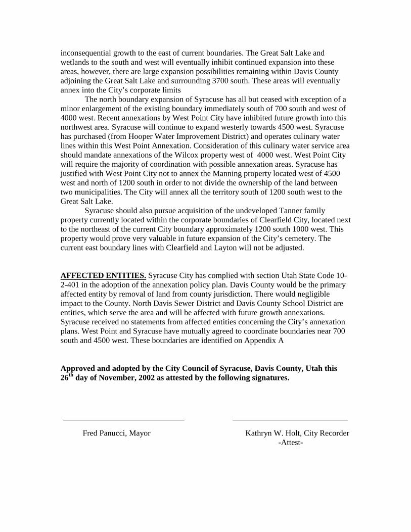
inconsequential growth to the east of current boundaries. The Great Salt Lake and wetlands to the south and west will eventually inhibit continued expansion into these areas, however, there are large expansion possibilities remaining within Davis County adjoining the Great Salt Lake and surrounding 3700 south. These areas will eventually annex into the City’s corporate limits
The north boundary expansion of Syracuse has all but ceased with exception of a minor enlargement of the existing boundary immediately south of 700 south and west of 4000 west. Recent annexations by West Point City have inhibited future growth into this northwest area. Syracuse will continue to expand westerly towards 4500 west. Syracuse has purchased (from Hooper Water Improvement District) and operates culinary water lines within this West Point Annexation. Consideration of this culinary water service area should mandate annexations of the Wilcox property west of 4000 west. West Point City will require the majority of coordination with possible annexation areas. Syracuse has justified with West Point City not to annex the Manning property located west of 4500 west and north of 1200 south in order to not divide the ownership of the land between two municipalities. The City will annex all the territory south of 1200 south west to the Great Salt Lake.
Syracuse should also pursue acquisition of the undeveloped Tanner family property currently located within the corporate boundaries of Clearfield City, located next to the northeast of the current City boundary approximately 1200 south 1000 west. This property would prove very valuable in future expansion of the City’s cemetery. The current east boundary lines with Clearfield and Layton will not be adjusted.
AFFECTED ENTITIES. Syracuse City has complied with section Utah State Code 10-2-401 in the adoption of the annexation policy plan. Davis County would be the primary affected entity by removal of land from county jurisdiction. There would negligible impact to the County. North Davis Sewer District and Davis County School District are entities, which serve the area and will be affected with future growth annexations. Syracuse received no statements from affected entities concerning the City’s annexation plans. West Point and Syracuse have mutually agreed to coordinate boundaries near 700 south and 4500 west. These boundaries are identified on Appendix A
Approved and adopted by the City Council of Syracuse, Davis County, Utah this 26th day of November, 2002 as attested by the following signatures.
Fred Panucci, Mayor Kathryn W. Holt, City Recorder -Attest-

CLEARFIELD
WEST POINT
LAYTON
GR
EA T S
AL T L A
KE
Future Cemetary Annexation
Future Annexation Plan
City Boundary
Parcels
CLEARFIELD
LAYTON
WEST POINT
Great Salt Lake
¦1 inch equals 0.6 miles
Printed 6/2006www.syracuseut.com
Appendix AAnnexationPolicy PlanAdopted 11/26/2002