Embed Size (px)
Citation preview

SURVEY AND GRADING

SURVEY AND GRADING
Surface drainage • Especially from house • Toward drain inlet

SURVEY AND GRADING
Design berms and slopes

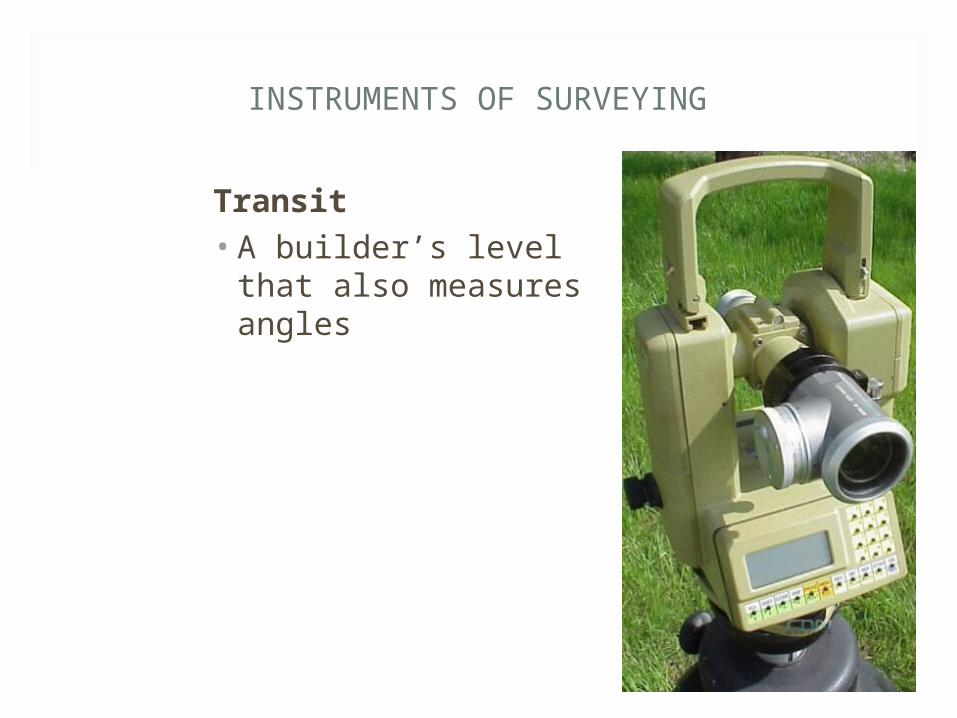
INSTRUMENTS OF SURVEYING
Tape measure• >100’• Feet/inches or feet/tenths

INSTRUMENTS OF SURVEYING
Builder’s level• Tripod mounted
“scope”• Leveled so view is
perfectly level in all directions
INSTRUMENTS OF SURVEYING
Transit• A builder’s level that
also measures angles

INSTRUMENTS OF SURVEYING
Laser levels

INSTRUMENTS OF SURVEYING
Spinning laser beam and sensor

INSTRUMENTS OF SURVEYING
Surveryor’s rod, big “yard stick,” to estimate spot elevation

INSTRUMENTS OF SURVEYING

SURVEY AND GRADING
What is elevation?• Height above average sea level

SURVEY AND GRADING
Benchmark• Permanent reference point
• Manhole cover, curb, fire hydrant

SURVEY AND GRADING

SURVEY AND GRADING
Contour lines • Connect points of similar elevation• The closer together contour lines, the
steeper the slope• The farther apart, the “flatter” the slope

SURVEY AND GRADING
Contour lines

SURVEY AND GRADING
What’s elevation of X(a) and X(b)?
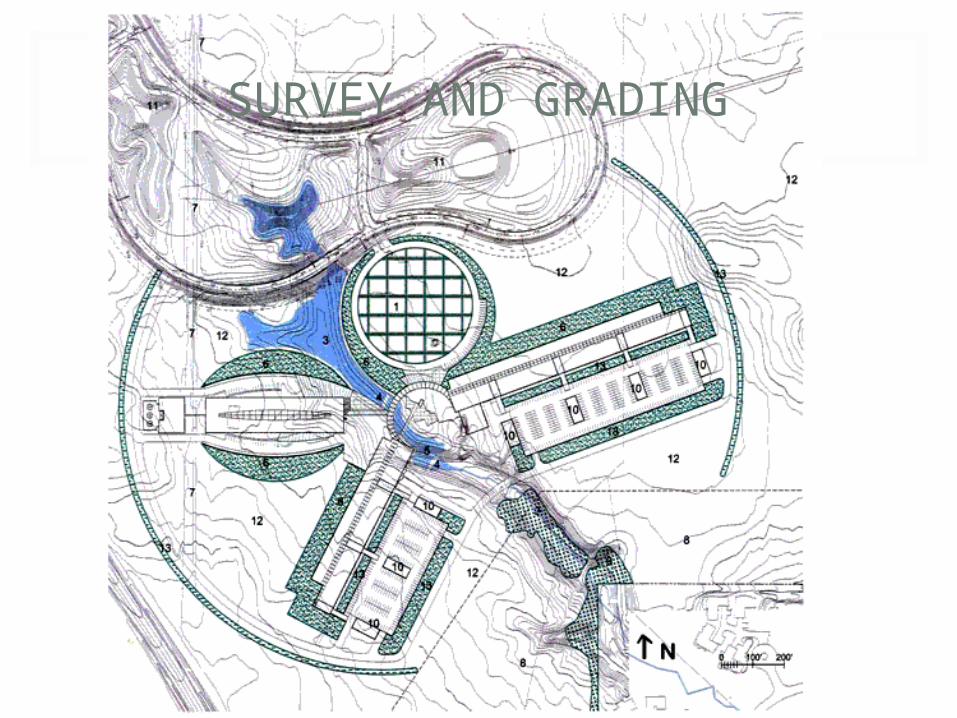
SURVEY AND GRADING

SURVEY AND GRADING
Contour lines based on spot elevations

SPOT ELEVATIONS
Backsite• Reading on benchmark (BM)
• BM has a known elevation• Backsite + Benchmark Elevation = Height of Instrument• 6.12’ + 100’ = 106.12’
106.12’

SPOT ELEVATIONS
Foresites
• Readings at unknown elevations• Height of Instrument – Foresite = Elevation
• 106.12’ – 3.98’ = 102.14’
106.12’
102.14’
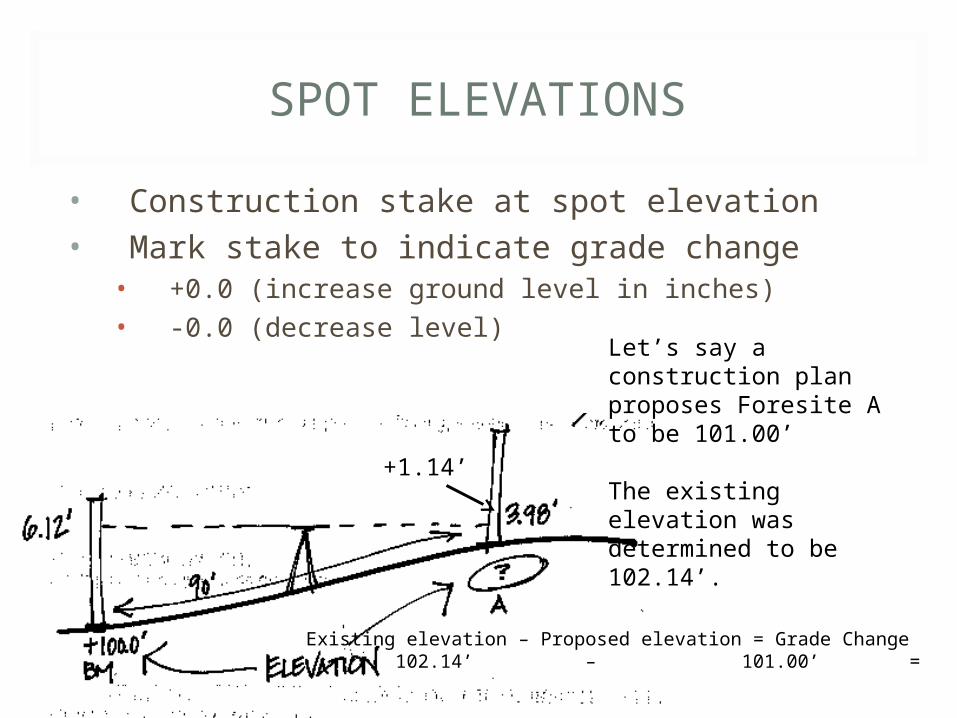
SPOT ELEVATIONS
• Construction stake at spot elevation• Mark stake to indicate grade change
• +0.0 (increase ground level in inches)• -0.0 (decrease level)
Let’s say a construction plan proposes Foresite A to be 101.00’
The existing elevation was determined to be 102.14’.
Existing elevation – Proposed elevation = Grade Change 102.14’ – 101.00’ = 1.14’
+1.14’

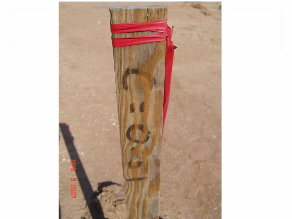
GRADING
Rough grading uses stakes with proposed changes marked

GRADING


LASER LEVELING
• Tractor adjusts box leveler according to laser level

LASER LEVELING

DETERMING SLOPES (39)
• (V÷H) X 100 = % OF SLOPE • Vertical (V) distance between 2 points• Horizontal (H) distance
• V = 3.14’ – 1.21’ = 1.93’• H = 150’• (1.93’ ÷ 150’) x 100 = 1.29%

CREATING A SLOPE (%)
H X Desired Slope % = Change in Elevation
H = 120’Slope % = 3% (or 0.03)120’ x 0.03’ = 3.6’
Slope needs to drop a total of 3.6’ to be 3%
3.6’