Embed Size (px)
Citation preview

LATITUDE AND LONGITUDE
PARALLELS AND MERIDIANS

LET´S THINK…….Suppose that we are in an unfamiliar land,
and we need to find an important object that is hidden somewhere else on the Earth. If we just start walking in a random direction, are we likely to find the hidden object ?

In order to both study and navigate the Earth, it is important to have a system , The simplest method for describing locations either on a planet, or on any flat object is to create a grid. A grid is a series of evenly spaced imaginary lines that intersect with one another at right angles. One set of lines are distributed across the globe horizontally, and one set of lines are distributed vertically.

But wait a moment. How do we know where the top and bottom of the Earth are?Because the Earth is rotating around an imaginary
axis, we can define a top and bottom. We call these the poles.
Having a top and bottom of the Earth allows us to then draw the imaginary lines that we need for our grid.
The lines that extend from pole to pole are called longitude, while the lines that circle the globe horizontally are referred to as latitude
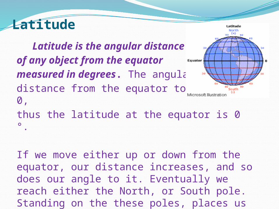
Latitude Latitude is the angular distance
of any object from the equator measured in degrees. The angular distance from the equator to itself is 0, thus the latitude at the equator is 0 °.
If we move either up or down from the equator, our distance increases, and so does our angle to it. Eventually we reach either the North, or South pole. Standing on the these poles, places us at exactly a 90 ° angle to the equator.

PARALLELS
If we were to cut the earth in half at the equator, and place a large piece of paper in-between the two halves, we would find that both halves were exactly the same size.
As we move either up or down the Earth, cutting the planet into two pieces produces one large piece, and one small piece.
As we approach the poles, the large piece gets very big, while the small piece becomes much smaller.
Drawing these imaginary lines at different latitudes produces what we call parallels.
All though technically it is possible to draw an infinite number of parallels at any number of latitudes, there are a few which are important for you to understand as you study our planet

The first of these is called the equator.The Equator is located at 0 ° latitude.
Going North from the Equator we find the Tropic of Cancer. This parallel is located at 23.5 ° North. Continuing further Northward we reachthe Arctic Circle at 66.5 ° North. Continuing all the way to the top of the Earth, at 90 ° latitude we encounter the North Pole.
If we journey southward from the Equator we will find the Tropic of Capricorn at 23.5 ° South.Continuing South we reach the Antarctic Circle at 66.5 ° South. Finally at 90 ° South we find the South Pole.|

LongitudeThe lines running vertically around the Earth are
called Longitude. These lines are called meridians, and measure how far East or West an object is.
As with latitude, longitude is measured as an angular distance.
With Latitude, the angular distance is measured from the equator. This is a natural place to begin. However, with longitude there isno natural beginning point.

Over time, more and more travelers began to recognize the meridian passing through Greenwich, England as the Prime Meridian. In 1884 a group of scientists, navigators, and businessmen made Greenwich, England the official worldwide Prime Meridian.
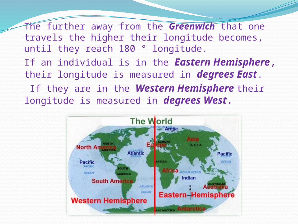
The further away from the Greenwich that one travels the higher their longitude becomes, until they reach 180 ° longitude.
If an individual is in the Eastern Hemisphere, their longitude is measured in degrees East.
If they are in the Western Hemisphere their longitude is measured in degrees West.

Plotting Your LocationFor hundreds of years, calculating your longitude
and latitude was a somewhat difficult process. Using specialize tools, and the stars as a guide, trained experts could determine their location. However, due to the limits of their equipment, these measurements were only approximate.

Today, anyone can quickly and accurately measure their location on the Earth. One popular method for determining the latitude and longitude of an object is through the use of Global Positioning Satellites or GPS. GPS devices use the signals from satellites orbiting the Earth to calculate the exact location of the person holding the device.
Lili