Embed Size (px)
Citation preview

Supported by:
Australasia 3 Peaks Glacier Expedition
2010
Papua Province, Indonesian New Guinea
Expedition Report
EXPEDITION LEADER: RICKY MUNDAY CA

2
PREFACE: The purpose of this report is two-fold:
1. To comply with the requirements of the Winston Churchill Memorial Trust (WCMT) that Fellows’ should submit a report within six months of completing their travels. The report is an essential part of the Fellowship and gives Fellows the opportunity to focus on what has been achieved and how the experience overseas will benefit others in their community and profession
2. To record my experiences and key expedition information in one comprehensive document in order that others can share in, benefit from and be inspired by my experiences
While this report is intended to be read by the Director General, Council members and Trustees of the WCMT, it is also being shared with the huge number of stakeholders who supported me in the preparation and execution of this expedition. During the course of planning and undertaking this expedition I faced some formidable obstacles. I always tried to face these obstacles in the knowledge that I had the full support of the WCMT and this gave me a deep sense of resolve and confidence. Throughout the expedition I was conscious that I was representing WCMT to the world and I was honoured and privileged to do so. While the expedition cannot be considered a success when measured against the expedition objectives that I set, many positives can be drawn from the expedition. I would encourage other people to learn from my own experiences and draw inspiration from some of Winston Churchill’s own words, which have had a profound impact on my outlook. The sentiments below not only helped me specifically on this expedition, but can easily apply to obstacles we all face in everyday life.
"Never Give In" "This is the lesson: never give in, never give in, never, never, never, never—in nothing, great or small, large or petty—never give in except to convictions of honour and good sense. Never yield to force; never yield to the apparently overwhelming might of the enemy."
3
TABLE OF CONTENTS: Aims of the Project 3 1. Location 4 2. Background to the Project & Objectives 5 3. Itinerary 6 4. Expedition Overview
a. Pre-expedition phase 7 b. Expedition phase 8
5. Success Factors 32 6. Logistics 36 7. Finance 42 8. Personnel 43 9. Training 43 10. Public Relations 45 11. Sponsors 46 12. Charity 48 13. Supporters 48 14. Science 50 15. Bibliography 51 16. Acknowledgements 52
AIMS: The expedition took place in November/December 2010. The expedition had 3 aims:
1. Mountaineering – Become the first person to safely summit the three highest peaks in Australasia in one expedition
2. Scientific - Support ongoing scientific research on the recession of New Guinea’s glaciers by verifying the existence/extent of ice caps on the three peaks and creating a photographic and data record for analysis
3. Community - Raise a substantial sum of money to support disadvantaged young people The expedition leader has extensive climbing and/or wilderness experience and experience of living, working and travelling in remote areas. Although a standalone expedition, it was also the second leg of a long-term project to climb the three highest peaks on each continent, which has never been completed or even attempted.

4
1. LOCATION: The Indonesian archipelago spans 5,000 km and includes some 17,500 islands. On the archipelago’s far-flung Eastern fringes sits the world’s second biggest island, covering an area of 786,000 km², more than three times the size of the UK. By any measure, the island of New Guinea is simply enormous. Ignored for centuries, it remains ethereal, conjuring up images of dripping montane forests, Stone Age tribes and tales of intrepid expeditions into a lost world inhabited by cannibals and exotic Birds of Paradise. Along the spine of the island runs a chain of mountain ranges that stretch almost 1,600 km and which rise to almost 5,000m, where atmospheric pressure is roughly half that at sea level. These central ranges have formed a formidable barrier to many expeditions over the last hundred years and contain the highest mountains between the Himalayas and the Andes. The combination of extreme height and equatorial latitude also generates an exceptionally high rainfall – up to 5,000mm per year. The tallest peaks hold permanent equatorial glaciers, which are currently receding dramatically due to the impact of global warming. Mapping of the province is either non-existent or incomplete.
Fig 1: Location of Indonesia: Papua is the most Easterly province Fig 2: Relief map of Papua showing extent of Central Highlands The island itself is split politically in two: the eastern half hosts the state of Papua New Guinea (PNG), which gained independence in 1975, having previously been under United Nations and Australian administration. The western portion, formerly Dutch New Guinea, was brought under Indonesian control in 1963, in controversial circumstances. Initially named Irian Jaya - “victorious hot land” – the western half of the island now incorporates two Indonesian provinces; West Papua comprises the Bird’s Head Peninsula in the western extremity; the sparsely populated but much larger Papua Province lies to the East and borders PNG. This province is huge, but is home to only two million people, a population density of only 4.7 souls per square kilometre. The UK, in comparison, which boasts a population of 62 million, has a population density of 255 people per square kilometre. The island’s political divide is a source of ongoing tension, particularly in the central highlands where the expedition took place, where native Papuans representing disparate pro-independence groups frequently clash with Indonesian security forces. A small band of separatist guerrillas, the Organisasi Papua Merdeke (OPM), or Free Papua Movement, still operates near the PNG border.

5
2. BACKGROUND TO THE PROJECT & OBJECTIVES: The Pegunungan Maoke range on Papua is home to the 3 highest peaks in Australasia. Papua province’s three highest mountains have the distinction of being the highest in Indonesia, the highest on the island of New Guinea and the highest in the continent of Australasia. The island of New Guinea sits on the Australian continental plate. This explains the predominance of marsupial fauna on the island, in stark contrast to many of islands in the archipelago to the west, where mammals prevail. Geologists believe that New Guinea became separated from the Australian mainland only 20,000 years ago; the shallow Torres Strait now covers the land bridges. New Guinea’s position also explains why Mount Kosciuszko on the Australian mainland, which Dick Bass climbed to complete the first-ever round of the ‘Seven Summits’, no longer makes the list. Puncak Jaya (4,884m), formerly called Carstensz Pyramid after Dutch explorer Jan Carstensz - who was the first to identify the peak’s glaciers in 1623 - has taken Kosciuszko’s place. Therefore, the three highest mountains on the broadly-defined continent of Australasia are:
A. Puncak Jaya (Carstensz Pyramid - 4,884m - 4°05'00“S., 137°11'00“E) B. Puncak Trikora (4,750m - 4°16'00“S., 138°41'00“E) C. Puncak Mandala (4,640m - 4°42'35“S., 140°17'25“E)
Mountaineering Objective - From a mountaineering perspective, there are only two recorded ascents of Puncak Mandala and no record of anyone having attempted to climb Papua’s three highest peaks in one expedition. This expedition planned an ascent of Puncak Mandala from the North. The expedition also planned to attempt the rarely climbed American Direct route on Carstensz Pyramid. Scientific Objective - During the 20th century, these three peaks are known to have supported glaciers. Since the 1970s tropical glaciers have been retreating quickly. This retreat has been mapped using advances in satellite imagery. In 2008, the World Glacier Monitoring Service, under the auspices of the UN Environment Programme (UNEP), published the first Global Glacier Changes: Facts and Figures report. This highlighted that the average annual melting rate of glaciers appears to have doubled after the turn of the millennium. If the trend continues, it is possible that glaciers may completely disappear from many mountain ranges in the 21st century. Both parties also warn that data gaps exist in some vulnerable parts of the globe, undermining the ability to provide precise early warning for countries and populations at risk. My scientific objective was to help fill one of these gaps. A better understanding of the changes in these small ice masses would provide a vital record of climate change information in this remote region. Puncak Jaya is known to still support glaciers and these are heavily studied; Puncak Trikora supported a small ice cap which disappeared during the period 1939–62; Puncak Mandala held an ice cap that researchers believe disappeared entirely before March 2003. However, research on Mandala has been limited to a desktop review of existing satellite imagery from 1973 to 2007. My expedition aimed to verify the existence and extent of ice cap cover on the ground on all three peaks to support this vital ongoing research. I would create a photographic record of the current extent of glaciers for analysis by scientists at three institutions, as follows: Dr. Andrew Ruddell – World Glacier Monitoring Service; Dr. Andrew Klein – Texas A&M University; Dr. Mike Prentice – Indiana University UNEP believe that there is mounting evidence that climate change is triggering a shrinking and thinning of many glaciers world-wide which may eventually put at risk water supplies for hundreds of millions of people. My expedition would support research that aims to reduce uncertainty over the sensitivity of the tropical troposphere to various forcings, which is a first-order uncertainty in global climate model predictions of the greenhouse effect. This would inform future climate change strategy, which would influence both human population and biodiversity conservation strategies. In addition, I planned to collect water and other samples to assist with ongoing research into past climate change in the western equatorial Pacific on behalf of Dr. Andrew Henderson (University of Glasgow).

6
3. ITINERARY:
Date Day From To Details 19-Nov 1 London Jakarta Scheduled flight on Emirates 16:35 departure to Jakarta via Dubai, arriving
15:45 on 20th November
20-Nov 2 Jakarta Jakarta Arrived in Jakarta 15:45, booked into Hotel Ibis Arcadia 21-Nov 3 Jakarta Jakarta No flights out of Jakarta to Jayapura available today so I made
preparations in Jakarta, including applying for a second passport and ensuring that my paperwork was in order. Also booked return flight from Jayapura to Jakarta for 3rd January 2011
22-Nov 4 Jakarta Jayapura Fly to Sentani Airport on scheduled flight with Lion Air leaving Jakarta at 22:00 via Makassar on Sulawesi. Arrived Jayapura at 07:30
23-Nov 5 Jayapura Jayapura Arrived Jayapura 07:30 and visited office of Adventist Mission Aviation, who had agreed to support me to secure a travel permit. Checked in to Hotel Sentani Indah and booked flight for next day to Bime in the Star Mountains.
24-Nov 6 Jayapura Bime Flew on chartered flight (chartered by two Indonesians) to Bime in the Star Mountains at 09:00, arrived 10:00. Spent night in District House in Bime.
25-Nov 7 Bime Jayapura Tour of Bime village in the early morning and asked to leave on mission flight at 10:00. Returned to Hotel Sentani Indah.
26-Nov 8 Jayapura Jayapura Met the Kepala Desa (headman) from Oksibil at Sentani airport at 10:00. Travelled to Hotel Sentani Indah for discussion re access to Bime. Second meeting in afternoon where access was confirmed after I completed Puncak Trikora and Carstensz Pyramid. Booked Trigana Air flight to Wamena for 27th November.
27-Nov 9 Jayapura Wamena Checked in at 06:00 for 08:00 scheduled flight to Wamena with Trigana Air. Meeting with local agent (Justinus Daby) to negotiate fee for Puncak Trikora logistical support. Agree a price of $1,200 to depart the following day (28th Nov). Check in to Hotel Baliem Pilamo for one night.
28-Nov 10 Wamena Wakikama Depart hotel 08:00 - 4WD for 2 hours to Lake Habbema (3,400m). Trek to Wakikama Camp (4.5 hours) and reached camp at 15:00 (3,301m).
29-Nov 11 Wakikama Semalak Cave Camp Left Wakikama at 08:00 - 6 hours trekking to reach Semalak Cave Camp at 14:00 (3,740m).
30-Nov 12 Semalak Cave Camp
Semalak Cave Camp Depart 06:00, trek to locate access to Trikora Summit ridge for 9 hours, unsuccessful, back in camp at 15:00. Max altitude 4,114m.
1-Dec 13 Semalak Cave Camp
Semalak Cave Camp Summit attempt: Depart 06:40. Trekked in and located route to access summit ridge of Trikora. After 2 hours, gained ridge at 4,467m. Traversed ridge for 1.5 hours to high point at 4,638m at base of rocky pyramid. Impossible to progress without technical climbing equipment due to steepness and exposure. Descended back to Semalak Cave camp, arrived in camp 13:45.
2-Dec 14 Semalak Cave Camp
Wamena Departed from Camp at 07:00. Trek for 4.5 hours back to Lake Habbema for vehicle pickup. Returned to Wamena via 4WD and arrived back at Baliem Pilamo Hotel at 14:00. Debrief with local agent and booked flight for 07:00 next morning (3rd Dec)
3-Dec 15 Wamena Jayapura Check in at 06:00 at Wamena airport for scheduled Trigana Air service to Jayapura. Arrived back at Hotel Sentani Indah at 09:00. and checked in again. Received email from international Carstensz Pyramid agent advising that the expedition was cancelled (due to depart 5th December). Contacted all local agents to ask if they had any December departures running. Also contacted Freeport McMoran (mining company) to request access through their project area. Permission denied.
4-7 Dec
16-19 Jayapura Jayapura Stuck in Hotel Sentani Indah awaiting responses from local agents
8-Dec 20 Jayapura Jayapura Last local agent confirmed that although he was running a December departure, his clients had refused me permission to join.
9-Dec 21 Jayapura Jayapura Made contact with Bime local representatives and arranged to return to Bime the next day (10th Dec). Booked flight with AMA for 12:00.
10-Dec 22 Jayapura Jayapura Phone call at 07:20 from Bime representatives. Meeting called for 08:30. At this meeting, I was informed that I would have to pay a $5,000 administration fee to return to Bime. I immediately cancelled the expedition and informed the representatives that I would return in July. Booked flight from Jayapura to Jakarta as my existing return flight was not available until 16th December
11-Dec 23 Jayapura Jakarta Flew on Merpati scheduled flight from Sentani airport to Jakarta, via Biak and Makassar, arriving Jakarta in late evening. Checked into Hotel Ibis Arcadia.
12-13 Dec
24-25 Jakarta Jakarta Day in Jakarta, picked up second passport from British Consulate
14-Dec 26 Jakarta London Scheduled Emirates flight departed from Jakarta at 00:15 via Dubai and arrived London Heathrow at 11:35 END EX

7
4. EXPEDITION OVERVIEW: Pre-expedition phase: Expedition planning began in October 2009, after I had already spent 4 months working in humanitarian aid in South Darfur, Sudan. In 2008, I had organised and attempted to climb Africa’s 3 highest peaks within 3 weeks (Africa 3 Peaks Expedition). The expedition team (me and two friends) were thwarted only by icy conditions halfway up the technical climb on the North Face of Batian on Mount Kenya, which made further progress unsafe. Otherwise, the expedition was a huge success – we raised over 6,000 GBP for a childrens’ home in Kenya - and inspired me to keep planning ambitious expeditions to the other continents with a long-term ambition of becoming the first person to climb the 3 highest peaks on each continent It quickly became obvious what a challenging expedition this leg would be as my research highlighted an almost complete lack of mapping for the mountain ranges concerned, the political instability in the region and the difficulty of even getting close to the mountains. I remained hopeful, however, that with luck and perseverance I could give myself a great chance of success. I made contact with a wide variety of people, including the last British team to attempt (and I believe the last people to visit) Puncak Mandala in 1999. I made connections with researchers in the UK, USA and Australia with a view to establishing any data requirements they had and it quickly became clear that the glaciers of Papua required careful investigation. Connections were made with various local agents who operated in and around Papua to determine the likely cost of logistical support and again it became obvious that this would be a major financial undertaking. I was very grateful therefore when WCMT awarded me a Fellowship in January 2010 because this ensured that the expedition would at least be feasible financially. I began to assemble a team and from early on Carol Sparks, who also worked in humanitarian aid in Sudan agreed to join me for the Puncak Mandala leg of the expedition. My research had indicated that Puncak Trikora was the easiest of the three peaks both logistically and technically and I decided that I could, if necessary, attempt this peak solo if I was unable to find any other expedition partners. I therefore focused my energies on pulling together a team to attempt Carstensz Pyramid. In June Carol and I undertook a 5-day Lead Climbing course in North Wales to ensure that we both had the necessary skills to cope with the technical climb on the South Face of Puncak Mandala. More details on this can be found in the ‘TRAINING’ section. On 23rd May I had a major boost when my cousin Mark McGowan decided to join the expedition for the Carstensz Pyramid leg. Mark had been one of the UK’s top climbers in the late 1980s and early 1990s and having him on board would help me from a technical climbing perspective and potentially also in raising the profile of the expedition. Toward the end of August I got more good news when an Australian medical student (Pei Lew) agreed to join the expedition following a post from me on UKClimbing.com. This meant I had my team of three and an agreed budget of $18,000 for this leg of the expedition from a local agent. UK expedition companies typically charge around 11,000 GBP for running a Carstensz Pyramid expedition so this was a very substantial saving. Of course every time a new member came on board there was quite a time investment from my side to update the sponsorship pack, grant applications and the press material. Nevertheless, I now felt more confident than ever that we could achieve the expedition objectives as planned. At the start of August, one of my sponsors connected me to a specialist in expedition PR and following a meeting I decided to engage her to manage the expedition PR and maximise our profile. This is covered in more detail in the ‘PUBLIC RELATIONS’ section of the report. In early August I also attended an intensive one-on-one Overseas Medical Intervention course in the UK that gave me a good grounding in how to deal with any potentially life-threatening situations in a wilderness setting. Again, more detail is provided in the ‘TRAINING’ section.

8
Sadly, in mid-August Carol pulled out of the expedition for personal reasons. This meant that my initial objective of climbing Puncak Mandala from the South was no longer feasible for safety reasons – it would have been far too risky to consider a solo technical climb in such a remote area. Therefore, my planning shifted focus from an approach from the South via Sumtamon to an approach from the North via Bime, which was much less technical but no less remote. Unfortunately, on 21st October I then received a message from Mark telling me that he could no longer commit to the expedition for financial reasons. This was a bitter disappointment as he had five full months months to develop a fundraising strategy and also because I had worked hard to get us both fully sponsored clothing. Finally, on 31st October I received a message from Pei Lew telling me that she was also pulling out because she was required to register for the next year of her medical degree in Sydney on 6th December, the date we were planning to leave Jayapura. With only a couple of weeks left before I was due to fly to Indonesia to start the expedition, I found myself in a very difficult position. The local agent had advised me that no-one else had committed to our expedition and I had to cancel with him as I couldn’t afford to pay $18,000 by myself. I therefore began a frantic process of trying to find a local or international agent who was planning to run a December departure that I could piggyback on. After a year of planning and with many sponsors and supporters on board it was a very difficult situation to manage. To complicate matters I was also trying to hand over my professional responsibilities to my replacement in Khartoum and I had precious little free time to tackle the pressing expedition issues. After spending a couple of weeks in the UK in late October and early November I made contact with an international expedition provider and he agreed that I could join his 6th December departure to Carstensz Pyramid. Unfortunately, this required that I pay a fee of $10,500, which I did reluctantly; however, this was realistically my only chance of reaching Carstensz Pyramid. It also required another change in my itinerary as it was earlier than I had planned so I shifted Carstensz Pyramid to the second leg of the expedition and planned to climb Puncak Trikora last. Finally, in mid-November, having picked up all of my sponsored kit and two weeks later than originally planned due to the decision to tackle Puncak Mandala from the North instead of the South, I set off for Indonesia on 19th November 2010 with a huge sense of trepidation about what lay ahead but relief that finally the expedition would start. Expedition Phase: Due to the complicated situation regarding the changing team composition and the flexibility in my itinerary, I hadn’t made any internal flight bookings from the UK. I knew from my professional experience and previous expeditions that in developing countries there is a high level of flexibility locally and so it proved. I had to spend a couple of days in Jakarta because the flight out to Jayapura were either full or prohibitively expensive but it gave me a chance to finalise some paperwork and make sure I had everything that was required to obtain my travel permit, which I would do in Papua. The reception staff in my hotel were able to assist with flight bookings to and from Jayapura through a local travel agent and my tickets were delivered to me in the hotel. . I was committed to be as flexible as possible to give myself the best chance of success. I knew that Carstensz Pyramid must be my priority, not only because it swallowed about 70% of the expedition budget, but also because that is where all of the verified existing glaciers on the island are located. In order to achieve the second expedition objective to create a photographic record of the glaciers, I needed to get to them first! I did have some flexibility after Carstensz because although my flight back to the UK was booked for 4th January 2011 I had no commitments until 17th January, when I would fly out to Berlin to be briefed on my new job as Finance Delegate for the German Red Cross in Bangladesh. Due to the fact that my carefully laid plans were thrown into disarray at late notice, my mission pilot Bob Roberts was unavailable at this time; however, he put me in touch with his son Eric who flies for a Catholic Mission organisation in Papua (AMA), who proved to very helpful. In fact an AMA pilot was flying on the same flight as me and I approached him at the airport and he took me to the AMA office. The AMA Operations Director, also called Bob, proved to be immensely helpful and arranged for me to be taken to the local Police HQ to have my travel permit processed. He also booked me on a flight the next morning to Bime airstrip in the Star Mountains!

9
Besides my excitement, I was also conscious that I was really flying into unknown territory - I knew almost nothing about Bime and even one of the AMA pilots I spoke to could only tell me it was a grass airstrip at about 1,800m. He couldn't tell me if there was a police post or how many people lived there or any other basic information. Nevertheless, it seemed that the gods were smiling on me - at the airport, I was able to fill my fuel bottle with Kerosene and because two Indonesians had chartered the flight, I didn't have to pay a penny. The Cessna Caravan was stripped out so I was pushed right up at the back seat for the 1-hour flight to Bime. As we took off over Lake Sentani, I could see a lot of deforestation around the city and lots of palm oil plantations, but within a few minutes we were gaining altitude over unbroken forest as far as the eye could see. For the most part it was undulating terrain, punctuated by broad, brown, sweeping rivers. After about 25 minutes, we started to pick up altitude again and the towering clouds in the distance signalled that we were approaching the Central Highlands. Very soon, the earth began to appear crumpled and we started crossing deep ravines and sharp, forested ridges. I spotted an airstrip carved out of the mountain away to the left and thought that we would bank left to line it up. To my surprise, we headed straight for a high ridge ahead of us and as we popped up over it I saw Bime airstrip directly ahead of us on the westerly slopes of a steep-sided valley. As we sped in for a bumpy landing I caught my first sight of the local villagers and my stomach leapt - I suddenly realised that as soon as the plane took off again I would be here alone in one of the world's most remote locations with no way to communicate with the local people! The plane rolled to a stop at the apex of the runway and turned in a tight circle. The pilot, an Indonesian named Arnold, disembarked and opened the doors and I followed the two other passengers out. I didn't want to approach anyone directly for fear of offending them so I waited until Arnold had run his checks and asked if he could translate my purpose. The local Kepala Desa (headman) stepped forward and Arnold explained that I wanted tiga orang (three men) to accompany me to Puncak Mandala. The headman seemed to suggest that this was OK. Then another villager stepped forward and asked in (very) broken English if I needed help with my bags. His name was James and he told me he spoke Pidgin English and that he was the only person in the village that did - he was employed in the Kantor (District Office) as assistant to the District Officer, who was absent. That was a stroke of luck for me because when I explained that I had brought a tent, he insisted that I would stay in the District House, meaning I would at least be dry and comfortable for one night. To my surprise, the District House had running electricity. James explained there was a small water powered turbine further up into the mountains that provided Bime with 24 - hour electricity! The house I was staying in was a simple wooden affair with two small bedrooms and a living area. It also boasted an indoor latrine, which I was grateful for. Very soon, James abandoned me and I understood that he would speak more with the Kepala Desa to figure out if we could leave the next day. In late afternoon when a villager turned up at the door - he didn't speak English but was very enthusiastic and it was clear that he wanted to join me on the trek to Mandala. After an animated conversation that somehow made sense despite neither of us speaking the other's language, Manius left, and I spent some time testing my satcomms again (they worked!) and cooking some food. A little while later James arrived again with food that his wife had prepared (rice and vegetables). All the rice that was available in the village has to be flown from Jakarta because they can't grow rice in the Star Mountains – the staple diet is potatoes. James disappeared again and I waited patiently for him to return so that I could ask him about the plan for the next day. After dark, James and several others turned up to the District House. James informed me that he had been in radio contact with Oksibil, the capital of Pegununggan Bintang (Star Mountains) regency. The Kepala Desa from there had decided that I couldn't proceed and James informed me that he would fly into Bime the next day to discuss my options.

10
After a promising start, this was a real blow and I had a sinking feeling that things would not go smoothly. My mood was quite black and I started thinking that James and the others were only interested in how much money they could extract from me. At about 7 p.m., I went to bed but had quite a troubled sleep because I couldn't stop thinking that this could be a disaster for the expedition. Next morning, James turned up to the house around 7 a.m. to tell me there had been another change of plan – now, the Kepala Desa would fly to Jayapura the next day and James and I would fly to meet him there. I explained to the best of my ability (with the enormous language barrier) that I hadn't known that I needed permission from Oksibil and that had I known I would certainly have done so. I think one of the reasons why it was difficult to gain access was because James's boss, the senior District Official of Bime District, was on leave. I got the impression that James did not want to get himself into trouble and lacked the authority to make any decision. Therefore, he would discuss the situation by radio with anyone who would listen. Having accepted that I would be staying only one more night in Bime, James then asked if I wanted to have a look around the village and local area. I jumped at the chance; up to this point I had really just stayed in the District House because I wasn't sure what was appropriate and what wasn't – for example I knew from previous expedition reports that often the women in villages are hidden from visitors and I didn't want to offend my hosts any more than I had already done just by being there. With James, Manius and his two kids we left the compound and walked up the path adjacent to the airstrip, then crossed a small river, following a path cut into the steep hillside. At the top of the small ridge was another small settlement and there I was introduced to the Kepala Desa of this settlement, who was sitting on a log and handling a large parang (knife). He had visited the District House the previous day and was happy to meet me again. There were a few children sheltering from the hot morning sun under a simple wood and grass structure. Two young men approached and explained as best they could that they attended school in Borme, some distance away, but that they were back in Bime for the school holidays. They were dressed like Gangsta rappers but were very friendly. They spoke extremely broken Pidgin English but joined us with a small posse to visit the local District school, which was set in a prominent position on a nearby west-facing hillside.
The school was formed of 3 wooden buildings; each Grade had their own classroom with simple wooden desks and a blackboard. Nixon was one of the students from Borme and he told me he was in Grade 3 and was 16 years old. I was constantly surprised when I asked people their age to discover that I was much older than most of them. For example, James was only 26 years old and I would have guessed he was probably 40. Similarly, I would have guessed that Nixon was in his mid-20s. I guess it's still a very harsh life in the Star Mountains, even if you live in a village next to an airstrip. Although they now have 24-hour electricity and access to satellite TV, access to basic healthcare is limited and there is a huge reliance on the few missionary organisations that serve the various remote airstrips that are spread around the Star Mountains. Primary education in Papua is now free to all pupils, thanks to the Government working in partnership with NGOs. However, parents then have to start paying 50% of school fees beyond this and University education
PUNCAK MANDALA (4,640m) is the highest mountain in the Pegunungan Bintang (Star Mountains) Regency of Papua. The entire Star Mountains region is very isolated and due to the lack of infrastructure and development the area is only accessible by missionary flight. Due to the remoteness and inaccessibility, I had set aside 3 weeks for this leg of the expedition. The northern aspect of the mountain appears like a giant swelling in the forest. It can be reached by trekking in from the northern village of Bime along local hunting trails. Nevertheless, an Austrian team attempting this route in 1996 failed to even reach the mountain – the approach was too arduous. In stark contrast to the gentle incline from the north, the steep limestone cliffs of the South Face present a true challenge to the committed climber. The first expedition to reach Mandala’s summit described the view to the south as like looking into a “stupendous abyss”. This description inspired the first and only team to find a route up the steep southern cliffs – in 1990, Bruce Parry and Mark Anstice reached the summit after trekking in from the south coast of the island. Due to one unplanned change in the expedition team when Carol Sparks withdrew, my plan to complete the second ascent of the South face was abandoned – I therefore attempted to reach the summit via the jungle-clad northern slopes. I planned to fly into Bime, the nearest village with an airstrip to the north. On arrival at Bime, I planned to follow local trails for a week, heading generally south-west and crossing several rivers. With no existing photographs of the route and the tree-line extending to 4,000m, I would have relied on sketch maps provided by a party that previously failed to reach the summit due to a hailstorm. However, I would also have sent daily GPS readings via BGAN or satellite phone to my UK Base Manager Iain Mackay, who was tracking my progress on Google Earth.
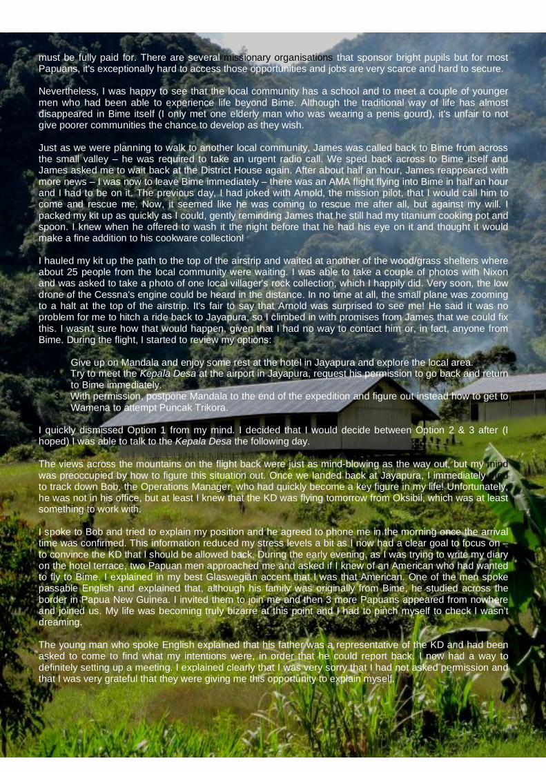
11
must be fully paid for. There are several missionary organisations that sponsor bright pupils but for most Papuans, it's exceptionally hard to access those opportunities and jobs are very scarce and hard to secure. Nevertheless, I was happy to see that the local community has a school and to meet a couple of younger men who had been able to experience life beyond Bime. Although the traditional way of life has almost disappeared in Bime itself (I only met one elderly man who was wearing a penis gourd), it's unfair to not give poorer communities the chance to develop as they wish. Just as we were planning to walk to another local community, James was called back to Bime from across the small valley – he was required to take an urgent radio call. We sped back across to Bime itself and James asked me to wait back at the District House again. After about half an hour, James reappeared with more news – I was now to leave Bime immediately – there was an AMA flight flying into Bime in half an hour and I had to be on it. The previous day, I had joked with Arnold, the mission pilot, that I would call him to come and rescue me. Now, it seemed like he was coming to rescue me after all, but against my will. I packed my kit up as quickly as I could, gently reminding James that he still had my titanium cooking pot and spoon. I knew when he offered to wash it the night before that he had his eye on it and thought it would make a fine addition to his cookware collection! I hauled my kit up the path to the top of the airstrip and waited at another of the wood/grass shelters where about 25 people from the local community were waiting. I was able to take a couple of photos with Nixon and was asked to take a photo of one local villager's rock collection, which I happily did. Very soon, the low drone of the Cessna's engine could be heard in the distance. In no time at all, the small plane was zooming to a halt at the top of the airstrip. It's fair to say that Arnold was surprised to see me! He said it was no problem for me to hitch a ride back to Jayapura, so I climbed in with promises from James that we could fix this. I wasn't sure how that would happen, given that I had no way to contact him or, in fact, anyone from Bime. During the flight, I started to review my options:
1. Give up on Mandala and enjoy some rest at the hotel in Jayapura and explore the local area. 2. Try to meet the Kepala Desa at the airport in Jayapura, request his permission to go back and return
to Bime immediately. 3. With permission, postpone Mandala to the end of the expedition and figure out instead how to get to
Wamena to attempt Puncak Trikora. I quickly dismissed Option 1 from my mind. I decided that I would decide between Option 2 & 3 after (I hoped) I was able to talk to the Kepala Desa the following day. The views across the mountains on the flight back were just as mind-blowing as the way out, but my mind was preoccupied by how to figure this situation out. Once we landed back at Jayapura, I immediately tried to track down Bob, the Operations Manager, who had quickly become a key figure in my life! Unfortunately, he was not in his office, but at least I knew that the KD was flying tomorrow from Oksibil, which was at least something to work with. I spoke to Bob and tried to explain my position and he agreed to phone me in the morning once the arrival time was confirmed. This information reduced my stress levels a bit as I now had a clear goal to focus on – to convince the KD that I should be allowed back. During the early evening, as I was trying to write my diary on the hotel terrace, two Papuan men approached me and asked if I knew of an American who had wanted to fly to Bime. I explained in my best Glaswegian accent that I was that American. One of the men spoke passable English and explained that, although his family was originally from Bime, he studied across the border in Papua New Guinea. I invited them to join me and then 3 more Papuans appeared from nowhere and joined us. My life was becoming truly bizarre at this point and I had to pinch myself to check I wasn't dreaming. The young man who spoke English explained that his father was a representative of the KD and had been asked to come to find what my intentions were, in order that he could report back. I now had a way to definitely setting up a meeting. I explained clearly that I was very sorry that I had not asked permission and that I was very grateful that they were giving me this opportunity to explain myself.
12
By next morning, I had decided that rather than wait for the KD to come to my hotel, I wanted to meet him off his flight. This was because I wanted him to know how important he was in my eyes and also because I had about $5,000 cash in my room and a huge amount of equipment and didn't want them to see any of this. Not long after I arrived at the airport, the KD appeared with a big smile and as I stepped forward to shake his hand, he grabbed me in a bear hug, although given that the typical Papuan is less than 5 feet tall, it was around my waist rather than my chest. I was really happy that he was pleased to meet me and also very happy that I had made the decision to meet him at the airport. He took me by the hand and ushered everyone into a taxi. Although he didn't speak any English, I felt confident that I could work something out with him. I'd already decided that the maximum amount of money I could realistically afford to pay for a 'permit fee' would be $500, but wanted to negotiate to around $300. At the hotel, I ordered tea for everyone and we started a discussion. They explained that we would have a break in the discussions around 1 p.m., in order that I could get some rest. I explained again my position and then explained that I was respectfully asking his permission to complete the important project. This time I explained in detail that I was in Papua on behalf of the Winston Churchill Memorial Trust to photograph Papua's glaciers and also pointed out that Her Majesty the Queen was patron of the Trust, which really seemed to make an impression. With a flourish, I produced my Letter of Support from the Director General, asking for any assistance that they could provide. This turned out to be a master stroke and I suppose that is exactly why the Trust issues such a letter in the first place. I also explained that if the KD was kind enough to give me permission to return to Bime and allow me to access Puncak Mandala, I would have to postpone my visit until after I had completed the Carstensz Pyramid leg of my expedition. He agreed to consider this as part of the decision-making process. After I had finished explaining my position, they informed me that they would now leave to discuss amongst themselves and would return at 1 p.m., and that I should get some rest (I must have looked tired). I was feeling pretty low through a combination of lack of sleep and a heavy cold that had come on the day before and I would have jumped at the chance to get some rest, but I decided to take the calculated risk to go back into Sentani town to book a ticket to Wamena for the following day. I was pretty sure that the KD would allow me to visit and felt I could convince him that I should postpone to the end of my trip. I therefore wanted to make sure I could fly to Wamena in the Baliem Valley as soon as possible to make an attempt on Puncak Trikora. I took a taxi directly to the Trigana Air ticket office to try to figure something out. Luckily, I was able to book a ticket for the 08:00 flight the next day to Wamena and also booked a return flight for 4th December, which would allow me to meet up with the Carstensz Pyramid team ahead of the scheduled 6th December departure.
STAR MOUNTAINS Governance Although my local contact in Bime (James) described ‘Enus’ as the Kepala Desa of Oksibil, I later became aware of his real position. Damianus Lepki was elected in October 2009 as one of 10 District Assembly members of the Star Mountains District Assembly. He is also the Deputy Chairman of Parliament of Pegunungan Bintang (Star Mountains) Regency Geography Western and central are mountainous with highest peak Mandala 4,640m above sea level. The Regency has an area of 15,683 sq.km. and is located between 140°05’00” - 141°00’00” East Longitude and 3°04’00” - 5°20’00” South Latitude. Bime District is the largest area of 3,458 sq.km or equal to 22.05% of the total area. Batom District is the smallest district with an area of 440 sq.km or 2.81% of total area. In 2005 the amount of rainfall in the Star Mountains was 1,960 mm. The number of rainy days in 2005 was 212 days, while in 2004 there were 237 days of rain. Population Population density in the Regency was 6 persons per sq.km in 2005. In 2007, there were 6,023 households in Bime District with a total population of 21,601 (compared to 95,601 people in the Regency as a whole). In 2007, 2/3 of the Regency’s population had never attended any school and there were only 60 schools in total. In comparison, there were 109 churches!! Health In 2006, there were only 7 doctors across 2 Districts in the Regency
13
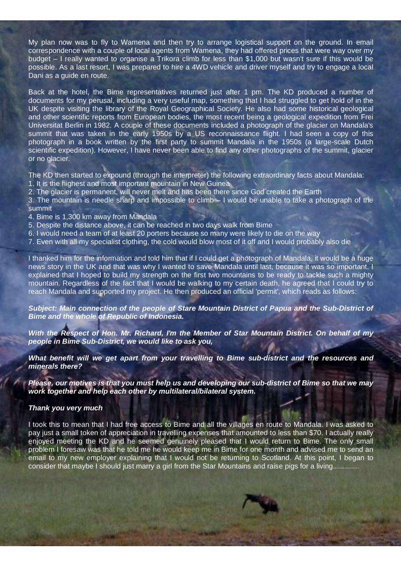
My plan now was to fly to Wamena and then try to arrange logistical support on the ground. In email correspondence with a couple of local agents from Wamena, they had offered prices that were way over my budget – I really wanted to organise a Trikora climb for less than $1,000 but wasn't sure if this would be possible. As a last resort, I was prepared to hire a 4WD vehicle and driver myself and try to engage a local Dani as a guide en route. Back at the hotel, the Bime representatives returned just after 1 pm. The KD produced a number of documents for my perusal, including a very useful map, something that I had struggled to get hold of in the UK despite visiting the library of the Royal Geographical Society. He also had some historical geological and other scientific reports from European bodies, the most recent being a geological expedition from Frei Universitat Berlin in 1982. A couple of these documents included a photograph of the glacier on Mandala's summit that was taken in the early 1950s by a US reconnaissance flight. I had seen a copy of this photograph in a book written by the first party to summit Mandala in the 1950s (a large-scale Dutch scientific expedition). However, I have never been able to find any other photographs of the summit, glacier or no glacier. The KD then started to expound (through the interpreter) the following extraordinary facts about Mandala: 1. It is the highest and most important mountain in New Guinea 2. The glacier is permanent, will never melt and has been there since God created the Earth 3. The mountain is needle sharp and impossible to climb – I would be unable to take a photograph of the summit 4. Bime is 1,300 km away from Mandala 5. Despite the distance above, it can be reached in two days walk from Bime 6. I would need a team of at least 20 porters because so many were likely to die on the way 7. Even with all my specialist clothing, the cold would blow most of it off and I would probably also die I thanked him for the information and told him that if I could get a photograph of Mandala, it would be a huge news story in the UK and that was why I wanted to save Mandala until last, because it was so important. I explained that I hoped to build my strength on the first two mountains to be ready to tackle such a mighty mountain. Regardless of the fact that I would be walking to my certain death, he agreed that I could try to reach Mandala and supported my project. He then produced an official 'permit', which reads as follows: Subject: Main connection of the people of Stare Mountain District of Papua and the Sub-District of Bime and the whole of Republic of Indonesia. With the Respect of Hon. Mr. Richard, I'm the Member of Star Mountain District. On behalf of my people in Bime Sub-District, we would like to ask you, What benefit will we get apart from your travelling to Bime sub-district and the resources and minerals there? Please, our motives is that you must help us and developing our sub-district of Bime so that we may work together and help each other by multilateral/bilateral system. Thank you very much I took this to mean that I had free access to Bime and all the villages en route to Mandala. I was asked to pay just a small token of appreciation in travelling expenses that amounted to less than $70. I actually really enjoyed meeting the KD and he seemed genuinely pleased that I would return to Bime. The only small problem I foresaw was that he told me he would keep me in Bime for one month and advised me to send an email to my new employer explaining that I would not be returning to Scotland. At this point, I began to consider that maybe I should just marry a girl from the Star Mountains and raise pigs for a living.............

14
Day 9 - 27th November - It was another early start and the check-in queue at the Trigana Air counter gave me goose bumps – it reminded me of the check-in desks for local flights at Khartoum Airport in Sudan. However, I soon realised that, unlike in Sudan, there was some order behind the chaos. When I checked in, I was told me my flight would start boarding in 10 minutes, which was 1 hour 45 minutes ahead of schedule – luckily my biggest fear in life is missing a flight so I'm always at the airport in good time and I made it on OK. The flight into Wamena is incredible – the plane has to pass through an opening in the mountains and suddenly the whole Baliem valley opens up in front you. The Baliem Valley was only discovered in 1936 by coincidence by a mail aircraft and had a self-supporting agricultural system of high standard, despite having had no previous contact with the civilized world. These days, Wamena is home to 10,000 people but due to the lack of transport infrastructure all goods have to be flown in, which pushes prices up and makes life expensive for the local residents. I had been advised by my PR Alex that if I could seek out a Japanese man called Fuji he could organise my trip to Trikora. I never found the café where he was supposedly based but I found another café and was amazed to discover a wireless internet connection. I decided to try to phone both of the guides that I had previously been in contact with now that I was in Wamena and had my travel permit, to see if they would be willing to negotiate. The first guy I called had come highly recommended on several internet forums, but when I tried his number it didn't connect. The second guide answered and I arranged for him to come to the cafe to discuss a trip. He spoke really good English and over a cup of tea (and several cigarettes for him) he explained that he had been sponsored by a missionary priest through school (which is how he had learned such good English), that he had 7 children, including 6 daughters and that each time one of his daughters marries he receives pigs as a gift from her husband's family. It really pays to have daughters in Papua. The local population come from the Dani tribe and he explained that very few people now live the traditional way. Then, we started to negotiate. I explained my position that I didn't have a large budget and that I wanted to be as quick (while staying safe) and as lightweight as possible. Over email his lowest price had been $1,750 but his opening price was this time was $3,000 and I immediately told him that if he didn't give me a serious price I would simply fly back to Jayapura the next day. I don't actually have access to lots of cash in Papua so I told him my limit was $1,000 and eventually we settled on a price of $1,200, which I was relatively happy with. I know that the most expensive part of the trip was renting a 4WD vehicle for the 2.5 hour drive to Lake Habbema and back. The cost of fuel in Wamena is prohibitive since, like all other goods, it has to be flown in from Jayapura. Officially, Lake Habbema and Puncak Trikora are off-limits to tourists but this being Indonesia; anything is possible at the right price.

15
Day 10 - 28th November - Puncak Trikora Day 1: Lake Habbema to Wakikama I woke early (05:30) just to make sure that my kit was packed and to try to grab a quick breakfast before the scheduled 7 am pick up from the hotel. Outside the hotel, the vehicle was already waiting with my Indonesian driver and I was pleased to see it was in good condition. I wasn't sure what state the road would be in but was glad that at least the first part of my 'budget' trip would be trouble-free. After 20 minutes I texted the local agent to ask where he was. During my previous expedition in Indonesia in 1994, I had experienced the phenomenon known locally as 'rubber time' so I wasn't too upset to learn that the guide was still buying food. He eventually turned up after 45 minutes with the guide/cook and 2 porters, one of whom looked rather old and frail. The arrangement was that there would be 3 porters; the 3rd porter was planned to be an acquaintance of the elderly porter but he hadn't shown up so instead we left the elderly porter and jumped in the car to find a friend of the guide/cook who lived near the local market. It didn't take him long to agree to earn a bit of spending money and after a quick stop to buy more provisions we sped off West on the road into the mountains. Initially, the road was in good condition and was passable by 2WD. We drove past smallholdings and schools that, although traditionally built, were in good order and the Indonesian flag was prominently displayed. After about 15 minutes of driving out of Wamena, we stopped at an Army checkpoint; despite my concerns about being denied access, the soldier manning the checkpoint was happy with my Surat Jalan and my permit from the Forestry Office and we were allowed to proceed. By now, the driver, his friend and the guide and porters must already have smoked about 5 cigarettes each – lung disease rates in Indonesia in general and Papua in particular must be among the highest in the world. The road surface soon became much rougher and although it was a graded road, it would have been impossible for a 2WD vehicle to progress. Luckily it was dry; otherwise it would have been very difficult even for a 4WD vehicle to ascend. As we climbed up the winding road into the mountains, we passed small groups of Papuans walking either towards or out of Wamena. There were several small settlements hidden by the vegetation, but which were identifiable by the breaks in vegetation that allowed villagers access. There were several small logging camps by the roadside, where a few Papuans brandishing chainsaws were busy sawing logs into planks. It was clear that most of the forest around Wamena had already been denuded and it really felt like I was travelling through a frontier. Papua feels like it's on the brink of something big, either for better or worse. So far, the only traditional dress I had seen was an old man in Wamena selling tourist trinkets – every other person was wearing Western clothes in different gaudy combinations. We stopped at a viewpoint where the forest opened up and there was an incredible vista across the broad, flat Baliem Valley, where I stopped to take a few photos. It felt really exciting to know I was the only Westerner making my way through this frontier and into an area that was really off-
limits to tourists. The fact that I was going with a ragtag bunch of Papuans increased the sense of adventure. The reality was that no Indonesian official knew I was headed so if someone decided that I should disappear then only my daily contact with Iain Mackay, who knew my co-ordinates and plans in details, could help get me out.
PUNCAK TRIKORA - Located 240 miles WNW of Puncak Mandala, Puncak Trikora (4,730m) sits SW of the world-famous Baliem Valley in the Jayawijaya Range, only a few days trekking from Wamena, which is the largest town in the Papuan highlands with a population of c. 10,000. The Jayawijaya Mountains are the central part of the Pegunungan Maoke Range. The Baliem Valley was only discovered in 1936 by coincidence by a mail aircraft and had a self -supporting agricultural system of high standard, despite having no previous contact with the civilized world. Puncak Trikora was planned to be the least technically difficult leg of this expedition. Nevertheless, at 4,730m high, this mountain is only marginally lower than Mont Blanc and so I would be severely tested by the effects of altitude. The percentage of oxygen in air remains essentially constant with altitude at 21% up until 70,000 feet (21,330 m), but the air pressure (and therefore the number of oxygen molecules) drops as altitude increases — consequently, the available amount of oxygen to sustain mental and physical alertness decreases above 3,050m. At 5,000m, marginally above the height of Trikora, the barometric pressure is nearly half the sea level value, meaning only half the number of oxygen molecules is available Therefore the body has to work overtime to absorb as much oxygen as possible to lessen the impact of this deficit.

16
After about an hour and a half of progress up into the mountains, I started to get good views of the Snow Mountains to the south. This far into the mountains, there were no real forestry operations. In actual fact, we were now deep into the Lorentz National Park, hence why I had to apply for a forestry permit to access Lake Habbema. Officially, deforestation is illegal in this Park, which is a World Heritage Site that stretches for over 150 kilometers (km), from the central cordillera mountains in the north to the Arafura Sea in the south. In the distance, I caught my first glimpse of Lake Habbema, which sits in a broad alpine valley. To be honest, it was a bit disappointing, but that's not surprising when you consider that I'm from Scotland, which boasts many incredibly beautiful lochs. I think the fact that the landscape was scarred by the white sand of the road (which soon splits and runs all the way to either Timika or Tiom) spoiled my impression. We soon stopped on the road when the guide was happy that we were at the right spot. As it turned out, we were in the wrong spot and as the vehicle sped off back to Wamena I had a sinking feeling that things might not go as smoothly as planned. The 'guide' (Wameak, which means Little Pig in Dani) and one of the porters headed west down the road to find the path, while the other porter headed east. My agent had assured me that the guide, who was in actual fact a cook, had been to Trikora many times before. This was stretching the truth more than a little. Meanwhile, I sat down on my pack and waited while they hooted and hollered at each other from a distance before they decided the porter to the East had found a suitable path. As I trudged slowly uphill in the morning sun, I found myself breathing quite heavily. Habbema sits at an altitude of 3,400m and the effect of the lower oxygen pressure on my physiology was obvious. I was also carrying my big pack (around 20 kgs) because I wanted to build up a base of mountain fitness on this first leg of the expedition, having had precious little chance to train while working in Sudan. One thing I was not wearing at this point, however, was sun-cream, which I was later to regret. We trudged slowly down the steep slope that ran south from the lake to a broad, boggy plain. To the south was a scrubby forest, beyond which were a series of rocky ridges ridges, and beyond those ridges Puncak Trikora was shrouded in cloud. The porters pace was initially slow. Two of them wore flip-flops and the third walked barefoot. The flip-flops were discarded whenever we crossed really slippery ground, to be replaced by...er...nothing – they preferred to go barefoot and as I followed in their footsteps I could see that the big toe was slightly splayed compared to my own foot, which helped balance on e.g. tree roots. We seemed to be heading slightly to the West of Puncak Trikora, which seemed strange to me, and Wameak seemed unsure of himself but obviously didn't want to lose face so early in the trip. So we continued to walk in the same direction and I already started to lose my faith in his guiding abilities and his judgement. After a while, we reached the forest at the other side of the plain and started to ascend through the shrubby trees. There were visible footprints so it was obvious that people used this route, however it was clearly heading too far West. At this point Wameak decided that we had veered slightly off course and decided to change direction. We had been heading up into the mountains to a village called Brumu, which was under rebel OPM control. The Free Papua Movement (Indonesian: Organisasi Papua Merdeka, abbreviated OPM) is an indigenous organisation established in 1965 to promote self-determination and secession of West Papua from the Republic of Indonesia. The movement is outlawed in Indonesia, and raising the Morning Star flag and speaking in support of OPM goals are similarly outlawed. Wameak also decided that the forest was too thick to walk through (it wasn't), so instead we walked back the way we had come for half an hour and then spent another hour walking East to meet the actual path that we should have taken all along. It was really infuriating to know that I had been under the equatorial sun for an hour and a half for no reason, and that I had used up energy walking with a heavy pack to boot. Once we hit the right path it was easy to follow up through the forest and about halfway up a shallow slope we hit a heathery open area with many tree stumps – in the centre of this area was a raised, flat, grassy mound with a traditional A-frame shelter built from branches with space for a small tent adjacent. We had reached Wakikama (3,301m).We had walked for 4.5 hours and arrived at camp at 3 p.m. As I pitched my wee GoLite tent above the shelter, the porters collected wood for the cooking fire (hence
17
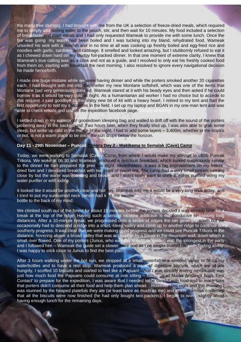
the many tree stumps). I had brought with me from the UK a selection of freeze-dried meals, which required me to simply add boiling water to the pouch, stir, and then wait for 10 minutes. My food included a selection of breakfasts and main meals and I had only requested Wameak to provide me with some lunch. Once the fire was going, my water had been boiled and I was tucking into my bland, rehydrated food, Wameak unveiled his wok with a flourish and in no time at all was cooking up freshly boiled and egg-fried rice and noodles with garlic, sardines and cabbage. It smelled and looked amazing, but I stubbornly refused to eat it as I chewed down hard on my stodgy foil-packed dinner. In that one moment of extreme clarity, I knew that Wameak's true calling was as a cook and not as a guide, and I resolved to only eat his freshly cooked food from them on, starting with breakfast the next morning. I also resolved to ignore every navigational decision he made henceforth. I made one huge mistake while we were having dinner and while the porters smoked another 20 cigarettes each. I had brought with me into the shelter my new Montane softshell, which was one of the items that Montane had very generously donated. Wameak stared at it with his beady eyes and then asked if he could borrow it as it would be very cold at night. As a humanitarian aid worker I had no choice but to accede to this request. I said goodbye to this shiny new bit of kit with a heavy heart. I retired to my tent and had the first opportunity to test my satcomms in the field. I set up my laptop and BGAN in my one-man tent and was able to check emails and update the expedition facebook page. Simply amazing! I settled down in my waterproof goosedown sleeping bag and waited to drift off with the sound of the porters jabbering away in the background. Two hours later, when they finally shut up, I was also able to grab some sleep, but woke up cold in the middle of the night. I had to add some layers – 3,400m, whether in the tropics or not, is not a warm place to be once the sun drops below the horizon. Day 11 - 29th November – Puncak Trikora Day 2 - Wakikama to Semalak (Cave) Camp Today, we were walking to Semalak (Cave) Camp, from where I would make my attempt to climb Puncak Trikora. We woke at 06:30 and Wameak produced a delicious breakfast, which looked suspiciously similar to the dinner he had prepared the previous night; nevertheless, it was a big improvement on my freeze-dried fare and I devoured breakfast with two cups of sweet tea. The camp had a very small stream running close by but the water was standing and brown and I didn't really want to drink it, either purified using my water purifier or with iodine. It looked like it would be another clear and hot day. Wameak told me it would be a very long walk today, and I tried to put my sunburned neck (which had kept me awake most of the night) and my almost empty water bottle to the back of my mind. We climbed south out of the forest for about 15 minutes before the porters decided it was already time for a break at the top of the ridge. Having such a serious nicotine addiction is not conducive to trekking long distances. After a 10-minute break, we progressed onto a series of ridges the ran generally south but we occasionally had to descend a ridge into a short, steep valley and climb up to another ridge to continue our southerly progress. It was clear that we were making good progress and we could see Puncak Trikora in the distance, hovering above a broad valley that was accessible by a break in the mountain wall, down which a small river flowed. One of my porters (Junus, who was the 'substitute' porter) was the strongest in the party and I followed him – Wameak the guide set a slower pace and as I no longer trusted his path-finding ability, I was happy to stick close to Junus to find the best path. After 3 hours walking under the hot sun, we stopped at a small waterfall in a wooded valley to fill up my waterbottles and to have a rest stop. Wameak produced a pack of digestive biscuits, which we all ate hungrily. I scoffed 10 biscuits and started to feel like a Papuan! What I was already finding remarkable was just how much food the Papuans could consume at one sitting – having read Marks Anstice's book 'First Contact' to prepare for the expedition, I was aware that I needed to be careful with food and to make sure that porters didn't consume all their food and help them plan ahead. . However, last night and this morning I was stunned by the heaped platefuls they ate (at least twice as much as me) and when Wameak confirmed that all the biscuits were now finished (he had only bought two packets), I began to worry slightly about having enough lunch for the remaining days.

18
We spotted some fresh bootprints heading south on the small path. Although I was surprised to see that there would be tourists climbing Trikora (which is still rarely climbed), I was a bit relieved to know that we could ask detailed questions about the route. We climbed over a small rise and Wameak pointed out a small cave in an escarpment in the distance. We headed slightly downhill towards it and could soon see a tent wedged in the left-hand end of the cave and a tarpaulin flapping in the wind to the right, supported by wooden stakes. Smoke was issuing from behind the tarpaulin so we knew there would be porters sheltering from the wind behind the screen. We climbed up a short, steep slope into the cave, which was about 50 feet wide, 8 feet high and 12 feet deep. The roof of the cave, which was caked black with the smoke of hundreds of fires, sloped back sharply, so that as you entered you had to crouch lower and lower to reach the back of the cave. The floor was spread with grass to make it more comfortable. Although the cave would provide excellent shelter from the rain, because it was effectively open to the front, it funnelled the wind that blew down the valley, hence why the incumbent porters had erected a tarpaulin for shelter. As I sat wearily down on my pack, my Dani team introduced themselves to the two others, who were from the Lani tribe and appeared much younger than my porters. The Lani porters explained that one Indonesian tourist was climbing Trikora with one guide and one other porter. They had set off at 5 am and were expected back late in the afternoon . Soon, Wameak was doing what he did best – cooking up a storm. As I was pitching my tent the Indonesian tourist returned from his climb, and although we acknowledged each other briefly, he immediately entered his tent to rest. I decided that was a splendid idea so I did the same. Wameak and I had discussed the possibility of walking up towards Trikora in the afternoon to try to identify the best access route. I thought this was a great idea, but as the afternoon wore on, it became clear that this would remain an idea and would not be put into practice as we were both exhausted from a long, hot walk. I consoled myself with the knowledge that he would interrogate the other guide and porter for vital navigational information that would help us the next day. Unfortunately, I forgot to consider Papuan male pride, which meant that under no circumstances would a Papuan male ever show a sign of weakness (such as admitting he didn't know the path to the mountain), even if that sign of weakness could help save his or his client's life. I had brought with me a rough sketch map drawn by one of my email correspondents, who had visited both Puncak Trikora and Puncak Mandala 20 years before. I had tried to find any reliable mapping of the three mountains for several months but had come up with almost nothing. I had visited the Library of the Royal Geographical Society in London in January and made copies of what was available, but these consisted mainly of old maps from expeditions in the 1950s that had no contour lines and very little in the way of detail. Therefore, I was relying heavily on local knowledge to help me find a safe route up the mountains. Late in the afternoon, the Indonesian tourist re-appeared from his tent and he explained that he was a mountain guide who had guided on Carstensz a few times and he was surveying Trikora with a view to running commercial trips. After Trikora, he was planning to walk for a week down to the Asmat region in the south, where the tribes still lived relatively traditional lives. I showed him my sketch map and asked him some questions about the route onto the mountain. The sketch map didn't bear much resemblance to the physical geography that I could see with my own eyes and he confirmed that he had some difficulty finding a way up to the summit ridge. He also confirmed that there was a lot of scrambling once on the ridge and at least some sections that required technical climbing. He wasn't exactly sure which of the several rocky high points on the ridge was the actual summit. My worst fears were confirmed. He had taken 10.5 hours to ascend and descend with a guide who had apparently been strong and fit and who did in theory know the mountain and had been there before. My situation, on the other hand, was less advantageous. I didn't have my mountain legs, my guide was unsure of the way and I would have to try to ascend alone. My discussion with him seemed to confirm that we should skirt West along the base of the mountain to find a path up to the summit ridge and then follow the ridge East. I spent a very restless night worrying about whether the easiest of the three summits I would attempt (in theory at least) would even be possible.
19
Day 12 - 30th November - Puncak Trikora Day 3 - All Hope Gone I rose next morning at 04:45 and could barely eat any breakfast. Whether this was down to altitude (we were now at 3,700m), nerves or lack of sleep I couldn't be sure, but I couldn't face much food in the morning and was keen to get moving. Wameak and Junus were going to accompany me to an unspecified point, after which I would continue alone. We followed a clear path heading south-west from the cave along a valley. After an hour of gentle ascent that kept Trikora to our left-hand side, Wameak spotted a break in the first escarpment and headed off the path over some boggy ground to try to find a path. I could still see boot marks heading south west on the actual path, but the language barrier prevented us from really understanding each other. My frustration with the situation began to grow and after Wameak had been gone for about 45 minutes with no sign of finding a path, I gestured to Junus that I had had enough. I asked him to bring me the lunch food and gestured to indicate that I would continue along the path and try to skirt round a subsidiary peak that protected Trikora's north-facing buttress to look for a safe way up. I thought I could see path up to the summit ridge high up behind this subsidiary peak. I felt like the time wasted so far would be fatal to my attempts to even get on the mountain and I preferred moving positively to sitting around and waiting for the guide to identify the path. I was sure if he found a path it would most probably be the wrong one anyway. I set off to skirt round the minor peak over grassy ground that got steeper and steeper. As I traversed, I realised that the ground ahead was becoming steeper and steeper and so I decided I may as well climb to the top of the minor peak to at least gain a good vantage point to survey the ground ahead. The porter had shouted across to Wameak and they followed me at some distance. It was hot, sweaty work to plod slowly up this waterlogged peak, which was riven with many narrow but deep fissures that I had to cross with care. Eventually, I reached the crest and was joined some time later by the two others. My hopes of spotting an obvious break in the buttresses ahead were dashed – I really couldn't see any feasible way to get on this mountain! Ahead and slightly to the right was a steep, 100m high grass-covered rampart and Wameak identified this as the route I should take to gain the summit ridge. He explained that two Japanese climbers had climbed this way using ropes and climbing gear. Although the route got less steep near the top, it looked atrocious and would have been incredibly risky, especially in the wet. I decided to call this Plan B and explained that I wanted to explore all other options before committing to this. Therefore, we continued to skirt West and South along the base of Trikora's flank. We were now off the path and had to cover broken ground where every footstep had to be placed with care. It sapped a huge amount of mental energy, knowing that every footstep could lead to a plunge into an unseen hole. We walked like this for two hours and as we progressed slowly, I always expected to see round the next corner a break in the wall that would allow easy access to the summit ridge. I identified a col where we should be able to see down into a valley that ran south and from where I hoped to identify an accessible route. As we sat on the col, I looked south and saw that Trikora's buttresses seemed to run unbroken into the distance. It was clear that it would take too long to reach a ridge at the bottom of the valley that may have given me good access to Trikora's ridge. I was completely despondent. We had walked for four hours, it was increasingly hot and now we would have to retrace our footsteps with no prospect of getting on Trikora today. I had been desperately scanning the wall to my left for any possible access routes and could see that even if I managed to climb up some of the steep and exposed corners, I would still have faced an unknown but steep route above to gain the summit ridge. We trudged back to the rampart that Wameak had identified and I began to feel weaker and weaker. I explained that there was no way I would be able to attempt that route today. We had already walked for four and a half hours across difficult ground, I was feeling weak and my breathing was very rapid. My heart rate was 120 bpm and I was not going to risk being stuck halfway up Trikora when I had no clear exit strategy. I was starting to feel nauseous and was now struggling to keep pace with the two others. We had decided to walk East, this time keeping Trikora to our right-hand side, to recce a path for the next day.

20
Although this sounded good in principle, my physical condition was not good and I was starting to run low on water. From my previous experiences at altitude I knew how easy it was to become dehydrated and how badly this could affect my performance. I tried hard to keep pace with the others and became frustrated and angry with Wameak. I began to feel more nauseous and finally knelt down and threw up. I explained that I was going to head immediately back down to the cave – I should have told the others to accompany me but I also wanted to make sure I had some possibility to get on the mountain the next day, so I allowed them to continue on with their search for the right path. I wanted to find the place where Wameak had gone off the path earlier in the day, because I thought if I found that boggy ground where he had explored then I would just head East to hit the path. However, I didn't want to have to climb back up the energy-sapping subsidiary peak that I had climbed earlier. I made my second big mistake and made my way down to the edge of the escarpment to find a way down to the boggy ground. The ground below was steep and I wasn't sure what I would face after the initial easy descent. I crept my way down beside a small stream through thick bush. I was grabbing handfuls of bush, tree and grass to cover the steep ground and realised soon that I had made a serious error. I was on my own, with no way to contact the others; I was weak, dehydrated and I had no idea what lay below me as the ground dropped off sharply. However, my adrenaline was kicking in and I had to trust in my own abilities. Most of the trees and tree stumps were dead, and therefore brittle, so I grasped clumps of grass and bush for safety. At one point, I had to swing out over the stream 20 feet below and this was the worst moment of all – I was only holding on to two clumps of grass and as I gingerly found a foothold below to make it on to relatively safe ground I breathed a huge sigh of relief. I followed the ravine down for another fifty feet and then saw the welcome sight of a more gentle slope that ran down to the boggy ground below. At this point I started to both relax and curse myself for my own stupidity. It was a stark reminder of how easily one bad decision can snowball and lead to a very dangerous situation. Once I was on the boggy ground I had to make my way back uphill to reach an exit route from the escarpment. It was soul-destroying having to trudge back uphill in my physical condition, but eventually I spotted the path and knew that I just had to stumble along it and it would eventually take me back to the cave. I finally reached the cave one and a half hours later to find all the others asleep. I crashed out, and only rose when I heard Wameak asking if I wanted tea. I was annoyed that he had not boiled any water so that I could rehydrate. I had lost a huge amount of fluid both from sweating and from water vapour in my breath. The Papuan porters didn't sweat and drank infrequently and couldn't seem to appreciate how important it was for me as a Westerner to
Global 3 Peaks The Seven Summits are the highest mountains of each of the seven continents. Since Dick Bass became the first person to climb all Seven Summits in 1985, 198 climbers are now recognized to have joined the elite club. However, many more mountain climbers aspire to complete the seven ascents, but the expense, the demands placed on fitness, the physical hardship and the dangers involved are often greater than imagined. Popularisation of the Seven Summits has not been without its detractors, who argue that it tempts the ambitious but inexperienced into paying large sums to professional guides who promise the "seven", and that the guides are therefore pressured to press on toward summits even to the detriment of their clients' safety. Alpinism author Jon Krakauer (1997) wrote in Into Thin Air that it would be a bigger challenge to climb the second-highest peak of each continent, known as the Seven Second Summits. This is especially true for Asia, as K2 (8,611 m) demands greater technical climbing skills than Everest (8,848 m), while altitude-related factors such as the thinness of the atmosphere, high winds and low temperatures remain much the same. To date, no-one has successfully climbed the second Seven Summits. At the time of writing, a number of world-class mountaineers are seeking to be the first, including: Hans Kammerlander (Germany, still to climb Dyctau, Mount Tyree & Puncak Trikora); Piotr Pustelnik (Poland, no info but has sumitted K2); Fredrik Strang (Swedish, no info, has not summited K2) and Christian Stangl (Austrian, recently lied about successful K2 ascent). In addition, a French-Canadian doctor, Dr. Andries Botha, is currently attempting this challenge, but has yet to climb either K2 or Mt. Tyree) The Seven Summits and the Second Seven Summits are remarkable aims in their own right. However, my long-term objective is to become the first person to climb the 3 highest peaks on every continent. This is a challenge so extreme that no-one has ever contemplated it before. This Australasia Peaks Glacier expedition was the second leg of this unique challenge, which I hope to complete over the next 10-15 years.

21
have access to copious amounts of fresh water. But I was too tired to fight with them so I quietly drank my tea, refused any offer of food and sank back into my tent. As I lay in my tent, I began to convince myself that it was now impossible for me to get up this mountain. I was still feeling sick, dehydrated and tremendously weak. I decided that I would make a token attempt on the sketchy climb up the rampart in the morning (depending how I felt) and that I would fail, head back to the cave, pack up and get the hell out to Wakikama. It seemed like the only option. After some snatched sleep, I made up a diluted Oral Rehydration Solution (ORS) drink, took half a Diamox tablet (a prescription diuretic that prevents and reduces the symptoms of Acute Mountain Sickness (AMS)) and managed to eat some fried noodles. It was now 17:30 and my improving mood was helped further when Wameak explained that they had identified the correct path to get on the mountain. Although I still wasn't completely convinced that I could get on the mountain, my black mood was lightening and I resolved to at least try. I had come this far and overcome so many obstacles already to be in this remote and beautiful part of the world and the mountain was right there in front of me. When I checked my emails there were so many messages of support that I knew I couldn't concede defeat just yet. Now, I just had to get on with the part that I had spent over a year preparing for – actually climbing the mountain! Day 13 - 1st December - Puncak Trikora - Summit Day I lay in my sleeping bag and looked at my watch – 04:00, then 04:30 and I still couldn't force myself outside. Despite my earplugs, I could hear the porters preparing breakfast but it was 05:50 before I forced myself out of my cocoon to face today's challenge. I had asked that the porters boil some water the night before because I wanted 3 fresh litres to take onto the mountain, but they hadn't done this. We wasted some time boiling fresh water, which was annoying on several levels, but the clear skies and pink-tinged clouds quickly banished my negativity. My appetite had returned and I ate a huge portion of rice and noodles. Somehow, whether the Diamox was taking effect (I'm sure it was because I felt pins and needles in my hands and forearms, one of the side-effects) or not, I felt immeasurably stronger. Perhaps it was just that I had resolved myself to giving it everything today. We set off late (06:40), but I had my headtorch and enough warm kit to see out a night on the mountain if necessary. Instead of following the path southwest in the next valley as we had yesterday, today we forked off the path directly towards the mountain. Boot prints in the mud convinced me that we were now on the right path, which boosted my confidence further. We were trekking towards the scrubby forest again and soon we were ascending steeply through mud and tree roots. At the top of this short climb (4,100m (04 15.224 S, 138 40.115 E)) there was a firepit where porters had obviously been keeping themselves warm on earlier climbs. This was followed by another short forest section and then we came to the first buttresses on the mountain itself. From a distance this looked suicidal - from up close it just looked plain stupid. I was faced with a steep 50m – 60m grass-covered, near-vertical slope. It was a really uncomfortable experience and required me to grab handfuls of wet grass to ascend, which was not an enjoyable experience after yesterday's debacle. I prayed it wouldn't rain today, otherwise the descent would be a nightmare. I slowly followed the guide and porter up and gladly reached the top of the climb and safe ground (approx. 4,200m (04 15.310 S, 138 40.157 E)). From the top of this slope, the views northwards back past the cave and towards Lake Habbema were sensational. It was possible to see from this height where historic ice flows had carved and shaped the earth. From the top of the grassy slope, the path meandered left to the foot of a buttress into a small valley that ran south from Trikora. It was one of several parallel valleys but this most easterly valley allowed the only easy access to Trikora's upper reaches. The path led up through some rocky ground and then as the ground became boggier we passed a boulder, on top of which sat the propeller shaft from an AMA aircraft that had crashed several years previously on the mountain, killing the missionary pilot and a local woman. This marked the end of the small valley and now we turned right (West) along a larger valley that ran parallel to Trikora's summit ridge, which was now high up to our left. The valley climbed and narrowed in the distance and as we ascended it became more rocky. We walked for about 40 minutes and my confidence increased with every step. I still wasn't sure how I would gain the actual summit ridge but the sun had stayed behind some light cloud and I was feeling strong and knew that
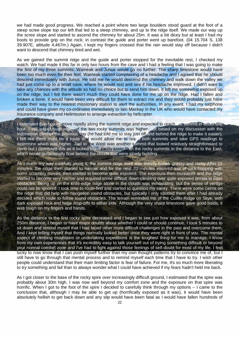
22
we had made good progress. We reached a point where two large boulders stood guard at the foot of a steep scree slope top our left that led to a steep chimney, and up to the ridge itself. We made our way up the scree slope and started to ascend the chimney for about 25m. It was a bit dicey but at least I had my boots to provide grip on the rock; in contrast the guide and porter went up barefoot. (04 15.704 S, 138 39.907E, altitude 4,467m.) Again, I kept my fingers crossed that the rain would stay off because I didn't want to descend that chimney tired and wet. As we gained the summit ridge and the guide and porter stopped for the inevitable rest, I checked my watch. We had made it this far in only two hours from the cave and I had a feeling that I was going to make the first of my three summits. Wameak and Junus would go no further. The sharp limestone would have been too much even for their feet. Wameak started complaining of a headache and I agreed that he should descend immediately with Junus. He told me he would descend the chimney and walk down the valley we had just come up to a small cave, where he would rest and see if his headache improved. I didn't want to take any chances with the altitude so had no choice but to send him down. It left me somewhat exposed up on the ridge, but I felt there wasn't much they could have done for me up on the ridge. Had I fallen and broken a bone, it would have been very difficult for them to extract me and they would probably just have made their way to the nearest missionary station to alert the authorities, In any event, I had my satphone and could have given my co-ordinates immediately to Iain Mackay in the UK who would have contacted my insurance company and Helimission to arrange extraction by helicopter. I estimated that I could move rapidly along the summit ridge and expected to reach the summit in about one hour. I still wasn't sure which of the two rocky summits was higher, but based on my discussion with the Indonesian climber the previous day (he had told me to stay just off and behind the ridge to make it easier), I felt like there must be a route that would allow me to reach both summits and take GPS readings to determine which was higher. Just to the West was another summit that looked relatively straightforward to climb but I dismissed this as it looked significantly lower than the rocky summits in the distance to the East, which would occasionally float behind the clouds that were slowly building. As I made my way carefully along it, the summit ridge itself was initially broad, grassy and rocky After 15 minutes, the ridge then started to narrow and for the next 20 minutes involved lots of rock-hopping with some scrambly moves, then started to become quite exposed. The exposure then increased and the ridge started to become very narrow and required some difficult down-climbing over quite exposed terrain to pass obstacles. Being up on the knife-edge ridge alone in the clouds was exhilarating, but the sense of vertigo could not be ignored. I took time to route-find and started to question my sanity. There were some cairns on the ridge that did help with navigation round obstacles, but typically I only spotted them after I had already decided which route to follow round obstacles. The terrain reminded me of the Cuillin Ridge on Skye, with dark exposed rock and huge drop-offs to either side. Although the very sharp limestone gave good holds, it was tough on my fingers and hands. As the distance to the first rocky spire decreased and I began to see just how exposed it was, from about 250m distance, I began to have major doubts about whether I could or should continue. I took 5 minutes to sit down and remind myself that I had faced other more difficult challenges in the past and overcome them. And I kept telling myself that things normally looked better once they were right in front of you. The mental aspect of climbing mountains or undertaking expeditions is the toughest thing for me to manage. I know from my own experiences that it's incredibly easy to talk yourself out of trying something difficult or beyond your normal comfort zone and I've had to fight against those feelings of self-doubt for most of my life. I feel lucky to now know that I can push myself further than my own thought patterns try to convince me of, but I still have to go through that mental process and to remind myself each time that I have to try. I wish other people could understand that their main limiting factor is fear of failure. For me, it's so much more liberating to try something and fail than to always wonder what I could have achieved if my fears hadn't held me back. As I got closer to the base of the rocky spire over increasingly difficult ground, I estimated that the spire was probably about 30m high. I was now well beyond my comfort zone and the exposure on that spire was horrific. When I got to the foot of the spire I decided to carefully think through my options – I came to the conclusion that, although I may be able to get up (horrifically exposed as it was), it would have been absolutely hellish to get back down and any slip would have been fatal as I would have fallen hundreds of
23
feet. For me, the risk of attempting to climb it solo was too high. The spire was connected to the next peak on the far side by another horrendously exposed ridge. I was already tired from the concentration required to get to this point. If I had a climbing partner and some technical equipment I would definitely have tried to summit; as it was, I decided that I had reached my limit. I was quietly satisfied with my efforts. After a terrible day the day before, I had found my confidence and fitness, and although I had missed out on the summit, I felt like it was the right decision in the circumstances. I took a GPS reading at my high point (04 15.778 S, 138 40.511 E, altitude 4,638m), took a few photos and then started to descend. Scientists have known that the ice cap on Trikora disappeared sometime between 1939 and 1962. That gives some indication of just how infrequently this mountain was climbed during this period. Snow does fall on the mountain but the warming of the Earth's troposphere ensures that this snow cover is only transient. As I started to descend, it began to rain lightly. I tried to move as quickly as possible because I was aware that the two difficult down climbs (one on rock at the chimney and the other down the steep grassy slope) would be much more challenging in the wet. I had a bit of trouble following the route around obstacles again on my way back along the ridge, and was conscious of where I was placing my feet due to the long drop-off behind the ridge itself. Soon enough, I was past the difficult ground and back to stepping from rock to rock and could get into an easy rhythm. After about one hour, I had made it back to the broader, grassy ridge and was heading towards the lower peak that lay West of the chimney. At the foot of this peak, I spotted a small cairn that marked the start of the chimney and I started to make my way carefully down. On the first short section that was less steep, I made my way down facing out, feet first and half-slid, half-climbed down the slope. It then became steeper and I had to down-climb, facing into the rock. Although there was a scree slope beneath that ran out to the small valley below, I was still careful because any fall here would not be fatal but any broken bone would be a massive issue in this remote location. About five metres from the bottom of the chimney, I had to move over to the left-hand side to find the easier ground. As I was reaching to move my left hand up and across to a good handhold, the rock that I was holding with my right hand broke free and I felt myself falling backwards. Instantly, I grasped at another rock with my right hand and as I did so, I also managed to grab onto something with the outstretched left hand and managed to hold myself against the fall. Not good. I carefully picked my way down the last few moves to the scree slopes and, using my trekking poles as supports, I made my way quickly down into the small valley that I had earlier walked up. As I made my way down the valley, I looked for the cave where Wameak had said he would wait, but couldn't identify it. I shouted but there was no response. I walked down the valley for about thirty minutes, looking for anything that would jog my memory. I felt certain that the propeller shaft would be visible from this valley but there were so many small ravines off to my left and they all looked the same. I explored a couple of them to try to identify a path but they all ended in steep drops to the North. I was becoming tired and frustrated again that the guide and porter had left me alone on the mountain. Finally, I explored the second-to-last ravine, then realised that it was the wrong one. I climbed up a small ridge and looked down into the last valley, expecting to be disappointed, when I caught sight of the propeller shaft sitting on a rock. Excellent! I had found the route get down. I followed the path down the initially grassy and boggy ground, then into a rocky path that lay close to the mountain wall. It ended abruptly at a grassy ledge and as I looked down into the forest 50 m below I saw Wameak next to the firepit and Junus collecting firewood. I shouted and gesticulated to him – I was now at the top of the steep grassy climb and was not impressed that they had gone down this and had not waited for me. I wasn't exactly sure where the route started and I frantically tried to ask Wameak whether I needed to move left or right to start the down climb. His response was that I was at the correct starting point and I should just come down. With my blood boiling, I removed my rucksack and launched it over the edge, aiming at a small ledge 20 feet below. I didn't want the extra weight to potentially drag me off or the bulk to put me off-balance. My rucksack cartwheeled well beyond the ledge and stuck in a bush halfway down the slope. I really didn't care – I knew we could retrieve the rucksack later and I was more interested in getting down safely.

24
I inched forward to the edge of the slope and peered over, trying to identify any safe footholds. It was a horrible experience – again, I had to grab handfuls of grass to gently lower myself over the edge and hope that they would take my weight. I immediately realised that I was a few metres too far to the right and couldn't believe my guide had left me in this position. I inched carefully over to the spot I had climbed up earlier and then very cautiously made my way down, grabbing handfuls of grass with each move. When I finally reached the bottom , I hurried through the forest and up to the small hill where Wameak was warming himself at the fire. Although he probably understood very little of what I screamed at him, he was left in no doubt that I wasn't happy with him and hopefully he learned a few good Scottish swearwords as a bonus. I was pretty subdued for the rest of the walk down the mountain – the clouds had closed in and it had started to rain steadily so I was quite cold and just wanted to get down to the cave to get a hot brew and some food. We made quick progress down the mountain and turned the corner into Camp at about 1.45 p.m. It had taken me seven hours or so to get up and down – it was hard to compare with the Indonesian's ascent the previous day because I don't know how far along the summit ridge he climbed, but I felt we had set a good pace. The plan now was to leave early next morning to make our way back to Lake Habbema – I asked Wameak what time we should expect to arrive at Habbema and he said 3 pm, so I texted the agent on my satphone to request pickup for that time. When we tried to figure out timings I was sure he was overestimating how long it would take us but I didn't want to underestimate so followed his advice. During the afternoon we ate noodles, rice and cabbage and drank tea and Wameak recounted the story of a 20-year old Indonesian climber (with no travel permit) who had been climbing Trikora using technical equipment. One of his climbing nuts (used to wedge into cracks in the rock, thus protecting the climber form a fall) had failed and he had fallen badly. His Lani guide had made his way to the nearest mission station to report the accident, leaving the climber lying badly injured on the mountain. The Army dispatched a helicopter to the site and he was later flown to hospital in Jakarta. No doubt he would also have been heavily punished for not having the correct papers to be there! Day 14 - 2nd December - Puncak Trikora - Lake Habbema - Wamena We set off from Semalak at 7 am sharp. I had plenty of water and was keen to make good progress to get back to Wamena as soon as humanly possible. I wanted to get clean, have a Coke and get back to Jayapura to prepare to meet the Carstensz team on 6th December. I needed to clean my clothing (especially the softshell that Wameak was still wearing for the fourth night and day in a row!) and kit, book my flight to wherever I would meet the Carstensz team and I also wanted to bring my diary and blog up to date. One of the aims of the WCMT Fellowships is to share my journey with as many people as possible and I had the opportunity to do that. I felt pretty sure that we could cover the ground back to Wakikama pretty quickly. My idea was that when we got there I could then call the local agent to ask him to dispatch the driver and vehicle to save us hanging around. With lighter loads (we'd eaten almost all the food) and with our mountain legs, we raced down the valley, over, down and up the series of ridges and soon we were descending into the forest towards Wakikama. We arrived just after 9 am. I fired up the satphone to see if Justinus had acknowledged any of my messages; he hadn't. I then tried to call him on the number I had stored, but it wouldn't connect. I decided to check the number against the number that Wameak had stored in his mobile, but because he had left his phone switched on during the entire trip, his battery was flat. This had the potential to become a very difficult situation. If I had no way to contact Justinus and if he had never received any of my messages, we could be stranded at Lake Habbema with little food and no way to get back to Wamena other than on foot. I checked my own mobile and although it had been playing up for a couple of weeks (mysteriously switching itself off and on) it thankfully fired up and I was able to check the number I had stored for Justinus. I realised that I had made a mistake when adding his details to my satphone and was really annoyed with myself for this stupid mistake. I quickly dialled his number and after a long delay he answered. I tried to explain as quickly as I could our location and likely time of arrival at Habbema (12 noon). He told me that, having not received any word from me, he had sent the vehicle and driver that morning to Habbema in the expectation that we would have spent the night at Wakikama – the driver had been waiting since 8 a.m. I tasked Junus

25
with the job of getting to Habbema as quickly as possible to try to find the driver, since we were taking a different (i.e. the correct) route back. At least I knew that if we made it safely to Habbema and found the driver that we should be back in Wamena in the mid-afternoon. I also asked Justinus if he could arrange to bring my flight back to Jayapura forward one day from 4th to 3rd December, so that I could get settled in my hotel and get myself organised. Junus set off in front of us but we followed closely behind at a steady pace. We were all keen to get back, for different reasons. The guide and porters had wives and children; my motivation was just to get to the next mountain. We had to cross a boggy, flat valley to reach the foot of a steep, tree-clad ravine. It took us about 45 minutes to cross the valley and at the foot of the ravine ran a broad, shallow and slow-moving river. It was quite picturesque and although I would normally have tried to find the shallowest part to keep my feet as dry as possible, I plunged straight in and waded through the water, since I felt we were so close to the end of the trek. The path up the ravine initially followed a small stream that fell sharply from the valley in which Lake Habbema sat. With the sun beating down on my neck again it was hot work to follow the narrow, steep path, which soon turned sharply away from the left hand bank of the stream to climb a series of narrow, switchback turns that took about 25 minutes of exhausting and hot work to ascend. I felt certain that Habbema would be in sight once we reached the crest of the valley, which was coming closer and closer as the ground became less steep. Wameak would climb for just a few steps, then stop suddenly. I found this incredibly frustrating because it would spoil my rhythm. I prefer to keep going at a steady pace and find my mind wandering off into different directions. This ability to take my mind off whatever my body was doing was being constantly interrupted and made the final climb much less bearable than it needed to be. As we breached the crest, instead of the welcome sight of Habbema in the distance and the road back to Wamena, I looked down into another boggy plain that I estimated would take another hour of fast marching to cover. At this point, my contempt for my guide reached a zenith. I quietly fumed while we plodded through the mud and every utterance from Wameak was met by stony silence. I started to believe that whenever he was faced with a decision between 2 paths, he would always choose the more difficult path. The porter, on the other hand, seemed to take the easier path, so I started following him instead, because I trusted him more. Finally, just when I started to despair of ever reaching the road, I caught sight in the near distance of the sandy ribbon that would deliver me back to Wamena. It was a huge relief. As I slumped onto my rucksack at the side of the road and removed my wet boots and socks, I wondered where the porter who had gone ahead, Junes, had got to. Wameak started to light a fire and was hollering into the distance, but no reply was heard. We waited by the roadside for half an hour, then in the distance we could see sand being kicked up by a vehicle and before long a 4WD pulled up beside us. There were about 10 or 12 local tribespeople in the back of the pickup and it took me a few seconds to register the Indonesian driver and then recognise Junus's smiling face in the front seat. It was our vehicle! They had picked up some villagers who were making their way down the road into Wamena, which would take them 2 or 3 days walking. I noticed that a few of the tribespeople were armed; two of them carried rifles and others had parangs, but thought nothing of it. The villagers disembarked and as we started loading our kit into the back, the driver explained politely, but with a tangible sense of exasperation, that he had been waiting here since 7 a.m. Ouch. I felt sorry for him but what could I do? We had got there as quickly as humanly possible and it had taken us less than 4.5 hours to walk from the Cave back to Lake Habbema. We jumped into the truck and started driving. After about 10 minutes, we stopped at a makeshift shelter by the side of the road – the driver and his friend (who was also in the vehicle, for safety, I guessed) hadn't eaten since very early morning and we had a small amount of food left. Therefore, we let them prepare a hot meal of noodles and cabbage and as they cooked and ate, the villagers started to pass us and make their way up the steep road ahead. Once the drivers had eaten their fill (about 40 minutes later), we jumped back in the car. The driver seemed determined to make up for lost time. He was going flat out but seemed to know the road well enough, so I never felt particularly unsafe. Having worked in the field in South Darfur, I was used to covering very rough ground at relatively high speeds. We soon caught up with the group of villagers again and a few of them started flagging us down. It would have been impossible for us to take them all in the truck now and as we passed one of the villagers on the left hand side, the driver seemed to slow down as though he was going to stop. The man began to gesticulate and shout angrily and this

26
persuaded the driver to pick up speed again as we passed him. I could see the villager’s face flashing with anger as we passed and then I watched in the wing mirror as he threw his parang with all his strength at the back of the vehicle as we accelerated past. It was a terrifying moment for me. If we were to break down now or further up the road we could have found ourselves in a very serious situation. As I sat in the car trying to collect my thoughts, my first thought was that these were OPM rebels, which would explain the weapons and the aggressive attitude. I was really glad that we were moving at high speed away from the mountains. I began to rationalise a bit more and instead came to the conclusion that they were most probably just villagers who really didn't fancy walking all the way to Wamena and had missed the chance of a free ride. However, before my brain had fully processed the incident, we had to pass quite a few other groups of Papuans on the road and each time I caught sight of them a little chill would run down my spine until we were safely past. It was with a huge sense of relief that I finally reached the Baliem Pilamo Hotel at 2pm. The driver had done a great job of getting me back safely in good time.
Figure 3: Google Earth route to Puncak Trikora with altitude profile
Day 15 - 3rd December– Wamena – Jayapura - Ready for Carstensz Pyramid It was an early check in at 6 am for the first flight out of Wamena at 7 am. I caught a bicycle rickshaw outside the hotel and asked 'berapa' (how much)? The rickshaw driver said 'seppulu' (10,000 rupiah, just over $1). I feigned disgust and said I would rather walk. He then offered 'tiga ribu' or 5,000 rupiah and with my new-found confidence in Bahasa Indonesia I decided to negotiate further, since it was such a short journey. 'Tedak (no)! I will pay only dua pulu ribu', which every Indonesian knows means 20,000 rupiah. Somehow, I had managed to negotiate the wrong way. I figured this out on the journey and my smugness at playing hardball so effectively soon turned to mild embarrassment. Given that I am about a foot taller than the average passenger, I was awkwardly wedged under the fabric shade with two bags sticking out at strange angles. Ah, to be a tourist in Papua. The check in counter for Trigana and the other airlines was an MDF structure with holes cut out for check-in windows. The system (such as I could make out) was for all the passenger tickets to be lined up on the
27
counter in the order that people turned up. About half an hour before the flight, an Indonesian staff member arrived and all hell broke loose. People started waving their tickets in his face and demanding to be included on the passenger list. I was grateful that I had arranged the previous day for my name to be on that list. As it turned out there was plenty of spare seats on the first flight so everyone who wanted to get on board got a seat. This time I had a window seat and was privileged to have amazing views across the central highlands. Cloud was lying in the valleys but the rugged, emerald and still-growing peaks of New Guinea stood proudly above the cloudbase. The 45 minute flight passed quickly and before I knew it was landing back at Jayapura. I now felt like an old hand and was able to assist a Western couple with luggage collection. Instead of hailing an overpriced airport taxi for the 10-minute journey back to the hotel, I walked out of the airport and jumped one of the local minibuses that serve as the local transport network. Similar in size to a matatu in Kenya, these minibuses are different in that you just tell the driver where you want to go and he will drop you off and then return to his regular route. As we approached the Sentani Indah Hotel there were a huge number of blue banners lining the street and fluttering in the breeze. I had returned in the middle of the PAN's Papua branch's 5-year political conference, and was grateful that I had made my reservation as Room 131 was still available. Although I'd like to believe that this was due to my important status as a VIP guest, I was pretty sure it was more to do with the fact that the toilet leaked and the room was at the very back of the hotel. I was feeling really ready for the next challenge and excited to meet up with the Carstensz expedition team after so long on my own. I was hoping for an email from the European agent as he was supposed to send me details of where I would meet the team in Papua and I had come back as soon as possible from Wamena specifically for that purpose. Having had my team pull out on me just a few weeks before I left the UK, I had no option but to pay him as he was the only agent that I knew of (local or international) who was running a December expedition. I was really happy to see an email in my inbox from him (via Iain Mackay) and opened it expectantly. To my shock and massive disappointment, the email was telling me that the expedition had been postponed. I was gutted and my brain started to kick into emergency footing. I think that, although I doubt myself sometimes and worry too much about small things, I am quite good at coming up with creative solutions in an emergency. His email stated that the trip may go ahead on 19th December but I had now lost all trust in this man, since he had only given me three days’ notice of cancellation. I sent an email to him directly stating that I required immediate reimbursement and that he had left me in a very difficult situation. I needed to get my hands on the money in case I could find another solution so that I could, if necessary, pay another (local) agent. I sent an email to Iain Mackay and asked that we discuss options later that day when Iain had a break from work. I communicated with a friendly local agent that I had built a good relationship with to identify any agents now running an expedition in December. She gave me an email address of one and I sent a message asking if I could get on their expedition. As far as I could see, I now had the following options: 1. If local agent said yes and the Carstensz expedition began 19th Dec or later, I would arrange a flight back to Bime as soon as possible and attempt Mandala first. This would depend on the Czech agent reimbursing me his fee, which he claimed he will do the next day. 2. If local agent said yes and the Carstensz expedition began before 19th Dec, it would not be worth trying to get to Mandala before Carstensz and I would figure out a short term-plan to save money and wait for Carstensz 3. If local agent said no, then I would arrange to fly to Bime as soon as possible, try Mandala and then plan to go back early to the UK and postpone Carstensz until possibly next summer 4. Ask Freeport McMoran (who operate the Grasberg mine adjacent to Carstensz) if they would allow me access through their project area to Base Camp to at least collect some photos of the glaciers. During my
28
research, they had already refused me access, although they have in the past supported expeditions collecting data for the same researchers that I support. I emailed my contact there to gauge their reaction The local agent sent me a message to tell me that they would ask their client if I could join the private expedition and told me they would contact me on Monday with an answer. This meant being stuck in Sentani over the weekend in the middle of a political party conference, which was truly bizarre. However, it was the first time I had seen other guests at the hotel. Days 16 – 20, 4 – 8 December, Stranded in Sentani Saturday and Sunday were spent contemplating a lot about what had happened so far and what may or may not happen over the next few days. I was really frustrated because there was really nothing I could do except wait for confirmation from the international agent (re refund) and the local agent (re potential Carstensz departure) before I could really plan my next move. I spent some time over the weekend trying to catch up with my blog and updating the expedition facebook page with photos and videos so that people could share as much of my experience as possible. I tried to remain positive over the weekend and also sent emails to a couple of production company contacts I had about the possibility of producing a documentary of the expedition. I also reconnected with Dr. Mike Prentice of the University of Indiana, who I was providing glacier photos and elevation data for to update him on my position and he wished me luck and told me he would have loved to join me on the expedition, which I appreciated. On the 7th December, I received confirmation that the refund from the international agent had hit my account, which cheered me up from my misery. I felt trapped in the hotel and Sentani had no real tourist sites to speak of. I was concerned about haemorrhaging money the longer I stayed in the hotel. There was no-one else to hang out with or speak to and my frustration and sense of isolation was starting to wear me down. I phoned the local agent and he told me he still hadn't heard back from his clients but would know by Wednesday 8th December. This was a big blow. I decided to walk into Sentani proper just to get away from the hotel. On Wednesday 8th, I got the email I was dreading – the local agent confirmed that his clients had refused to allow me to join their expedition. It was a crushing blow. However, I immediately started trying to create something positive out of this disappointment. I decided to postpone Carstensz Pyramid until after my contract with German Red Cross i.e. until July 2011. At least now that I knew either way I could plan to access Puncak Mandala. I wasn’t sure of the correct protocol now – should I contact the Bime representatives before I booked my mission flight, or book the flight and then let them know that I was going back? I decided to check the flights first, since the weekend was approaching and I knew they wouldn't fly on a Saturday or Sunday. I decided to try to arrange a mission flight back to Bime for Friday morning i.e. 10th December. I sent a message to Bob Roberts from Adventist Aviation to ask if he was around. He phoned right back to say he was on the way to Jakarta for dental treatment so instead I sent a text to the other Bob, the Ops Manager at AMA, and also to Eric Roberts, the AMA pilot, to ask if a flight was available for Friday. Realistically, I didn't know how many days I would need for Puncak Mandala as none of the Bime representatives were clear on either the route or how many days walk it would take. The last person I knew who attempted this route failed to make the summit due to a hailstorm, after 5 days of walking from Bime. However, when I had showed his sketch map to the Bime locals and representatives they told me that the names of some of the villages they passed were wrong. I know that Mark Anstice and Bruce Parry had some trouble on their attempt from the south when they were taken partly up the wrong valley so I would plot my progress carefully using GPS to make sure we'd be heading in the right direction at least. I planned to take max 5 porters but again knew that I may have more forced on me by the community. I hoped that I could leave the day after I arrived (i.e. Saturday), but again I didn't expect it would be a straightforward process. Hopefully, I could get in and out in a maximum of 3 weeks.

29
I sent a text to Titus's father informing him of my plans and I got an immediate response asking how many of the delegation I wanted to take back to Bime with me. The answer was that I planned to take only one, Titus himself (to translate and help with negotiations). He then sent another message telling me that Enus would fly to Sentani on Friday (the day I planned to fly), which troubled me a little bit. Day 21 - 9th December - Back to the Star Mountains? During the morning, the hotel staff arranged a car and driver to take me on the 1-hour drive to Jayapura to try to change USD to Indonesian rupiah (not possible in Sentani) as funds were getting a bit low after so long in this hotel. The Sentani/Abepura/Jayapura conurbation is really not set up for tourists and there is only one Bank in Jayapura that changes money. At the Bank, I was told that two of my $100 bills were fakes and couldn't be exchanged. Also, this was not a good time to find out that there is a daily exchange limit of 1,000 USD (which didn't apply in Jakarta)! I had hoped to change at least $1,500 to make sure I had a small float of Rupiah for any unexpected emergency payments. I still hadn't heard back from AMA so I called Bob Ops Manager and he told me he was in Merauke and would not arrive back in Sentani until Friday afternoon. He told me to go to his office and visit his assistant, who I knew from my last trip. The trip to exchange money took three hours in total and then I rushed to the AMA office at the airport. I explained to Bob's assistant that I was hoping to fly the next day and to my relief she confirmed there was a flight and that there were four confirmed passengers. I tried to explain that I may fly with one other (Titus). My next stop was the supermarket. Bob Roberts had advised me to take a 10 kg bag of rice as a gift to the community and I also bought some Indonesian cigarettes as gifts for either my porters or the community leaders from the villages I passed through. I also stocked up on lots of chocolate, which I had missed on Puncak Trikora. I rushed back to the hotel in good spirits that at last my luck seemed to be changing. I packed my kit that evening and ate my last big meal at the hotel. I checked a press release that my PR wanted to issue recounting my attempt on Puncak Trikora and tried to get some sleep. I was really nervous about going back to the Star Mountains after my last visit and the fact that there were so many factors beyond my control. I had no idea if I would make more progress or if I would get stuck in Bime or another village en route. I didn't know how much the porters would expect to be paid. I had received a lot of useful information from several correspondents but no-one had visited the area in the last 10 years so I was still going back into the unknown, although I was very happy that I would at least have one other English-speaker to help this time. Day 22 - 10th December - the plot thickens I was awoken at 07:20 by a phone call to be told that the Bime delegation would be coming to my hotel. I was really annoyed by this because I hadn't had breakfast or packed all my kit. It also meant that my plan to fly to Bime with the translator Titus had obviously changed. I told Titus, while trying to remember that he was just the messenger, that they must not come until after 9 am because I wouldn't be ready. At 08:30 he called again to say they had arrived. I told him they would have to wait because I wasn't ready and after a quick shower I headed out to the terrace to figure what was going on. Enus was in Oksibil so it was just Titus, his father and two others with links to Bime. I shook hands and tried to smile and then asked if everything was OK. I was assured that it was, apart from the small matter of an administration fee that I had to pay immediately before I left for Bime. Titus told me it was 50,000 Rupiah, which seemed very reasonable (about $6). I then asked if Titus was ready to fly and he said no, because he had to go back across the border to Papua New Guinea because his Indonesian visa would expire in a few days. This was a real blow. I wanted him there to help me arrange porters and negotiate with each village kepala desa on the trek in and it would be so much harder without him. I then started asking questions about how to pay the porters, because the fact was that I only had about $1,200 in rupiah since the bank had only changed $1,000 for me the previous day. I had been planning to offer the porters about 100,000 rupiah per day (about $11), which I felt was very fair considering the remote community they lived in. I estimated 10 days with 5 porters would cost about $550, which was affordable. I

30
still had to pay for my own AMA flight, which would cost me another $250. So, I had a little bit of spare cash that I hoped would be enough to see me through back to Jakarta (since it was inconvenient to travel to Jayapura to change money). Titus' father was constantly on the phone with Enus as the discussion developed to check and confirm details. Titus told me first that Enus would fly to Sentani the next day (but I knew he couldn't because it was a Saturday) and would then fly to Bime. Realistically, the earliest that he could be there would be Tuesday. I would therefore be in Bime for 4 nights with no prospect of leaving until Enus arrived. This was quickly becoming a ridiculous and unrealistic situation. I started to think for the first time about cancelling my flight that day because it made no sense for me to fly out only to be stranded in Bime. I explained this to Titus and this was relayed to Enus. His next plan was that I would go to AMA and meet his brother Nas and be accompanied by one of the Bime representatives (from out of nowhere, four other people had now mysteriously appeared at the negotiating table). This would now involve me flying out and paying for a return ticket for me and Enus' brother and a single for the other Bime representative – total cost to me was $750 for the tickets. I explained again that I really had only a small amount of money and that I couldn't in reality afford to pay those tickets and then also pay the porters etc. Throughout the discussion, Titus mentioned several times how important it was that I paid the administration fee. I couldn't see what the problem was and reassured him that it was OK. I understood why I had to pay and would do so willingly. Finally, Titus confirmed that Enus had advised that I pay the porters 300,000 Rupiah per day ($33). Total cost to me would be $1,666 just for porters. Clearly, I didn't have the funds to pay this and I calmly (I think) explained that I would not be able to travel to Bime now and would have to fly back to the UK. This got their attention and I was asked again to pay the admin fee while they came up with a new plan. I reached into my bag and pulled out a 100,000 rupiah note and said I would happily pay double what they had asked. I looked up into blank faces. Then it dawned on me. Papuan people tend to forget about the last 3 zeros when they are talking about money – they were asking me to pay 50,000 thousands! 50 million rupiah is the equivalent of about $5,500! I closed my notebook and tried to remain polite. I asked Titus to apologise to his father and Enus for wasting their time. I explained that I was here as an individual, a guest in their country and that there was no way I could ever afford to pay that amount. Immediately, Titus' father was on the phone to Enus and explained that I could instead pay a fee of 15 million ($1,600) and that I could pay the porters around 50 – 100,000 rupiah per day. Although this was much more realistic, it was still beyond my means and I resolved at this point that any further negotiation was a waste of time and that I would leave Papua as soon as possible. I explained to Titus that I would have to postpone my trip back to Bime – I would come back in July to attempt Carstensz Pyramid and I started to form a plan to also keep two weeks free to come back to Bime. I really wanted Titus on board as he spoke good English and he confirmed that he had two weeks of school holidays at the end of July/beginning of August. It was obvious that everyone was disappointed and that they really did want me to come back to Bime, but their greed had defeated them. I had a very heavy heart but a very clear head as I explained my position. Titus asked me what they could have done better. I explained that I (and other tourists) would understand an administration fee but that they had asked for far too much money. I told him that if they had discussed the administration fee earlier in the negotiations, we could have agreed a position and I could have changed more money or arranged a transfer into Indonesia and that it was not appropriate for them to come to my hotel just before I fly to try to extort money from me. Titus seemed to understand and was very apologetic about the whole situation. Finally, I brought from my room a 10kg bag of rice and some cigarettes that I was taking as a gift to the community in Bime and instead, gifted them to his father as a sign of my understanding and co-operation. Titus and I then agreed to keep in touch between now and July and to make concrete agreements before I go back. That afternoon, I booked a ticket out of Jayapura to Jakarta and changed the date of my return flight to the UK. It had been an incredible, exhilarating experience but left me with a sense of frustration and disappointment since I had failed to meet my original expedition objectives. And it definitely felt like unfinished business.

31
LATITUDE / LONGITUDE:
Date Name Lat/Long Altitude (m)
23-Nov Jayapura 2°34'38.40"S 140°32'17.90"E 86
24-Nov Bime 4°17'9.65"S 140° 7'29.98"E 1,800
25-Nov Jayapura 2°34'38.40"S 140°32'17.90"E 86
27-Nov Wamena 4°5'51.00"S 138°57'4.00"E 1,865
28-Nov Wakikama 4°10'58.20"S 138°41'30.42"E 3,301
29-Nov Semalak Cave Camp
4°14'26.40"S 138°40'10.20"E 3,740
30-Nov Highest trekking point
4°14'26.40"S 138°40'10.20"E 4,114
01-Dec Summit Ridge - expedition high
point
4°14'26.40"S 138°40'10.20"E 4,638
02-Dec Wamena 4°5'51.00"S 138°57'4.00"E 1,865
03 - 10-Dec Jayapura 2°34'38.40"S
140°32'17.90"E 86
32
5. SUCCESS FACTORS: The purpose of a Churchill Traveling Fellowship is to widen an individual’s experience in such a way that he or she grows in confidence, knowledge, authority and ambition, and to bring benefit to others in the UK through sharing the results of their travel experience. This is to be achieved through: • the inspiration provided by the individual’s example – his or her subsequent performance and achievements • the dissemination and application of new knowledge, different perspectives and innovative solutions In order to determine whether the purpose of the Fellowship was achieved, it is important to measure not only whether the expedition objectives were achieved, but more importantly how I attempted to achieve them. The qualitative factors relating to the Fellowship outweigh any quantitative results that may or may not be achieved. Relevant factors to consider are: i) How far the purpose of the Fellowship was achieved Confidence: It is difficult at this early stage to determine whether the purpose of the Fellowship was fully achieved, given that it requires measurement against future achievements. However, while I experienced frustration and disappointment on the expedition, I also discovered hidden strengths while dealing with complicated negotiations. I had the confidence to fly into a remote location alone and negotiate directly with the local community. Thereafter, I negotiated with a delegation from the District Assembly of the Star Mountains and I did this with self-belief, a cool head and a great deal of patience. I also had the confidence to make the tough decision to walk away when it became clear that access to Puncak Mandala would be impossible within the expedition timeframe and budget. Prior to the expedition, during the planning phase, I was able to build relationships with equipment sponsors and media representatives to raise the expedition profile. I plan to build on this experience and those relationships over the next 10-15 years in pursuit of my long-term goal to be the first person to climb the three highest peaks on every continent. The confidence that I have gained from my experience in planning and undertaking this expedition also has a direct impact on my chosen career. I have recently started a contract with the German Red Cross working on Disaster Risk Reduction projects in Bangladesh and there is no doubt in my mind that my personal ambitions and experiences during the preparation and execution of this expedition both helped me secure that role and have given me the confidence to fulfil it to the best of my ability. Knowledge: I certainly left Papua with a much deeper understanding of the local political environment and a keen sense of just how complicated it can be to negotiate access to the mountains of Papua. I also have a good understanding of the logistics required to undertake an expedition in Papua, which will stand me and others in good stead in years to come. In terms of scientific knowledge, although I did not complete my intended scientific objectives, the knowledge I developed in relation to the impact of climate change on glacial recession in the tropics will stand me in good stead when planning future expeditions. My visit game me new perspectives on the political situation in Papua and the struggle for self-determination. This struggle for self-determination is something that I also experienced during the 8 months that I worked in Darfur and is likely to become an issue with global focus in the coming years, especially as the Arab world and the African continent undergo further democratisation. In addition, recent events in the Arab world have indicated that developing technologies and their impact on globalisation are likely to give voice to a new generation of dissidents and I feel like I had a unique insight into a region where some form of uprising whether violent or peaceful, is likely to occur during my lifetime. Authority: Very few climbers visit the remote areas that I visited on this expedition. Carstensz Pyramid, being one of the Seven Summits, is visited relatively frequently. However, Puncak Trikora is very rarely climbed by Western climbers and Puncak Mandala has only a handful of recorded ascents, the last being in 2000. I was the first Westerner to fly into Bime (other than mission pilots who just fly in and out) in many years. Therefore, I have the most up-to-date knowledge of those areas of any current adventurer or climber. Since the expedition, I have had enquiries and correspondence from people all over the world, including the United Arab Emirates, Indonesia, the US and the UK. As this report will be disseminated through several

33
channels, I expect this to generate more enquiries for information on the possibilities for mountaineering in Papua. In January 2011, WideWorld Magazine chose mountaineering in Papua as one of their top 10 adventure destinations for 2011 and chose this expedition as one of their favourite attempts of 2010. Ambition: As I stated in my original application, this expedition was also the second leg of my long-term project to climb the three highest peaks on each continent. This is a hugely ambitious undertaking and although on this expedition I was not able to meet my original mountaineering objectives, it has only increased my belief that over the long-term this is an achievable goal and I am firmly focused on achieving this. Over the last eighteen months I have made connections with a number of other adventurers and expedition planners and enjoy being part of this network of ambitious and dedicated people, some of who are previous Churchill Fellows. Benefits to the UK: As stated above, sharing my experiences with others is a huge part of why I enjoy undertaking expeditions and I have had enquiries from many sources over recent months. Unfortunately, my international work in humanitarian aid places certain limitations on the possibility to directly share my experiences through lectures or school visits. However, the use of developing technologies such as social networking sites and the expedition webpage ensured that the expedition reached a large number of people (see Figure 4 below), and will continue to do so. I know from receiving direct emails that the expedition has inspired people. I give two examples below of messages received in the last few months: “Hello Ricky, how are you? I've been reading your blog, how's the trip going? It sounds like it is tough but if anyone can do it, it's you :) It's very inspirational to read.” Louise Bonnar, Deloitte “Hi Ricky, I’ve not seen you since school but find you totally inspirational! I am vice chair for a charity in Scotland "the SSC" but what you do is amazing!” Douglas Currie, Vice-Chair, SSC Inspiring people is a huge part of why I undertake these expeditions. I want people to understand that they can set themselves remarkable goals and through a combination of self-belief, hard work and persistence they can at least partially achieving them. As I indicated in the Preface, Churchill’s own words strike a chord with me here: "Never Give In" "This is the lesson: never give in, never give in, never, never, never, never—in nothing, great or small, large or petty—never give in except to convictions of honour and good sense. Never yield to force; never yield to the apparently overwhelming might of the enemy." This sentiment, and the feeling that I have unfinished business in Papua, is what is driving me to return this year. Although I pushed as hard as I could to make the expedition a success, there were too many external factors that I could not influence, such as team members pulling out at short notice and the last-second cancellation of the Carstensz Pyramid leg of the expedition by the international agent. Now that I have current information directly from the ground, and with the expedition research already completed, I feel very confident about returning to Papua to complete my original objectives, in line with Churchill’s words above. On a side note, my UK Operations Manager, Iain Mackay, has recently decided to establish his own business offering Adventure and Expedition Training services. While he has extensive military and civilian leadership experience, this was at least partly influenced by his role in supporting me from the UK on this expedition. In summary, I believe that the purpose of the Fellowship was largely achieved. This is especially true if this expedition is considered as a reconnaissance. Returning to Papua would enable to me to meet most of the original expedition objectives and bring much greater benefits to the UK in terms of scientific understanding and the ability to support disadvantaged young people in the UK to experience their own overseas expedition and develop their own characters. It would also give me the opportunity to meet my original mountaineering objectives as part of my long-term goal.

34
ii) The adequacy of the grant Please see the ‘BUDGET’ section of the report for a full breakdown of expedition expenses. WCMT generously supported the expedition with a grant of £6,500. My original budget of £27,457 was based on a team of three (£9,152 per person). I submitted a final budget estimate in August showing total expedition costs of £11,491 just for my costs. Actual expenditure amounted to £14,535, despite not reaching Carstensz Pyramid. However, eligible costs that WCMT funding was planned to cover were £5,517. The main variances were due to the engagement of a PR firm for 3 months, which was not originally planned (see ‘PUBLIC RELATIONS’ section for more details) and additional kit costs, which were borne personally by me. Had the Carstensz Pyramid leg been completed and had a return to Puncak Mandala also been feasible, the total eligible expenditure would have been in the range £12 – 13,000. The grant would therefore have covered approximately half of eligible costs. This reflects the logistical and political difficulty in reaching Papua and demonstrates how difficult it is to accurately budget for such an expedition when accurate, current information is not available. iii) Suggestions for future Fellows Papua province and Indonesia as a whole have almost unlimited potential for future Fellows to investigate. This is not just limited to future expeditions in the Exploration, Adventure & Sport category. Indonesia consists of an archipelago of over 17,000 islands and is the world’s most populous Muslim country. Despite this, the population consists of distinct ethnic, linguistic, and religious groups. Nevertheless, Indonesia has a shared national identity defined by a national language, ethnic diversity, religious pluralism and a history of colonialism including rebellion against it. Indonesia's national motto reflects this: “Unity in Diversity”. Geographically, Indonesia has vast areas of wilderness that support the world's second highest level of biodiversity. There are incredible opportunities for future Fellows across all categories and I would strongly encourage any future applicants to consider Indonesia as a destination. iv) My dissemination plans Regarding the continued dissemination of the expedition, I am still in discussion with a production company about the possibility of producing a documentary of the expedition. The main obstacle to this is the time constraint I face in reformatting all of my video footage due to my heavy workload in Bangladesh. This would be a great opportunity to share my experiences and I am actively following this up. The fact that I am planning to return is a huge selling point in potentially producing a documentary. The figure below illustrates user statistics for the Australasia 3 Peaks glacier expedition Facebook page, which was the main tool used to share my experiences. The page continues to attract additional ‘Likes’ and I will continue my PR activities over the coming months in the run-up to my intended return to Papua. I also secured a broad range of media coverage and this is highlighted in the ‘PUBLIC RELATIONS’ section of the report.

35
Figure 4: Australasia 3 Peaks Glacier expedition facebook page user statistics

36
6. LOGISTICS A: Permits - I made contact with a number of agents in Indonesia and experienced expedition leaders prior to the expedition to assess what permits would be required. The information I collated indicated the following:
i. Puncak Mandala – previous expeditions to the area had been undertaken (the last in 2000) with no official climbing permit necessary, although it was necessary to obtain a standard surat jalan (travel permit) for the Pegunungan Bintang (Star Mountains) Regency from the police. I obtained my surat jalan as soon as I arrived in Sentani with the help of staff from Associated Mission Aviation (AMA). This was obtained from the Sentani Police HQ (about 10 minutes away from Sentani Airport by motorbike) and covered the Star Mountains, Jayawijaya Regency and Timika. The cost of issuing the SJ was about 20 USD but there is no fixed fee and you pay what you feel is appropriate.
ii. Puncak Trikora – although officially off-limits to tourists, I obtained price quotations by email from two local agents based in Wamena. It was necessary to have both a surat jalan for the Jayawijaya Regency and a permit from the Forestry Ministry to enter Lorentz National Park. This was issued by the local Forestry Office in Wamena. The trip was organized under the guise of a bird-watching trip by the local agent that I selected. His contact details are: Name: Justinus Daby Telephone Number: +628134486395 Email: [email protected]
Figure 5: Local agent Justinus Daby who arranged the Puncak Trikora leg of the expedition
He was able to organize the logistics of the trip overnight and the price of the guide he provided reflected my limited budget. I would recommend any future expeditions to Puncak Trikora to insist on an English speaking guide with a thorough knowledge of the route to, and up, Puncak Trikora

37
iii. Carstensz Pyramid – in order to access Carstensz Pyramid it is necessary to obtain a climbing permit, which can only be done through a local agent who has contacts with the relevant Ministries. In addition, the local agent liaises with the local tribal groups through whose land II would have to pass. This is an expensive and time-consuming process. The current security situation is unstable so trekking in at this time is not always possible. It used to be possible to charter a helicopter for a direct flight to Base Camp but in the last two months this has been impossible. I actively sought to engage with field scientists either in the field or based in research institutions both in Indonesia and worldwide for advice on travel in Papua province. I engaged with the following local agents regarding Carstensz Pyramid: Bob Sumoked - [email protected] - http://climbcarstenszpyramid.com Cost - $6,000 each from Sugapa (party of 3) Notes – there was a warning posted on several internet forums about using Bob and another agent, but a Norwegian team used him in 2010 and gave great reports and he answered many emails from me quickly and accurately. I had arranged a team of three and Bob agreed to run an expedition for us (I told him he could find others if he wanted). However, my two team members pulled out for financial and educational reasons in late October, which left me scrambling around to get on another expedition. Priestly Rumagit - [email protected] - http://www.carstensz-expedition.com Cost - $9,300 for private expedition (one person) Notes – I corresponded with Priestly for several months and she was very helpful in trying to help me find an expedition using her network of contacts. She is very quick to answer emails or messages and I plan to use her company’s services in 2011.
Leonardo Padeatu Indonesia Trekking - [email protected] Cost - $8,500 Notes – When I contacted them at the end of October they apparently had a group from Korea consisting of three persons who planned to go and one climber from US. Over the course of a week (with one month to go before exped), they couldn't confirm it would run and then I got an email saying it was postponed, at which point I contacted Petr Jahoda, the international agent who let me down)
Ferdinand Tabaluyan Adventure Indonesia - [email protected] - Mobile Number: +62 813 4444 3352 Cost - c. $12,000 Notes – I was given his details by Priestly (see above) when I was stranded in Papua after my international agent cancelled – he had a private exped running in December but the client refused to allow me to join, which was the last chance to get to Carstensz Pyramid in 2010. International Agent: After my two team members pulled out at short notice, I had to cancel the private expedition I had planned with Bob Sumoked (local agent, above). No other local agent was planning an expedition in December and therefore I contacted an international agent (Petr Jahoda) and he confirmed that he was planning a December 5th departure, which would have allowed me to complete the Carstensz Pyramid leg of the expedition. This was confirmed on 5th November at a cost of $10,500. Three days before the expedition was due to depart and after I had flown back to Jayapura from Puncak Trikora, he cancelled the expedition. I would strongly advise anyone considering using his services not to www.carstenszpapua.com
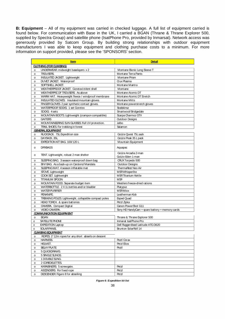
38
B: Equipment – All of my equipment was carried in checked luggage. A full list of equipment carried is found below. For communication with Base in the UK, I carried a BGAN (Thrane & Thrane Explorer 500, supplied by Spectra Group) and satellite phone (IsatPhone Pro, provided by Inmarsat). Network access was generously provided by Satcom Group. By building strong relationships with outdoor equipment manufacturers I was able to keep equipment and clothing purchase costs to a minimum. For more information on support provided, please see the ‘SPONSORS’ section.
Item Detail
CLOTHING (FOR CLIMBING) o UNDERWEAR. midweight baselayers x 2 Montane Bionic Long Sleeve T o TROUSERS. Montane Terra Pants o INSULATED JACKET. Lightweight Montane Prism o DUVET JACKET. Waterproof Crux Plasma o SOFTSHELL JACKET. Montane Mantra o WEATHERPROOF JACKET. Goretex/eVent shell Montane o WEATHERPROOF TROUSERS. As above Montane Atomic DT o WARM HAT. Heavyweight fleece / windproof membrane Montane Atomic DT Stretch o INSULATED GLOVES. Insulated mountain gloves. Montane Mitts o FINGER GLOVES. 2 pair synthetic contact gloves. Montane powerstretch gloves o WATERPROOF SOCKS. 1 set Goretex Sealskinsz o SOCKS. 4 sets Smartwool/Bridgedale o MOUNTAIN BOOTS. Lightweight (crampon compatible) Scarpa Charmoz GTX o GAITERS Outdoor Designs o MOUNTAINEERING SUN GLASSES. Full UV protection. Julbo o TRAIL SHOES. For trekking in forest Salamon GENERAL EQUIPMENT o RUCKSACK. 75L Expedition size GoLite Quest 75L sack o DAYSACK. 35L GoLite Peak 35 L pack o EXPEDITION KIT BAG. 100/120 L Mountain Equipment
o DRYBAGS Aquapac
o TENT. Lightweight, robust 2 man shelter GoLite Arcadia 2-man GoLite Eden 1-man
o SLEEPING BAG. 3 season waterproof down bag CRUX Torpedo 500 o BIVI BAG. As a back-up on Carstenz/Mandala Outdoor Designs o SLEEPING MAT. 4 season inflatable mat ThermaRest Neo Air o STOVE. Lightweight MSR Whisperlite o COOK SET. Lightweight MSR Titanium Kettle o TITANIUM SPOON MSR o MOUNTAIN FOOD. Separate budget item Westlers freeze-dried rations o WATERBOTTLE. 2 X 1L bottles and/or bladder Platypus o WATER PURIFIER MSR Miox o PENKNIFE. Leatherman Kick o TREKKING POLES. Lightweight, collapsible compact poles Exped Quad o HEAD TORCH. & spare batteries Petzl Zipka o CAMERA. Compact Digital Canon PowerShot G11 o VIDEO CAMERA. Sony HD HandyCam + spare battery + memory cards COMMUNICATION EQUIPMENT o BGAN Thrane & Thrane Explorer 500 o SATELLITE PHONE Inmarat IsatPhone Pro o EXPEDITION Laptop Dell Ruggerdised Latitude ATG D620 o SOLAR PANEL Brunton SolarRoll 14 CLIMBING EQUIPMENT o ROPES. 1*12m ropes for any short abseils on descent o HARNESS. Peztl Corax o HELMET. Petzl Elios o BELAY PLATE Peztl o 5 QUICKDRAWS. o 5 SINGLE SLINGS. o 1 DOUBLE SLING. o 2 COREDELETTES. o KARABINERS. 5 screwgate. Petzl o ASCENDERS. For fixed rope Petzl o DESCENDER. Figure 8 for abseiling Petzl
Figure 6: Expedition kit list

39
Figure 7: Kit ready to be repacked in Jayapura C: Food & Drink – Food for the field was planned to be a mixture of freeze-dried, imported food brought from the UK, and locally bought produce. On Puncak Mandala, I planned to rely on local produce (sweet potato and spinach), supplemented with 1 freeze-dried meal each day and then 3 freeze-dried meals a day after that. For Puncak Trikora, the local agent made arrangements in Wamena, which has a full selection of fresh and canned foods available. Freeze-dried food was taken as a contingency. For Puncak Jaya, I planned to use a mix of local produce and freeze-dried food. I bought privately from an advertisement on UKclimbing.com 70 freeze-dried pouch meals (40 dinner / 30 breakfast) made by Westlers. These are pouches to which boiling water can be added and left for 10 minutes. I left a selection in my hotel in Jayapura in storage for when I return in July. I also brought with me an MSR Miox water purifier and used this to purify my water on Puncak Trikora. I would highly recommend this piece of equipment. D: Transport– International: London to Jakarta return The European Union lifted a two-year ban on four Indonesian airlines, permitting Garuda Indonesia, Mandala Air, Airfast Indonesia and PremiAir to fly within EU airspace. However, I flew with Emirates on 19th November with a short stopover in Dubai and an anticipated return date of 4th January 2011, at a cost of £763.39. Emirates have a bigger checked baggage allowance (30kg) than any other airline that flies this route. The ground staff were very flexible and despite having double the permitted weight of carry-on baggage I was allowed to proceed without paying excess baggage charges. Due to the expedition finishing early, I was able to change the return date to 14th December with a change fee of approximately £70. Regional: Jakarta to Jayapura I booked my flight to Jayapura when I arrived at my hotel in Jakarta on 20th November. Given the flexibility in my itinerary this was not a huge issue, but I did have to spend two days in Jakarta to find a relatively cheap flight (£130). The carrier was Lion Air and the flight was via Makassar on Sulawesi. My return flight was booked on Batavia Air for 3rd January. Both bookings were made through a local travel agent with the support of my hotel reception staff. Again, due to the early end to the expedition, I had to rebook my return flight to Jakarta from Jayapura. I was unable to rebook with Batavia so booked with Merpati at a cost of £172.34. I plan to use my original Batavia ticket when I return to Papua in July. I did have to pay excess

40
baggage on both the outward and inward legs of the journey as the luggage allowance was only 20kgs. However, in both cases I was able to negotiate down from 10kgs to only 5 kgs. Local: Jayapura to Bime return I flew with Associated Mission Aviation (AMA) to Bime airstrip in the Star Mountains. During the planning phase, I had been corresponding with Bob Roberts of Adventist Aviation in Jayapura, who had very kindly offered to support me by flying me into Bime airstrip. Unfortunately as the timing of the expedition changed, Bob was out of the country when I arrived but had put me in touch with his son Eric, who is a mission pilot for AMA out of Jayapura. He in turn, put me in touch with Bob, the Operations Director and I was able to arrange both my travel permit and my flight with his support. I am immensely grateful to all three for their support. Sentani Airport Komplek Bandara Sentani Jayapura, Papua 99352 Telp : 0967 - 591675 / 592654 Fax : 0967 - 592508 Email : [email protected] / [email protected] Website : www.ama-papua.com Local: Jayapura to Wamena return I flew with Trigana Air, who operate several daily services between Jayapura and Wamena. Their main ticket office is located just a few minutes from Sentani airport. The cost of a return flight from Jayapura to Wamena was £62 and the flight time is only 45 minutes. Flights can be easily changed at no cost up to 24 hours in advance. Any local agent or travel agent can make these arrangements with minimal fuss. E: Accommodation In Jakarta, I stayed at the Ibis Arcadia Jakarta (room rate approx. £40 pppn) In Sentani, I stayed at the Sentani Indah Hotel (room rate approx. £32 pppn) In Wamena, I stayed at the Baliem Pilamo Hotel (room rate approx. £50 pppn) In Bime, I was accommodated for one night at the local Government House, which was a three-roomed wooden building that is normally used by the local Government official (who was on leave when I stayed there)
Figure 8: Government House in Bime

41
On Puncak Trikora, I slept in my GoLite Eden 1-man tent, which I would recommend highly to anyone looking for a spacious, lightweight one-man shelter. The porch is quite spacious for such a small tent and lots of kit can be stored there. F: Use of Porters – I planned to engage local porters from Bime on approach to Puncak Mandala, both to ensure my security and to assist with route-finding and load-carrying. I used two Dani porters and a cook/guide on Puncak Trikora. In Papua, it is always advisable to hire some local porters to bring some economic benefit to local communities and to improve security due to the local political situation and to minimise language difficulties. G: Mapping – Reliable, up to date maps of New Guinea are not readily available, even for Carstensz Pyramid, which is climbed relatively frequently. Through the Royal Geographical Society and other sources, I was able to source the following maps: 1. Western Sudirman Range – adapted from 1501 AIR SERIES - JOINT OPERATIONS GRAPHICS (AIR) SCALE 1:250 000 (sheets SB53-4, SB53-16) – showing location / proposed route on Puncak Jaya 2. Map of Wamena / Baliem Valley / Lake Habbema / Trikora 3. Google Map relief print showing location of both Puncak Mandala and Bime airstrip, which 4. Indonesia 1:100,000 topographic maps - Nederlands Nieuw Guinea – 1956 (Sheet 19-Y, Oriongebergte) 5. Sketch maps of: a. Route from Bime to Abom to access Mandala b. Route from Wamena to Puncak Trikora c. Topography of Puncak Trikora These sketch maps were provided by Franz Kvech, who travelled to the base of the mountain from the South. However, the sketch map of Puncak Trikora did not directly match with the topography I found. In addition, I was able to obtain a copy of the following maps from the Royal Geographical Society: Indonesia 1:250,000 maps - "Series HIND 644" (Irian Jaya); 1947 Juliana – Gebergte E14

42
7. FINANCE:
Budget Actual
INCOME
Fundraising
X1 Grant income 5,700 7,250
X2 Corporate Sponsorship 500 500
X3 Fundraising events 0 0
6,200 7,750
Personal Contributions X4 Unrestricted 5,291 6,785
5,291 6,785
GRAND TOTAL INCOME 11,491 14,535
EXPENDITURE
TRAVEL
A1 International travel 700 1,363
A2 Internal flights 530 437 A3 Excess Baggage 500 74
A4 Vehicles 200 111 A5 Visas 50 192 1,980 2,178
ACCOMMODATION B1 Hotels/guesthouses 390 592
390 592
FOOD
C1 Expedition Food 158 158
C2 Other food 90 149
248 306
EQUIPMENT
D1 Climbing Equipment & Clothing 450 1,681
D2 General Equipment 200 1,220 D3 Communication Equipment 500 273
1,150 3,174
PERMITS / FEES E1 Climbing Permits 5,340 853
5,340 853
INSURANCE F 313 0
PR /ADVERTISING G 290 5,844
TRAINING H 360 931
MISCELLANEOUS I 375 657
CONTINGECY 10% J 1,045 0
GRAND TOTAL EXP 11,491 14,535
The major unbudgeted expenditure was the engagement of a professional PR agency to maximize media coverage. This decision was taken because in the last few months leading up to the expedition I was working for two different humanitarian organisations in Sudan and had extremely limited time to commit to PR activities. Please see the ‘PUBLIC RELATIONS’ section of the report for an analysis of media coverage.

43
8. PERSONNEL:
Ricky Munday CA (Expedition Leader, Finance, Logistics, PR) is a 34-year old British Citizen working in humanitarian aid in Bangladesh. Having won 3 Scottish league championship & 2 Scottish Cups with Glasgow Hawks RFC from1999-2008, he has switched his focus to outdoor challenges. Achievements include completing the Marathon des Sables and organising and leading a two-man expedition to Khan Tengri (6,995m) in Kyrgyzstan. In 2008, he organised and led the Africa 3 Peaks expedition, which attempted to climb Mount Stanley (5099m), Mount Kenya (5199m) and Mount Kilimanjaro (5895m) in 20 days. This event raised over £6k for a children’s home in Nairobi, where he had spent 4 months working on secondment. Ricky has an Honours degree in Physiology & Sport Science from the University of Glasgow.
Ricky is an Advocate of Nite Watches and is planning a return expedition to Papua in 2011. Following this, he hopes to travel to either North America or South America in 2012 to continue his quest to become the first person to climb the three highest peaks on every continent.
9. TRAINING: Ricky undertook the following training courses to prepare for the expedition (both funded by the Winston Churchill Memorial Trust): Lead Climbing Course (5 days, North Wales, June 2010). This course was delivered by the Rock Climbing Company www.rockclimbingcompany.co.uk, which is owned and run by Sylvia Fitzpatrick and Simon Marsh. He was joined on this course by Carol Sparks, who pulled out of the expedition for personal reasons
Figure 9: Carol Sparks being instructed on the Lead Climbing course in North Wales

44
Advanced medical training - Course delivered over 1.5 days in August by Dr. Ross Anderson and covered the following topics:
i. Legal issues of medical care and training ii. Measuring vital signs iii. Vital signs – normal values iv. Refresher on first aid protocols –(c)ABCDE v. CPR vi. Safe airway position/airway manoeuvers vii. Bleeding / haemorrhage control viii. Dislocations ix. Fracture management x. Head injury/c-spine special considerations xi. Wound assessment, cleaning and management (practical on butcher prepared meat) xii. Pain management xiii. Fluids xiv. Management of common and rare but severe illness in remote locations Dr. Anderson delivers courses on behalf of Adventure First Aid www.adventurefirstaid.co.uk Medical supplies and a comprehensive expedition First Aid kit were prepared and delivered by Nomad www.nomadtravel.co.uk
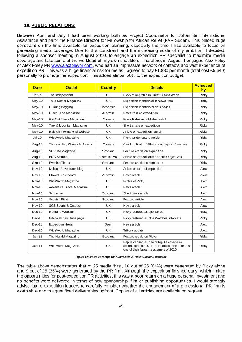
45
10. PUBLIC RELATIONS: Between April and July I had been working both as Project Coordinator for Johanniter International Assistance and part-time Finance Director for Fellowship for African Relief (FAR Sudan). This placed huge constraint on the time available for expedition planning, especially the time I had available to focus on generating media coverage. Due to this constraint and the increasing scale of my ambition, I decided, following a sponsor meeting in August 2010, to engage an expedition PR specialist to maximize media coverage and take some of the workload off my own shoulders. Therefore, in August, I engaged Alex Foley of Alex Foley PR www.alexfoleypr.com, who had an impressive network of contacts and vast experience of expedition PR. This was a huge financial risk for me as I agreed to pay £1,880 per month (total cost £5,640) personally to promote the expedition. This added almost 50% to the expedition budget.
Date Outlet Country Details Achieved by
Oct-09 The Independent UK Ricky mini-profile in Great Britons article Ricky
May-10 Third Sector Magazine UK Expedition mentioned in News Item Ricky
May-10 Gunung Bagging Indonesia Expedition mentioned on 3 pages Ricky
May-10 Outer Edge Magazine Australia News item on expedition Ricky
May-10 Get Out There Magazine Canada Press Release published in full Ricky
May-10 Trek & Mountain Magazine UK Short article on expedition Ricky
May-10 Raleigh International website UK Article on expedition launch Ricky
Jul-10 WideWorld Magazine UK Ricky wrote feature article Ricky
Aug-10 Thunder Bay Chronicle Journal Canada Carol profiled in 'Where are they now' section Ricky
Aug-10 SCRUM Magazine Scotland Feature article on expedition Ricky
Aug-10 PNG Attitude Australia/PNG Article on expedition's scientific objectives Ricky
Sep-10 Evening Times Scotland Feature article on expedition Ricky
Nov-10 Neilson Adventures blog UK Article on start of expedition Alex
Nov-10 Etravel Blackboard Australia News article Alex
Nov-10 WideWorld Magazine UK Profile of Ricky Alex
Nov-10 Adventure Travel Magazine UK News article Alex
Nov-10 Scotsman Scotland Short news article Alex
Nov-10 Scottish Field Scotland Feature Article Alex
Nov-10 SGB Sports & Outdoor UK News article Alex
Dec-10 Montane Website UK Ricky featured as sponsoree Ricky
Dec-10 Nite Watches Unite page UK Ricky featured as Nite Watches advocate Ricky
Dec-10 Expedition News Open News article Alex
Dec-10 WideWorld Magazine UK Trikora update Alex
Jan-11 The Herald Magazine Scotland Feature article on Ricky Ricky
Jan-11 WideWorld Magazine UK Papua chosen as one of top 10 adventure destinations for 2011 - expedition mentioned as one of their favourite attempts of 2010
Ricky
Figure 10: Media coverage for Australasia 3 Peaks Glacier Expedition
The table above demonstrates that of 25 media ‘hits’, 16 out of 25 (64%) were generated by Ricky alone and 9 out of 25 (36%) were generated by the PR firm. Although the expedition finished early, which limited the opportunities for post-expedition PR activities, this was a poor return on a huge personal investment and no benefits were delivered in terms of new sponsorship, film or publishing opportunities. I would strongly advise future expedition leaders to carefully consider whether the engagement of a professional PR firm is worthwhile and to agree fixed deliverables upfront. Copies of all articles are available on request.

46
11. SPONSORS:
TREKKING SPONSOR The expedition is grateful for the support of the following expedition sponsor:
Formed in 1997 to develop and operate new build internationally branded hotels, BDL is now one of the UK’s largest multi-brand hotel management companies. Specialising in managing hotels for asset owners, we manage more than 30 hotels in locations across the UK and Ireland. BDL has a proven track record in delivering global brands such as Crowne Plaza, Holiday Inn and Holiday Inn Express (Intercontinental Hotel Group), Ramada Encore (Wyndham Hotel Group) as well as un-branded hotels under the BDL Select umbrella.
COMMMUNICATION SPONSORS
The expedition is extremely grateful for the support of the following kit and equipment sponsors:
The Spectra Group (UK) is a leading provider of voice and data services in areas where either none exist or where high intensity conflicts, natural disasters, pandemics or terrorist attacks may have destroyed existing networks. They provided me with a ruggerdised expedition laptop and satcomms training as part of our satellite communications capability.
Inmarsat has stood at the forefront of mobile satellite services for 30 years. They are internationally recognised as pioneers in their field and they continue to introduce new technologies that redefine the standard for their industry. They supplied us with a BGAN terminal to allow us to send live updates back from the field and a satellite phone for emergency use.
CLOTHING SPONSOR
Montane is a company owned and run by people with a passion for outdoor performance sports which challenge and inspire. Montane is one of the most specialised outdoor clothing brands, being at the forefront of innovative, lightweight design and the use of the most technologically advanced fabrics. I was very fortunate that Montane provided full clothing sponsorship to the expedition.
Montane supplied the following clothing: - Terra pants - Bionic t–shirt long sleeve - Mantra softshell. - Atomic DT stretch jacket - Atomic DT pants - Prism Insulated jacket
I have used Montane clothing on expedition in the Tien Shan mountains of Kyrgyzstan, the Africa 3 Peaks expedition (Uganda, Kenya and Tanzania) and now in Papua and it has never let me down.

47
KIT SPONSORS The expedition benefitted from the support of the following kit and equipment sponsors:
GoLite is the premier global manufacturer of lightweight, innovative and sustainable equipment designed specifically for outdoor athletes. GoLite is committed to building a truly sustainable business, one that minimises its environmental impacts and produces its products in factories that are fair, safe, and non-discriminatory. GoLite supplied the expedition with tents and packs.
Nite watches are issued to UK Special Forces and feature a rare illumination technology called GTLS (Gaseous Tritium Light Source). I was delighted to welcome Nite Watches on board as the official expedition time keeper – Nite supplied me with a VISION VS2, which stood up well to the challenging conditions in the forests and mountains of Papua.
.
Aquapac manufactures top-quality, waterproof, protective cases. The montane rain forests of the central highlands of New Guinea get as much as 5,000mm of rainfall per year (compared to 700mm in Edinburgh). So I knew it was going to be wet. And Aquapac kept my equipment dry.
CRUX is a small, specialist brand dedicated to developing product specifically for climbing. The design philosophy is simple - crux products are to be tough, light and functional. Their waterproof down sleeping bags & clothing provided optimal protection against the challenging conditions we will face in the mountains.
First Ascent are exclusive UK agents and distributors of outdoor equipment for the following brands:
First Ascent supplied the following kit, with a substantial discount: MSR Miox purifier, MSR Whisperlite Internationale stove, MSR Fuel Bottle, Platypus Big ZIP SL (2 litres), Thermarest Neo Air mattress. All of this kit stood up well to the demands of an expedition to the Papuan highlands. I would like to extend a huge thanks to all of my kit, equipment and expedition sponsors for their unwavering support.

48
12. CHARITY:
Raleigh run expeditions in the UK and other countries for young people aged 17 - 24, with the purpose of providing experiential learning and personal development through adventure, challenge, and through community, environmental, and development projects. Raleigh's Youth Agency Partnership Programme exists to support young people who would otherwise not be able to access the opportunity to join an expedition, usually due to external factors such as economic or social exclusion. Ricky wanted to create opportunities for other disadvantaged young people to have life-changing experiences, by fundraising for and supporting this programme. (www.justgiving.com/aus3peaks)
Unfortunately, due to the expedition finishing early, I decided not to pursue the charity fundraising as it felt unfair to ask people to donate money until I get the opportunity to go back to Papua in 2011. This will be a major initiative during 2011. I will definitely return to attempt Carstensz Pyramid and I am still negotiating with community representatives to visit Puncak Mandala.
13. SUPPORTERS:
Winston Churchill Memorial Trust - Sir Winston Churchill’s legacy lives on through the work of the Winston Churchill Memorial Trust. Annually the Trust awards over 100 grants to individuals who wish to undertake studies relating to their interest, education or profession. WCMT believes the inspirational journey benefits the Fellows and others in the UK through knowledge sharing; achieved primarily through personal development and dissemination of the benefits of what they learn on their travels. Ricky was awarded a 2010 Travelling Fellowship as Leader of the Australasia 3 Peaks Glacier Expedition.
Alpine Club of Canada Environment Fund - The purpose of the Fund is to provide support that contributes to the protection and preservation of mountain and climbing environments. This expedition was made possible in part through a grant from the Alpine Club of Canada’s Environment Fund. The expedition was awarded funding to buy photographic equipment to help create a photographic record of ice cap cover in the region.
We were successful in our application to the Lyon Equipment Expedition Awards 2010. We're very grateful to Lyon Equipment for their support. Lyon Equipment is the sole UK and Ireland distributor for the following brands: Petzl, Beal, La Sportiva, Exped - the highest quality products from the worlds’ leading manufacturers.
The Jeremy Willson Charitable Trust (JWCT) is a charity set up in tribute to and memory of Jeremy Willson. The charity helps people and projects that reflect Jeremy’s passions in life: athletics, geology, adventure and the environment. The expedition was awarded a grant of £750 against expedition costs and we’re very grateful to JWCT and the Willson family for their support.

49
British Mountaineering Council is the national representative body for climbers, hill walkers and mountaineers in England and Wales. The Expedition was ‘approved’ by the BMC. This means that the expedition carried the official endorsement of the BMC.
The Royal Scottish Geographical Society is the foremost charity in Scotland which promotes an understanding of the natural environment and human societies. RSGS aims to reinforce the importance of Geography in schools and wider education, by underlining its relevance in national and global issues of public concern and helping to frame the debate around these issues. The Expedition was ‘approved’ by RSGS.
Foreign & Commonwealth Office - The British Embassy in Jakarta is supporting the Governor of Papua Province to try to set the economic development of the province onto a sustainable low carbon pathway and to ensure that it stays that way. The aims of our research are pertinent to this objective.

50
14. SCIENCE: The uncertainty in tropical tropospheric climate change over the last 30-plus years contributes significantly to the uncertainty in global climate model predictions. The recent and on-going recession of the glaciers of Papua is a response to tropospheric climate change and so a potential source of important climate-change information for a remote region. Tropical mountain glaciers have received attention because glaciers are now widely accepted as reliable recorders of climate-change over decadal and longer timescales. The 2007 Intergovernmental Panel on Climate Change (IPCC) assessment noted that, like glaciers worldwide, tropical glaciers have been in a state of retreat from their mid-19th-century maximum. Since the 1970s, coinciding with the beginning of the Landsat satellite era, tropical glaciers have been retreating quickly. Moreover, the smallest tropical glaciers appear to be the most affected (Lemke and others, 2007). While glaciers in the Andes and in East Africa have received the most recent attention, work on the last remaining glaciers in Papua has been more limited. Advances in satellite technology and methods for detecting and analyzing glacier areas have enabled researchers to better document the retreat and demise of these small ice masses. A better understanding of the temporal changes in these small, and quickly disappearing, ice masses may aid in gaining better knowledge of the exact climate–glacier interactions in this region. The western New Guinea glaciers overlook the western Pacific warm pool, a center of warm water that generates El Nino disturbances and the largest heat source to the global atmosphere, which influences climate from India's monsoons to the Amazon's droughts. Strategic location, the sparseness of climate data there, and the potential for a long past record are three reasons for the importance of New Guinea glacier history. While Puncak Jaya’s peak is free of ice, there are several glaciers on its slopes, including the Carstensz Glacier and the Northwall Firn. Being equatorial, there is little variation in the mean temperature during the year (around 0.5°C) and the glaciers fluctuate on a seasonal basis only slightly. However, analysis of the extent of these rare equatorial glaciers from historical records show significant retreat since the 1850s, indicating a regional warming of around 0.6°C per century between 1850 and 1972. As previously mentioned, the glacier on Puncak Trikora disappeared completely some time between 1939 and 1962. Since the 1970s, evidence from satellite imagery indicates the Puncak Jaya glaciers have also been retreating rapidly. The Meren Glacier melted away sometime between 1994 and 2000. In two years alone, between 2000 and 2002, the remaining glaciers lost more than 7% of their area. Researchers estimate that since about 1850, as heat-trapping industrial emissions accumulated in the atmosphere, Puncak Jaya's ice has shrunk from covering 7 square miles to less than 1 square mile. Klein and Kincaid speculate that the glaciers on Puncak Jaya will disappear within the next 50 years. Dr. Mike Prentice, an Indiana University paleoclimatologist, or climate historian, believes temperature increases in the New Guinea uplands have far exceeded the 1-degree Fahrenheit average rise recorded globally in the past century. Glacier recession on Mt. Jaya, Indonesia in 1972, 1987, 2000, and PUNCAK MANDALA – Ice Cap Mystery Puncak Mandala is composed of massive limestone units that dip to the north, causing the peak to be asymmetric, with steep southern cliffs (which we will attempt to climb) and much gentler slopes to the north. It has been known to have glacier cover since 1909, when the earliest observation of snow cover on the peak was recorded and a sketch of the ice cover was made. Oblique aerial photographs taken in 1945 by the United States Air Force show a small summit glacier lying to the north of the peak on the gentler northern slopes. In 1959, the Dutch expedition climbed the peak and estimated the glacier to be approximately 100m thick, while photographs taken in 1959 show the ice cap to be semicircular in shape. None of these observations enabled the ice loss to be calculated. Allison and Peterson (1989) were able to identify the ice cap on early 1980s MSS images, but these were of insufficient quality to map its extent.
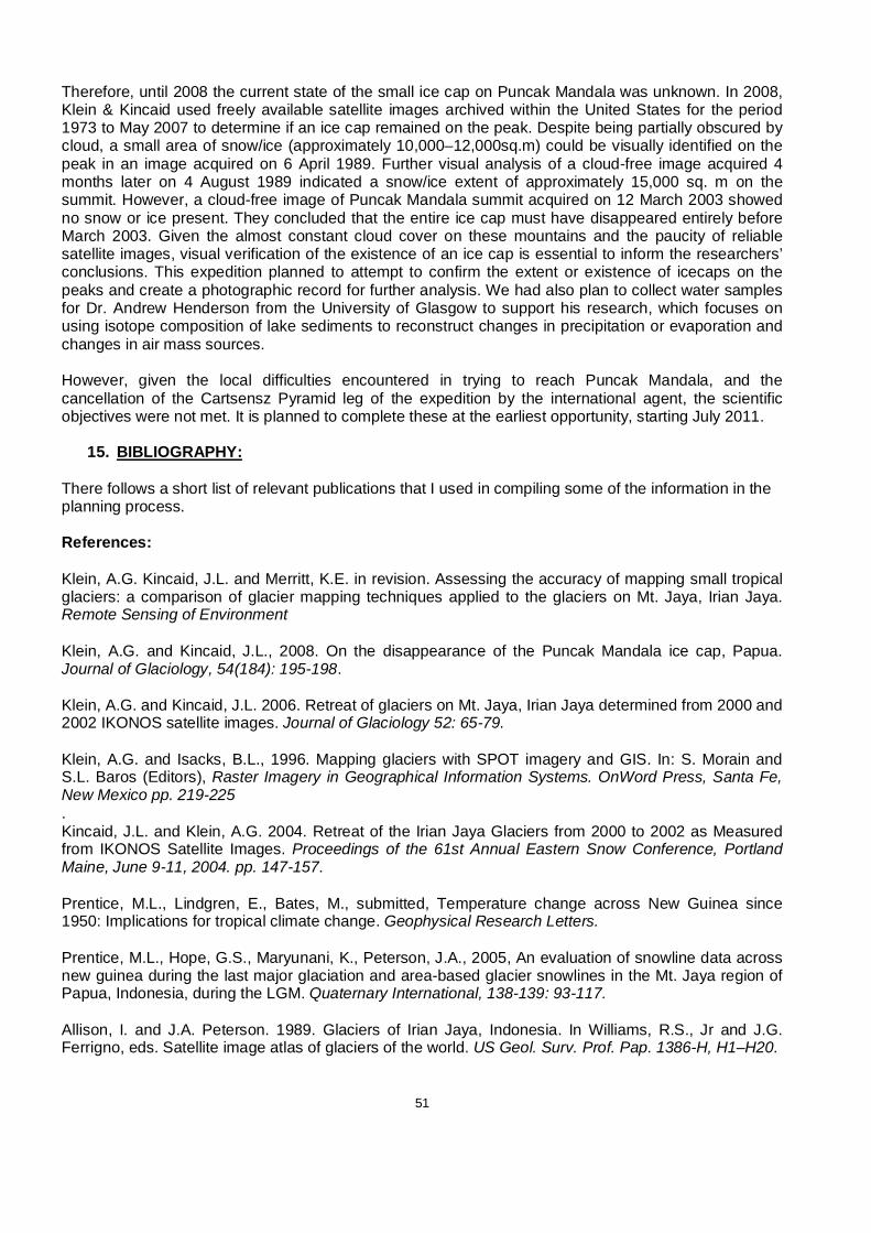
51
Therefore, until 2008 the current state of the small ice cap on Puncak Mandala was unknown. In 2008, Klein & Kincaid used freely available satellite images archived within the United States for the period 1973 to May 2007 to determine if an ice cap remained on the peak. Despite being partially obscured by cloud, a small area of snow/ice (approximately 10,000–12,000sq.m) could be visually identified on the peak in an image acquired on 6 April 1989. Further visual analysis of a cloud-free image acquired 4 months later on 4 August 1989 indicated a snow/ice extent of approximately 15,000 sq. m on the summit. However, a cloud-free image of Puncak Mandala summit acquired on 12 March 2003 showed no snow or ice present. They concluded that the entire ice cap must have disappeared entirely before March 2003. Given the almost constant cloud cover on these mountains and the paucity of reliable satellite images, visual verification of the existence of an ice cap is essential to inform the researchers’ conclusions. This expedition planned to attempt to confirm the extent or existence of icecaps on the peaks and create a photographic record for further analysis. We had also plan to collect water samples for Dr. Andrew Henderson from the University of Glasgow to support his research, which focuses on using isotope composition of lake sediments to reconstruct changes in precipitation or evaporation and changes in air mass sources. However, given the local difficulties encountered in trying to reach Puncak Mandala, and the cancellation of the Cartsensz Pyramid leg of the expedition by the international agent, the scientific objectives were not met. It is planned to complete these at the earliest opportunity, starting July 2011.
15. BIBLIOGRAPHY:
There follows a short list of relevant publications that I used in compiling some of the information in the planning process. References: Klein, A.G. Kincaid, J.L. and Merritt, K.E. in revision. Assessing the accuracy of mapping small tropical glaciers: a comparison of glacier mapping techniques applied to the glaciers on Mt. Jaya, Irian Jaya. Remote Sensing of Environment Klein, A.G. and Kincaid, J.L., 2008. On the disappearance of the Puncak Mandala ice cap, Papua. Journal of Glaciology, 54(184): 195-198. Klein, A.G. and Kincaid, J.L. 2006. Retreat of glaciers on Mt. Jaya, Irian Jaya determined from 2000 and 2002 IKONOS satellite images. Journal of Glaciology 52: 65-79. Klein, A.G. and Isacks, B.L., 1996. Mapping glaciers with SPOT imagery and GIS. In: S. Morain and S.L. Baros (Editors), Raster Imagery in Geographical Information Systems. OnWord Press, Santa Fe, New Mexico pp. 219-225 . Kincaid, J.L. and Klein, A.G. 2004. Retreat of the Irian Jaya Glaciers from 2000 to 2002 as Measured from IKONOS Satellite Images. Proceedings of the 61st Annual Eastern Snow Conference, Portland Maine, June 9-11, 2004. pp. 147-157. Prentice, M.L., Lindgren, E., Bates, M., submitted, Temperature change across New Guinea since 1950: Implications for tropical climate change. Geophysical Research Letters. Prentice, M.L., Hope, G.S., Maryunani, K., Peterson, J.A., 2005, An evaluation of snowline data across new guinea during the last major glaciation and area-based glacier snowlines in the Mt. Jaya region of Papua, Indonesia, during the LGM. Quaternary International, 138-139: 93-117. Allison, I. and J.A. Peterson. 1989. Glaciers of Irian Jaya, Indonesia. In Williams, R.S., Jr and J.G. Ferrigno, eds. Satellite image atlas of glaciers of the world. US Geol. Surv. Prof. Pap. 1386-H, H1–H20.
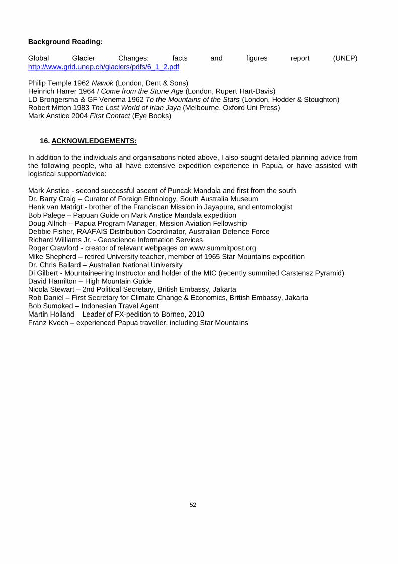
52
Background Reading: Global Glacier Changes: facts and figures report (UNEP) http://www.grid.unep.ch/glaciers/pdfs/6_1_2.pdf Philip Temple 1962 Nawok (London, Dent & Sons) Heinrich Harrer 1964 I Come from the Stone Age (London, Rupert Hart-Davis) LD Brongersma & GF Venema 1962 To the Mountains of the Stars (London, Hodder & Stoughton) Robert Mitton 1983 The Lost World of Irian Jaya (Melbourne, Oxford Uni Press) Mark Anstice 2004 First Contact (Eye Books)
16. ACKNOWLEDGEMENTS:
In addition to the individuals and organisations noted above, I also sought detailed planning advice from the following people, who all have extensive expedition experience in Papua, or have assisted with logistical support/advice: Mark Anstice - second successful ascent of Puncak Mandala and first from the south Dr. Barry Craig – Curator of Foreign Ethnology, South Australia Museum Henk van Matrigt - brother of the Franciscan Mission in Jayapura, and entomologist Bob Palege – Papuan Guide on Mark Anstice Mandala expedition Doug Allrich – Papua Program Manager, Mission Aviation Fellowship Debbie Fisher, RAAFAIS Distribution Coordinator, Australian Defence Force Richard Williams Jr. - Geoscience Information Services Roger Crawford - creator of relevant webpages on www.summitpost.org Mike Shepherd – retired University teacher, member of 1965 Star Mountains expedition Dr. Chris Ballard – Australian National University Di Gilbert - Mountaineering Instructor and holder of the MIC (recently summited Carstensz Pyramid) David Hamilton – High Mountain Guide Nicola Stewart – 2nd Political Secretary, British Embassy, Jakarta Rob Daniel – First Secretary for Climate Change & Economics, British Embassy, Jakarta Bob Sumoked – Indonesian Travel Agent Martin Holland – Leader of FX-pedition to Borneo, 2010 Franz Kvech – experienced Papua traveller, including Star Mountains