Embed Size (px)
Citation preview

Withiel Neighbourhood Development Plan
SUPPLEMENTARY DOCUMENTS
CONSULTATION STATEMENT
1. Initial Discussion, Consultation and Designation of Plan Area
2. Membership of the Steering Group
3. Work of the Steering Group, January – June 2016
4. Community Consultation Event
5. Pre-Submission Consultation
6. Appendices
JANUARY 2017

2
1. Initial Discussion, Consultation and Designation of Plan Area
The process towards a neighbourhood plan was initiated in July 2013 when the parish
council resolved to take forward the idea (Minute 13/41 refers). Informal soundings
were taken with Cornwall Council and the Cornwall Association of Local Councils
and these received en-couraging responses on the strength of which a public ‘drop-in’
meeting was organised on 12th November 2013 to brief residents and solicit their
views (Appendix 1). Around 30 residents of the parish attended this meeting and a
clear consensus emerged in favour of creating a neighbourhood development plan.
Over the following months informal soundings continued to be taken about who
might be willing to participate in a steering group and what issues people thought
should be addressed in a plan.
The informal steering group in May 2014 produced a questionnaire designed to gauge
what interest and support there might be for a neighbourhood development plan in the
parish, and what issues residents thought should be highlighted. This was distributed
during July and August 2014 to every household (approximately 200) in the parish
and collected after a week. There were 83 returns with a clear majority in favour of
producing a neighbourhood plan based on the parish as the unit of planning
(Appendix 2).
In October 2014 the parish council resolved to go ahead with a parish plan and apply
to Cornwall Council to have the parish designated as the neighbourhood plan area,
with the parish council as the relevant body. This was done in February 2015
(Appendix 4) and the official letter of designation of Withiel as the neighbourhood
plan area, with the parish council as the relevant body, was issued by Cornwall
Council on 30th April 2015 (Appendix 7). In the meantime public meetings were held
during February, March and April 2015 (Appendices 3, 5, 6) and again, following the
summer break, in October 2015 (Appendices 8, 9). These were advertised by posters
in various parts of the parish and through the parish magazine which is delivered
monthly to every household. Turnout was generally between 15 and 30 residents.
Housing policy for the parish was discussed at a meeting on Wednesday 21st October
2015 on the basis of a short discussion paper prepared by one of the councillors
(Appendix 8), and a number of ideas and suggestions were brought forward. It was
agreed to establish a small working party to refine and formulate these ideas. This
working party met on Friday 23rd October 2015 and mapped out the basic features of
the proposed parish housing policy to be embodied in a draft document for
presentation to the steering group. A member of the parish council was charged with
taking forward the production of the draft document.
The pace of activity was slowed sharply during the autumn of 2015 when Mrs. Sue
Kirkby, the chair of the parish council and very much the moving and energising spirit
of the whole neighbourhood plan initiative, was diagnosed with a terminal illness,
became increasingly incapacitated, and died on 4th December 2015; this was a
significant setback for the project, and work was only able to be resumed at the
beginning of 2016.

3
2. Membership of the Steering Group
Up to this point (end of 2015) the process of developing a plan had an essentially
informal and fluid character. Membership of groups carrying forward the plan
changed from meeting to meeting and the discussions themselves had a loose and
unstructured character. This way of proceeding worked well in the earlier stages of
the process when the emphasis was on canvassing opinions widely, encouraging
active involvement, and building up community engagement and interest in the
project, however by the beginning of 2016 there was a feeling that the process was
approaching the point where a more formal structure was needed to give focus to the
project. On 27th January 2016 a steering group was formally set up under the new
chair of the parish council (Appendix 10), with the aim of meeting at approximately
monthly intervals to progress the draft, with sub-groups taking on specific tasks, and
meetings to be open to residents of the parish.
While membership of the steering group was on a voluntary basis, at the time it was
being considered there was a clear desire to encourage a variegated membership
which could draw on and reflect the different kinds of economic activity characteristic
of the parish (commercial, agricultural, creative…) and values (openness to outside
influences, respect for traditions and distinctiveness… ) with, above all, a strong
personal commitment to the character of the parish. We believe that in the steering
group as constituted we have got just such a range of talents and interests.
NAME
OCCUPATION
RELEVANT
SKILLS/INTERESTS
RESIDES
Janet
Shearer
(Chair)
Artist and smallholder Chair of Parish Council
and NDP Steering Group
Ruthern
Bridge
Jo Ashby
Estate agent Housing valuation
specialist
Withiel
Mike Cherry
Farmer Tregawne
David
Cubitt
Retired university
lecturer
Member of Parish
Council
Ruthern
Bridge
Alison
Davey
Retire physiotherapist Bard of the Cornish
Gorsedd
Withiel
Merv Davey
Lecturer on Cornish
language and culture
Grand Bard of the
Cornish Gorsedd
Withiel
David Horn
Self-employed builder Withielgoose
Anna Hoyle
Retired community
worker and trainer
Member of Parish
Council
Retire
Patrick
Malone
Freelance journalist Member of Parish
Council
Tregawne

4
3. Work of the Steering Group January-June 2016
Working meetings of the steering group took place on 10th February, 9th March, 13th
April and 18th May when, as well as progressing our own proposed texts, we took
evidence from members of the St. Eval neighbourhood development plan group,
examined the Roche plan for comparative purposes, and received advice and
comments from a member of the Cornwall Council neighbourhood development
support team (Appendices 11, 12, 13, 14). Following the 18th May meeting, copies of
the draft were sent to the four adjacent parishes (Lanivet, Roche, St. Breock, St.
Wenn) and to the county councillor for this electoral division for their information and
comments. This stage of the process culminated in a community consultation event in
the Withiel village hall.
4. Community Consultation Event
This was held on Saturday 18th June 2016 in the Withiel village hall. It was publicised
through the ‘Withiel News & Views’ parish magazine which is delivered to every
household, on village notice boards, and on the parish website (Appendix 15). The
exhibition ran from 10.00 am to 4.00 pm and consisted of maps and poster-size blow-
ups of the key sections of the draft, with hard copies available to browse. Members of
the steering group were in attendance to answer questions and receive comments, and
tea, coffee and small eats were provided to encourage visitors to take their time in the
exhibition. Post-It notes and flip-chart sheets were provided for visitors to record their
comments. About 40 residents of the parish came to the exhibition. Comments were
subsequently collated and presented to the steering group for action at its meeting on
29th June 2016 (Appendices 16, 17, 18). Some comments related more to parish
matters as a whole or village hall matters rather than neighbourhood plan matters and
these were forwarded to the parish council and the hall management committee
respectively for their consideration. Otherwise the steering group noted relevant
comments and the draft plan was amended accordingly. This was the draft which went
forward to the next stage of the process.
5. Pre-Submission Consultation
Under the Neighbourhood Planning Regulations 2012, the relevant body (in this case
Withiel parish council and its neighbourhood development plan steering group) is
required to publi-cise and invite comments on the draft plan proposal from people
who live, work or carry out business in the neighbourhood plan area and also from a
range of statutory and non-statutory consultee bodies. This pre-submission
consultation must run for a minimum of six weeks from the date that the draft plan
proposal is published.
The pre-submission consultation/examination was set for the period 1st August to 16th
September. The 44 statutory consultees were notified by email or (in four cases where
no email address listed) post on 20th and 21st July 2016. The eight non-statutory
consultees were notified by email on various dates between 20th May and 21st July
2016 (Appendix 19). Within the parish the notification was published in the ‘News &

5
Views’ parish magazine and in addition a notification letter was delivered by hand to
every household and business premises on the 30th and 31st July 2016 (Appendix 20).
Following the consultation, the comments were assembled and collated (Appendix 21
Statutory Consultees; Appendix 22 Non-Statutory and Resident Consultees) and the
actions required to be taken or amendments to be made to the Plan and made. In the
case of two of the Statutory Consultees, it was necessary to negotiate and resubmit for
their consideration the draft sections they were concerned with; this was done during
the sutumn of 2016. Some redrafting was also suggested and negotiated with the
Cornwall Council neighbourhood planning team during this time, and consideration
was given to whether it was necessary to rescreen for a SEA. These various actions
and activities were finalised during December 2016/January 2017 when Natural
England and Historic England expressed themselves satisfied with the amended text,
and it was confirmed that a rescreening for an SEA or HRA would not be required
(Appendix 23). The Steering Group met on 10th February 2017, reviewed the full
documentation, and approved it to be submitted to Cornwall Council on behalf of the
parish (Appendix 24).
6. APPENDICES
Appendix 1: Drop-in meeting, 12th November 2013
Appendix 2: Survey Results, July-August 2014
Appendix 3: Poster calling Public Meeting, 4th February 2015, and Report
Appendix 4: Application for designation, 4th February 2015
Appendix 5: Poster calling Public Meeting, 18th March 2015, and Report
Appendix 6: Poster calling Public Meeting, 22nd April 2015
Appendix 7: Designation of Neighbourhood Plan Area, 30th April 2015
Appendix 8: Some Thoughts on Housing Policy, 19th October 2015
Appendix 9: Poster calling Open Meeting, 21st October 2015, and Summary
Appendix 10: Minutes of Steering Group Meeting, 27th January 2016
Appendix 11: Minutes ofSteering Group Meeting, 10th February 2016
Appendix 12: Minutes of Steering Group Meeting, 9th March 2016
Appendix 13: Minutes of Steering Group Meeting, 13th April 2016
Appendix 14: Minutes of Steering Group Meeting, 18th May 2016
Appendix 15: Notification of Community Consultation, June 2016
Appendix 16: Community Consultation Event, 18th June 2016
Appendix 17: Minutes of Steering Group Meeting, 29th June 2016
Appendix 18: Report on Community Consultation, July 2016
Appendix 19: Letter to Statutory and Non-Statutory Consultees, July 2016
Appendix 20: Letter to Residents, July 2016
Appendix 21: Statutory Consultees’ Comments, August-September 2016
Appendix 22: Non-Statutory and Resident Consultees’ Comments, August-September
2016
Appendix 23: Final Comments on Pre-Submission Consultation, December 2016-
January 2017
Appendix 24: Minutes of Steering Group Meeting, 8th February 2017

6

7
APPENDIX 1: DROP-IN MEETING, 12TH NOVEMBER 2013

8
APPENDIX 2: SURVEY RESULTS, JULY-AUGUST 2014

9
APPENDIX 3: POSTER CALLING PUBLIC MEETING, 4TH FEBRUARY
2015, AND REPORT

10

11
APPENDIX 4: APPLICATION FOR DESIGNATION, 4TH FEBRUARY 2015

12
APPENDIX 5: POSTER CALLING PUBLIC MEETING, 18TH MARCH 2015,
AND REPORT

13

14
APPENDIX 6: POSTER CALLING PUBLIC MEETING, 22ND APRIL 2015

15
APPENDIX 7: DESIGNATION NEIGHBOURHOOD PLAN AREA, 30TH
APRIL 2015

16
APPENDIX 8: SOME THOUGHTS ON HOUSING POLICY, 19TH OCTOBER
2015
Withiel Neighbourhood Development Plan
Some Thoughts on Housing Policy
(1) Policy Framework determining how housing development is carried out. This is a
list of the most relevant documents:
National Planning Policy Framework (published March 2012) following the Localism Act of 2011 includes a section ‘Neighbourhood Planning’ which sets
out the procedure for developing a neighbourhood plan.
Cornwall Housing Strategy adopted January 2010, updated May 2015, sets out the five key priorities in housing policy for the county.
Cornwall Local Plan (submitted for examination January 2015) was rejected
by the Planning Inspector because, inter alia, the target of 47,000 homes by
2030 was deemed insufficient; the plan is currently under revision and until it
is resubmitted and approved (winter 2015/spring 2016?) all the numbers are
guesstimates.
Core Strategy Based Area Discussion Paper (2011), the nearest thing we have to a statement of what is required for the Bodmin Community Area Network,
until the revised Local Plan overtakes it. Envisages 3000 (almost the entire
quota) homes to be built in Bodmin town to 2030, so surrounding parishes are
likely to have very little additional home building beyond organic
development. I estimate 1-2 homes a year would fulfil our obligation.
(2) Possible Criteria for determining our policy
I have mulled over some possible criteria (in no particular order of importance) for
promoting/assessing building applications. The underlying question is how far the
council should be proactive i.e actively shaping and determining building
developments, and how far it should be reactive i.e. simply approving or otherwise
applications that come before it which meet its minimum standards.
We need to keep in mind the character of the parish which we want to preserve and enhance i.e it is rural and principally engaged in agriculture and tourism
(mainly the Saints’ Way).
Should the council try to determine what should be the mix of development types i.e. (larger) family homes, (smaller) starter homes, singleton
homes/apartments?

17
Should there be a policy on the balance/mix of approvals for properties for sale and properties for rent i.e. should the council actively promote one or the
other?
Should priority in approving applications be given to people with family or
occu-pational links in the parish? How could this be made an ongoing
obligation in the case of properties built for sale rather than rent?
Should we aim to promote the building of small estates (3-4 houses grouped to-gether) rather than isolated properties for the purposes of creating mutually
supportive community networks?
Should we give priority to applications to build on brownfield/low grade agri-cultural land? Is there sufficient of this kind within the parish?
Should we take into account the need for good access to the wider county trans-port network for travel-to-work purposes i.e. should we encourage
development near to main roads (A30, A389) accessing Bodmin, Wadebridge
etc?
Should we be actively promoting enhancement of the parish as a complement
to the development activity i.e. imposing landscaping requirements around
approved locations, planting trees and creating hedges etc., or can this be left
to private owners and public agencies e.g. English Heritage, Environment
Agency, Forestry Commission?
How far should our housing development policy take into account the promotion of business and commercial activities/job creation, that might
benefit the parish e.g. guest houses, hotels, small businesses?
Should we be considering the needs of disabled people in planning developments? The topography of the parish (uneven, hilly, few pavements,
many isolated properties etc.) is not a particularly favourable environment.
Should we actively require that developments be designed in an appropriate
style which reflects traditional i.e. vernacular forms and enhances the built
environment?
David Cubitt
19th October 2015

18
APPENDIX 9: POSTER CALLING PUBLIC MEETING, 21ST OCTOBER 2015,
AND SUMMARY

19
20
APPENDIX 10; MINUTES OF STEERING GROUP MEETING, 27TH
JANUARY 2016
Withiel Neighbourhood Development Plan (NDP) Steering Group
Minutes of a meeting held at 7.00 pm on Wednesday 27th January 2016 in the village
hall.
Present: Cllr Janet Shearer in the chair, 18 residents of the parish.
16/1. Cllr Shearer welcomed everyone and outlined the purpose of the meeting,
which was to resume the process of producing a neighbourhood development plan
(NDP); this was got under way last year under the leadership of the then chair of the
parish council, Sue Kirkby, but was then delayed by her subsequent illness and early
death. More specifically this meeting was to set up a steering group to take on the
detailed work of producing such a plan.
16/2. Two short papers were tabled as a basis for discussion: (1) proposed layout and
structure of the NDP, (2) draft introductory section describing the parish and the
statutory framework for producing an NDP.
16/3. There followed a general discussion about the project, what needed to be done,
what aspects of the parish life and needs should be highlighted, how best to carry it
out. The following members offered or were proposed for the steering group:
Jo Ashby
Mike Cherry (economic development, agriculture)
David Cubitt (rapporteur)
Merv Davey (heritage, tourism, environment)
Alison Davey (green assets)
David Horn
Anna Hoyle (accessing funding)
Patrick Malone (economic development, business and commerce)
Janet Shearer (design and presentation)
16/4. Agreed to arrange for all documentation, drafts, minutes etc., about the NDP to
be put onto the Withiel website.
16/5. Agreed to ask the parish clerk to check back through records to establish what
funds have been accessed, applied for, and/or have been received or are available to
support the work of the steering group.
16/6. Agreed to hold the next meeting (steering group and open to all residents) on
Wed-nesday 10th February at 7.00 pm in the village hall. At this meeting David
Cubitt to bring the ‘box’ containing all material assembled by Sue Kirkby for
members to familiarise themselves.
Cllr Shearer thanked everyone for coming, and closed the meeting at 8.20 pm.

21
APPENDIX 11: MINUTES OF STEERING GROUP MEETING, 10TH
FEBRUARY 2016
Withiel Neighbourhood Development Plan (NDP) Steering Group
Minutes of a meeting held at 7.00 pm on Wednesday 10th February 2016 in the
village hall.
Present: Cllr Janet Shearer in the chair, Steering Group members Jo Ashby, Mike
Cherry, David Cubitt, Alison Davey, Merv Davey, David Horn, Patrick Malone, four
residents of the parish. Apologies for absence Anna Hoyle.
16/7. Cllr Shearer welcomed everyone and outlined the purpose of the meeting,
which was to review the documentation assembled by Sue Kirkby, and allocate the
tasks to be undertaken.The files of evidence and information were tabled for members
of the steering group to study, together with an initial draft of sections of the NDP.
16/8. There followed a general discussion of various aspects of the proposed NDP. On
housing, the provisions of the latest iteration of the Cornwall local plan (Schedule of
Further Significant Changes, January 2016) were noted, in particular that the effect of
the housing allocation in the Bodmin community network area is for an annual growth
of less than one dwelling a year for Withiel, which can be met from normal organic
growth. Also noted that the area towards the south of the parish previously identified
as a possible development node does not actually lie within the parish boundary, and
it is difficult to identify any other area of the parish suitable for such development.
16/9. Reference minute 16/5, it was noted that Anna Hoyle has been examining the
funding situation, but in her absence we are unable to take this further at this time.
16/10. It was agreed to allocate sections to be drafted as follows: Jo Ashby, housing;
Mike Cherry and Patrick Malone, economic development (including roads and
transport); David Horn and Janet Shearer, green assets (including footpaths); Alison
and Merv Davey, heritage and tourism. These should if possible be ready for
submission and discussion at the next meeting.
16/11. Agreed to hold the next meeting (steering group and open to residents) on
Wed-nesday 9th March at 7.00 pm in the village hall.
Cllr Shearer thanked everyone for coming, and closed the meeting shortly after 8.00
pm.

22
APPENDIX 12: MINUTES OF STEERING GROUP MEETING, 9TH MARCH
2016
Withiel Neighbourhood Development Plan (NDP) Steering Group
Minutes of a meeting held at 7.00 pm on Wednesday 9th March 2016 in the village
hall.
Present: Cllr Janet Shearer in the chair, Steering Group members Jo Ashby, Mike
Cherry, David Cubitt, Alison Davey, Merv Davey, David Horn, Anna Hoyle, two
representatives of St. Eval NDP group, three residents of the parish. Apologies for
absence Patrick Malone.
16/12. Cllr Shearer welcomed everyone and outlined the purpose of the meeting,
which was to receive a briefing from the St. Eval representatives, receive a report
from Anna Hoyle on funding matters, agree and/or amend the Economic
Development and Environ-ment and Community Facilities sections of the draft plan,
and receive reports back for other sections.
16/13. The St. Eval representatives gave us a briefing on their experience of preparing
an NDP which was guided by the need to develop the old MoD site vacated some
years back by the RAF. They emphasised the importance of frequent consultation
with residents of the parish; of liaison with Cornwall Council which was helpful; and
of precision in speci-fying content of policies. The whole process from inception to
acceptance into the local plan takes around 2-2 ½ years.
16/14. Anna Hoyle briefed us on funding. She has applied for £3000 from Locality
(an arms-length organisation for supporting community development activities under
the Localism Act) towards materials, hire of venues etcetera. The grant, if awarded,
should start on 1st May and be operated through the parish council bank account.
16/15. We discussed the Economic Development draft section, in particular how to
approach regeneration issues at Victoria square; pinch points including Lawellan lane;
the need for more passing places for farmers’ vehicles; the problem of Ruthern bridge;
the question of landowners’ contribution to amelioration of problems; flooding.
Appro-priate amendments to be incorporated into the draft plan.
16/16. We discussed the Environment and Community draft section. We noted that
the bus shelter project would be complex and a medium- to longer-term one. We
noted it would be desirable to seek community opinion on what to do with the old
telephone box. Further proposals and preferred policies will be forthcoming from the
sub-group for incorporation into the draft plan on flooding issues; anti-litter signs;
enhancing wildlife ‘corridors’.
16/17. Jo Ashby reported on her work so far on the Housing draft section. There is
more text, on the use of sympathetic materials, to come for incorporation into the
draft. We have agreed to express support for managed development in the south part
of the parish and to amend the draft accordingly.

23
16/18. Merv Davey reported on his work so far on the Heritage and Tourism draft
section. Material on this to come.
16/19. Agreed to hold the next meeting (steering group and open to residents) on
Wed-nesday 13th April at 7.00 pm in the village hall.
Cllr Shearer thanked everyone for coming, and closed the meeting shortly after 8.30
pm.

24
APPENDIX 13: MINUTES OF STEERING GROUP MEETING, 13TH APRIL
2016
Withiel Neighbourhood Development Plan (NDP) Steering Group
Minutes of a meeting held at 7.00 pm on Wednesday 13th April 2016 in the village
hall.
Present: Cllr Janet Shearer in the chair, Steering Group members Mike Cherry, David
Cubitt, Alison Davey, Merv Davey, David Horn, Anna Hoyle, Patrick Malone, one
resident of the parish. Apologies for absence Jo Ashby.
16/20. Anna Hoyle briefed us on funding. We have been awarded a grant of £3000
from Locality (an arms-length organisation for supporting community development
activities under the Localism Act) towards materials, hire of venues etcetera. The
paperwork is being done and it is expected the grant will be paid out on 1st May and
be operated through the parish council bank account.
16/21. We worked through the changes and amendments to the most recent draft of
the neighbourhood plan:
16/22. Text on Description of the Process so far agreed.
16/23. Text on Superfast Broadband agreed. Janet Shearer has forwarded copy of this
to Coucillor Batters to raise at the community network meeting taking place this
evening.
16/24. Text on Housing agreed. We agreed there is a need for photographic evidence
to be included to support the entry on housing (see 16/29 below). We need to produce
a design guide as an adjunct to the plan, and Jo Ashby has agreed to work on this.
16/25. Text on Heritage and Tourism agreed, but noted Merv Davey’s reservations
about the reliability of Historic England’s listings. We will keep this under review.
16/26. Text on Green Assets: this is still being drafted and should be ready in the next
few days, so item held over to a subsequent meeting.
16/27. Appendix A.1. This list is not yet complete. Colleagues to pass to David
Cubitt details of other local businesses to be included.
16/28. Appendix D.1. Merv Davey to check if any further listings need to be added.
16/29. We will aim to have a final text of the draft plan ready for a read-through at
the next meeting, and at the same time to consider what photographic material to
include. Janet Shearer and David Horn to assemble a selection of photographs
illustrative of the life and character of the parish for us to review.

25
16/30. Proposal to produce a booklet on the history and heritage of Withiel as an
accom-paniment or supporting evidence for the neighbourhood plan, but also as a
separate publication for e.g. residents, tourists, visitors, local historians and others.
Merv Davey to take this forward and aim to have something ready in the autumn.
16/31. We discussed arrangements and possible formats for a community
consultation on the draft, and will aim to hold this on Saturday 18th June from
11.00am to 4.00pm. The draft will be put on the Withiel website and hard copies will
be available to those resi-dents who require it. Patrick Malone will supply an entry
about this event to the Withiel News & Views.
16/32. Agreed to hold the next meeting (steering group and open to residents) on
Wed-nesday 18th May at 7.00 pm in the village hall.
Cllr Shearer thanked everyone for coming, and closed the meeting shortly after 8.00
pm.

26
APPENDIX 14: MINUTES OF STEERING GROUP MEETING, 18TH MAY
2016
Withiel Neighbourhood Development Plan (NDP) Steering Group
Minutes of a meeting held at 7.00 pm on Wednesday 18th May 2016 in the village
hall.
Present: Cllr Janet Shearer in the chair, Steering Group members Jo Ashby, David
Cubitt, Alison Davey, Merv Davey, Anna Hoyle, Patrick Malone, one resident of the
parish. Apologies for absence David Horn.
16/33. Janet Shearer welcomed everyone to the meeting and listed the business to be
done: read through of the draft text, agree maps and photographs to be used, go
through arrangements for the community consultation.
16/34. David Cubitt introduced a read-through of the draft.Colleen O’Sullivan from
Cornwall Council is unable to attend the meeting but sent her comments through
today; there are no major problems with the draft and David Cubitt will amend the
draft in light of her comments. The appendix on the business directory is being
rewritten in the light of new information, and this will require some rewriting of the
non-agricultural economy section of the plan. Otherwise the draft was broadly
acceptable, with most comments requiring only minor changes to the text. Copies
should be sent for information and comment to county councillor Chris Batters and
adjacent parish councils.
16/35. Janet Shearer presented a selection of photographs, and David Cubitt tabled a
list of maps, which might be used. In discussion it was agreed that we should keep the
current proposed front cover and the merits of other pictures were canvassed. Agreed
that there should be about six or eight pictures altogether. Janet Shearer and David
Cubitt should confer to make an appropriate selection. These should be used both in
the plan text and in the community consultation event.
16/36. Anna Hoyle led a discussion on arrangements for the community consultation
event on Saturday 18th June in the village hall. She will arrange for half a dozen
folding stands to be available for displaying text, photographs and maps; Jo Ashby
will organise printing of large-format texts. There will be flip charts and/or post-it
notes for visitors to record their comments and suggestions. Text of the proposed plan
will be made available on the Withiel website and 25 hard copies will be available at
the event for those without access to the internet. The Withiel WI will provide
refreshments (tea, coffee and cakes) throughout the day and we will make a donation
of £50 in consideration of this. The event will be set up the night before, Friday 17th
June, and colleagues are asked to come and help do this from 7.00 pm. Volunteers to
help on the Saturday to make themselves known to Anna.
Cllr Shearer thanked everyone for coming, and closed the meeting shortly after 8.00
pm.

27
APPENDIX 15: NOTIFICATION OF COMMUNITY CONSULTATION, JUNE
2016

28
APPENDIX 16: COMMUNITY CONSULTATION EVENT, 18TH JUNE 2016
Withiel Neighbourhood Development Plan Public Consultation.
June 18th 2016.
36 members of the public attended and there were many useful comments made.
This document lists these comments by the relevant sections to which they relate:
Economic Development
The comments on this section can be broken down into two types:
Those relating to Broadband and other issues
Has anyone thought about 3 phase electric supply to Ruthern and good
broadband!!!
I wholeheartedly support he UNIVERSAL superfast broadband policy – It is
ESSENTIAL
Superfast broadband is an ABSOLUTEL ESSENTIAL.
Need high speed and consistent broadband
Those relating to Roads and the effect on the economy of the Parish
Passing bay needed down the hill from Withiel towards Withielgoose.
IF minimal road maintenance is planned then there is a need to restrict HGV usage
to essential agricultural vehicles only.
Housing
Most of the comments related to the policy of creating clusters of housing rather than
random development
Policy on primary residences only
Building of single dwellings instead of clusters
Favour towards isolated dwellings as well as clusters.
Isolated dwellings built to blend in with the surrounding buildings would be
preffered to clusters – more in keeping with our rural parish.
The idea of clusters in one place in Parish would leave people isolated from the rest
of Withiel.
Wanting clarification of the ‘No Development’ boundaries created by North Cornwall
District Council – In Withiel Goose and Withielgoose Mills. Also wanted to know is
anyone could apply to Withiel Parish Council or direct to Cornwall Council.
Environment and Community Assets
The majority of the comments on this section related to the Bus Shelter

29
Tidy up existing shelter including replacing broken items and then leave as shelter
only. Plenty of room elsewhere for visitor facilities.
Put measures together to encourage visitors to use more of the village and the
promote the eastern end of the village by using village hall car park for parking put
notice boards here and make them easier to find and to use.
Better utilise the current facilities in village hall area. Benches, Drinks, notices, toilets
etc – grant funding possibilities
Bus shelter surrounded by listed buildings and any alterations should take this into
consideration.
Parish Council must into consideration the legal implication of providing hot drinks
machine – service costs legionella etc.
Maintain the bus shelter and the kiosk – which at the moment are disgusting.
There were two comments concerning local footpaths
Parish Council should only consider the upkeep of paths /bridleways that are used
on regular
Occasions
ALL Footpaths and Bridleways should be maintained to encourage use.
There were also comments concerning the village hall and other items
Agree strongly with the policies set out but feel that the Saints Way is a huge asset
which is underutilised in Withiel Parish itself.
Village Hall toilets – available to visitors. Drinks etc available in the hall
Consider siting a “Defib” in the old telephone kiosk.
Village hall – suggest handrail protection to prevent falls from car park into gas tank
area – not well lit. Claim waiting to happen
Heritage and Tourism
Road signs in Cornish are NOT a priority.
Green Assets and Sustainable Development
Can the policies be protected rather than just preferred
I would not favour any more wind or solar farms in our area
Ensure that ALL planning and developments are completed fully in line with ALL the
original specifications. – ie barn / cattle shed recently built at Brynn should have
been screened by trees on the North Side.
30
APPENDIX 17: MINUTES OF STEERING GROUP MEETING, 29TH JUNE
2016
Withiel Neighbourhood Development Plan (NDP) Steering Group
Minutes of a meeting held at 7.00 pm on Wednesday 29th June 2016 in the village
hall.
Present: Cllr Janet Shearer in the chair, Steering Group members David Cubitt, Alison
Davey, Merv Davey, Anna Hoyle, Patrick Malone, Anita Dunstan from the parish.
16/37. Janet Shearer welcomed everyone to the meeting and David Cubitt listed the
business to be done: receive and decide on action on the comments received from the
community consultation event, set the dates for the statutory consultation/examination
period, fix a date for the meeting of the steering group after that, decide how to
publicise the process.
16/38. We reviewed the comments from the community consultation event. Most are
thoughtful and supportive and the plan will need only minor tweaking to
accommodate them. We agreed which ones to pick up and which ones it would be
more appropriate to bring to the attention of the Withiel Parish Council and/or the
Withiel Playing Fields Association. David Cubitt to amend the draft accordingly.
Merv Davey told us that as a result of the event he has received a number of field
names to add to the collection he is assembling as part of the project on Withiel
heritage.
16/39. Dates for the statutory consultation/examination: We decided on the period
Monday 1st August to Friday 16th September. For the parish residents’ part, every
household and business premises (about 200) will be notified by a standard letter.
Patrick Malone will organise distribution of these. David Cubitt will organise
notification of the statutory consultees (about 44) external to the parish. We will
expect most consultees to access the draft plan online but will have a dozen or so
printed off for those who ask for a hard copy.
16/40. The date for the next steering group meeting, to assess the outcome of the
statutory consultation/examination process, was provisionally set for Wednesday 28 th
September at 7.00 pm.
Cllr Shearer thanked everyone for coming, and closed the meeting shortly after 8.00
pm.

31
APPENDIX 18: REPORT ON COMMUNITY CONSULTATION, JULY 2016

32
APPENDIX 19: LETTER TO STATUTORY AND NON-STATUTORY
CONSULTEES, 21ST JULY 2016
(a) To Statutory Consultees
Withiel Neighbourhood Development Plan Steering Group
Pre-Submission Consultation
Letter to Statutory Consultees
21st July 2016
Dear Statutory Consultee,
This is to inform you that for the past two years a steering group set up by the Withiel
Parish Council has been preparing a neighbourhood development plan for the parish.
This is in line with government policy under the Localism Act of 2012, which
encourages the production of such plans to give localities a meaningful say in the
planning rules of the county local plan, which control development.
Within a framework of frequent consultation with residents of the parish, and with
advice and guidance from the neighbourhood plans support team at Cornwall Council,
we now have an advanced draft of our neighbourhood plan, and are ready to submit it
for consultation to the relevant statutory bodies, of which you are one, as is required
under the current legislation.
The consultation/examination period will start on Monday 1st August 2016 and will
last for a little over six weeks, until Friday 16th September 2016. During this period
you are invited to view the draft plan and submit comments to the steering group.
You can view the draft plan by going to the parish website at www.withiel.com and
down-loading the section titled “Development Plan consultation”. In the interests of
the environ-ment and also to save on our costs, we hope you will opt for this.
However, if you want to view the draft plan in hard copy, you should request one
from the rapporteur of the steering group, David Cubitt, who can be reached at
[email protected] or telephone [01208] 831870.
Please send your comments to David Cubitt by Friday 16th September 2016. They will
be collated and reviewed by the steering group as soon as practicable and a final text
of the plan produced for submission to Cornwall Council.
With best wishes,
Janet Shearer,
Chair, Withiel NDP Steering Group
33
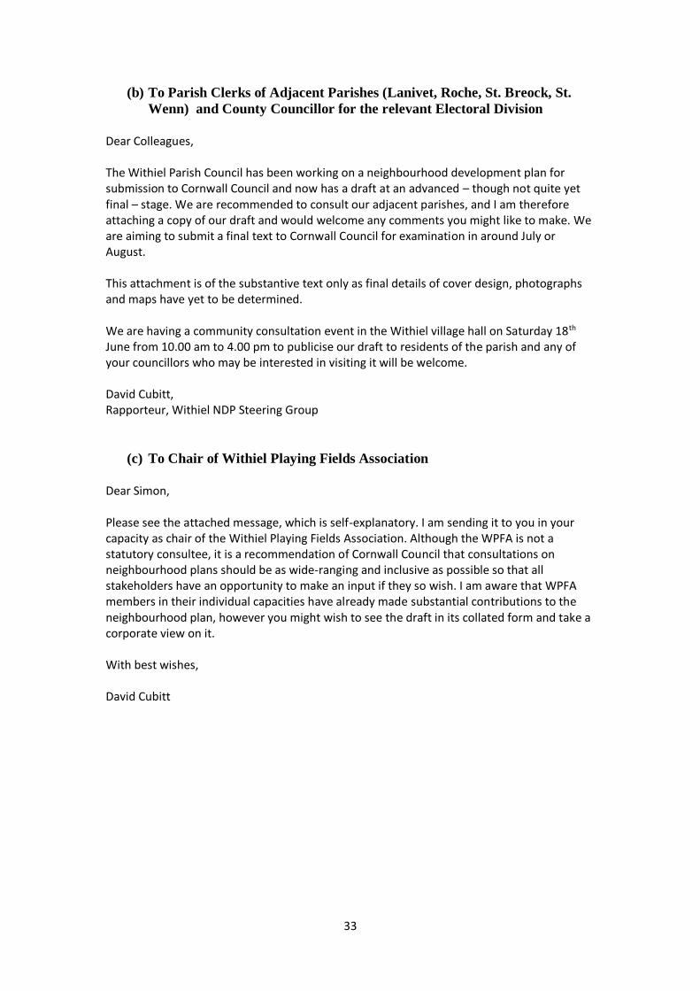
(b) To Parish Clerks of Adjacent Parishes (Lanivet, Roche, St. Breock, St.
Wenn) and County Councillor for the relevant Electoral Division
Dear Colleagues, The Withiel Parish Council has been working on a neighbourhood development plan for submission to Cornwall Council and now has a draft at an advanced – though not quite yet final – stage. We are recommended to consult our adjacent parishes, and I am therefore attaching a copy of our draft and would welcome any comments you might like to make. We are aiming to submit a final text to Cornwall Council for examination in around July or August. This attachment is of the substantive text only as final details of cover design, photographs and maps have yet to be determined. We are having a community consultation event in the Withiel village hall on Saturday 18th June from 10.00 am to 4.00 pm to publicise our draft to residents of the parish and any of your councillors who may be interested in visiting it will be welcome. David Cubitt, Rapporteur, Withiel NDP Steering Group
(c) To Chair of Withiel Playing Fields Association
Dear Simon, Please see the attached message, which is self-explanatory. I am sending it to you in your capacity as chair of the Withiel Playing Fields Association. Although the WPFA is not a statutory consultee, it is a recommendation of Cornwall Council that consultations on neighbourhood plans should be as wide-ranging and inclusive as possible so that all stakeholders have an opportunity to make an input if they so wish. I am aware that WPFA members in their individual capacities have already made substantial contributions to the neighbourhood plan, however you might wish to see the draft in its collated form and take a corporate view on it. With best wishes, David Cubitt

34
APPENDIX 20: LETTER TO RESIDENTS, JULY 2016
Withiel Neighbourhood Development Plan Steering Group
Letter to Resident Consultees
July 2016
Dear Resident Consultee,
As you may already know, for the past two years a steering group set up by the
Withiel Parish Council has been preparing a neighbourhood development plan for the
parish. This is in line with government policy under the Localism Act of 2012, which
encourages the production of such plans to give localities a meaningful say in the
planning rules of the county local plan, which control development.
There has already been some consultation with residents of the parish and we now
have an advanced draft of our neighbourhood plan. The next step is to submit the plan
to a public examination/consultation. This is a requirement under the current
legislation.
The consultation/examination period will start on Monday 1st August 2016 and will
last for just over six weeks, until Friday 16th Septermber 2016. During this period you
are invited to view the draft plan and submit comments to the steering group.
You can view the draft plan by going to the parish website at www.withiel.com and
down-loading the section titled “neighbourhood-plan”. Alternatively, if you want to
view the draft plan in hard copy, you should request one from the rapporteur of the
steering group, David Cubitt, who can be reached at [email protected] or
telephone [01208] 831870.
Please send your comments to David Cubitt by Friday 16th September 2016. They will
be collated and reviewed by the steering group as soon as practicable and a final text
of the plan produced for submission to Cornwall Council.
With best wishes,
Janet Shearer,
Chair, Withiel NDP Steering Group

35
APPENDIX 21: STATUTORY CONSULTEES’ COMMENTS, AUGUST-
SEPTEMBER 2016
Withiel Neighbourhood Development Plan
Statutory Consultees’ Comments
Ancient Monuments Society
No comment made
British Gas
No comment made
BT Openreach
No comment made
Campaign to Protect Rural
England
No comment made
Civil Aviation Authority
Acknowledged 1/8/16. Copies standard guidance to developers
(annexed below). Noted but no NDP amendment needed
CAA Director of Airspace
Policy
Addressed under previous entry
Coastline Housing
Acknowledged 20/7/16
Community Energy Plus
No comment made
Cornwall & Isles of Scilly
Local Enterprise Partnership
No comment made
Cornwall AONB Unit
Acknowledged 21/7/16
Cornwall Buildings
Preservation Trust
No comment made
Cornwall Chamber of
Commerce and Industry
No comment made
Cornwall Fire and Rescue
Service
No comment made
Cornwall Wildlife Trust
No comment made
Devon and Cornwall
Housing Association
No comment made
Devon & Cornwall Police
(Architectural Liaison)
Acknowledged 13/9/16. Comment annexed below. Withiel NDP
policy group B amended to reflect advice
Duchy of Cornwall (Land
Steward)
No comment made
Duchy of Cornwall (Deputy
Estate Surveyor)
No comment made
EDF Energy Ltd
No comment made
EE Mobile
No comment made

36
Environment Agency
No comment made
First Great Western
No comment made
First Group Buses (Devon
and Cornwall)
No comment made
Forestry Commission
No comment made
Healthwatch Cornwall
No comment made
Highways Agency
Acknowledged 16/8/16. Comment annexed below. Withiel NDP
policy group A amended to reflect advice
Historic England
Acknowledged 9/9/16. Comment annexed below. Withiel NDP
policy group B amended to reflect advice
Homes and Communities
Agency
No comment made
Imerys Minerals Ltd
No comment made
Kaolin and Ball Clay
Association
No comment made
Marine Management
Organisation
No comment made
National Farmers’ Union
(South West)
No comment made
National Trust
No comment made
Natural England
Acknowledged 20/7/16. Comment annexed below. Draft being
amended to reflect advice
Network Rail
Acknowledged 22/8/16. Copies standard guidance to developers
(annexed below). Noted but no NDP amendment needed
O2 and Vodafone Mobile
No comment made
OFCOM
Acknowledged 20/7/16
Peninsula Community
Health
No comment made
Royal Cornwall Hospital
Trust
No comment made
South West Water
Acknowledged 27/7/16. Does not consider any comment needs
to be made
Three Mobile
No comment made
Wales and West Utilities Ltd
Acknowledged 20/7/16
Westcountry Housing
Association
No comment made
Western Power Distribution
No comment made

37
Comment from Civil Aviation Authority (1st August 2016) Civil Aviation Authority Screening and Scoping Opinion for Wind Turbine Applications
The CAA regularly gets asked by Planning Authorities and Developers for its opinion on the
Screening or Scoping of Wind Turbine Applications under the Environmental Impact
regulations. In all cases the advice is the same and in the past the CAA has also advised
applicants specifically which aviation stakeholders to consult. With increasing pressure on
limited resources within the CAA this customised service is no longer viable. The following
guidance is provided to enable applicants to identify the appropriate elements to include
within the aviation section of any environmental report and how Local Planning Authorities
should assess the information. Only in cases where the CAA is statutorily consulted under
the Electricity Act or the Planning Act will it provide a specific response to the application or
scoping request.
That said, if a Local Planning Authority (LPA) has specific questions relating to an application
it is recommended that they contact the CAA at [email protected].
Screening Opinion
The CAA has no authority over the conduct of the planning process and hence it is the view
of the CAA that the decision as to whether an applicant requires to submit an Environmental
Impact Assessment rests solely with the relevant planning authority.
Scoping Opinion
When considering aviation effects, there are typically two aspects to consider; obstacles and
electromagnetic impact including radar. Different aviation stakeholders will be affected in
different ways. Applicants should be made aware that several consultees act on a national
basis and, therefore, leaving consultations until just before an application is submitted
negates the purpose of the scoping process and will lead to delays.
Sometimes a developer or agent will claim that due to a development’s small size, aviation is
not an issue. This is not necessarily the case; indeed to date no evidence has been supplied
to substantiate these claims and, for example, there are a number of instances where small
wind turbines are detected by radar. Research is being undertaken to identify whether
there is a set of dimensions and materials that would have no substantial impact.
Identifying Statutory Consultees
Both NATS (which provides En Route Air Traffic Control) and the Ministry of Defence (MoD)
are statutory consultees under the Town and Country Planning Acts. The impact on their
infrastructure should be assessed within the Environmental Impact Assessment. The MoD
currently provide a free service although demand is high leading to the need to allow
sufficient time to respond, although this should be well within the timescales of other
consultation requirements such as ecological or noise surveys. NATS provide a number of
paid-for services and free self-assessment tools details of which can be found on their
website. Both of these organisations need to be consulted in all cases.
There are also a number of officially safeguarded aerodromes which are defined in
government circulars (listed at the end of this guidance). These may offer pre-planning
services for which there may be a charge. Such aerodromes should have lodged

38
safeguarding maps with LPA identifying the areas in which they need to be consulted. Due
to the nature of their operations these areas may be in excess of 50km from the aerodrome.
Local Planning Authorities and applicants must note that if an objection is raised by any of
the above, and consent is granted there is a possibility that the decision will be subject to
‘call-in’ by the Secretary of State or Scottish Ministers.
Identifying Non statutory Consultees
In addition to officially safeguarded Aerodromes there are several hundred other
aerodromes in the United Kingdom. These may be Licensed or Unlicensed by the
CAA. Associated Aerodrome Licence Holders or operators may have registered safeguarding
maps with their LPAs. To verify the presence of aerodromes known to the CAA in any
particular area, it is recommended that an aeronautical chart is purchased and the site of the
turbine checked to see if it falls within the range of an aerodrome using the distances
recommended in CAP 764. It is also recommended that Emergency Service Helicopter
Support Units are consulted as they may operate in the area of concern and be affected by
the introduction of tall obstacles. For example Police helicopters are permitted to operate
down to 75 feet and will routinely follow main roads and motorways during their
operations. Both the Police and Air Ambulance may need to land anywhere and will also
have specifically designated landing sites. In England and Wales, police aviation is centrally
co-ordinated by the National Police Air Service. They can be contacted via
[email protected]. Air Ambulance and Scottish Police need to be
consulted, where appropriate, on a local level. In addition, for offshore developments, the
Maritime and Coastguard Agency should be consulted.
Consideration of Electromagnetic Effects Including Radar and Radio Impacts
Almost uniquely among land developments wind turbines can be interpreted as moving
objects by Air Traffic Control Radar. This can lead to impacts such as increased workload for
Air Traffic Controllers, misidentification of tracks or loss of a genuine aircraft track, any of
which could have safety implications. It is for this reason that consultation with the
statutory consultees is essential in determining whether there is an operational impact on
the radar system and if so, whether a mitigation can be agreed.
There may also be impacts upon other radio systems such as Air Ground Air communications
and radio navigation beacons.
Consideration of Obstacle Aspects
As wind turbines are tall structures they can become obstacles to aviation. When in the
vicinity of an aerodrome this will be assessed by the aerodrome itself. Away from an
aerodrome, guidance for wind turbines is provided in CAP 764. The key blade tip heights to
consider for developments away from an aerodrome are:
91.4 metres as there is an international requirement for all obstacles of 300 feet or more in height to be marked on aeronautical charts and listed in the UK Aeronautical Information Publication. This assists pilots to safely plan their flights to take into consideration the locations of tall obstacles. The national database of aeronautical obstacles is maintained by the Defence Geographic Centre (mail to [email protected]).

39
150 metres at which the display of medium intensity aviation warning lights becomes mandatory as specified in Article 219 of the Air Navigation Order. There may also a requirement that the turbine is appropriately marked which would require the upper 2/3 of the turbine to be painted white. NB. Like any structure a wind turbine less than 150m in height might need to be lit / marked if, by virtue of their location and nature, it is considered a significant navigational hazard. If asked for comment, it would be unlikely that the CAA would have any issues associated with an aviation stakeholder (eg a local aerodrome operator or airspace operator) request for lighting / marking of any structure that was considered to be a significant hazard to air navigation.
Adrian Stead, Surveillance Policy (Airspace, ATM and Aerodromes), Civil Aviation Authority
Comment from Highways Agency (16th August 2016) Thank you for your letter of 21 July providing Highways England with an opportunity to
comment on Withiel Parish’s pre-submission draft neighbourhood plan. We acknowledge that
the small and predmoninantly rural nature of the parish means that any development
proposals coming forward are unlikely to have a significant impact on the A30 which runs
through the south west corner of the parish. We note that proposed housing allocations are
small and although you support a cluster of dwellings to the south of the plan area to take
advantage of the A30 connection, we accept that the scale of development is likely to be
small. However, reflecting the policies contained within the adjacent Roche Neighbourhood
Plan, the Wthiel plan also proposes supporting a change of use on part of the employment
site at Victoria to enable housing development, subject to employment use not being
economically viable. It will be impoortant to ensure that development in Victoria, whether
housing or employment, will need to be supported by an assessment of traffic impacts which
consider the A30 and Victoria junction, in line with prevailing policy.
Sally Parish, Asset Manager
Comment from Network Rail (22nd August 2016) Developer Contributions
The Neighbourhood Development Plan should set a strategic context requiring developer
contributions towards rail infrastructure where growth areas or significant housing allocations
are identified close to existing rail infrastructure.
Many stations and routes are already operating close to capacity and a significant increase in
patronage may create the need for upgrades to the existing infrastructure including improved
signalling, passing loops, car parking, improved access arrangements or platform extensions.
As Network Rail is a publicly funded organisation with a regulated remit it would not be
reasonable to require Network Rail to fund rail improvements necessitated by commercial
development. It is therefore appropriate to require developer contributions to fund such
improvements.
Specifically, we request that a Policy is included within the document which requires
developers to fund any qualitative improvements required in relation to existing facilities and
infrastructure as a direct result of increased patronage resulting from new development.
The likely impact and level of improvements required will be specific to each station and each
development meaning standard charges and formulae may not be appropriate. Therefore in

40
order to fully assess the potential impacts, and the level of developer contribution required, it
is essential that where a Transport Assessment is submitted in support of a planning
application that this quantifies in detail the likely impact on the rail network.
To ensure that developer contributions can deliver appropriate improvements to the rail
network we would recommend that Developer Contributions should include provisions for rail
and should include the following:
A requirement for development contributions to deliver improvements to the rail network where appropriate.
A requirement for Transport Assessments to take cognisance of impacts to existing rail infrastructure to allow any necessary developer contributions towards rail to be calculated.
A commitment to consult Network Rail where development may impact on the rail network and may require rail infrastructure improvements. In order to be reasonable these improvements would be restricted to a local level and would be necessary to make the development acceptable. We would not seek contributions towards major enhancement projects which are already programmed as part of Network Rail’s remit.
Level Crossings
Development proposals’ affecting the safety of level crossings is an extremely important
consideration for emerging planning policy to address. The impact from development can
result in a significant increase in the vehicular and/or pedestrian traffic utilising a crossing
which in turn impacts upon safety and service provision.
As a result of increased patronage, Network Rail could be forced to reduce train line speed in
direct correlation to the increase in vehicular and pedestrian traffic using a crossing. This
would have severe consequences for the timetabling of trains and would also effectively
frustrate any future train service improvements. This would be in direct conflict with strategic
and government aims of improving rail services.
In this regard, we would request that the potential impacts from development affecting
Network Rail’s level crossings, is specifically addressed through planning policy as there have
been instances whereby Network Rail has not been consulted as statutory undertaker where
a proposal has impacted on a level crossing. We request that a policy is provided confirming
that:
The Council have a statutory responsibility under planning legislation to consult the statutory rail undertaker where a proposal for development is likely to result in a material increase in the volume or a material change in the character of traffic using a level crossing over a railway:
o Schedule 5 (f)(ii) of the Town & Country Planning (Development Management Procedure) order, 2010 requires that… “Where any proposed development is likely to result in a material increase in volume or a material change in the character of traffic using a level crossing over a railway (public footpath, public or private road) the Planning Authority’s Highway Engineer must submit details to both Her Majesty’s Railway Inspectorate and Network Rail for separate approval”.
Any planning application which may increase the level of pedestrian and/or vehicular usage at a level crossing should be supported by a full Transport Assessment assessing such impact: and
The developer is required to fund any required qualitative improvements to the level crossing as a direct result of the development proposed.
Planning Applications
We would appreciate the Council providing Network Rail with an opportunity to comment on
any future planning applications should they be submitted for sites adjoining the railway, or

41
within close proximity to the railway as we may have more specific comments to make (further
to those above).
We trust these comments will be considered in your preparation of the forthcoming
Neighbourhood Development Plan document.
Barbara Morgan, Town Planning Technician (Western and Wales)
Comment from Historic England (9th September 2016)
Thank you for your consultation on the draft Withiel Neighbourhood Plan. We have in parallel been consulted by Cornwall Council on the SEA Screening for the Plan. Our response highlights the need for greater clarity on how the proposed housing allocation has taken any necessary account of relevant heritage assets in its promotion – a point of consideration also necessary in order to demonstrate conformity with national and local planning policy. I have attached a copy of that response, which you will see otherwise praises the Plan for its identification of locally distinctive heritage initiatives. We must also congratulate your community on the progress it has made in the preparation of its Plan. I am sure that the clarification we have identified can be easily provided and the Plan proceed smoothly to its successful conclusion. David Stuart | Historic Places Adviser South West APPENDIX Thank you for your consultation on the SEA Screening for the emerging Withiel Neighbourhood Plan. Our focus is on the Plan’s intention to allocate a site for housing in the south of the parish adjacent to the A30 access. The Screening Report suggests that this will be a cluster of 3-4 dwellings (Para 4.2, section 8 of table 1) but the draft Plan states that there may be clusters (plural) each containing 3-4 dwellings without specifying how many clusters that might amount to. Certainly the proposed allocation area (Map B2) looks large enough to accommodate significantly more than 3-4 dwellings. The Screening Report also doesn’t make any mention of designated heritage assets other than to identify the existence of two scheduled ancient monuments. As our previous letter to your authority (attached) identifies, the Plan area contains 1 Grade 1, 1 Grade II* and 20 Grade II Listed Buildings, and 5 Scheduled Ancient Monuments. While few of these are near the proposed housing development area (and the nearest looks as though it might

42
be a Grade II Listed milestone) we would expect the Screening to demonstrate that such assets won’t be harmed by the site allocation. It is also useful to confirm that there isn’t significant below ground archaeological potential which might affect either the feasibility of an in-principle allocation of the site or the manner in which it should be developed. The draft Plan itself refers to the evidence base which has been used to inform its contents but this doesn’t include any reference to historic environment databases. Although the Plan contains a schedule of the designated heritage assets in the area it doesn’t indicate how this information has been used to inform the Plan’s policies and proposals. The website on which the Plan is available as part of the current and parallel consultation doesn’t appear to include, or refer to sources of, supporting information either. As the Screening Report is currently drafted we do not believe that it adequately demonstrates that the historic environment of the area has been sufficiently understood to allow for the conclusion that an SEA will not be required. We would be happy to review this advice in the light of additional evidence. Otherwise, we are pleased that the Plan highlights the value of its distinctive historic character and how this should be protected end enhanced. We are particularly impressed by the locally specific heritage and tourism initiatives which the Plan sets out. David Stuart | Historic Places Adviser South West
Comment from Devon & Cornwall Police (16th September 2016)
Thank you for the copy of the plan. As we briefly discussed my only comments are rather generic in nature I would therefore suggest that the following statement is included within the local plan “All development proposals should consider the need to design out crime, disorder and anti-social behaviour to ensure ongoing community safety and cohesion” This can apply to all forms of development not just housing. May also be just as relevant for car parks, footpaths, play areas, any future commercial development etc Martin Mumford Designing Out Crime Officer
Comment from Natural England (16th September 2016)
Thank you for your consultation on the above dated 20 July 2016.

43
Natural England is a non-departmental public body. Our statutory purpose is to ensure
that the natural environment is conserved, enhanced, and managed for the benefit of
present and future generations, thereby contributing to sustainable development.
We recognise the hard work being done in Withiel parish in developing a
Neighbourhood Plan and we welcome being consulted on this pre-submission draft.
The parish of Withiel supports a rich natural environment, including areas designated
for their national and international biodiversity significance. A considerable part of
the internationally important Camel SAC1 is within the parish boundaries, as is the
nationally important Retire Common SSSI2. Part of the newly proposed Mid Cornwall
Moors SAC is also within the parish as are newly proposed SSSI extensions,
considerably enlarging the area’s existing SSSI. Moreover, the Breney Common and
Goss and Tregoss Moors SAC, whilst not within the parish boundaries, is in close
proximity to the plan area.
Our comments: We have a number of comments to make which are shown in
Appendix A below. We hope that our comments will assist the Parish in developing a
robust plan which will help achieve the community’s vision and ambitions and
withstand future challenges. We would be happy to comment further should the
need arise but if in the meantime you have any queries please do not hesitate to
contact us.
1 Special Area of Conservation, a European biodiversity designation 2 Site of Special Scientific Interest, a national biodiversity designation
Corine Dyke Lead Adviser Sustainable Development Team – Devon, Cornwall &
Isles of Scilly
Appendix A
General comments
A clearer distinction could be made between planning policies and community actions. Not all items shown under ‘policies’ are within the remit of planning
and could more usefully identified as ‘community actions’.
Whilst we positively welcome community driven allocations, it is not entirely clear whether this plan makes allocations, or merely expresses a wish to see
certain development.
More detailed comments
Policies on Objectives for Economic Development (p.12)
The third bullet point relating to the regeneration of Victoria square is unclear
in planning terms. Is it the intention to allocate Victoria square or is it intended
to just indicate a desire to see regeneration happen there? If Victoria Square is
allocated for re-development then it is important to fully screen the proposal

44
for environmental impacts. Please also see our response to Cornwall Council’s
SEA screening consultation on the plan (attached separately).
The other bullet points appear to be outside the planning remit and could be re-branded as community actions.
Policies on Housing (p.15)
We have made the assumption that the plan proposes to allocate the area
shown on Map B for housing. Clarity is however required about the total
number of dwellings proposed. To enable a robust allocation to be made, the
proposal should be fully screened for its environmental impacts on the nearby
SACs and SSSIs. Please also see our response to Cornwall Council’s SEA
screening consultation on the plan.
The fourth and tenth bullet points could be shown as community actions.
Policies on Environmental and Community Facilities (p. 20)
This section could benefit from some clarification. The first sentence under the main heading could be identified more clearly as the policy. The list of
projects could be identified as community actions, outside the planning remit.
Description of Relevant features of Parish (p.25)
The first sentence under this heading should be amended as this section describes not just landscape but also biodiversity designations.
The new Mid Cornwall Moors possible SAC designation as well as the
proposed extensions to the area’s SSSI should be added in the description of
landscape and biodiversity designations. These proposed designations have the
same planning protection as existing designations, in accordance with
paragraph 118 of the NPPF.
Policies on Green Assets and Sustainable Development (p.26)
We welcome these policies which aim to protect and enhance the environment. We
advise that a number of improvements are needed to make the policies more robust
and accord with national planning policy:
The first bullet point should be slightly amended to better reflect national policy on SSSIs. We recommend that that you amend the final part of the
sentence to: ‘…other than development proposals where the primary objective
is to conserve or enhance biodiversity’. The second bullet point should be
amended to read ’…in accordance with, and carefully monitored in line with
the principles, policies and requirements of the Cornwall Local Plan and the
Cornwall Council and Withiel parish design guidance.’
The third bullet point should include in its first sentence the protection of landscape and geodiversity as well as biodiversity. We also recommend that
the word ‘sensitivity’ is replaced by ‘protection and enhancement’, in
accordance with the NPPF. We furthermore recommend that the final sentence
of this bullet point is amended to: ‘… and maximise the opportunities for
enhancing wildlife, geodiversity and landscape in new areas of public space
and across the parish.’

45
APPENDIX 22: NON-STATUTORY AND RESIDENT CONSULTEES’
COMMENTS, AUGUST-SEPTEMBER 2016
Withiel Neighbourhood Development Plan
Non-Statutory and Resident Consultees’ Comments
(a) Non-Statutory Consultees
Chris Batters (Cornwall
Councillor)
No comments made
Lanivet Parish Council
No comments made
Cornwall Council
Acknowledged 28/7/16. Detailed comments made 16/9/16.
Appropriate amendments currently under negotiation
Roche NDP Steering Group
Acknowledged 30/5/16. No comments made on draft, but
helpful advice on managing the process given
Roche Parish Council
No comments made
St. Breock Parish Council
No comments made
St. Wenn Parish Council
No comments made
Withiel Playing Fields
Association
No comments made
Withel branch, Women’s
Institute
No comments made
(b) Resident Consultees
I found it a very positive and interesting document. The only comment I would make is about the idea of leaflets etc. for walkers and tourists passing through Withiel. I walk around the parish quite a lot and rarely encounter other walkers, although the people in the village would have more of an idea about this. Most walkers take with them the relevant OS map or printed route and some seem to take GPS gizmos. School groups do seem to come through on training walks occasion-ally but seem well equipped. The most important factors for walkers are clear signage and cleared footpaths. When I walked around yesterday I through how well the path I was using had been cleared. (Pat Ling, 5th August 2016)
46
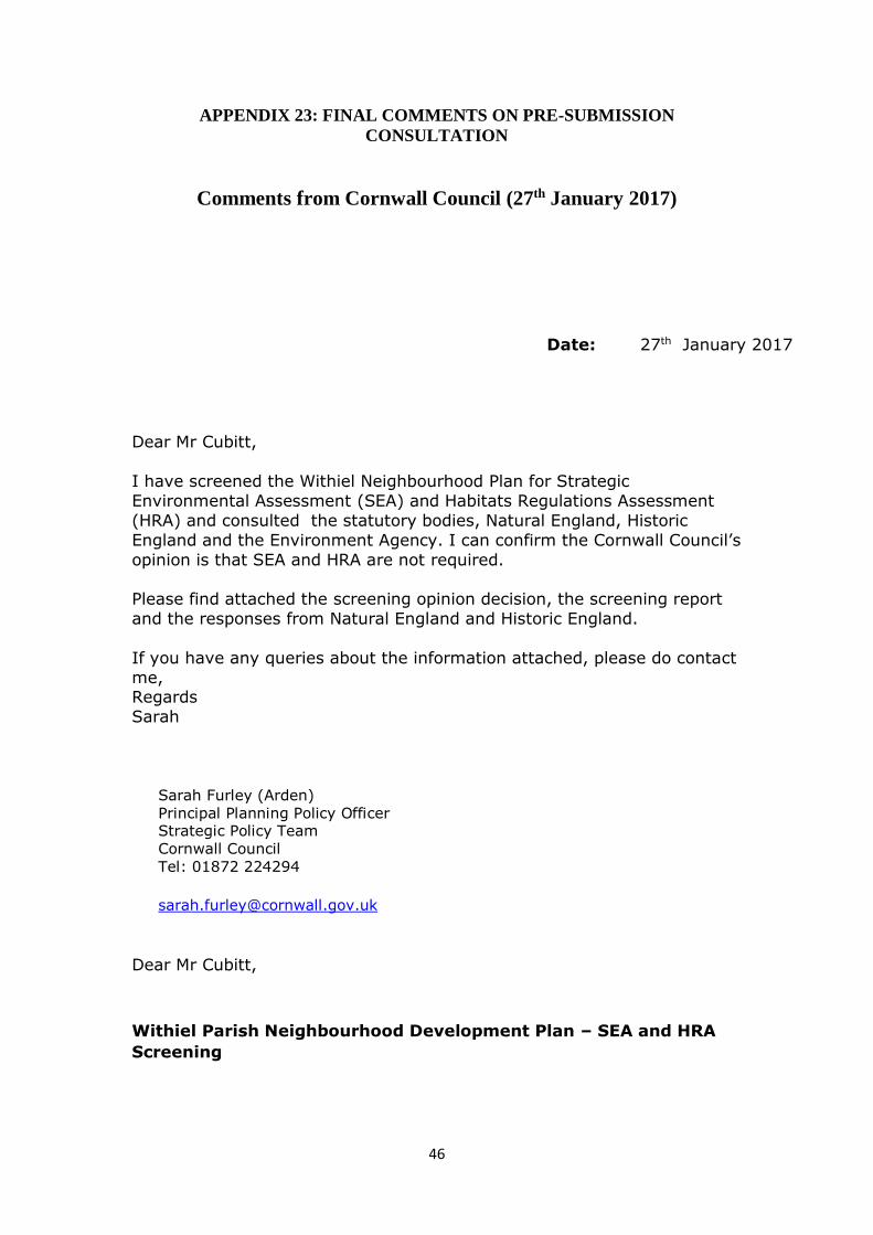
APPENDIX 23: FINAL COMMENTS ON PRE-SUBMISSION
CONSULTATION
Comments from Cornwall Council (27th January 2017)
Dear Mr Cubitt,
I have screened the Withiel Neighbourhood Plan for Strategic
Environmental Assessment (SEA) and Habitats Regulations Assessment
(HRA) and consulted the statutory bodies, Natural England, Historic
England and the Environment Agency. I can confirm the Cornwall Council’s
opinion is that SEA and HRA are not required.
Please find attached the screening opinion decision, the screening report
and the responses from Natural England and Historic England.
If you have any queries about the information attached, please do contact
me, Regards
Sarah
Sarah Furley (Arden)
Principal Planning Policy Officer Strategic Policy Team
Cornwall Council Tel: 01872 224294
Dear Mr Cubitt,
Withiel Parish Neighbourhood Development Plan – SEA and HRA
Screening
Date: 27th January 2017
47
As requested I have screened the Withiel Neighbourhood Development
Plan ( revised draft November 2016) to see whether the plan requires
Strategic Environmental Assessment (SEA) or Habitats Regulations
Assessment (HRA.)
As required by the SEA regulations I produced a screening opinion for the
Withiel neighbourhood plan and consulted the statutory bodies, Natural
England, Historic England and the Environment Agency. I also asked
Natural England to confirm whether or not HRA was required under the
HRA directive.
Based on the scale and location of development proposed, Cornwall
Council is of the opinion that the Withiel neighbourhood plan is unlikely to
have significant effects on the environment or on European Sites and that
SEA and HRA is therefore not required.
This view is confirmed by the consultation bodies and the full screening
opinion and the responses from the consultation bodies are attached.
If significant changes or additions are made to your plan I would advise
you to have it rescreened.
Yours sincerely,
Sarah Arden
Principal Development Officer
Strategic Planning Policy
Tel: 01872 224294
Email: [email protected]
48
Withiel Neighbourhood Development Plan
Strategic Environmental Assessment
Habitats Regulations Assessment
Screening Report
14th December 2016

49
Contents
1. Introduction
4
2. Legislative Background
4
3. Criteria for Assessing the Effects of the Neighbourhood Plan
5
4. Assessment
6
5. Screening Outcome
8

50
1. Introduction
1.1 This screening report is designed to determine whether or not the contents of the
Withiel Neighbourhood Development Plan require a Strategic Environmental
Assessment (SEA) in accordance with the European Directive 2001/42/EC and
associated Environmental Assessment of Plans and Programmes Regulations 2004.
The report also considers whether Habitats Regulations Assessment is required
under Article 6 or 7 of the Habitats Directive.
1.2 The purpose of the Withiel Neighbourhood Development Plan is to maintain the
predominately “peaceful and attractive rural environment with strong community
cohesion, but with a commitment to high-quality communications both physical and
electronic, effective controls on industrial development, adequate provision of
appropriate and good-quality housing for residents, and a thriving economy using local
talents and resources”. The Plan contains policy objectives on economic development,
housing, environment and community facilities, heritage and tourism, green assets and
sustainable development.
1.3 The legislative background set out below outlines the regulations that require the need
for this screening exercise. Section 4, provides a screening assessment of the likely
significant environmental effects of the Neighbourhood Plan and the need for a full
SEA.
2. Legislative Background
2.1 The basis for Strategic Environmental Assessments and Sustainability Appraisal
legislation is European Directive 2001/42/EC and was transposed into English law by
the Environmental Assessment of Plans and Programmes Regulations 2004, or SEA
Regulations. Detailed Guidance of these regulations can be found in the Government
publication ‘A Practical Guide to the Strategic Environmental Assessment Directive’
(ODPM 2005)
2.2 .The Planning and Compulsory Purchase Act 2004 required Local Authorities to
produce Sustainability Appraisals (SA) for all local development documents to meet
the requirement of the EU Directive on SEA. It is considered best practice to
incorporate requirements of the SEA Directive into an SA.
2.3 However, Neighbourhood Plans are not Local Development Documents and are not
required to be subject to sustainability appraisal by legislation (although it is advisable
to carry out some form of sustainability assessment.) Neighbourhood plans are
produced under the Localism Act 2011. The Localism Act requires neighbourhood
plans to be compatible with EU and Human rights legislation, therefore, depending on
their content, neighbourhood plans may trigger the Strategic Environmental
Assessment Directive and Habitats Directive and unless they choose to complete a full
SA plans will need to be screened for SEA separately.

51
2.4 This report focuses on screening for SEA and the criteria for establishing whether a
full assessment is needed. The requirement for HRA is also considered.

52
3. Criteria for Assessing the Effects of the Neighbourhood Plan
3.1 Criteria for determining the likely significance of effects referred to in Article 3(5) of
Directive 2001/42/EC are set out below:
1. The characteristics of plans and programmes, having regard, in particular, to
- the degree to which the plan or programme sets a framework for projects and other activities, either with regard to the location, nature, size and operating conditions or by allocating resources,
- the degree to which the plan or programme influences other plans and programmes including those in a hierarchy,
- the relevance of the plan or programme for the integration of environmental considerations in particular with a view to promoting sustainable development,
- environmental problems relevant to the plan or programme,
- the relevance of the plan or programme for the implementation of Community legislation on the environment (e.g. plans and programmes linked to waste-management or water protection).
2. Characteristics of the effects and of the area likely to be affected, having regard, in particular, to
- the probability, duration, frequency and reversibility of the effects,
- the cumulative nature of the effects,
- the transboundary nature of the effects,
- the risks to human health or the environment (e.g. due to accidents),
- the magnitude and spatial extent of the effects (geographical area and size of the population likely to be affected),
- the value and vulnerability of the area likely to be affected due to:
- special natural characteristics or cultural heritage,
- exceeded environmental quality standards or limit values,
- intensive land-use,
- the effects on areas or landscapes which have a recognised national, Community or international protection status.
Source: Annex II of SEA Directive 2001/42/EC

53
4. Assessment
4.1 The diagram below illustrates the process for screening a planning document to
ascertain whether a full SEA is required1.
1 Source: A Practical Guide to the Strategic Environmental Assessment Directive

54
4.2 The table below shows the assessment of whether the neighbourhood plan will require
a full SEA. The questions below are drawn from the diagram above which sets out how
the SEA Directive should be applied.
Table 1: Establishing the Need for SEA
Stage Y/N Reason 1. Is the PP (plan or programme) subject to preparation and/or adoption by a national, regional or local authority OR prepared by an authority for adoption through a legislative procedure by Parliament or Government? (Art. 2(a))
Y Will be adopted (‘made’) by the Local Planning Authority and used in decision making as part of the development plan.
2. Is the PP required by legislative, regulatory or administrative provisions? (Art. 2(a))
Y Localism Act 2011
3. Is the PP prepared for agriculture, forestry, fisheries, energy, industry, transport, waste management, water management, telecommunications, tourism, town and country planning or land use, AND does it set a framework for future development consent of projects in Annexes I and II to the EIA Directive? (Art 3.2(a))
N Annex I and II projects are (typically) large scale industrial and commercial processes – the plan does not deal with this scale of development.
4. Will the PP, in view of its likely effect on sites, require an assessment for future development under Article 6 or 7 of the Habitats Directive? (Art. 3.2 (b))
N Part of the River Camel SAC is within the Parish, as tributaries to the River Camel flow through the Parish. The protected species are dry heaths, oak woodland, Alder woodland, Bullhead, Otter and Atlantic Salmon. The otter and bullhead populations are dependent on high water quality and a natural river environment. Most of the habitats and species are not particularly vulnerable to recreational pressure. Dry heath is more susceptible to recreational pressure. The Site Improvement Plan (SIP) for the SAC identifies pressures as water pollution, inappropriate weirs, dams or structures, invasive species, water abstraction, forestry and woodland management and deer. The SIP also identifies management methods and delivery bodies. Development within the area described as Victoria Sqaure (map A2) either to regenerate the existing industrial estate or to provide a small clusters of affordable housing will be located a

55
minimum of 100m from the SAC and will not drain into it, being to the south of the watershed. Breney Common and Tregoss Moors SAC lies
just outside the parish boundary, to the south west. The existing SAC boundary is currently in the process of being extended and revised into the new Mid Cornwall Moors SSSI/SAC. The SIP identifies Undergrazing, inappropriate scrub control, hydrological changes and drainage as pressures and arson and air pollution as a pressure/threat. The majority of these issues are controlled by site management and the SIP identifies appropriate actions, funding and delivery partners. Recreational pressures are not currently an issue on the site. Footpaths and tracks are underused and overgrown. Policies for Economic Development earmark an area known as Victoria Square for industrial or retail regeneration, as this is an existing industrial estate, see Map A2, some 85m from the SACs. Support is also given for the continuation of farming activities. Policies on housing also favour development of a cluster of dwellings (3-4 dwellings) adjacent to the A30, as shown on Map A2, some 250 and 270m from the SACs. However, policies also recognise the need to protect designated areas and the Plan does not support any built development within the SSSI (these areas overlap with the SAC).
5. Does the PP Determine the use of small areas at local level, OR is it a minor modification of a PP subject to Art. 3.2? (Art. 3.3)
Y The Plan contains land use planning policies to guide development within the Parish. It supports the principle of redevelopment of

56
an existing industrial estate and supports infill development within settlement boundaries and the potential for exception site development if the need arises. .
6. Does the PP set the framework for future development consent of projects (not just projects in annexes to the EIA Directive)? (Art 3.4)
Y The NDP will be ‘made’ and used as part of the development plan for determining planning applications in the Plan area.
7. Is the PP’s sole purpose to serve the national defence or civil emergency, OR is it a financial or budget PP, OR is it co-financed by structural funds or EAGGF programmes 2000 to 2006/7? (Art 3.8, 3.9)
N/A
8. Is it likely to have a significant effect on the environment? (Art. 3.5)
N The Plan proposes small scale development to meet local and development within an existing industrial estate. No housing target is set in the Plan and the policy favours individual dwellings or very small scale developments. The Plan sets a policy framework which aims to protect the landscape and environment, it does not support built development within the SSSIs.
Table 2 likely significant effects: Establishing the Need for SEA
SEA requirement Comments
The characteristics of plans and programmes, having regard, in particular, to:
1. the degree to which the plan or programme sets a framework for projects and other activities, either with regard to the location, nature, size and operating conditions or by allocating resources
The Plan names an existing industrial site, Victoria Square as suitable for commercial redevelopment. Although the level of development is not specified in the Plan a tight settlement boundary is defined for Withiel Churchtown and support is given to agro-pastoral farming developments and superfast broadband. The Plan also provides local criteria based policies to control the quality of development within the parish.
2. the degree to which the plan or programme influences other plans and programmes including those in a hierarchy
The neighbourhood plan must be in general conformity with the National Planning Policy Framework and the Cornwall Local Plan: Strategic Policies.
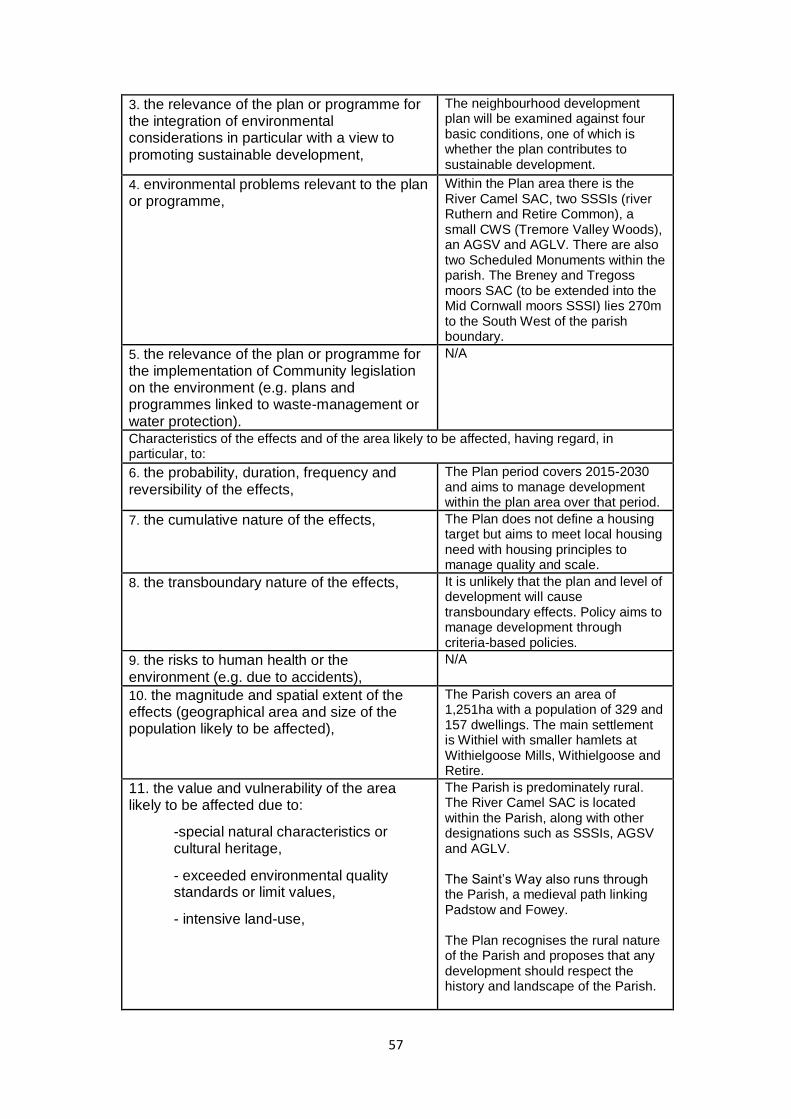
57
3. the relevance of the plan or programme for the integration of environmental considerations in particular with a view to promoting sustainable development,
The neighbourhood development plan will be examined against four basic conditions, one of which is whether the plan contributes to sustainable development.
4. environmental problems relevant to the plan or programme,
Within the Plan area there is the River Camel SAC, two SSSIs (river Ruthern and Retire Common), a small CWS (Tremore Valley Woods), an AGSV and AGLV. There are also two Scheduled Monuments within the parish. The Breney and Tregoss moors SAC (to be extended into the Mid Cornwall moors SSSI) lies 270m to the South West of the parish boundary.
5. the relevance of the plan or programme for the implementation of Community legislation on the environment (e.g. plans and programmes linked to waste-management or water protection).
N/A
Characteristics of the effects and of the area likely to be affected, having regard, in particular, to:
6. the probability, duration, frequency and reversibility of the effects,
The Plan period covers 2015-2030 and aims to manage development within the plan area over that period.
7. the cumulative nature of the effects, The Plan does not define a housing target but aims to meet local housing need with housing principles to manage quality and scale.
8. the transboundary nature of the effects, It is unlikely that the plan and level of development will cause transboundary effects. Policy aims to manage development through criteria-based policies.
9. the risks to human health or the environment (e.g. due to accidents),
N/A
10. the magnitude and spatial extent of the effects (geographical area and size of the population likely to be affected),
The Parish covers an area of 1,251ha with a population of 329 and 157 dwellings. The main settlement is Withiel with smaller hamlets at Withielgoose Mills, Withielgoose and Retire.
11. the value and vulnerability of the area likely to be affected due to:
-special natural characteristics or cultural heritage,
- exceeded environmental quality standards or limit values,
- intensive land-use,
The Parish is predominately rural. The River Camel SAC is located within the Parish, along with other designations such as SSSIs, AGSV and AGLV. The Saint’s Way also runs through the Parish, a medieval path linking Padstow and Fowey. The Plan recognises the rural nature of the Parish and proposes that any development should respect the history and landscape of the Parish.

58
The plan also does not support development within the SSSIs (these areas overlap with the SAC). Development is directed to existing settlements with provision for protecting AGLV, AGSV and SSSIs. The plan will not result in intensive land use.
12. the effects on areas or landscapes which have a recognised national, Community or international protection status.
The Plan aims to protect the rural nature of the Parish. The housing policies note that development should be in keeping with the rural character of the Parish. The Plan area does contain several designated areas (SAC, SSSIs, AGLV and AGSV) although policies aim to steer development away from these sensitive areas and applications for development must take account of the need to protect and enhance landscape, geodiversity and biodiversity.
5. Screening Outcome
5.1 As a result of the assessment in section 4, it is unlikely there will be any significant
environmental effects arising from the Withiel Neighbourhood Development Plan. The
Plan area does include sensitive landscapes and designated areas; there are no
housing targets included within the Plan, however it aims to meet local needs. The
NDP does not allocate new sites, but identifies a tight settlement boundary for the main
settlement and an existing industrial estate where commercial development is
aceptable. Policy within the Plan also provides protection to the designated SSSI
(which overlaps with the SAC). Given the scale of development proposed, the Withiel
NDP does not require a full SEA to be undertaken.
The plan is not likely to have a significant effect on European sites and HRA is not
required.

59
Comment from Natural England (16th January 2017)
Date: 16 January 2017
Our ref: 204011
Your ref: Withiel Neighbourhood Development Plan, SEA & HRA Screening Report
Withiel Neighbourhood Development Plan Strategic Environmental Assessment Screening Report
FAO Sarah Furley
Principal Planning Officer Customer Services
Strategic Policy Team Hornbeam House
Cornwall Council Crewe Business ParkElectra Way
Crewe [email protected] Cheshire
CW1 6GJ T 0300 060 3900
BY EMAIL ONLY
Dear Sarah
Planning consultation:
Withiel Neighbourhood Development Plan, Strategic Environmental Assessment
(SEA) and Habitats Regulations Assessment (HRA) Screening Report
Thank you for your consultation on the above dated 14 December 2016 which was received by
Natural England on the same date.
Natural England is a non-departmental public body. Our statutory purpose is to ensure that the
natural environment is conserved, enhanced, and managed for the benefit of present and future
generations, thereby contributing to sustainable development.
We concur with the conclusions set out in section 5.1 of the Screening report which states that

60
“there are unlikely to be any significant environmental effects arising from the Withiel
Neighbourhood Development Plan” and that therefore the Neighbourhood Plan does not require a
full SEA or HRA to be undertaken.
We would be happy to comment further should the need arise but if in the meantime you have any
queries please do not hesitate to contact us.
For any queries relating to the specific advice in this letter only please contact Carol Reeder on 0208
225 6245 / 07721 108902 or [email protected]. For any new consultations, or to
provide further information on this consultation please send your correspondences to
We really value your feedback to help us improve the service we offer. We have attached a feedback
form to this letter and welcome any comments you might have about our service.
Yours sincerely
Carol Reeder
Lead Adviser
Sustainable Development Team – Devon, Cornwall & Isles of Scilly
Page 1 of 1

61
Comment from Historic England (9th January 2017)
Dear Sarah Thank you for your consultation on the revised SEA Screening Report for the draft Withiel Neighbourhood Plan. We had previously advised the community that the proposal to allocate sites for housing development needed to be supported by more evidence. The relevant policy has now been amended and we note that the Plan now avoids any site specific housing allocations. On that basis we have no objection to the view that an SEA will not be required. On a point of formatting, we note that the version of the Plan received has the same referencing nomenclature for formal Policies and Community Actions. We wonder whether different referencing for each might assist clarity in the distinction between the purpose and status of these provisions. Otherwise, we are not sure what Policy B4 is advocating as an Action. Our previous advice related to a particular site but it is not clear where B4 as drafted might be referring to. In the absence of a particular site where relevant and specific heritage assets can be identified there is a general policy requirement deriving from the National Planning Policy Framework (NPPF) for development proposals to demonstrate the significance of relevant heritage assets and B4 as drafted does not appear to be adding any local value. We would also only need to be consulted on specific development proposals on any site where our formal statutory interests would be affected. I attach a copy of our previous correspondence for information. Kind regards David David Stuart | Historic Places Adviser South West Direct Line: 0117 975 0680 | Mobile: 0797 924 0316 Historic England | 29 Queen Square | Bristol | BS1 4ND
We have launched four new, paid-for Enhanced Advisory Services, providing enhancements to our existing free planning and listing services. For more information on the new Enhanced Advisory Services as well as our free services go to our website: HistoricEngland.org.uk/EAS
62
We help people understand, enjoy and value the historic environment, and protect it for the
future. Historic England is a public body, and we champion everyone’s heritage, across
England.
Follow us: Facebook | Twitter | Instagram Sign up to our newsletter
For the first time, we are opening up The List asking people to share images, insights and
secrets of these special historic places to capture them for future generations. Can you help us
#ListEngland?
This e-mail (and any attachments) is confidential and may contain personal views which are not the views of Historic England unless specifically stated. If you have received it in error, please delete it from your system and notify the sender immediately. Do not use, copy or disclose the information in any way nor act in reliance on it. Any information sent to Historic England may become publicly available.
From: Furley Sarah [mailto:[email protected]] Sent: 14 December 2016 14:06
To: [email protected]; [email protected]; Stuart, David Subject: Withiel NDP SEA screening
Dear all,
Please find attached a revised SEA screening report for Withiel NDP, which has
been rescreened following amendments to the draft plan.
Please could I have your comments on the need for SEA (and HRA from Natural
England) by the 11th January 2017.
Regards Sarah
Sarah Furley (Arden)
Principal Planning Policy Officer Strategic Policy Team
Cornwall Council Tel: 01872 224294
Fourth Floor North, Pydar House, Pydar Street, Truro, Cornwall, TR1 1XU
www.cornwall.gov.uk

63
APPENDIX 24: STEERING GROUP MINUTES, 8TH FEBRUARY 2017
Withiel Neighbourhood Development Plan (NDP) Steering Group
Minutes of a meeting held at 6.00 pm on Wednesday 8th February 2017 in the village hall.
Present: Cllr Janet Shearer in the chair, Steering Group members David Cubitt, Alison
Davey, David Horn, Anna Hoyle. Apologies for absence Jo Ashby, Mike Cherry, Merv
Davey, Patrick Malone.
17/1. Janet Shearer welcomed everyone to the meeting and David Cubitt explained the next
steps to be taken. The purpose of this meeting is to discuss and approve the final draft
neighbourhood plan and supporting documents. These will then be submitted to Cornwall
Council for further review and consultation with interested parties. This takes approximately
8-10 weeks. An examiner is then appointed by Cornwall Council in consultation with the
parish council, to examine the documents and either approve them or require further work to
be undertaken. This takes approximately 8-10 weeks. Once the examiner has approved the
plan, Cornwall Council will hold a referendum of the inhabi-tants of the parish to seek their
approval. If approved in the referendum, the plan then becomes a subordinate part of the
Cornwall Local Plan.
17/2. David Cubitt tabled the latest draft, dated 24th January 2017, of the neighbourhood
plan. This incorporates amendments and changes arising from comments made during the
pre-submission consultation and in subsequent discussions with Cornwall Council, Historic
England and Natural England. The main changes have to do with (a) clarifying the distinction
between policy statements and community actions which flow from them, (b) restating the
policies in the housing section in a more concise form and making explicit their relationship
with the Cornwall Local Plan, (c) excising the specification and accompanying map of a
possible site at the southern end of the parish for a housing cluster development, following
objections from Cornwall Council and Historic England. These and other minor amendments
were discussed and approved.
17/3. David Cubitt tabled the draft Consultation Statement, Basic Conditions Statement and
Design Statement. The first two are mandatory requirements to accompany the
neighbourhood plan, the third is optional. After discussion all three documents were approved
for submission. Agreed that David Cubitt should now go ahead and in the next few days
submit the draft plan and supporting documents to Cornwall Council. Whether or not there
should be a further meeting of the Steering Group was left open, to depend on circumstances.
Cllr Shearer thanked everyone for coming, and closed the meeting at approximately 6.50 pm.