Embed Size (px)
Citation preview

APPENDIX A
SUMMARY OF AVOIDANCE, MINIMIZATION, AND MITIGATION MEASURES

Appendix A Summary of Avoidance, Minimization, and Mitigation Measures
SUMMARY OF AVOIDANCE, MINIMIZATION, AND MITIGATION MEASURES
Community Impacts
Preferred Alternative and Pedestrian Crossing Alternative
Community Character and Cohesion
The following measure would be implemented to minimize short-term access impacts related to community character and cohesion during construction:
� A TMP would be implemented during Project construction. Specific elements of the TMP could include the use of flaggers and temporary lane realignments to maintain through traffic, concrete barriers, signage to direct traffic movements, and possible reduction of speed limits in construction zones. Access to existing businesses within the Project vicinity would be maintained during construction by creating temporary driveways, and/or providing alternate access points.
Utilities/Emergency Services/Life Safety
Preferred Alternative and Pedestrian Crossing Alternative
Utilities
Implementation of the following measure would avoid or reduce potential impacts related to utilities:
� The construction contractor should coordinate with responsible utility providers to protect systems in place or arrange for the temporary or permanent relocation of existing utility lines.
Emergency Services
Implementation of the following measures would avoid or reduce potential impacts related to emergency services during constructiion:
� A TMP should be implemented to provide for emergency access on roadways that would be temporarily affected during the construction period.
� The construction contractor should contact local emergency service providers prior to the start of construction to ensure construction activities would not impede provision of emergency services within the Project area during the construction period.
Life Safety
The Project would incorporate the following protective design measures to ensure the safety of people at the San Ysidro LPOE:
� Bollards and barriers should be used to protect structural elements from vehicle damage. Anti-ram barriers must be provided wherever moving vehicles approach booths or buildings.
A-1

Appendix A Summary of Avoidance, Minimization, and Mitigation Measures
� Exterior walls and interior walls in high-risk areas, such as lobbies and public screening spaces, should be reinforced with cast-in-place or precast reinforced concrete.
� Exterior windows and interior windows between high-risk areas and occupied space should be thermally tempered or laminated glass.
� Bullet resistant glazing should be provided on windows that face inspection areas, on-coming traffic, or the border.
� Building perimeters and doors between inspection areas should be designed to resist forced entry.
� Utilities critical to LPOE operations should be located within the Central Plant building, which would be structurally reinforced.
� Where utilities are located within occupied buildings they should be separated from inspection and public lobby areas by at least 25 feet or by reinforced walls and floors.
� Air intakes should be secured.
� Mechanical equipment should not be placed at grade and directly adjacent to vehicle movement pathways.
� Utilities and feeders should not be located adjacent to vehicle pathways, or on the Mexican side of the primary inspection lanes.
Traffic and Transportation/Pedestrian and Bicycle Facilities
Preferred Alternative and Pedestrian Crossing Alternative
A primary Project goal in support of the Project purpose is to increase the processing capacity and efficiency of the LPOE in response to the need that is created by the current and projected demand for vehicles and persons to cross the border. Thus, the Preferred Alternative or the Pedestrian Crossing Alternative does not directly generate a substantial volume of traffic, but would accommodate existing and projected border crossing demand. It would also modify the patterns of traffic flow in the Project area. The purpose and need for the Project does not include local roadway improvements; however, feasible improvements have been identified that may be implemented by others to achieve acceptable LOS, based on commonly accepted local roadway segment and intersection standards. These potential improvements to be implemented by others are described below.
Near-term Conditions
Implementation of the following avoidance, minimization and mitigation measures would avoid or reduce traffic impacts for near-term (2014) conditions:
� Widening the segment of Camino de la Plaza between Virginia Avenue and the I-5 southbound ramps to four-lane major standards.
� Installation of a traffic signal at the Camino de la Plaza/Virginia Avenue intersection.
A-2

Appendix A Summary of Avoidance, Minimization, and Mitigation Measures
Horizon Year Conditions
In addition to the measures listed above under near-term conditions, implementation of the following avoidance, minimization and mitigation measures would avoid or reduce traffic impacts of the Preferred Alternative for horizon year (2030) conditions:
� Re-striping of the I-5 southbound ramps at Camino de la Plaza to one southbound left-turn lane, one southbound right-turn lane, one southbound shared through/right-turn lane, and one westbound through lane.
Visual/Aesthetics
Preferred Alternative and Pedestrian Crossing Alternative
Implementation of the following measures would provide increased visual quality within the Project Study Area:
� A comprehensive landscape concept plan should be developed and implemented, including landscape features such as:
� Drought tolerant and sustainable plant palettes.
� Vine planting at fences and walls to reduce the visual scale and to act as a graffiti deterrent.
� Street trees and landscaping should be retained to the highest extent possible during Project construction.
� Architectural treatments should be consistent throughout the proposed LPOE buildings.
� Metal fencing and safety railing should be consistent throughout the proposed pedestrian walkways.
� Where possible, integrate new public art consistent with the international border setting.
Cultural Resources
Preferred Alternative and Pedestrian Crossing Alternative
Archaeological Resources
Implementation of the following avoidance, minimization, and mitigation measure would avoid impacts to unknown subsurface archaeological resources:
� If cultural materials are discovered during construction, all earth-moving activity within and around the immediate discovery area should be avoided until a qualified archaeologist can assess the nature and significance of the find.
A-3

Appendix A Summary of Avoidance, Minimization, and Mitigation Measures
Historical Resources
The following measures would avoid, minimize, or mitigate impacts to historical resources during renovation of the Old Customs House:
� All renovation of the Old Customs House for interim pedestrian processing operations and any future use should conform to The Secretary of the Interior’s Standards for the Treatment of Historic Properties.
� Prior to alteration or removal of building features, detailed documentation of the Old Customs House should be completed as agreed to in the Section 106 consultation process.
If all adverse effects cannot be avoided, then other mitigation measures will be determined through Section 106 consultation.
The following measure would avoid, minimize, or mitigate indirect impacts to historical resources, including the International Building:
� Measures consistent with The Secretary of the Interior’s Standards for the Treatment of Historic Properties would be implemented as agreed to in the Section 106 consultation process.
If all adverse effects cannot be avoided, then other mitigation measures will be determined through Section 106 consultation.
Hydrology and Floodplain
Preferred Alternative and Pedestrian Crossing Alternative
Avoidance, minimization, and mitigation recommendations related to hydrology and floodplain include appropriate design, sizing, and location of proposed storm drain facilities, incorporation of applicable recommendations from detailed geotechnical investigations, and consideration of the location and extent of proposed retention/infiltration basins with respect to potential surficial saturation issues.
Water Quality and Stormwater
Preferred Alternative and Pedestrian Crossing Alternative
Implementation of the following (or other appropriate) measures, in conformance with applicable regulatory requirements, would avoid, minimize or mitigate any potential impacts related to water quality and storm water runoff. These measures for short- and long-term water quality impacts are subject to modification based on updated Project design and engineering information.
A-4

Appendix A Summary of Avoidance, Minimization, and Mitigation Measures
Short-Term Construction
Erosion and Sedimentation
� Construction-related erosion and sedimentation impacts would be addressed through conformance with the applicable NPDES Construction Permit and related City standards, as previously described. This would include implementing an authorized SWPPP to address (among other issues) erosion and sedimentation concerns. While specific erosion and sediment control measures would be determined as part of the Project design and SWPPP process, standard BMPs from sources such as the Project WQTR, the NPDES permit text/City standards, and additional regulatory/industry sources that would likely be applicable include the following:
� Use a phased construction schedule to limit the extent of grading at any given time to the smallest feasible area.
� Preserve existing vegetation wherever feasible.
� Restrict construction during the rainy season (October 1 to May 1) when feasible, install erosion control BMPs prior to the rainy season, and implement a “weather triggered” (i.e., 40 percent or greater chance of rain) action plan to inspect, repair, and/or upgrade BMPs as necessary during periods of inclement weather.
� Avoid or minimize work and associated construction-related impacts in live streams and environmentally sensitive areas.
� Implement and store erosion and sediment controls on-site that are adequate to provide complete erosion and sedimentation protection (including “standby” capacity) for exposed portions of the site not actively worked for seven or more consecutive calendar days. Specifically, such controls may include fiber rolls, gravel bags/hay bales (e.g., at storm drain inlets), silt fence, mats or mulching, temporary sediment basins, soil binders (e.g., bonded fiber matrix), hydroseeding, street sweeping/vacuuming, energy dissipators, stabilized construction access points/sediment stockpiles, vehicle wash sumps, sediment transport vehicle covers, and concrete washouts.
� Implement sampling/analysis, monitoring/reporting and post-construction management/ maintenance programs, as applicable, per NPDES/City requirements.
� Provide appropriate training for personnel responsible for BMP installation and maintenance.
� Comply with local dust control requirements.
� Implement appropriate water conservation practices (e.g., repairing leaks and avoiding or minimizing washing of construction-related vehicles and areas).
� Install permanent landscaping, with emphasis on native and/or drought-tolerant varieties, as soon as feasible during or after construction.
� Implement additional BMPs as necessary to ensure adequate erosion and sediment control.
A-5
Appendix A Summary of Avoidance, Minimization, and Mitigation Measures
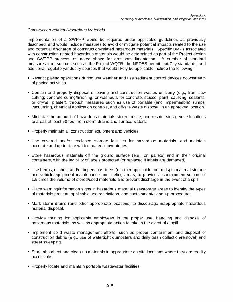
Construction-related Hazardous Materials
Implementation of a SWPPP would be required under applicable guidelines as previously described, and would include measures to avoid or mitigate potential impacts related to the use and potential discharge of construction-related hazardous materials. Specific BMPs associated with construction-related hazardous materials would be determined as part of the Project design and SWPPP process, as noted above for erosion/sedimentation. A number of standard measures from sources such as the Project WQTR, the NPDES permit text/City standards, and additional regulatory/industry sources that would likely be applicable include the following:
� Restrict paving operations during wet weather and use sediment control devices downstream of paving activities.
� Contain and properly disposal of paving and construction wastes or slurry (e.g., from saw cutting; concrete curing/finishing; or washouts for concrete, stucco, paint, caulking, sealants, or drywall plaster), through measures such as use of portable (and impermeable) sumps, vacuuming, chemical application controls, and off-site waste disposal in an approved location.
� Minimize the amount of hazardous materials stored onsite, and restrict storage/use locations to areas at least 50 feet from storm drains and surface waters.
� Properly maintain all construction equipment and vehicles.
� Use covered and/or enclosed storage facilities for hazardous materials, and maintain accurate and up-to-date written material inventories.
� Store hazardous materials off the ground surface (e.g., on pallets) and in their original containers, with the legibility of labels protected (or replaced if labels are damaged).
� Use berms, ditches, and/or impervious liners (or other applicable methods) in material storage and vehicle/equipment maintenance and fueling areas, to provide a containment volume of 1.5 times the volume of stored/used materials and prevent discharge in the event of a spill.
� Place warning/information signs in hazardous material use/storage areas to identify the types of materials present, applicable use restrictions, and containment/clean-up procedures.
� Mark storm drains (and other appropriate locations) to discourage inappropriate hazardous material disposal.
� Provide training for applicable employees in the proper use, handling and disposal of hazardous materials, as well as appropriate action to take in the event of a spill.
� Implement solid waste management efforts, such as proper containment and disposal of construction debris (e.g., use of watertight dumpsters and daily trash collection/removal) and street sweeping.
� Store absorbent and clean-up materials in appropriate on-site locations where they are readily accessible.
� Properly locate and maintain portable wastewater facilities.
A-6

Appendix A Summary of Avoidance, Minimization, and Mitigation Measures
� Use recycled or less hazardous materials wherever feasible.
� Post regulatory agency telephone numbers and a summary guide of clean-up procedures in a conspicuous location at or near the job site trailer.
� Monitor and maintain hazardous material use/storage facilities and operations regularly (at least weekly) to ensure proper working order.
� Implement a Storm SWSAS program pursuant to regulatory guidelines.
Demolition-related Debris Generation
Preliminary demolition-related BMPs from NPDES and City standards that are likely applicable include the following:
� Recycle appropriate (i.e., non-hazardous) construction debris for on- or off-site use whenever feasible.
� Use dust-control measures such as watering to reduce particulate generation for pertinent locations/activities (e.g., concrete removal).
� Use appropriate erosion prevention and sediment control measures downstream of all demolition activities.
� Conform with applicable requirements related to the removal, handling, transport, and disposal of hazardous materials generated during demolition, including efforts such as implementing appropriate sampling and monitoring procedures; proper containment of contaminated materials during construction; providing protective gear for workers handling contaminated materials; ensuring acceptable exposure levels; and ensuring safe and appropriate handling, transport, and disposal of hazardous materials.
Disposal of Extracted Groundwater
While individual BMPs to address potential water quality concerns from disposal of extracted groundwater would be determined based on site-specific parameters, they may include the following types of standard measures derived from the NPDES Permit text and the previously referenced regulatory/industry sources:
� Use erosion prevention and sediment catchment devices (similar to those described above for erosion and sedimentation).
� Test extracted groundwater for appropriate contaminants prior to discharge.
� Treat extracted groundwater prior to discharge if required to provide conformance with applicable discharge criteria (e.g., through methods such as filtration, aeration, adsorption, disinfection, and/or conveyance to a municipal wastewater treatment plant).
� Remove contaminated groundwater for off-site treatment and disposal by a licensed operator in conformance with applicable legal requirements.
A-7

Appendix A Summary of Avoidance, Minimization, and Mitigation Measures
Long-term Operation and Maintenance
Site Design/Low Impact Development BMPs
� The use of site design/LID measures is intended to mimic predevelopment hydrologic conditions by effectively capturing, filtering, storing, evaporating, detaining, and/or infiltrating runoff close to its source. Potential site design/LID BMPs identified in the Project WQTR and/or the noted regulatory/industry sources that may be applicable to the Preferred Alternative include the following:
� Implement runoff control through the use of on-site infiltration basins designed to accommodate a 2-year, 24-hour storm event (refer to Subchapter 3.7, Hydrology and Floodplain, for additional discussion of proposed infiltration basins).
� Minimize impervious areas through efforts such as: (1) using an underground parking structure to reduce surface parking requirements; (2) constructing streets, sidewalks, and parking lot aisles to the minimum widths necessary to meet design and safety standards; (3) incorporating additional landscaping where feasible; (4) restricting the use of impervious surfaces within landscaped areas; and (5) using pervious paving materials in applicable locations wherever feasible (e.g., pedestrian walkways and low-vehicle traffic areas).
� Preserve existing landscaped areas and direct runoff from impervious areas into landscaping wherever feasible; and incorporate appropriate vegetation varieties into landscape designs to maximize the potential to receive, infiltrate, and/or treat runoff from impervious areas (e.g., use of applicable tree species to increase rainfall interception and evapotranspiration).
� Minimize soil compaction in landscaped areas by techniques such as scarification, and incorporate appropriate amendments to improve soil quality/water holding capacity and foster healthy vegetation.
� Use “green” (vegetated) rooftops for applicable structures to reduce runoff volumes (e.g., through capture and evapotranspiration of storm flows), sediment loads, and temperatures (refer to the discussion of Treatment Control BMPs below for additional description of green rooftops).
Source Control BMPs
Specific source control BMPs identified in the Project WQTR and/or the noted regulatory/industry sources that may be applicable to the Project include the following:
� Install “no dumping” stencils, tiles, and/or signs (per current City standards) at all proposed onsite storm drain inlets and other applicable locations (e.g., drainages and building entrances) to discourage illegal contaminant disposal.
� Provide paved, enclosed, and covered areas for trash storage, with regular maintenance (e.g., cleaning up spills) and weekly trash pick-up by a licensed waste management company.
� Conduct weekly mechanical sweeping of applicable onsite streets and parking areas to remove accumulated particulates and associated contaminants before they are picked up by site runoff.
A-8

Appendix A Summary of Avoidance, Minimization, and Mitigation Measures
� Use integrated pest management (IPM) weed/pest control measures wherever feasible, including efforts such as: (1) removing weeds by hand and avoiding the use of chemical pesticides, herbicides, and fertilizers in landscaped areas; (2) using pest-resistant or well-adapted native plant varieties; and (3) providing informational materials to site maintenance personnel and occupants to increase awareness and implementation of IPM measures.
� Manage irrigation to minimize runoff through measures such as the use of automated and tailored watering schedules (i.e., to avoid over-watering), and installing moisture/pressure sensors to shut off irrigation under appropriate conditions (e.g., during/after precipitation events or in the event of broken pipes or sprinkler heads).
� Provide an underground parking structure to reduce the exposure of onsite parking areas to run-on, direct precipitation contact, and associated pollutant transport.
� Direct flows from fire sprinkler system use, maintenance, and/or testing into the sanitary sewer system.
Treatment Control BMPs
Potential treatment control options identified in the Project WQTR include:
� The use of proprietary inlet/outlet and rooftop-downspout filters. Specific proprietary filters identified in the Project WQTR include FloGard® LoPro™ Series Filters, which typically encompass a modular filter designed to remove particulates, debris, metals, and petroleum hydrocarbons.
� The use of vegetated swales which typically consist of shallow, trapezoidal or parabolic channels lined with appropriate vegetation types (e.g., turf) that provide filtration and (to a lesser extent) infiltration as storm flows move slowly along the channel length.
� The use of green rooftops typically consist of a thin layer of living vegetation on flat or sloped rooftops that help to reduce runoff (through capture and evapotranspiration) and provide some water quality treatment through removal of contaminants (e.g., sediment) and reduction of water temperatures. One or more of the described treatment control BMP options (or potentially other measures if deemed appropriate during the ongoing Project design process) would be implemented as part of the Preferred Alternative to ensure Project conformance with all applicable regulatory requirements related to long-term water quality.
Post-construction BMP Monitoring/Maintenance Schedules and Responsibilities
Identified long-term BMPs include physical facilities such as “no dumping” stencils/tiles and signs, control features for drainage (e.g., infiltration basins) and trash (e.g., enclosures), and proprietary filters; as well as programs/activities including street sweeping, landscape/irrigation management, and IPM. All Project-related BMP facilities would be located on site, with associated monitoring and maintenance efforts (including funding) to be the responsibility of the property owner. A Storm Water Management and Discharge Control Maintenance Agreement would be prepared by the Project applicant and submitted to the City of San Diego for all pertinent BMP facilities and programs. Specifically, this agreement would: (1) identify responsible parties for BMP funding and monitoring/maintenance efforts; and (2) describe all associated training programs, operating schedules, maintenance duties and frequencies, and other pertinent information.
A-9

Appendix A Summary of Avoidance, Minimization, and Mitigation Measures
Geology/Soils/Seismicity/Topography
Preferred Alternative and Pedestrian Crossing Alternative
A comprehensive geotechnical evaluation would be conducted prior to final design and during Project construction. This evaluation would include subsurface exploration, laboratory testing, and field inspection/verification by the Project geotechnical engineer, and would be intended to further evaluate surface and subsurface geotechnical conditions and provide detailed information regarding the engineering characteristics of earth materials present within the study area. From these data, specific recommendations would be generated for applicable geotechnical issues to ensure conformance with associated regulatory and design requirements. The following types of standard design and construction measures may be considered in the noted geotechnical evaluation, along with additional or revised recommendations identified during detailed investigations. Implementation of these or other appropriate measures, in conformance with applicable regulatory requirements, would avoid, minimize or mitigate any potential impacts related to geologic, soil, seismic, or topographic conditions.
� Potential impacts related to seismically-induced ground rupture or related effects (if applicable) may be addressed through measures such as:
� Conformance with applicable seismic design criteria from sources including the IBC;
� Implementation of design efforts for ground rupture hazards (e.g., inclusion of buffer zones or set-backs from on-site faults) if determined appropriate during detailed geotechnical investigation; and
� Use of properly engineered fill and reinforced concrete and masonry.
Potential impacts related to seismic ground acceleration may be addressed through measures such as the use of:
� Applicable seismic design criteria from sources including the IBC;
� Proper fill composition, moisture content, placement, and compaction parameters;
� Appropriate foundation and pavement design;
� Reinforced concrete and masonry; and
� Appropriate structure and utility design.
Potential liquefaction and seismically-induced settlement effects may be addressed through efforts such as:
� Conformance with applicable seismic design criteria from sources including the IBC;
� Removal and recompaction or replacement of materials susceptible to liquefaction and/or seismic settlement with properly engineered fill;
A-10
Appendix A Summary of Avoidance, Minimization, and Mitigation Measures
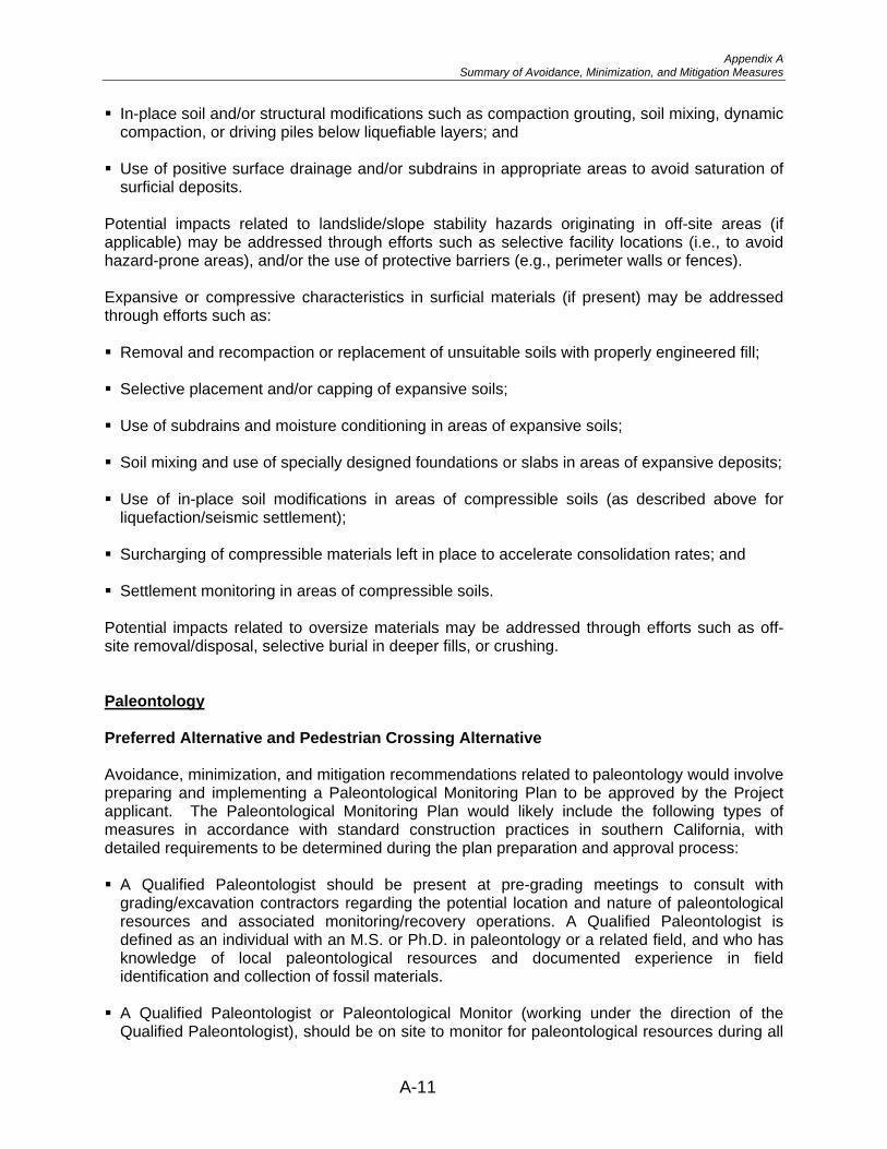
� In-place soil and/or structural modifications such as compaction grouting, soil mixing, dynamic compaction, or driving piles below liquefiable layers; and
� Use of positive surface drainage and/or subdrains in appropriate areas to avoid saturation of surficial deposits.
Potential impacts related to landslide/slope stability hazards originating in off-site areas (if applicable) may be addressed through efforts such as selective facility locations (i.e., to avoid hazard-prone areas), and/or the use of protective barriers (e.g., perimeter walls or fences).
Expansive or compressive characteristics in surficial materials (if present) may be addressed through efforts such as:
� Removal and recompaction or replacement of unsuitable soils with properly engineered fill;
� Selective placement and/or capping of expansive soils;
� Use of subdrains and moisture conditioning in areas of expansive soils;
� Soil mixing and use of specially designed foundations or slabs in areas of expansive deposits;
� Use of in-place soil modifications in areas of compressible soils (as described above for liquefaction/seismic settlement);
� Surcharging of compressible materials left in place to accelerate consolidation rates; and
� Settlement monitoring in areas of compressible soils.
Potential impacts related to oversize materials may be addressed through efforts such as off-site removal/disposal, selective burial in deeper fills, or crushing.
Paleontology
Preferred Alternative and Pedestrian Crossing Alternative
Avoidance, minimization, and mitigation recommendations related to paleontology would involve preparing and implementing a Paleontological Monitoring Plan to be approved by the Project applicant. The Paleontological Monitoring Plan would likely include the following types of measures in accordance with standard construction practices in southern California, with detailed requirements to be determined during the plan preparation and approval process:
� A Qualified Paleontologist should be present at pre-grading meetings to consult with grading/excavation contractors regarding the potential location and nature of paleontological resources and associated monitoring/recovery operations. A Qualified Paleontologist is defined as an individual with an M.S. or Ph.D. in paleontology or a related field, and who has knowledge of local paleontological resources and documented experience in field identification and collection of fossil materials.
� A Qualified Paleontologist or Paleontological Monitor (working under the direction of the Qualified Paleontologist), should be on site to monitor for paleontological resources during all
A-11

Appendix A Summary of Avoidance, Minimization, and Mitigation Measures
original grading/excavation activities involving previously undisturbed areas of the Otay Formation and/or Old Paralic Deposits. A Paleontological Monitor is defined as an individual with at least one year of experience in field identification and collection of fossil materials.
� If paleontological resources are discovered, the Qualified Paleontologist (or Paleontological Monitor) should implement appropriate salvage operations, potentially including simple excavation, plaster-jacketing of large and/or fragile specimens, or quarry excavations for richly fossiliferous deposits. The Qualified Paleontologist and Paleontological Resources Monitor should be authorized to halt or divert construction work in salvage areas to allow for the timely recovery of fossil remains.
� Paleontological resources collected during the monitoring and salvage portion of the mitigation program should be cleaned, repaired, sorted, and cataloged pursuant to accepted industry methods.
� Prepared fossils, along with copies of all pertinent field notes, photos and maps, should be deposited in an approved scientific institution with paleontological collections.
� A final report should be prepared by the Qualified Paleontologist to describe the results of the mitigation program, including field and laboratory methods, stratigraphic units encountered, and the nature and significance of recovered paleontological resources.
Hazardous Waste/Materials
Preferred Alternative and Pedestrian Crossing Alternative
The following avoidance, minimization, and mitigation measures would effectively avoid or address potential impacts related to hazardous waste/materials:
� Soil sampling should be conducted in areas within the Project Study Area proposed to be disturbed and/or excavated prior to soil export, reuse, or disposal to characterize the soil for the presence of hazardous materials (e.g., metals, petroleum hydrocarbons, volatile organic compounds, pesticides, etc.). If contaminated soil is present, appropriate abatement actions should be implemented in accordance with applicable regulatory requirements.
� Health risk assessments should be conducted for facilities within the LPOE in which contamination has been documented (e.g., former Red Cab facility) to evaluate whether the levels of contaminants would pose a risk to human health.
� Prior to commencement of excavation activities, a Site and Community Health and Safety Plan should be prepared to manage potential health and safety hazards to workers and the public.
� Prior to commencement of excavation activities, a Soil Management Plan should be prepared to address the notification, monitoring, sampling, testing, handling, storage, and disposal of contaminated media or substances that may be encountered during construction activities.
� Prior to commencement of excavation activities, a Groundwater Management Plan should be prepared to address the notification, monitoring, sampling, testing, handling, storage, and disposal of potentially contaminated groundwater.
A-12

Appendix A Summary of Avoidance, Minimization, and Mitigation Measures
� Existing transformers and elevator equipment within the Project Study Area should be sampled for PCB content if proposed to be disturbed and/or moved during construction activities. If PCBs are present, appropriate abatement actions for their disposal should be implemented in accordance with regulatory requirements, and soil beneath transformers and/or elevators should be evaluated for evidence of releases. If present in underlying soils, appropriate abatement actions for removal and disposal should be implemented in accordance with applicable regulatory requirements.
� Wastes and potentially hazardous waste on the Project site, including trash, debris piles, and equipment should be removed and disposed of off site in accordance with applicable regulatory requirements.
� Prior to renovation or demolition of existing structures, surveys should be conducted to evaluate the presence, locations, and quantities of hazardous building materials (ACMs and LCSs). Suspect materials should be sampled and analyzed, and if present, appropriate abatement actions should be implemented in accordance with applicable regulatory requirements.
� Contract specifications should include references to the potential to encounter contaminated soil, groundwater, or other regulated wastes during construction activities.
Air Quality
Preferred Alternative and Pedestrian Crossing Alternative
Construction
Implementation of the following avoidance, minimization, and mitigation measures would reduce air quality impacts resulting from construction activities:
� Water or dust palliative should be applied to exposed soil surfaces at the construction site(s) and equipment as frequently as necessary to control fugitive dust emissions.
� Soil binder should be spread on any unpaved roads used for construction purposes, and all construction parking areas.
� Trucks should be washed off as they leave the construction site(s), as necessary, to control fugitive dust emissions.
� Construction equipment and vehicles should be properly tuned and maintained. Low sulfur fuel should be used in all construction equipment.
� Track-out reduction measures such as gravel pads should be used at access points to minimize dust and mud deposits on roads affected by construction traffic.
� Transported loads of soils and wet materials should be covered prior to transport, or adequate freeboard (space from the top of the material to the top of the truck) should be provided to reduce PM10 and deposition of particulate during transportation.
A-13

Appendix A Summary of Avoidance, Minimization, and Mitigation Measures
� Dust and mud that are deposited on paved, public roads due to construction activity and traffic should be removed to decrease particulate matter.
� To the extent feasible, construction traffic should be routed and scheduled to reduce congestion and related air quality impacts caused by idling vehicles along local roads during peak travel times.
� Grading and earth moving should be suspended when wind gusts exceed 25 mph unless the soil is wet enough to prevent dust plumes.
Global Climate Change
To the extent that it is applicable or feasible, the following measures can help to reduce GHG emissions and potential climate change impacts resulting from the Preferred Alternative:
� Provide landscaping where possible, which reduces surface warming and decreases CO2 through photosynthesis
� Use lighter color surfaces, such as Portland cement, which helps to reduce the albedo effect (i.e., surface reflectivity of the sun’s radiation) and cool the surface
� Use of energy efficient lighting
� Limit idling times on trucks and equipment used during construction
Energy
Preferred Alternative and Pedestrian Crossing Alternative
The following avoidance and minimization measures would be implemented during construction activities:
� Construction equipment and vehicles should be properly tuned and maintained.
� Idling times of construction equipment should be minimized, to the extent practical.
� To the extent feasible, construction traffic should be routed and scheduled to reduce congestion and related air quality impacts caused by idling vehicles along local roads during peak travel times.
Biological Resources
Preferred Alternative
Implementation of the following avoidance, minimization, and mitigation measure would avoid or reduce impacts to biological resources:
� During construction, jurisdictional areas and sensitive vegetation within the BSA should be fenced with orange plastic exclusionary fencing, and no personnel, debris, or equipment would be allowed within the jurisdictional areas.
A-14

Appendix A Summary of Avoidance, Minimization, and Mitigation Measures
� Impacts to 0.07 acre of non-wetland WUS should be mitigated at a 1:1 ratio through purchase of mitigation credits equal to 0.07 acre of ephemeral drainage at an approved mitigation bank.
� If removal of habitat and/or construction activities is necessary adjacent to nesting habitat during the bird breeding season (January 15 to September 15), the GSA shall retain an approved biologist to conduct a pre-construction survey to determine the presence or absence of: (1) non-listed nesting migratory birds on, or within, 100 feet of the construction area; (2) Federally- or State-listed birds on, or within, 300 feet of the construction area; and (3) nesting raptors within 500 feet of the construction area. The pre-construction survey will be conducted within 10 calendar days prior to the start of construction. The results of the survey will be submitted to the GSA for review and approval prior to initiating any construction activities.
� If nesting birds are detected by the approved biologist, the following buffers will be established: 1) no work will occur within 100 feet of a non-listed nesting migratory bird nest; 2) no work will occur within 300 feet of a listed bird nest; and 3) no work will occur within 500 feet of a raptor nest. If construction within these buffers cannot be avoided, GSA, in consultation with the resource agencies, will determine the appropriate buffer.
Pedestrian Crossing Alternative
Implementation of the following avoidance, minimization, and mitigation measure would avoid or reduce impacts to biological resources:
� During construction, jurisdictional areas and sensitive vegetation within the BSA should be fenced with orange plastic exclusionary fencing, and no personnel, debris, or equipment would be allowed within the jurisdictional areas.
� Impacts to 0.05 acre of non-wetland WUS should be mitigated at a 1:1 ratio through purchase of mitigation credits equal to 0.05 acre of ephemeral drainage at an approved mitigation bank.
� If removal of habitat and/or construction activities is necessary adjacent to nesting habitat during the bird breeding season (January 15 to September 15), the GSA shall retain an approved biologist to conduct a pre-construction survey to determine the presence or absence of: (1) non-listed nesting migratory birds on, or within, 100 feet of the construction area; (2) Federally- or State-listed birds on, or within, 300 feet of the construction area; and (3) nesting raptors within 500 feet of the construction area. The pre-construction survey will be conducted within 10 calendar days prior to the start of construction. The results of the survey will be submitted to the GSA for review and approval prior to initiating any construction activities.
� If nesting birds are detected by the approved biologist, the following buffers will be established: 1) no work will occur within 100 feet of a non-listed nesting migratory bird nest; 2) no work will occur within 300 feet of a listed bird nest; and 3) no work will occur within 500 feet of a raptor nest. If construction within these buffers cannot be avoided, GSA, in consultation with the resource agencies, will determine the appropriate buffer.
A-15

Appendix A Summary of Avoidance, Minimization, and Mitigation Measures
CUMULATIVE IMPACTS
Traffic and Transportation/Pedestrian and Bicycle Facilities
Preferred Alternative and Pedestrian Crossing Alternative
Implementation (by others) of the avoidance, minimization, and mitigation measures previously identified above for Traffic and Transportation/Pedestrian and Bicycle Facilities would avoid or reduce cumulative traffic impacts to roadway segments and intersections. No avoidance, minimization, or mitigation measures are identified to lessen impacts to freeway segments, but the large reduction in congestion for northbound traffic crossing through the LPOE would offset these freeway impacts.
Air Quality
Preferred Alternative and Pedestrian Crossing Alternative
Implementation of the avoidance, minimization, and mitigation measures identified previously above for Air Quality would avoid or reduce cumulative air quality impacts.
A-16

APPENDIX B
LIST OF ACRONYMS AND ABBREVIATIONS

LIST OF ACRONYMS AND ABBREVIATIONS
AASHTO American Association of State Highway and Transportation Officials
AB Assembly Bill ABA Architectural Barriers Act ABAAS Architectural Barriers Act Accessibility Standards ACMs asbestos-containing materials ACSE American Society of Civil Engineers ADA Americans with Disabilities Act ADL aerially-deposited lead ADT average daily traffic AEP Association of Environmental Professionals APCD Air Pollution Control District APE Area of Potential Effect ARB Air Resources Board AST Aboveground Storage Tank ASTM ASTM International (formerly the American Society for Testing
and Materials)
B Boron Basin Plan San Diego Basin Plan BAT Best Available Technology BCT Best Conventional Pollutant Control Technology BLM Bureau of Land Management BMI Benthic Macroinvertebrate BMPs Best Management Practices B.P. Before Present BSA Biological Study Area
CA-EO California Executive Order CAA Clean Air Act, as amended in 1990 CAAQS California Ambient Air Quality Standards CAFE Corporate Average Fuel Economy Caltrans California Department of Transportation CBP Customs and Border Protection CDFG California Department of Fish and Game CDMG California Division of Mines and Geology CEQ Council on Environmental Quality CERCLA Comprehensive Environmental Response, Compensation and
Liability Act of 1980 CERFA Community Environmental Response Facilitation Act of 1992 cf cubic feet cfs cubic feet per second CGS California Geological Survey CFR Code of Federal Regulations CHP California Highway Patrol CIA Community Impact Assessment City City of San Diego City Register City of San Diego Historical Resources Register
B-1

CIWMB Cl CO CO2 COCsCorps County CRC CRHR CWA
DEH DHS DOD DOS DOTDWR
EIS EO EPCA ESA
F Fe FEMA FHWA FIFRA FPS FY
g General Plan GHG GMP Greenbook Greenbook Committee GRP GSA gsf
H2S HA HABS HOV HPSR HRB HSA HU
I-IBC IBWC
California Integrated Waste Management Board Chlorides
Carbon monoxide Carbon dioxide
Constituents of Concern U.S. Army Corps of Engineers
County of San Diego Community Representative Committee
California Register of Historical Resources Clean Water Act
County of San Diego Department of Environmental Health U.S. Department of Homeland Security
Department of Defense Department of State
U.S. Department of Transportation California Department of Water Resources
Environmental Impact Statement Executive Order
Energy Policy and Conservation Act Endangered Species Act
Fluoride Iron
Federal Emergency Management Agency Federal Highway Administration
Federal Insecticide, Fungicide and Rodenticide Act Federal Protective Service Fiscal Year
Acceleration due to gravity City of San Diego General Plan
greenhouse gas Gross Metropolitan Product
Greenbook Standard Specifications for Public Works Construction Greenbook Committee of Public Works Standards, Inc.
Gross Regional Product General Services Administration gross square feet
Hydrogen sulfide Hydrologic Area Historic American Buildings Survey High occupancy vehicle Historic Properties Survey Report Historic Resources Board Hydrologic Subarea Hydrologic Unit
Interstate - International Building Code
International Boundary and Water Commission
B-2

ICC International Code Council ICE Immigration and Customs Enforcement IPM Integrated Pest Management IRIS Integrated Risk Information System ISA Initial Site Assessment
kWh kilowatt hour
LCFS Low Carbon Fuel Standard LCS lead-containing surface LEED Leadership in Energy and Environmental Design LID Low Impact Development LOS Level of Service LPOE Land Port of Entry LUST Leaking Underground Storage Tank
MBAS Methylene Blue Activated Substances MBTA Migratory Bird Treaty Act MEP Maximum Extent Practicable mg/l milligrams per liter mg/m3 milligrams per cubic meter MHPA Multiple Habitat Planning Area MLS Mass Loading Station Mn Manganese mph miles per hour MSATs Mobile Source Air Toxics MSCP Multiple Species Conservation Plan MSL Mean Sea Level MTDB Metropolitan Transit Development Board MTS Metropolitan Transit System MY model year
N&P Nitrogen and Phosporous Na Sodium NAAQS National Ambient Air Quality Standards NAFTA North American Free Trade Agreement NAHC Native American Heritage Commission NCCP Natural Communities Conservation Program NEPA National Environmental Policy Act NES-MI Minimal Impacts Natural Environment Study NHPA National Historic Preservation Act NHTSA National Highway Traffic Safety Administration NOx Nitrogen oxides NO2 Nitrogen dioxide NO3 Nitrate NOAA National Oceanic and Atmospheric Administration NOI Notice of Intent NPDES National Pollutant Discharge Elimination System NRHP National Register of Historic Places NTU Nephelometric Turbidity Units
O3 Ozone OSHA Occupational Safety and Health Act
B-3
Pb lead PCB Polychlorinated biphenyls PM particulate matter PM2.5 fine particulate matter with a diameter of 2.5 microns or less PM10 respirable particulate matter with a diameter of 10 microns or less ppm parts per million PRC California Public Resources Code Project San Ysidro Land Port of Entry Improvements Project Protocol Project-Level Carbon Monoxide Protocol Province Peninsular Ranges Geomorphic Province
RCP Regional Comprehensive Plan RCRA Resource Conservation and Recovery Act of 1976 ROD Record of Decision ROW right of way RTIP Regional Transportation Improvement Program RTP Regional Transportation Plan RWQCB San Diego Regional Water Quality Control Board
SAM site assessment and mitigation SANDAG San Diego Association of Governments SANTEC/ITE San Diego Traffic Engineers’ Council and Institute of
Transportation Engineers SBI Secure Border Initiative SCAQMD South Coast Air Quality Management District SD&AE San Diego and Arizona Eastern SDAB San Diego Air Basin SDCWA San Diego County Water Authority SDIV San Diego and Imperial Valley SENTRI Secure Electronic Network for Travelers Rapid Inspection program SHPO State Historic Preservation Officer SIP State Implementation Plan SO2 Sulfur dioxide SO4 Sulfate SR- State Route – SRA Subregional Area Subarea Plan MSCP Subarea Plan SWMP Storm Water Management Plan SWPPP Storm Water Pollution Prevention Plan SWRCB State Water Resources Control Board SWSAS Storm Water Sampling and Analysis Strategy SYCP San Ysidro Community Plan SYIO San Ysidro Implementing Ordinance SYRP San Ysidro Redevelopment Plan
TDS Total Dissolved Solids TIS Traffic Impact Study TMDL Total Maximum Daily Load TMP Traffic Management Plan TPH total petroleum hydrocarbons
B-4

TSCA Toxic Substances Control Act Turb Turbidity
UFAS Uniform Federal Accessibility Standards U.S. United States USBP U.S. Border Patrol U.S.C. U.S. Code USDA U.S. Department of Agriculture USEPA U.S. Environmental Protection Agency USFWS U.S. Fish and Wildlife Service USGBC U.S. Green Building Council UST Underground Storage Tank US-VISIT U.S. Visitor and Immigrant Status Indicator Technology program
V/C Volume to Capacity VMT Vehicle Miles Traveled VOCs Volatile Organic Compounds WHTI Western Hemisphere Travel Initiative\ WQTR Water Quality Technical Report WUS Waters of the U.S.
μg/m3 micrograms per cubic meter
B-5

THIS PAGE INTENTIONALLY LEFT BLANK
B-6

APPENDIX C
LIST OF TECHNICAL STUDIES

List of Technical Studies
The following technical studies were prepared to support this Draft EIS:
Focused Acoustical Analysis for the San Ysidro LPOE Improvements Project. July 2009 – HELIX Environmental Planning, Inc.
Air Quality Impact Assessment for the San Ysidro Land Port of Entry Border Station Expansion. July 2009 – Scientific Resources Associated.
Initial Site Assessment, San Ysidro Border Station Expansion/Reconfiguration, San Diego, California. September 2008 – Ninyo and Moore.
Preliminary Geotechnical Evaluation. September 2005 – Ninyo and Moore.
Drainage Study for the San Ysidro Land Port of Entry (LPOE) Border Station Expansion, in Design Narratives Report. 2008 – AECOM and RossDrullsCusenbery Architecture, Inc.
Storm Water Management Plan for the San Ysidro Land Port of Entry (LPOE) Border Station Expansion, in Design Narratives Report. 2008 – AECOM and RossDrullsCusenbery Architecture, Inc.
San Ysidro LPOE Improvements Community Impact Assessment. July 2009 – HELIX Environmental Planning, Inc. and CIC Research, Inc.
San Ysidro Land Port of Entry Improvements Project Natural Environment Study – Minimal Impacts, April 2009 – HELIX Environmental Planning, Inc.
San Ysidro Land Port of Entry Cultural and Historical Resource Inventory and Evaluation Report, April 2009 – ASM Affiliates, Inc.
Historic Properties Survey Report for the San Ysidro Border Station Expansion, San Diego County, California. October 2003 – Mooney and Associates.
Relocation Study, U.S. Customs House. July 2008 – Page and Turnball, Inc.
San Ysidro Land Port of Entry Border Station Expansion Traffic Impact Study, April 2009 – KOA Corporation.
San Ysidro Land Port of Entry Border Station Expansion Mobility Study, April 2009 – KOA Corporation.
C-1

THIS PAGE INTENTIONALLY LEFT BLANK
C-2