Embed Size (px)
Citation preview

Sub-Saharan Africa


Countries for Tuesday’s Political Map Quiz
Mali Somalia Niger Malawi Chad Botswana Cameroon Zimbabwe Senegal South Africa Liberia Lesotho Togo Madagascar Democratic Rep. of the Congo Mozambique Tanzania Uganda Ethiopia Nigeria Sierra Leone Kenya Angola Sudan Equatorial Guinea Rwanda

Facts
2nd largest continent
Known as the “Plateau Continent”
Most of Africa is covered by a huge plateau
Several basins (depressions) lie throughout the plateau


Important Physical Features
1. Nile River Flows through Egypt; over 4,100 miles
long– Numerous cataracts, rapids, & waterfalls
makes transportation via rivers difficult
2. Rift Valleys (East Africa)3. Mount Kilimanjaro4. Escarpments (Great Escarpment)

Features Continued
At the bottom of rift valleys are clusters of lakes
Examples: Lake Tanganyika
– World’s largest freshwater lake Lake Victoria
– Africa’s largest lake

Africa’s Resources
Mineral resources makes Africa one of the richest continents
Examples: gold, platinum, copper, cobalt, phosphates, diamonds

Oil & Coffee in Africa
Nigeria, Algeria, Angola, & Libya
– Leading petroleum producers
– Produce about 7% of world’s oil
Coffee: – 2nd most profitable
commodity– Africa grows 20% of
the world’s supply Lumber & chocolate are
also major commodities

Importance of Agriculture
Single most important economic activity in Africa
66% of Africans earn their living from farming– Accounts for 1/3 of Africa's exports


Climate & Vegetation
Majority of Africa is between the Tropic of Cancer and the Tropic of Capricorn
The equator runs through the middle of the continent
Africa = warm temperatures

8 climate regions are found in Africa
Which is found the most?– Desert
Exs: Sahara, Sahel, Kalahari, and Namib
Travel is risky due to EXTREME conditions

Rainfall?
Matter of EXTREMES– Some areas receive too much, while other
too little Closer to equator = longer rainy season Closer to desert = longer dry season MOST RAIN:
– Rainforest in Central Africa & Africa’s west coast
Serengeti Plain
Grassland area in northern Tanzania– Very dry with
few trees– Lots of animal
life

DesertificationWhen the land becomes so dry
That it turns into deserts

Desertification

Aswan High Dam
Built to control cycle of floods and droughts throughout Egypt
Gives farmers a regular supply of water

Problems with the Aswan High Dam
1. Relocation of people
2. Moving/destruction of ancient Egypt’s treasure (temples/pyramids)
3. Decreased fertility of soil
4. Increased rate of diseases, such as Malaria

Vocabulary Time!!!
Define the following words on the RIGHT side of your notebook; Draw pictures on the LEFT side
Rift Valley -Pandemic Basin -Stateless Society Escarpment -Aquifer Serengeti Plain -Bantu Migrations Sahel -Cash Crop Desertification -Commodity Aswan High Dam -Apartheid Silt -Canopy


4 Regions
1. East
2. Central
3. Western
4. South

East Africa’s Aksum
Aksum (important East African civilization)– Important trading
center; contributed to expansion and power (traded w/Egypt)
6th Century: Aksum lost many trade partners….empire soon began to weaken

European Colonization
The Slave Trade * Existed for centuries, however
Europeans dramatically heightened the traffic
* Middle Passage- slave trade from Africa to New World ( N. America)
* Many died during this trip across the Atlantic


Scramble for Africa
European powers divide Africa
All Countries were controlled by Europeans, except Liberia and Ethiopia (independent)– Most nations become
independent in the mid 1900’s
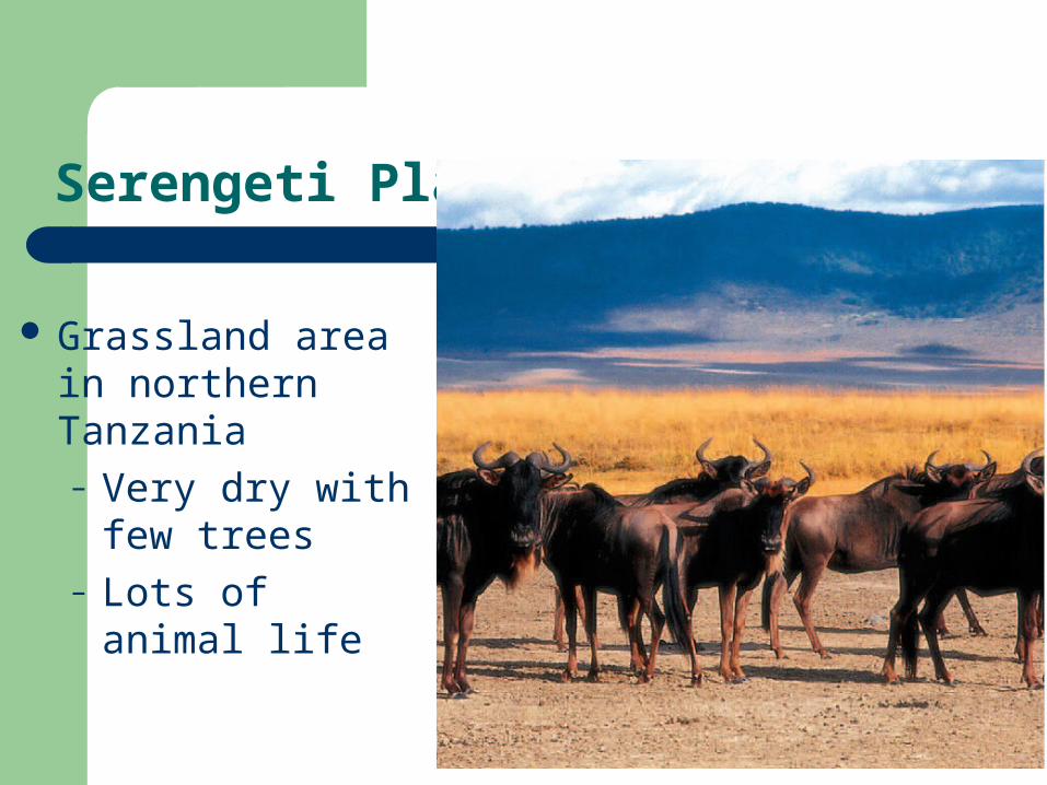
Ethiopia
Was not colonized by Europeans
Emperor Menelik II kept the country independent.

* Political boundaries made by Europeans was/is causing ethnic conflict (2 opposing groups occupying same land)
* Left many regions under developed
Colonial Legacy

The Masai of Kenya
An ethnic group
Lives on the grasslands of the rift valley and herd livestock.


West African Empires

Ethnic Groups
Ashanti– Kente cloth weaving

Bantu Migrations: Central Africa

South Africa
White dominated government enforced the policy of apartheid (strict separation of the races)
**Blacks lived in separate areas **No political rightsApartheid ended in 1991

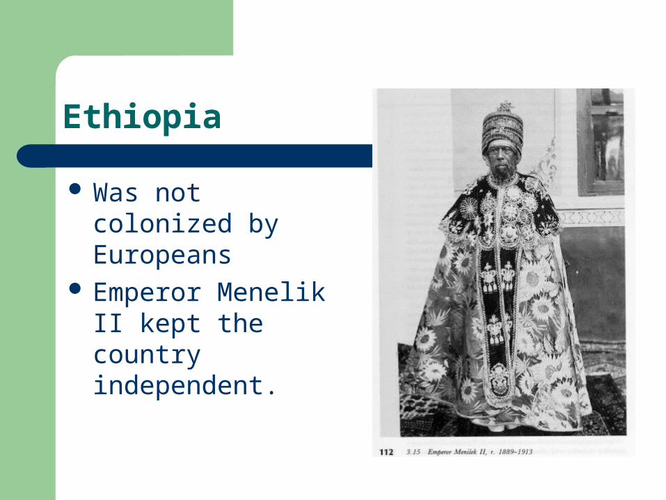
Mandela
In 1994, held first election following policy of universal suffrage
Nelson Mandela was elected 1st black president of South Africa


South African Flag
South African Flag Meaning:Although the colors have no official meaning attached to them the South African flag incorporates the colors black, green and yellow of Nelson Mandela's political party, the African National Congress and the former Boer republics flags (red, white, and blue).
– The Y shape represents the convergence of South Africa's diverse society and the desire for unity.
The South African flag is basically made up of former South African flags. The past meanings of the colors were:
– Red for bloodshed – Blue of open blue skies – Green for the land – Black for the black people – White for the European people – Yellow for the natural resources such as gold.