Embed Size (px)
Citation preview

Step By Step
Step 1Building Base Data
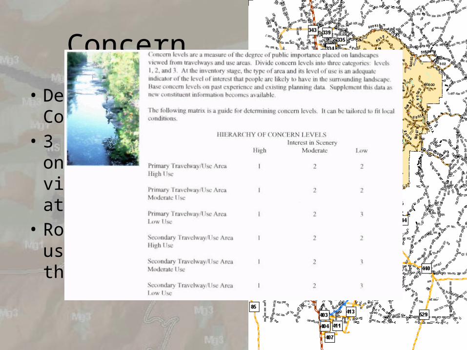
Concern
• Determine Concern
• 3 levels, based on number of viewers and area attributes.
• Route system usually provides the base.
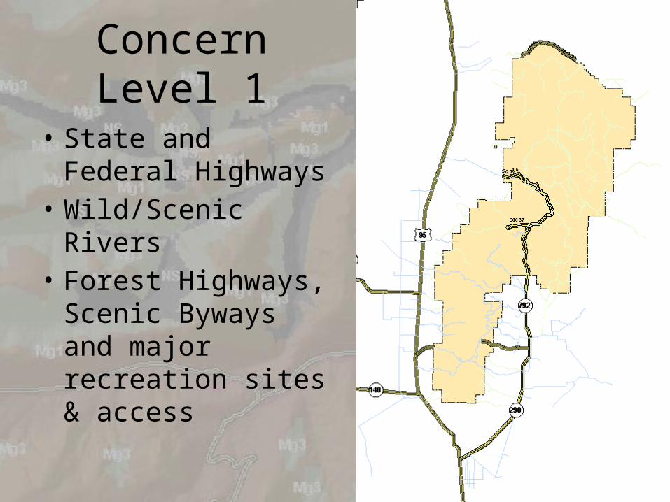
Concern Level 1
• State and Federal Highways
• Wild/Scenic Rivers• Forest Highways,
Scenic Byways and major recreation sites & access
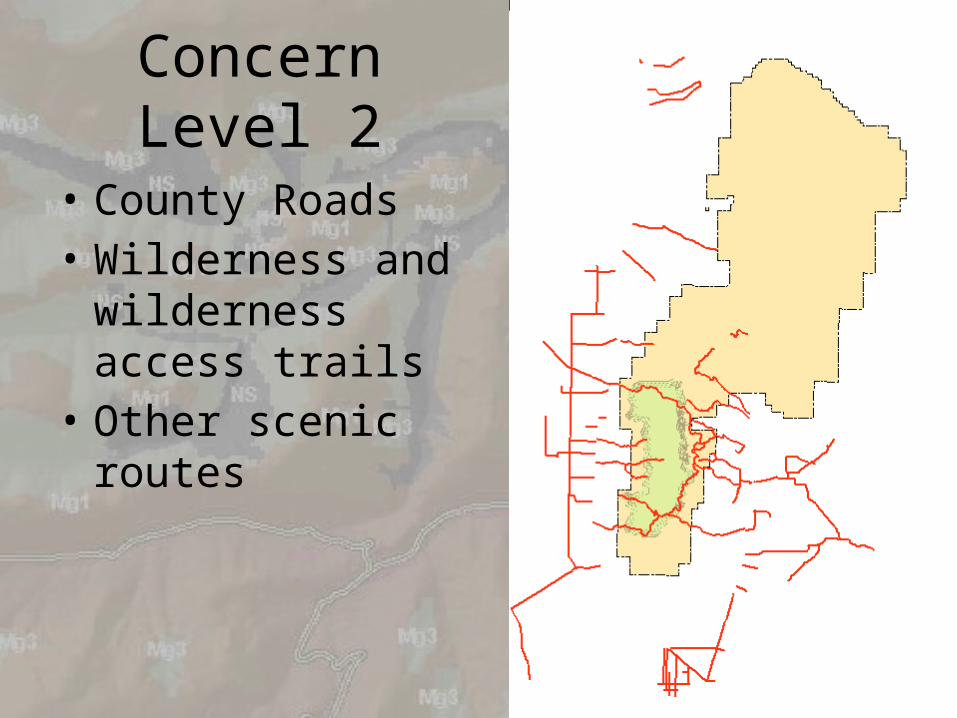
Concern Level 2
• County Roads• Wilderness and
wilderness access trails
• Other scenic routes

Concern Level 3
• Other Forest Roads
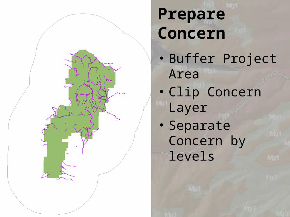
Prepare Concern
• Buffer Project Area
• Clip Concern Layer
• Separate Concern by levels
12 m
iles
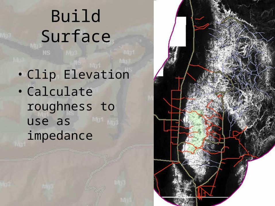
Build Surface
• Clip Elevation• Calculate
roughness to use as impedance
Step 2
Build View Zones

Distance Zones
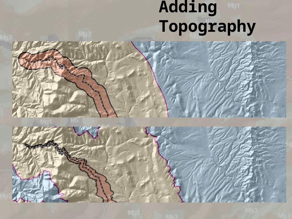
Adding Topography
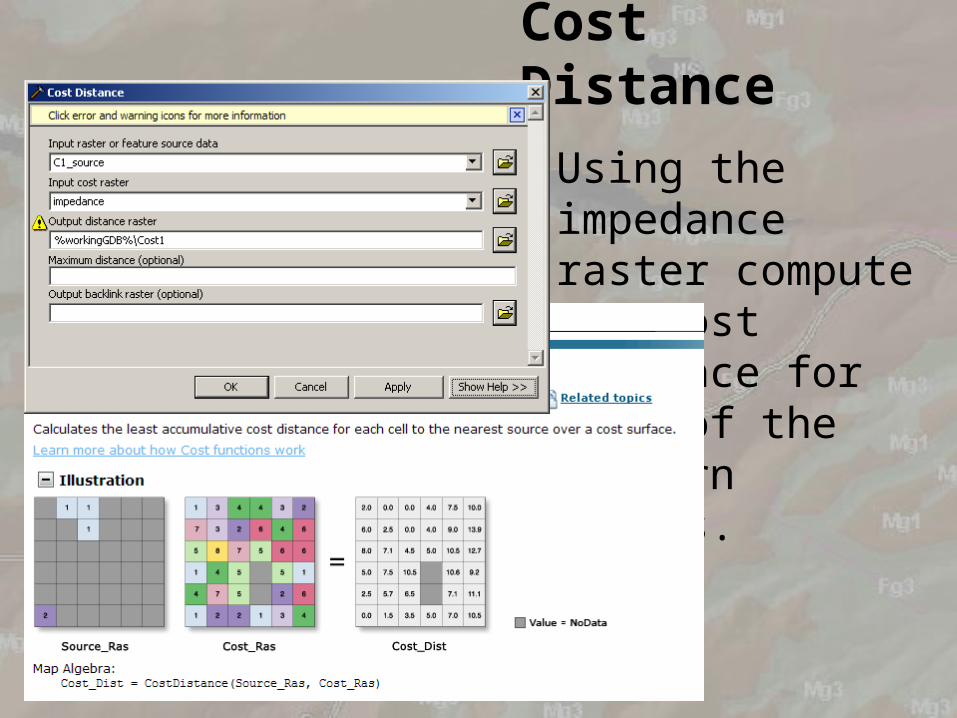
Cost Distance• Using the
impedance raster compute the cost distance for each of the concern layers.
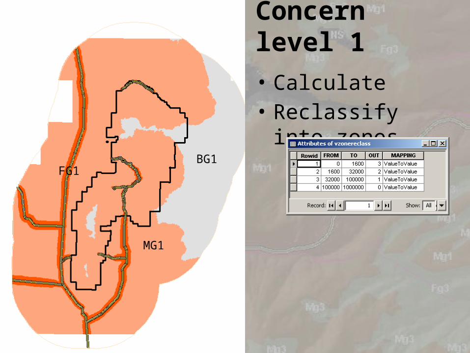
Concern level 1• Calculate• Reclassify into
zones
FG1
MG1
BG1
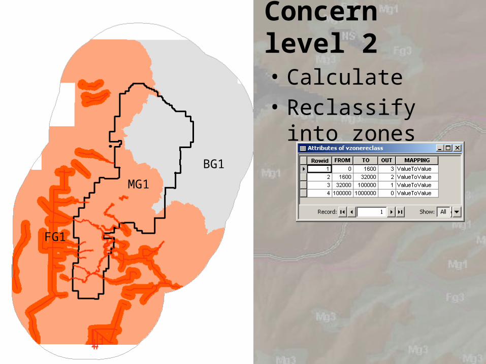
Concern level 2• Calculate• Reclassify into
zones
FG1
MG1
BG1
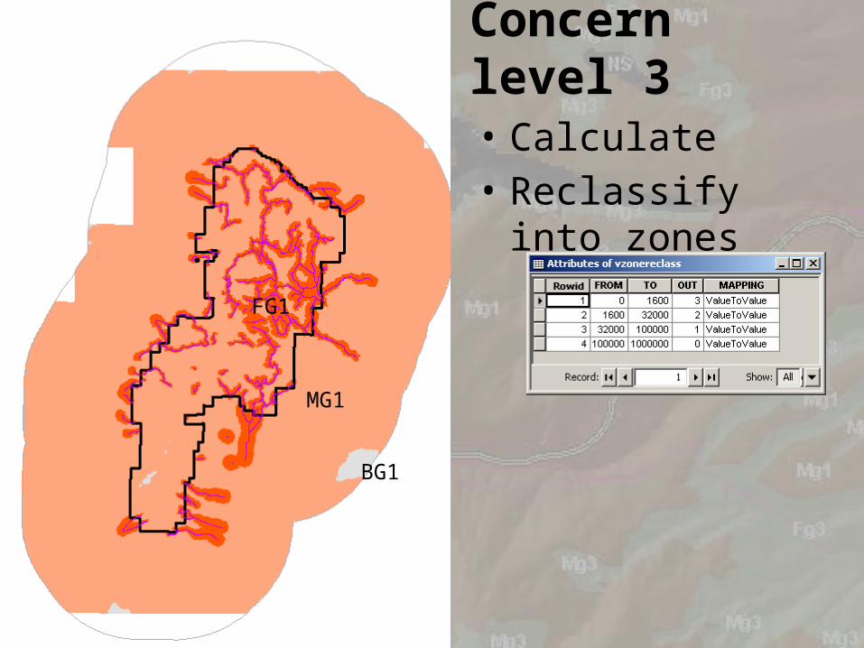
Concern level 3• Calculate• Reclassify into
zones
FG1
MG1
BG1

Step 3
Build View Points

Create Fishnet• Create 1 km
Fishnet using XTools
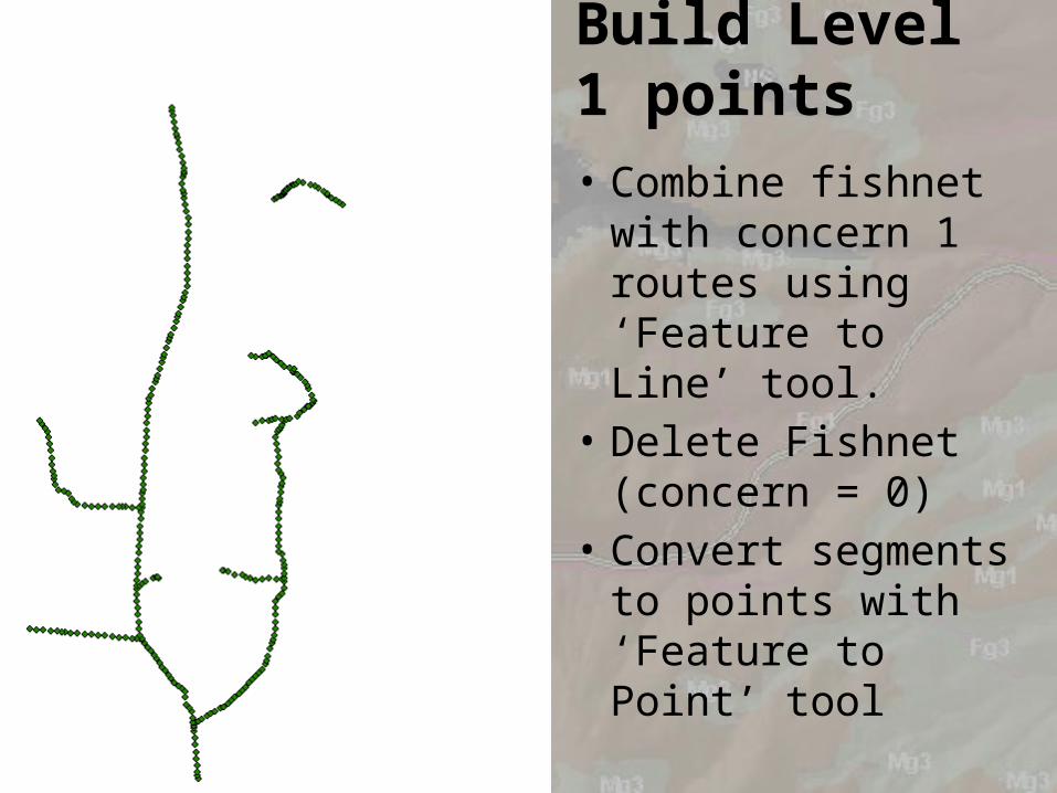
Build Level 1 points• Combine fishnet
with concern 1 routes using ‘Feature to Line’ tool.
• Delete Fishnet (concern = 0)
• Convert segments to points with ‘Feature to Point’ tool

Repeat for level 2• Combine fishnet
with concern 2 routes using ‘Feature to Line’ tool.
• Delete Fishnet (concern = 0)
• Convert segments to points with ‘Feature to Point’ tool

And again for level 3• Combine fishnet
with concern 2 routes using ‘Feature to Line’ tool.
• Delete Fishnet (concern = 0)
• Convert segments to points with ‘Feature to Point’ tool

Group for Processing• Subdivide
viewpoints into groups of 200-300 points.
• Use buffered clips of elevation, based on the zones.
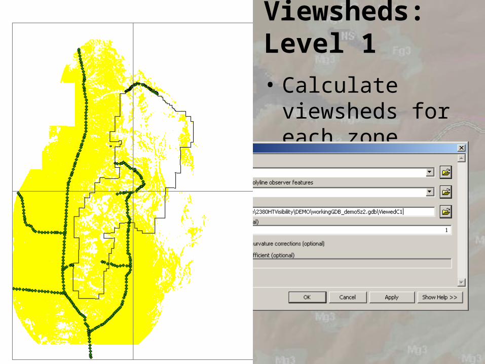
Viewsheds: Level 1• Calculate
viewsheds for each zone.
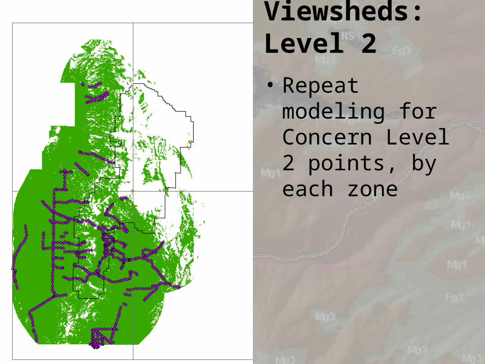
Viewsheds: Level 2• Repeat modeling
for Concern Level 2 points, by each zone
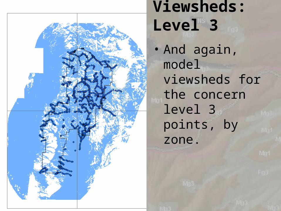
Viewsheds: Level 3• And again,
model viewsheds for the concern level 3 points, by zone.
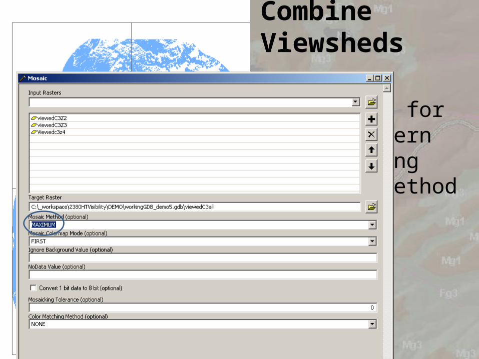
Combine Viewsheds• Combine
viewsheds for each concern level using MAXIMUM method
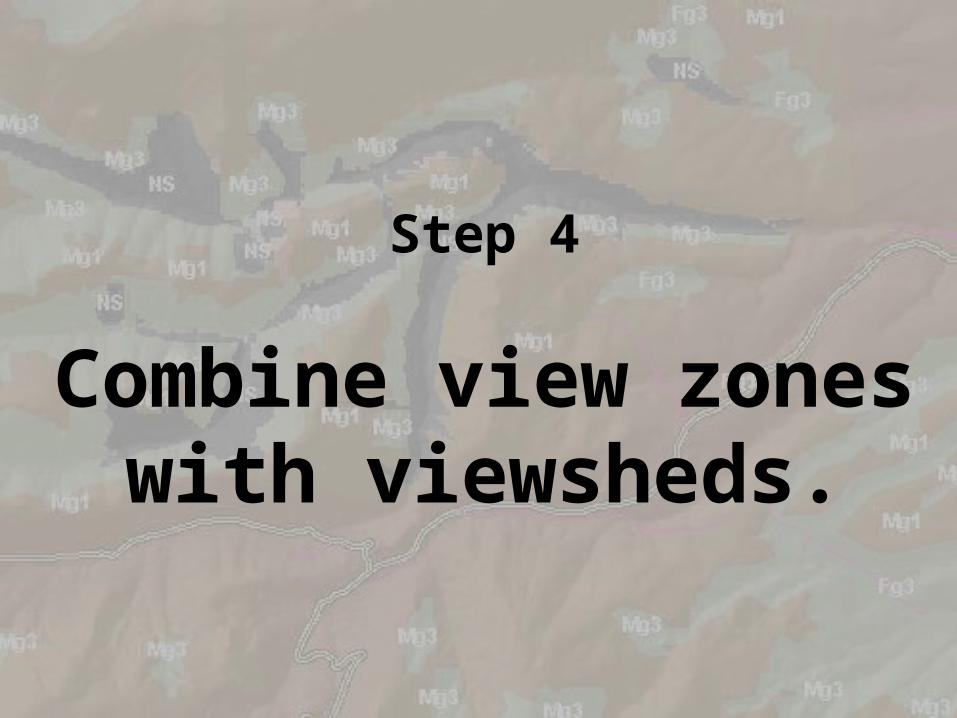
Step 4
Combine view zones with viewsheds.

• Use Viewshed to mask Zones
• Unmask Foreground
• Redraw Zones
Masking Viewsheds
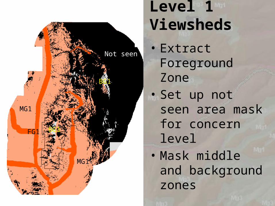
Level 1 Viewsheds• Extract
Foreground Zone• Set up not seen
area mask for concern level
• Mask middle and background zones
FG1
MG1
MG1
BG1
BG1
Not seen
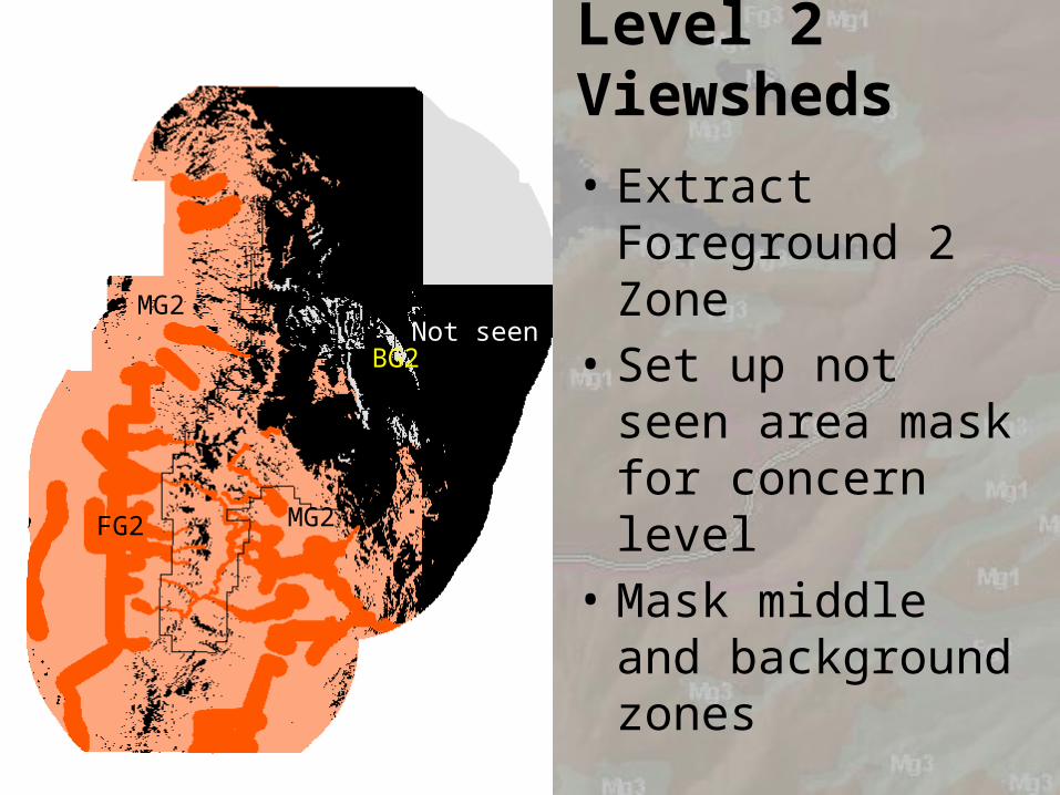
Level 2 Viewsheds• Extract
Foreground 2 Zone
• Set up not seen area mask for concern level
• Mask middle and background zones
FG2
MG2
MG2
BG2Not seen
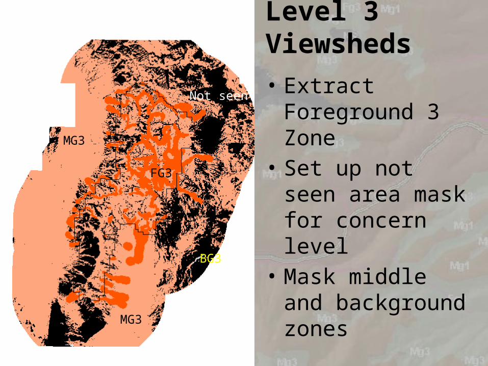
Level 3 Viewsheds• Extract
Foreground 3 Zone
• Set up not seen area mask for concern level
• Mask middle and background zones
FG3
MG3
MG3
BG3
Not seen
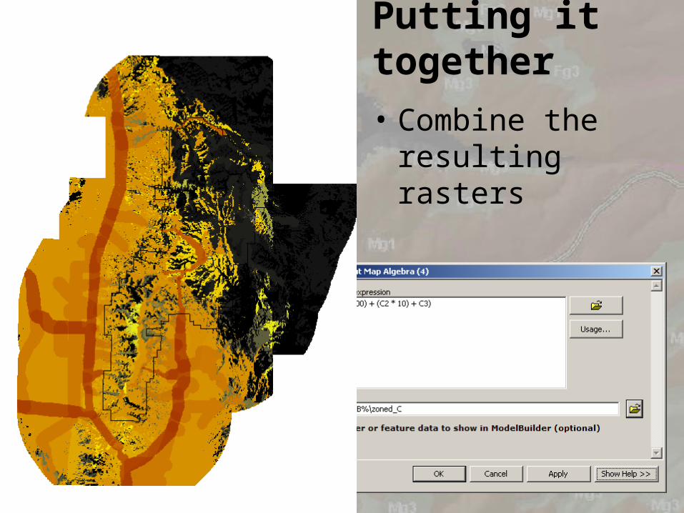
Putting it together• Combine the
resulting rasters

Final Processing• Convert to
polygons• Classify grid
values and dissolve
• Eliminate zones less than 100 acres
• Clip to boundary

A Closer Look
References• Landscape
Aesthetics- Agriculture Handbook 701
• ESRI Spatial Analyst Help Files
USFS-2010 David C. McMorran
•Step By Step