Embed Size (px)
Citation preview

Revised Planning Pack 2015 1
STANDARD PLANNING PACK
COMHAIRLE CHONTAE LAOISE
LAOIS COUNTY COUNCIL Planning Department, Aras an Chontae, JFL Avenue, Portlaoise, Co. Laois
Tel : 057 8664039 Fax: 057 8622491
Email: [email protected] Website: www.laois.ie
CONTENTS
1. PLANNING APPLICATION FORM SUPPLEMENTARY APPLICATION FORMS
- AGRICULTURE -COMMERCIAL/INDUSTRIAL
2. APPENDIX 1- DOCUMENTATION TO ACCOMPANY FORM 3. APPENDIX 2- DIRECTIONS FOR COMPLETING THIS FORM 4. APPENDIX 3
-GUIDANCE NOTES -SITE NOTICE (1) -DIRECTIONS FOR COMPLETING SITE NOTICE (1) -SITE NOTICE(2) OF FURTHER INFORMATION -DIRECTIONS FOR COMPLETING SITE NOTICE(2) -REQUIREMENTS FOR PLANS, DRAWINGS & MAPS 5. SITE SUITABILITY ASSESSMENT(SSA) - EXPLANATORY NOTES -APPLICATION FORM FOR SITE SUITABILITY ASSESSMENT
(TO BE COMPLETED IN THE EVENT OF LAOIS COUNTY COUNCIL CARRYING OUT THE SSA)
-NOTIFICATION FORM FOR SITE SUITABILITY ASSESSMENT (TO BE COMPLETED IN THE EVENT OF APPLICANT/AGENT CARRYING OUT THE SSA)

Revised Planning Pack 2015 2
- LANDOWNER CONSENT FORM - SITE NOTICE 7. SCALE OF PLANNING FEES 8. SECTION 97 APPLICATION FORM 9. STATUTORY DECLARATION

Revised Planning Pack 2015 3
BEFORE FILLING OUT THIS FORM PLEASE NOTE THE FOLLOWING:
ALL INFORMATION SUBMITTED WITH A PLANNING APLICATION WILL BE
AVAILABLE TO VIEW ON THE PUBLIC FILE AND ON THE COUNCIL’S
WEBSITE
APPLICATION FORM AND ACCOMPANYING DOCUMENTATION
Failure to complete this form or attach the necessary documentation, or the submission
of incorrect information or omission of required information will lead to the
invalidation of your application. Therefore, please ensure that that each section of this
application form is fully completed and signed, entering n/a (not applicable) where
appropriate, and that all necessary documentation is attached to your application form.
ADDITIONAL INFORMATION
It should be noted that each planning authority has its own development plan, which
sets out local development policies and objectives for its own area. The authority may
therefore need supplementary information (i.e. other than that required in this form) in
order to determine whether the application conforms with the development plan and
may request this on a supplementary application form.
Failure to supply the supplementary information will not invalidate your planning
application but may delay the decision making process or lead to a refusal of
permission. Therefore, applicants should contact the relevant planning authority to
determine what local policies and objectives would apply to the development proposed
and whether additional information is required.
DATA PROTECTION
The use of the personal details of planning applicants, including for marketing purposes, may
be unlawful under the Data Protection Acts 1988-2003 and may result in action by the Data
Protection Commissioner against the sender, including prosecution.
OTHER STATUTORY CODES
An applicant will not be entitled solely by reason of a planning permission to carry out the
development. The applicant may need other consents, depending on the type of development.
For example, all new buildings, extensions and alterations to, and certain changes of use of
existing buildings must comply with building regulations, which set out basic design and
construction requirements.

Revised Planning Pack 2015 4
PLANNING APPLICATION FORM
1. Name of Relevant Planning Authority
LAOIS COUNTY COUNCIL
2. Location of Proposed Development:
Postal address or
townland or location
(as may best identify
the land or structure in
question)
Ordnance Survey Map
Ref No. (and the grid
reference where
available)1
3. Type of Planning Permission (please tick appropriate box)
[ ] Permission
[ ] Permission for retention
[ ] Outline Permission
[ ] Permission consequent on Grant of Outline Permission
4. Where planning permission is consequent on grant of outline permission:
Outline Permission Register Reference Number: _________________
Date of grant of Outline Permission: _____/______/_______

Revised Planning Pack 2015 5
- 2 -
5. Applicant2:
Name(s)
Contact details to be supplied at the end of this form. (Question: 24)
6. Where Applicant is a Company (registered under the Companies Acts):
Name(s) of company
director(s)
Registered Address
(of company)
Company Registration No.
7. Person/Agent acting on behalf of the Applicant (if any):
Name
Address to be supplied at the end of this form (Question 25)
8. Person responsible for preparation of Drawings and Plans3:
Name
Firm/Company

Revised Planning Pack 2015 6
- 3 -
9. Description of Proposed Development:
Brief description of
nature and extent of
development4
10. Legal Interest of Applicant in the land or Structure:
Please tick appropriate box. A. Owner
B. Occupier
C. Other
Where legal interest is ‘Other’,
please expand further on your
interest in the land or structure
If you are not the legal
owner, please state the name
and address of the owner and
supply a letter from the owner
of consent to make the
application as listed in the
accompanying documentation
11. Site Area: Area of site to which the application relates in hectares
Ha.
12. Where the application relates to a building or buildings: Gross floor space
5 of any existing building(s) in m
2
Gross floor space of proposed works in m2
Gross floor space of work to be retained in m2 (if appropriate)
Gross floor space of any demolition in m2 (if appropriate)
Revised Planning Pack 2015 7
- 4 -
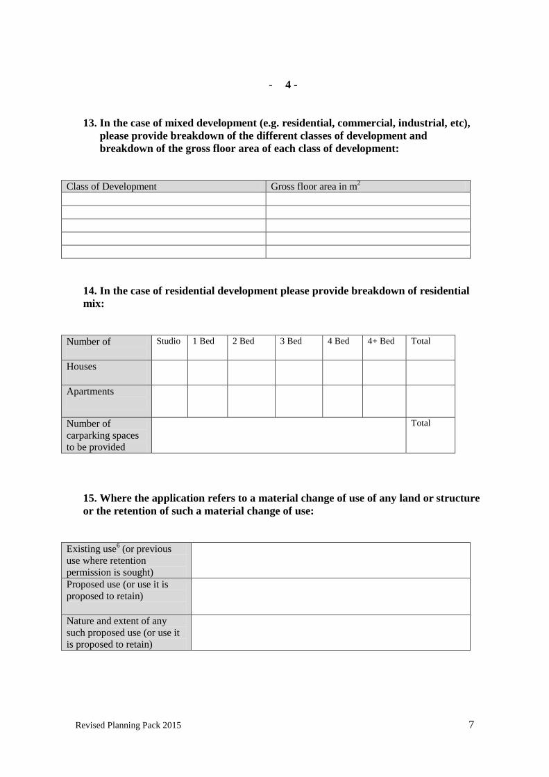
13. In the case of mixed development (e.g. residential, commercial, industrial, etc),
please provide breakdown of the different classes of development and
breakdown of the gross floor area of each class of development:
Class of Development Gross floor area in m
2
14. In the case of residential development please provide breakdown of residential
mix:
Number of
Studio 1 Bed 2 Bed 3 Bed 4 Bed 4+ Bed Total
Houses
Apartments
Number of
carparking spaces
to be provided
Total
15. Where the application refers to a material change of use of any land or structure
or the retention of such a material change of use:
Existing use
6 (or previous
use where retention
permission is sought)
Proposed use (or use it is
proposed to retain)
Nature and extent of any
such proposed use (or use it
is proposed to retain)

Revised Planning Pack 2015 8
-5 -
16. Social and Affordable Housing
Please tick appropriate box Yes No Is the application an application for permission for
development to which Part V of the Planning and
Development Act 2000 as amended, applies?7
If the answer to the above question is “yes” and the
development is not exempt (see below), you must
specify, as part of your application, the manner in which
you propose to comply with Section 96 of Part V of the
Act. If the answer to the above question is “yes” but you
consider the development to be exempt by virtue of
section 97 of the Planning and Development Act 20008,as
amended, a copy of the Certificate of Exemption under
section 97 must be submitted (or, where an application
for a certificate of exemption has been made but has not
yet been decided, a copy of the application should be
submitted). If the answer to the above question is “no” by virtue of
section 96(14) of the Planning and Development Act
2000 as amended details indicating the basis on which
section 96(14) is considered to apply to the development
should be submitted.
17. Development Details Please tick appropriate box Yes No Does the proposed development consist of work to a
protected structure and/or its curtilage or proposed
protected structure and/or its curtilage?
Does the proposed development consist of work to the
exterior of a structure which is located within an
architectural conservation area (ACA)?
Does the application relate to development which affects
or is close to a monument or place recorded under section
12 of the National Monuments (Amendment) Act, 199410
Does the proposed development require the preparation
of an Environmental Impact Statement11
?
Does the application relate to work within or close to a
European Site (under S.I. No. 94 of 1997) or a Natural
Heritage Area12
?
Does the application relate to a development which
comprises or is for the purposes of an activity requiring
an integrated pollution prevention and control licence?
Does the application relate to a development which
comprises or is for the purposes of an activity requiring a
waste licence?
Do the Major Accident Regulations apply to the proposed
development?
Does the application relate to a development in a
Strategic Development Zone?
Does the proposed development involve the demolition
of any structure?

Revised Planning Pack 2015 9
-6-
18. Site History
Details regarding site history (if known)
Has the site in question ever, to your knowledge, been flooded? Yes [ ] No [ ] If yes, please give details e.g. year, extent.
Are you aware of previous uses of the site e.g. dumping or quarrying? Yes [ ] No [ ] If yes please give details
Are you aware of any valid planning applications previously made in respect of this
land structure?
Yes [ ] No [ ]
If yes, please state planning reference number(s) and the date(s) of receipt of the planning
application(s) by the planning authority if known:
Reference No: _____________________________ Date:,_______________________________
If a valid application has been made in respect of this land or structure in the 6 months prior to the
submission of this application, then the site notice must be on a yellow background in accordance with
Article 19(4) of the Planning and Development Regulations 2001 as amended.
Is the site of the proposal subject to a current appeal to An Bord Pleanala in respect of a
similar development13
? ___________________________________________________________________________________
Yes [ ] No [ ]
An Bord Pleanala Reference No. ________________________________

Revised Planning Pack 2015 10
-7-
19. Pre-application Consultation
Has a pre-application consultation taken place in relation to the proposed development14
?
Yes [ ] No [ ]
If yes, please give details:
Reference No. (if any): ____________________________
Date(s) of consultation: _________/____________/____________
Persons involved: __________________________________________________________________
_________________________________________________________________________________
20. Services
Proposed Source of Water Supply
Existing connection [ ] New connection [ ]
Public Mains [ ] Group Water Scheme [ ] Private Well [ ]
Other (Please specify):
________________________________________________
Name of Group Water Scheme (where applicable)
_____________________________________________
Proposed Wastewater Management/Treatment
Existing [ ] New [ ]
Public Sewer [ ] Conventional septic tank system [ ]
Other on-site treatment system [ ] Please specify
_______________________________________________________
Proposed Surface Water Disposal
Public Sewer/Drain [ ] Soakpit [ ]
Watercourse [ ] Other [ ] Please specify ___________________________________________
-8-

Revised Planning Pack 2015 11
21. Details of Public Notice
Approved newspaper15
in which notice was
published
Date of publication
Date on which site
notice was erected
22. Application Fee
Fee Payable
Basis of Calculation
23. I hereby declare that, to the best of my knowledge and belief, the information
given in this form is correct and accurate and fully compliant with the Planning
& Development Acts 2000 to 2015 and the Regulations made there-under:
Signed (Applicant or
Agent as appropriate)
Date

Revised Planning Pack 2015 12
-9-
CONTACT DETAILS – NOT TO BE PUBLISHED
24. Applicant address/contact details
Address
Email address
Telephone number
(optional)
25. Agent’s (if any) address/contact details
Address
Email address
Telephone number
(optional)
Should all correspondence be sent to the agent’s address? (where applicable)
Please tick appropriate box. (Please note that if the answer is ‘No’, all correspondence will be
sent to the Applicant’s address)
Yes[ ] No[ ]
A contact address must be given, whether that of the applicant or that of the agent.

Revised Planning Pack 2015 13
LAOIS COUNTY COUNCIL
SUPPLEMENTARY APPLICATION FORM – A
TO BE COMPLETED FOR ALL COMMERCIAL AND INDUSTRIAL
DEVELOPMENTS
1. Specify precisely the nature of the proposed development
________________________________________________________________________
________________________________________________________________________
______________________________________________________
2. Specify type of machinery, finished and unfinished products
________________________________________________________________________
________________________________________________________________________
______________________________________________________
3. Hours of operation and number of employees
________________________________________________________________________
________________________________________________________________________
______________________________________________________
4. Indicate accurately storage and parking areas
________________________________________________________________________
________________________________________________________________________
______________________________________________________
5. Submit full details of all signage
________________________________________________________________________
________________________________________________________________________
______________________________________________________
6. Submit detailed landscaping and screening proposals
________________________________________________________________________
________________________________________________________________________
______________________________________________________

Revised Planning Pack 2015 14
LAOIS COUNTY COUNCIL
SUPPLEMENTARY APPLICATION FORM – B
TO BE COMPLETED FOR ALL AGRICULTURAL DEVELOPMENTS
1. Distance of proposed development from the public road: ……………. Metres
2. State proposed means of waste collection
Dungstead & Seepage Tank ……………………………….Cu.M. (M³)
Underslat Tanks ……………………………… Cu.M. (M³)
Separate Slurry Tank ……………………………….Cu.M. (M³)
Separate Silage Effluent Tank ……………………………….Cu.M. (M³)
3. State size of concrete yard area associated with proposed development
…………Sq. M.
4. State the Means of Collection of soiled yard water
Dungstead & Seepage Tank ……………………………….Cu.M. (M³)
Underslat Slurry Tanks ……………………………… Cu.M. (M³)
Separate soiled run-off Tank ……………………………….Cu.M. (M³)
5. State the means of collection of dairy or milking parlour washings
Dungstead & Seepage Tank ……………………………….Cu.M. (M³)
Underslat SlurryTanks ……………………………… Cu.M. (M³)
Solied Water Tank ……………………………….Cu.M. (M³)
Separate Dairy Washing Tank ……………………………….Cu.M. (M³)
6. State the means of disposal of soiled water/dungstead seepage:
Own Tanker
Contract Tanker
Automatic Pump
7. State maximum number and type of animals to be accommodated in the proposed
development:
Dairy Cows No: _________ Beef Cattle No:_________
Young Cattle No: _________ Calves No:_________
Fattening Pigs No: _________ Weaners No:_________

Revised Planning Pack 2015 15
- 2-
SUPPLEMENTARY APPLICATION FORM – B CONTD.
AGRICULTURAL DEVELOPMENTS
Farrowing Pigs: No: _________ Dry Sows No:_________
Gilts No: _________ Boars No:_________
8. State proposed Feeding Method:
Self Feed
Easy Feed
9. If the proposed development includes pig housing, state whether dry feed or liquid feed
is to be used:
Dry Feed
Liquid Feed

Revised Planning Pack 2015 16
APPENDIX 1
This form should be accompanied by the following documentation:
Please note that if the appropriate documentation is not included, your application will be
deemed invalid.
A. ALL Planning Applications (2 No. copies of planning application form)
□ The relevant page of newspaper that contains notice of your application.(2 No. copies)
□ A copy of the site notice (2 no. copies)
□ 6 copies of site location map16
□ 6 copies of site or layout plan 16+17
□ 6 copies of plans and other particulars required to describe the works to which the
development relates (include detailed drawings of floor plans, elevations and sections –
except in the case of outline permission)
□ The appropriate Planning Fee
B. Where the applicant is not the legal owner of the land or structure in question:
□ The written consent of the owner to make the application (2 No. copies)
C. Where the application is for residential development that is subject to Part V of
the 2000 Act, as amended:
□ Specification of the manner in which it is proposed to comply with section 96 of Part V (2
No. copies)
Or
□ A certificate of exemption from the requirements of Part V (2 No. copies)
Or
□ A copy of the application submitted for a certificate of exemption (2 No. copies)
D. Where the application is for residential development that is not subject to Part V
of the 2000 Act, as amended, by virtue of section 96(14) of the Act:
□ Information setting out the basis on which section 96(14) is considered to apply to the
development. (2 No. copies)
E. Where the disposal of wastewater for the proposed development is other than to
a public sewer:
□ Information on the on-site treatment system proposed and evidence as to the suitability of the
site for the system proposed (2 No. copies)
F. Where the application refers to a protected structure/proposed protected structure/or
the exterior of a structure which is located within an architectural conservation area (ACA):

Revised Planning Pack 2015 17
□ Photographs, plans and other particulars necessary to show how the development would affect
the character of the structure. (2 No. copies)
G. Applications that refer to a material change of use or retention of such a material
change of use:
□ Plans (including a site or layout plan and drawings of floor plans, elevations and sections
which comply with the requirements of Article 23) and other particulars required describing the
works proposed. (2 No. copies)
H. Where an application requires and Environmental Impact Statement:
□ 10 copies of Environmental Impact Statement and one electronic copy
I. Applications that are exempt from planning fees:
□ Proof of eligibility for exemption18
(2 No. copies)

Revised Planning Pack 2015 18
APPENDIX 2 Directions for Completing this Form
1. Grid reference in terms of the Irish Transverse Mercator.
2. “The applicant” means the person seeking the planning permission, not an agent
acting on his or her behalf.
3. Where the plans have been drawn up by a firm/company the name of the person
primarily responsible for the preparation of the drawings and plans, on behalf of that
firm/company, should be given.
4. A brief description of the nature and extent of the development, including reference to
the number and height of buildings, protected structures, etc.
5. Gross floor space means the area ascertained by the internal measurement of the floor
space on each floor of a building; i.e. Floor area must be measured from inside the
external wall.
6. Where the existing use is ‘vacant’, please state most recent authorised use of the land
or structure.
7. Part V of the Planning and Development Act 2000, as amended, applies where:-
The land is zoned for residential use or for a mixture of residential and other
uses;
There is an objective in the Development Plan for the area for a percentage of
the land to be made available for social and/or affordable housing: and
The proposed development is not exempt from part V.
8. Under Section 97 of the Planning and Development Act 2000, as amended,
applications involving development of 9 or fewer houses or development on land of
less than 0.1 hectare may be exempt from Part V.
9. Under Section 96(14) of the Planning and Development Act 2000, as amended, part V
does not apply to certain housing developments by approved voluntary housing
bodies, certain conversions, the carrying out of works to an existing house or the
development of houses under an agreement made under section 96 of the Act.
10. The Record of Monuments and Places, under section 12 of the National Monuments
Amendment Act 1994, is available, for each county, in the local authorities and public
libraries in that county. Please note also that if the proposed development affects or is
close to a national monument, which, under the National Monuments Acts 1930 to
2004, is in the ownership or guardianship of the Minister for Arts, Heritage and the
Gaeltacht or a local authority or is the subject of a preservation order or a temporary
preservation order, a separate statutory consent is required, under the National
Monuments Acts, from the Minister for Arts, Heritage and the Gaeltacht. For
information on whether national monuments are in the ownership or guardianship of
the Minister for Arts, Heritage and the Gaeltacht or a local authority or are the subject

Revised Planning Pack 2015 19
of preservation orders, contact the National Monuments Section, Department of Arts,
Heritage and the Gaeltacht.
11. An Environmental Impact Statement (EIS) is required to accompany a planning
application for development of a class set out in Schedule 5 of the Planning and
Development Regulations 2001-2013 which exceeds a limit, quantity or threshold set
for that class of development. An EIS will also be required by the planning authority
in respect of sub-threshold development where the authority considers that the
development would be likely to have significant effects on the environment (article
103).
12. An appropriate assessment of proposed development is required in cases where it
cannot be excluded that the proposed development would have a significant effect on
a European site. It is the responsibility of the planning authority to screen proposed
developments to determine whether an appropriate assessment is required and where
the authority determines that an appropriate assessment is required, the authority will
normally require the applicant to submit a Natura Impact Statement (NIS). Where the
applicant considers that the proposed development is likely to have a significant effect
on a European site it is open to him/her to submit an NIS with the planning
application.
13. The appeal must be determined or withdrawn before another similar application can
be made.
14. A formal pre-application consultation may only occur under Section 247 of the
Planning and Development Act 2000, as amended. An applicant should contact his or
her planning authority if he/she wishes to avail of a pre-application consultation. In
the case of residential development to which Part V of the 2000 Act, as amended,
applies, applicants are advised to avail of the pre-application consultation facility in
order to ensure that a Part V agreement in principle can be reached in advance of the
planning application being submitted.
15. The list of approved newspapers, for the purpose of giving notice of intention to make
a planning application, is available from the planning authority to which the
application will be submitted.
16. All plans, drawing and maps submitted to the planning authority should be in
accordance with the requirements of the Planning and Development Regulations
2001-2015.
17. The location of the site notice(s) should be shown on site location map.
18. See Schedule 9 of Planning and Development Regulations 2001, as amended. If a
reduced fee is tendered, details of previous relevant payments and planning
permissions should be given. If exemption from payment of fees is being claimed
under Article 157 of the 2001 as amended Regulations 9, evidence to prove eligibility
for exemption should be submitted.

Revised Planning Pack 2015 20
APPENDIX 3 GUIDANCE NOTES
Notice in Newspaper:
The notice must be published in one or other of the following newspapers:- Irish Independent Irish Times Nationalist and Leinster Times The Leinster Express
The period between the publication of the notice and the receipt of the application by the Planning Authority must not be greater than 14 days. The notice shall contain as a heading ‘Laois County Council’. The notice shall state:-
-The name of the applicant.
-The location, townland or postal address of the land or structure to which the application relates (as may be appropriate).
-Whether the application is for permission for development, permission for retention of development, outline permission for development or permission consequent on the grant of outline permission (stating the reference number on the register of the relevant outline permission).
-a brief description of the nature and extent of the development, including:-
(i) Where the application relates to development consisting of or comprising the provision
of houses, the number of houses to be provided.
(ii) Where the application relates to the retention of a structure, the nature of the proposed
use of the structure and, where appropriate, the period for which it is proposed to retain
the structure.
(iii) Where the application relates to development which would consist of or comprise the
carrying out of works to a protected structure or proposed protected structure, an
indication of that fact.
(iv) Where the application relates to development which comprises or is for the purposes of
an activity requiring an integrated pollution prevention and control licence or a waste
licence, an indication of that fact, or

Revised Planning Pack 2015 21
(v) Where a planning application relates to development in a strategic development zone, an
indication of that fact, and
That the planning application may be inspected or purchased at a fee not exceeding the reasonable cost of making a copy at the offices of the Planning Authority during its public open hours and a submission or observation in relation to the application may be made to the Authority in writing on payment of the prescribed fee within the period of 5 weeks beginning on the date of receipt by the Authority of the application.
This description should be substantially similar to the description in the site notice. Note: If the published notice does not comply fully with all of these requirements, the planning application shall be invalid and shall be returned to the applicant.

Revised Planning Pack 2015 22
DRAFT NEWSPAPER NOTICE
Laois County Council :
We (name of applicants) intend to apply for (type of permission) for (description of works) at (location of development). The planning application may be inspected or purchased at a fee not exceeding the reasonable cost of making a copy, at the offices of the planning authority during its public opening hours. A submission or observation in relation to the application may be made to the authority in writing on payment of the prescribed fee within a period of 5 weeks beginning on the date of receipt by the authority of the application.

Revised Planning Pack 2015 23
SITE NOTICE
DIRECTIONS FOR COMPLETING THIS NOTICE
1. The name of the planning authority to which the planning application will be made
should be inserted here.
2. The name of the applicant for permission (and not his or her agent) should be inserted
here.
3. Delete as appropriate. The types of permission which may be sought are:-
a. Permission
b. Retention Permission
c. Outline Permission
d. Permission consequent on the grant of outline permission. If this type of
permission is being sought, the reference number on the planning register of
the relevant outline permission should be included.
4. The location, townland or postal address of the land or structure to which the
application relates should be inserted here.
5. Delete as appropriate. The present tense should be used where retention permission is
being sought.
6. A brief description of the nature and extent of the development should be inserted
here. The description should include:-
a. Where the application relates to development consisting of or comprising the
provision of houses, the number of houses to be provided. ‘Houses’ includes
buildings designed as 2 or more dwellings or flats, apartments or other
dwellings within a building,
b. Where the application relates to the retention of a structure, the nature of the
proposed use of the structure and, where appropriate, the period for which it is
proposed to retain the structure,
c. Where the application relates to development which would consist of or
comprise the carrying out of works to a protected structure or proposed
protected structure, an indication of that fact,
d. Where an Environmental Impact Statement or Natura Impact Statement has
been prepared in respect of the planning application, an indication of that fact,
e. Where the application relates to development which comprises or is for the
purposes of an activity requiring an integrated pollution control licence or a
waste licence, an indication of that fact, or
f. Where a planning application relates to development consisting of the
provision of, or modifications to an establishment within the meaning of Part
11 of these Regulations (Major Accidents Directive), an indication of that fact.
7. Either the signature of the applicant or the signature and contact address of the person
acting on behalf of the applicant should be inserted here.
8. The date that the notice is erected or fixed at the site should be inserted here.

Revised Planning Pack 2015 24
LAOIS COUNTY COUNCIL1
SITE NOTICE
I, _________________________________
2 , intend to apply for permission/retention permission/outline permission/permission consequent on
the grant of outline permission (Ref. No. of outline permission )3 for development at this site
________________________________________________________________________________________________________
________________________________________________________________________________________________________4
The development will consist/consists5 of ______________________________________________________________________
________________________________________________________________________________________________________
_______________________________________________________________________________________________________ 6
The planning application may be inspected, or purchased at a fee not exceeding the reasonable cost of making a copy, at the offices of the
planning authority during its public opening hours.
A submission or observation in relation to the application may be made in writing to the planning authority on payment of the prescribed
fee,€20, within the period of 5 weeks beginning on the date of receipt by the authority of the application, and such submissions or observations
will be considered by the planning authority in making a decision on the application. The planning authority may grant permission subject to or
without conditions, or may refuse to grant permission.
SIGNED: ________________________________________________________________7
DATE OF ERECTION OF SITE NOTICE ______________________________________8

Revised Planning Pack 2015 25
LA
OIS
CO
UN
TY
CO
UN
CIL
SIT
E N
OT
ICE
OF
FU
RT
HE
R IN
FO
RM
AT
ION
/RE
VIS
ED
PL
AN
S
Nam
e of A
pplican
t ___________________________________________________________________________________________________
1
Referen
ce No. o
f the ap
plicatio
n _
_______________________________________________________________________________________
2
The d
evelo
pm
ent ap
plied
for co
nsisted
of _
______
__________________________________________________________________________
___________________________________________________________________________________________________________________
___________________________________________
________________________________________________________________________³
Sig
nifican
t Furth
er Info
rmatio
n/R
evised
Plan
s4 h
as/hav
e4 b
een fu
rnish
ed to
the p
lannin
g au
thority
in resp
ect of th
is pro
posed
dev
elopm
ent, an
d
is/are5 av
ailable fo
r insp
ection o
r purch
ase at the o
ffices of th
e auth
ority
durin
g its p
ub
lic open
ing h
ours.
A su
bm
ission o
r observ
ation in
relation to
the fu
rther in
form
ation o
r revised
plan
s may
be m
ade in
writin
g to
the p
lannin
g au
thority
with
in th
e
statuto
ry tim
e limit. A
subm
ission o
r observ
ation m
ust b
e accom
pan
ied b
y th
e prescrib
ed fee, ex
cept in
the case o
f a perso
n o
r body w
ho h
as
already m
ade a su
bm
ission o
r observ
ation.
Sig
ned
: ____________________________________________5
Date o
f erection o
f site notice: _
___________________
_____________6

Revised Planning Pack 2015 26

Revised Planning Pack 2015 27
Directions for completing the site notice of further information/revised plans
1. The name of the applicant for permission (and not his or her agent) should be inserted here.
2. Reference number of the planning application on the register of the planning
authority.
3. This description should be identical to that used on the original site notice.
4. Delete as appropriate.
5. Either the signature of the applicant or the signature and contact address of the person acting on behalf of the applicant should be inserted here.
6. The date that the notice is erected or fixed at the site should be inserted here.

Revised Planning Pack 2015 28
Requirements for Plans, Drawings and Maps: Plans, drawings and maps accompanying a planning application shall all be in metric scale, which shall be duly identified thereon, and shall comply with the following requirements:- Site or layout plans shall be drawn to a scale of not less than 1 : 500, the site boundary shall be clearly delineated in red, and buildings, roads, boundaries, septic tank percolation areas, bored wells, significant tree stands and other features on, adjoining or in the vicinity of the land or structure to which the application relates shall be shown, land which adjoins, abuts or is adjacent to the land to be developed and which is under the control of the applicant or the person who owns the land which is the subject of the application shall be outlined in blue and wayleaves shall be shown in yellow. Other plans, elevations and sections shall be drawn to a scale of not less than 1 : 200, (which shall be indicated thereon) or such other scale as may be agreed with the Planning Authority prior to the submission of the application in any particular case. The site layout plan and other plans shall show the level or contours, where applicable, of the land and the proposed structures relative to ordnance survey datum or a temporary local benchmark, whichever is the more appropriate. Drawings of elevations of any proposed structure shall show the main features of any buildings which would be contiguous to the proposed structure if it were erected whether on the application site or in the vicinity, at a scale of not less than 1 : 200, as may be appropriate and where the development would involve work to a protected structure, shall show the main features of any buildings within the cartilage of the structure which would be materially affected by the proposed development. Plans relating to works comprising reconstruction, alteration or extension of a structure shall be so marked or coloured as to distinguish between the existing structure and the works proposed. Plans and drawings of floor plans, elevations and sections shall indicate in figures the principle dimensions (including overall height) of any proposed structure and the site, and site or layout plans shall indicate the distances of any such structure from the boundaries of the site. Any map or plan which is based on an ordnance survey map shall indicate the relevant ordnance survey sheet number. The north point shall be indicated on all maps and plans other than drawings of elevations and sections. Plans and drawings shall indicate the name and address of the person by whom they were prepared. A planning application for development consisting of or comprising the carrying out of works to a protected structure, or proposed protected structure or to the exterior of a structure which is located within an architectural conservation area or an area specified as an architectural conservation area in a draft of a proposed development plan or a proposed variation of a development plan, shall be accompanied by such photographs, plans and other particulars as are necessary to show how the development would affect the character of the structure. The Planning Authority may require an applicant to provide additional copies of any plan, drawing, map, photograph or other particulars which accompanies the planning application. Outline Application: An outline application shall, in addition to the relevant page in the newspaper, copy of site notice, 6 copies of site location map (scale 1:2500/1:100) indicating the position of the site notice, etc., certificate under Part V of the Act and appropriate fee, be accompanied only by such plans and particulars as are necessary to enable the
Revised Planning Pack 2015 29
Planning Authority to make a decision in relation to the siting, layout or other proposals for development in respect of which a decision is sought.
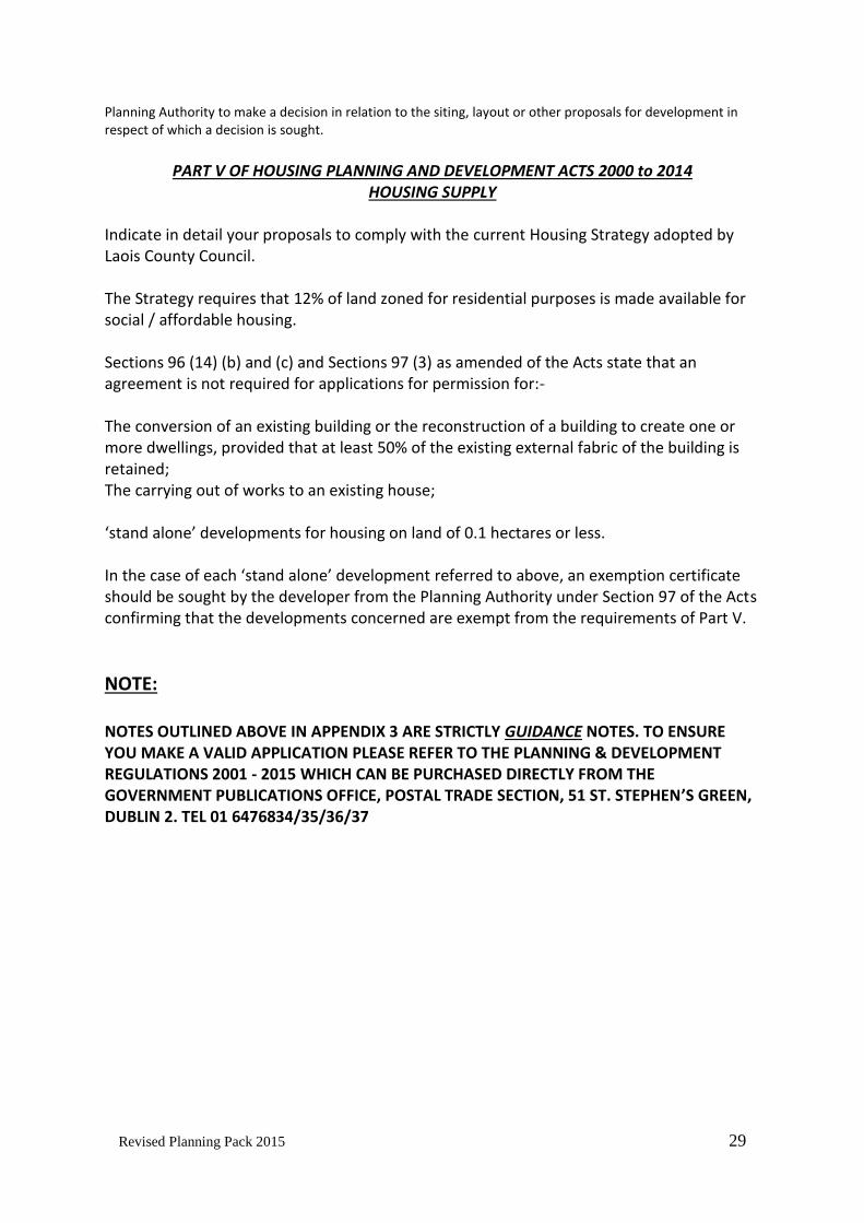
PART V OF HOUSING PLANNING AND DEVELOPMENT ACTS 2000 to 2014
HOUSING SUPPLY Indicate in detail your proposals to comply with the current Housing Strategy adopted by Laois County Council. The Strategy requires that 12% of land zoned for residential purposes is made available for social / affordable housing. Sections 96 (14) (b) and (c) and Sections 97 (3) as amended of the Acts state that an agreement is not required for applications for permission for:- The conversion of an existing building or the reconstruction of a building to create one or more dwellings, provided that at least 50% of the existing external fabric of the building is retained; The carrying out of works to an existing house; ‘stand alone’ developments for housing on land of 0.1 hectares or less. In the case of each ‘stand alone’ development referred to above, an exemption certificate should be sought by the developer from the Planning Authority under Section 97 of the Acts confirming that the developments concerned are exempt from the requirements of Part V.
NOTE: NOTES OUTLINED ABOVE IN APPENDIX 3 ARE STRICTLY GUIDANCE NOTES. TO ENSURE YOU MAKE A VALID APPLICATION PLEASE REFER TO THE PLANNING & DEVELOPMENT REGULATIONS 2001 - 2015 WHICH CAN BE PURCHASED DIRECTLY FROM THE GOVERNMENT PUBLICATIONS OFFICE, POSTAL TRADE SECTION, 51 ST. STEPHEN’S GREEN, DUBLIN 2. TEL 01 6476834/35/36/37

Revised Planning Pack 2015 30
Comhairle Chontae Laoise
Laois County Council
Explanatory Notes
Site Assessment in accordance with E.P.A. Code of Practice for Wastewater Treatment and Disposal Systems serving Single Houses (p.e.≤ 10)
Items 1-5 to be submitted with all Site Suitability Assessment irrespective of whether the Applicant/Agent or Laois County Council is carrying out the Site Suitability Assessment
1. 3 no. 6” Ordnance Survey Maps or 2 no. Discovery Series Maps. a. The proposed site must be outlined in red.
2. 3 no. Site Location Maps of the area to a scale of 1/2500. a. The proposed site must be outlined in red, the north point indicated and the
relevant Ordnance Survey Sheet number should be included. b. Access to the site and position of site notice should be clearly shown. c. The site location map must show all up to date development on adjacent sites
within 250m radius. It should include buildings, wells, septic tanks, proprietary treatment systems and percolation areas, streams and water courses denoting distances to relevant site.
3. 3 no. Site Layout Plans to minimum scale of 1/500. a. The proposed site must be outlined in red, the north point indicated and it
should show contours/levels. b. All developments existing and proposed on site must be shown, including
location of wells, septic tanks, proprietary treatment systems and percolation areas and existing and proposed buildings, streams, water courses and measurements
4. Written confirmation from the landowner to the effect that: (a) Council officials are permitted onto the lands for inspection purposes
Or (b) Council Officials are permitted onto the lands for testing purposes
And

Revised Planning Pack 2015 31
Please ensure that there are no livestock on the site or entry lands to the site for the duration of the site visits. (Refer to the attached consent form.)
5. Direct access to the site must be provided.
6. A Site Notice (enclosed) must be erected on site.
PLEASE NOTE THAT WHERE THE APPLICANT/AGENT INTENDS TO CARRY OUT THE SITE SUITABILITY ASSESSMENT ITEMS 6-9 MUST ALSO BE SUBMITTED TOGETHER WITH ITEMS 1-5 ABOVE
7. Photographs 1. Site area prior to dig 2. Site area during dig 3. T & P test and site characterization test been carried out.
MAPS OR DRAWINGS THAT SHOW INACCURACIES OR CONFLICTING INFORMATION WILL NOT BE ACCEPTED, AND YOUR REPORT WILL BE RETURNED FOR CLARIFICATION. THE NAME AND ADDRESS OF THE PERSON WHO PREPARED ALL MAPS AND DRAWINGS SHOULD BE INDICATED ON THEM.
8. Assessors Qualifications & Professional indemnity (Min €1,000,000)
9. The following maps are required 1. National Vulnerability Map 2. Aquifer Maps 3. Soils Maps 4. Bedrock Maps 5. Ground Water Protection Scheme
10. 3 no. copies of SSA Report
Failure to comply with any of the above may result in a Further Information Request and a requirement for test holes to be re-opened at Planning stage.
Any query in relation to Site Suitability Assessment should be directed to (057) 8664114.

Revised Planning Pack 2015 32
PLEASE NOTE THAT WHERE THE APPLICANT/AGENT INTENDS TO ENGAGE LAOIS COUNTY COUNCIL TO CARRY OUT THE SITE SUITABILITY ASSESSMENT THE FOLLOWING APPLIES:
Following the submission of the APPLICATION FORM FOR SITE ASSESSMENT IN ACCORDANCE WITH E.P.A CODE OF PRACTICE WASTEWATER TREATMENT AND DISPOSAL SYSTEMS SERVING
SINGLE HOUSES ( p.e. ≤10) and the completion of a desktop study on your application site, Laois County Council will notify you of a date and time for the excavation of the test holes, under the supervision of Laois County Council personnel.
This notice will also advise as to the required depth of the trial hole. Requirement for “P. Test Holes” and “T. Test Holes” will be advised on site during excavation at the scheduled date and time.
If for exceptional reasons you wish to postpone or cancel the site suitability assessment or excavation of the trial holes, a minimum of 4 working days notice is required otherwise you will be liable for the re-visit fee of €250.
If a site has previously undergone the site suitability assessment, a retest of the site will not be carried out unless one of the following actions is undertaken:
In the case of a site of 0.75 acres or more that has previously failed a site suitability assessment, the test area must be moved a minimum of 20m from the original test location within the site.
In the case of a site of 0.5 acres that has previously failed a site suitability assessment, the site is extended by a minimum of 0.25 acres and the percolation area moved into additional area (a minimum of 20m from the original test location).
Significant site improvement works are carried out on site and detail supplied to Laois County Council.
The Test Fee - €550 per test.
(Where a result has previously issued on the same site any subsequent test will incur a full fee.)
A message may be left on the following telephone no: 057 8664114 at anytime.
Failure to comply with any of the above will result in delays in processing the
application and in carrying out the test.

Revised Planning Pack 2015 33
TEST HOLES REQUIRED
All 7 test holes must be excavated adjacent to the proposed percolation area of the site. There must be a minimum of 1000 litres of water and a bucket provided at the T and P test holes. The 7 no. test holes should be excavated as follows:
1 x Trial Hole 3 x T-Test Holes 3 x P-Test Holes
Less Than 3mDistance Between
Percolation Holes and Water
3 x P-Test Percolation Holes
3 x T-Test Percolation HolesInnerT-TestHole
Barrel of Water330 Ltrs330 Ltrs
2 No. Barrels of Water
Steps
Step Step Step
Below is a typical Plan view of a Site Ready for Site Suitability Testing
HoleT-TestInner
1 No. Trial Hole

Revised Planning Pack 2015 34
1 X TRIAL HOLE
SECTION THROUGH WATER TABLE TRIAL HOLE
DEPTHS FOLLOWING DESK STUDYLAOIS COUNTY COUNCIL WILL SPECIFY THESE
IMPORTANT AQUIFERS)BELOW GROUND LEVEL (3M FOR REGIONALLYMINIMUM DEPTH OF 2.1 METRES
below ground level
Minimum base width of 1 metre
GROUND LEVEL
Minimum depth of 2.1 metres
2 steps must be provided to ensure safe accessBy the Council Official
REQUIREMENTS: Number: 1 water table trial hole per site. Location: To be dug ADJACENT to the proposed percolation area. Size: At least 1m square, by a minimum of 2m deep (or 3m for regionally
important Aquifer). These depths will be specified by Laois County Council Official following desk study.
Perimeter: The area around the perimeter of any excavated hole should be clear of any
soil for Health and Safety reasons, and to prevent the hole from collapsing. The clear distance should be greater than or equal to the depth of the excavated hole, i.e. if the trial hole depth is 2.1m, the excavated soil should not be placed within 2m of the hole perimeter.
Shoring: Temporary shoring may be necessary to prevent slippage and any shoring
should not extend more than 1.4m below ground level. Shoring should not interfere with the flow of water into the hole.
Steps: 2 steps as shown above and a clear path around the hole perimeter must be
provided to ensure safe access by the council official into the trial hole.

Revised Planning Pack 2015 35
Covers: Each hole may be covered separately to prevent the ingress of surface or rainwater. Time: Test holes must be dug at least 48 hours prior to testing.
3 x T-Test Holes
depths of X and Y following desk study
Laois County Council will specify
NOTE
TO ALLOW SAFE ACCESS BY THE COUNCIL OFFICIALTHIS HOLE MUST INCLUDE A STEP AS SHOWN
X
TEST HOLE TO BE 300mm x 300mm SQUARE
GROUND LEVEL
Y
Section through the percolation T-Test Hole
Three T-Test holes at least 1.0m square shall be dug to the same depth as the invert of the proposed percolation pipes. A step as shown above and a clear path around the hole perimeter must be included to allow safe access by the council official. An inner percolation test hole measuring 300mm square x 400mm deep shall then be dug by hand in the base of these holes. These test holes shall be dug ADJACENT to the proposed percolation area and at least 3m from the trial hole. The main hole may be dug by mechanical excavator but the inner percolation test holes shall be dug by hand as squarely as possible and to the exact dimensions as given above. REQUIREMENTS:
Number: 3 x T-Test holes per site.
Location: Adjacent to the percolation area, at least 3.0m from the trial hole and 3m from any other test hole.
Perimeter: The area around the perimeter of the excavated holes should be secured and clear of any soil for Health & Safety reasons, and to help prevent the hole from collapsing. The clear distance should be greater than or equal to the depth of the excavated hole i.e. if the T hole depth is 900mm, the excavated soil should not be placed within 900mm of the hole perimeter.

Revised Planning Pack 2015 36
Steps: 1 Step must be provided to ensure safe access by the council official into each T hole.
3 x P-TEST HOLES
GROUND LEVEL
400mm DEPTH
300mm x 300mm SQUARE
SECTION THROUGH PERCOLATION P-TEST HOLE
Three P Test holes 300mm square must be dug to a depth of 400mm below ground level. These test holes shall be dug ADJACENT to the proposed percolation area and at least 3m from the trial hole. Both these test holes shall be dug by hand as squarely as possible and to the exact dimensions as given above. REQUIREMENTS: Number: 3 x P Test percolation holes per site. Location: To be dug adjacent to the proposed percolation area, at least 3.0 m from the
trial hole and at least 3.0 m from any other test hole.

Revised Planning Pack 2015 37
Covers: Each hole may be covered separately to prevent the ingress of surface or rainwater.
Time: Test holes to be dug at least 48 hours prior to test being carried out.

Revised Planning Pack 2015 38
Comhairle Chontae Laoise
Laois County Council
APPLICATION FORM FOR
SITE ASSESSMENT IN ACCORDANCE WITH E.P.A CODE OF PRACTICE WASTEWATER TREATMENT AND DISPOSAL SYSTEMS SERVING SINGLE HOUSES ( p.e. ≤10)
1. Applicant Name: __________________________________________
2. Contact Tel. No: __________________________________________
3. Applicant Address: __________________________________________
_____________________________ 4. Address for Correspondence: __________________________________________________________
__________________________________________________________
5. Email Address: __________________________________________________________
6. Description of Proposed Development:
__________________________________________
No of Sites: _______________ No. Of Bedrooms per dwelling:
A)Single:_______________ B)Double:_______________
7. Location of proposed dwelling:
__________________________________________ 8. Site Area (Acres / Hectares): __________________________________________
9.
Has the site or any part of the site undergone percolation test by Laois County Council: If yes, please outline what site improvement works/changes have been made prior to this application:
Yes: No: If yes, please state reference number:_________________ ____________________________________________________________________________________________________________________________________________________________

Revised Planning Pack 2015 39
10. 11.
Name and address of Landowner: (Refer to attached form) Source of Water Supply for Proposed Development: (Please tick appropriately)
Proposed bored well Existing well New public mains connection Existing public mains connection Group Water Scheme Name of Scheme__________________________________
12. Name of Public/Group Water Supply Scheme within 1KM (if applicable)
PLEASE ENSURE THAT THE FOLLOWING ARE ENCLOSED WITH YOUR COMPLETED APPLICATION FORM, FAILURE TO DO SO WILL RESULT IN YOUR APPLICATION BEING RETURNED TO YOU. 13. Fee of €550 enclosed Yes: No: 14. 3 no. 6” Ordnance Survey Maps or 2 no. Discovery Series Maps.
a. The proposed site must be outlined in red.
15. 3 no. Site Location Maps of the area to a scale of 1/2500. a. The proposed site must be outlined in red, the north point indicated and the
relevant Ordnance Survey Sheet number should be included. b. Access to the site and position of site notice should be clearly shown. c. The site location map must show all up to date development on adjacent sites within
250m radius. It should include buildings, wells, septic tanks, proprietary treatment systems and percolation areas, streams and water courses denoting distances to relevant site.
16. 3 no. Site Layout Plans and Cross Section to minimum scale of 1/500. a. The proposed site must be outlined in red, the north point indicated and it should
show contours/levels. b. All developments existing and proposed on site must be shown, including location of
wells, septic tanks, proprietary treatment systems and percolation areas and existing and proposed buildings, streams, water courses and measurements
c. Cross section drawing of the site.
17. Written confirmation from the landowner to the effect that: a. Council officials are permitted onto the lands for inspection purposes
Or b. Council Officials are permitted onto the lands for testing purposes
And

Revised Planning Pack 2015 40
Please ensure that there are no livestock on the site or entry lands to the site for the duration of the site visits. (Refer to the attached consent form.)
18. Direct access to the site must be provided.
19. A Site Notice (enclosed) must be erected on site.
Please be advised that on completion of the desk top study Laois County Council will advise the applicant of date and time for trial holes to be excavated on site under the supervision of Laois County Council Official .
If for exceptional reasons you wish to postpone or cancel the Site Suitability Assessment or excavation of trial holes, a minimum of 4 working days notice is required or you may be liable for a revisit fee of €250.
Any query in relation to Site Suitability Assessment should be directed to (057) 8664114.
A message may be left on the above telephone number after 5pm and at weekends.
SIGNED APPLICANT/AGENT: _________________________________ DATE: _____________________ Completed applications should be submitted to: The Planning Section, Áras an Chontae, Laois County Council, Portlaoise, Co. Laois.
OFFICIAL USE ONLY
Is form satisfactorily completed: Yes No ____________________________________________________________________________________________________________________________________________________________________ SIGNED: ____________________________________ DATED:____________________________
OFFICIAL USE ONLY Date and time of requested excavation of trial holes on site: _____________________________________________________________________
SIGNED: __________________________________DATE: _____________

Revised Planning Pack 2015 41
Comhairle Chontae Laoise
Laois County Council
NOTIFICATION FORM FOR
SITE ASSESSMENT IN ACCORDANCE WITH E.P.A CODE OF PRACTICE WASTEWATER TREATMENT AND DISPOSAL SYSTEMS SERVING SINGLE HOUSES ( p.e. ≤10)
1. Applicant Name: __________________________________________
2. Contact Tel. No: __________________________________________
3. Applicant Address: __________________________________________
_____________________________ 4. Address for Correspondence: __________________________________________________________
__________________________________________________________
5. Email Address: __________________________________________________________
6.
Date and Time of P & T and site characterisation test to be carried out.
__________________________________________________________
7. Description of Proposed Development:
__________________________________________
No of Sites: _______________ 8. Location of proposed dwelling:
__________________________________________ 9. Site Area (Acres / Hectares): __________________________________________
10.
Has the site or any part of the site undergone percolation test by Laois County Council: If yes, please outline what site improvement works/changes have been made prior to this application:
Yes: No: If yes, please state reference number:_________________ ____________________________________________________________________________________________________________________________________________________________

Revised Planning Pack 2015 42
11. 12.
Name and address of Landowner: (Refer to attached form) Source of Water Supply for Proposed Development: (Please tick appropriately)
Proposed bored well Existing well New public mains connection Existing public mains connection Group Water Scheme Name of Scheme__________________________________
13.
Name of Public/Group Water Supply Scheme within 1KM (if applicable)
PLEASE ENSURE THAT THE FOLLOWING ARE ENCLOSED WITH YOUR COMPLETED NOTIFICATION, FAILURE TO DO SO WILL RESULT IN YOUR NOTIFICATION BEING RETURNED TO YOU.
ASSESSORS QUALIFICATIONS & EVIDENCE OF PROFESSIONAL INSURANCE INDEMNITY (€1,000,000)
3 no. 6” Ordnance Survey Maps or 2 no. Discovery Series Maps. a. The proposed site must be outlined in red.
3 no. Site Location Maps of the area to be to a scale of 1/2500. a. The proposed site must be outlined in red, the north point indicated and the
relevant Ordnance Survey Sheet number should be included.
b. Access to the site and position of site notice should be clearly shown.
c. The site location map must show all up to date development on adjacent sites within 250m radius. It should include buildings, wells, septic tanks, proprietary treatment systems and percolation areas, streams and water courses denoting distances to relevant site.
3 no. Site Layout Plans to minimum scale of 1/500. a. The proposed site must be outlined in red, the north point indicated and it
should show contours/ levels.

Revised Planning Pack 2015 43
Laois County Council requires 2 weeks notice of test date
Site notice (enclosed) must be erected on site
Please contact the Planning Department when the test has been completed.
If for exceptional reasons you wish to postpone or cancel the Site Suitability Assessment, a minimum of 1 working day’s notice is required. Out of office hours, a message may be left at the following number 057 8664114
Completed Notification Form to be returned to Planning Department, Laois County Council, Áras an Chontae, JFL Avenue, Portlaoise, Co. Laois
SIGNED: _____________________________ Date:____________________________ Applicant/Agent
OFFICIAL USE ONLY
Is form satisfactorily completed: Yes No ____________________________________________________________________________________________________________________________________________________________________ SIGNED: ____________________________________ DATED:____________________________
OFFICIAL USE ONLY Date and time of requested excavation of trial holes on site: _____________________________________________________________________
SIGNED: __________________________________DATE: _____________
Revised Planning Pack 2015 44
LANDOWNER CONSENT FORM I _____________________________________ CONSENT TO THE FOLLOWING: 1. COUNCIL STAFF ARE PERMITTED ONTO MY LANDS FOR TESTING PURPOSES. 2. THERE ARE NO LIVESTOCK ON THE SITE OR ENTRY LANDS TO THE SITE. SIGNED: _________________ LANDOWNER

Revised Planning Pack 2015 45
SITE NOTICE
SITE SUITABILITY ASSESSMENT
APPLICANT NAME: _________________________________
LOCATION (TOWNSLAND): _________________________________ DATE: _________________________________

Revised Planning Pack 2015 46
SCALE OF PLANNING FEES DOMESTIC DWELLING €65 EXTENSION €34 OUTLINE €48.75 APPROVAL €34 CHANGE OF HOUSE DESIGN €34 RETENTION (extension etc) €102 or €2.50 for per sqm of gross floor space
for which permission is sought, whichever is the greater.
RETENTION (dwelling) €195 or €2.50 per sqm of gross floor space for which permission is sought, whichever is the greater fee.
COMMERCIAL DEVELOPMENT €3.60 per sqm Minimum Charge €80 COMMERCIAL RETENTION €10.80 per sqm OUTLINE - INDUSTRIAL €2.70 per sqm AGRICULTURAL €1 per sqm in excess of 200 sqm Minimum Charge €80 Maximum Charge €300 MINIMUM FEE €34 APPEAL – COMMERCIAL APPLICANT €660 3RD PARTY €220 REFERRAL €210 SUBMISSION €50 ORAL HEARING €50 SCAFFOLDING LICENCE €1,250.00 per annum SIGN LICENCE (public) €630.00 per annum SIGNS ON PRIVATE PROPERTY €20 per sqm (minimum fee - €80) SITE SUITABILITY TEST €550 SITE SUITABILITY RETEST €250 COPY OF PLANNING PERMISSION €9.25 COPY OF REPORT €6.00 RETRIEVAL OF OLD FILES €63.50

Revised Planning Pack 2015 47
LAOIS COUNTY COUNCIL
COMHAIRLE CHONTAE LAOISE
Application for Certificate under Section 97 of the Planning and Development Acts 2000 to 2014
1. NAME: ______________________________________________________________ 2. ADDRESS: ______________________________________________________________ ______________________________________________________________ ______________________________________________________________ 3. TELEPHONE NUMBER ______________________________________________________________ 4. LOCATION OF SITE _______________________________________________________________ (Map to be submitted, scale 1:1000 or 1:2500 as appropriate)
Site area: ____________________________________________ (Hectares)
5. NAME AND ADDRESS OF PERSON WHO PREPARED PLANS AND DRAWINGS: ________________________________________________________________________________________________________________________________________________________________________________________________________________________________________________________________________________________________________________________________________ 6. NUMBER OF DWELLINGS TO BE PROVIDED: ________________ 7. PARTICULARS OF LEGAL AND BENEFICIAL OWNERSHIP OF THE LAND OVER THE LAST 5
YEARS IN WHICH IT IS PROPOSED TO CARRY OUT THE DEVELOPMENT IN WHICH THE APPLICATION RELATES AS ARE WITHIN THE APPLICANT’S KNOWLEDGE OR PROCUREMENT:
____________________________________________________________________________________________________________________________________________________________________ ____________________________________________________________________________________________________________________________________________________________________

Revised Planning Pack 2015 48
1. DETAILS OF ANY PERSONS WITH WHOM THE APPLICANT IS ACTING IN CONCERT:
________________________________________________________________________________________________________________________________________________________________________________________________________________________________________________________________________________________________________________________________________ 9. PARTICULARS OF: (i) Any interest that the applicant has, or had at any time during the said period, in any land
in the immediate vicinity of the land on which it is proposed to carry out such development, in the preceding 5 years:
________________________________________________________________________________________________________________________________________________________________________________________________________________________________________________________________________________________________________________________________________
(ii) Any interest that any person with whom the applicant is acting in concert has, or had at any time during the said period, in any land in the said immediate vicinity of which the applicant has knowledge:
____________________________________________________________________________________________________________________________________________________________________________________________________________________________________________________________________________________ _________________________________________________________________________________________________________________________________________________________________________________________________________________________________-___________________________________________________________________________
10. ARE YOU AWARE OF ANY FACTS OR CIRCUMSTANCES THAT WOULD CONSTITUTE GROUNDS UNDER subsection (12) FOR THE REFUSAL BY THE PLANNING AUTHORITY TO GRANT A CERTIFICATE?
Yes No
If Yes give details
___________________________________________________________________________
___________________________________________________________________________
___________________________________________________________________________
___________________________________________________________________________

Revised Planning Pack 2015 49
STATUTORY DECLARATION
I, _______________________________________ of
______________________________________
________________________________________ Make OATH that all the foregoing
statements and particulars in this application form are true, complete and accurate in
every respect, to the best of my knowledge and belief.
SWORN AT ________________________________________ in the COUNTY OF LAOIS this
day of _______________________________________ before me Commissioner of Oaths
and I know the despondent.
Signature: ___________________________
__________________________________
COMMISSIONER OF OATHS
Signature: ___________________________
Name: _______________________________
APPLICANT
NOTES : Please see copy of Section 97 of the Planning and Development Act, 2000 as
amended for your information.