Embed Size (px)
Citation preview

Spherical Coordinate Systems
Exploring Space Through Math Pre-Calculus

let's examine the Earth in 3-dimensional space. The Earth is a large spherical object. In order to find a
location on the surface, The Global Pos~ioning System
grid is used.

The Earth is conventionally broken up into 4 parts called hemispheres . The North and
South hemispheres are separated by the equator.

The East and West hemispheres are separated
by the Prime Meridian.

The Geographic Coordinate System grid utilizes a series
of horizontal and vertical lines. The horizontal lines are called latitude lines. The equator is
the center line of latitude. Each line is measured in
degrees to the North or South of the equator. Since there are 360 degrees in a circle,
each hemisphere is 180 degrees .

The vertical lines are called longitude lines. The Prime
Meridian is the center line oflongitude . Each hemisphere either East or West from the center line is 180 degrees.

These lines form a grid or mapping system for the
surface of the Earth ,

This is how latitude and longitude lines are
represented on a flat map called a Mercator Projection.

Lat~ude , long~ude , and elevalion allows us to uniquely
identify a location on Earth but, how do we identify the pos~ion of another point or
object above Earth's surface relat ive to that I?
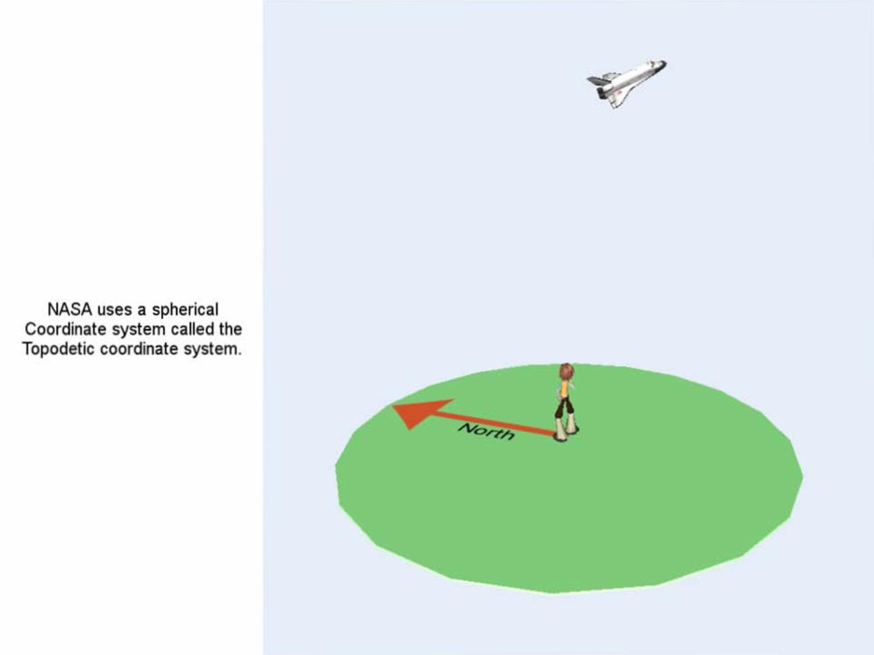
NASA uses a spherical Coordinate system called the Topodetic coordinate system.

Consider the position of the space shuttle .

The first variable used for position is called the azimuth.
Azimuth is the horizontal angle of the location on the Earth , measured clockwise from a
line pointing due north.
Az
-

EI Elevation is the angle of the object above the horizon .

Finally, the radial distance or the actually distance the
object is space is from the surface of the Earth .

Ir, fl, Az)
Az
Using these three measurements we can identify
the specific location of an object above the Earth's surface using a spherical
coordinate system.

Ir, fl, Az)
Az The final slide showing our observer standing on the surface of the Earth! Well
done!