Embed Size (px)
Citation preview

OA East Report No: 1444
OASIS No: oxfordar3-144548
NGR: TL 4510 5882
Client: Anglian Water Services
Sewer replacement
works, Jesus Lane,
Cambridge
March 2013
ArchaeologicalWatching Brief Report
Archaeological Watching BriefReport
Sewer replacement works, Jesus Lane, Cambridge
Archaeological Watching Brief
Site Code: CAMJEL13
CHER No.: ECB 3910
Date of Works: January – February 2013
Report No.: 1444
Authors: Louise Bush BA MA PIfA and Gareth Rees BA MA AIfA
Client: Anglian Water Services
Report Date: February 2013
© Oxford Archaeology East Page 1 of 15 Report Number 1444


© Oxford Archaeology East Page 3 of 15 Report Number 1444

Table of Contents
Summary.........................................................................................................................................5
1 Geology and Topography.........................................................................................................7
2 Archaeological and Historical Background ...........................................................................7
3 Methodology.............................................................................................................................11
4 Results......................................................................................................................................11
5 Discussion and Conclusions..................................................................................................11
6 Acknowledgements.................................................................................................................11
Bibliography ................................................................................................................................12
Appendix A. OASIS Report Form .............................................................................................13
© Oxford Archaeology East Page 4 of 15 Report Number 1444

List of FiguresFig. 1 Site location map
Fig. 2 HER plot
Fig. 3 Richard Lyne Map, 1574
Fig. 4 George Braun Map, 1575
Fig. 5 William Smith Map, 1588
Fig. 6 John Speed Map, 1610
Fig. 7 David Loggan Map, 1688
Fig. 8 Map of Cambridge, 1763
Fig. 9 William Custance Map, 1798
Fig. 10 Cole Map, 1804
Fig. 11 Richard Grey Baker Map, 1830
Fig. 12 J. Dewhurst and W. Nichol Map, 1840
Fig. 13 First Edition Ordnance Survey Map, 1886
Fig. 14 1926 Ordnance Survey Map
List of PlatesPlate 1 Initial ground investigation (looking west)
Plate 2 Ground works using a cassion
© Oxford Archaeology East Page 5 of 15 Report Number 1444

Summary
Throughout January and February 2013, Oxford Archaeology East carried out anarchaeological watching brief at Jesus Lane, Cambridge (TL 4510 5882). Themonitoring was carried out during sewer replacement works along the length ofJesus Lane.
No archaeological features or deposits were identified during the monitoring. Thesewer trench only revealed post-medieval and modern demolition and backfill, alongwith modern sevices.
© Oxford Archaeology East Page 6 of 15 Report Number 1444

© Oxford Archaeology East Page 7 of 15 Report Number 1444

1 GEOLOGY AND TOPOGRAPHY
1.1.1 Jesus Lane is located to the east of Cambridge city centre (Fig. 1). The currentground-level rises from 8m at the eastern end to 9.4m OD at the western end. Theunderlying geology comprises alluvial deposits overlying 1st terrace deposits of theriver Cam (British Geological Survey 1981). These are covered by 2-3m of buried soil,dumped deposits and modern over-burden.
2 ARCHAEOLOGICAL AND HISTORICAL BACKGROUND
2.1.1 This background takes into consideration historical sources, cartographic evidence anddata currently held in the HER. A search was carried out for all sites recorded in theCambridgeshire HER within 100m of Jesus Lane (Fig. 2). Research has previouslybeen carried out in to the archaeological significance of Jesus Green (Phillips 2008)and much of this background is reproduced here.
Prehistoric2.1.2 Archaeological remains dating to the prehistoric period are not common in this area and
consist of two sites and one find spot. Excavations at Jesus Close (MCB15990)uncovered ditches and postholes which may have been part of a Bronze Age fieldsystem (Whittaker 1998). Residual later prehistoric lithic material recovered from St.John's Triangle may indicate that this agricultural usage continued to the west(MCB18192; Newman 2008). A single lithic implement was recovered from a site atJesus College Library site (HER11890; Evans 1995).
Roman2.1.3 The Roman town of Cambridge (Duroliponte) was located on modern day Castle Hill,
approximately 0.5km to the north-west of Jesus Lane. This location was chosenbecause a combination of a slow-moving river and firm ground on either side made it anatural river crossing since prehistoric times (RCHM 1988).
2.1.4 Although the focus of settlement was on Castle Hill it appears to have spread to thesouth of the river. Evidence of settlement as well as industrial activity has beenuncovered during excavations at 35 Jesus Lane (CB15727; Alexander et al. 2004),Sydney Sussex College (HER04638; HER04802; HER05004c), Park Street (CB15513;Dodwell 2002) and St. Johns Triangle (MCB18192; ECB2513). Numerous finds ofcoins, a quern stone and pottery around Jesus Lane indicate that settlement waspresent in this area from the 1st to the 4th century.
2.1.5 Later Roman activity was evidenced at 11 Park Street and 35 Jesus Lane which mayhave been part of a large inhumation cemetery (discussed below). If this is the casethis cemetery would have lain under much of the present course of Jesus Lane.
Saxon2.1.6 The core of the Late Saxon town (Grantabrycge) appears to be to the south of the river
with archaeological work suggesting the area between the market and St. Benetschurch was the most densely settled (Taylor 2004: 48). The Late Saxon/early MedievalKing’s Ditch enclosed the settlement, running from the river at Mill Lane across the eastside of the town, going under Jesus Lane and along the approximate line of modernday Park Street, before returning to the river (Whittaker 2002).
© Oxford Archaeology East Page 8 of 15 Report Number 1444

2.1.7 Saxon finds in the vicinity of Jesus Lane include several brooches (HER04541;HER04608a; HER04804) as well as a comb, blue glass beads and a spindle whirl fromPetty Cury (HER10362). Domestic properties and boundaries were established at St.John's Triangle, to the west of Jesus Lane in the Saxo-Norman period (Newman 2008;HER18193). An inhumation found during excavation of drains on Jesus Lane wasassociated with a Saxon brooch, but may relate to the late Roman cemetery(HER04804).
Medieval2.1.8 Jesus College is located along the north-eastern edge of Jesus Lane and has its origins
in the early Medieval period. Between 1159 and 1161 King Malcolm IV of Scotland,who was also Earl of Huntingdon, gave to the nuns of Cambridge ten acres on which tobuild a Benedictine nunnery, dedicated to St. Radegund (Salzman 1948, 218-9). It wasbounded to its north by Jesus Ditch, which is still present today (Whittaker 1999).Presumably the line of Jesus Lane was established at this time as a southern boundaryto this nunnery. Excavations at Jesus College library uncovered external working areasas well as storage pits and a garden, probably associated with the nunnery (HER11890;Evans 1995) whilst investigations in the Master's Garden uncovered fifteen skeletonswhich probably lay in the parishioners cemetery (HER11307; Evans et al. 1998).
2.1.9 Jesus College, (founded 1496/7) dedicated to St Mary and St. Radegund, wasestablished in the dissolved nunnery buildings (Roach 1959, 421). The collegeacquired its name from its chapel, Jesus chapel, which originally served the oldnunnery and the surrounding area. This is significant as Jesus Lane (formerly Nun'sLane) is likely to have acquired its name from the college by which it passed. There islikely to have been a road of sorts in this location prior to this time as a main routebetween Cambridge, Barnwell and Newmarket.
2.1.10 A Franciscan friary of 'Grey Friars' (HER05004) was located at the south-western endof Jesus Lane and several artefacts relating to this establishment have been uncovered(HER04434; HER04546; HER04602). The friary was founded in the 13th century byWilliam de Esseby and later expanded on to the land of an old synagogue. It wasdissolved in 1538 prior to the construction of Sydney Sussex College on the site in1596.
2.1.11 To the north of the friary a bridge spanned the King's Ditch at the point where JesusLane crossed it (HER04606). Occupation along Jesus Lane in the medieval period isattested to in part by the discovered of building rubble dating to this period during theoriginal drainage works (HER04758) as well as pits and ditches uncovered duringexcavations at the ADC theatre (CB15310).
Post-medieval2.1.12 Three small scale metalworking workshops along with extensive building remains have
been uncovered to the west of Jesus Lane, at St. John's Triangle (MCB18196; Newman2008).
2.1.13 In the 17th century, during the Civil War period, Cambridge was the administrativecentre for the New Model Army in East Anglia. Defensive earthen banks ran along themodern course of Emmanuel Road and Victoria Avenue passing by the eastern end ofJesus Lane (Taylor 2004, 134).
2.1.14 Cartographic evidence indicates that the course of Jesus Lane did not alter much fromthe post-medieval period to the modern day (see below).
© Oxford Archaeology East Page 9 of 15 Report Number 1444

Excavations
No. 35-37 Jesus Lane (CB15727; Alexander et al. 2004)2.1.15 Part of a middle Roman settlement and a later Roman inhumation cemetery was
uncovered in the basements of 35 to 37 Jesus Lane. The settlement may have beenassociated with industrial activity speculated to have taken place in this part of thelower Roman town. The cemetery consisted of 32 skeletons, six with grave goods,aligned north-east to south-west. The extents of the cemetery were not located and itmay have continued north in to the current location of Jesus Lane. The burials werelocated between c. 6.8m and c. 6.15m, approximately 1.9m below the modernpavement level.
No.11 Park Street (CB15513; Dodwell 2002)2.1.16 Roman inhumations were also uncovered in the basement of 11 Park Street, 150m to
the north-west of the 35-37 Jesus Lane cemetery. Pottery recovered from two ditchesindicated that settlement activity was also occurring in this area in the mid Romanperiod. It is possible that both the Jesus Lane and Park Street cemeteries were part ofa large late Roman cemetery.
Master's Garden, Jesus College (HER 11307; Gdaniec and Miller 1993)2.1.17 Human skeletons were uncovered during groundworks for services in the Master's
Garden of Jesus College. Fifteen bodies were recovered, thought to relate to theparishioners cemetery of the chapel of the convent of St. Rhadegund. These wouldhave dated from the 12th to 15th century.
Evaluation at the ADC Theatre, Park Street (CB15310; Whittaker 2002)2.1.18 Two trenches excavated at the ADC theatre uncovered a ditch dating to the middle
Roman period. A ditch dating the medieval period may have been part of the King'sDitch, originally the Late Saxon town boundary.
Cartographic Evidence2.1.19 Cambridge, being an important historic town, has many cartographic sources,
stretching back to the 16th century. Jesus Lane is shown following it's current coursefrom the earliest map, produced by Richard Lyne in 1574 (Fig. 3). Jesus College andits east and west boundaries are visible, as is the King’s Ditch running under a bridge atthe western end of Jesus Lane to the north of the friary. No buildings are depicted tothe south-east of Jesus Lane, opposite the college. A similar view can be seen onGeorge Braun’s 1575 map of Cambridge viewed this time from the west (Fig. 4),William Smith’s map of 1588 (Fig. 5) and John Speed’s map of 1610 (Fig. 6), viewedfrom the east. The early maps also show the area of Jesus Green running all the wayup to the King’s Ditch on its western side. On the John Speed map of 1610 the Friaryhas been replaced by Sydney Sussex College but the King's Ditch is still visible.
2.1.20 The 1688 map of Cambridge by David Loggan (Fig. 7), viewed from the east, is the firstto refer to Jesus Green by name. Although this map was drawn approximately 40 yearsafter the Civil War period, the earthworks, which supposedly run through Jesus Green,are not recorded. Whereas the Civil War fort on Castle Hill is clearly depicted. The lineof the King's Ditch is still depicted but it is not labelled as such.
2.1.21 The 1763 map of Cambridge (Fig. 8), viewed again from the east, and the 1798 WilliamCustance map (Fig. 9) shows a channel running from the intersection of the King's
© Oxford Archaeology East Page 10 of 15 Report Number 1444

Ditch and Jesus Lane, around Jesus College into Jesus Ditch and then returning tointersect with the eastern end of Jesus Lane. The western part of this channel isparticularly straight and may follow the line of the civil war defensive ditch. The line ofthe eastern part of the King's Ditch is depicted as crossing over Jesus Lane. Cole’smap of 1804 (Fig. 10) is very similar in detail to the Custance map.
2.1.22 Richard Grey Baker’s 1830 map of Cambridge (Fig. 11) shows a much wider area asthe town slowly spreads eastwards, however there still appears to be common land tothe south of Jesus Lane. By the time of Baker’s map the King’s Ditch had been filled in.An Act of Parliament in 1794 for the cleaning up and paving of Cambridge saw the ditchinfilled by 1815 (Whittaker 2002).
2.1.23 A map of Cambridge in 1840 by J. Dewhurst and W. Nichols (Fig. 12) is very similar indetail to the Baker map of ten years earlier. The First Edition Ordnance Survey map of1886 (Fig. 13) shows that by this time the land west of Malcolm Street had been builton whilst there remained undeveloped land in the grounds of Sydney Sussex College.
2.1.24 By the time of the 1901 Ordnance Survey map the Middle Ditch has disappeared,possibly filled in as part of the work carried out in preparation for the 1894 RoyalAgricultural Show, which took place on Jesus Green. Victoria Avenue was constructedin 1890 and this can be seen on the map, on the alignment of a footpath visible on the1886 map.
2.1.25 The 1926 Ordnance Survey map (Fig. 14) depicts major changes in the use of JesusGreen from common land to recreation ground with avenues of trees, tennis courts, abowling green and the lido present.
© Oxford Archaeology East Page 11 of 15 Report Number 1444

3 METHODOLOGY
3.1.1 The objective of this watching brief was to determine as far as reasonably possible thepresence/absence, location, nature, extent, date, quality, condition and significance ofany surviving archaeological deposits within the development area.
3.1.2 The monitoring took the form regular site visits in order to establish the extent anddepth of any surviving archaeological deposits. The archaeological level, if present, isexpected to be 1-2m below the road surface and at the edges of the trench in areasunaffected by the Victorian sewer.
3.1.3 All archaeological features and deposits were recorded using OA East's pro-formasheets. Trench locations, plans and sections were recorded at appropriate scalesdigital photographs were taken of all relevant features and deposits.
4 RESULTS
4.1.1 The original replacement works plan was to cut a 5m wide trench along the length ofthe road (Plate 1). Once this was started the method used to replace the sewer wasaltered to using cassions, resulting in only a 3m wide trench being cut (Plate 2)
4.1.2 During the interventions along the centre of Jesus Lane, only post-medieval backfill andmodern services were seen.
5 DISCUSSION AND CONCLUSIONS
5.1.1 No archaeological features were observed during the replacement works. No findsdating to to before the post-medieval period were seen. The soil matrix seen beneathJesus Lane is the type to be expected within a town, consisting of post-medievaldemolition backfill.
6 ACKNOWLEDGEMENTS
6.1.1 The authors would like to thank Anglian Water Services who commissioned and fundedthe archaeological work. Thanks also go to Ben Tate of Claret Civil Engineering Ltd. forhis on site cooperation.
6.1.2 The project was managed by James Drummond-Murray. The site visits wereundertaken by Gareth Rees and James Fairbairn.
© Oxford Archaeology East Page 12 of 15 Report Number 1444

BIBLIOGRAPHY
Alexander, M., Dodwell,N. and Evans, C.
2004 A Roman cemetery in Jesus Lane, Cambridge. PCAS vol 93. 67-94
British Geographical Survey
1981 Cambridge. England and Wales sheet 188. Solid and drift edition.
Dodwell, N. 2002 Archaeological investigations at 11 Park Street, Cambridge. CAUreport 485
Evans, C. 1995 The Library site excavations, Jesus College Cambridge. Unpub. CAU report no.137
Evans, C., Dickens, A. and Richmond D.A.H.
1998 Cloistered communities: Archaeological and architectural investigations in Jesus College, Cambridge, 1988-97. PCAS 86.91-144
Newman, R. 2008 St. John's Triangle, Cambridge . An archaeological excavation and watching brief. CAU report no 851
Phillips, T. 2008 Jesus Green, Cambridge, Cambridgeshire. Desktop assessment. Unpub OA East DBA.
Roach, J.P.C. (ed) 1959 A history of the county of Cambridge and the Isle of Ely. Victoria County Histories volume II. (London: Dawsons)
Salzman, L.F. (ed) 1948 A history of Cambridge and the Isle of Ely. Victoria County Histories volume II. (London: Dawsons)
Taylor, A. 2004 Cambridge. The hidden history. (Stroud:Tempus)Whittaker, P. 1999 Archaeological investigations within Jesus Close, Jesus College,
Cambridge. CAU report no.295Whittaker, P. 2002 An archaeological evaluation at the ADC theatre, Park Street,
Cambridge. CAU report 511Whittaker, P. 1998 Archaeological excavations within Jesus Close, Jesus College,
Cambridge. Unpub CAU report no.278
© Oxford Archaeology East Page 13 of 15 Report Number 1444
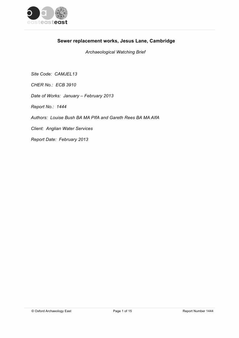
APPENDIX A. OASIS REPORT FORM
All fields are required unless they are not applicable.
Project DetailsOASIS Number
Project Name
Project Dates (fieldwork) Start Finish
Previous Work (by OA East) Future Work
Project Reference CodesSite Code Planning App. No.
HER No. Related HER/OASIS No.
Type of Project/Techniques UsedPrompt
Please select all techniques used:
Monument Types/Significant Finds & Their Periods List feature types using the NMR Monument Type Thesaurus and significant finds using the MDA Object type Thesaurus together with their respective periods. If no features/finds were found, please state “none”.
Monument Period Object Period
Project Location
County Site Address (including postcode if possible)
District
Parish
HER
Study Area National Grid Reference
© Oxford Archaeology East Page 14 of 15 Report Number 1444
Jesus LaneCambridgeCB5
None Select period...
Select period...
Select period...
08-02-2013
CAMJEL13
ECB 3910
No Yes
oxfordar3-144548
Sewer replacement works, Jesus Lane, Cambridge
Select Prompt (this should be in your brief/spec)...
cambridg1-38502
08-01-2013
Cambridgeshire
TL 4510 5882
Select period...
Select period...
Select period...
None
Cambridge City
Cambridge
CCC Store
Linear
Field Observation (periodic visits) Part Excavation Salvage Record
Full Excavation (100%) Part Survey Systematic Field Walking
Full Survey Recorded Observation Systematic Metal Detector Survey
Geophysical Survey Remote Operated Vehicle Survey Test Pit Survey
Open-Area Excavation Salvage Excavation Watching Brief
Project Originators
Organisation
Project Brief Originator
Project Design Originator
Project Manager
Supervisor
Project Archives
Physical Archive Digital Archive Paper Archive
Archive Contents/Media
PhysicalContents
DigitalContents
PaperContents
Digital Media Paper Media
Animal Bones
Ceramics
Environmental
Glass
Human Bones
Industrial
Leather
Metal
Stratigraphic
Survey
Textiles
Wood
Worked Bone
Worked Stone/Lithic
None
Other
Notes:
© Oxford Archaeology East Page 15 of 15 Report Number 1444
CCC Store OA East CCC Store
CAMJEL13 CAMJEL13 CAMJEL13
OA EAST
-
James Drummond-Murray
Louise Bush and Gareth Rees
Database
GIS
Geophysics
Images
Illustrations
Moving Image
Spreadsheets
Survey
Text
Virtual Reality
Aerial Photos
Context Sheet
Correspondence
Diary
Drawing
Manuscript
Map
Matrices
Microfilm
Misc.
Research/Notes
Photos
Plans
Report
Sections
Survey
Andy Thomas

Lincoln
Oxford
Norwich
Cambridge
Ipswich
London
Site Location
Site Location
258500 258500
259000 259000
259500 259500
5445
0054
4500
5450
0054
5000
5455
0054
5500
5460
0054
6000
Contains Ordnance Survey data © Crown copyright and database right 2013
0 500 m
Figure 1: Site location
Site Location

Jesu
sLa
ne
Malcom Street
ManorStreet
Jesu
s C
olle
ge
Sid
ney
Sus
sex
Col
lege
Chr
ist’s
Pie
ces
Park Street
Low
erP
ark
Str
eet
Bridge Stre
etRound
Churc
hSt
reet
Trinity Street
Kin
gS
tree
t
Sidney Streeet
EC
B16
27
EC
B16
74
EC
B29
77
EC
B35
44
EC
B36
19
EC
B13
00
EC
B21
62
EC
B18
19
EC
B11
54
EC
B96
6E
CB
1410
EC
B16
76
EC
B10
98
EC
B11
36
EC
B16
28
EC
B16
56
EC
B16
74
EC
B16
75E
CB
1676
EC
B15
95
EC
B16
80
EC
B16
80
EC
B16
80
EC
B31
13
EC
B25
13
EC
B25
44
EC
B23
52
EC
B20
07
EC
B35
44
EC
B37
8904
795
0479
5A
0480
4
0483
7
0500
4b05
004c
0519
4
CB
1531
0
0460
6
0460
804
608a
0466
0
0500
4
1189
0
0475
8
0495
0
0477
0
MC
B15
990
0480
2
0527
505
275a
0527
5b
0527
5c
1130
7
0468
7A10
358
CB
1551
3
CB
1572
7
0452
5
0452
6
0453
9
0454
1
0454
6
0456
7
0460
2
0460
4
0463
804
687
0475
6
0478
4
0478
5
0488
8
0500
4a
0494
9M
CB
1590
0
MC
B17
480
MC
B19
458
MC
B19
600
1036
2
MC
B18
192 M
CB
1819
3M
CB
1819
4
MC
B18
202
MC
B18
203
MC
B18
204
MC
B18
205
MC
B18
268
0798
3
0443
4
MC
B18
196
MC
B17
328
Key
Mon
umen
t poi
ntA
rcha
eolo
gica
leve
nt-
(are
a)-
(line
)-
(poi
nt)
Fig
ure
2: H
ER
rec
ords
men
tione
d in
the
text
© Oxford Archaeology East Report Number 1444

Figure 3: Richard Lyne Map, 1574
© Oxford Archaeology East Report Number 1444

Fig
ure
4: G
eorg
e B
raun
Map
, 157
5
© Oxford Archaeology East Report Number 1444

Figure 5: William Smith Map, 1588
© Oxford Archaeology East Report Number 1444

Figure 5: John Speed Map, 1610
© Oxford Archaeology East Report Number 1444

Figure 7: David Loggan Map 1688
© Oxford Archaeology East Report Number 1444

Fig
ure
8: M
ap o
f Cam
brid
ge 1
763
© Oxford Archaeology East Report Number 1444

Fig
ure
9:W
illia
m C
usta
nce
Map
179
8
© Oxford Archaeology East Report Number 1444

Figure 10: Cole Map, 1804
© Oxford Archaeology East Report Number 1444

Fig
ure
11: R
icha
rd G
rey
Bak
er M
ap, 1
830
© Oxford Archaeology East Report Number 1444

Fig
ure
12:J
. Dew
hurs
t and
W. N
icho
l Map
, 184
0
© Oxford Archaeology East Report Number 1444

Fig
ure
13: F
irst E
ditio
n O
rdna
nce
Sur
vey
Map
, 188
6
© Oxford Archaeology East Report Number 1444

Fig
ure
14: 1
926
Ord
nanc
e S
urve
y M
ap
© Oxford Archaeology East Report Number 1444

Plate 2: Ground works using a cassion
Plate 1: Initial ground investigation (looking west)
© Oxford Archaeology East Report Number 1444

Di rec to r : Dav id Jenn ings , BA MIFA FSA
Oxfo rd Archaeo logy L td i s a
P r i va te L im i ted Company , N o : 1618597
and a Reg i s te red Char i t y , N o : 285627
OA Nor t hMi l l 3Moor LaneLancas te r LA1 1GF
t : +44 ( 0 ) 1524 541 000f : +44 ( 0 ) 1524 848 606e : oanor th@thehuman jou r ney .netw:h t tp : / / thehuman jou r ney .net
Head Of f ice/Reg i s te red Of f ice/OA Sou th
Janus HouseOsney MeadOxfo rd OX2 0ES
t : +44 ( 0 ) 1865 263 800f : +44 (0 )1865 793 496e : in fo@ox fo rdarch .co .ukw:h t tp : / / thehuman jou rney .ne t
OA Eas t
15 Tra fa lga r WayBar H i l lCambr idgesh i reCB23 8SQ
t : +44 (0 )1223 850500f : +44 (0 )1223 850599e : oaeas t@thehuman jou r ney .netw:h t tp : / / thehuman jou r ney .net