Embed Size (px)
Citation preview

Saturna Island Local Trust CommitteeRegular Meeting Agenda
Date: April 20, 2017Time: 12:30 pmLocation: Saturna Recreation and Cultural Centre
104 Harris Road, Saturna Island, BC
Pages
1. CALL TO ORDER 12:30 PM - 12:35 PM
2. APPROVAL OF AGENDA
3. TOWN HALL AND QUESTIONS
4. COMMUNITY INFORMATION MEETING
none
5. PUBLIC HEARING
none
6. MINUTES
6.1 Local Trust Committee Minutes Dated February 17, 2017 (for Adoption) 3 - 9
6.2 Section 26 Resolutions-without-meeting Reportnone
6.3 Advisory Planning Commission Minutes Dated
none
7. BUSINESS ARISING FROM THE MINUTES
7.1 Follow-up Action List Dated April 2017 10 - 10
8. DELEGATIONS
none
9. CORRESPONDENCE
Correspondence received concerning current applications or projects is posted to theLTC webpage
none
1

10. APPLICATIONS AND REFERRALS
10.1 North Pender Island Local Trust Committee Bylaws No. 209 & 210 Referral 11 - 13
(for response)
11. LOCAL TRUST COMMITTEE PROJECTS 1:00 PM - 2:30 PM
11.1 Land Use Bylaw Technical Review – Staff Report 14 - 81
12. REPORTS
12.1 Work Program Reports (attached)12.1.1 Top Priorities Report dated April 2017 82 - 8212.1.2 Projects List Report Dated April 2017 83 - 83
12.2 Applications Report Dated April 2017 (attached) 84 - 85
12.3 Trustee and Local Expense Report Dated February 2017 (attached) 86 - 86
12.4 Adopted Policies and Standing Resolutions (attached) 87 - 88
12.5 Local Trust Committee Webpage
12.6 Chair's Report
12.7 Trustee Report
12.8 Trust Fund Board Report Dated February 2017 and April 2017 89 - 92
13. NEW BUSINESS 2:30 PM - 3:00 PM
13.1 CRD Gulf Islands Regional Trail Plan Open House - Letter of Invitation 93 - 99
14. UPCOMING MEETINGS
14.1 Next Regular Meeting Scheduled for June 15, 2017, at the Recreation &Cultural Hall, Saturna Island
15. TOWN HALL
16. CLOSED MEETING
none
17. ADJOURNMENT 3:00 PM - 3:00 PM
2

Saturna Island Local Trust Committee Minutes of a Regular Meeting February 17, 2017 DRAFT Page 1 of 7
Saturna Island Local Trust Committee
Minutes of Regular Meeting Date: Location:
February 17, 2017 Saturna Island Community Hall 105 East Point Road, Saturna Island, BC
Members Present George Grams, Chair
Paul Brent, Local Trustee Lee Middleton, Local Trustee
Staff Present Robert Kojima, Regional Planning Manager
Gary Richardson, Island Planner Russ Hotsenpiller, Chief Administrative Officer Fiona Macraild, Senior Intergovernmental Policy Advisor Sandy Nelson, Recorder
Others Present: Approximately 20 members of the public. 1. CALL TO ORDER
Chair Grams called the meeting to order at 12:35 pm. He acknowledged that the meeting was being held in traditional territory of the Coast Salish First Nations.
2. APPROVAL OF AGENDA
By general consent the agenda was approved as presented.
3. TOWN HALL AND QUESTIONS
John Hutchinson requested a response regarding why the Tsawout First Nations turned down the offer of free signage. Fiona Macraild answered that this has not been refused outright, and it may be considered after their elections.
Priscilla Ewbank asked if there would be discussion re: groundwater and private wells. Chair Grams replied this would be clarified later in the meeting. She also enquired about density transfer mechanisms, specifically, from where donor land would come, and questioned if there will be a map for planning.
Morgan Yates stated for the record, that he would like to take the opportunity to express thanks to Chair George Grams and Trustees Middleton and Brent for the excellent beginning with First Nations Relationship building on Saturna.
Chair Grams confirmed there would be time for questions later in the meeting.in response to an inquiry from Janet Land regarding clarification on the density transfer application
DRAFT
Local Trust Committee
Minutes Subject to Approval By
the Local Trust Committee
3

Saturna Island Local Trust Committee Minutes of a Regular Meeting February 17, 2017 DRAFT Page 2 of 7
4. COMMUNITY INFORMATION MEETING
none
5. PUBLIC HEARING
none
6. MINUTES
6.1 Adopted Local Trust Committee Minutes Dated October 20, 2016 (for information)
By general consent the Local Trust Committee meeting minutes of. Oct 20th were adopted.
6.2 Section 26 Resolutions-without-meeting Report Dated February 2017 6.3 Advisory Planning Commission Minutes (for Receipt)
none
7. BUSINESS ARISING FROM THE MINUTES
7.1 Follow-up Action List Dated February 2017
Planner Richardson updated that there was no update for the meeting today regarding the Robert Kos variance application for a retaining wall and there will be follow up for the April LTC meeting.
Trustee Middleton reported that the Saturna LTC was successful in receiving phase one of funding for Community to Community, and he enquired as to the next step. Fiona Macraild advised that the funding would expire at the end of March 2017; and as no funds have been distributed she recommended that we allow it to lapse and request new funding, thereby extending the timeline an additional year.
8. DELEGATIONS
none
9. CORRESPONDENCE
Correspondence received concerning current applications or projects is posted to the LTC webpage none
10. APPLICATIONS AND REFERRALS
4

Saturna Island Local Trust Committee Minutes of a Regular Meeting February 17, 2017 DRAFT Page 3 of 7
10.1 SA-RZ-2012.1 (Nepenthe Holdings Ltd.) - Staff Report
Gary Richardson, Island Planner, reviewed the report and application and commented that the density cap within the Official Community Plan (OCP) is the roadblock because recipient and donor areas were not specified, making it difficult to analyze. In 1971, three houses were permitted, on that property, and they cannot be subdivided. The applicant, Alan R. Peretz, was advised that densities must be found that could be transferred to Nepenthe Holdings, so as not to increase overall density on the island. Planner Richardson recommended that a pilot project be pursued, with follow-up in April. Trustee Middleton suggested an explanation of the land density bylaw process. Robert Kojima, Regional Planning Manager, described how it would work. If it gets first reading a Community Information meeting is held for second, third reading. It was noted the applicant is in attendance and he approves. Trustees Middleton and Brent re-iterated that the community appreciates this process. In response to a comment that density transfer has happened on Saturna previously, Priscilla Ewbank mentioned that density transfer is still an issue in our community, and that it would help to have maps and more clarity. Chair Grams confirmed that this is what is planned. Morgan Yates thanked the chair for his explanation, thanked the applicant for his patience, and agreed that the pilot is necessary. John Hutchinson commented that the density issue is a long-term issue and agrees we should deal with this issue now.
SA-2017-01 It was MOVED and SECONDED that the Saturna Island Local Trust Committee direct staff to prepare a report and draft bylaws regarding the proposed transfer of two subdivision densities to Lot 3, Section 18, Plan 11979, except part in Plan 17076, Saturna Island.
CARRIED
11. LOCAL TRUST COMMITTEE PROJECTS
11.1 First Nations Relationship Building Project Charter - Staff Report
Fiona Macraild, Senior Intergovernmental Policy Advisor, thanked the chair and gave a summary of the staff report, explaining the reasons for moving forward with relationship building. She provided a printed Power Point presentation as a handout and briefly discussed the contents. Fiona presented a list of First Nations websites and encouraged the audience to seek them out. Currently, there are 27 active First Nations initiatives, local and trust related. The event held on Saturna last November was attended well, by approximately 100 local residents. Fiona noted that the Indian Act has a 2 year election cycle, meaning that as this is a busy time, and decisions take longer, but the gesture of a free sign is appreciated.
5

Saturna Island Local Trust Committee Minutes of a Regular Meeting February 17, 2017 DRAFT Page 4 of 7
John Hutchinson commented about Fiona's explanation about turning down the offer of the sign and suggested an explanation be added to the Project Charter for First Nations, so as not to be as abrupt sounding. Sea-to-Sea funding requires that meetings are held with elected officials, and Fiona suggested that this initiative move forward over the next 12-18 months. She encouraged the Trustees to work with Parks and Recreation, and choose a locally managed place to present a First Nations shared narrative. It was suggested that the OCP be reviewed before the April LTC meeting and maps containing place names be made available. Fiona acknowledged that there is some hesitancy among island resident's regarding the First Nations and their history here, but she reminded us that this feeling has been the same for members of the First Nations for many years. Trustee Brent thanked staff for the report. Priscilla says she appreciates this initiative very much because tourists have commented that there is a lack of information regarding First Nations history on Saturna Island. She added that Parks and Recreation do not feel qualified to depict First Nations history and that this is not out of lack of respect. Fiona stated that we must continue sharing First Nation's knowledge emphasizing positive experiences. There was a comment from a Fog Alarm Building volunteer that Parks Canada wouldn’t allow First Nations commentary due to agreed protocol that all 19 bands must approve information for display panels. Fiona responded that there are 19 separate nations because of the BC treaty process. Trustee Middleton commented that in his opinion, the LTC has previously neglected to acknowledge local First Nations history, but that with the help of the council we can now demonstrate our very real intent and thank you to all community members, staff, fellow trustee and chair. Trustee Brent added that he hopes this is just the beginning of a good, long relationship with local First Nations. `` SA-2017-02 It was MOVED and SECONDED that the Saturna Island Local Trust Committee endorse the attached project charter to amend the Saturna Official Community Plan by integrating a First Nation narrative and place names within the OCP.
CARRIED
6

Saturna Island Local Trust Committee Minutes of a Regular Meeting February 17, 2017 DRAFT Page 5 of 7
SA-2017-03 It was MOVED and SECONDED that the Saturna Island Local Trust Committee request through the Electoral Director that the Local Parks and Recreation Commission of the Capital Regional District consider a site on Saturna Island for signage that reflects a place-based shared narrative of both the local First Nations and the settler history of the island.
CARRIED 12. REPORTS
12.1 Work Program Reports (attached)
12.1.1 Top Priorities Report dated February 2017 Current items on the list were discussed. Trustee Brent and Middleton agree that there is now an opportunity to pursue Density transfer mechanisms.
12.1.2 Projects List Report Dated February 2017
For information
12.2 Applications Report Dated February 2017 (attached)
No comments
12.3 Trustee and Local Expense Report Dated December 2016 (attached)
No comments
12.4 Adopted Policies and Standing Resolutions (attached)
For information
12.5 Local Trust Committee Webpage
No comments
12.6 Chair's Report
Chair Grams commented on Salt Spring Island's governance. There will be no referendum before the May provincial election, and likely no decision made until July 2017 or later. He also updated that Golder Associates is currently mapping groundwater on Salt Spring, with plans to expand this to other Gulf Islands. CAO Hotsenpiller anticipates the budget will approve this new 'pan-Trust' position.
7

Saturna Island Local Trust Committee Minutes of a Regular Meeting February 17, 2017 DRAFT Page 6 of 7
12.7 Trustee Report Trustee Brent reported on the selection committee for the Victoria office location. He suggested the possibility of a satellite office in Sidney. Trustee Brent recently attended a Local Planning Committee meeting in Ladysmith, where he noted the Islands Trust and Capital Regional District are working together on a housing needs assessment, with initial focus on the Southern Gulf Islands. Trustee Middleton discussed the Parks Advisory Board and the issue with the reconciliation process with local First Nations. The question is how to approach reconciliation, management, and construction of potential visitor's facilities. The community noted the following concerns: that the parks board does not have a voice, and that the employment agreement at the time of the Gulf Islands Park Reserve creation is not being upheld.
12.8 Trust Fund Board Report
none
13. NEW BUSINESS
13.1 Provincial Private Moorage Policy Update - Staff Memo
Regional Planning Manager Kojima reviewed The Ministry of Forest, Lands and Natural Resource Operations (FLNRO) general permission requirements for private moorage. He explained that Saturna still requires a planner to approve private moorage as this policy update does not include Saturna. Russ Hotsenpiller explained further that FLNRO no longer requires that a license be required for applicable areas.
14. UPCOMING MEETINGS
14.1 Next Regular Meeting Scheduled for April 20, 2017, at 12:30 pm, at the Recreation & Cultural Centre, Saturna Island
15. TOWN HALL
John Hutchison stated that he understands there are complex First Nation issues, for example, approving new signage, and he supports the process now in place. Alan Sewell mentioned that perhaps doing nothing is an alternative until the local First Nation bands reconciles their internal differences, so as not to offend. He suggests that perhaps a complete history of all settlers on Saturna Island would be worthwhile.
16. CLOSED MEETING (Distributed Under Separate Cover)
16.1 Motion to Close the Meeting
8

Saturna Island Local Trust Committee Minutes of a Regular Meeting February 17, 2017 DRAFT Page 7 of 7
SA-2017-04
It was MOVED and SECONDED that the meeting be closed to the public in accordance with the Community Charter, Part 4, Division 3, s. 90(1) (a & d) for the purpose of considering:
Adoption of In-Camera Meeting Minutes Dated September 16, 2016,
Appointment of APC Members AND that the recorder and staff attend the meeting.
CARRIED
16.2 Recall to Order 16.3 Rise and Report
It was reported that there have been resignations on the APC and vacancies will be considered by staff, it was questioned as to whether previous applicants are still interested.
Russ Hotsenpiller, Chief Administrative Officer, introduced himself and addressed the meeting. He described his experiences and interests within the islands, and that he is looking forward to working with everyone.
17. ADJOURNMENT
By general consent the meeting was adjourned at 2:30 pm.
_________________________ George Grams, Chair Certified Correct: _________________________ Sandy Nelson, Recorder
9

Print Date: April 13, 2017
Follow Up Action Report
Saturna Island
Target DateActivity StatusResponsibility
16-Sep-2016
SA-DVP-2016.1 (Henry) - LTC consideration delayed until screening is provided. On GoingGary Richardson
Target DateActivity StatusResponsibility
17-Feb-2017
LTC Minutes of October 20, 2016 adopted as drafted. DoneRegina Robinson
SA-RZ-2012.1 (Napenthe Holdings Ltd) - Staff to prepare draft bylaw(s) and staff
report for June LTC Mtg.
DoneGary Richardson
First Nations Relationship building project charter to be updated with endorsement
date and resolution number and place on the web site.
DoneRegina Robinson
Staff to request through the Electoral Area Director that the local Parks and Rec
Commission consider a site on Saturna Island for signage that reflects a place base
d narrative of both the First Nations and the settler history of the island.
DoneGary Richardson
Page 1 of 110

PLEASE TURN OVER u:\local trust committees\north pender\bylaws\referrals\bls no. 206, 207, 208, 209, 210\bl 209 & 210\bylaws 209 & 210 referral.doc
BYLAW REFERRAL FORM
Suite 200, 1627 Fort Street Victoria, B.C. BC V8R 1H8
Ph: (250) 405-5151 Fax: (250) 405-5155
[email protected] www.islandstrust.bc.ca
Island: North Pender Island Local Trust Area Bylaws No.: 209 & 210 Date: February 9, 2017
You are requested to comment on the attached Bylaw for potential effect on your agency's interests. We would appreciate your response within 30 days. If no response is received within that time, it will be assumed that your agency's interests are unaffected.
APPLICANTS NAME / ADDRESS:
Lloyd Eakins c/o Mill Bay Marine Group, 740 Handy Road, Mill Bay, BC V0R 2P1
PURPOSE OF BYLAW:
The purpose of Bylaw 209 is to amend the North Pender Island Official Community Plan to re-designate a portion of Lot 3, Plan 7982, except Part in Plan 21227 and 1772RW from Community Service – CS to Rural – R. The change will allow the relocation
of existing septic infrastructure for sewage generated on Lot A (DD G54184), Section 11, Plan 7982 to be re-located on the same portion of the subject property. The purpose of Bylaw 210 is to amend the North Pender Island Land Use Bylaw to: rezone a portion of Lot 3, Plan 7982, except Part in Plan 21227 and 1772RW from Service Zone (a) (SD(a)) and Rural (R) to Rural (d) (R9d)); and, to rezone Lot 4, Plan 7982 from Rural (R) to Rural (d) (R9d)). The bylaw is a technical amendment allow the relocation of existing septic
infrastructure for sewage generated on Lot A (DD G54184), Section 11, Plan 7982 to be re-located on the two properties. Professional reports and staff reports are available on the North Pender island webpage: http://www.islandstrust.bc.ca/islands/local-trust-areas/north-pender/current-applications/
GENERAL LOCATION:
North Pender Island Local Trust Area
LEGAL DESCRIPTION:
Lot 3, Section 11, Pender Island, Plan 7982 except Part in Plan 21227 and 1772RW and Lot 4, Section 11, Pender Island, Plan 7982
SIZE OF PROPERTY AFFECTED: ALR STATUS: OFFICIAL COMMUNITY PLAN DESIGNATION:
(portion) Lot 3, Plan 7982 – 1.38 ha (3.14 ac) Lot 4, Plan 7982 - 0.99 ha (2.44 ac)
N/A Community Service – CS and Rural - R
OTHER INFORMATION:
Additional information, including the current bylaws, is available at: http://www.islandstrust.bc.ca/islands/local-trust-areas/north-pender/current-applications/
Please fill out the Response Summary on the back of this form. If your agency's interests are "Unaffected", no further information is necessary. In all other cases, we would appreciate receiving additional information to substantiate your position and, if necessary, outline any conditions related to your position. Please note any legislation or official government policy which would affect our consideration of this Bylaw.
Name: Justine Starke
(Signature) Title: Island Planner
Contact Info Tel: 250-405-5189 Email: [email protected]
11

u:\local trust committees\north pender\bylaws\referrals\bls no. 206, 207, 208, 209, 210\bl 209 & 210\bylaws 209 & 210 referral.doc
This referral has been sent to the following agencies:
Federal Agencies
N/A
Regional Agencies
Capital Regional District – Electoral Area Director Capital Regional District – Building Inspection Capital Regional District – Infrastructure Engineering Island Health North Pender Island Fire Rescue
Provincial Agencies
Ministry of Community, Sport and Cultural Development Ministry of Forest, Lands & Natural Resource Operations -- Archaeology Branch Ministry of Transportation and Infrastructure
Adjacent Local Trust Committees and Municipalities
Mayne Island Local Trust Committee Saturna Island Local Trust Committee South Pender Island Local Trust Committee Salt Spring Island Local Trust Committee
Non-Agency Referrals
Islands Trust – Bylaw Enforcement
First Nations
Cowichan Tribes Halalt First Nation Lake Cowichan First Nation Lyackson First Nation Malahat First Nation - TE’Mexs Treaty Association Pauquachin First Nation Penelakut Tribe Semiahmoo First Nation Stz’uminus First Nation Tsartlip First Nation Tsawout First Nation Tsawwassen First Nation Tseycum First Nation
12

u:\local trust committees\north pender\bylaws\referrals\bls no. 206, 207, 208, 209, 210\bl 209 & 210\bylaws 209 & 210 referral.doc
BYLAW REFERRAL FORM RESPONSE SUMMARY
Approval Recommended for Reasons Outlined Below
Approval Recommended Subject to Conditions Outlined Below
Interests Unaffected by Bylaw
Approval Not Recommended Due to Reason Outlined Below
North Pender Island Local Trust Area 209 & 210
(Island) (Bylaw Number)
(Signature) (Name and Title)
(Date) (Agency)
13

STAFF REPORT
U:\LOCAL TRUST COMMITTEES\Saturna\Projects\2016-2017 LUB Technical Review\Staff Reports\Staff Report Apr 2017.docx
Islands Trust Staff Report 1
File No.: File Number: 6500-20-LUB Technical Review
DATE OF MEETING: April 20, 2017
TO: Saturna Island Local Trust Committee
FROM: Gary Richardson, Island Planner
Southern Team
SUBJECT: Saturna Land Use Bylaw - Technical Review
RECOMMENDATION
1. That the Saturna Island Local Trust Committee review the attached staff report containing recommended LUB amendments and provide staff direction on each proposed amendment
REPORT SUMMARY
The review and update of the Land Use Bylaw (LUB) is a top priority project of the Saturna Island Local Trust Committee (LTC). This report provides comments on recommended amendments to the LUB based on a review carried out by staff and legal counsel.
BACKGROUND
A project charter was endorsed at the October 20, 2016 LTC meeting.
The LUB has not been reviewed in its entirety since it was adopted on November 14, 2002. The LTC made the
review of the LUB a top work program priority at its September 16, 2016 LTC meeting. Clear regulations assist
the LTC, planning staff and the public in understanding how LUB regulations apply to the Saturna Island Planning
area. Staff and legal counsel have reviewed the existing LUB and have prepared a list of recommended
revisions, additions, or deletions of a technical nature.
The recommended amendments include:
Revising or removal of out-of-date references
Revisions for clarity, correctness, and consistency
Changes to regulations that exceed the LTC’s jurisdiction
Revisions to regulations that are inconsistent with recent case law
Review of definitions
14

Islands Trust Staff Report 2
Any amendments that involve substantive policy changes identified as part of the technical will be itemized and set aside for future consideration as a separate project(s) for the LTC to consider.
An LUB showing recommended amendments is attached for the LTCs consideration.
ANALYSIS
Many of the amendments being recommended are of a general nature and should require little discussion; however others are of a more complex nature and may have a more significant impact on land use. The simple amendments that have little or no impact are identified in the draft LUB attached; some have comments in the margin explaining the reason for the amendment. The more complex amendments are identified in the draft LUB and also discussed below. It is recommended that before amendments are made to specific properties that amend land use that the property owner be consulted prior to proceeding with the amendment.
1. Food Bus Temporary Use - A temporary use permit was issued for a Food Bus/Café in 2012 and renewed for 3 years in 2015. The TUP applies to a portion of Lot B, Section 18, Plan 20198. The remainder of the lot is used for residential purposes and contains a dwelling. There are no known complaints or concerns associated with the use since it started in 2012. Staff is recommending that the LTC consider amending the zoning on the portion of Lot B that is used for commercial activity by the Café. If the LTC considers amending the zone to an appropriate commercial zone the property owner and business operator should be contacted prior to an amendment proceeding to determine if they are in support of the proposed amendment. Zoning cannot contain as detailed conditions as a temporary use permit does; however the zone could be drafted in a way to allow the existing use to carry on in a similar fashion.
2. Campground Temporary Use – a temporary use permit was issued for a small campground for three years on Lot A, Section 18, plan VIP75287 (100 East Point Road). The small campground is on an industrial zoned portion of land between the community hall and the fuel tanks by the public dock. There are no known complaints or concerns associated with the use since it started in 2016. It is recommended that the LTC consider amending the zoning to allow campgrounds on a limited basis as a permitted use on Lot A.
3. Industrial Zoned Property – the industrial zoned property listed in number two above contains uses that are not clearly permitted in the land-use bylaw for that zone. As the list of industrial uses is quite broad and any other uses that are added of a retail nature will likely have less of an impact on the surrounding area it seems reasonable to allow them provided there is sufficient parking. Staff is recommending that further research be done to determine the types of uses that are be carried out on Lot A and prepare a report for the Local Trust Committee identifying those uses and if appropriate recommending the be added to the permitted uses in the zoning for this lot.
4. Lighthouse Pub building – the pub building, Lot A Section 18, plan VIP75287, is in the CRA zone. The CRA zone only allows retail use if it is accessory to a: visitor accommodation use, restaurant use or neighbourhood pub use. Retail use should be permitted as an outright permitted use so that doesn’t have to be accessory to one of the other permitted uses.
15

Islands Trust Staff Report 3
5. House on Lot by the Pub – the house next to the pub on Lot B section 18, plan VIP75287 is on a lot zoned CRA. Lot B was originally on the property associated with the pub and was likely built as the permitted caretaker’s house. Now that is has been subdivided and is on a separate lot it is recommended that the zoning be amended to an appropriate residential zone.
6. Derelict automobiles – there is no restriction on the number of derelict automobiles in the LUB. This is a common restriction as there are often properties on an island with large collections of uninsured, unscreened, derelict automobiles. This can be both an environmental hazard and a visual problem and often will lead to an unsightly premises complaint from surrounding property owners. Without specific wording in the LUB addressing numbers of permitted uninsured vehicles the bylaw enforcement officer has no ability to enforce if a complaint is received. Staff is recommending that wording be put in the land use bylaw to address numbers of derelict automobiles permitted on a lot.
7. Saturna Ecological Education Centre (SEEC School) – the school is presently operating on portion of a residential property. A site specific zoning or additional uses added to the existing zoning addressing the school use would be beneficial if the school is to be expanded or altered future. Also it would be appropriate to recognize the school use and its associated buildings and structures in zoning. It is recommended that the property owner be contacted to discuss a proposed amendment that recognizes the school and zoning. If this amendment proceeds staff will prepare a further report.
8. National Park Reserve – properties within the national park reserve still remain in the zones that applied to the properties before the park reserve was created. Staff is recommending that the zoning on the park reserve lands be amended to reflect the present use of the lands.
9. Density Clustering– there are sections in the bylaw, section 2.12 section 12.3 and others, that provide for the transfer of residential density and the transfer of subdivision within split zoned lots that contain areas in the Watershed, Farmland or Forest designations. The sections that enable these transfers to take place require clarification as to how this is to take place and whether or not it is optional or a requirement that density be transferred.
There is planning rationale for transfers like this to be supported as taking the density off of land that is less suitable for development and allowing it to be transferred to zones where development is more appropriate is beneficial. It is recommended that any sections dealing with development transfer be put under one heading in the LUB and that the wording be clarified so that it is clear how the mechanism is to be used. If this amendment proceeds staff will prepare a further report containing recommended wording.
10. Setbacks from the Sea – the present wording of the LUB allows structures to be sited within the setback from the sea. It is recommended that the LUB be amended to only allow certain structures within the setback of the sea with restrictions being put on siting and height. If the LTC directs staff to proceed with this amendment a further report will be prepared outlining the types of structures that might reasonably be permitted in the setback from the sea.
It should be noted that some of the amendments being proposed in this LUB review may make some buildings and structures nonconforming.
16

Islands Trust Staff Report 4
In some cases the amendments being proposed will generate consequential OCP amendments this will be addressed in future staff reports once it is determined which LUB amendments are proceeding.
NEXT STEPS
1. Once direction is given as to which amendments the LTC is proceeding with staff will incorporate the simple ones into an amending bylaw and provide further staff reports for the more complex amendments that require more research.
2. Community consultation should be scheduled in July or September to obtain public comment of on the proposed changes.
Submitted By: Gary Richardson
Island Planner April 12, 2017
Concurrence: Robert Kojima
Regional Planning Manager
April 12, 2017
ATTACHMENTS
1. Draft Land Use Bylaw containing recommended amendments dated April 11, 2017
17

SATURNA ISLAND LOCAL TRUST COMMITTEE
LAND USE BYLAW NO. 78, 2002
AS AMENDED BY SATURNA ISLAND LOCAL TRUST COMMITTEE BYLAWS: 76, 79, 81, 82, 89, 91, 94, 95, 96, 99, 100, 108 and 110
NOTE: This Bylaw is consolidated for convenience only and is not to be construed as a legal document.
Certified copies of the Land Use Bylaw are available from the Islands Trust Office, 200 - 1627 Fort Street, Victoria, B.C. V8R 1H8
Consolidated April 25, 2013
LAND USE BYLAW REVIEW
COMMENTS PROVIDED FOR
DISCUSION PURPOSES ONLY
First Draft
April 11, 2017
18

This copy is consolidated for convenience only and includes the following text amendments only: Bylaw Number Amendment Number Adoption Date Bylaw No. 76 Amendment No. 2, 2002 February 18, 2004 Bylaw No. 79 Amendment No. 3, 2002 December 15, 2003 Bylaw No. 81 Amendment No. 1, 2003 June 18, 2003 Bylaw No. 82 Amendment No. 2, 2003 August 31, 2005 Bylaw No. 89 Amendment No. 1, 2005 August 31, 2005 Bylaw No. 91 Amendment No. 1, 2007 February 20, 2008 Bylaw No. 94 Amendment No. 2, 2008 November 12, 2008 Bylaw No. 95 Amendment No. 3, 2008 December 8, 2008 Bylaw No. 96 Amendment No. 4, 2008 November 12, 2008 Bylaw No. 99 Amendment No. 1, 2009 September 15, 2010 Bylaw No. 100 Amendment No. 1, 2010 September 15, 2010 Bylaw No. 108 Amendment No. 1, 2012 November 8, 2012 Bylaw No. 110 Amendment No. 2, 2012 April 18, 2012
19

i
TABLE OF CONTENTS
Page
PART 1 .......................................................................................................................................................... 1 ADMINISTRATION .................................................................................................................................... 1
1.1 Compliance ................................................................................................................................. 1 1.2 Violation ....................................................................................................................................... 1 1.3 Penalty ........................................................................................................................................ 1 1.4 Inspection and Enforcement ..................................................................................................... 21 1.5 Severability ................................................................................................................................ 32 1.6 Metric Units of Measurement .................................................................................................... 32 1.7 Numbering ................................................................................................................................. 32
PART 2 ........................................................................................................................................................ 43 GENERAL REGULATIONS ..................................................................................................................... 43
2.1 Uses Permitted in any Zone ...................................................................................................... 43 2.2 Prohibited Uses ......................................................................................................................... 43 2.3 General Height Regulations ...................................................................................................... 43 2.4 Accessory Buildings .................................................................................................................. 54 2.5 Setbacks from Watercourses and Natural Boundaries ............................................................. 54 2.6 Setbacks between Cottages and Other Residences ................................................................ 54 2.7 Covenants Against Buildings and Subdivision .......................................................................... 54 2.8 Enforcement of Siting Regulations - Other Permits .................................................................. 65 2.9 Non-conforming Use ................................................................................................................. 65 2.10 Provisional Residence while Constructing ............................................................................. 65 2.11 Cottages ................................................................................................................................ 65 2.12 Determination of Residential Density - Lots in More than One Zone .................................... 65 2.13 Use of Common Property ...................................................................................................... 76 2.14 Use of Crown Foreshore ....................................................................................................... 76 2.15 Measurements of Setbacks ................................................................................................... 76 2.16 Home Occupation Regulations .............................................................................................. 76 2.17 Home Based Industry Regulations ........................................................................................ 97 2.18 Water Storage ..................................................................................................................... 119
PART 3 .................................................................................................................................................... 1210 ESTABLISHMENT OF ZONES ........................................................................................................... 1210
3.1 Division Into Zones ................................................................................................................ 1210 3.2 Zone Boundaries ................................................................................................................... 1210
4. RURAL ZONING REGULATIONS .................................................................................................. 1412 4.1 RURAL RESIDENTIAL ZONE (RR) ......................................................................................... 1412
Permitted Uses ................................................................................................................................ 1412 Residential Site Density. .................................................................................................................. 1412 Lot Coverage .................................................................................................................................... 1412 Building Setbacks............................................................................................................................. 1412 Subdivision Lot Size Requirements ................................................................................................. 1513
4.2 RURAL GENERAL ZONE (RG) ................................................................................................ 1513 Permitted Uses ................................................................................................................................ 1513 Residential Site Density. .................................................................................................................. 1513 Lot Coverage .................................................................................................................................... 1513 Building Setbacks............................................................................................................................. 1614 Subdivision Lot Size Requirements ................................................................................................. 1614
4.3 RURAL AGRICULTURAL SALES ZONE (RAS) ...................................................................... 1614 Permitted Uses ................................................................................................................................ 1614 Site Density. ..................................................................................................................................... 1614 Building Setbacks............................................................................................................................. 1614 Subdivision Lot Size Requirements ................................................................................................. 1715
4.4 RURAL COMPREHENSIVE DEVELOPMENT ZONE (RCD) ................................................... 1715
20

ii
Permitted Uses ................................................................................................................................ 1715 Residential Site Density. .................................................................................................................. 1715 Building Setbacks............................................................................................................................. 1715 Subdivision Lot Size Requirements ................................................................................................. 1816
4.5 MULTIPLE FAMILY RESIDENTIAL ZONE (MFR) ................................................................... 1816 Permitted Uses ................................................................................................................................ 1816 Lot Coverage .................................................................................................................................... 1816 Setback Provisions .......................................................................................................................... 1816 Site Density ...................................................................................................................................... 1816 Subdivision Lot Size Requirements ................................................................................................. 1816
4.6 COMMUNITY SERVICES ZONE (CS) ..................................................................................... 1917 Permitted Uses ................................................................................................................................ 1917 Lot Coverage .................................................................................................................................... 1917 Setback Provisions .......................................................................................................................... 1917 Subdivision Lot Size Requirements ................................................................................................. 1917
4.7 PUBLIC UTILITIES ZONE (PU) ................................................................................................ 2018 Permitted Uses ................................................................................................................................ 2018 Lot Coverage .................................................................................................................................... 2018 Setback Provisions .......................................................................................................................... 2018 Subdivision Lot Size Requirements ................................................................................................. 2018
4.8 COMMUNITY PARK ZONE (CP) ............................................................................................ 2018 Permitted Uses ................................................................................................................................ 2118 Permitted Structures ........................................................................................................................ 2219
5. COMMERCIAL ZONING REGULATIONS ...................................................................................... 2320 5.1 COMMERCIAL RECREATION AND ACCOMODATION ZONE (CRA) ................................... 2320
Permitted Uses ................................................................................................................................ 2320 Lot Coverage .................................................................................................................................... 2320 Site Density ...................................................................................................................................... 2320 Building Setbacks............................................................................................................................. 2421 Subdivision Lot Size Requirements ................................................................................................. 2421
5.2 COMMERCIAL ZONE (C) ........................................................................................................ 2421 Permitted Uses ................................................................................................................................ 2421 Lot Coverage .................................................................................................................................... 2421 Building Setbacks............................................................................................................................. 2421 Residential Site Density ................................................................................................................... 2421 Subdivision Lot Size Requirements ................................................................................................. 2522
6 INDUSTRIAL ZONING REGULATIONS ......................................................................................... 2623 6.1 INDUSTRIAL STORAGE AND REPAIRS ZONE (ISR) ........................................................... 2623
Uses Permitted ................................................................................................................................ 2623 Height ............................................................................................................................................... 2623 Lot Coverage .................................................................................................................................... 2623 Building Setbacks............................................................................................................................. 2724 Subdivision Lot Size Requirements ................................................................................................. 2724
6.2 INDUSTRIAL COMPREHENSIVE ZONE (IC) .......................................................................... 2724 Permitted Uses ................................................................................................................................ 2724 Height ............................................................................................................................................... 2724 Lot Coverage .................................................................................................................................... 2724 Building Setbacks............................................................................................................................. 2724 Subdivision Lot Size Requirements ................................................................................................. 2825
7. FARMLAND ZONING REGULATIONS ........................................................................................... 2926 7.1 FARMLAND ZONE (F) ............................................................................................................. 2926
Permitted Uses ................................................................................................................................ 2926 Lot Size and Site Density ................................................................................................................. 2926 Building Setbacks............................................................................................................................. 2926 Special Building Setback .................................................................................................................. 2926
21

iii
Subdivision Lot Size Requirements ................................................................................................. 3026 7.2 FARM RESORT ZONE (F1) ..................................................................................................... 3027
Permitted Uses ................................................................................................................................ 3027 Height ............................................................................................................................................... 3027 Site Coverage .................................................................................................................................. 3027 Site Density ...................................................................................................................................... 3027 Siting of Uses, Buildings and Structures .......................................................................................... 3027 Site Area Restrictions....................................................................................................................... 3128 Subdivision Lot Size Requirements ................................................................................................. 3128
7.3 FARM RETREAT ZONE (F2) ................................................................................................... 3128 Permitted Uses ................................................................................................................................ 3128 Lot Coverage .................................................................................................................................... 3128 Site Density ...................................................................................................................................... 3128 Siting of Uses, Buildings and Structures .......................................................................................... 3229 Subdivision Lot Size Requirements ................................................................................................. 3229
8. WATERSHED ZONING REGULATIONS .................................................................................... 3330 8.1 WATERSHED ZONE (W) ......................................................................................................... 3330
Permitted Uses ................................................................................................................................ 3330 Buildings Setbacks ........................................................................................................................... 3330 Subdivision Lot Size Requirements ................................................................................................. 3330
9. FORESTLAND ZONING REGULATIONS ...................................................................................... 3431 9.1 FOREST RESERVE (FR) ZONE .............................................................................................. 3431
Permitted Uses ................................................................................................................................ 3431 Lot Size Requirements. .................................................................................................................... 3431
9.2 FOREST GENERAL ZONE (FG).............................................................................................. 3431 Permitted Uses ................................................................................................................................ 3431 Height ............................................................................................................................................... 3532 Building Setbacks............................................................................................................................. 3532 Site Density ...................................................................................................................................... 3532 Lot Size Requirements ..................................................................................................................... 3532
9.3 FOREST RESIDENTIAL ZONE (FR1) ..................................................................................... 3532 Permitted Uses ................................................................................................................................ 3532 Height ............................................................................................................................................... 3532 Building Setbacks............................................................................................................................. 3532 Site Density ...................................................................................................................................... 3532 Lot Size Requirements ..................................................................................................................... 3633
10. WILDERNESS RESERVE ZONING REGULATIONS ................................................................. 3734 10.1 WILDERNESS RESERVE (WR) ZONE ............................................................................... 3734
Uses Permitted ................................................................................................................................ 3734 Building Setbacks............................................................................................................................. 3734 Site Density ...................................................................................................................................... 3734 Lot Coverage .................................................................................................................................... 3734 Subdivision Lot Size Requirements ................................................................................................. 3734
11. WATER ZONING REGULATIONS .............................................................................................. 3835 11.1 WATER ZONE (WA) ............................................................................................................. 3835
Permitted Uses ................................................................................................................................ 3835 Setbacks of Floats and Wharves ..................................................................................................... 3835 Buildings Prohibited ......................................................................................................................... 3835 Commercial and Industrial Activity Prohibited .................................................................................. 3835 Site Specific Regulations ................................................................................................................. 3936
11.2 WATER HARVEST ZONE (WH) .......................................................................................... 3936 Permitted Uses ................................................................................................................................ 3936 Setbacks of Floats and Wharves ..................................................................................................... 3936 Permitted Buildings .......................................................................................................................... 4037
11.3 WATER GENERAL COMMERCIAL ZONE (WGC) ................................................................... 4037
22

iv
Permitted Uses ................................................................................................................................ 4037 Setbacks of Floats and Wharves ..................................................................................................... 4037
11.4 WATER PUBLIC UTILITY ZONE (WPU) ................................................................................... 4037 Permitted Uses ................................................................................................................................ 4037 Setbacks of Floats and Wharves ..................................................................................................... 4038
11.5 OPEN WATERS ZONE (WO)............................................................................................... 4138 Permitted Uses ................................................................................................................................ 4138
12. SUBDIVISION REGULATIONS ................................................................................................... 4239 Compliance with Minimum and Average Lot Area ........................................................................... 4239 Covenant Against Further Subdivision and Development................................................................ 4239 Undersized Parcels .......................................................................................................................... 4340 Parcel Size calculations ................................................................................................................... 4340 Lot Size Exemptions ........................................................................................................................ 4340 Lot Width .......................................................................................................................................... 4441 Panhandle Lots ................................................................................................................................ 4441 Lots in More than One Zone ............................................................................................................ 4441 Subdivision Capacity of Split Zoned Lots ......................................................................................... 4441
13. SIGN REGULATIONS.................................................................................................................. 4643 14. OFF STREET PARKING REGULATIONS .................................................................................. 4744
Off street parking ............................................................................................................................. 4744 15. INTERPRETATION ...................................................................................................................... 4946
Definitions ........................................................................................................................................ 4946 16. SHORT TITLE AND REPEAL ...................................................................................................... 5651
23

1
Saturna Island Local Trust Committee
Bylaw No. 78 ______________________________________________________________________________ A bylaw to regulate the use of land, buildings and structures, the subdivision of land, the provision of off street parking spaces, screening and landscaping, and the erection of signs in the Saturna Island Local Trust Area ______________________________________________________________________________ The Saturna Island Local Trust Committee, being the trust committee having jurisdiction on and in respect of the Saturna Island Local Trust Area under the Islands Trust Act, enacts as follows:
PART 1
ADMINISTRATION
1.1 Compliance
1.1.1 No person may use or permit any land, water surface, building or structure to be used or
occupied, or subdivide any land, except as permitted by this bylaw. 1.1.2 No person may construct, reconstruct, place, alter, extend or maintain any building,
structure or sign except as expressly permitted by this Bylaw. 1.1.3 Nothing contained in this Bylaw relieves any person from the responsibility to comply with
other legislation applicable to their undertaking their use of land, buildings or structures or the subdivision of land.
1.1.4 The use of land, building and structures that is lawful at the time of the adoption of this Bylaw, although not conforming to the provsions of this Bylaw may be continued subject to Section XXX of the Local Government Act.
1.1.5 Any existing lot that has less area than the minimum lot area specified in the applicable zone for the creation of lots by subdivision may be used for any use permitted in that zone unless otherwiae specified in this Bylaw.
1.1.6 No land may be subdivided, no building, structure or land may be used, and nobuilding or structure may be sited in a manner which renders the existing use, building or structure illegal or non-conforming.
1.2 Violation
1.2.1 Any person who does any act or thing or permits any act or thing to be done in
contravention of this Bylaw, or who neglects to do or refrains from doing any act or thing which is required to be done by any of the provisions of this Bylaw, is deemed to have violated provisions of this committed an offence under this Bylaw. Each day during which an offence against this Bylaw is continued is deemed to constitute a new and separate offence.
1.3 Penalty
1.3.1 Any person who violates any of the provisions of this Bylaw is, upon summary conviction,
liable to a penalty of not more that two thousand dollars ($2000.00) and the cost of prosecution. Each day that such violation continues, or is allowed it continue, constitutes a separate offense.
Comment [GR1]: The revisions in this section
incorporate wording from recent bylaws.
24

2
Any person who commits an offense against this Bylaw is liable, upon summary conviction, to a fine and penalty, pursuant to the Offense Act and the costs of prosecution.
1.4 Inspection and Enforcement
1.4.1 The Islands Trust Bylaw Investigations Enforcement Officer and any other officer of
person designated by the Islands Trust to administer this Bylaw who may be appointed, are is authorized to enter, at allany reasonable times, upon any property that is subject to subject to the provisions regulation under of this Bylaw, for the purpose of administering or enforcing this Bylaw. Inspecting and determining whether the regualtions, prohibitions and requirements are being met.
25

3
1.5 Severability
1.5.1 If any provision of this Bylaw is for any reason held to be invalid by the decision of any
court of competent jurisdiction, such decision shall not affect the validity of the remaining portions of this Bylaw.
1.6 Metric Units of Measurement
1.6.1 Metric dimensions are used in this Bylaw. Imperial equivalents provided are
approximate and for convenience only, and do not form part of this Bylaw.
1.7 Numbering
1.7.1 In the numbering system used in this Bylaw, the first number indicates parts of the Bylaw;
the second indicates Sections; the third indicates Subsections; the fourth indicates Articles; and, the fifth indicates clauses as follows:
18 Part 18.1 Section 18.1.1 Subsection 18.1.1(1) Article 18.1.1(1)(a) Clause
26

4
PART 2
GENERAL REGULATIONS
2.1 Uses Permitted in any Zone
2.1.1 The following uses are permitted in every zone except the Wilderness Reserve Zone:
2.1.1(1) public service uses 2.1.1(2) approved navigational aids 2.1.1(3) natural area parks and reserves 2.1.1(4) accessory uses, buildings and structures 2.1.1(5)passive recreation 2.1.1(6) roadside stands for sale of produce 2.1.1(7) water storage tanks
2.2 Prohibited Uses
2.2.1 Only the uses, buildings and structures expressly permitted in this Bylaw are permitted in
the relevant zones. Without limiting the generality of the foregoing, the following uses, buildings and structures are prohibited in all zones: 2.2.1(1) Except in the Farmland Zone and land within the Agricultural Land Reserve, on
a lot having an area of less than 1.0 hectare (2.5 acres) the keeping of cattle, sheep, goats, pigs, donkeys or similar animals, bees, llamas, ostriches and emus, and more than one horse
2.2.1(2) Other than on land within the Agricultural Land Reserve, intensive farm use operations 2.2.1(3) Commercial airstrips and helicopter landing pads except for emergency landing
sites 2.2.1(4) Disposal of any waste matter on land and in marine areas, except such waste
matter as may lawfully be discharged pursuant to a permit under the Sewage Disposal Regulation or the Waste Management Act
2.3 General Height Regulations
2.3.1 No building or structure used for farm use purposes may exceed 15 metres (50 feet) in
height and no other building or structure may exceed 9 metres (30 feet) in height unless otherwise specifically permitted in the Bylaw. (Note: The Industrial Zones permit buildings up to a maximum of 15 metres in height.)
2.3.2 The height restrictions for buildings and structures specified in this Bylaw may be
exceeded for retaining walls, wind generators, radio and television antennas, chimney stacks, flag poles, lightning poles, barns, farm silos, water towers, electrical transmission towers, church steeples, fire hose towers and fire alarm towers, provided that the lot coverage of such structures does not exceed 1% or, if located on a building, they do not occupy more than 10% of the roof area of the building
Comment [GR2]: Disposal in this context not a
use of land that can be regulated in a zoning bylaw.
Comment [GR3]: Barn height is regulated 2.3.1
and 7.2.2 to not exceed 15 metres (50 feet). This
exclusion is not necessary unless barns are
envisioned to exceed 15 metres in height.
27

5
2.4 Accessory Buildings
2.4.1 Where a building or structure is attached to the principal building on a parcel by a
breezeway attached to both buildings, it is to be considered a part of the principal building and is not an accessory building. The distance of the breezeway between the building or structure and the principal building is not to exceed 5 meters (16.4 feet).
2.4.2 Accessory buildings shall be subject to the same setback requirements as the principal
building and no accessory building shall be located less than within 3 metres (10 ft.) from of any principal building. (Note: See Section 2.6 for setbacks between a residence and a cottage)
2.4.3 The maximum combined floor area of accessory buildings and structures other than
cottages shall not exceed 140 square metres (1500 sq. ft.) in respect of each permitted residence on a lot. For clarity, the reference to residence in this subsection does not include a cottage.
BL#100 2.4.4 The following buildings and structures may be constructed or placed on a lot prior to the
construction of a principal residence or the commencement of a principal residential use on the same lot:
2.4.4(1) one storage building not exceeding 61 square metres (656 sq. ft.) in floor area,
and 2.4.4(2) one utility building or pumphouse not exceeding 9.3 square metres (100 sq. ft.) in
floor area.
Any other accessory building or structure may only be constructed where a valid building permit has been issued for the construction of a principal use building on the same lot.
2.5 Setbacks from Watercourses and Natural Boundaries
2.5.1 No building except a boathouse or pumphouse or marine related structure, nor any mobile
structure may be located within 7.6 metres (25 ft.) of the natural boundary of the sea or any natural watercourse.
2.6 Setbacks between Cottages and Other Residences
2.6.1 Notwithstanding Subsection 2.4.2, no cottage may be located within 5 metres (16 feet) of
a residence or other cottage.
2.7 Covenants Against Buildings and Subdivision
2.7.1 Where, under this bylaw, an owner of land is required or authorized to grant a covenant
restricting subdivision or development, the covenant must be granted to the Saturna Island Local Trust Committee in priority to all financial charges. The covenant must be delivered in a form that will be accepted for registration by the Registrar of Titles and is satisfactory to the Trust Committee prior to the granting of the approval or authorization in respect of which the covenant is required. The covenant must indemnify the Trust Committee in respect of any fees or expenses it may incur as a result of a breach of the covenant by the covenant holder covenantor.
Comment [GR4]: For this purpose breezeway
should be enclosed as its meant to be a linear room
connecting one part of a house to another this should
be reflected in the definition of breezeway.
Comment [GR5]: May want to change to per
constructed residence so in the case of multiple
dwellings built over a period of time that the first
dwellings don’t use up the permitted accessory
building entitlement for the whole lot.
Comment [GR6]: May want to include structures
in this setback from watercourses or limit the types
of structures that would be reasonable to include in a
setback from a watercourse.
Comment [GR7]: Should be consistent between
this and definition which includes both natural and
human made watercourses.
28

6
2.8 Enforcement of Siting Regulations - Other Permits
2.8.1 Unless the Saturna Island Local Trust Committee otherwise decides, every applicant for
a development permit or development variance permit must provide a plan signed by a BC Land Surveyor showing the location on the lot of all existing and proposed buildings, structures and sewage absorption fields in relation to the lot and zone boundaries, watercourses, wells and the sea, and in relation to other buildings on the lot.
Every applicant for a development permit, temporary use permit or development variance permit must provide a plan signed by a B.C. Land Surveyor showing the location on the lot of all existing and proposed buildings, structures and sewage absorption fields in relation to lot and zone boundaries, watercourses, wells and the sea, and in relation to other buildings on a lot unless an Islands Trust staff member determines that the provision of such a plan is not reasonably necessary to establish whether the proposed buildings, structures and sewage absorption fields comply with the siting requirements of this or any other bylaw.
2.9 Non-conforming Use
2.9.1 A lawful use of premises existing at the time of the adoption of this Bylaw, although such
use does not conform to the provisions of this Bylaw, may be continued, subject to the provisions of the Section 911 of the Local Government Act respecting non-conforming uses.
2.10 Provisional Residence while Constructing
2.10.1 Where a valid building permit has been issued for the construction of a residence, one
travel trailer or camper or an accessory building may be used for the provisional residence of the owner or builder. However, as soon as the residence is occupied the travel trailer, camper or accessory building must not be used for residential purposes.
2.11 Cottages
2.11.1 On those parcels where a residence and a cottage are permitted uses, a cottage may
be constructed prior to the construction of a residence.
2.12 Determination of Residential Density - Lots in More than One Zone
*[Note: The determination of residential density is based on the gross acreage of the lot]
2.12.1 Where a lot is located in two or more zones, additional residences may only be
constructed in compliance with the density regulation for the zone in which the residence is to be constructed unless otherwise called for in the OCP such as, locating buildings outside of arable land.
Without limiting the generality of section 2.12.1, the following provisions 2.12.2 and
2.12.3 apply: 2.12.2 Where the zoning on a lot contains provisions of both the Farmland and Rural zones, site density shall be the combined area of the Rural and Farmland portions of the parcel
as though the sum total of the land were all in the Rural Zone provided that;
a) all residential uses are located on the rural zone portion of the parcel;
Comment [GR8]: Addressed in section 2.2
Comment [GR9]: This whole section is
confusing to the reader. It’s not clear if someone has
the choice to transfer density or that it must be done
if they have a split zoned property. It should also be
made clear whether or not a rezoning is required to
carry out the density transfer. The section would
benefit from clear wording. Should not reference
OCP. There are other sections in the bylaw that are
associated with these density transfer provisions.
They are sections
29

7
b) maximum density shall be 5 primary residences and 5 cottages; and c) where necessary, a covenant is to be placed on the other zone areas prohibiting
further residential construction.
2.12.3 Where a lot contains both Watershed and either Rural or Forest zones maximum permitted residential density shall be one primary residence per 10.12 hectares (25 acres) of Watershed; provided that: a) the residential density doesn’t exceed the subdivision capacity; b) all residential uses are restricted to the Rural or Forest zoned portions of the lot; and c) where necessary, a covenant is to be placed on the Watershed zoned area
prohibiting further development.
2.13 Use of Common Property
2.13.1 Land comprising the common property in a strata plan is not a "lot" for the purposes of
the density regulations set out in this Bylaw, but may be used for accessory uses to principal uses located on strata lots in the same strata plan.
2.14 Use of Crown Foreshore
2.14.1 All uses of the Crown foreshore must be authorized by this Bylaw and a crown lease
obtained from Land and Water BC Inc.
2.15 Measurements of Setbacks
2.15.1 All setbacks of buildings and structures must be measured on a horizontal plane from the building or structure to the point specified in this Bylaw. 2.15.2 Steps, eaves, gutters, cornices, sills, chimneys, or other similar features, may project up
to 1 metre into the setback area or 0.5 metres in the case of a side yard setback area less than 3 metres in width; and balconies, decks and sun shades, may project up to 1 metre into the required setback area.
2.16 Home Occupation Regulations
BL #79
2.16.1 A home occupation use other than a horticultural use must be carried out wholly within a residence or within a permitted accessory building. The combined floor area of all accessory buildings used in the a home occupation must not exceed 140 sq. metres (1500 sq feet).
2.16.2 There shall not be carried on as a home occupation, any occupation which by reason of
its nature, emits or causes to be produced or emitted, noises, dust, smoke, gas or other effluents in such quantities or under such conditions as to be noxious or offensive.
2.16.3 There may be no exterior indication of the existence of the home occupation either by: 2.16.3(1) storage exterior to a building or structure of any material used in the
processing or resulting from the processing of any product unless such storage areas are screened by a landscape screen or fence not less than 2 metres in height; or
2.16.3(2) displays, lighting; or 2.16.3(3) by any other variation from the residential character of the residence or
accessory building, with the exception of signs permitted by this Bylaw.
Comment [GR10]: Not necessary can leave in as
information note.
Comment [GR11]: This appears in more than
one section determine if it should be left in as its not
measureable. Requires further discussion with bylaw
enforcement staff.
30

8
2.16.4 A home occupation is not permitted unless the premises on which it is conducted are
concurrently occupied as a residence. A person or persons residing in the residence must operate the home occupation. Not more than two additional persons (two full time equivalent positions) not residing in the residence, may be employed in the home occupation.
31

9
2.16.5 The following activities are not permitted:
2.16.5(1) the serving of food or drink products on the premises as part of a home occupation except for bed and breakfast home occupations as noted in subsection 2.16.6; and,
2.16.5(2) the retail sale of liquor. 2.16.6 The following additional regulations apply to bed and breakfast home occupations:
2.16.6(1) not more than 3 bedrooms may be used to accommodate guests; 2.16.6(2) in addition to the 2 off street parking spaces required for the residence, one
additional off street parking space for each bedroom used for bed and breakfast accommodation must be provided;
2.16.6(3) a bed and breakfast home occupation must be conducted solely on the property;
2.16.6(4) breakfast may be served on the premises to paying guests; 2.16.6(5) up to twelve special events per calendar year may be catered on the premises
by the bed and breakfast operator; and, 2.16.6(6) occasional dinners may be served on the premises to paying guests staying
more than two consecutive nights.
2.16.7 The operator of every home occupation must comply with all licensing, health and other applicable regulations of British Columbia and the Capital Regional District, including building, public health, noise, air quality, and water quality regulations.
2.16.8 Sufficient off street parking spaces must be provided to accommodate customers and employees of any home occupation, in addition to the 2 off street parking spaces required for the residence as defined in Section 14 - Off Street Parking Regulations.
2.16.9 Home occupations involving retail sales of products not made or grown on the premises may have not more than 25% of the built premises (residential and accessory buildings), to a maximum of 30 sq metres (323 sq ft) dedicated to the presentation and sale of those products.
BL#94 2.16.10 The following additional regulations apply to the short term rental of a cottage as a home occupation:
2.16.10(1) no more than one cottage per constructed residence may be used as a short term vacation rental at any one time;
2.16.10(2) despite subsection 2.16.1 the total combined floor area per lot of cottages being used for short term vacation rentals under the home occupation regulations can exceed 140 sq. metres (1500 sq. feet).
2.17 Home Based Industry Regulations
BL # 79
2.17.1 A home based industry other than a horticultural use must be carried out wholly within a residence or within a permitted accessory building. The combined floor areas of all accessory buildings used in the home based industry must not exceed 140 m
2 (1500
ft2).per permitted residence
2.17.2 There shall not be carried on as a home based industry, any use which by reason of its
nature, emits or causes to be produced or emitted, noises, dust, smoke, gas or other effluents in such quantities or under such conditions as to be noxious or offensive.
Comment [GR12]: Small breweries are
becoming more common. Mayne Island has a
brewery that runs as a home occupation on a
residential lot with limited sales to the public.
Comment [GR13]: Move to parking regulation
section.
Comment [GR14]: The reason for this is the
limited restaurant facilities on Saturna; however
occasional is vague.
Comment [GR15]: Vague, a number needs to be
put in parking section.
Comment [GR16]: This should be for
constructed residence.
Comment [GR17]: Enforceable?
32

10
2.17.3 A home based industry use: 2.17.3(1) is not permitted on any lot less than 2 hectares (5 acres) in area; 2.17.3(2) must be sited not less than not be sited within 22.5 metres (75 feet) fromof any
lot line ornor be sited within 7.5 metres (25 feet) fromof the sea; and 2.17.3(3)must be screened from view from abutting lots and from public lands and public
road rights-of-way public roads.
2.17.4 The hours of operation for a home based industry use are limited to 7:00 a.m. to 7:00 p.m. Operation is permitted outside those hours when there is no discernible negative impact, in terms of noise, light, smell, dust, smoke, gas or other effluents, on the surrounding neighbourhood.
2.17.5 There may be no exterior indication of the existence of the home based industry either
by: 2.17.5(1) storage exterior to a building or structure of any material used in the
processing or resulting from the processing of any product unless such storage areas are screened by a landscape screen or fence not less than 2 metres in height; or
2.17.5(2) displays, lighting; or 2.17.5(3) by any other variation from the residential character of the residence or
accessory building, with the exception of signs permitted by this Bylaw. 2.17.6 A home based industry is not permitted unless the premises on which it is conducted are
concurrently occupied as a residence. A person or persons residing in the residence must operate the home based industry. Not more than two additional persons (two full time equivalent positions) not residing in the residence, may be employed in the home based industry.
2.17.7 The following activities are not permitted as part of a home based industry:
2.17.7(1) the serving of food or drink products on the premises; and, 2.17.7(2) the retail sale of liquor.
2.17.8 The operator of every home based industry must comply with all licensing, health and
other applicable regulations of British Columbia and the Capital Regional District, including building, public health, noise, air quality, and water quality regulations.
2.17.9 Sufficient off street parking spaces must be provided to accommodate customers and employees of any home based industry, in addition to the 2 off street parking spaces required for the residence as defined in Section 14 - Off Street Parking Regulations.
2.17.10 Home based industries involving retail sales of products not made or grown on the
premises may have not more than 25% of the built premises (residence and accessory buildings) to a maximum of 40 sq metres (430 sq ft) dedicated to the presentation and sale of those products.
Comment [GR18]: change to not sited within
throughout the bylaw for consistency.
Comment [GR19]: Enforceable?
Comment [GR20]: as per the earlier comment
regarding small breweries with limited retail sales.
Comment [GR21]: Not necessary but can leave
as information note.
Comment [GR22]: Vague
33

11
2.18 Water Storage
BL # 99
A building permit shall not be issued for any new residential building, visitor accommodation unit, or addition to a residential building or visitor accommodation unit in the water management area depicted on Schedule C unless a building on the lot is equipped with a water catchment system and cistern(s) for the storage of rainwater. Minimum cistern capacity is required as follows:
A minimum cistern capacity of 21820 litres (4800 gallons) is required for any new construction of a residence or visitor accommodation unit, or any addition to a residence or visitor accommodation unit that exceeds 11.6 square metres (125 square feet) of floor area.
34

12
PART 3
ESTABLISHMENT OF ZONES
3.1 Division Into Zones
The Saturna Island Local Trust Area shown on Schedule A is divided into the zones
identified in Column 1 and described in abbreviated form in Column II. COLUMN I COLUMN II
Rural Residential RR Rural General RG Rural Agricultural Sales RAS Rural Comprehensive Development RCD Multiple Family Residential MFR Community Services CS Public Utilities PU
BL#108 Community Park CP Commercial Recreation and Accommodation CRA Commercial C Industrial Storage and Repairs ISR Industrial Comprehensive IC
Farmland F Farm Resort F1
BL#82 Farm Retreat F2 Watershed W
Forest Reserve FR Forest General FG Forest Residential FR1 Wilderness Reserve WR Water WA Water Harvest WH Water General Commercial WGC Water Public Utility WPU Open Water WO
3.2 Zone Boundaries
3.2.1 The extent of each zone is shown on Schedule B and the interpretation of Schedule B is
subject to Sections 3.2.2 to 3.2.4 inclusive. 3.2.2 The boundary between land and water zones is the surveyed lot line and where there is
no survey plan the boundary is the natural boundary.
3.2.3 If a zone boundary follows a highway or other right of way, a creek, or a stream, the centre line of the highway, creek, or stream is the zone boundary.
Comment [GR23]: Need to provide clear
reference to schedules A, B and C in the index.
35

13
3.2.4 If a zone boundary does not coincide with a lot boundary, natural boundary, or the centre
line of a highway, creek, or stream, and where distances are not specifically indicated on Schedule B, the location of the zone boundary must be determined by scaling from Schedule B.
3.2.5 Unless otherwise indicated on Schedule B, marine zones extend from the natural boundary of the sea to the boundary of the Saturna Island Local Trust Area as described in Schedule A to the Islands Trust Regulation B.C. Reg. 119/90.
36

14
4. RURAL ZONING REGULATIONS
4.1 RURAL RESIDENTIAL ZONE (RR)
Permitted Uses
4.1.1 In the Rural Residential (RR) Zone the following uses are permitted, subject to the regulations set out in this section and the general regulations set out in Part 2, and all other uses are prohibited.
4.1.1(1) residential;
4.1.1(2) home occupations.
4.1.2 In addition to the uses permitted above, the following uses shall be permitted on parcels lots 1.0 ha (2.5 acres) in area or larger:
4.1.2(1) farm use; 4.1.2(2) the harvesting of trees and the carrying out of all silviculture practices; and 4.1.2(3) portable temporary sawmills and log , chippers and other similar machinery used
for processing logs for the processing of logs harvested on the parcel only.
Residential Site Residential Density.
4.1.3 On a parcel lot having an area of 1.21 hectares (3 acres) or less the maximum density is
one (1) residence. 4.1.4 On a parcel lot greater than 1.21 hectares (3 acres) in area the maximum density is one
(1) residence and one (1) cottage.
Lot Coverage
4.1.5 On lots less than .4 hectare (one acre) in area, lot coverage for buildings and structures
shall not exceed 20 %.
Building Setbacks
4.1.6 No building or structure except a fence or pumphouse shall be located within 7.6 metres
(25 ft.) of any front lot line or rear lot line. 4.1.7 No building or structure or part thereof except a fence or pumphouse shall be located
closer thanwithin a distance of 3 metres (10 ft.) measured from the interior side lot line to the furthest projection of the building, nor, subject to the regulations adopted pursuant to the Highways Act, closer than within 4.5 metres (15 ft.) fromof an exterior side lot line.
4.1.8 No enclosure or structure for housing animals and poultry shall be closer than within 7.6 metres (25 ft.) toof any property line.
Comment [GR24]: Will be replacing parcel for
lot everywhere it appears to be consistent.
Comment [GR25]: Temporary sawmills and log
chippers appears in several locations. Change to this
wording as it includes a more complete reference.
Comment [GR26]: Use this wording throughout
bylaw to be consistent
Comment [GR27]: Put area in wherever size of
lot is referenced throughout LUB.
Comment [GR28]: Delete wherever it appears as
not necessary to reference this regulation of the
Highways Act.
37

15
Subdivision Lot Size Requirements
4.1.8 No lot having an area less than 0.81 hectares (2 acres) may be created by subdivision in
the Rural Residential Zone except where a proposed lot fronts on the ocean, it may have an area not less than 0.4 hectares (1 acre).
4.1.9 No subdivision plan may be approved unless the lots created by the subdivision have an
average area of at least 2.02 hectares (5 acres).
4.2 RURAL GENERAL ZONE (RG)
Permitted Uses
4.2.1 In the Rural General (RG) Zone the following uses are permitted, subject to the regulations set out in this section and the general regulations set out in Part 2, and all other uses are prohibited.
4.2.1(1) residential; 4.2.1(2) home occupations and home based industry;
4.2.2 In addition to the uses permitted above, the following uses shall be permitted on parcels
lots having an area of 1.0 ha (2.5 acres) or larger:
4.2.2(1) farm use; 4.2.2(2) the harvesting of trees and the carrying out of all silviculture practices; 4.2.2(3) portable temporary sawmills, and log chippers and other similar machinery used
for the processing of logs harvested on the parcel lot only.
Residential Site Density.
4.2.4 On a parcel lot 1.21 hectares (3 acres) in area or less the maximum density is one (1)
residence.
4.2.5 On a parce lot l having an area greater than 1.21 hectares (3 acres) and less than 4.05 hectares (10 acres) the maximum density is one (1) residence and one (1) cottage.
4.2.6 On parcels lots having an area of 4.05 hectares (10 acres) or greater one (1) residence
and one (1) cottage per 2.02 hectares (5 acres) are permitted up to a maximum density of five (5) units and five (5) cottages per lot parcel.
Lot Coverage
4.2.7 On lots having an area less than .4 hectare (one acre), lot coverage for buildings and
structures shall not exceed 20 %.
Comment [GR29]: Make consistent throughout
bylaw
38

16
Building Setbacks
4.2.8 No building or structure or part thereof except a fence or pumphouse shall be located
within 7.6 metres (25 ft.) of any front lot line or rear lot line. 4.2.9 No building or structure or part thereof except a fence or pumphouse shall be located
sited within 3 metres (10 feet) of any interior side lot line nor subject to the regulations adopted pursuant to the Highways Act, shall be located sited closer than within 4.5 metres (15 ft.) fromof an exterior side lot line.
4.2.10 No enclosure or structure for housing animals and poultry shall be sited closer than within
7.6 metres (25 ft.) toof any property lot line.
Subdivision Lot Size Requirements
4.2.11 No lot having an area less than 0.81 hectares (2 acres) may be created by subdivision in
the Rural General Zone . 4.2.12 No subdivision plan may be approved unless the lots created by the subdivision have an
average area of at least 2.02 hectares (5 acres).
4.3 RURAL AGRICULTURAL SALES ZONE (RAS)
Permitted Uses
4.3.1 In the Rural Agricultural Sales (RAS) Zone the following uses are permitted, subject to the regulations set out in this section and the general regulations set out in Part 2, and all other uses are prohibited.
4.3.1(1) retail sales of horticultural and landscaping products; 4.3.1(2) farm use;
Site Density.Lot Coverage
4.3.2 Lot coverage requirement for buildings and structures and parking areas shall not exceed
30 %.
Building Setbacks
4.3.3 No building or structure except a fence or pumphouse shall be located sited within 7.6
metres (25 ft.) of any front lot line or rear lot line. 4.3.4 No building or structure or part thereof except a fence or pumphouse shall be sited within
located closer than a distance of 3 metres (10 ft.) measured from the interior side lot line to the furthest projection of the building, nor, subject to the regulations adopted pursuant to the Highways Act, closer than sited within 4.5 metres (15 ft.) from of an exterior side lot line.
Comment [GR30]: Change located to sited
wherever it appears
Comment [GR31]: Remove wherever it appears
Comment [GR32]: Change heading so lot
coverage is not considered density. Want to be clear
throughout bylaw that density is number of
residences and cottages permitted and number of lots
permitted by subdivision.
39
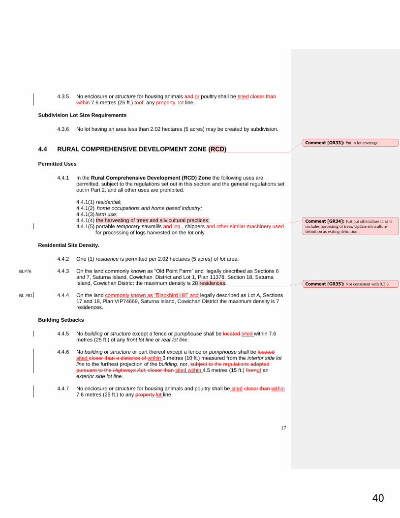
17
4.3.5 No enclosure or structure for housing animals and or poultry shall be sited closer than
within 7.6 metres (25 ft.) toof any property lot line.
Subdivision Lot Size Requirements
4.3.6 No lot having an area less than 2.02 hectares (5 acres) may be created by subdivision.
4.4 RURAL COMPREHENSIVE DEVELOPMENT ZONE (RCD)
Permitted Uses
4.4.1 In the Rural Comprehensive Development (RCD) Zone the following uses are permitted, subject to the regulations set out in this section and the general regulations set out in Part 2, and all other uses are prohibited.
4.4.1(1) residential; 4.4.1(2) home occupations and home based industry;
4.4.1(3) farm use; 4.4.1(4) the harvesting of trees and silvicultural practices; 4.4.1(5) portable temporary sawmills and log , chippers and other similar machinery used
for processing of logs harvested on the lot only.
Residential Site Density.
4.4.2 One (1) residence is permitted per 2.02 hectares (5 acres) of lot area.
BL#76 4.4.3 On the land commonly known as “Old Point Farm” and legally described as Sections 6 and 7, Saturna Island, Cowichan District and Lot 1, Plan 11378, Section 18, Saturna Island, Cowichan District the maximum density is 28 residences.
BL #81 4.4.4 On the land commonly known as “Blackbird Hill” and legally described as Lot A, Sections
17 and 18, Plan VIP74669, Saturna Island, Cowichan District the maximum density is 7 residences.
Building Setbacks
4.4.5 No building or structure except a fence or pumphouse shall be located sited within 7.6
metres (25 ft.) of any front lot line or rear lot line. 4.4.6 No building or structure or part thereof except a fence or pumphouse shall be located
sited closer than a distance of within 3 metres (10 ft.) measured from the interior side lot line to the furthest projection of the building, nor, subject to the regulations adopted pursuant to the Highways Act, closer than sited within 4.5 metres (15 ft.) fromof an exterior side lot line.
4.4.7 No enclosure or structure for housing animals and poultry shall be sited closer than within
7.6 metres (25 ft.) to any property lot line.
Comment [GR33]: Put in lot coverage
Comment [GR34]: Just put silviculture in as it
includes harvesting of trees. Update silviculture
definition as exiting definition .
Comment [GR35]: Not consistent with 9.3.6
40

18
Subdivision Lot Size Requirements
4.4.8 No lot having an area less than 12.14 hectares (30 acres) may be created by subdivision.
in the Rural Comprehensive Development Zone 4.4.9 No subdivision plan may be approved unless the lots created by the subdivision have an
average area of at least 2.02 hectares (5 acres).
4.5 MULTIPLE FAMILY RESIDENTIAL ZONE (MFR)
Permitted Uses
4.5.1 In the Multiple Family Residential (MFR) Zone the following uses are permitted, subject to the regulations set out in this section and the general regulations set out in Part 2, and all other uses are prohibited. 4.5.1(1) residential for the purpose of providing Senior Citizen Housing sponsored by a
Public or Quasi Public Society Incorporated under the Society Act.
Lot Coverage
4.5.2 Buildings and structures shall not cover more than 33 percent of the parcel of land lot on
which they are located.
Setback Provisions
4.5.3 No building or structure or part thereof except a fence or a pumphouse shall be located
sited within 7.6 metres (25 ft.) of any front or rear lot line. 4.5.4 No building or structure or part thereof except a fence or a pumphouse shall be located
sited closer than a distance of within 6.1 metres (20 ft.) measured from any interior side lot line to the farthest projection of the building, nor, subject to regulations adopted pursuant to the Highways Act, closer than sited within 7.6 metres (25 ft.) fromof an exterior side lot line.
Site Density
4.5.5 There shall not be more than four (4) residential units per 0.4 hectares (one acre) in the
Multiple Family Residential Zone.
Subdivision Lot Size Requirements
4.5.6 No lot having an area less than 0.81 hectares (2 acres) may be created by subdivision.
4.5.7 No subdivision plan may be approved unless the lots created by the subdivision have an
average area of at least 2.02 hectares (5 acres).
Comment [GR36]: Put this wording and
structure in all other zones to be consistent.
Comment [GR37]: sponsored by public society
unenforceable use or user distinction
Comment [GR38]: remove this from all zones
and put that setbacks are measured from the farthest
projection of a building unless otherwise stated. Put
in sec 2.15
Comment [GR39]: other places called
residential density, make consistent throughout
41

19
4.6 COMMUNITY SERVICES ZONE (CS)
Permitted Uses
4.6.1 In the Community Services (CS) Zone the following uses are permitted, subject to the regulations set out in this section and the general regulations set out in Part 2, and all other uses are prohibited.
4.6.1(1) community halls 4.6.1(2) churches 4.6.1(3) public schoolsschools 4.6.1(4) libraries 4.6.1(5) fire halls, police and ambulance stations 4.6.1(6) cemeteries.
Lot Coverage
4.6.2 Buildings and structures shall not cover more than 33 percent of the parcel of land lot on
which they are located.
Setback Provisions
4.6.3 No building or structure or part thereof except a fence or a pumphouse shall be located
sited within 7.6 metres (25 ft.) of any front or rear lot line. 4.6.4 No building or structure or part thereof except a fence or a pumphouse shall be located
sitedcloser than a distance of within 6.1 metres (20 ft.) measured from of any interior side lot line measured from to the farthest projection of the building, nor, subject to regulations adopted pursuant to the Highways Act, closer than sited within 7.6 metres (25 ft.) fromof an exterior side lot line.
Subdivision Lot Size Requirements
4.6.5 No lot having an area less than 2.02 hectares (5 acres) may be created by subdivision.
BL#96 4.6.6 Site Specific Regulations
4.6.6(1) The regulations listed in Colum 3 of the following table only apply to the land listed
in Column 2 of the same row. These lands are identified on the zoning map by the site-specific zoning reference listed in Column 1.
Column 1 Column 2 Column 3
Site-Specific
Zone
Reference
Legal Description Site Specific Regulations
Comment [GR40]: amend this in all other areas
42

20
CS(a) Lot A, Section 8, Plan VIP67333, Saturna Island, Cowichan District. (Recreation Centre)
(1) Despite 4.6.5, no lot having an area of less than 0.2 ha (.5 acre) may be created by subdivision. (2) Despite 4.6.5 no subdivision plan may be approved unless the lots created by the subdivision have an average area of at least 0.8 ha (2 acres).
4.7 PUBLIC UTILITIES ZONE (PU)
Permitted Uses
4.7.1 In the Public Utilities (PU) Zone the following uses are permitted, subject to the regulations set out in this section and the general regulations set out in Part 2, and all other uses are prohibited.
4.7.1(1) highways maintenance yard 4.7.1(2) hydro maintenance yard 4.7.1(3) telephone maintenance yard 4.7.1(4) water supply facilities 4.7.1(5) recycling facilities
Lot Coverage
4.7.2 Buildings and structures shall not cover more than 33 percent of the parcel of land lot on
which they are located.
Setback Provisions
4.7.3 No building or structure or part thereof except a fence or a pumphouse shall be located
sited within 7.6 metres (25 ft.) of any front or rear lot line. 4.7.4 No building or structure or part thereof except a fence or a pumphouse shall be located
sited closer than a distance of within 6.1 metres (20 ft.) measured from of any interior side lot line measured from to the farthest projection of the building, nor, subject to regulations adopted pursuant to the Highways Act, closer than sited within 7.6 metres (25 ft.) from of an exterior side lot line.
Subdivision Lot Size Requirements
4.7.5 No lot having an area less than 2.02 hectares (5 acres) may be created by subdivision.
4.8 COMMUNITY PARK ZONE (CP) BL#108
Comment [GR41]: identify on map
Comment [GR42]: needs lot coverage
43

21
Permitted Uses
4.8.1 In the Community Park Zone the following uses are permitted, subject to the regulations set out in this section and the general regulations set out in Part 2, and all other uses are prohibited.
4.8.1(1) Playgrounds; and 4.8.1(2) Picnic facilities.
44

22
Permitted Structures
4.8.2 No buildings or structures other than playground structures, picnic tables, picnic shelters,
toilets and storage buildings may be constructed.”
45

23
5. COMMERCIAL ZONING REGULATIONS
5.1 COMMERCIAL RECREATION and ACCOMODATION ZONE (CRA)
Permitted Uses
5.1.1 In the Commercial Recreation and Accommodation (CRA) Zone the following uses are permitted, subject to the regulations set out in this section and the general regulations set out in Part 2, and all other uses are prohibited. 5.1.1(1) visitor accommodation; 5.1.1(2) 1a restaurant; 5.1.1(3) 1a neighbourhood pub; 5.1.1(4) a retail use which is accessory to any of the above uses; 5.1.1(5) an accessory residential use together with any of the uses listed in this
subsection which shall not exceed one self-contained residential unit for the caretaker, owner or operator.
5.1.2 Despite Subsection 5.1.1 on the CRA zoned area of the parcel legally described as Lot 1,
Section 18, Plan 14913, Cowichan District , Saturna Island the only uses permitted in addition to those set out in Section 2.1 are: visitor accommodation; restaurants and cafes; neighbourhood pub; retail stores; and, an accessory residential use together with any of the uses listed in this subsection which shall not exceed one self-contained residential unit for the caretaker, owner or operator.
5.1.3 Despite Subsection 5.1.1 and 5.1.2 on the CRA zoned area of the parcel legally described
as Section 13&14, Portion Saturna island, except plan 13357 14023 20126 20127 21418 38382 51385 VIP53200 VIP55663 VIP58068, ex VIP60837 frac s e 1/4 of sec 13 & s 1/2 of sec 14 , Cowichan District , Saturna Island (commonly known as East Point Resort) the only uses permitted in addition to those set out in Section 2.1 are: visitor accommodation; a restaurant; a retail use which is accessory to any of the above uses; boat ramp and boat rentals; and, an accessory residential use together with any of the uses listed in this subsection which shall not exceed one self-contained residential unit for the caretaker, owner or operator.
.
Lot Coverage
5.1.4 Buildings and structures shall not cover more than 10 percent of the CRA zoned portion of
land on which they are located.
Site Density
5.1.5 For the CRA zoned portion of a parcel of land on which accommodation units and
sleeping units are permitted, the number of accommodation units shall not exceed three per 0.4 ha (1 acre) and the number of bedrooms shall not exceed six per 0.4 ha (1 acre) nor twelve per building.
(Note: These site density requirements apply to commercial accommodation
establishments existing legally prior to the adoption of the Official Community Plan (OCP),
Comment [GR43]: “1” is clearer that “a”
Comment [GR44]: This would allow for more
than one retail use
Comment [GR45]: Was it the intent to have the
retail uses accessory to visitor accommodation,
restaurant and neighborhood pub.
Comment [GR46]: Lighthouse Pub – update
legal description.
Comment [GR47]: Update legal description if
necessary
Comment [GR48]: May want to list Saturna
Lodge in this section to clearly list number of rooms
permitted to aid with future interpretations..
46

24
Bylaw No. 70. The density of new commercial accommodation establishments is to be consistent with policy D.1.A.3 of the OCP).
Building Setbacks
5.1.6 No building or structure except a fence shall be located sited within 7.6 metres (25 ft.) of
any front or rear lot line.
5.1.7 No building or structure except a fence shall be located sited within 3 metres (10 ft.) of any interior side lot line, nor, subject to regulations adopted pursuant to the Highways Act, sited within 4.6 metres (15 ft.) of an exterior side lot line.
Subdivision Lot Size Requirements
5.1.8 No lot having an area less than 2.02 hectares (5 acres) may be created by subdivision.
5.2 Commercial Zone (C)
Permitted Uses
5.2.1 In the Commercial (C) Zone the following uses are permitted, subject to the regulations set out in this section and the general regulations set out in Part 2, and all other uses are prohibited.
5.2.1(1) retail stores and shops; 5.2.1(2) professional or business offices including medical or dental clinics; 5.2.1(3) barber shops, beauty parlours, shoe repair shops, electric and electronic repair
shops, launderette, laundry and dry cleaning shops; 5.2.1(4) printers and publishers; 5.2.1(5) restaurants, cafes, bakeries; 5.2.1(6) places of indoor recreation; and 5.2.1(7) residential.
Lot Coverage
5.2.2 Buildings and structures shall not cover more than 33 percent of the parcel of land lot on
which they are located.
Building Setbacks
5.2.3 No building or structure except a fence shall be located sited within 7.6 metres (25 ft.) of
any front or rear lot line. 5.2.4 No building or structure except a fence shall be located sited within 3 metres (10 ft.) of
any interior side lot line, nor, subject to regulations adopted pursuant to the Highways Act, sited within 4.6 metres (15 ft.) of an exterior side lot line.
Residential Site Density
Comment [GR49]: Reference to OCP not
required.
Comment [GR50]: Saturna Store
47

25
5.2.5 On the Commercial zoned portion of a lot, a maximum of three self-contained residential units are permitted.
Subdivision Lot Size Requirements
5.2.6 No lot having an area less than 0.4 hectares (1 acre) may be created by subdivision. 5.2.7 No subdivision plan may be approved unless the lots created by the subdivision have an
average area of at least 2.02 hectares (5 acres).
Comment [GR51]: Ensure this is consistent with
definition
48

26
6 INDUSTRIAL ZONING REGULATIONS
6.1 INDUSTRIAL STORAGE AND REPAIRS ZONE (ISR)
Uses Permitted
6.1.1 In the Industrial Storage and Repairs (ISR) Zone the following uses are permitted, subject to the regulations set out in this section and the general regulations set out in Part 2, and all other uses are prohibited.
6.1.1(1) warehouses; 6.1.1(2) storage yards; 6.1.1(3) contractor's yards and workshops; 6.1.1(4) building materials and supplies sales; 6.1.1(5) freight service; 6.1.1(6) motor vehicle sales and repairs; 6.1.1(7) machinery and parts sales, rentals and repairs; 6.1.1(8) wood, metal and plastic fabricating; 6.1.1(9) welding and machine shops; 6.1.1(10) boat building and repairs; 6.1.1(11) off street parking lots; 6.1.1(12) marinas for the accommodation, maintenance and servicing of boats including
refueling; 6.1.1(14) one residential unit in conjunction with an industrial use for the accommodation
of the owner, operator or an employee of the principal use is permitted. 6.1.2 In addition to the uses permitted in subsection 6.1.1, on the ISR portion of the lot legally
described as Lot 17, Plan 18592, Section 8, Cowichan District, Saturna Island the following use is permitted: retail sale of fuels.
6.1.3 Despite subsection 6.1.1, on the ISR portion of the lot legally described as Lot 1, Section 18, Plan 14515, Cowichan District , Saturna Island the only uses permitted in addition to those set out in Section 2.1 are: boat building and repairs; marinas for the accommodation, maintenance and servicing of boats including refueling; service stations; bulk fuel storage tanks; off street parking lots; and, one residential unit in conjunction with an industrial use for the accommodation of the owner, operator or an employee of the principal use is permitted.
Height
6.1.4 No building shall exceed 15 metres (50 ft.) in height.
Lot Coverage
6.1.5 Buildings and structures shall not cover more than 33 percent of the parcel of land lot on
which they are located.
Comment [GR52]: garage
Comment [GR53]: Update legal description.
Add to list of uses permitted (campground, garden
centre)? Industrial area beside the community hall
49

27
Building Setbacks
6.1.6 No building or structure except a fence shall be located sited within 7.6 metres (25 ft.) of
any front or rear lot line. 6.1.7 No building or structure except a fence shall be located sited closer than within a distance
of 3 metres (10 ft.) from cof any interior side lot line, nor, subject to regulations adopted pursuant to the Highways Act, sited closer than within 4.6 metres (15 ft.) from of an exterior side lot line.
Subdivision Lot Size Requirements
6.1.8 No lot having an area less than 0.4 hectares (1 acre) may be created by subdivision.
6.1.9 No subdivision plan may be approved unless the lots created by the subdivision have an average area of at least 2.02 hectares (5 acres).
6.2 INDUSTRIAL COMPREHENSIVE ZONE (IC)
Permitted Uses
6.2.1 In the Industrial Comprehensive (IC) Zone the following uses are permitted, subject to the regulations set out in this section and the general regulations set out in Part 2, and all other uses are prohibited.
6.2.1(1) All of the uses in the Industrial Storage and Repairs (ISR) Zone; 6.2.1(2) services stations; 6.2.1(3) bulk fuel storage tanks and sale of fuels 6.2.1(4) sawmills, and related wood products processing; and, 6.2.1(5) manufacturing.
Height
6.2.2 No building shall exceed 15 metres (50 ft.) in height.
Lot Coverage
6.2.3 Buildings and structures shall not cover more than 33 percent of the parcel of land lot on
which they are located.
Building Setbacks
6.2.4 No building, structure or storage of materials except a fence shall be located sited within
7.6 metres (25 ft.) of any front or rear lot line.
Comment [GR54]: Take out and repeat list in
this zone
50

28
6.2.5 No building or structure except a fence shall be located sited closer than a distance of
within 3 metres (10 ft.) from of any interior side lot line, nor, subject to regulations adopted pursuant to the Highways Act, sited closer than within 4.6 metres (15 ft.) fromof an exterior side lot line.
Subdivision Lot Size Requirements
6.2.6 No lot having an area less than 0.4 hectares (1 acre) may be created by subdivision.
6.2.7 No subdivision plan may be approved unless the lots created by the subdivision have an average area of at least 2.02 hectares (5 acres).
51

29
7. FARMLAND ZONING REGULATIONS
7.1 FARMLAND ZONE (F)
Permitted Uses
7.1.1 In the Farmland (F) Zone the following uses are permitted, subject to the regulations set out in this section and the general regulations set out in Part 2, and all other uses are prohibited. Uses that are inconsistent with permitted uses under the Agricultural Land Commission Act or Regulations will require approval from the Agricultural Land Commission.
7.1.1(1) farm use;
7.1.1(2) the harvesting of trees and the carrying out of all silvicultural practices; 7.1.1(3) portable wood chippers and sawmills only for the processing of logs harvested
on the parcel; 7.1.1(4) residential; 7.1.1(5) sleeping accommodation for farm employees; 7.1.1(6) fish farming; 7.1.1(7) home occupations and home based industry.
Lot Size and Site Density
7.1.2 The maximum density is one residence on parcels lots having an area of 20.24 ha (50
acres) or less and one residence and one cottage on parcels lots having an area greater than 20.24 ha (50acres).
7.1.3 Notwithstanding 7.1.2, no residential buildings may be located on arable portions of a parcel
lot except if the total parcel lot is arable.
Building Setbacks
7.1.4 No building or structure except a fence or pumphouse shall be located sited within 7.6
metres (25 ft.) of any front lot line or rear lot line. 7.1.5 No building or structure or part thereof except a fence or pumphouse shall be located
sited closer than a distance of within 6.1 metres (20 ft.) measured from the of an interior side lot line measured from to the farthest projection of the building, nor, subject to regulations adopted pursuant to the Highways Act, sited closer than within 6.1 metres (20 ft.) from of the an exterior side lot line.
Special Building Setback
7.1.6 No building or structure associated with farm uses except a fence or a pumphouse shall
be located sited within 30 metres (100 ft.) of a front lot line, nor sited within 15 metres (50 ft.) from of an the interior, exterior or rear lot line, measured from the lot line to the farthest projection of the building, except where the interior or rear lot line abuts the FR, FG, W or WR zones.
Comment [GR55]: Lot coverage
Comment [GR56]: Use amended wording to be
consitent
Comment [GR57]: No density limit.
Comment [GR58]: Who determines?
Comment [GR59]: Clarify what setbacks apply
in this case.
52

30
Subdivision Lot Size Requirements
7.1.7 No lot having an area less than 20.24 hectares (50 acres) may be created by subdivision
in the zone.
7.2 FARM RESORT ZONE (F1) BL #82
Permitted Uses
7.2.1 In the Farm Resort (F1) Zone the following uses are permitted, subject to the regulations
set out in this section and the general regulations set out in Part 2, and all other uses are prohibited.
7.2.1(1) farm use; 7.2.1(2) vinting and bottling of wines and ciders; 7.2.1(3) accessory to the vinting and bottling of wines and ciders, the sale of wine and cider including tasting facilities 7.2.1(4) accessory to the vinting and bottling of wines and ciders, a restaurant and premises licensed under the Liquor Control and Licensing Act for the sale and consumption of beverages on the premises; 7.2.1(5) accessory to the farm use, visitor accommodation of the traveling and vacationing public in accommodation units and sleeping units; and 7.2.1(6) an accessory residential use which shall not exceed one self-contained residential unit and one cottage.
Height
7.2.2 No building shall exceed 9 metres (30 feet) in height, except a barn which shall not
exceed 15 metres (49.2 ft.) in height.
Site Coverage
7.2.3 Buildings and structures and required parking areas shall not cover more than two
percent (2%) of the parcel of land lot on which they are located.
Site Density
7.2.4 Visitor Accommodation use shall not exceed five accommodation units and the total
number of bedrooms shall not exceed twenty nor twelve bedrooms per building. 7.2.5 Residential use shall not exceed one self-contained residence and one cottage.
Siting of Uses, Buildings and Structures
7.2.6 No use other than farm use shall be located on any land that is south of Quarry Trail,
except for three non -agricultural buildings provided that: not more than one shall contain
Comment [GR60]: No density limit on sleeping
units.
Comment [GR61]: Also in height exclusions.
Have in one spot or the other not both.
Comment [GR62]: What about split zoned lots
clarify in definition of lot coverage. Do this in
definitions of lot coverage.
53

31
a restaurant, not more than one shall contain transient accommodation and not more than one shall contain residential use.
7.2.7 No building or structure except a fence or pumphouse shall be located sited within 7.6
metres (25 feet) of any front or rear lot line.
7.2.8 No building or structure except a fence shall be sited within 6.1 metres (20 feet) of any interior side lot line or exterior side lot line.
Site Area Restrictions
7.2.9 The minimum site area for all of the uses set out in Section 7.2.1 is 31.5 hectares (78
acres), and for the purposes of this regulation a “site” may not comprise more than one parcel.”
Subdivision Lot Size Requirements
7.2.10 No lot having an area less than 31.5 hectares (78 acres) may be created by subdivision.
7.3 FARM RETREAT ZONE (F2)
Permitted Uses
7.3.1 In the Farm Retreat (F2) Zone the following uses are permitted, subject to the regulations
set out in this section and the general regulations set out in Part 2, and all other uses are prohibited. Uses that are inconsistent with permitted uses under the Agricultural Land Commission Act or regulations will require approval from the Provincial Agricultural Land Commission.
7.3.1(1) Farm use; 7.3.1(2) Educational and instructional uses; 7.3.1(3) Residential; 7.3.1(4) Accessory to 1 and/or 2 above, Visitor Accommodation and special events,
such as, but not limited to weddings, reunions and retreats; 7.3.1(5) Accessory to 1, 2 or 4 above, the serving of food and drink; 7.3.1(6) Accessory to 1, 2 or 4 above, retail and rental uses; 7.3.1(7) Accessory to 3 above, home occupations.
Lot Coverage
7.3.2 Buildings, structures and required parking areas associated with non-farm uses shall not
cover more than two percent (2%) of the parcel of land lot on which they are located.
Site Density
7.3.3 Visitor accommodation use shall not exceed 8 sleeping units and 4 campsites.
(Information Note: Subsection 7.3.3 does not apply to rooms that may be used as part of a bed and breakfast home occupation in any of the permitted residences.)
54

32
7.3.4 On the parcel of land legally described as Lot B, Plan 11380, Section 7 and Lot 1, Plan
51011, Section 8 both in Cowichan District, Saturna Island the maximum residential site density on the parcel shall not exceed 7 residences and 7 cottages. number of residences is 7 and the maximum number of cottages is 7.
Siting of Uses, Buildings and Structures
7.3.5 No building or structure except a fence shall be located sited within 12 metres (40 ft.) of
any front lot line. 7.3.6 No building or structure except a fence shall be located sited within 3 metres (l0 ft.) of any
interior or rear lot line. 7.3.7 No building or structure associated with an intensive farm use, except a fence or
pumphouse, shall be located sited within 30 metres (100 ft) from of a front lot line. 7.3.8 No use other than farm use shall be located sited on arable portions of the land. 7.3.9 Buildings, structures and uses associated with any of the uses listed in sub-sections 7.3.1
(4) through 7.3.1 (6) with the exception of campsites are restricted to that area shown as “Accommodation Area” on the attached site plan. .
Subdivision Lot Size Requirements
7.3.10 No lot having an area less than 20.24 hectares (50 acres) may be created by subdivision.
Comment [GR63]: Update legal description
Comment [GR64]: who determines
Comment [GR65]: remove, no plan attached to
LUB.
55

33
8. WATERSHED ZONING REGULATIONS
8.1 WATERSHED ZONE (W)
Permitted Uses
8.1.1 In the Watershed (W) Zone the following uses are permitted, subject to the regulations set out in this section and the general regulations set out in Part 2, and all other uses are prohibited. 8.1.1(1) growing and harvesting of forest products; and, 8.1.1(2) accessory buildings.
Buildings Setbacks
8.1.2 No building or structure except a fence or a pumphouse shall be located sited within 7.6
metres (25 ft.) of any front lot line, nor sited within 3 metres (10 ft.) of any interior side or rear lot line, nor sited within 4.6 metres (15 ft.) of any exterior side lot line, nor sited within 61 metres (200 ft.) of any watercourse or body of fresh water.
Subdivision Lot Size Requirements
8.1.3 No lot having an area less than 10.12 hectares (25 acres) may be created by subdivision
in this Zone
Comment [GR66]: Lot coverage
56

34
9. FORESTLAND ZONING REGULATIONS Information Note: Pursuant to Forest Policies in the Saturna Island Official Community Plan (Bylaw
No. 70, properties may be rezoned to Forest Residential Zone providing an opportunity to cluster and concentrate permitted residential development. Every rezoning to Forest Residential Zone is to entail a simultaneous rezoning of the residual forest lands to Forest Reserve Zone. The reserve area would be for forestry and conservation purposes. All Forest Subdivision Capacity attributable to the forestlands is to be transferred to the Forest Residential zoned area, and result in the subdivision capacity of the area zoned Forest Reserve to be nil.
9.1 FOREST RESERVE (FR) Zone
Permitted Uses
9.1.1 In the Forest Reserve (FR) Zone the following uses are permitted, subject to the regulations set out in this section and the general regulations set out in Part 2, and all other uses are prohibited.
9.1.1(1) green space; 9.1.1(2) the harvesting of trees and the carrying out of all silvicultural practices; 9.1.1(3) portable wood chippers and sawmills for logs harvested on the parcel; and, 9.1.1(4) farm use on land within the Agricultural Land Reserve.
Lot Size Requirements.
9.1.2 Minimum lot size shall be 20.24 hectares (50 acres).
9.2 FOREST GENERAL ZONE (FG)
Permitted Uses
9.2.1 In the Forest General (FG) Zone the following uses are permitted, subject to the regulations set out in this section and the general regulations set out in Part 2, and all other uses are prohibited.
9.2.1(1) residential; 9.2.1(2) the harvesting of trees and the carrying out of all silvicultural practices; 9.2.1(3) grazing, accessory to the growing of trees 9.2.1(4) portable wood chippers and sawmills for logs harvested on the parcel; 9.2.1(5) television and radio antennas; 9.2.1(6) home occupations and home based industry; and, 9.2.1(7) farm use on land within the Agricultural Land Reserve.
Comment [GR67]: Lot coverage
Comment [GR68]: Remove green space as its
not definable.replace (1) and (2) with silviculture.
Comment [GR69]: Change to amended wording
for consistency.
Comment [GR70]: Change to be consistent
57

35
Height
9.2.2 No building shall exceed 9 metres (30 ft.) in height.
Building Setbacks
9.2.3 No building or structure except a fence or a pumphouse shall be located sited within 7.6
metres (25 ft.) of any front or rear lot line, nor sited within 3 metres (9.8 ft.) of any interior side lot line, nor sited within 4.6 metres (15 ft.) of any exterior side lot line.
Site Density
9.2.4 The permitted site density shall be one residence and one cottage per parcel.
Lot Size Requirements
9.2.5 No lot having an area less than 20.24 hectares (50 acres) may be created by subdivision
in this Zone.
9.3 FOREST RESIDENTIAL ZONE (FR1)
Permitted Uses
9.3.1 In the Forest Residential (FR1) Zone the following uses are permitted, subject to the regulations set out in this section and the general regulations set out in Part 2, and all other uses are prohibited.
9.3.1(1) residential; 9.3.1(2) the harvesting of trees and the carrying out of all silvicultural practices; 9.3.1(3) grazing, accessory to the growing of trees 9.3.1(4) portable sawmills for sawing of logs harvested on the property;
Height
9.3.2 No building shall exceed 9 metres (30 ft.) in height.
Building Setbacks
9.3.3 No building or structure except a fence or a pumphouse shall be located sited within 7.6
metres (25 ft.) of any front or rear lot line, nor sited within 3 metres (9.8 ft.) of any interior side lot line, nor sited within 4.6 metres (15 ft.) of any exterior side lot line.
Site Density
9.3.4 The permitted site density shall be one residence on lots having an area less than 1.21
hectares (3 acres) and a maximum of one residence and one cottage on lots having an area of 1.21 hectares (3 acres) or more.
Comment [GR71]: make consistent throughout
Comment [GR72]: lot coverage
58

36
9.3.5 Notwithstanding Subsection 9.3.4, on the FR1 zoned portion of the land legally described as the south-west ¼ of Section 8, Plan 23285, Cowichan District, Saturna Island a maximum of 5 residences and 5 cottages is permitted. Residences are not permitted on the area of land zoned Forest Reserve.
9.3.6 Notwithstanding Subsection 9.3.4, on the parcel of land commonly known as “Old Point
Farm” and legally described as Sections 6 and 7, Saturna Island, Cowichan District a maximum of 13 residences and 13 cottages is permitted. Residences are not permitted on the area of the parcel zoned Farmland.
Lot Size Requirements
9.3.7 The minimum lot area required for subdivision shall be 0.81 hectares (2 acres) and the
maximum lot area required for subdivision is not to exceed 1.21 hectares (3 acres). plus 1.21 hectares (3 acres) for each additional lot permitted by the parcel’s remaining Subdivision Capacity.
BL#91 9.3.8 Notwithstanding 9.3.7, no more than five lots (not to exceed three acres each) may be
created in the Forest Residential portion of Lot 1, Section 8, Plan 23285, Saturna Island.
Comment [GR73]: Old Point Farm is zoned
RCD and F. Density is listed in the RCD zone.
Comment [GR74]: Amend for consistency.
Comment [GR75]: IB
59

37
10. WILDERNESS RESERVE ZONING REGULATIONS
10.1 Wilderness Reserve (WR) Zone
Uses Permitted
10.1.1 In the Wilderness Reserve (WR) Zone the following uses are permitted, subject to the regulations set out in this section and the general regulations set out in Part 2, and all other uses are prohibited.
10.1.1(1) residential; 10.1.1(2) ecological reserves
Building Setbacks
10.1.2 No building or structure except a fence or a pumphouse shall be locatedsited within 7.6
metres (25 ft.) of any front lot line, nor sited within 3 metres (10 ft.) of any interior side or rear lot line, nor sited within 4.6 metres (15 ft.) of any exterior side lot line.
Site Density
10.1.3 The maximum density permitted shall be one residence.
Lot Coverage
10.1.4 Buildings or structures shall not cover more than 1% of the parcel of land lot on which
they are located.
Subdivision Lot Size Requirements
10.1.5 No lot having an area less than 64.7 hectares (160 acres) may be created by subdivision.
60

38
11. WATER ZONING REGULATIONS
(Note: All uses of the Crown foreshore must be authorized by this Bylaw and a crown lease obtained from Land and Water BC Inc.)
11.1 WATER ZONE (WA)
Permitted Uses
11.1.1 In the Water (WA) Zone the following uses are permitted, subject to the regulations set out in this section and the general regulations set out in Part 2, and all other uses are prohibited:
11.1.1(1) private or communal floats, wharves, piers and walkways accessory to
residential use and providing access to properties adjacent to the foreshore; 11.1.1(2) sea walls, breakwaters, ramps, dolphins and pilings necessary for the
establishment or maintenance of the uses permitted in this Section; 11.1.1(3) log dumping where the logs originate on the abutting upland parcel;
BL 110 11.1.1(4) Ocean loop geo-exchange systems for the purpose of domestic heat and cooling accessory to the residential use of the upland property.
Setbacks of Floats and Wharves
11.1.2 Floats and wharves shall be set back 3 metres (10 ft.) from the projection of any side lot
line and shall be located within the boundaries of water leases and licenses of occupation.
Buildings Prohibited
11.1.3 Other than posts to carry lighting fixtures or safety supports, no buildings, including a
boathouse, shelter or structure shall be erected on any float or wharf.
Commercial and Industrial Activity Prohibited
11.1.4 Private floats and wharves shall be used for private access only and no commercial or
industrial activity or use shall be permitted.
Comment [GR76]: Sea walls and breakwaters
have been removed from most bylaws in favour of a
green shores approach to protecting the shore.
61

39
Site Specific Regulations
BL #95 11.1.5 The regulations listed in Column 3 of the following table only apply to the land identified in
Column 2 of the same row. These lands are identified on the zoning map by the site-specific zoning reference listed in Column 1.
Column 1 Column 2 Column 3
Site-Specific
Zone
Reference
Legal Description Site Specific Regulations
WA(a) Portion of Unsurveyed Crown Foreshore or land covered by water being part of the beds of Breezy Bay and Plumper Sound, Saturna Island, Cowichan District.
(1) Despite subsections 11.1.1 and 11.1.4 and in addition to the uses permitted in the Water Zone (WA), a float, wharf and walkway is permitted accessory to the uses permitted on Strata Lot 32, Section 5, Plan VIS3488, Saturna Island, Cowichan District.
(2) For certainty the commercial use of the float,
wharf and walkway structure is to be limited to the loading, unloading and moorage of boats, used by guests and owners of Strata Lot 32, Section 5, Plan VIS3488, Saturna Island, Cowichan District and no other commercial use of the dock is permitted.”
11.2 WATER HARVEST ZONE (WH)
Permitted Uses
11.2.1 In the Water Harvest (WH) Zone the following uses are permitted, subject to the regulations set out in this section and the general regulations set out in Part 2, and all other uses are prohibited:
11.2.1(1) accessory floats and walkways necessary for the harvesting operations
permitted in this part; 11.2.1(2) sea walls, breakwaters, ramps, dolphins and pilings necessary for the
establishment or maintenance of the uses permitted in this part; 11.2.1(3) aquaculture, excluding fin-fish farming; 11.2.1(4) signs related to the marine area.
Setbacks of Floats and Wharves
11.2.2 Floats or wharves shall be set back 3 metres (10 ft.) from the projection of any side lot
line of an abutting upland property and shall be located within the boundaries of water leases or licenses of occupation.
Comment [GR77]: There are no active leases or
licences of occupation in these areas, is the zoning
still required.
62

40
Permitted Buildings
11.2.3 One building not exceeding 46.5 square metres (500 sq. ft.) in total area, and not
exceeding 4.5 metres (15 ft.) in height is permitted on a parcel in this zone. Such a building shall have non-reflective exterior covering.
11.3 WATER GENERAL COMMERCIAL ZONE (WGC)
Permitted Uses
11.3.1 In the Water General Commercial (WGC) Zone the following uses are permitted, subject to the regulations set out in this section and the general regulations set out in Part 2, and all other uses are prohibited:
11.3.1(1) boat rentals and boat sales; 11.3.1(2) boat building, repair and sales; 11.3.1(3) marinas and yacht clubs; 11.3.1(4) boathouses and shelters; 11.3.1(5) mooring facilities for water taxis, pleasure craft, ferries, fishing boats or sea
planes; 11.3.1(6) marine fuelling stations; 11.3.1(7) sea walls, breakwaters, slips, docks, ramps, dolphins and pilings necessary for
the establishment or maintenance of the uses permitted in this part; and 11.3.1(8) log dumping, booming and storage.
Setbacks of Floats and Wharves
11.3.2 Floats and wharves shall be located within the boundaries of water leases or licenses of
occupation.
11.4 WATER PUBLIC UTILITY ZONE (WPU)
Permitted Uses
11.4.1 In the Water Public Utility (WPU) Zone the following uses are permitted, subject to the regulations set out in this section and the general regulations set out in Part 2, and all other uses are prohibited:
11.4.1(1) ferry docks; 11.4.1(2) government wharves; 11.4.1(3) boathouses and shelters; 11.4.1(4) mooring facilities for water taxis, pleasure craft, ferries, fishing boats or sea
planes; 11.4.1(5) marine fuelling stations; and, 11.4.1(6) sea walls, breakwaters, slips, docks, ramps, dolphins and pilings necessary for the establishment or maintenance of the uses permitted in this part;
Setbacks of Floats and Wharves
Comment [GR78]: Not a valid zoning
regulation.
63

41
11.4.2 Floats and wharves shall be located within the boundaries of water leases or licenses of
occupation.
11.5 OPEN WATERS ZONE (WO)
Permitted Uses
11.5.1 In the Open Waters (WO) Zone, the following uses are permitted, subject to the regulations set out in this section and the general regulations set out in Part 2, and all other uses are prohibited:
11.5.1(1) marine navigation 11.5.1(2) marine navigational aids 11.5.1(3) marker buoys 11.5.1(4) aquaculture, excluding fin-fish farming
BL 110 11.5.1(5) Ocean loop geo-exchange systems for the purpose of domestic heat and cooling accessory to the residential use of the upland property.
64

42
12. SUBDIVISION REGULATIONS
Compliance with Minimum and Average Lot Area
12.1 The average lot area of every subdivision must equal or exceed the applicable
minimum and average lot area specified by this Bylaw and for that purpose the average lot area of the proposed subdivision is the sum of the areas of the proposed lots divided by the number of proposed lots.
12.2 For the purposes of determining compliance with average lot size regulations set out in
the zoning designation of this bylaw, areas of land that are designated as park on the subdivision plan may be included in the total area of lots being created, and the park is deemed not to be a lot being created:
12.2.1 where the owner of land being subdivided is providing land for a school site
pursuant to an agreement under s.942of the Local Government Act as well as park land pursuant to s.941 of the Local Government Act, the total amount being provided as park land pursuant to the agreement and the Local Government Act; and
12.2.2 if s.941(1) of the Local Government Act applies to the subdivision, 5 percent of the land being subdivided and if the subdivision is one described in s.941(5) of the Local Government Act as being exempt from s.941(1) any area of land dedicated as park on the subdivision plan may be included in the total area of lots being created for the purposes of determining such compliance.
Covenant Against Further Subdivision and Development
12.3 When a subdivision is proposed that yields the maximum number of lots permitted by
the applicable minimum and average lot sizes specified by this Bylaw, and one or more of the lots being created has an area equal to or greater than twice the applicable average lot size, the applicant must grant a covenant complying in respect of every complying with s.2.7 of this bylaw in respect of such lot prohibiting further subdivision of the lot and prohibiting the construction, erection, or occupancy on the lot of more than one residence and where a cottage is a permitted use, more than one such cottage.
12.4 When a subdivision is proposed that yields fewer than the maximum number of lots
permitted by the applicable average lot sizes specified by this Bylaw, and:
12.4.1 one or more of the lots being created has an area equal to or greater than twice the applicable average lot size; and
12.4.2 one or more of the lots being created has an area less than the applicable average lot size;
The applicant must grant a covenant complying with s. 2.7 of this Bylaw in respect of every lot referred to above prohibiting: 12.4.3 the subdivision of the lot so as to create a greater total number of lots by
subdivision and re-subdivision of the original lot than would have been created had the first subdivision created the maximum number of lots permitted by the applicable minimum and average lot sizes specified by this Bylaw; and
12.4.4 the construction, erection, or occupancy on the lot of residences and, where
Comment [GR79]: This is not consitent with
12.2 is parkland is to be included.
Comment [GR80]: Contrary to how lot area
required for subdivision is calculated
Comment [GR81]: Update LGA section
Comment [GR82]: Update LGA section
65

43
permitted by this Bylaw, cottages so as to create a greater density of such development on the original lot than would have been created had the original lot been developed to the greatest density permitted by this Bylaw.
Undersized Parcels
12.5 Some parcels of land that are shown on a plan deposited in the Land Title Office prior to
the passing of this Bylaw may have less than the minimum area required in this land use bylaw. The lot may be used for any of the uses permitted in the zone in which the lot is situated, subject to all the other regulations for the zone and sewage is disposed satisfactory to the Medical Health Officer.
Parcel Size calculations
12.6 Where a parcel proposed to be subdivided is subject to a registered covenant in favour of
the Saturna Island Local Trust Committee limiting the number of parcels into which it may be subdivided the maximum number of new parcels that may be created by subdivision of that parcel is the number specified in the covenant.
12.7 For the purpose of the Strata Property Bare Land Strata Regulations, the average parcel
size shall be the average parcel size as specified in the zone and where the parcel proposed to be subdivided lies is located. within two or more zones the average parcel size shall be the area of the original lot divided by the number of lots authorized by the zones.
12.8 Where a parcel proposed to be subdivided is subject to a registered covenant in favour of
the Saturna Island Local Trust Committee limiting the number of parcels into which it may be subdivided, the average parcel size for the purpose of the Strata Property Regulations shall be as specified in the covenant.
Lot Size Exemptions
12.9 The average and minimum lot sizes specified in the zones shall not apply as described in
sections 12.9.1 to 12.9.6:
12.9.1 Where the parcel being created is to be used solely for the unattended equipment necessary for the operation of:
12.9.1(1) a community water or sewer system; 12.9.1(2) a community gas distribution system;
12.9.1(3) a community radio or television receiving antenna; 12.9.1(4) a telecommunication relay station; 12.9.1(5) an automatic telephone exchange; 12.9.1(6) an air or marine navigational aid; 12.9.1(7) electrical substations or wind or hydro generating stations; and 12.9.1(8) any other similar public service facility or utility. 12.9.2 Where the land proposed to be subdivided is entirely within a zone in which none
of the uses permitted would generate sewage, and the owner registers a covenant in favour of the Saturna Island Local Trust Committee prohibiting any use of the land that would generate sewage;
12.9.3 Where a parcel being created is for dedicated park use only;
Comment [GR83]: Better suited for general reg
section
Comment [GR84]: Consider removing as
covenants normally restrict density and don’t allow
more than the zoning permits.
Comment [GR85]: Take this out and ensure
there is a current split lot provision in the bylaw.
66

44
12.9.4 To subdivisions for the provision of a residence for a relative under Section 946
514(4) of the Local Government Act provided the land: 12.9.4(1) is not within the Agricultural Land Reserve; 12.9.4(2) has not been subdivided previously under Section 946 of the Local
Government Act; and 12.9.4(3) has a minimum lot size of 8.1 hectares;
such a subdivision shall be subject to all the requirements of that Section.
12.9.5 Where the subdivision will consolidate two or more parcels or to annex a portion
of a lot where it is separated from the main portion of the lot by a road, watercourse or topographical feature so as to render it useless to the main portion.
12.9.6 Where the subdivision: 12.9.6(1) adjusts the boundary between two or more parcels, 12.9.6(2) no additional parcels are created, and 12.9.6(3) no parcel is increased in area such that it may be further subdivided
under this Bylaw.
Lot Width
12.10 No lot may have a width less than one third of its depth.
Panhandle Lots
12.11 The minimum width of the access strip of a panhandle lot is: 12.11.1 6 metres in the case of a lot that has insufficient area to be further subdivided
under the provisions of this bylaw; and 12.11.2 20 metres in the case of a lot that has sufficient area to be further subdivided
under the provisions of this bylaw.
Lots in More than One Zone
12.12 If a lot is located in two or more zones, for the purposes only of the minimum and average
lots size regulations of Parts 4 through 11 of this bylaw the portions of the lot that have different zoning designations must be considered as if they were separate lots unless specific regulations pertaining to split zoned lots appliesapply.
Subdivision Capacity of Split Zoned Lots
12.13 Rural together with Farmland, Forest or Watershed Where a lot contains areas of Rural together with any Heritage Forest, Farmland, Forest
or Watershed lands as designated in the Saturna Island Official Community Plan, Bylaw No. 70, the subdivision capacity from these designations, if any, may be transferred to the Rural portion of the lot. The Saturna Island Local Trust Committee will require the placing of a restrictive covenant reflecting the reduction in subdivision capacity and residential building density on the contributing areas.
Comment [GR86]: Ensure this is consistent with
current wording for this provision.
Comment [GR87]: This section needs to be
rewritten for clarity and combined with the density
transfer provisions in s. 2.12.
67
45
12.14 Forest together with Farmland or Watershed
Where a lot contains areas of Forest together with any Heritage Forest, Farmland, or Watershed lands as designated in the Saturna Island Official Community Plan, Bylaw No. 70, the subdivision capacity from these designations, if any, may be transferred to the Forest designated portion of the lot. The Saturna Island Local Trust Committee will require the placing of a restrictive covenant reflecting the reduction in subdivision capacity and residential building density on the contributing areas.
Comment [GR88]: As above
68

46
13. SIGN REGULATIONS
13.1 No signs shall be erected in any zone except in accordance with this Section and subject to the signs being located upon the lot occupied by the principal use to which they refer.
13.2 The maximum total area of signs per use shall be in accordance with the following table:
BL #89
Zone Total sign area per use
permitted
Number of signs per use
permitted
Commercial, Community Services and Industrial zones WCM and WGC zones
A lit sign of 1.8 metres (19.4
sq. ft.) OR An unlit sign of 3.7 square metres (39.8 sq. ft.)
2
All other zones
1 square metre (10.7 sq.ft.)
1
13.3 Any sign which has become obsolete because of discontinuance of the business, service
or activity which it advertises shall be removed from the premises within thirty (30) days after the sign becomes obsolete.
13.4 Nothing in this Bylaw prohibits the erection of a sign by an agency of government for
purposes of public health or safety, or by a candidate in a local, provincial or federal election during the period after nomination and prior to the election.
13.5 Third party signs must be removed within 30 days of the event or purchase or, in the case
of a sign advertising a property for sale , within 30 days of the sale..
69

47
14. OFF STREET PARKING REGULATIONS *[Note: These off street parking regulations only apply to new developments and not to those developments that exist as of the date of
adoption of this Bylaw]
Off street parking
14.1 When any new use of buildings or structures takes place or when any existing use of land
or buildings or structures is enlarged or increased in capacity, provisions must be made for vehicular off street parking spaces in accordance with the standards set out in this section.
14.2 The number of off street parking spaces required in respect of particular uses is set out in
Table 1, and where a particular use is not listed, the number required for the most similar listed use applies.
Table 1: Off street parking requirements
Use Minimum Number of Off
street parking Spaces
Required
(a) Residences and cottages 2 per residential unit
(b) Retail Stores, Offices 1 per 23 square metres (248 sq. ft.) of floor area.
(c) Cafe, Restaurant, Neighbourhood Pub,
1 per 3 seats
(d) Visitor Accommodation 1 per accommodation or sleeping unit plus 1 per 3 seats in food or beverage service area
(e) Marina 1 per 2 berths used for year round moorage plus 1 per 2 employees
(f) Campground 1 per camp space plus 1 per 2 employees
(g) Industrial 1 per 2 employees counted as total of 2 shifts but not less than 5 spaces per tenant or establishment
(h) Bed and Breakfast 1 per room used for guest accommodation
(j) Community halls, churches and lodge halls
1 per 4 seats
14.3 Each required off street parking space shall be a minimum of 2.6 metres (8.5 ft.) in width,
and a minimum of 5.5 metres (18 ft.) in length, exclusive of access drives or aisles, ramps, columns, or similar obstructions, and have vertical clearance of at least 2 metres (6.5 ft).
70

48
14.4 For parallel off street parking spaces, the length of the off street parking spaces must be
increased to 7.3 metres (24. feet) except end spaces, which must be a minimum length of 5.5 metres (18 feet).
14.5 Maneuvering aisles must be a minimum of 7.3 metres (24 feet) wide for 90 degree off
street parking; 5.5 metres (18 feet) wide for 60 degree off street parking; and 3.6 metres (12 feet) wide for 45 degree and parallel off street parking. Where off street parking spaces are directly off a lane, the lane may be considered part of the aisle and in such cases the combined width of the aisle and off street parking spaces must be a minimum of 12.8 metres (42 feet).
71

49
15. INTERPRETATION
Definitions
15.1 In this bylaw,
BL #79 15.1.1 “accessory” in relation to a use, building or structure means incidental and secondary to a principal use, building or structure, expressly permitted by this bylaw on the same lot or, where the accessory use is located on the common property in a bare land strata plan, or a strata lot in the same strata plan.
15.1.2 “accommodation unit” means a rental unit with a kitchen and a bathroom and no more than two bedrooms with a total combined floor area of not more than 92.9 square metres (1,000 sq. ft.) used exclusively for temporary commercial accommodation of the public.
15.1.3 “aquaculture” means marine based culturing of uni and bivalves
“aquaculture” means the growing and cultivation of aquatic plants or animals for commercial purposes, in any water environment, or in human-made containers of water, and includes the growing and cultivation of shellfish on, in or under the foreshore or in the water column.
15.1.4 “arable land” means land that, due to topography and soil conditions, is suitable for cultivation by plowing or tillage.
15.1.5 "basement" means that portion of a building between two floor levels which is partly underground and which has its ceiling less than 1.8 metres (6 ft.) above average building grade.
15.1.6 "boathouse" means a one storey structure to house a boat or boats. In the Water zones, a boathouse is a one storey floating structure to house a boat or boats.
15.1.7 “breezeway” means a covered passageway without walls between two buildings constructed of permanent building materials and architecturally attached to each building.
15.1.8 "building" means any structure (including a manufactured home) which is attached to a permanent foundation embedded in the ground and which is used or intended to be used for the shelter, habitation, accommodation, assembly, or storage of persons, animals, goods or chattels. In the Water zones, building means any structure which is used or intended to be used for the shelter, habitation, accommodation, assembly, or storage of persons, animals, goods or chattels.
“building” means a roofed structure, including a mobile home, used or intended to be used for supporting or sheltering any use or occupancy.
15.1.9 "cottage" means a building accessory to a residence that shall not be greater than 92.9 square metres (1,000 sq. ft.) in total floor area, excluding a basement that does not exceed the footprint of the main floor.
15.1.10 "comprehensive development" means a development involving the construction, erection or placement of more than two (2) self-contained residential units on a single parcel and which does not involve the subdivision of land.
Comment [GR89]: This definition and some
others contain floor area limits and height
restrictions. If a floor area limit or maximum height
is contained in a definition it cannot be varied.
Could amend all definitions containing specific
measurements of floor area and/or height and place
limits in zones or general regulations so that if need
be a variance could be considered.
Comment [GR90]: Natural grade or finished
grade, should be consistent with definition of height
Comment [GR91]: Unnesessary duplication
Comment [GR92]: Put in new def of breezeway
see if its used in bylaw and put a length limit or take
def from other bylaw with length limit. Needs more
work see how its used in bylaw then make this
consistent with it and put in legnth
Comment [GR93]: May want to consider putting
cottage size somewhere else so it can be varied if
necessary. Allows for a 2000 ft2 cottage
Comment [GR94]: Unnecessary to define
72

50
15.1.11 "depth of a parcel" means the mean distance between front and rear parcel boundaries, excluding the access strip of panhandle lots.
15.1.12 "Ecological Reserve" means a land or water area established as an ecological reserve under the Ecological Reserves Act.
15.1.13 "existing" means at the date of adoption of this Bylaw.
15.1.14 "farm use" means the use of land, buildings or structures for: the growing, producing, raising or keeping animals or plants, or the primary products of those plants or animals; bee-keeping; aquaculture; and, the storage, processing or direct marketing by a farmer of the agricultural products.
“farm use” means an occupation or use of land for farm purposes, including farming of land, plants and animals and any other activity designated as farm use by the Agricultural Land Commission Act or its regulation and includes a farm operation as defined in the Farm Practices Protection (Right to Farm) Act.
15.1.15 "floor area" means the sum of the total floor areas of each storey in a building measured to the interior walls, excluding the area between two floors or between the floor and the roof next above that is less than 1.5 metres (5 feet) in height.
“floor area" means the sum of the horizontal areas of all storeys in a building, measured to the inner surface of the exterior walls, exclusive of any floor area occupied by a cistern used for the collection of rainwater for domestic use or fire protection, and exclusive of any space where a floor and the ceiling above it are less than 1.5 metres (5 feet) apart, and includes the floor area of balconies, decks, porches and similar projections fully enclosed by siding, glazing, screening or other materials. For certainty if a balcony, deck, porch or similar projection is not fully enclosed then the floor area of such projections is excluded from any calculation of floor area.
15.1.16 "height of building or structure" means the vertical distance from the average finished ground level measured outside the exterior walls of the building or structure at a point 1.5 metres (5 ft.) distant from such walls to the highest point of the building or structure.
"height" means the vertical distance between the highest point of a building or structure and the average natural grade, being the average undisturbed elevation of the ground at the perimeter of the building or structure calculated by averaging the elevations at the midpoints of all the exterior walls. In the case of buildings and structures on the surface of water, average natural grade shall be the natural boundary for a building or structure fixed to the bed of the water and the watermark of any floating building or structure. In the case of a fence, height means the vertical distance between the top of the fence and the grade at any point along the fence.
Comment [GR95]: helps with s. 12.10
Comment [GR96]: consider removing or
amending as not all uses of existing mean existing at
adoption of bylaw. .
Comment [GR97]: more complete definition.
Excludes areas occupied by cisterns. Ensure this is
addressed and consistent with pumphouse definition.
Comment [GR98]: Presently finished grade –
discuss the differences between the two.
73

51
Figure XX – Illustration of calculation of height
BL #79 15.1.17 "home based industry" means typically a manufacturing, maintenance or repair or similar enterprise carried on for gain, which due to the noise, dust, etc. generated by the use is conducted on a larger property, and is clearly incidental and secondary to the use of the residence.
15.1.18 "home occupation" means an occupation or profession carried on for gain which is clearly as an incidental and secondary to the use of a the residence and meets all the provisions set forth in this Bylaw pertaining to home occupations.
15.1.19 “intensive farm use” means the use of the land, buildings or structures by a commercial enterprise or an institution for the confinement of poultry, livestock or fur-bearing animals or the growing of mushrooms.
15.1.20 "landscape screen" means a visual barrier which may be a compact evergreen hedge, or trees, or a fence, or a brick, stone or concrete wall incorporating suitable plant material, terracing or grassed area and broken only for access drives or walks.
15.1.21 “lot” means a lot, block, or other area in which land is held or into which land is subdivided and registered in the land title office or held under the Strata Title Act.
"lot" means any parcel, block or other area in which land is held or into which it is subdivided whether under the Land Title Act or the Strata Property Act.
15.1.22 “lot coverage” means the total area of a lot covered by buildings and structures expressed as a percentage of the total lot area
"lot coverage" means the total area of those portions of a lot that are covered by buildings and structures, divided by the area of the lot, and for this purpose the area of a lot that is covered by a building or structure is measured to the drip line of the roof and the common property of a bare land strata plan is deemed to be a lot for the application of lot coverage regulations if the common property is used for accessory buildings or structures.
Comment [GR99]: This allows home
occupations that are not carried on for gain to be
subject to the home occupation regulations
Comment [GR100]: Put where a lot is in two or
more zones a separate calculation is made for each
zone as if it were a separate lot.
74

52
15.1.23 "lot line - exterior side" means the lot line or lines not being the front or rear lot line, common to the lot and a street.
15.1.24 "lot line - front" means the lot line common to the lot and an abutting street, or where there is more than one lot line common to abutting streets, the shortest of these lines shall be considered as the front lot line.
15.1.25 "lot line - interior side" means a lot line not being a rear lot line, common to more than one lot or to the lot and a lane.
15.1.26 "lot line - rear" means the lot line opposite to and most distant from the front lot line or where the rear portion of the lot is bounded by intersecting side lot lines it shall be the point of such intersection.
"lot line" means the boundary of a lot as shown on a plan of survey registered with the BC Land Titles Office, or the boundary of a lot as otherwise described under the Land Title Act; and
"front lot line" means the lot line that is common to the lot and an abutting highway or access route in a bare land strata plan, and where there are two or more such lot lines the shortest (other than corner cuts) is deemed the front lot line;
"rear lot line" means the lot line that is opposite the front lot line in the case of a lot having four or more sides, and where the rear portion of a lot is bounded by intersecting side lot lines the point of intersection is deemed the rear lot line;
"exterior side lot line" means a lot line that is not a front or rear lot line and that is common to the lot and an abutting highway or access route in a bare land strata plan; and
"interior side lot line" means a lot line that is not a front, rear or exterior side lot line.
Figure XX - Illustration of lot lines
15.1.27 “manufacturing” means an industrial use involving the fabrication or assembly of articles or materials into new products.
15.1.28 "manufactured home" means a structure manufactured as a unit, intended to be
75

53
occupied in place other than that of its manufacture and designed for residential purposes but does not include a travel trailer or camper.
15.1.29 “natural boundary” means the visible high water mark of the sea a lake, river, stream or other body of water where the presence and action of water are so common and usual and so long continued in all ordinary years as to mark upon the soil of the bed of the sea, a lake, river, stream or other body of water a character distinct from that of the banks thereof in respect to vegetation as well as in respect to the soil itself.
BL 110 15.1.30 ocean loop geo-exchange system” means a renewable geo-exchange system (geothermal heat exchange) utilizing the natural occurring temperature of the ocean for the purpose of heating and cooling that: (a) is a closed-loop system using only water or a combination of water and propylene
glycol as the circulating heat transfer fluid, (b) meets or exceeds the Canadian CSA design standards CAN/CSA-448-02, as
amended from time to time, and (c) is designed and installed by a Registered System Designer accredited by the
Canadian Geoexchange Coalition, or the International Ground Source Heat Pump Association.
15.1.31 “off street parking space" means an area for motor vehicle off street parking other than a public highway.
15.1.32 "panhandle lot" means any parcel, the building area of which is serviced and gains road frontage through the use of a relatively narrow strip of land which is an integral part of the parcel (hereinafter called the "access strip").
15.1.33 "parcel" means the same as a lot.
15.1.34 "passive recreation" means recreation that is of an informal nature, performed by individuals or informal groups of individuals and usually requires little or no specialized equipment, places or fields, but excludes recreation that primarily involves the use of a power driven conveyance.
15.1.35 "public service uses" means a use providing for the essential servicing of Saturna Island with water, sewer, solid waste disposal, electricity, telephone, cablevision, and similar services. where such use is established by a government or other public agency.
15.1.36 "pumphouse" means a subordinate building or structure not exceeding 9.3 square metres (100 sq. ft.) in area, separated from and located on the same parcel as the main building, that is used for water or sewage pumping facilities.
15.1.37 “residence” means a building used by an individual, or group of individuals living together in common occupancy, as a single household and containing only one kitchen.
15.1.38 "residential" means a use providing for the accommodation and home life of a person or persons.
15.1.39 “residential unit” means that part of a building designed for use by an individual, or a group of individuals living together in common occupancy, as a single household, which includes a kitchen and bathroom for the exclusive use of the unit’s household.
15.1.40 "residential unit, self-contained" means a residential unit , which includes kitchen, toilet and bathroom facilities.
Comment [GR101]: Not necessary as
manufactured homes are just dwellings, they need to
meet building code requirements.
Comment [GR102]: public/private distinction is
invalid
Comment [GR103]: amend with direction from
enforcement office.
Comment [GR104]: Ensure this works with the
one area its used.
Comment [GR105]: redundant, residential unit
provides full definition
76

54
BL#94 15.1.41 “short term vacation rental” means the use of a cottage as temporary commercial accommodation for a period of less than a month at a time by persons, other than the owner or a permanent occupier. For this purpose, a cottage used as short term vacation rental shall be considered an accessory home occupation subject to the regulations established in section 2.16.
15.1.42 "silviculture" means the theory and practice of controlling forest establishment, composition and growth.
15.1.43 “sleeping unit” means a bedroom with or without an attached bathroom and containing no cooking or dining facilities.
15.1.44 "storey" means the space between two floors or between the floor and the roof next above, used or occupied as the habitation, place of assembly or work area of a person or persons, or place of business or storage area, but excludes a basement.
15.1.45 "street" includes all public thoroughfares except lanes, walkways or bridges.
BL#99 15.1.46 "structure" means any construction fixed to, supported by, or sunk into land or water, but excludes concrete and asphalt paving and similar surfacing, septic tanks, sewage disposal fields, and buried water tanks.
"structure" means a construction or portion thereof of any kind that is fixed to, supported by or sunk into land or water, but excludes landscaping, septic tanks and fields, buried water tanks, wells, and related appurtenances below ground, concrete and asphalt paving or similar surfacing of the land, and retaining structures less than 1.2 metres (4 feet) in height at all points.
15.1.47 “subdivision capacity” means the maximum permitted number of lots that can be created from a parcel of land or, the maximum number of permitted lots which can be created with respect to that portion of a parcel lying within a particular zone
15.1.48 “temporary” in respect of the use of an accommodation unit, sleeping unit or campsite means use by a succession of different persons, whether by license, rental or otherwise, and excludes the personal use of an accommodation unit or sleeping unit by the Unit Owner for more than 45 days in a calendar year and or more than 29 continuous days. In the case of sawmills, chippers, and other similar equipment and machinery used for processing logs, For uses such as sawmills and log chippers, temporary means not more than 45 days of use in a calendar year.
15.1.49 “unit owner” means: (a) the registered owner of one or more accommodation units or sleeping units located on a Commercial Recreation zoned parcel, and includes the spouse, children and parents of the registered owner and the parents of the registered owner’s spouse; (b) where there is more than one registered owner of one or more accommodation units or sleeping units located on a Commercial Recreation zoned parcel, all the registered owners, and includes their spouses, children, parents and parents of their spouses; and (c) where the registered owner of one or more accommodation units or sleeping units located on a Commercial Recreation zoned parcel is a corporation or corporations, all directors, officers, shareholders and employees of the corporation or corporations, and includes the spouse, children and parents of each of them, together with the corporation or corporations.”
15.1.50 “visitor accommodation” means the temporary use by any person of an
Comment [GR106]: put in more complete
definition
Comment [GR107]: includes more complete
explanation of what is excluded and exclusion of
retaining structures is consistent with building bylaw
requirements for engineering of retaining wall.
77

55
accommodation unit or sleeping unit exclusively for accommodation while traveling or vacationing, and where permitted by the bylaws of the Trust Committee includes such subordinate and incidental uses as are customarily accessory to the use of the accommodation unit or sleeping unit.
15.1.51 "watercourse" is any natural or man-made depression with well defined banks and a bed .61 metres (2 ft.) or more below the surrounding land serving to give direction to a current of water at least six (6) months of the year or having a drainage area of 2.59 square kilometers (1 sq. mi.) or more or as required by a designated Water Resources Official of the Province of British Columbia.
“watercourse” means a natuarally formed area of land that usually or periodically contains surface water, including a lake, river, creek, spring, ravine, wetland, salt water march, and a bog, but does not include a constructed ditch, or surface drain, or the sea.
15.1.52 "width of a parcel" means the mean distance, measured perpendicularly between the two boundaries intersecting a highway, or a parcel fronting on a highway, but excluding access strips.
15.1.53 "zone" means the use and the regulation of the use as established in a district by this Bylaw and the Zoning Map attached hereto.
78

56
16. SHORT TITLE AND REPEAL
16.1 This Bylaw may be cited as “Saturna Island Land Use Bylaw No. 78, 2002” 16.2 “Saturna Island Zoning Bylaw No. 8, 1981” and “Saturna Island Subdivision Bylaw No. 1, 1976”
are repealed. READ A FIRST TIME THIS 29th DAY OF October 2002 PUBLIC HEARING HELD THIS 13th DAY OF November 2002 READ A SECOND TIME THIS 13th DAY OF November 2002 READ A THIRD TIME THIS 13th DAY OF November 2002 APPROVED BY THE EXECUTIVE COMMITTEE OF THE ISLANDS TRUST THIS 14th DAY OF November 2002 ADOPTED THIS 14th DAY OF November 2002 Kathy Jones David Essig SECRETARY CHAIRPERSON
79

57
SATURNA ISLAND LOCAL TRUST COMMITTEE
BYLAW NO. 78
SCHEDULE “A”
80

58
K:\LTC\Saturna\Bylaws\OCP and LUB Base Bylaws\LUB\Current LUB\LUB No. 78 2002_con September 16, 2010.doc
81

Saturna Island
Print Date: April 13, 2017
No. Description Activity R/Initiated Target DateResponsibility
Top Priorities
1 First
NationsRelationship
Building
A process was initiated (Oct 20, 2016) to allow for a long
term
program that reflects a thriving and sustainable relationship w
ith First Nations
Staff report to be prepared for June 15, 2017 LTC meeting
16-Sep-2016 Gary Richardson
2 LUB Technical
Review
Project Charter endorsed Oct 20, 2016
Staff report and proposed amendments prepared for April 20,
2017 for the LTC review.
16-Sep-2016 Gary Richardson
Page 1 of 182

Saturna Island
Print Date: April 13, 2017
Projects
Description Activity R/Initiated
Shoreline Review 17-Jun-2016
Review Density Transfer Mechanisms 16-Sep-2016
Amenity Zoning Review 16-Sep-2016
Secondary Suite Review 23-Apr-2015
Page 1 of 183

Print Date: April 13, 2017
Applications
Development Variance Permit
SA-DVP-2016.1 114 BOOT COVE RD\nVariance for driveway retaining wall setback21-Jun-2016HENRY, ROSEMARY
Applicant Name Date Received PurposeFile Number
Planner: Gary Richardson
Planning Status
07-Oct-2016
At September 16, 2016 LTC meeting the LTC deferred its decision until screening is provided to the satisfaction of the
immediate neighbor.
Status Date:
09-Sep-2016
Notification done, staff report and draft permit prepared for LTC consideration at its September 16, 2016 LTC Mtg.
Status Date:
21-Jun-2016
File opened and forwarded to planner and LTC
Status Date:
Rezoning
SA-RZ-2012.1 Rezone to allow subdivision26-Jan-2012NEPENTHE
HOLDINGS LTD
Applicant Name Date Received PurposeFile Number
Planner: Gary Richardson
Planning Status
11-Apr-2017
Draft Bylaws to implement development transfer being prepared for June 15, 2017 LTC meeting for the LTCs
consideration.
Status Date:
01-Feb-2017
Applicant wants to proceed with Transfer of Development option. Staff report on February 17, 2017 agenda for the LTCs
consideration.
Status Date:
07-Oct-2016
Applicant advised staff that they want to proceed with application. Applicant will provide information on how they want to
proceed.
Status Date:
Page 1 of 284

Print Date: April 13, 2017
Applications
Subdivision
SA-SUB-2016.1 186 East Point Rd\nSubdivision to create 2 lots28-Sep-2016JORDAN LITKE
POLARIS LAND
SURVEYING
Applicant Name Date Received PurposeFile Number
Planner: Gary Richardson
Planning Status
11-Apr-2017
Final letter being prepared to MoTI. Further work required on covenants.
Status Date:
11-Oct-2016
File being reviewed by planner - response to be sent to MoTI no later than Oct 25, 2016
Status Date:
28-Sep-2016
File opened and forwarded to planner and LTC
Status Date:
Page 2 of 285

86

Updated: June 19, 2013
Saturna Island Local Trust Committee
POLICIES AND STANDING RESOLUTIONS
No Meeting
Date
Resolution
No.
Issue
Policy
1.
May
16/07
SA-LTC-16-07
Travel Trailer or
Camper
It was M
oved and Seconded that staff be directed to not take enforcement action against property
owners when a travel trailer or camper is located on a lot when:
The travel trailer or camper is being used for recreational purposes by the owners of the lot and;
The travel trailer or camper is being used interm
ittently and for short periods not exceeding two
months.
Not withstanding this direction, staff is to take action to prevent the recreational use of travel trailers or
campers on inappropriately zoned land if:
The travel trailer or camper is being used as a second residence or;
The trailer or camper is situated within the setbacks for a structure or;
There are serious safety issues, unsightliness, noise, or health problems related to the use or;
A complaint based on the above three items is received from a person who owns neighboring
property.
Nothing in this direction should be interpreted by a property owner as giving perm
ission to violate the
Land Use Bylaw and the Saturna Island Trust Committee m
ay change this policy at any time and m
ay
give direction to enforce the Bylaw at any time.
2.
August
20/08
SA-LTC-43-08
Bylaw
Enforcement:
Short Term
Vacation Rentals
It was M
oved and Seconded THAT given finite resources available for enforcement activities and in
order to ensure the m
ost effective results for enforcement activities, STVRs not perm
itted by Section
2.16.10 of the Saturna Island Land Use Bylaw No. 78 that have one or more of the following
characteristics will be subject to enforcement:
1.
They are advertised on the internet, newspapers or other media;
2.
They are not managed by the property owner;
More than one STVR per constructed residence on the lot is simultaneously m
ade available
for STVR;
4.
While the property is rented persons are also staying in tents, trailers, or RV’s;
5.
There are issues related to health and safety;
6.
There is a written complaint by owners or residents about bona fide nuisance issues such as
noise or parking congestion related to the STVR;
87

7.
The owner of the property uses m
ore than one property on Saturna Island as an unperm
itted
STVR.
And THAT nothing in this enforcement policy should be interpreted as giving perm
ission to violate
the Land Use Bylaw and the Saturna Island Local Trust Committee m
ay change this policy at any
time and m
ay give direction to expand enforcement activities at any time.
3.
February
25/09
SA-LTC-09-09
Adopt LTC
Minutes by RWM
It was M
oved and Seconded that the Saturna Island Local Trust Committee draft m
inutes be
adopted by Resolution without meeting within 30 days of the m
eeting and posted to the website.
4.
June
22/11
SA-LTC-
Adopting In
Camera M
inutes
It was M
oved and Seconded that the Saturna Island Local Trust Committee adopt a Standing
Resolution to direct staff to place the in camera m
inutes on the agenda when there is a need to
close the m
eeting or at least once a year.
5.
February
9/12
SA-LTC-11-12
Adopt SOL policy
It was M
oved and Seconded that where a Liquor Control and Licensing Branch Special Occasion
Licence referral relates to a property where Saturna Island Land Use Bylaw No. 78, 2002 perm
its
public assembly uses, such as halls, recreation facilities or restaurants, and where there have been
no issues related to parking or past complaints for the preceding three years, planning staff m
ay
approve the Special Occasion License without referral to the Local Trust Committee. All other
Special Occasion License referrals are to be referred to the Local Trust Committee for consideration
88

Trust Fund Board Report to Local Trust Committees
and Bowen Island Municipality February 2017
Regional Conservation Plan – LTC input
The Regional Conservation Plan guides the work of the Islands Trust Fund. The Plan’s objectives and goals shape how we pursue our mission based on good science, the regional context and the resources available. Our current five year plan – extended for a further two years – will conclude this year. We are pleased to report that most of its goals have been, or are about to be, achieved. The Trust Fund Board has approved the project charter for developing a new Regional Conservation Plan. This time, we are looking at a ten year plan with action items being developed and reviewed every two to three years. First steps include background research and preliminary consultations with trustees, partners and planners over the spring. We very much welcome the input of local trust committees and Bowen Island Municipality. We will be in touch with a formal way to provide feedback, but feel free to contact us for more information or send us your ideas informally. New Board Member: Robin Williams
At our February meeting we welcomed a new Board member appointed by the Province: Robin Ashley Williams. Robin is a resident of Salt Spring Island who has been very actively involved in his community. Prior to his retirement, Mr. Williams was the President and Owner of Rombus Digital Systems and Ashley Fraser Technologies. Active in his community, Robin is the elected Chair for the Capital Regional District (CRD) Salt Spring Island Transportation Commission. He brings a range of expertise and experience that will be of great value to the Board. We are now back up to our full complement of six members. Moore Hill, Thetis Island - New Nature Reserve
We are excited to announce the acquisition of a new 21 hectare nature reserve of unspoiled waterfront forest on Thetis Island. Moore Hill forms one of the highest peaks on Thetis and features sandstone cliffs with caves that provide bat habitat. This hill is ecologically rich and is culturally significant to the Penelakut Tribe. The acquisition involved an Ecological Gift from the former owner, a significant private donation, a major grant and partnership with Cowichan Community Land Trust and the Thetis Island Nature Conservancy. Fairyslipper Forest campaign
This project is moving into its crucial final fund-raising stage. Thetis Islanders have already provided huge support through donations and pledges, so the balance required to close the purchase will likely have to be found from off-island sources. To that end, applications have been submitted to appropriate funding agencies. Deep appreciation is due to Lisa Gordon and everyone who contributed to her retirement campaign which raised $3,000 towards the Fairyslipper Forest acquisition.
89

Please feel free to contact members of the Trust Fund Board or Islands Trust Fund staff for more details.
Tony Law, Chair [email protected] Islands Trust Fund [email protected]
Summary of Current Island-by-Island Activities Bowen Bowen Island Conservancy has just completed site remediation work in the David Otter Nature Reserve and installed a new sign. ITF staff are working with a contractor to revise the management plan for the Singing Woods Nature Reserve. Denman The Islands Trust Fund Manager and the Director of Trust Area Services met recently with staff of the Ministry of Forests, Lands and Natural Resources to explore options for the protection of provincially managed parcels on Denman Island that have identified conservation values. Gabriola A survey of Western Screech Owls is being carried out during February in the Elder Cedar Nature Reserve. We are waiting to hear about potential funding to cover the cost of a boardwalk around the iconic large western redcedar. Two new signs for the entry points are being created to remind visitors about leashing dogs. A management plan for Burren’s Acres Nature Reserve has been approved and posted to the ITF website. Galiano Restoration activities including tree planting plus weeding of last year’s planting are taking place in March in the Trincomali Nature Reserve. Gambier Gambier Island Conservancy will be carrying out restoration work in the Long Bay Wetlands Nature Reserve. This will involve planting and caging new western redcedar seedlings in the old gravel pit and in the areas that have been previously logged. Lasqueti A Species at Risk survey on all three Lasqueti Island nature reserves has begun. The revision of the management plan for the Kwel Nature Reserve is underway. Salt Spring The Trust Fund Board approved a conservation covenant on Salt Spring Island to be held with the Salt Spring Island Conservancy.
90

Trust Fund Board Report to Local Trust Committees
and Bowen Island Municipality April 2017
100 Protected Places
The protection of Moore Hill on Thetis Island marks a milestone of 100 protected places for the Islands Trust Fund. We hope you take a moment to reflect on your part in this achievement, as every single protected place is truly a result of collaboration, cooperation and partnership.
Property Management Strategy approved
The Trust Fund Board has approved a Property Management Strategy which will guide the management of Islands Trust Fund nature reserves and covenants. The strategy provides a framework for informed decision-making to ensure that the ecological integrity of protected areas is maintained or enhanced while making the most effective and efficient use of resources. There will soon be a page on our website providing information on this strategy.
Regional Conservation Plan consultation
Look out for the trustee survey on the Regional Conservation Plan coming your way in early May. Input from trustees will be really valuable and will help make our session at the Trust Council meeting in June more productive. In the fall, Islands Trust Fund staff will attend local trust committee meetings to discuss conservation planning for each local trust area with you. ITF is also hosting workshops for our conservation partners and First Nations in Nanaimo on May 1st and in Sidney on May 4th.
Financial Planning Committee appointment: Robin Williams
The Trust Fund Board has appointed member Robin Williams to serve as our representative on the Financial Planning Committee. We are grateful for Robin’s interest.
Property Monitoring
Visits to monitor Islands Trust Fund properties and covenants will be taking place from April to July. Our monitoring is carried out by a contractor who has worked with the Islands Trust Fund for many years.
Summary of Current Island-by-Island Activities
Bowen Bowen Island Conservancy has restored an area of the David Otter Nature Reserve, planting and caging cedar trees. The group has also been working with consultants to determine the site and design of a proposed viewing platform at Fairy Fen Nature Reserve.
Gabriola A $10,000 grant from TD Friends of the Environment has been received towards the cost of a wooden boardwalk around the iconic large western redcedar at the Elder Cedar Nature Reserve. The raised boardwalk will allow people to get close to the majestic giant, but lessen the impact on the root zone of the tree.
Galiano Following a presentation by the Chair of the Crystal Mountain Society Rezoning Committee with respect
91

Please feel free to contact members of the Trust Fund Board or Islands Trust Fund staff for more details.
Tony Law, Chair [email protected] Islands Trust Fund [email protected]
to the possibility of the Society donating land to the Trust Fund Board as a nature reserve, TFB reconfirmed its agreement to hold a covenant on approximately 18 hectares of the lands owned by Crystal Mountain Society and indicated a willingness to consider a Conservation Proposal with respect to transferring of some or all of the land to the Board.
A successful restoration project was carried out at the Trincomali Nature Sanctuary involving new planting and weeding of last year’s planting. Thanks to the volunteers involved!
Gambier Restoration work at the Long Bay Wetlands Nature Reserve was successfully carried out involving volunteers from Gambier Island Conservancy and Camp Suzuki.
Keats Islands Trust Fund has indicated support for provisions in proposed Bylaws 143 and 144 that pertain to dedicating an area as a nature reserve. If the bylaws are approved, ITF will continue to work with the owners to secure the transfer of land.
Lasqueti TFB has approved a revised management plan for the Kwel Nature Reserve. The plan will be posted to our website soon.
Mayne TFB has approved an Opportunity Fund grant of $5,000 towards the costs of an ecological assessment and legal fees in conjunction with Mayne Island Conservancy Society’s project to acquire and conserve a property at St John Point.
North Pender An arborist limbed a danger tree that fell over the trail at Medicine Beach Nature Sanctuary.
Salt Spring A representative of Salt Spring Trail and Nature Club presented a proposal to Trust Fund Board members requesting the Islands Trust Fund consider releasing or amending the covenant on Lot 31, Salt Spring Island, to allow BC Parks to acquire the land as an expansion of Mount Erskine Provincial Park. Board members identified a number of issues that would have to be addressed once a formal proposal is received, including the board’s over-riding responsibility to maintain ecological protection, limited staff, time and financial resources and possible legal issues.
A conservation covenant, co-held with the Salt Spring Island Conservancy, has been registered on Isabella Point. The covenant protects 2.15 hectares of forest, woodland and rocky bluffs along the shoreline.
Thetis A covenant held by the Cowichan Community Land Trust Society is now registered on the property recently acquired on Moore Hill. Management planning will begin in the next few months.
The campaign to protect Fairyslipper Forest is in its last few months, and the push is on to raise the funds required.
92

93

94

CAPITAL REGIONAL DISTRICT | PARKS & ENVIRONMENTAL SERVICES | FEBRUARY 2017
Gulf Islands Regional Trails Plan
The Capital Regional District is developing a regional trails plan for Galiano, Mayne, North and South Pender, Salt Spring and Saturna Islands. The plan will identify a conceptual regional trail route on each of the islands, and include direction for implementation.
Inside this Bulletin• Background• What’sPlanned• Timeline• Map• DemonstrationProject• ExperiencetheGulf
IslandsInitiative• GetInvolved
May
ne Is
land.
Phot
o Or
iana G
raber
95

2 CAPITAL REGIONAL DISTRICT | PARKS & ENVIRONMENTAL SERVICES | FEBRUARY 2017
BackgroundThe Board-approved CRD Regional Parks Strategic Plan 2012-2021 includes an action that CRD staff “In partnership with other public agencies, local government and private landowners, initiate planning for the regional trails system on Salt Spring Island and Southern Gulf Islands.” Planning for a system of trails on the Southern Gulf Islands was initiated in 2013 and public input was gathered regarding potential trails in 2014. This information will be used to inform the development of the plan in 2017.
What’s PlannedRegional Trails in the CRD are envisioned to be major routes for recreation and active transportation that connect communities and key regional destinations. The Gulf Islands Regional Trails Plan will identify a regional trail route on each of Galiano, Mayne, North and South Pender, Salt Spring and Saturna islands. The project area is shown on the map (page 3).
In general, each regional trail route will provide a ‘spine’ or ‘loop’ that other trails can connect with to create a broader network. The goal is that each regional trail will connect the ferry terminal to at least one key destination on the island. Where possible and feasible, preference will be given to locating the regional trail along road rights-of-way. Although the preference for regional trails is to be separate from roads, in some cases on-road sections may be required. In addition to identifying the general route for the regional trail on each island, the plan will also include policies relating to trail priorities and development.Detailed individual trail planning, design and construction is outside of the scope of this project.
January-June 2017
Round 1 public, First Nation &
government engagement
Develop Draft Plan
CRD Regional Parks Committee review of Draft Plan
July-December 2017
Round 2 public, First Nation & government
engagement on Draft Plan
Review all comments received & revise Draft Plan
January-March 2018
CRD Regional Parks Committee
endorsement and CRD Board approval
Timeline
96

CAPITAL REGIONAL DISTRICT | PARKS & ENVIRONMENTAL SERVICES | FEBRUARY 2017 3
!
!
!
!
!
!
!
!
Regi
onal
Par
k
Oth
er P
ark
Firs
t N
atio
n Re
serv
e
Lake
/ O
cean
Mun
icip
al /
Ele
ctor
al A
rea
Bou
ndar
y
Capi
tal R
egio
nal D
istr
ict
Bou
ndar
y
Inte
rnat
iona
l Bou
ndar
y
Maj
or R
oad
.
06
24
Kilo
met
res
Febr
uary
201
7
|
Gul
fIsl
ands
_Reg
iona
lTra
ilsPl
an_P
roje
ctA
rea.
mxd
|
gis@
crd.
bc.c
a
Proj
ectio
n: U
TM Z
ON
E 10
N N
AD
83
Impo
rtan
tTh
is m
ap i
s fo
r ge
nera
l in
form
atio
n pu
rpos
es o
nly.
The
Cap
ital
Reg
iona
l D
istr
ict
(CR
D)
mak
es n
ore
pres
enta
tion
s or
war
rant
ies
rega
rdin
g th
e ac
cura
cy o
r com
plet
enes
s of
this
map
or
the
suit
abili
ty o
f the
map
for a
nypu
rpos
e.Th
is m
ap is
not
for
nav
igat
ion.
The
CRD
will
not
be
liabl
efo
r an
y da
mag
e, lo
ss o
r in
jury
res
ultin
g fr
om t
heus
e of
the
map
or i
nfor
mat
ion
on th
e m
ap a
nd th
e m
ap m
ay b
e ch
ang
ed b
y th
e CR
D a
t any
tim
e.
Capi
tal R
egio
nal D
istr
ict
Gul
f Is
land
s Re
gion
al T
rails
Pla
nPr
ojec
t A
rea
Sout
her
n G
ulf
Isla
nds
Elec
tora
l Are
a
Salt
Sp
ring
Isla
ndEl
ecto
ral A
rea
COW
ICH
AN
VA
LLEY
REG
ION
AL
DIS
TRIC
T
Gal
iano
Isla
nd
May
neIs
land
Satu
rna
Isla
nd
Nor
th
Pend
erIs
land
Sout
hPe
nder
Isla
nd
Mor
esby
Isla
nd
Port
land
Isla
nd
Salt
Spr
ing
Isla
nd
CA
NA
DA
U.S
.A.
Prev
ost
Isla
nd
Salis
h Se
a
Boun
dary
Pas
sSa
anic
hIn
let
Trin
com
ali
Chan
nel
Stra
it of
Geo
rgia
!Fe
rry
Term
inal
97

4 CAPITAL REGIONAL DISTRICT | PARKS & ENVIRONMENTAL SERVICES | FEBRUARY 2017
Regional Trail Demonstration ProjectA project has been initiated on Mayne Island to plan and develop a regional trail from the Village Bay ferry terminal to Miners Bay. The trail will be designed to accommodate pedestrians and cyclists. This demonstration project will inform the design and development of future routes identified in the Gulf Islands Regional Trails Plan. Construction of the demonstration trail will occur at a later date, when funding is secured.
Experience the Gulf Islands InitiativeThe intent of the Experience the Gulf Islands (ETGI) initiative is to enhance the social, environmental and economic sustainability of the islands. The ETGI Concept Plan recognizes that having regional trails will advance the intent of the ETGI initiative and recommends a coordinated approach by the various local and regional trail planning groups. Find out more at sustainableislands.ca.
Get InvolvedThe CRD will engage the public through two rounds of consultation: one prior to drafting the plan and the second to review the draft. The trail plan will be finalized in 2018, following public consultation. Trail construction on the islands will take place over many years as funding is identified. Watch newspapers and the website for project announcements crd.bc.ca/project/gulf-islands-regional-trails-plan
For more information:CRD Regional ParksT: 250.478.3344 | [email protected]/project/gulf-islands-regional-trails-plan
Trail use in the Capital Regional District
98

The Capital Regional District is developing a regional trails plan for the Gulf Islands. The plan will identify a conceptual regional trail route on each of the main islands and provide direction for implementation. You are welcome to drop in at one of the open houses to provide comments.
You may also provide your feedback online by March 31, 2017. www.crd.bc.ca/project/gulf-islands-regional-trails-plan
M
ayne
Islan
d Ph
oto
Orian
a Gr
aber
OPEN HOUSES on Gulf Islands Regional Trails Plan
Date Time Island Location
Tuesday, March 7 3:30-6:30 pm North & South Pender Community Hall
Thursday, March 9 3:30-6:30 pm Salt Spring Artspring
Tuesday, March 21 12-3 pm Saturna Community HallWednesday, March 22 1-4 pm Mayne Community Hall Tuesday, March 28 1-4 pm Galiano Community Hall
99