Embed Size (px)
Citation preview

ROCKINGHAM
STRATEGIC REGIONAL CENTRE
C E N T R E P L A N
Final Report
Volume 1 Planning Framework

ROCKINGHAM
STRATEGIC REGIONAL CENTRE
C E N T R E P L A N
Final Report
Volume 1 Planning Framework
Prepared for the City of Rockingham
by
Max Margetts & Associates
Chris Antill Planning & Urban Design
Sinclair Knight Merz
January 2010

Rockingham Strategic Regional Centre | Centre Plan | Final Report – Volume 1
TABLE OF CONTENTS
Summary 7
1 IntroductIon 11
1.1 Scope and Purpose of the Report 12
1.2 Location of the Strategic Regional Centre 13
1.3 Background Information 14
1.4 Study Objectives 17
1.5 Status of this Centre Plan Document 19
2 PlannIng ParameterS 21
2.1 Planning and Policy Context 22
2.2 Needs Analysis 25
2.3 Property Tenure and Zoning 30
2.4 Key Issues 32
3 VISIon for the StrategIc regIonal centre 33
3.1 Planning and Development Principles 34
4 acceSS and moVement network oPtIonS 41
4.1 Street Types 42
4.2 Improving the Transport System 43
4.3 Network Options 43
4.4 Further Assessment and Refinement of Options 46
5 regIonal centre concePt Plan 47
5.1 Concept Plan 48
6 tranSIt orIented deVeloPment PotentIal 51
6.1 Background 52
6.2 TOD Policy Framework 53
6.3 TOD Case Studies 54
6.4 TOD Catchment 55
6.5 Land Use Distribution and Development Intensity 55
6.6 Urban Design and Built Form 57
6.7 Residential Yields 58
6.8 TOD Potential 59
6.9 Sector Potentials 62
4

Rockingham Strategic Regional Centre | Centre Plan | Final Report – Volume 1
7 adoPted acceSS and moVement network 65
7.1 The Adopted Network 66
7.2 Traffic Modelling and Traffic Predictions 66
7.3 Public Transport Network Planning 67
7.4 Parking Policy and Principles 69
7.5 Transport Network Staging 70
7.6 Discussion – Network Changes 71
8 contemPorary artS centre 73
8.1 Background 74
8.2 Scale and Characteristics of other Venues 74
8.3 Alternative Locations within the Strategic Regional Centre 75
8.4 SWOT Analysis of Alternative Locations 75
9 regIonal centre framework Plan 79
9.1 Framework Plan 80
9.2 Residential Density 84
9.3 Building Height 84
9.4 Frontage Types 85
10 Sector PlannIng guIdelIneS 87
10.1 Sector 1 – City Centre 88
10.2 Sector 2 – Waterfront Village 90
10.3 Sector 3 – Smart Village (South) 91
10.4 Sector 4 – Smart Village (North) 92
10.5 Sector 5 – Northern Gateway 93
10.6 Sector 6 – Central Campuses 94
10.7 Sector 7 – Eastern 94
10.8 Sector 8 – Leeuwin 95
10.9 Sector 9 – Northern Waterfront 96
10.10 Sector 10 – Southern Gateway 96
10.11 Sector 11 – Rockingham Station 97
11 ImPlementatIon 99
11.1 Statutory and Policy Implications 100
11.2 Sector Planning Priorities and Staging 100
11.3 Infrastructure Strategy 101
11.4 Sustainable Development 101
12 conSultatIon 103
12.1 Approach 104
12.2 Consultation with Key Stakeholders 104
next StePS 107
gloSSary of termS 109
5

Rockingham Strategic Regional Centre | Centre Plan | Final Report – Volume 1
TABLE OF CONTENTS
IlluStratIonS
1.1 Rockingham Strategic Regional Centre 13
1.2 Rockingham Centre Planning Envelope 14
1.3 Rockingham City Centre DPP Indicative Development Plan (1995) 16
1.4 Rockingham City Centre DPP Indicative Development Plan (DPP Amdt. No.1 April 2006) 16
2.1 Rockingham Centre – Land Ownership 30
2.2 Metropolitan Region Scheme (MRS) – Extract 31
2.3 Town Planning Scheme No2 32
4.1 Transport Option 1 44
4.2 Transport Option 2 44
5.1 Rockingham Centre Concept Plan 49
6.1 Under–utilised land 60
6.2 Rockingham Centre Sectors 64
7.1 Adopted Movement Network 66
7.2 Proposed Principal Public Transport Routes 67
7.3 Walkable Catchment – Central Transit System 68
7.4 Combined Public Transport Services 69
7.5 Street Network – Staging Plan 70
9.1 Framework Plan 81
9.2 City Centre Sector 82
9.3 Smart Village Sectors 82
9.4 Waterfront Village Sector 83
9.5 Density and Height 84
9.6 Indicative Sections 85
9.7 Frontage Types 86
10.1 Sector Overlay on Framework Plan 89
6

SUMMARy

Rockingham Strategic Regional Centre | Centre Plan | Final Report – Volume 1
SUMMARy
The City of Rockingham, in conjunction with the Department for Planning and Infrastructure and the Rockingham/Kwinana Development Office, has completed the second stage of a major review of planning to guide the development of the Rockingham Strategic Regional Centre.
The resulting Centre Plan has been planned to accommodate a sophisticated coastal Activity Centre servicing an ultimate population of approximately 275,000 people in the Rockingham/Kwinana area.
The planning envelope covers nearly 600 hectares from the new Rockingham Rail Station to Rockingham Beach and includes the City Centre, the Rockingham Waterfront Village, the joint education campuses and associated service commercial, residential and recreation areas.
Since 1995, planning and development in the City Centre, (the planning focus for many years of the Strategic Regional Centre), has been based on the City Centre Development Policy Plan (DPP).
With continuing growth in the region and the construction of the City Centre Transit System, a broader and more comprehensive Centre Plan is required to provide a long term vision and an integrated planning framework for the development of the area. Development and redevelopment along the route of the transit system will offer an attractive, inner-city lifestyle opportunity within walking distance of a primary public transport system.
The vision is for a modern, distinctly coastal centre offering a wide range of mixed uses including retail, commercial, office, civic, residential, education and recreation within an accessible and highly inter-connected, urban–scaled townscape, comprising a major activity centre and related urban villages based on ‘main street’ principles.
Development in the Rockingham Strategic Regional Centre will be defined and characterised by:
Medium to high density development based on activated, “Main Street” principles. •
A configuration of generally contiguous street front buildings and a mix of uses that generate high levels of •pedestrian activity and a sense of vitality.
A street–based transit system, with closely spaced stops.•
A permeable network of streets, laneways, arcades and public spaces that provide high quality linkages, •particularly for pedestrians, to Centre activities.
An identifiable City Centre hub to provide major CBD functions.•
Connected village precincts between the City Centre and Rockingham Beach along the route of the •transit system.
Consistent with the vision for the centre, a set of development principles and an overall Concept for the Regional Centre has been developed in conjunction with the preparation of a preferred access and movement network.
Two transport network options were evaluated to arrive at a preferred transport network. The preferred network includes a significant enhancement to the route of the yet to be constructed, northern section of the City Centre Transit system. The plan also makes provision for improved road connectivity and a more legible road network with particular emphasis given to north–south connectivity.
The foundation of the plan is the ongoing development of land within the existing City Centre zone, with the expectation that development will consolidate around the commercial and civic core of the City, with progressive expansion along street fronts generally to the north.
Between the designated City Centre and the Waterfront Village, there are opportunities to develop two new, mixed use urban villages north and south of Dixon Road, along the route of the central transit system. The southern, ‘Smart Village’ presents an opportunity to integrate the western end of the Murdoch university campus with other mixed uses in a consolidated, ‘main street’ configuration.
8

Rockingham Strategic Regional Centre | Centre Plan | Final Report – Volume 1
Between Dixon Road and Patterson Road an opportunity exists to extend the mixed use activity corridor northwards via a second ‘Smart Village’ to directly connect with Victoria Street and the fast redeveloping Rockingham Waterfront Village sector.
Further expansion of the Waterfront Village is envisaged, particularly to the west of Patterson Road. An intensification of residential development to the east of the Waterfront Village would follow the coastal route of the transit system.
Approximately 115,000m² of retail floorspace and 100,000m² of office floorspace could be developed between the City Centre, the Waterfront Village and the proposed new Smart Villages to the west of the Murdoch University campus. This is consistent with proceeding commercial strategies and expectations for the City Centre and the Waterfront Village.
Estimates of residential potential within the walkable catchment of the transit system vary depending upon density assumptions. In general terms, by applying Transit Oriented Development (TOD) principles, there is the potential to more than triple the anticipated population within the walkable catchment of the system from 12,000 residents to at least 36,000 residents at a gross average density of 62 persons per hectare. This outcome would be sufficient to support the operation of light rail which has an accepted threshold density of 50 persons per hectare.
Approximately 30 hectares of land within the two ‘Smart Villages’ could be developed for multi-residential purposes at net block densities ranging between 80 and 200 dwellings per hectare.
While the overall TOD concept is for a consolidated corridor of development, it is essential that the Rockingham Strategic Regional Centre has a varied and geographically appropriate character that offers multiple choices in lifestyle and convenience.
TOD with a commercial content will range from the expanded shopping centre, that has been sleeved to connect with street front tenancies and an entertainment complex along the new retail ‘main street’, through to individual mixed use developments on freehold sites.
A variety of residential dwelling types, sizes, tenures and levels of affordability will be encouraged, including traditional street front townhouses, contemporary row houses, mews housing, low rise apartment blocks and medium to high–rise multiple apartments ranging in height from three to twenty or more storeys, subject to precinct–specific guidelines.
The development of a Contemporary Arts Centre forms an integral part of Council’s vision for a community arts focus in the core of the Strategic Regional Centre. It would be beneficial to locate the arts complex somewhere close to established public parking areas and the transit route, and/or co-locate with other complementary uses where car parking can be shared both during and after hours.
Coastal setting for the Strategic Regional Centre
9

Rockingham Strategic Regional Centre | Centre Plan | Final Report – Volume 1
SUMMARy
Following a review of public submissions to the Stage 1 proposals, the City of Rockingham endorsed the recommended overall planning framework as the basis for more detailed planning within the various Sectors, including the City Centre.
The planning framework describes and illustrates a long term (ie. greater than 10 year) view of development and redevelopment potential. It provides a platform for more detailed conceptual planning and urban design within each of the Centre Plan Sectors (e.g. City Centre, Waterfront Village, Smart Villages etc.).
The Centre Plan has been compiled through a consultation dialogue that built on the solid participatory foundation laid over recent times through the following studies:
the Waterfront Village Urban Design and Feasibility studies•
the Waterfront Village Master Plan exercise•
the RCCTS planning and master planning exercises and,•
the City Centre “Main Street” Enquiry by Design exercise.•
The Centre Plan has been developed by the consultant team in close collaboration with officers from the City of Rockingham and the Department for Planning and Infrastructure.
At various stages of the project the team has sought out major stakeholders to assist with plan and strategy formulation and to test ideas and concepts. An informal project reference group that includes representatives of the Rockingham/Kwinana Development Office and Government agencies was convened as necessary to participate in critical aspects of the work.
The City of Rockingham has also used an exhibition dialogue process to allow the community to discuss issues and ideas with project representatives as an adjunct to the normal submission process.
10

INTRODUCTION

Rockingham Strategic Regional Centre | Centre Plan | Final Report – Volume 1
INTRODUCTION
1.1 Scope and Purpose of the report
Under its Statement of Planning Policy 4.2 (Metropolitan Centres Policy), the Western Australian Planning Commission requires the City of Rockingham to prepare and maintain an endorsed Centre Plan to guide the development of public and private property within the Rockingham Strategic Regional Centre.
In 2006 the City commissioned a review of its endorsed 1995 Centre Plan with the goal of producing an updated and expanded plan that would cover the full extent of the area to be serviced by the new Rockingham City Centre Transit System (RCCTS). The scope of the project covers an area of almost 600 hectares between the new Rockingham Train Station and Rockingham Beach and includes the area covered by the existing City Centre zone.
Stage 1 of the Centre Plan Review was advertised for public comment in December 2007. It laid down an overall Concept Plan that included a balanced access and movement network and an integrated land use pattern based on contemporary ‘Main Street’ and ‘Transit Oriented Development’ principles. A Framework Plan translated the Concept Plan into a general arrangement of built form and space.
The overall Centre Plan area was divided into 11 Sectors as follows:
City Centre•
Waterfront Village•
Smart Village (South)•
Smart Village (North)•
Northern Gateway•
Campus•
Eastern•
Leeuwin (referred to as ‘Central’ in Stage 1 Report)•
Northern Waterfront •
Southern Gateway•
Rockingham Station•
In February 2008, following a review of stakeholder and public submissions, the City of Rockingham endorsed the proposed long term planning framework and transport network recommendations for the Strategic Regional Centre, as proposed in the Stage 1 Report.
Centre Plan Volume 1 – Planning Framework, includes a condensed version of the Stage 1 Report, preliminary planning guidelines for each of the Sectors and a preliminary implementation strategy. It provides the context for more detailed planning and policy making within each of the nominated Sectors, including the City Centre, which is the subject of Centre Plan Volume 2 – City Centre Development Policy Plan.
12

Rockingham Strategic Regional Centre | Centre Plan | Final Report – Volume 1
Figure 1.1 Rockingham Strategic Regional Centre
waterfront VIllage
rockIngham StatIon read Street
council offices
existing retail mall
dixon road
Patterson road
kent Street
rockingham Beach road
rockIngham Beach
1.2 location of the Strategic regional centre
The Rockingham Strategic Regional Centre is being developed on land located about 38 km south west of central Perth. The City Centre core of the Strategic Regional Centre lies about 2 km south east of the historic Rockingham Beach settlement (refer to Figures 1.1 and 1.2).
The planning envelope for the Strategic Regional Centre covers approximately 600 hectares and extends from the new Rockingham Rail Station to Rockingham Beach and includes the area designated City Centre in the City of Rockingham Town Planning Scheme No.2 as well as the Rockingham Waterfront Village, the joint campus of Murdoch University and Rockingham College of TAFE; the Dixon Road commercial and light industrial area; regional recreation reserves and related residential areas. The perimeter of this planning envelope is generally defined by Read Street, Rockingham Beach, Victoria Street, Patterson Road, Ennis Avenue and Rae Road.
The north–south extent of this planning envelope (ie: from Rae Road to Rockingham Beach) is similar in distance to the north–south extent of the overall Joondalup Strategic Regional Centre site.
The area zoned City Centre within the greater Strategic Regional Centre is generally defined by Council Avenue, Read Street, Leghorn Street, Success Drive and Goddard Street and covers approximately 90 hectares.
13

Rockingham Strategic Regional Centre | Centre Plan | Final Report – Volume 1
INTRODUCTION
1.3 Background Information
The Western Australian Planning Commission Statement of Planning Policy No.9, the Metropolitan Centres Policy (MCP), classifies the Rockingham Centre as a Strategic Regional Centre. As such it should be a major and diverse centre, acting as a focus for a broad region. The centre should be promoted as a major multi purpose and employment centre, containing a full range of regional shopping, office, administrative, social, entertainment, recreation, residential and community services.
Liveable Neighbourhoods (2007) provides more detailed guidance on the development of Activity Centres and is regarded by the Department for Planning and Infrastructure as the most relevant guide to centre planning, at least until a complete revision of the MCP is undertaken.
Consistent with this approach, planning and development in the City Centre, (the planning focus for many years of the Strategic Regional Centre), has been based on the City Centre Development Policy Plan (DPP) which was incorporated in Town Planning Scheme No.1 in 1995 by way of Amendment 207 to Town Planning Scheme No.1.
In August 2002, the State Government endorsed the Perth Urban Railway Development (PURD) Supplementary Master Plan that incorporated a ‘direct route’ for the South West Metropolitan Railway (SWMR) between Perth and Mandurah.
The Master Plan located a new Rockingham Station at the junction of Rae Road and Ennis Avenue at Rockingham. The new station connects the metropolitan railway network with the principal activity nodes in central Rockingham via the new Rockingham City Centre Transit System (the RCCTS).
Figure 1.2 Rockingham Centre Planning Envelope
14

Rockingham Strategic Regional Centre | Centre Plan | Final Report – Volume 1
The route of the RCCTS has been planned to provide a link between the new Rockingham rail station and the Rockingham City Centre, the Murdoch University campus, the Rockingham Foreshore and any other identified sectors and precincts within the Strategic Regional Centre.
Experience from around the world suggests that the provision of a modern and efficient passenger transit system provides a positive incentive for development of land in close proximity to transit stations for higher density housing, retail, commercial, office and other transit supportive uses.
The increase in demand for urban development adjacent to light rail stops is generally found within 600 metres (a five to ten minute walk or a two to three minute cycle) from the stops.
It is important that the development of precincts adjacent to the transit route is planned to provide land uses which are reliant on and would benefit from pedestrian–based custom and to encourage patronage of the transit system. An integrated land use and passenger transit planning approach is required to meet this aim.
The RCCTS Taskforce completed a detailed Masterplan in November 2003. This work was illustrated through the preparation of an overall indicative development plan and a series of sketch precinct plans along the route, including the City Centre transit street, the University ‘main street’ and the Rockingham Foreshore.
While the work demonstrated that the route of the RCCTS could be well integrated with the strategic purpose of the major land parcels, it was evident that a broader strategic vision would be needed to cover all of the lands (both developed and undeveloped) within the walkable catchment of the transit system.
The Final RCCTS Masterplan Report was presented to the Ministerial Taskforce by consultants Sinclair Knight Merz in November 2003 and the recommended transit route was subsequently endorsed by the Minister for Planning and Infrastructure.
The validity of the planned interface of the proposed ‘transit street’ with City Centre development was examined in some detail through the statutory evaluation of a major retail development application and its referral to the planning appeals system in April 2004.
The recommendation of the Planning Appeals Tribunal and the subsequent decision by the Minister for Planning and Infrastructure in favour of the Respondent (the City of Rockingham), recognised the relevance of the integrated transport principles and the underlying ‘main street’ concept, objectives and policies outlined in the Rockingham City Centre DPP.
With the announcement by the Government that it would proceed with the construction of the RCCTS, the way was cleared for the DPP to be updated and expanded to incorporate a wider Regional Centre planning framework.
In November 2005, a separate ‘Main Street’ Enquiry by Design (EbD) urban design exercise for the proposed ‘transit street’ and adjoining properties was undertaken through a collaborative workshop process involving the City, the State Government and the major landowners. The City of Rockingham subsequently amended the City Centre DPP in April 2006 to accommodate the EbD outcomes as they relate to the next stage of development of the shopping centre and the RCCTS (see Figures 1.3 and 1.4).
Development in the Rockingham foreshore area (which is outside of the current Central City Area zone in the MRS), is being undertaken in accordance with both the Waterfront Village zone in Town Planning Scheme No.2 and the adopted development plan being implemented by the City of Rockingham/LandCorp joint venture. Planning for urban renewal in this area needs to extend beyond the current confines of the Waterfront Village project to incorporate older, low-density residential and commercial areas that fall within the walkable catchment of the Rockingham Beach District Centre and the RCCTS.
15

Rockingham Strategic Regional Centre | Centre Plan | Final Report – Volume 1
Figure 1.4 Rockingham City Centre DPP Indicative Development Plan (DPP Amdt. No.1
April 2006)
Figure 1.3 Rockingham City Centre DPP Indicative Development Plan (1995)
INTRODUCTION
16

Rockingham Strategic Regional Centre | Centre Plan | Final Report – Volume 1
1.4 Study objectives
The aim of the project is to prepare a composite Centre Plan to guide the development of public and private property within the Rockingham Strategic Regional Centre.
Recent and current planning for the development of specific projects, such as the proposed Rockingham City Centre Transit System (RCCTS), the ‘transit street’ adjacent to the shopping centre, the expansion of the shopping centre, the higher education precinct, inner city housing and other mixed use developments are to be reviewed and integrated into the Centre Plan.
In addition, there are areas of undeveloped land along the route of the RCCTS and the study addresses those areas within its walkable catchment (generally 600 metres, based on planning for a future street car system).
Integral to the project is the need to update the Rockingham City Centre Development Policy Plan 1995 (DPP) for the city centre to reflect recent developments and currently planned and endorsed projects. This review revisits the vision, issues, trends, and land use and development options for the future of the city centre and related areas.
Waterfront Village elements
17

Rockingham Strategic Regional Centre | Centre Plan | Final Report – Volume 1
“TOD” along Central Transit route
Key objectives of this Centre Plan project include:
Confirmation of the project vision, consistent with the objectives of the City, the community and the State.•
Identification of the extent and status of developable areas (both undeveloped and underdeveloped).•
Provision for an appropriate range of land uses. •
Provision for an appropriate access and movement network that addresses the need for improved legibility •and connectivity between all transport modes.
Incorporation, where appropriate, of the findings and recommendations of the Transit Street EbD •workshop report.
Preparation of an outline Context Plan that extends from the new rail station to the beachfront.•
Preparation of a Centre Framework Plan covering the City Centre, an expanded Waterfront Village and two •new Urban Villages north and south of Dixon Road.
Identification of potential sites for a contemporary arts centre.•
Preparation of an Indicative Development Plan (IDP) for the City Centre.•
Identification of statutory and land management issues.•
Revision and expansion of Precinct and Sub-Precinct Boundaries as necessary.•
Preparation of updated design guidelines for each of the Precincts and Sub-Precincts.•
Preparation of an implementation framework.•
INTRODUCTION
18

Rockingham Strategic Regional Centre | Centre Plan | Final Report – Volume 1
1.5 Status of this centre Plan document
Following a six week consultation period, the review of the Centre Plan was considered by Council at its ordinary Meeting on the 22nd September 2009, following which, it resolved to:
Adopt the Schedule of Submissions in respect of the Stage 2 Reports (Volumes 1 and 2) on the Review of the 1. Rockingham Strategic Regional Centre, as attached to the Officer’s report dated 9th September 2009, and the comments and recommendations contained therein.
Endorse the long-term planning framework and transport network recommendations for the Strategic 2. Regional Centre, as set out in the Stage 2 Reports.
Adopt the Stage 2 Reports as Final Strategic Planning Reports for the Rockingham Centre, subject to the 3. comments and recommendations as set out in the Officer’s Report dated 9th September 2009 and attached Schedule of Submissions, including a modified Carparking Table A.1 (Volume 2).
Forward the modified Stage 2 Final Reports to the Western Australian Planning Commission for endorsement 4. as the Rockingham Strategic Regional Centre Plan.
Council further directed that taking into account the submissions and comments on the Stage 2 Reports, and the adopted modified Final Stage 2 Reports, that City Officers proceed to prepare:
the Policy framework in accordance with the requirements as set out in Clause 8.9 of the Town Planning •Scheme;
amendments to the Metropolitan Region Scheme and Town Planning Scheme, as appropriate. •
On the 10th November 2009, the WAPC Statutory Planning Committee considered the Stage 2 Final Reports on the Review of the Rockingham Strategic Regional Centre and resolved to endorse the documents as an appropriate Centre Plan to guide future planning and development, subject to the adopted comments and recommendations as set out in the City of Rockingham Officer’s Report dated 9th September 2009.
Higher density mixed use development
19

PLANNING PARAMETERS
Rockingham Strategic Regional Centre | Centre Plan | Final Report – Volume 1
PLANNING PARAMETERS
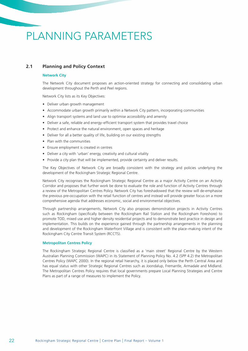
2.1 Planning and Policy context
network city
The Network City document proposes an action-oriented strategy for connecting and consolidating urban development throughout the Perth and Peel regions.
Network City lists as its Key Objectives:
Deliver urban growth management•
Accommodate urban growth primarily within a Network City pattern, incorporating communities•
Align transport systems and land use to optimise accessibility and amenity•
Deliver a safe, reliable and energy–efficient transport system that provides travel choice•
Protect and enhance the natural environment, open spaces and heritage•
Deliver for all a better quality of life, building on our existing strengths•
Plan with the communities•
Ensure employment is created in centres•
Deliver a city with ‘urban’ energy, creativity and cultural vitality•
Provide a city plan that will be implemented, provide certainty and deliver results.•
The Key Objectives of Network City are broadly consistent with the strategy and policies underlying the development of the Rockingham Strategic Regional Centre.
Network City recognises the Rockingham Strategic Regional Centre as a major Activity Centre on an Activity Corridor and proposes that further work be done to evaluate the role and function of Activity Centres through a review of the Metropolitan Centres Policy. Network City has foreshadowed that the review will de-emphasise the previous pre-occupation with the retail function of centres and instead will provide greater focus on a more comprehensive agenda that addresses economic, social and environmental objectives.
Through partnership arrangements, Network City also proposes demonstration projects in Activity Centres such as Rockingham (specifically between the Rockingham Rail Station and the Rockingham Foreshore) to promote TOD, mixed use and higher density residential projects and to demonstrate best practice in design and implementation. This builds on the experience gained through the partnership arrangements in the planning and development of the Rockingham Waterfront Village and is consistent with the place–making intent of the Rockingham City Centre Transit System (RCCTS).
metropolitan centres Policy
The Rockingham Strategic Regional Centre is classified as a ‘main street’ Regional Centre by the Western Australian Planning Commission (WAPC) in its Statement of Planning Policy No. 4.2 (SPP 4.2) the Metropolitan Centres Policy (WAPC 2000). In the regional retail hierarchy, it is placed only below the Perth Central Area and has equal status with other Strategic Regional Centres such as Joondalup, Fremantle, Armadale and Midland. The Metropolitan Centres Policy requires that local governments prepare Local Planning Strategies and Centre Plans as part of a range of measures to implement the Policy.
22

Rockingham Strategic Regional Centre | Centre Plan | Final Report – Volume 1
The policy states:
“Traditional ‘Main Street’ Centres
As far as practicable centres at all levels should be developed or redeveloped in accordance with the traditional ‘main street’ design principles as integrated, attractive, safe and vibrant places to provide a focus for community activities.
Incentives are provided to promote traditional ‘main street’ development by allowing shopping floorspace development to exceed the shopping floorspace guide of this policy or the floorspace specified in an endorsed Local Planning Strategy.”
liveable neighbourhoods (2007)
Liveable Neighbourhoods (2007) has significant application to the future of the Rockingham Strategic Regional Centre.
Element 7 – Activity Centres and Employment has introduced a new and much needed set of principles, objectives and requirements to control the planning and development of activity centres.
The emphasis given to strengthening ‘main street’ development and achieving walkable centres and the delivery of jobs through mixed use development is consistent with the policy position of the City of Rockingham, as detailed in the Rockingham City Centre Development Policy Plan (Statement of Planning Policy 8.1).
In relation to the Strategic Regional Centre, ‘Key Changes from Current Practice’ include:
Main street–fronting retail layouts should predominate, instead of enclosed or parking lot–dominant retail •formats.
The key focus of centre planning is the quality of the public realm with the street being the main organising •element for centre design (not the land use).
All centres are to be planned as mixed–use centres, not just shopping centres.•
Centres are designed to facilitate and encourage walking, cycling and public transport access, not just •car access.
Parking requirements may be reduced where the mix of uses, the parking management and the availability •of other access modes justify reduction.
On-street parking is important, and is incorporated on most streets and counted towards the overall parking •requirements.
Off-street parking is located behind and sleeved by buildings, and is shared between different centre uses.•
Centres are planned with, and provide support for railway stations and/or significant bus services.•
Mixed use centres and other employment generating activity areas are located to become strong •destinations in the public transport network.
Most commercial and business uses are integrated into mixed use centres, rather than segregated in •single–use ‘business parks’.
Centres have an appropriate range of higher density housing both within and immediately round them.•
Large institutional uses such as universities, TAFEs and hospitals are designed as urban complexes, and should •be located in or adjoining activity centres, rather than in campus–style, car based stand–alone precincts.
Building typologies that generate good street frontage become an important component of the centre •planning process.
In order to achieve good streetscapes, appropriate typologies (especially at ground floor) are needed to •support adaptability, economic change, and amenity over time.
23

Rockingham Strategic Regional Centre | Centre Plan | Final Report – Volume 1
PLANNING PARAMETERS
The Liveable Neighbourhoods (2007) document refers to the importance of the ‘main street’ model to centres at all levels. It notes that the Policy No. 4.2 “…already promotes main street mixed use centres, with street–frontage retail, significant levels of employment provision, higher density housing, high amenity environments and facilitation of non-car transport modes.”
LN (2007) goes on to state that,
“SPP 4.2 is to be revised to strengthen these and other requirements in response to the State Sustainability Strategy.”
city of rockingham town Planning Scheme no. 2
TPS 2 updates the overall municipal Town Planning Scheme and retains the City Centre Zone and relevant clauses that give effect to Statement of Planning Policy No.8.1, the Rockingham City Centre Development Policy Plan.
rockingham city centre development Policy Plan (1995)
For approximately 15 years, planning and development in the Rockingham City Centre, the core area of the Strategic Regional Centre (SRC), has been based on the City Centre Development Policy Plan (DPP), which was incorporated in Town Planning Scheme No.1 in 1995 by way of Amendment 207. The DPP is founded on the principles of a ‘main street’ town centre with mixed use, street front development framing and activating the public domain of the city centre.
city centre dPP amendment no.1 (June 2006)
The DPP including/incorporating an Indicative Development Plan was amended to accommodate a set of Enquiry by Design (EbD) Workshop Outcomes from the Rockingham City Centre Transit Street Urban Design Study, conducted in November 2005. The amendment also incorporated Design Guidelines for the new Retail Main Street and Transit Street, as recommended in the EbD Workshop Outcomes Report.
State Sustainability Strategy
The State Government’s sustainability strategy defines sustainability as, “…meeting the needs of current and future generations through an integration of environmental protection, social advancement and economic prosperity”.
The Strategic Regional Centre Plan review endorses and supports key State Government transport and land development policies, including Network City and Liveable Neighbourhoods. Specifically, it endorses the need to reduce car dependency by improving the quality of public transport and by making walking and cycling viable options for a growing proportion of the Rockingham population.
As stated in Liveable Neighbourhoods, “…the emphasis is upon connectivity, amenity and integration to achieve safe, efficient and attractive street networks. The priority is to develop a street network that not only works for vehicles and public transport provision but specifically aims to attract a high level of use by pedestrians, cyclists and the disabled”.
24

Rockingham Strategic Regional Centre | Centre Plan | Final Report – Volume 1
waPc development control Policy dc 1.6 – Planning to Support transit use and transit oriented development
This policy seeks to maximize the benefits to the community of an effective and well used public transit system by promoting planning and development outcomes that will support and sustain public transport use, and which will achieve the more effective integration of land use and public transport infrastructure.
The scope of the policy includes:
Transit–supportive development patterns•
Land use to support transit•
The public domain in transit oriented precincts•
Transit supportive design•
Integrating transit infrastructure•
Precinct planning•
These measures should be applied to the development of the Rockingham Centre and will be addressed through all stages of the planning process, including the preparation of this Centre Plan.
2.2 needs analysis
2.2.1 Population and Workforce Data
rockingham Population estimates
Based on DPUD (August 1991) estimates, the 1995 City Centre Development Policy Plan assumed a municipal population of 67,954 by the year 1996 and 92,302 by the year 2001. It assumed an ultimate municipal population of 215,000.
Source: “Rockingham City Centre Development Policy Plan” City of Rockingham, 1995
1996 Population estimates/Projections
year 1991 1996 2001 2004 2006 2011 2016 2021
Total pop. of City (estimated/projected)
44,201 (actual)
60,190 72,255 82,914 (2,132/yr)
95,230 (2,463/yr)
Source: Population Report No. 1 – June 1996 – WAPC
2005 Population estimates/Projections
year 1991 1996 2001 2004 2006 2011 2016 2021
Total pop. of City (estimated/projected)
70,008 (actual)
82,200 88,900 (3,350/yr)
103,900 (3,000/yr)
116,500 (2,520/yr)
130,100 (2,720/yr)
Source: Population Report No. 6 – November 2005 – WAPC
Note: Population estimates contained in ABS publication 3218.0 released in July 2007 show an estimated resident population of 87,541 in June 2006 for Rockingham (approximately 1,400 less residents than the 2005 projections for 2006).
25
Rockingham Strategic Regional Centre | Centre Plan | Final Report – Volume 1
PLANNING PARAMETERS
Comment:
Earlier population growth forecasts for the municipality based on 1991 census data proved to be optimistic. •
The 1996 forecast was considerably more restrained. •
The 2005 forecast once again predicted stronger growth.•
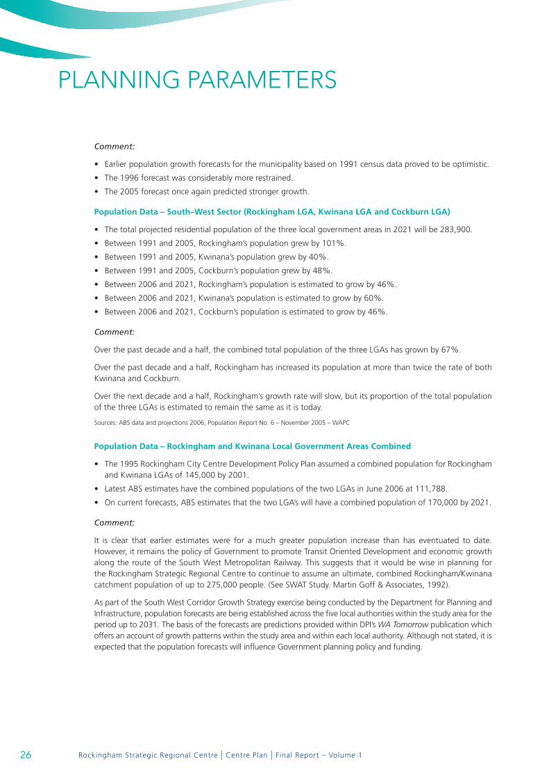
Population data – South–west Sector (rockingham lga, kwinana lga and cockburn lga)
The total projected residential population of the three local government areas in 2021 will be 283,900.•
Between 1991 and 2005, Rockingham’s population grew by 101%.•
Between 1991 and 2005, Kwinana’s population grew by 40%.•
Between 1991 and 2005, Cockburn’s population grew by 48%.•
Between 2006 and 2021, Rockingham’s population is estimated to grow by 46%.•
Between 2006 and 2021, Kwinana’s population is estimated to grow by 60%.•
Between 2006 and 2021, Cockburn’s population is estimated to grow by 46%.•
Comment:
Over the past decade and a half, the combined total population of the three LGAs has grown by 67%.
Over the past decade and a half, Rockingham has increased its population at more than twice the rate of both Kwinana and Cockburn.
Over the next decade and a half, Rockingham’s growth rate will slow, but its proportion of the total population of the three LGAs is estimated to remain the same as it is today.
Sources: ABS data and projections 2006, Population Report No. 6 – November 2005 – WAPC
Population data – rockingham and kwinana local government areas combined
The 1995 Rockingham City Centre Development Policy Plan assumed a combined population for Rockingham •and Kwinana LGAs of 145,000 by 2001.
Latest ABS estimates have the combined populations of the two LGAs in June 2006 at 111,788.•
On current forecasts, ABS estimates that the two LGA’s will have a combined population of 170,000 by 2021.•
Comment:
It is clear that earlier estimates were for a much greater population increase than has eventuated to date. However, it remains the policy of Government to promote Transit Oriented Development and economic growth along the route of the South West Metropolitan Railway. This suggests that it would be wise in planning for the Rockingham Strategic Regional Centre to continue to assume an ultimate, combined Rockingham/Kwinana catchment population of up to 275,000 people. (See SWAT Study. Martin Goff & Associates, 1992).
As part of the South West Corridor Growth Strategy exercise being conducted by the Department for Planning and Infrastructure, population forecasts are being established across the five local authorities within the study area for the period up to 2031. The basis of the forecasts are predictions provided within DPI’s WA Tomorrow publication which offers an account of growth patterns within the study area and within each local authority. Although not stated, it is expected that the population forecasts will influence Government planning policy and funding.
26

Rockingham Strategic Regional Centre | Centre Plan | Final Report – Volume 1
With respect to the precinct that includes the Rockingham Strategic Regional Centre, City Officers have attempted to ensure that the population forecasts are mindful of the framework being progressed as part of the review of the Centre Plan. In this regard, the City has assumed an ultimate population potential for the Centre Plan area of around 36,000 people, based on the application of transit oriented development principles and preliminary modeling undertaken in the course of this Centre Plan project.
The timeframe within which this growth will be achieved will be influenced by numerous factors, however, within the period up to 2031 the City considers it reasonable to assume that the population within the Centre Plan envelope will increase by approximately 11,000 people. This assumption is based on a number of parameters, some anecdotal, including the apparent maturing of the Rockingham market, the urban renewal outcomes from the Rockingham Waterfront Village project, interest from prospective developers, the move towards more sustainable living, planned infrastructure projects etc. These figures have been relayed to DPI for its consideration as part of the South West Corridor Growth Strategy exercise.
workforce 2006
rockingham local government area australia
Employment Rates
Employed full-time 61.0% 60.7%
Employed part-time 26.9% 27.9%
Unemployed 4.7% 5.2%
Occupation
Technicians and Trades Workers 23.1% 14.4%
Clerical and Administrative Workers 13.2% 15.0%
Labourers 12.2% 10.5%
Professionals 11.0% 19.8%
Community and Personal Service Workers 10.8% 8.8%
Sales Workers 10.1% 9.8%
Managers 9.2% 13.2%
Machinery Operators and Drivers 8.6% 6.6%
Source: ABS Data from 2006 Census
27

Rockingham Strategic Regional Centre | Centre Plan | Final Report – Volume 1
PLANNING PARAMETERS
In Rockingham (2006), the most popular employment sectors were:
defence (5.4%), •
school education (4.5%), •
cafes, restaurants and takeaway food services (3.7%), •
supermarket and grocery stores (2.9%), and•
building completion services (2.2%).•
By comparison, Australian figures (2006) for the same industries were:
defence (0.7%), •
school education (4.5%), •
cafes, restaurants and takeaway food services (3.6%), •
supermarket and grocery stores (2.4%), and•
building completion services (1.4%).•
Source: ABS Data from 2006 Census
Comment:
These figures reflect the fact that Rockingham workers and industry are more “blue collar” than the Australian average. The high percentage of workers engaged in the defence industry is notable with a growing requirement for HMAS Stirling Naval Base personnel to be located in offices in the Regional Centre.
2.2.2 Employment
Structure planning for the South West Corridor over the last 30 years has consistently set as an essential objective, the provision of maximum opportunities for economic growth and the creation of a high level of employment self-sufficiency.
The 1995 DPP acknowledged a DPUD target employment figure of around 20,000 persons for the Rockingham Strategic Regional Centre.
2.2.3 Land Use Budget
In 1994 the WAPC endorsed the City Centre Development Policy Plan as the guiding instrument for floorspace provision in the Rockingham Centre.
The DPP made provision for retail, office, commercial, civic and arts floorspace on the basis of an ultimate, combined population catchment of 250,000 and a local workforce in excess of 20,000 employees.
Minimum retail and office floorspace allocations of 100,000m² each were adopted for planning purposes, with a recognition that demand beyond that figure could be accommodated through progressive intensification and development of land within the broader Strategic Regional Centre planning envelope (ie. extending to the Rockingham Beachfront). It was reasoned that floorspace initially developed for showrooms and purposes generally related to home establishment, would progressively change or be redeveloped to more intensive retail and office uses as the community matures.
In the 1998 DPUD Commercial Survey, Rockingham Beach had a total commercial floor area of 9,769m². Since that survey was conducted, the Woolworths supermarket and arcade have closed and it is considered that the total commercial floorspace may have fallen to approximately 6,000m².
28
Rockingham Strategic Regional Centre | Centre Plan | Final Report – Volume 1
The findings and detailed conclusions of the Local Commercial Strategy reinforce the view that local convenience and comparison goods retailing on the beachfront will continue to struggle in the shadow of the City Centre. However, the Strategy anticipates that Rockingham Beach will increasingly take on the role of the Eating, Entertainment and Drinking Outlet (EEDO) extension of the Strategic Regional Centre, in a manner similar to that of Fremantle.
The Commercial Strategy concluded that,
“(Rockingham Beach) …needs definite promotion to reach its approved size and function as a regional entertainment attraction. It may be better to consider Rockingham Beach as ancillary and complementary, as the EEDO extension to the City Centre, rather than a competitor to be restricted in size.”
This concept reflects existing Council Policy with respect to the Waterfront Village.
The Commercial Strategy anticipates that Rockingham Beach could ultimately support about 2,400m² of comparison retail, about 3,200m² of convenience retail and about 13,300m² of EEDO for a total of 18,000+m².
The Commercial Strategy does not make any provision for permanent office and related small business tenancies. Such tenancies are recognised as being an appropriate component of District Centres in the Metropolitan Centres Policy. An office component is certainly an important ingredient in any mixed–use, ‘main street’ form of development.
Another issue of structural importance to the distribution of land use is the prospect of a commercial Pier development on a seabed lease at the end of Wanliss Street. While the City has promoted the concept as an economic development drawcard, no firm plans have been produced.
It is not known if the provision of commercial floorspace on a Pier at the far eastern end of the Waterfront Village would impact negatively on the commercial potential of the established (and struggling) commercial focus which sits generally between Val Street and Flinders Lane. It would be reasonable to assume however that floorspace in any Pier development would fall within the 18,000+m² ultimate total that the Commercial Strategy has assigned for Rockingham Beach.
No arbitrary limit has been placed on the amount of service commercial development accommodated within the Strategic Regional Centre, subject to development meeting the urban intent of the overall Development Plan and conforming with associated planning and design standards for particular precincts.
Given the extent of undeveloped land with the Centre and the emphasis being placed on mixed use performance and urban infill along the transit route, there is no reason at this stage to further revise earlier, theoretical floorspace limits in the course of preparing and implementing an overall planning framework.
In an environment where walking, cycling and the use of public transport is to be encouraged, residential development at urban densities is to be encouraged in accordance with the planning and design requirements of particular precincts. Section 6 explores the potential for transit oriented development along the route of the central transit system with the expectation that a transit system catchment population target could be assigned to the Centre to support infrastructure development and strategic decision-making.
29
Rockingham Strategic Regional Centre | Centre Plan | Final Report – Volume 1
PLANNING PARAMETERS
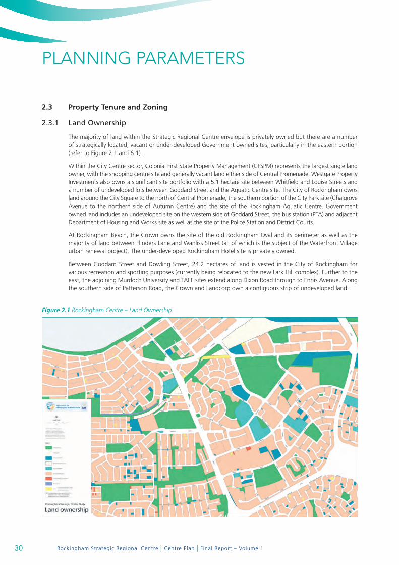
Figure 2.1 Rockingham Centre – Land Ownership
2.3 Property tenure and Zoning
2.3.1 Land Ownership
The majority of land within the Strategic Regional Centre envelope is privately owned but there are a number of strategically located, vacant or under-developed Government owned sites, particularly in the eastern portion (refer to Figure 2.1 and 6.1).
Within the City Centre sector, Colonial First State Property Management (CFSPM) represents the largest single land owner, with the shopping centre site and generally vacant land either side of Central Promenade. Westgate Property Investments also owns a significant site portfolio with a 5.1 hectare site between Whitfield and Louise Streets and a number of undeveloped lots between Goddard Street and the Aquatic Centre site. The City of Rockingham owns land around the City Square to the north of Central Promenade, the southern portion of the City Park site (Chalgrove Avenue to the northern side of Autumn Centre) and the site of the Rockingham Aquatic Centre. Government owned land includes an undeveloped site on the western side of Goddard Street, the bus station (PTA) and adjacent Department of Housing and Works site as well as the site of the Police Station and District Courts.
At Rockingham Beach, the Crown owns the site of the old Rockingham Oval and its perimeter as well as the majority of land between Flinders Lane and Wanliss Street (all of which is the subject of the Waterfront Village urban renewal project). The under-developed Rockingham Hotel site is privately owned.
Between Goddard Street and Dowling Street, 24.2 hectares of land is vested in the City of Rockingham for various recreation and sporting purposes (currently being relocated to the new Lark Hill complex). Further to the east, the adjoining Murdoch University and TAFE sites extend along Dixon Road through to Ennis Avenue. Along the southern side of Patterson Road, the Crown and Landcorp own a contiguous strip of undeveloped land.
30
Rockingham Strategic Regional Centre | Centre Plan | Final Report – Volume 1
2.3.2 Zoning
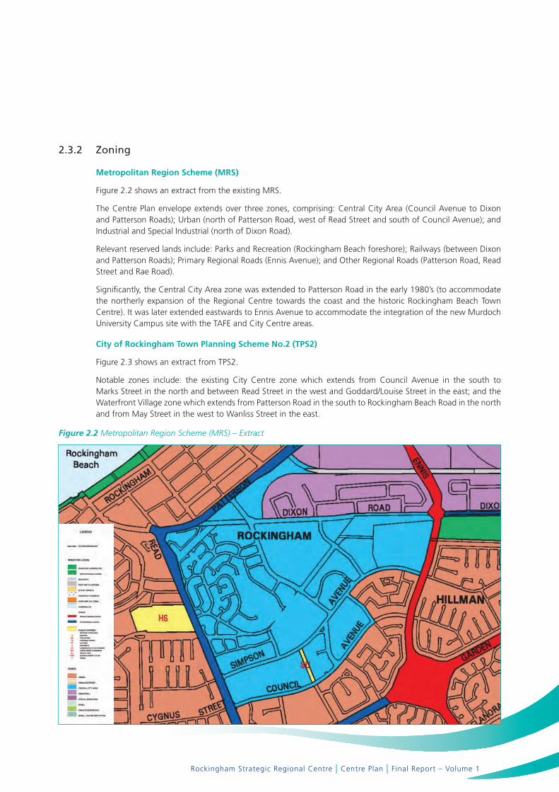
metropolitan region Scheme (mrS)
Figure 2.2 shows an extract from the existing MRS.
The Centre Plan envelope extends over three zones, comprising: Central City Area (Council Avenue to Dixon and Patterson Roads); Urban (north of Patterson Road, west of Read Street and south of Council Avenue); and Industrial and Special Industrial (north of Dixon Road).
Relevant reserved lands include: Parks and Recreation (Rockingham Beach foreshore); Railways (between Dixon and Patterson Roads); Primary Regional Roads (Ennis Avenue); and Other Regional Roads (Patterson Road, Read Street and Rae Road).
Significantly, the Central City Area zone was extended to Patterson Road in the early 1980’s (to accommodate the northerly expansion of the Regional Centre towards the coast and the historic Rockingham Beach Town Centre). It was later extended eastwards to Ennis Avenue to accommodate the integration of the new Murdoch University Campus site with the TAFE and City Centre areas.
city of rockingham town Planning Scheme no.2 (tPS2)
Figure 2.3 shows an extract from TPS2.
Notable zones include: the existing City Centre zone which extends from Council Avenue in the south to Marks Street in the north and between Read Street in the west and Goddard/Louise Street in the east; and the Waterfront Village zone which extends from Patterson Road in the south to Rockingham Beach Road in the north and from May Street in the west to Wanliss Street in the east.
Figure 2.2 Metropolitan Region Scheme (MRS) – Extract
31

Rockingham Strategic Regional Centre | Centre Plan | Final Report – Volume 1
2.4 key Issues
Key issues to be addressed in the Centre Plan include:
There is no clear focus or gravitational hub to the centre and visitors have no real sense of arrival;•
The street network does not provide legible and direct routes into the centre; •
The centre lacks a well-connected network of activated streets to facilitate more direct pedestrian, cycle and •vehicle access to and between various activities and facilities.
There are extensive voids of undeveloped land between the internally focused shopping centre and other •elements of the Strategic Regional Centre, including the adjoining civic core and the embryonic Murdoch University campus.
There is a general absence of urban–scaled mixed use and residential development elements within the centre. •
The public transport system connects to a bus station in the centre, but the low profile, poor image and lack •of townscape integration of the system hinders patronage by centre users.
Beyond the completed streetscapes, civic buildings and public spaces of the civic core, City Park, stage 1 of •the university campus and progressing urban renewal of the Waterfront Village, most of the remainder of the Strategic Regional Centre (including the dominant off-street retail and service commercial elements) falls well short of a credible standard of townscape appearance and amenity.
Figure 2.3 Town Planning Scheme No2
PLANNING PARAMETERS
32

VISION FOR THE STRATEGIC REGIONAL CENTRE

Rockingham Strategic Regional Centre | Centre Plan | Final Report – Volume 1Rockingham Strategic Regional Centre | Centre Plan | Final Report
VISION FOR THE STRATEGIC REGIONAL CENTREA vision statement has been generated to guide planning and development of the Centre.
The vision is for a modern, distinctly coastal centre offering a wide range of mixed uses including retail, commercial, office, civic, residential, education and recreation within an accessible and highly inter-connected, urban–scaled townscape, comprising a major activity centre and related urban villages based on ‘main street’ principles.
This builds on the principles of the Network City regional planning framework and the objectives and concepts of the adopted 1995 Rockingham City Centre Development Policy Plan. It has a wider scope to encompass higher education campuses and adjoining precincts along the route of the proposed transit system through to Rockingham Beach.
Development in the Rockingham Strategic Regional Centre will be defined and characterised by:
Medium to high density development based on activated, “Main Street” principles. •
A configuration of generally contiguous street front buildings and a mix of uses that generate high levels of •pedestrian activity and a sense of vitality.
A street–based transit system, with closely spaced stops.•
A permeable network of streets, laneways, arcades and public spaces that provide high quality linkages, •particularly for pedestrians, to Centre activities from transit stops, street and off-street car parking and from the surrounding walkable catchment.
An identifiable City Centre hub to provide major CBD functions.•
Connected village precincts between the City Centre and Rockingham Beach along the route of the transit •system. The new village precincts will make provision for mixed and consolidated education (university), technology, commercial and medium to high density residential development, based on sustainable planning principles and design criteria.
3.1 Planning and development Principles
3.1.1 Built Form and Urban Design
Principles
Develop generally in accordance with ‘main street’ design principles.•
Incorporate a diversity of activities and human scale in street front development.•
Develop local areas in accordance with specific precinct design and development guidelines and controls.•
Locate and configure buildings to generally address the street and progressively facilitate continuous and contained •streetscapes which provide interest and interaction between buildings and pedestrians at street level.
Make public buildings and spaces universally accessible.•
Design buildings and public spaces that contribute to a comfortable pedestrian environment, providing •opportunities for weather protection, including shelter from prevailing strong wind conditions.
Minimise any detrimental impacts on neighbouring properties.•
Encourage a gradual stepping up of the built form at the interface of low and high rise development.•
34

Rockingham Strategic Regional Centre | Centre Plan | Final Report – Volume 1
3.1.2 Access, parking
Principles
Make walking the most important mode of transport within the Centre. Streets, public places and adjacent •development should be designed to provide a safe, secure, stimulating and pleasant walking environment.
Link the major regional and sub-regional road system to the city centre by a range of direct and legible street •connections.
Ensure that the city centre and related activity centre street networks are “fine grained” to provide a multiple •choice of routes for pedestrians, cyclists and vehicles.
Provide a custom–designed, street–based public transit system to link the city centre with the railway station, •the university precinct and the Rockingham foreshore.
Centre elements – mixed commercial/residential
Centre elements – ‘TOD’ residential range
Centre elements – mixed uses framing central park
35
Rockingham Strategic Regional Centre | Centre Plan | Final Report – Volume 1
VISION FOR THE STRATEGIC REGIONAL CENTRE
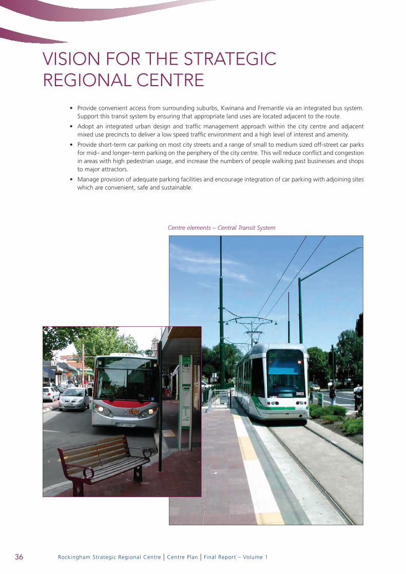
Centre elements – Central Transit System
Provide convenient access from surrounding suburbs, Kwinana and Fremantle via an integrated bus system. •Support this transit system by ensuring that appropriate land uses are located adjacent to the route.
Adopt an integrated urban design and traffic management approach within the city centre and adjacent •mixed use precincts to deliver a low speed traffic environment and a high level of interest and amenity.
Provide short-term car parking on most city streets and a range of small to medium sized off-street car parks •for mid– and longer–term parking on the periphery of the city centre. This will reduce conflict and congestion in areas with high pedestrian usage, and increase the numbers of people walking past businesses and shops to major attractors.
Manage provision of adequate parking facilities and encourage integration of car parking with adjoining sites •which are convenient, safe and sustainable.
36

Rockingham Strategic Regional Centre | Centre Plan | Final Report – Volume 1
Centre elements – ‘green parking streets’
Locate parking areas to minimise adverse impacts on the streetscape.•
Control new development so that access ways and parking facilities do not visually dominate the public realm •or create obstructions to the pedestrian environment and minimise potential pedestrian/vehicle conflicts.
Avoid semi-basement car parking solutions as they impact negatively on the ground level activation of •adjoining streets.
37

Rockingham Strategic Regional Centre | Centre Plan | Final Report – Volume 1
VISION FOR THE STRATEGIC REGIONAL CENTRE
Centre elements – construction of ‘main street’
3.1.3 Public Domain
Principles
Enhance the quality, identity, comfort, accessibility and usability of existing streets, parks and civic spaces.•
Expand and link the number of public spaces wherever possible through both public and private initiatives.•
Integrate different precincts through the use of a simple and consistent palette of vegetation, paving, signage •and street furniture.
Design new development so as to contribute to the quality of the public domain and the framing and •activation of the public space network.
Provide for well–designed and integrated toilets, seating, lighting and public art within the public domain.•
3.1.4 Land Uses
Principles
Ensure that new uses support and enhance the role of the Rockingham Centre as the primary ‘main street’ •activity centre in the South West Perth Metropolitan Region.
Reinforce the ‘main street’ model for the centre by giving priority to active street–oriented land uses over •off-street ‘big–box’ activities.
Encourage land uses and developments that employ and attract high numbers of people, and have the •potential to activate the City centre and related village precincts by day and night along the route of the principal, street based public transport system. Such uses should include medium to high density residential, retail, civic and community facilities, educational and cultural facilities, cafes, restaurants, hotels, offices and other intensive employment uses.
Avoid land uses and developments that generate high volumes of cars and trucks and have low employment •intensities within the city centre or the adjacent transit–oriented development village precincts.
Encourage and promote a diverse mix of uses in preference to mono–functional land uses on larger sites.•
Enhance the activity appeal of the Rockingham Centre to both local and regional visitors.•
Encourage attractive and safe alfresco dining facilities to foster a lively streetscape.•
38

Rockingham Strategic Regional Centre | Centre Plan | Final Report – Volume 1
Centre elements – activated pedestrian links
Promote appealing and distinctive retail uses reflecting the coastal nature and lifestyle of Rockingham and •its community.
Ensure that residential uses are integrated with the retail, commercial and hospitality potential of the •Rockingham Centre.
Discourage the undue aggregation of facilities along “main street” corridors, pedestrian links and major •public spaces that are characterised by low levels of activity during normal shopping hours.
Encourage new development to provide options for future flexibility and changes in land use.•
39

Rockingham Strategic Regional Centre | Centre Plan | Final Report – Volume 1
VISION FOR THE STRATEGIC REGIONAL CENTRE3.1.5 Safety and Security
Principles
Design buildings to provide a safe environment for all users, contribute positively to the enhancement of •public safety, and minimise the need for intrusive surveillance technologies.
Incorporate unobtrusive security measures into building design that is in keeping with the building’s •architectural style and materials.
Design public spaces to facilitate safe pedestrian use and create a sense of public ownership.•
3.1.6 Sustainability
Principles
Ensure timely and efficient provision of physical and social infrastructure to enable the Centre to service its •strategic functions;
Promote environmentally sustainable practices, including resource efficiency (energy, water, waste, air quality, •material selection), at all stages of development – planning, subdivision design, building construction and maintenance;
Provide sufficient land for employment opportunities and to support local and regional economic growth;•
Expand sustainable and efficient transport options within and to the Centre for the broad population while •creating opportunities to reduce single occupancy vehicle trips;
Ensure timely provision of services and facilities that are equitable, durable, accessible, of a high–quality and •that promote community well-being and health;
Promote a range of housing choices (densities, ownership patterns, price and building types) to ensure a •diverse population can be housed, including designing buildings to be adaptable and to accommodate changes in land use or additions expected over time; and
Protect the air and water quality of the centre.•
Activated waterfront promenade
40

ACCESS AND MOVEMENT NETwORK OPTIONS

Rockingham Strategic Regional Centre | Centre Plan | Final Report – Volume 1
ACCESS AND MOVEMENT NETwORK OPTIONS4.1 Street types
A number of different street types are commonly found in city centres, mixed use urban villages and on access streets to, through and around these centres.
Street types relevant to the development of the Rockingham Strategic Regional Centre include:
major traffic routes• – the main traffic carrying roads in the area. They include Ennis Avenue, Patterson Road, Dixon Road, Read Street and Rae Road. They are generally dual carriageways designed to carry high volumes of traffic and generally do not penetrate the city centre or adjoining mixed use town or village centres.
city centre access Streets• – connect with the major traffic routes and provide access directly into and through the city centre. They include Council Avenue, Central Promenade, Chalgrove Avenue and Goddard Street. These streets generally balance access, parking and pedestrian amenity needs. They usually have only one traffic lane in each direction with a median and kerbside parking.
transit Street and transit Priority Streets• – custom designed to provide priority for public transport along major transit routes and avoid undue delay to public transport services. Transit priority is proposed along significant sections of the Rockingham City Centre Transit System route. The design varies to meet local design constraints. Access for other traffic is generally permitted within the street reservation, but this is not always the case. They are designed to provide for safe, convenient pedestrian movement.
city and town centre Streets• – pedestrian movement and circulation is very important on these streets. Design permits two–way traffic movement but at a slow speed to provide for safe pedestrian movement. Kerbside parking is normally permitted. A central median is sometimes provided to improve the streetscape, but is not mandatory.
low Speed Park road• – this road type could improve connectivity through the City Park to the north of Civic Boulevard. Such a road would be subject to closure at certain times when events such as open air concerts are held in the park. The paved area would be narrow (about 5 metres) to encourage slow speed. Parking would not be permitted along this section of road.
green Parking Streets• – to be constructed around the periphery of the city centre and on sections of Patterson Road near the foreshore. Their function is to assist with the provision of public parking whilst allowing the street to function normally for both pedestrian and vehicular access. Right angle median and parallel kerbside parking is normally permitted. An example of this type of street exists along part of Patterson Road near the foreshore. Streets of this type are quite common in areas of Melbourne (eg Carlton).
connector Streets• – provided outside the major activity nodes to link areas within and adjacent to the centre. They can pass through areas with different land uses (eg residential, business or education). Indented kerbside parking and appropriately designed pedestrian crossing areas would normally be incorporated into the design.
access Streets• – generally found outside of the highly trafficked areas of city, town and village centres. The primary purpose of these streets is to provide access to properties for motorists, pedestrians and cyclists. In light industrial and commercial areas (and in residential areas on an infrequent basis) they also cater for delivery vehicles.
Pedestrian malls/accessways• – provide essential pedestrian connectivity in areas where the street network is not well–connected. An internal network of pedestrian malls exists within the Rockingham City shopping centre. A major purpose of such pedestrian malls is to provide a sheltered and controlled retail environment. Beyond the private domain of the shopping centre, pedestrian laneways and pathways through public space connect a wide array of mixed uses.
42

Rockingham Strategic Regional Centre | Centre Plan | Final Report – Volume 1
4.2 Improving the transport System
In the Rockingham Strategic Regional Centre the transport system should be developed to:
Support the sustainable growth and development of the centre;•
Be an economic enabler;•
Be energy efficient and environmentally responsible;•
Promote place making and community building;•
Facilitate access and movement in an equitable and affordable manner.•
4.3 network options
In October 2006, an integrated transport workshop was held involving the centre study technical team and officers of the City of Rockingham and the Department for Planning and Infrastructure. Transport issues, principles and network options were discussed and modified as necessary.
Two network options were subsequently developed for the purposes of further evaluation (including transport modelling). The two network options are attached to this report as Figures 4.1 and 4.2. The major features of the two options and the extent to which they will contribute to the study objectives are described as follows:
Both options provide significantly improved access to the city centre for traffic entering the city from the •Kwinana Freeway via Mundijong Road and Dixon Road and from Kwinana via Dixon Road.
Both options provide improved access to the city centre from Patterson Road via a new access road connecting •north/south through the proposed educational, mixed use precinct.
Option 2 provides for improved access between the city centre and the proposed mixed use educational •precinct and the foreshore via a new signalised crossing of Patterson Road to Victoria Street.
Both options provide for improved east west connectivity through the city centre by the direct connection of •Central Promenade to Simpson Avenue.
Access to the city centre and the mixed use university precinct from the south via Read Road will be improved •with both options by the provision of additional north/south connections between Rae Road, Council Avenue, Central Promenade and Chalgrove Avenue. This improved connectivity is more pronounced with Option 2. Option 2 also provides for improved connectivity to west Rockingham via a signalised crossing of Read Street into Swinstone Street.
Option 2 provides for a more direct and legible street based major transit route to Rockingham foreshore •than Option 1.
Road network needs to provide more direct access to the ‘main street’ core of City Centre
43

Rockingham Strategic Regional Centre | Centre Plan | Final Report – Volume 1
ACCESS AND MOVEMENT NETwORK OPTIONSFigure 4.1 Transport Option 1
Figure 4.2 Transport Option 2
Transit Stations
Major Traffic Routes
City Centre Access Streets
Traffic Lights
Roundabout
City Centre / Town Centre Streets
Green Parking Streets
Connector Streets
Transit Street &Transit Priority Streets
Street Based Transit System
Pedestrian Links
Low Speed Park Road(Closed at certain times)
Transit Stations
Major Traffic Routes
City Centre Access Streets
Traffic Lights
Roundabout
City Centre / Town Centre Streets
Green Parking Streets
Connector Streets
Transit Street &Transit Priority Streets
Street Based Transit System
Pedestrian Links
Low Speed Park Road(Closed at certain times)
44
Rockingham Strategic Regional Centre | Centre Plan | Final Report – Volume 1
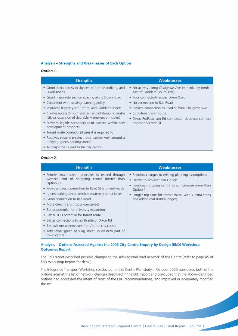
analysis – Strengths and weaknesses of each option
Option 1.
Strengths weaknesses
Good direct access to city centre from Mundijong and •Dixon Roads
Good major intersection spacing along Dixon Road•
Consistent with existing planning policy•
Improved legibility for Central and Goddard Streets•
Creates access through western end of shopping centre •(allows extension of desirable Mainstreet principles)
Provides legible secondary road pattern within new •development precincts
Transit route connects all uses it is required to•
Resolves eastern precinct road pattern well around a •unifying ‘green parking street’
All major roads lead to the city centre•
No activity along Chalgrove Ave immediately north–•east of Goddard (south side)
Poor connectivity across Dixon Road•
No connection to Rae Road•
Indirect connection to Read St from Chalgrove Ave•
Circuitous transit route•
Dixon Rd/Patterson Rd connection does not connect •opposite Victoria St
Option 2.
Strengths weaknesses
Permits ‘main street’ principles to extend through •western end of shopping centre (better than Option 1)
Provides direct connection to Read St and westwards•
‘green parking street’ resolves eastern precinct issues•
Good connection to Rae Road•
More direct transit route (perceived)•
Better potential for university expansion•
Better TOD potential for transit route•
Better connections to north side of Dixon Rd•
Better/more connections from/to the city centre•
Additional ‘green parking street’ in western part of •town centre
Requires changes to existing planning assumptions•
Harder to achieve than Option 1•
Requires shopping centre to compromise more than •Option 1
Longer trip time for transit route, with 4 extra stops •and added cost (600m longer)
analysis – options assessed against the 2005 city centre enquiry by design (ebd) workshop outcomes report
The EbD report described possible changes to the sub-regional road network of the Centre (refer to page 45 of EbD Workshop Report for detail).
The Integrated Transport Workshop conducted for this Centre Plan study in October 2006 considered both of the options against the list of network changes described in the EbD report and concluded that the above–described options had addressed the intent of most of the EbD recommendations, and improved or adequately modified the rest.
45
Rockingham Strategic Regional Centre | Centre Plan | Final Report – Volume 1
ACCESS AND MOVEMENT NETwORK OPTIONS4.4 further assessment and refinement of options
Further refinement of these options and consideration of a preferred option is discussed in Section 7.
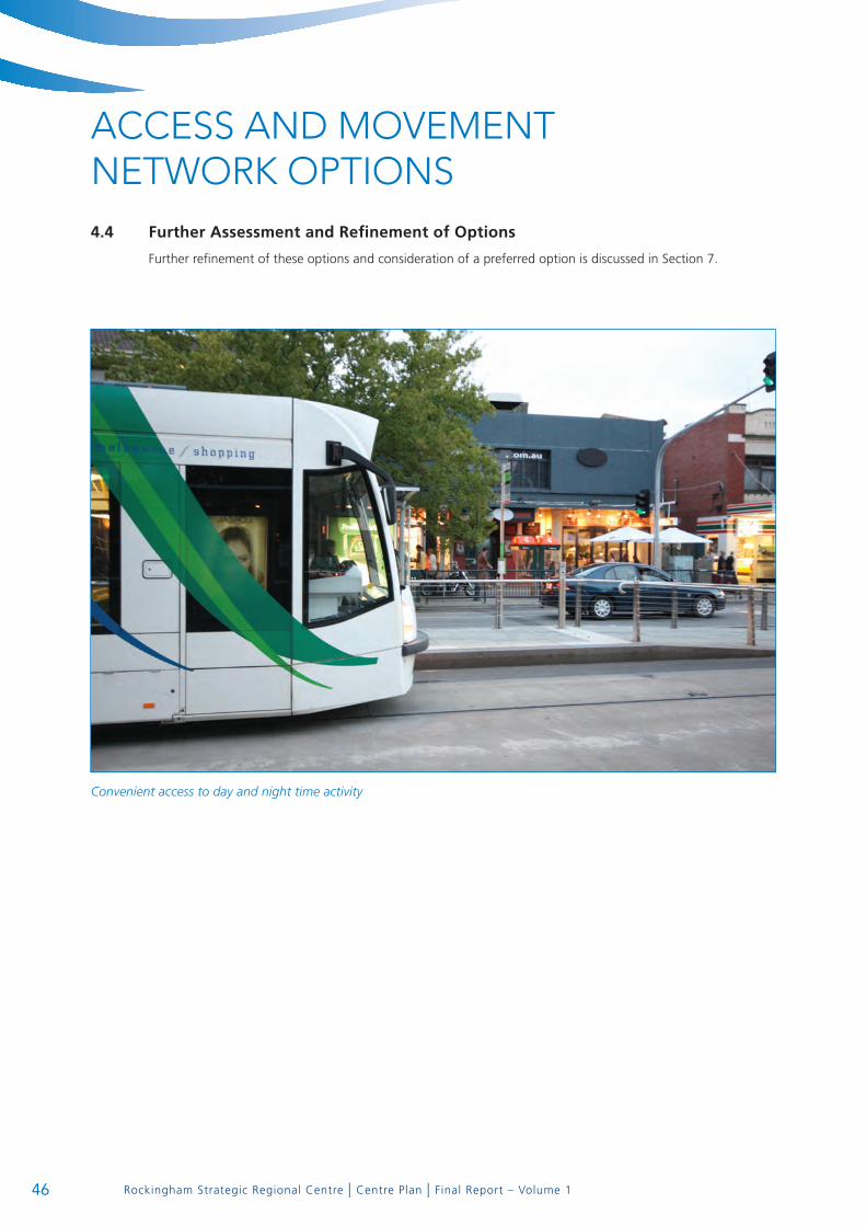
Convenient access to day and night time activity
46

REGIONAL CENTRE CONCEPT PLAN
Rockingham Strategic Regional Centre | Centre Plan | Final Report – Volume 1
REGIONAL CENTRE CONCEPT PLAN
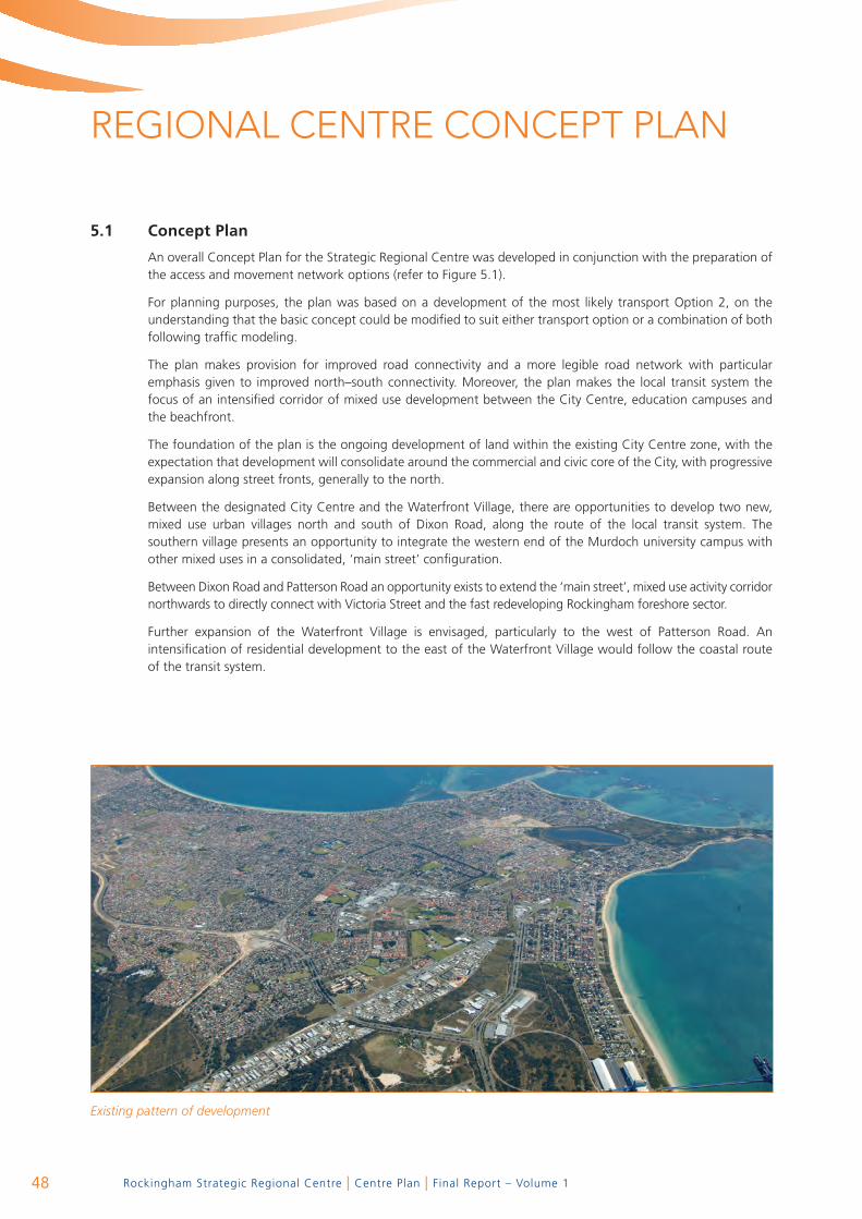
5.1 concept Plan
An overall Concept Plan for the Strategic Regional Centre was developed in conjunction with the preparation of the access and movement network options (refer to Figure 5.1).
For planning purposes, the plan was based on a development of the most likely transport Option 2, on the understanding that the basic concept could be modified to suit either transport option or a combination of both following traffic modeling.
The plan makes provision for improved road connectivity and a more legible road network with particular emphasis given to improved north–south connectivity. Moreover, the plan makes the local transit system the focus of an intensified corridor of mixed use development between the City Centre, education campuses and the beachfront.
The foundation of the plan is the ongoing development of land within the existing City Centre zone, with the expectation that development will consolidate around the commercial and civic core of the City, with progressive expansion along street fronts, generally to the north.
Between the designated City Centre and the Waterfront Village, there are opportunities to develop two new, mixed use urban villages north and south of Dixon Road, along the route of the local transit system. The southern village presents an opportunity to integrate the western end of the Murdoch university campus with other mixed uses in a consolidated, ‘main street’ configuration.
Between Dixon Road and Patterson Road an opportunity exists to extend the ‘main street’, mixed use activity corridor northwards to directly connect with Victoria Street and the fast redeveloping Rockingham foreshore sector.
Further expansion of the Waterfront Village is envisaged, particularly to the west of Patterson Road. An intensification of residential development to the east of the Waterfront Village would follow the coastal route of the transit system.
Existing pattern of development
48
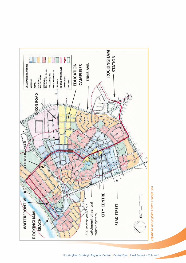
Rockingham Strategic Regional Centre | Centre Plan | Final Report – Volume 1
Fig
ure
5.1
Roc
king
ham
Cen
tre
Con
cept
Pla
n
rea
d S
tree
t
600
met
re w
alka
ble
ca
tch
men
t o
f ce
ntr
al
tran
sit
syst
em
ro
ck
Ing
ha
m
Bea
ch
wa
ter
fro
nt
VIl
lag
ePa
tter
Son
ro
ad
dIx
on
ro
ad
edu
ca
tIo
n
ca
mPu
SeS
enn
IS a
Ve.
ro
ck
Ing
ha
m
Sta
tIo
n
cIt
y c
entr
e
49

TRANSIT ORIENTED DEVELOPMENT POTENTIAL

Rockingham Strategic Regional Centre | Centre Plan | Final Report – Volume 1
TRANSIT ORIENTED DEVELOPMENT POTENTIAL
‘TOD’ along a street based transit route
6.1 Background
The Rockingham City Centre Transit System (RCCTS) connects the new rail station with the City Centre, education campuses and the renowned beachfront. The route of the street–based transit system is being developed initially as a busway with the understanding that it will be upgraded to an electric streetcar or light rail operation once a more supportive level of development has been achieved along the route.
The City of Rockingham is committed to achieving the vision of a fixed route, streetcar transit system as the focus of a corridor of high intensity, mixed use development between the rail station and the beachfront.
Accordingly, a review of the Centre Plan was commissioned on the understanding that it would demonstrate the application of sustainable development principles with a particular emphasis on Transit Oriented Development (TOD).
52

Rockingham Strategic Regional Centre | Centre Plan | Final Report – Volume 1
6.2 tod Policy framework
network city
The Network City document sets out a clear strategic foundation for TOD implementation in the Perth region.
According to the document,
“The concept of the Network city is designed to optimize land use and transport linkages between centres and for public transport to be supported by a range of activities at the centres as well as the land uses along the corridors linking the centres. Strong centres at each end of the ‘activity corridors’ support an effective public transport system in both directions along the corridor. The major elements of the Network city are the activity corridors, activity centres, and transport corridors.
Activity centres are locations where a range of activities is encouraged. Employment, retail, living, entertainment, higher education, high level or specialized medical services are just a few such activities.
Activity corridors are connections between activity centres that provide excellent, high frequency public transport to support the land uses that will occur along the activity corridors and at the activity centres. Activity corridors are not designed to be high–speed through traffic routes.”
Strategy 1.1 seeks to foster land use and transport integration to form a Network city, by:
“Encouraging mixed use development in activity centres, including higher density residential developments and employment generators, especially where centres are well served by public transport and have high amenity, walkable catchments.”
In a key action to support the strategy, Network City proposes demonstration projects in Activity Centres to promote TOD, mixed use and higher density residential projects, and to demonstrate best practice in design and implementation. The Rockingham Activity Centre between the new rail station and the foreshore was one of several locations nominated for a major TOD demonstration project. The Premier’s Taskforce is facilitating the project through the Terms of Reference of the Rockingham Centre Plan.
development control Policy dc 1.6 – Planning to Support transit use and transit oriented development
The amended Development Control Policy 1.6 was adopted by the WAPC in 2005 to reflect the Government’s vision for a sustainable future as outlined in the Network City and the State Sustainability Strategy.
The Policy notes that,
“As the public transport system is further refined and extended, there will be emerging opportunities for new development that is focused upon, and maximizes the benefits derived from significant new public investments in transit infrastructure.”
The Policy has direct application to the planning and development of property along the route of the Rockingham City Centre Transit System.
Policy measures include:
Transit–supportive development patterns•
Land use to support transit•
The public domain in transit oriented precincts•
Transit supportive design•
Integrating transit infrastructure•
Precinct planning•
53
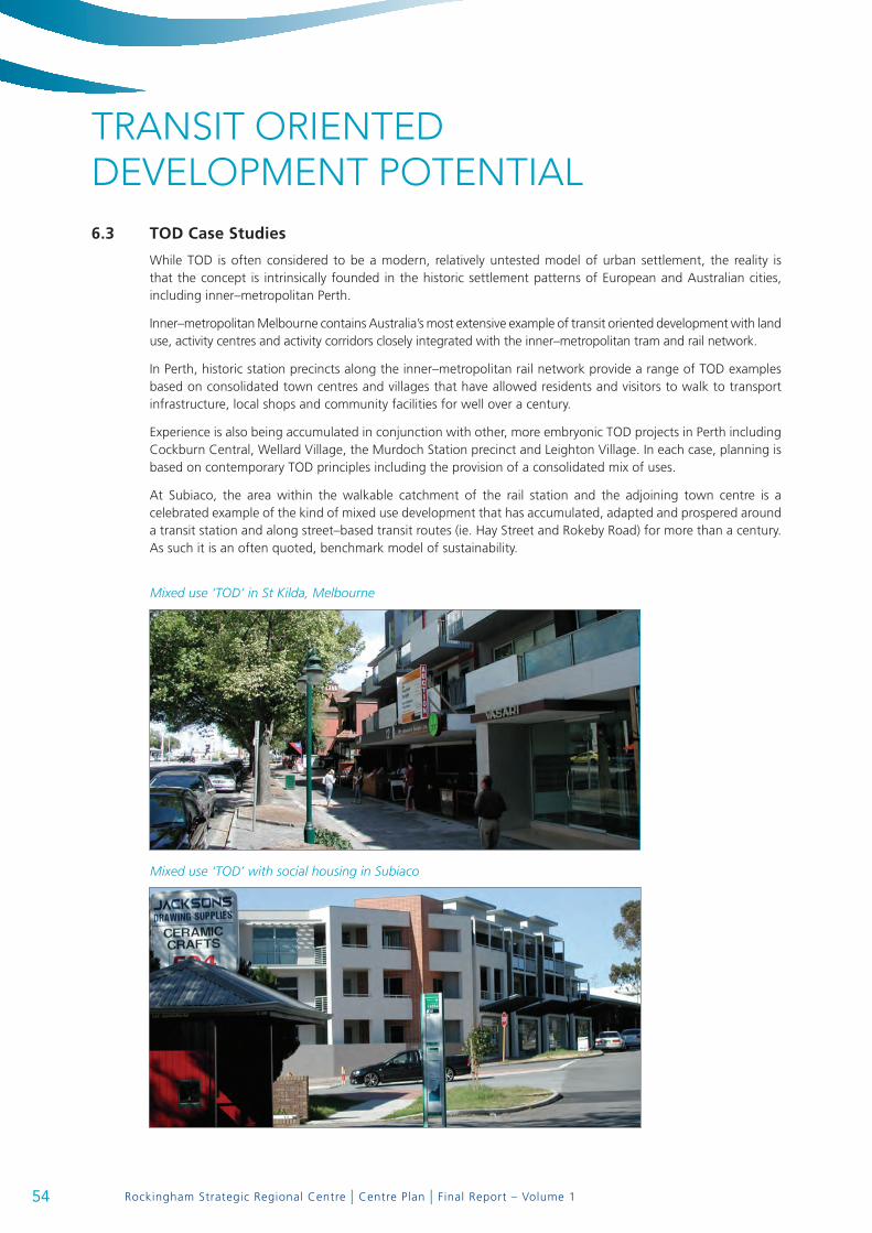
Rockingham Strategic Regional Centre | Centre Plan | Final Report – Volume 1
Mixed use ‘TOD’ in St Kilda, Melbourne
Mixed use ‘TOD’ with social housing in Subiaco
TRANSIT ORIENTED DEVELOPMENT POTENTIAL6.3 tod case Studies
While TOD is often considered to be a modern, relatively untested model of urban settlement, the reality is that the concept is intrinsically founded in the historic settlement patterns of European and Australian cities, including inner–metropolitan Perth.
Inner–metropolitan Melbourne contains Australia’s most extensive example of transit oriented development with land use, activity centres and activity corridors closely integrated with the inner–metropolitan tram and rail network.
In Perth, historic station precincts along the inner–metropolitan rail network provide a range of TOD examples based on consolidated town centres and villages that have allowed residents and visitors to walk to transport infrastructure, local shops and community facilities for well over a century.
Experience is also being accumulated in conjunction with other, more embryonic TOD projects in Perth including Cockburn Central, Wellard Village, the Murdoch Station precinct and Leighton Village. In each case, planning is based on contemporary TOD principles including the provision of a consolidated mix of uses.
At Subiaco, the area within the walkable catchment of the rail station and the adjoining town centre is a celebrated example of the kind of mixed use development that has accumulated, adapted and prospered around a transit station and along street–based transit routes (ie. Hay Street and Rokeby Road) for more than a century. As such it is an often quoted, benchmark model of sustainability.
54

Rockingham Strategic Regional Centre | Centre Plan | Final Report – Volume 1
The Subi–Centro redevelopment area, which includes the redeveloped Subiaco Rail Station precinct, has been developed around contemporary TOD principles over the last 10 years. While much of the early phases of development concentrated on medium density subdivision, residential development closer to the station is now predominantly focused on multi-residential apartments. It is anticipated that further intensification will be achieved in the remaining development parcels.
An unexpected outcome from the Subiaco experience is that while the redevelopment area has been designed around TOD principles, a large proportion of residents still use private motor vehicles as their primary means of transport.
In a household survey conducted for the Subiaco Redevelopment Authority (SRA) in 2006 it was found that the majority of residents in the Subiaco redevelopment project area still use a car as their most frequent mode of transport to work, school or university and 84% of dwellings in the Subiaco project area have at least one car at home. This survey is supported by an earlier post occupancy survey undertaken for the SRA in 2005 that found that car ownership levels had not changed since residents moved to Subi Centro, although there had been an overall increase in walking and the use of trains. In essence, the number of cars per residence correlated with household occupancy.
Further, it has been the experience of the City of Subiaco that while the Subiaco Regional Centre TOD model has accessible, high quality public transport servicing a multitude of trip options, demand for car parking emanating from the redevelopment area has exceeded supply and overflowed into the adjoining town centre.
This suggests that society is going through a transitional phase of re-orientation to transit and that TOD needs to accommodate a choice of transport modes, albeit within the framework and design disciplines of a pedestrian–focused townscape model.
Planning for TOD in a mixed use activity centre must focus on generally consolidated development without the imposition of fragmenting, highly trafficked road barriers and surface car parks within the walkable catchment. However, it is also necessary to make appropriate provision for both private vehicle access and parking to achieve threshold street activity levels and market acceptance, particularly during the crucial establishment phase. In other words, TOD and moderated private vehicle ownership, access and parking should not be seen as being mutually exclusive. They need to be carefully balanced to achieve the desired development outcome.
An appropriate TOD car parking strategy should make provision for a moderated but realistic supply of car parking bays that can be distributed between on-street bays and compact, off-street stations or garages (behind or below street front buildings).
6.4 tod catchment
The TOD catchment encompasses land within a walkable distance of the transit system. At Rockingham the catchment follows the route of the city centre transit system between the rail station and the beachfront. It is generally 600 metres wide (each side) along the transit route (to service a future tram or streetcar system). While physical barriers and the unsympathetic configuration of established development around the rail station limits its potential for TOD in the foreseeable future, the 3 kilometre long RCCTS transit corridor between the rail station and the beachfront encompasses an area of approximately 580 hectares and presents a TOD opportunity of considerable scope.
6.5 land use distribution and development Intensity
The following land use assumptions have been generated in conjunction with the preparation and refinement of the draft Concept Plan, the modeling of transport network options and the selection of a preferred transport network.
A mix of active, high intensity uses are appropriate for land within the walkable catchment of the transit route. The intensity and mix of uses should reflect local precinct characteristics along the activity corridor.
55
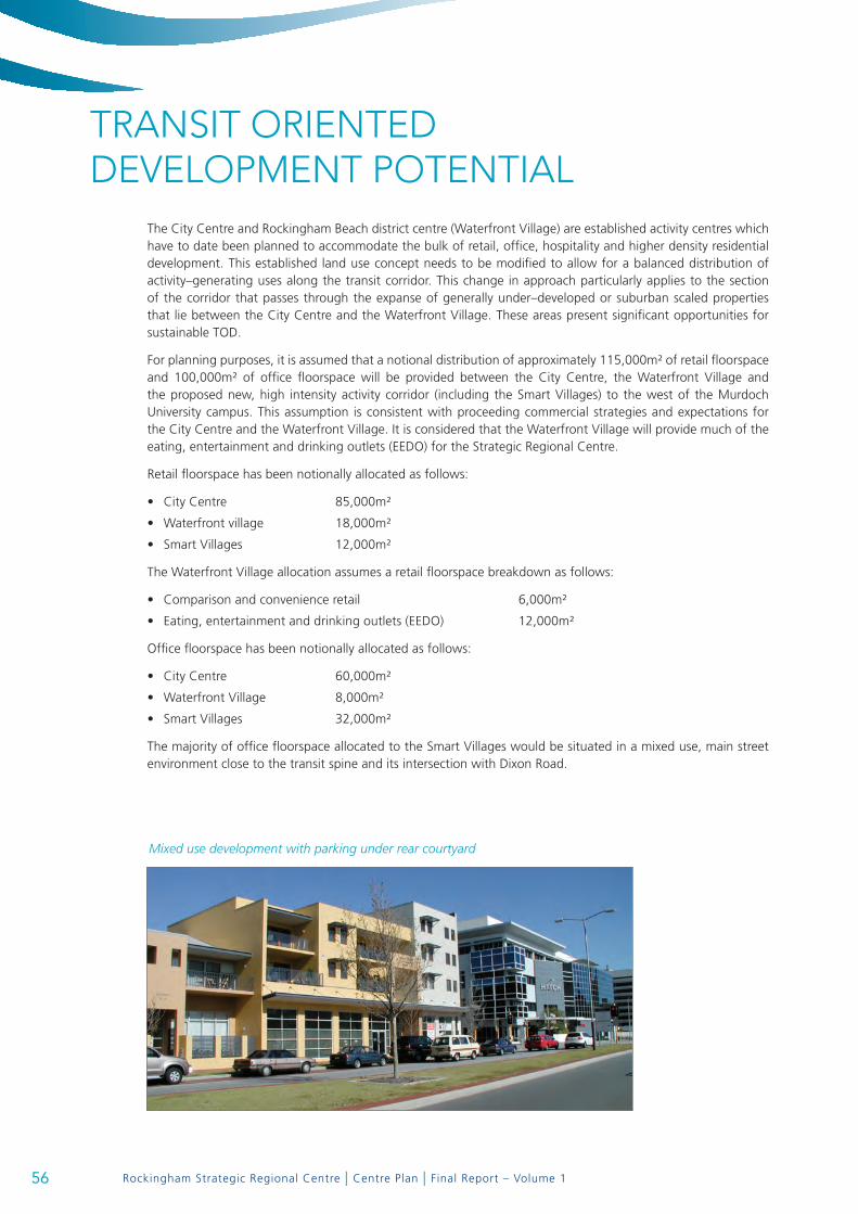
Rockingham Strategic Regional Centre | Centre Plan | Final Report – Volume 1
Mixed use development with parking under rear courtyard
TRANSIT ORIENTED DEVELOPMENT POTENTIAL
The City Centre and Rockingham Beach district centre (Waterfront Village) are established activity centres which have to date been planned to accommodate the bulk of retail, office, hospitality and higher density residential development. This established land use concept needs to be modified to allow for a balanced distribution of activity–generating uses along the transit corridor. This change in approach particularly applies to the section of the corridor that passes through the expanse of generally under–developed or suburban scaled properties that lie between the City Centre and the Waterfront Village. These areas present significant opportunities for sustainable TOD.
For planning purposes, it is assumed that a notional distribution of approximately 115,000m² of retail floorspace and 100,000m² of office floorspace will be provided between the City Centre, the Waterfront Village and the proposed new, high intensity activity corridor (including the Smart Villages) to the west of the Murdoch University campus. This assumption is consistent with proceeding commercial strategies and expectations for the City Centre and the Waterfront Village. It is considered that the Waterfront Village will provide much of the eating, entertainment and drinking outlets (EEDO) for the Strategic Regional Centre.
Retail floorspace has been notionally allocated as follows:
City Centre 85,000m²•
Waterfront village 18,000m²•
Smart Villages 12,000m²•
The Waterfront Village allocation assumes a retail floorspace breakdown as follows:
Comparison and convenience retail 6,000m²•
Eating, entertainment and drinking outlets (EEDO) 12,000m²•
Office floorspace has been notionally allocated as follows:
City Centre 60,000m²•
Waterfront Village 8,000m²•
Smart Villages 32,000m²•
The majority of office floorspace allocated to the Smart Villages would be situated in a mixed use, main street environment close to the transit spine and its intersection with Dixon Road.
56

Rockingham Strategic Regional Centre | Centre Plan | Final Report – Volume 1
Residential land use is typically a major component of mixed use TOD. Given that the Waterfront Village project has demonstrated a demand for high amenity, urban–scaled residential accommodation at Rockingham, it is realistic to assume that medium to high density residential development will be a major driver of the TOD process. It has the capacity to shape and populate the desired activity corridor.
Within the defined TOD catchment, existing residential densities generally match the suburban norm of Rockingham with the exception of pockets of higher density along the Rockingham beachfront (200 + dwellings per hectare along Rockingham Beach Road and up to 100 dwellings per hectare in the adjoining Waterfront Village) and in clusters of group housing around the City Centre (typically 50 dwellings per hectare).
Over the last few years, the City of Rockingham has received proposals for several medium rise, multi-residential apartment developments on City Centre zoned land. This has been driven by strong sales in the Waterfront Village and the realisation that the elevated apartment building model in central Rockingham could achieve expansive views around the entire Rockingham coastline. There appears to be a market potential for higher rise, multi-residential apartment development beyond the coastal fringe.
The advent of the TOD concept along the transit corridor provides the planning and amenity context for an orderly arrangement and distribution of medium to higher density residential development.
Since the late 1980’s there has been an international consensus among researchers and transit operators that the gross average residential density threshold for light rail transit is approximately 50 persons per hectare. More recently, planners have also recognized that a greater intensity and massing of development is needed to create the urban context for successful TOD.
TOD’s at Subiaco are being planned to achieve an average residential density of 120 dwellings per hectare with a net yield of 60 to 200 dwellings per hectare on defined blocks. Similar TOD densities are being implemented in Government fostered development projects at Leighton, Cockburn Central and Murdoch.
In the case of the Rockingham TOD, residential densities could range between 60 and 200+ dwellings per hectare (as is currently being developed in parts of the Rockingham Waterfront Village).
It has been assumed that car parking generated by various land uses and activities will generally be self–contained within the relevant traffic zones to avoid an over–concentration in any one sector.
6.6 urban design and Built form
While the overall TOD concept is for a consolidated, generally contiguous corridor of development along the transit route, it is essential that TOD at Rockingham has a varied and geographically appropriate character that offers multiple choices in lifestyle and convenience.
TOD with a commercial content will range from the expanded shopping centre, that will be sleeved to connect with street front tenancies and an adjacent entertainment complex, through to individual mixed use developments on freehold sites.
A variety of residential dwelling types and tenures will be encouraged, including traditional street front townhouses, contemporary row houses, mews housing, low rise apartment blocks and medium to high–rise multiple apartments with a lifestyle focus ranging in height from three to twenty or more storeys, subject to precinct–specific guidelines. Drawing on recent good practice, a range of urban–scaled dwelling sizes will also be encouraged (and possibly mandated) to ensure that a wide spectrum of household types and levels of affordability can be accommodated.
Particular emphasis will be given to shaping the form of development along the edge of the transit route and around transit stops. In particular, there is a need for design measures to optimise the safety and amenity of stops along the route, including achieving adequate levels of activation and passive surveillance from adjoining properties.
57