Embed Size (px)
Citation preview

Roadway Classification LRS Comparison Tool for Enhancing Data Integrity
James Krolick, VHB, Inc. Boulder, CO
Corey Webb, FDOT D3. Chipley, FL
Amy Wiwi, Metric Engineering. Chipley, FL

Team Profile
Who:
FDOT D3 (District 3) Planning Staff,
Internal GIS Staff and GIS Consultants
(VHB, Metric)
Where:
District Three represents Florida's Panhandle (16 counties). Its 1,402,000 residents
are spread over 16 counties and 11,500 square miles. Each day motorists travel
more than 26.1 million miles on state roads.
Centerline miles - 2,396
Lane miles - 6,464
Project Context
Why this tool is important?
Staff
• Changes in the LRS are made without Coordinators knowledge then data
• Nothing to validate between both sources
• Using Excel tables didn’t allow for cleanup of roadway topology
• Chance of misinformation and accuracy
Technical Bonuses
• Allows quicker access for distributed teams to view and manage
• Long term view of data management and knowledge transfer
• Reduce chance of data file loss
• Time saving and redundancy
• Increased TTL of system network
• Historical data review
• Allows direct error review between RCI and Roadway Characteristics

Project Context
Goal: Build a GIS tool that validates asset topology across various linear
sources and must utilize legacy systems.
Roadway Characteristics Inventory layers
• Access Management
• Functional Classification
• National Highway System (NHS)
• Strategic Intermodal System (SIS)
By comparing data from the
• Intersections
• Urban boundaries
• State Roads
• Roadway Status
It’s imperative to understand where topological constraints exist with miscoded
assets, and where issues in the spatial relationship between the different asset
systems require further review and updates.

SharePoint and Data Access
SharePoint is the primary access site to the Excel tables
and Map Viewers.
Overview:
• Data is hosted on Local ArcGIS Server
• Scripts are scheduled to run weekly
• Organization ArcGIS Online via HTTPS
• Use Enterprise Services for Imagery, Basemap
gallery tiles

Process and User Needs
Use current Excel tables with an automated analysis tool written in Python
+Browser visualization dashboard of transportation assets in their real-world
location
+Performs a comparison to identify topology (50ft tolerance) of the beginning and
ending milepost information along with the asset classification.
=The results are streamlined to evaluate and to determine the updates to the asset
network.
50ft

Outline of the Workflow
• LRS Tables & Exclusions
• Roadway ID
• Beg Mile Post
• End Mile Post
Tbl to FC
• Python
• Import datasets
• Create Vertices
• Comparison/Deselect
• Output to GDB FC
FC to Web• Script FC to Excel
• Publish services
• ArcGIS Online
• WMS
• KML
• Email Notification
Viewer

Technology – Tools & Template
• Started as Model Toolbox
• Python
- Feature Management Create Vertices from Start/End Points
- Calc Distance between Comparison Datasets and select all greater than 50ft
- Create Errors Feature Class
- Publish Web Service
• Database
- Enterprise Source to Local Geodatabase
• AGOL Hosted App Viewers
- Info Summary
- Basemap
- Customized Search
- Local Print Utility

Access Management

SISStrategic Intermodal System (SIS) is Florida’s high priority network of transportation facilities important to the state's economy and mobility and to focus the state's limited transportation resources on the facilities most significant for interregional, interstate.
Validation of LRS EMP

NHS
Consists of roadways important to
the nation's economy, defense,
and mobility.
Validation of Realignment

Functional Classification
Functional Classification is the assignment of roadways into systems according to the character of service they provide in relation to the total roadway network.
Urban Boundaries designate if a roadway segment is located in a rural or urban area and whether or not it is within a municipality.
Validation of Urban/Rural Class
Boundary
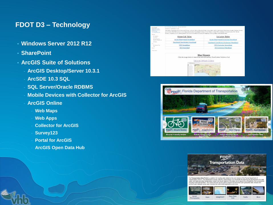
FDOT D3 – Technology
• Windows Server 2012 R12
• SharePoint
• ArcGIS Suite of Solutions
- ArcGIS Desktop/Server 10.3.1
- ArcSDE 10.3 SQL
- SQL Server/Oracle RDBMS
- Mobile Devices with Collector for ArcGIS
- ArcGIS Online
- Web Maps
- Web Apps
- Collector for ArcGIS
- Survey123
- Portal for ArcGIS
- ArcGIS Open Data Hub
Potential Future Enhancements
• Dynamic ArcGIS Online Editor
- Roads and Highways Extension for ArcGIS Server
- Live Linear Event editing to update, delete, insert record
- Snapping enabled to intersections and boundary layers
- Versioning and historical logging
- Built to scale so other regions can utilize and standardize

Lessoned Learned

Project Considerations:
• Simplify
• User centric solutions
• Use existing data schema and data formats
• Controlled migrate to new system tools
• Define the technology advantages and disadvantages
• Define best data management practices and gaps in data inputs
where biggest ROI can be gained
• Managing expectations and provide continuous outreach

Presentation Summary
• Problem/Issue:
• Potential data loss and need for GIS integration, system upgrades
provides a good opportunity to advance technology
• Solution:
• Easy access through data portals and SharePoint
• Use existing data schema when required
• Esri Open GIS data resource / Enterprise Esri GIS SDE
• Use Extensions (if available) to save on customized development

Thank You!
James Krolick, GISP [email protected]
Webb, Corey [email protected]
Amy Wiwi, [email protected]
• ArcGIS Online web maps
https://fdot.maps.arcgis.com/home/index.html
• Open Data
- https://gis-fdot.opendata.arcgis.com/