Embed Size (px)
Citation preview

Right of Way Manual Vol. 1 - Preliminary
Procedures for the Authority to Proceed
Revised December 2017
© 2017 by Texas Department of Transportation
(512) 463-8630 all rights reserved
Manual Notice 2017-3
From: Gus Cannon, CTCM, Right of Way Division Director
Manual: R/W Manual Vol. 1 - Preliminary Procedures for the Authority to Proceed
Effective Date: December 01, 2017
Purpose
This revision is intended to update Chapter 4 “Surveying, Maps, and Parcels” to match current requirements and procedures.
Changes
Section 3, Property Descriptions:
Revised the image depicting a property description heading.
Revised the “Parcel 9” example.
Updated the paragraph discussing control of access.
Added an item to the “Parcel Information” list.
Separated and clarified the discussions of Certification and Monuments.
Section 7, Requirements for Submission of Graphics Files for On-System Projects: Deleted one item from file naming convention examples.
Section 8, Requirements for Submission of ArcGIS Files: Revised the example in subsection “Rename Geo-Database Template to ROW CSJ Prior to Submission”.
All Sections: Minor text revisions.
Contact
Gus Cannon, CTCM, Right of Way Division Director, 512.416.2852
Archives
Past manual notices are available in a pdf archive.

Table of Contents
Chapter 1 — Project Development Overview
Section 1 — Overview. . . . . . . . . . . . . . . . . . . . . . . . . . . . . . . . . . . . . . . . . . . . . . . . . . . . . . 1-2Right of Way (ROW) Parcel Acquisition Process Flowchart . . . . . . . . . . . . . . . . . . . . . . . 1-2Definitions . . . . . . . . . . . . . . . . . . . . . . . . . . . . . . . . . . . . . . . . . . . . . . . . . . . . . . . . . . . . . . 1-2Example and Sample Forms . . . . . . . . . . . . . . . . . . . . . . . . . . . . . . . . . . . . . . . . . . . . . . . . 1-2Blank ROW Form Templates . . . . . . . . . . . . . . . . . . . . . . . . . . . . . . . . . . . . . . . . . . . . . . . 1-2
Section 2 — General ROW Project Development. . . . . . . . . . . . . . . . . . . . . . . . . . . . . . . . . 1-3Funding . . . . . . . . . . . . . . . . . . . . . . . . . . . . . . . . . . . . . . . . . . . . . . . . . . . . . . . . . . . . . . . . 1-3Obtaining Relocation Funding for State Projects and Local Government Acquisitions with
State Reimbursement . . . . . . . . . . . . . . . . . . . . . . . . . . . . . . . . . . . . . . . . . . . . . . . . . . 1-4Local Government Project Set Up and Funding . . . . . . . . . . . . . . . . . . . . . . . . . . . . . . . . . 1-4State Program Authorization . . . . . . . . . . . . . . . . . . . . . . . . . . . . . . . . . . . . . . . . . . . . . . . . 1-5Statutory Authority For ROW Acquisition . . . . . . . . . . . . . . . . . . . . . . . . . . . . . . . . . . . . . 1-5
Section 3 — Planning and Sequence of Project Development . . . . . . . . . . . . . . . . . . . . . . . 1-6Actions Preliminary to the ROW Acquisition Process . . . . . . . . . . . . . . . . . . . . . . . . . . . . 1-6Sequence of ROW Project Development . . . . . . . . . . . . . . . . . . . . . . . . . . . . . . . . . . . . . . 1-7Overview of Project Development Meetings . . . . . . . . . . . . . . . . . . . . . . . . . . . . . . . . . . . 1-8Contractual Agreements with Local Governments . . . . . . . . . . . . . . . . . . . . . . . . . . . . . . . 1-8
Chapter 2 — Contractual Agreements
Section 1 — Forms . . . . . . . . . . . . . . . . . . . . . . . . . . . . . . . . . . . . . . . . . . . . . . . . . . . . . . . . 2-2Overview . . . . . . . . . . . . . . . . . . . . . . . . . . . . . . . . . . . . . . . . . . . . . . . . . . . . . . . . . . . . . . . 2-2
Section 2 — The Acquiring Agency . . . . . . . . . . . . . . . . . . . . . . . . . . . . . . . . . . . . . . . . . . . 2-5Procedure . . . . . . . . . . . . . . . . . . . . . . . . . . . . . . . . . . . . . . . . . . . . . . . . . . . . . . . . . . . . . . . 2-5
Section 3 — Cost Participation . . . . . . . . . . . . . . . . . . . . . . . . . . . . . . . . . . . . . . . . . . . . . . . 2-6
Section 4 — Payment Procedures . . . . . . . . . . . . . . . . . . . . . . . . . . . . . . . . . . . . . . . . . . . . . 2-7
Chapter 3 — Acquisition Coordination
Section 1 — TxDOT - The Acquiring Agency . . . . . . . . . . . . . . . . . . . . . . . . . . . . . . . . . . . 3-2Overview . . . . . . . . . . . . . . . . . . . . . . . . . . . . . . . . . . . . . . . . . . . . . . . . . . . . . . . . . . . . . . . 3-2Contractual Agreements . . . . . . . . . . . . . . . . . . . . . . . . . . . . . . . . . . . . . . . . . . . . . . . . . . . 3-2Amendments to Contractual Agreements . . . . . . . . . . . . . . . . . . . . . . . . . . . . . . . . . . . . . . 3-3Submission of Contractual Agreements . . . . . . . . . . . . . . . . . . . . . . . . . . . . . . . . . . . . . . . 3-3
Section 2 — Acquisition Procedures for Economically Disadvantaged Counties . . . . . . . . 3-5Overview . . . . . . . . . . . . . . . . . . . . . . . . . . . . . . . . . . . . . . . . . . . . . . . . . . . . . . . . . . . . . . . 3-5
Chapter 4 — Surveying, Maps, and Parcels
Section 1 — Surveying for ROW Acquisition. . . . . . . . . . . . . . . . . . . . . . . . . . . . . . . . . . . . 4-2
R/W Vol. 1 - Prerequisites for Authority to Proceed i TxDOT 12/2017
Necessity for Correct Property Descriptions . . . . . . . . . . . . . . . . . . . . . . . . . . . . . . . . . . . . 4-2Surveying for ROW Acquisition . . . . . . . . . . . . . . . . . . . . . . . . . . . . . . . . . . . . . . . . . . . . . 4-2Texas Coordinate System of 1983. . . . . . . . . . . . . . . . . . . . . . . . . . . . . . . . . . . . . . . . . . . . 4-2Elimination of the Requirement for a Traditional Right of Way Map . . . . . . 4-2Traditional Right of Way Map . . . . . . . . . . . . . . . . . . . . . . . . . . . . . . . . . . . . . . . . . . . . . . 4-3
Section 2 — ROW Mapping for On-System Projects (For State and Local Government) . . 4-4General Requirements . . . . . . . . . . . . . . . . . . . . . . . . . . . . . . . . . . . . . . . . . . . . . . . . . . . . . 4-4Simultaneous ROW Mapping and Schematic Development. . . . . . . . . . . . . . . . . . . . . . . . 4-4ROW Parcel Numbering . . . . . . . . . . . . . . . . . . . . . . . . . . . . . . . . . . . . . . . . . . . . . . . . . . . 4-5Project Information . . . . . . . . . . . . . . . . . . . . . . . . . . . . . . . . . . . . . . . . . . . . . . . . . . . . . . . 4-7ROW Projects for Utility Accommodations Exclusively . . . . . . . . . . . . . . . . . . . . . . . . . . 4-8
Section 3 — Property Descriptions . . . . . . . . . . . . . . . . . . . . . . . . . . . . . . . . . . . . . . . . . . . . 4-9Overview . . . . . . . . . . . . . . . . . . . . . . . . . . . . . . . . . . . . . . . . . . . . . . . . . . . . . . . . . . . . . . . 4-9Certification . . . . . . . . . . . . . . . . . . . . . . . . . . . . . . . . . . . . . . . . . . . . . . . . . . . . . . 4-12Monuments . . . . . . . . . . . . . . . . . . . . . . . . . . . . . . . . . . . . . . . . . . . . . . . . . . . . . . . . . . . 4-12Public Roads and Alleys . . . . . . . . . . . . . . . . . . . . . . . . . . . . . . . . . . . . . . . . . . . . . . . . . . 4-12
Section 4 — Submission and Approval of ROW Mapping . . . . . . . . . . . . . . . . . . . . . . . . . 4-14Original Submission to Division . . . . . . . . . . . . . . . . . . . . . . . . . . . . . . . . . . . . . . . . . . . . 4-14Requirements for Right of Way Mapping Deliverables . . . . . . . . . . . . . . . . . . . . . . . . . . 4-14
Section 5 — Requirements for Final ROW Maps . . . . . . . . . . . . . . . . . . . . . . . . . . . . . . . . 4-15Overview for Traditional ROW Maps. . . . . . . . . . . . . . . . . . . . . . . . . . . . . . . . . . . . . . . . 4-15Overview for Online ROW Mapping . . . . . . . . . . . . . . . . . . . . . . . . . . . . . . . . . . . . . . . . 4-15
Section 6 — ROW Mapping for Off-System Projects. . . . . . . . . . . . . . . . . . . . . . . . . . . . . 4-16Overview . . . . . . . . . . . . . . . . . . . . . . . . . . . . . . . . . . . . . . . . . . . . . . . . . . . . . . . . . . . . . . 4-16
Section 7 — Requirements for Submission of Graphics Files for On-System Projects . . . 4-17Overview . . . . . . . . . . . . . . . . . . . . . . . . . . . . . . . . . . . . . . . . . . . . . . . . . . . . . . . . . . . . . . 4-17MicroStation . . . . . . . . . . . . . . . . . . . . . . . . . . . . . . . . . . . . . . . . . . . . . . . . . . . . . . . . . . . 4-17MicroStation Level Library Files . . . . . . . . . . . . . . . . . . . . . . . . . . . . . . . . . . . . . . . . . . . 4-17DGN File Properties and Naming Convention of the Parcel Plat Pages . . . . . . . . . . . . . . 4-17Naming Convention of the Master ROW Files (MRF) in DGN Format. . . . . . . . . . . . . . 4-18File Structure of Master and Reference DGNs . . . . . . . . . . . . . . . . . . . . . . . . . . . . . . . . . 4-18Line Weights, Line Styles, Colors, Text Size, Text Fonts, Scale, and Annotations . . . . . 4-19Text and Line Colors when Using Color Digital Orthos in the Background . . . . . . . . . . 4-19Required Data in the Geopak ROW GPK File . . . . . . . . . . . . . . . . . . . . . . . . . . . . . . . . . 4-19Surface Coordinates. . . . . . . . . . . . . . . . . . . . . . . . . . . . . . . . . . . . . . . . . . . . . . . . . . . . . . 4-19
Section 8 — Requirements for Submission of ArcGIS Files. . . . . . . . . . . . . . . . . . . . . . . . 4-20Overview . . . . . . . . . . . . . . . . . . . . . . . . . . . . . . . . . . . . . . . . . . . . . . . . . . . . . . . . . . . . . . 4-20ROW Geo-Database Template . . . . . . . . . . . . . . . . . . . . . . . . . . . . . . . . . . . . . . . . . . . . . 4-20Coordinate System of Template . . . . . . . . . . . . . . . . . . . . . . . . . . . . . . . . . . . . . . . . . . . . 4-20
R/W Vol. 1 - Prerequisites for Authority to Proceed ii TxDOT 12/2017
Features in the Template . . . . . . . . . . . . . . . . . . . . . . . . . . . . . . . . . . . . . . . . . . . . . . . . . . 4-20Feature Attributes or Fields . . . . . . . . . . . . . . . . . . . . . . . . . . . . . . . . . . . . . . . . . . . . . . . . 4-21Rename Geo-Database Template to ROW CSJ Prior to Submission . . . . . . . . . . . . . . . . 4-22Conversion of Survey Data to ArcGIS and Template Format. . . . . . . . . . . . . . . . . . . . . . 4-22Requirements for ArcGIS Deliverables. . . . . . . . . . . . . . . . . . . . . . . . . . . . . . . . . . . . . . . 4-22
R/W Vol. 1 - Prerequisites for Authority to Proceed iii TxDOT 12/2017

Chapter 1 — Project Development Overview
Contents:
Section 1 — Overview
Section 2 — General ROW Project Development
Section 3 — Planning and Sequence of Project Development
R/W Vol. 1 - Prerequisites for Authority to Proceed 1-1 TxDOT 12/2017
Chapter 1 — Project Development Overview Section 1 — Overview
Section 1 — Overview
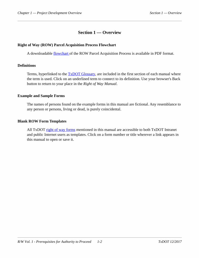
Right of Way (ROW) Parcel Acquisition Process Flowchart
A downloadable flowchart of the ROW Parcel Acquisition Process is available in PDF format.
Definitions
Terms, hyperlinked to the TxDOT Glossary, are included in the first section of each manual where the term is used. Click on an underlined term to connect to its definition. Use your browser's Back button to return to your place in the Right of Way Manual.
Example and Sample Forms
The names of persons found on the example forms in this manual are fictional. Any resemblance to any person or persons, living or dead, is purely coincidental.
Blank ROW Form Templates
All TxDOT right of way forms mentioned in this manual are accessible to both TxDOT Intranet and public Internet users as templates. Click on a form number or title wherever a link appears in this manual to open or save it.
R/W Vol. 1 - Prerequisites for Authority to Proceed 1-2 TxDOT 12/2017
Chapter 1 — Project Development Overview Section 2 — General ROW Project Development
Section 2 — General ROW Project Development
Funding
The following steps are involved in ROW funding:
Determine ROW acreage needed.
Determine the approximate cost of acquiring needed ROW. A ROW CSJ Request Form for Total Project Cost (Form ROW-RM-CSJTPC) is available.
Determine the availability of funding at the local, State, and Federal level.
ROW cost is a significant factor in TxDOT's project development process. To clearly state ROW funding needs in this process, prepare a reasonably accurate ROW cost estimate that addresses the following elements:
Consider local land use, which has a major impact on ROW funding and generally includes one or more of the following types of use.
Agricultural. May include farm or ranch land and related improvements, including sin-gle-family residential.
Urban residential. May include single-family or multi-family structures and associated improvements, such as landscaping or privacy fencing.
Commercial. May include wholesale and retail businesses, or professional office buildings.
Industrial. May include manufacturing plants, product assembly plants, and heavy equip-ment associated with these activities.
Public. May include parks, cemeteries, greenbelts, educational facilities, vacant land, or any of the uses in A through D above when the land is owned by a public agency.
Consider the value of land and improvements to be taken and make allowance for damages, if any, to remainders. Make reasonable allowances for acquiring some parcels in condemnation.
Estimate relocation assistance including the number of individuals, families and/or businesses being displaced. Consider the cost to move individuals, families and businesses, as well as sup-plemental payments for replacement housing and anticipated last resort housing.
Identify types of utilities to be moved and estimate the eligible costs. See the TxDOT Utility Manual.
Consider the cost to dispose of improvements acquired. Note that the disposition cost of com-mercial or industrial structures can be significant.
Consider other costs such as outsource contract fees, disposition of hazardous materials, clean up of contaminated land, or wetland mitigation.
R/W Vol. 1 - Prerequisites for Authority to Proceed 1-3 TxDOT 12/2017
Chapter 1 — Project Development Overview Section 2 — General ROW Project Development
Consider other State costs such as for appraiser fees, title, and court costs.
The Unified Transportation Program (UTP) authorizes projects for construction (CONST), devel-opment (DVLP), and planning (PLAN) activities. A ROW CSJ number may be obtained from the ROW Division after the Texas Transportation Commission approves the project as a PLAN or DEVELOP (DVLP) project. Typically, a CSJ number for ROW activities is obtained after obtain-ing a CSJ number for construction. A ROW CSJ Request Form for Total Project Cost (Form ROW-RM-CSJTPC) should be filled out and forwarded to ROW Division for any right of way cost including any proposed utility adjustments.
For information on programming and scheduling funds for a project, including ROW acquisition, refer to the TxDOT Transportation Systems Manual, Programming and Scheduling Volume.
Obtaining Relocation Funding for State Projects and Local Government Acquisitions with State Reimbursement
Costs for relocation payments and services will be paid by the State for (1) projects wholly financed with State funds and for (2) ROW projects involving local government acquisitions with State reimbursement.
If an overrun occurs or is anticipated, the overrun must be handled according to established overrun procedures.
Costs for relocation payments and services must be included in the total estimated ROW cost. Relo-cation costs incurred before project programming by the State are not eligible for State financing.
Local Government Project Set Up and Funding
The following information is required by the Right of Way Division:
Identify Texas Transportation Commission approval of the project. The project will be approved either by inclusion in the Unified Transportation Program or through a project spe-cific minute order.
Identify date of environmental clearance.
Include property descriptions, and parcel plats approved by the District prior to acquisition of right of way.
When authorizing for a project involving local government participation, be aware that local gov-ernments may participate in all of the right of way costs.
R/W Vol. 1 - Prerequisites for Authority to Proceed 1-4 TxDOT 12/2017

Chapter 1 — Project Development Overview Section 2 — General ROW Project Development
State Program Authorization
Projects programmed by the Texas Transportation Commission for construction are approved for development up to construction. If ROW is needed, there will be Commission program allotment for ROW cost separate from the program authorization for construction.
Projects programmed by the Commission for ROW acquisition but not construction are approved for development through schematic layout and ROW acquisition.
Statutory Authority For ROW Acquisition
Section 24, Article XVI, Texas Constitution, provides that:
"The Legislature shall make provisions for laying out and working public roads, for the building of bridges...." Under this constitutional authority:
The State Highway Department (now TxDOT) was established in 1917 by appropriate legislation (Acts 1917, 35th Legislature, p.416, Ch. 190, §1). The Highway Commission (now Texas Transpor-tation Commission) was given responsibility to "...plan and make policies for the location, construction and maintenance of a comprehensive system of state highways and public roads." (Transportation Code, §201.103)
In 1957, the 55th Legislature, regular session, passed H.B. 179, Chapter 300, (refer to Transporta-tion Code, §203.051), expressly granting the Highway Commission (now Texas Transportation Commission) authority to purchase or acquire through eminent domain proceedings land needed for highway purposes in the name of the State of Texas. The 55th Legislature, regular session, also passed H.B. 620 (Chapter 301) directing the Commission to handle the acquisition of ROW on the National System of Interstate and Defense Highways and to participate under certain conditions in the cost of ROW acquired by local political subdivisions for certain other highways (refer to Trans-portation Code, §224.001).
R/W Vol. 1 - Prerequisites for Authority to Proceed 1-5 TxDOT 12/2017

Chapter 1 — Project Development Overview Section 3 — Planning and Sequence of Project Development
Section 3 — Planning and Sequence of Project Development
Actions Preliminary to the ROW Acquisition Process
TxDOT's project development process is a joint effort of many team members. A flowchart show-ing the process is available. Reducing project delay can be accomplished by integrating ROW personnel into early stages of the project development process. This is important for:
identifying potential design/construction funding related to the current Unified Transportation Program (UTP);
placing a project in the Transportation Improvement Plan (TIP);
developing the Statewide Transportation Improvement Plan Plan (STIP).
The Right of Way staff should be consulted by the project planners and designers to determine the best project location and design with consideration given to:
local land usage;
potential disturbances to individual property owners; and
impact on area development and ROW costs, for example, effects of possible hazardous mate-rial and possible need for wetland mitigation.
ROW cost is a significant part of overall project cost and should receive due consideration with all engineering factors.
When studying proposed project locations, the designer should consult with Right of Way staff regarding ROW impacts that may have high costs for:
acquisition of improvements;
major utility relocation;
severance damages;
wetland mitigation;
hazardous material site clean up; and
relocation assistance.
Minor changes in design, such as change in alignment or adjustment of ROW width, may be made without a reduction in the integrity of the design or a disproportionate increase in construction costs in relation to ROW costs.
Refer to the TxDOT Project Development Process Manual for information on the following project development tasks.
R/W Vol. 1 - Prerequisites for Authority to Proceed 1-6 TxDOT 12/2017
Chapter 1 — Project Development Overview Section 3 — Planning and Sequence of Project Development
ROW acquisition requirements and information for obtaining CONSTRUCT (CONSTR) authori-zation are discussed in the TxDOT Project Development Process Manual. There is a targeted percentage of ROW acquisition that should be complete for priority status, but the percentage may vary depending on the size of the ROW project. To verify that a project can be constructed as a CONSTRUCT (CONSTR) Status project, evaluate the project's amount of ROW acquired to date. This evaluation minimizes the possibility of ROW acquisition delaying a letting and demonstrates the importance of involving ROW staff in project development.
Initial ROW acquisition is authorized when PLAN or DEVELOP (DVLP) authorization is obtained. PLAN or DEVELOP (DVLP) status is required for ROW acquisition authorization.
Long Range Project (LRP) status is obtained as the last and lowest level of project development.
Sequence of ROW Project Development
To initiate a ROW project:
the work must receive program approval by the Commission;
schematics must be approved (refer to Project Development Process Manual for information on schematic approval);
public involvement requirements must be met. (See the Environmental Procedures in Project Development Manual; and
environmental clearance requirements must be met. (See the Environmental Procedures in Project Development Manual)
The authority to proceed from the ROW Division and issuance of the General Expenditure Autho-rization, to cover the project costs, must be deferred until these preliminary requirements are complete.
After the project is authorized, the ROW staff is responsible to plan project development to com-pletion. The ROW staff should undertake the following actions in a coordinated work plan:
establish early coordination with utilities and railroads;
acquire ROW;
relocate displaced persons or businesses;
remove improvements; and
coordinate required utility adjustments.
Eminent domain (ED) proceedings should occur only when negotiation is unsuccessful. Once legal proceedings begin, they should be given priority handling, at least through deposit of the Commis-sioners' Award, which provides possession of the ROW. The ROW staff will assist with eminent domain proceedings. However, under the Constitution of the State of Texas, the Attorney General's
R/W Vol. 1 - Prerequisites for Authority to Proceed 1-7 TxDOT 12/2017

Chapter 1 — Project Development Overview Section 3 — Planning and Sequence of Project Development
Office (OAG) must act as counsel for TxDOT in Commissioners' Hearings and all court proceedings.
Area Engineer staff should consult with the Right of Way staff regarding special design and con-struction issues that may relate to ROW negotiations.
Overview of Project Development Meetings
Refer to the TxDOT Project Development Process Manual for more information on the following meetings and activities. The first step in beginning a project is to identify project need and scope.
Preparing a programming assessment may be needed to obtain approval of Long Range Project Sta-tus for some projects.
The two meetings required for most projects are the Preliminary Design Conference and the Design Conference. Each of these meetings should allow for sharing information and discussing ROW issues.
Contractual Agreements with Local Governments
Statutory Authorization. Transportation Code, §203.051, authorizes TxDOT to acquire whatever interest in any property that is needed for highway ROW purposes. Usually, TxDOT will enter into an agreement with a local government (LG) that established responsibilities of each agency in the acquisition process. Transportation Code, §224.002 (a) states that an LG must acquire highway ROW as requested by TxDOT. The statutory authority allowing LG's to contract with TxDOT for acquiring needed ROW is found in Transportation Code, §224.005. Terms and conditions of any agreement entered into by and between TxDOT and an LG is determined between the parties. Transportation Code, §224.005 (a) provides that TxDOT must reimburse an LG not less than 90% of the cost of the ROW.
R/W Vol. 1 - Prerequisites for Authority to Proceed 1-8 TxDOT 12/2017

Chapter 2 — Contractual Agreements
Contents:
Section 1 — Forms
Section 2 — The Acquiring Agency
Section 3 — Cost Participation
Section 4 — Payment Procedures
R/W Vol. 1 - Prerequisites for Authority to Proceed 2-1 TxDOT 12/2017

Chapter 2 — Contractual Agreements Section 1 — Forms
Section 1 — Forms
Overview
To establish acquisition and funding responsibilities and requirements of TxDOT and a local gov-ernment (LG), an agreement must be entered into before a project is released for ROW acquisition. These agreements are discussed more fully in the following Chapter 3- Acquisition Coordination.
Below is a list of agreements and Attachment C forms to be used with the LGs. Agreement forms can be found on the Right of Way Division’s SharePoint site.
TxDOT's Contract Services Office has implemented a new agreement procedure, which is used in conjunction with the ROW agreements listed above. The new procedure consists of two agree-ments. These are:
a Master Agreement Governing Local Transportation Project Advance Funding Agreements (MAFA), and
a Local Project Advance Funding Agreement (LPAFA).
By these agreements, regardless of the type of agreement signed, TxDOT authorizes and requests the local government to proceed with ROW acquisition and agrees to reimburse the LG for its share of costs incurred according to the agreement's provisions. The agreement provides LG acceptance
Table 1-1: Agreements Used with LPAs
Title
Agreement for Right of Way Procurement
Attachment C - Standard Funding Schedule - Local Performs Work
Attachment C - Economically Disadvantaged County (EDC) Funding Schedule - Local Performs Work
Supplemental Agreement for Right of Way Procurement - Government
Agreement to Contribute ROW Funds Fixed Price
Attachment C - Standard Funding Schedule - State Performs Work
Attachment C - Periodic Payment Funding Schedule - State Performs Work
Attachment C - Real Property in Lieu of Monetary Payment Funding Schedule - State Performs Work
Attachment C - EDC Funding Schedule - State Performs Work
Supplemental Agreement to Contribute ROW Funds
Attachment C - EDC Funding Schedule - Local Performs Work
R/W Vol. 1 - Prerequisites for Authority to Proceed 2-2 TxDOT 12/2017

Chapter 2 — Contractual Agreements Section 1 — Forms
of responsibility to acquire all needed ROW and to obtain good title in the name of the State of Texas. Terms of the agreement apply to:
new ROW authorized and requested by TxDOT which is needed and not yet dedicated, in use, or previously acquired in the name of the State or LG for highway, street, or road purposes; and
needed outstanding property interests in existing ROW and eligible utility adjustments not pre-viously made, as authorized and requested by TxDOT.
The contractual agreement establishes that:
TxDOT's reimbursement to the LG for negotiated parcels will be the percent of TxDOT's fund-ing participation of TxDOT's predetermined value of each parcel, or the parcel's net cost, whichever is the lesser amount; and
on condemned parcels, TxDOT's funding participation percent reimbursement will be based on the final judgment provided that TxDOT is given proper notice of all action taken therein.
TxDOT typically participates in costs of:
Special Commissioners' Hearings,
appraisal expenses for the State's fee appraisers used in condemnation cases,
utility relocations, and
fencing and property adjustments.
The contractual agreement provides for division of other responsibilities for project development. The LG typically assumes entire responsibility for:
costs incurred in arriving at values to recommend for State approval,
costs relative to negotiation,
its attorney fees for condemnation proceedings, and
costs of recording instruments of conveyance.
TxDOT typically assumes the responsibility and costs of:
land surveys,
property descriptions,
title information,
preparation of instruments, ROW maps, supplemental investigations or appraisals necessary to determine the appropriateness of submitted values and fees for title services,
appraisals where the State is to determine values as a result of the LG's use of the waiver provi-sion of the contractual agreement,
relocation assistance, and
R/W Vol. 1 - Prerequisites for Authority to Proceed 2-3 TxDOT 12/2017

Chapter 2 — Contractual Agreements Section 1 — Forms
removal of improvements.
The Right of Way staff prepares the necessary contractual agreements. Project limits should agree with project limits covered by minute order or program authorization. The preparation of all these agreements should be handled by the Right of Way field staff, with execution of all agreements by the Right of Way Division Director.
Submission of contracts involves the following:
Along with the contract, submit a copy of the ordinance or resolution containing authority for their designated official(s) to enter into contracts with the State (for procurement of ROW, util-ity adjustments and fencing work) for each project.
Submit two copies of each contractual agreement executed by the LG to the ROW Division for approval.
If a county and one or more cities are involved, submit companion agreements, as required, covering the entire project.
Detailed submission requirements for contractual agreements with the LG are described in the fol-lowing Chapter 3- Acquisition Coordination.
R/W Vol. 1 - Prerequisites for Authority to Proceed 2-4 TxDOT 12/2017
Chapter 2 — Contractual Agreements Section 2 — The Acquiring Agency
Section 2 — The Acquiring Agency
Procedure
In ROW acquisition projects, it is acceptable for either TxDOT or the LG to be the acquiring agency. Regardless of which is the acquiring agency, an agreement must be executed on each ROW project.
If the LG is the acquiring agency, the LG will be responsible for all aspects of the acquisition pro-cess as detailed in agreements between the parties. All property must be acquired in the name of the State of Texas. The LG must follow all acquisition procedures described in this manual. When the LG is the acquiring agency, TxDOT will provide approvals for procedures carried out by the LG and will provide reimbursement of ROW costs to the LG in accordance with State law and in accor-dance with the terms of the contractual agreement between TxDOT and the LG.
If TxDOT is the acquiring agency, TxDOT will be responsible for all acquisition activities, with the LG contributing a set percentage of the ROW costs. The authorization for this procedure is found in 43TAC §§15.50 - 15.56. Procedures for this are described more fully in the following Chapter 3- Acquisition Coordination.
R/W Vol. 1 - Prerequisites for Authority to Proceed 2-5 TxDOT 12/2017

Chapter 2 — Contractual Agreements Section 3 — Cost Participation
Section 3 — Cost Participation
43TAC §§15.50 - 15.56 also describes procedures governing the implementation of cost participa-tion between TxDOT, an LG and/or the Federal government. Section 15.55 contains a chart that shows participation percentages of an LG, Federal government and/or TxDOT for all aspects of a highway improvement project, up to and including ROW acquisition. The participation percentages are divided by the category of funding for the project as provided in the Unified Transportation Pro-gram. A summary of categories of the Unified Transportation Program can be found in TxDOT's Transportation, Planning and Programming Manual.
State statutes provide that when acquiring right of way to be used for Commission approved trans-portation projects and in cooperation with the LG, TxDOT will pay to the LG not less than 90 percent of the value of the ROW or the net cost of the ROW, whichever amount is less. Minute Order No. 80312 states that the participation percentage on ROW acquisition projects will be a State contribution of 90% and a 10% contribution by the LG. Any change to the percentage must be approved by the Commission.
If the acquisition is by eminent domain, the participation by TxDOT will be based on the final judgment if TxDOT has been notified in writing before the filing of the suit and given prompt notice as to all action taken in the suit.
R/W Vol. 1 - Prerequisites for Authority to Proceed 2-6 TxDOT 12/2017

Chapter 2 — Contractual Agreements Section 4 — Payment Procedures
Section 4 — Payment Procedures
If the contractual agreement between TxDOT and an LG requires the LG to be the acquiring agency, TxDOT will reimburse costs of the ROW to the LG upon acquisition of title acceptable to TxDOT. Title to each parcel must be in the name of the State of Texas. If the parcel is acquired through ED, payment to the LG will be made upon entry of a final judgment vesting title in the State of Texas. The procedures for reimbursement by TxDOT to the LG must be described in any contractual agreement executed between the parties. Any changes in this procedure must be approved by the ROW Division and an amended contractual agreement should be prepared and executed by the parties detailing the change. The procedures for payment to the LG should follow standard payment procedures described in Volume 2 - Right of Way Acquisition, Payment Policies and Procedures for State and LG.
If the contractual agreement requires TxDOT to be the acquiring agency, the preferred procedure is for the LG to contribute its' fixed share of the costs of the ROW at the time of execution of the con-tractual agreement. There may be instances when it may create an undue burden on the LG to contribute all the required funds at the time of execution of the contract. In those instances, any periodic payment arrangement must be approved by the Executive Director of TxDOT (see Special Approval Transmittal Form, per 43TAC §15.52, General Services Division’s Contract Services Office for form) and included in the contractual agreement. Another instance would be the LG would want their share to be a specified percentage instead of the fixed amount share which also requires approval by the Executive Director of TxDOT. Payment of the LG's fixed share should be given to the applicable Right of Way staff and immediately transmitted to the Finance Division using the Department’s Rapid Deposit Account for deposit in the proper account.
Upon delivery to TxDOT of acceptable instruments conveying to the State the required ROW, a payment for the reimbursement to the LG will be prepared and transmitted to the Comptroller of Public Accounts.
R/W Vol. 1 - Prerequisites for Authority to Proceed 2-7 TxDOT 12/2017

Chapter 3 — Acquisition Coordination
Contents:
Section 1 — TxDOT - The Acquiring Agency
Section 2 — Acquisition Procedures for Economically Disadvantaged Counties
R/W Vol. 1 - Prerequisites for Authority to Proceed 3-1 TxDOT 12/2017

Chapter 3 — Acquisition Coordination Section 1 — TxDOT - The Acquiring Agency
Section 1 — TxDOT - The Acquiring Agency
Overview
Local governments (LGs) are responsible for ROW acquisition, with exception of interstate high-ways; however, an LG may request that TxDOT assume the ROW acquisition function. TxDOT's role as the acquiring agency is subject to the following conditions:
the LG offers to make a contribution equal to the applicable percentage of the actual cost of the ROW;
the Commission has authorized the project; and
ROW costs are eligible for State participation reimbursement.
A city ordinance or Commissioners' Court Order must be submitted along with the LG's request for TxDOT to assume the acquisition responsibilities.
Typically, LG contribution is 10% unless otherwise stated in the contract agreement. Any change in LG percentage must be approved by the Commission. The initial LG contribution is based upon current estimates of the cost of the ROW to be acquired. The cost of ROW is defined as the total value of compensation to owners, including utilities, for their property interests. If the agreement is for a specified percentage, additional contributions will be made if the actual costs of ROW exceed the amount estimated. If the amount contributed by the LG is greater than the final actual ROW costs, the excess amount will be refunded to the LG. Since it is possible that some projects could financially burden an LG if the entire contribution is required with the submittal of the contractual agreement, the LG can make periodic payments. Any agreement with a periodic payment schedule has to be approved by the Executive Director of TxDOT in accordance with 43TAC, §15.52, Sub-section 6(B).
Contractual Agreements
An agreement must be executed by and between TxDOT and the applicable MPO or LG on all projects. This will customarily be executed early on in project development, prior to a project receiving full authority to proceed for ROW acquisition. The agreement will give details about the project and will state who is responsible for the acquisition of the ROW. If TxDOT is to be the acquiring agent, the fixed price participation amount required by the LG and the method of pay-ment by the LG, either in full with the execution of the agreement or in periodic payments as approved by the Executive Director, will be detailed in the agreement.
R/W Vol. 1 - Prerequisites for Authority to Proceed 3-2 TxDOT 12/2017
Chapter 3 — Acquisition Coordination Section 1 — TxDOT - The Acquiring Agency
Amendments to Contractual Agreements
An amendment or amendments to the agreement may be necessary if certain acquisition responsi-bilities or participation requirements change during the course of an ongoing project. If the agreement originally called for the LG to be the acquiring agency and it desires to transfer all or a portion of the remaining acquisition responsibilities to TxDOT, an amendment to the agreement should be used. The amendment should describe by parcel number any outstanding ROW that is being transferred to TxDOT for acquisition. It should also identify any utility adjustment or other outstanding obligation that is to be transferred to TxDOT. If only portions of the acquisition respon-sibilities are being transferred to TxDOT, the amendment should also set forth the LG's remaining acquisition responsibilities. The amendment would also be used if the participation ratio changes, for example pursuant to a Minute Order designated an LG as an economically disadvantaged county.
In fixed price agreements when the State is the acquiring agency the LG's fixed price contri-bution set forth in the agreement is not subject to adjustment unless: (1) site conditions change (2) work required by the LG is ineligible for federal participation or (3) the adjust-ment is mutually agreed on by the State and the LG.
Submission of Contractual Agreements
The Right of Way field staff submits two executed originals of the standard form to ROW Division Headquarters for approval. The transmittal memo must state the method of funding utilized by the LG. If the LG desires to pay the required amount in periodic payments, the memo must also set forth the requirements for periodic payment approval set forth in 43TAC, §15.52, Subsection 6(B). Accompanying this memo should also be
a copy of the LG's check,
a copy of the deposit transmittal evidencing deposit of funds in the appropriate rapid deposit account,
a copy of the LG's grant of signature authority for the person signing the agreement,
a copy of the resolution, and
special Approval Transmittal Form (per 43TAC §15.52) from GSD’s Contract Services Office, executed by the Executive Director of TxDOT, for periodic payments, if applicable.
If there are any changes proposed to the agreement, an unexecuted copy of the proposed agreement must be transmitted by the Right of Way field staff to ROW Division Headquarters. Also, any pro-posed amendment to an existing agreement must be submitted in the same manner. ROW Division Headquarters will review these submissions and inform the Right of Way field staff in writing of approval or disapproval of the proposed changes or of the proposed amendment. In this situation, the LG must not sign the contract or amendment prior to approval by the ROW Division.
R/W Vol. 1 - Prerequisites for Authority to Proceed 3-3 TxDOT 12/2017

Chapter 3 — Acquisition Coordination Section 1 — TxDOT - The Acquiring Agency
Once an approved agreement (executed by the LG) and other requirements have been sub-mitted to the ROW Division, the approval by TxDOT of these documents will be evidenced by execution by the Director of the ROW Division. One original will be retained by the ROW Division Headquarters for their records and the remaining original will be returned to the Right of Way field staff for delivery to the LG. Right of Way field staff should retain a copy for the right of way project file.
R/W Vol. 1 - Prerequisites for Authority to Proceed 3-4 TxDOT 12/2017
Chapter 3 — Acquisition Coordination Section 2 — Acquisition Procedures for Economically Disadvantaged Counties
Section 2 — Acquisition Procedures for Economically Disadvantaged Counties
Overview
Acquisition procedures for counties designated as economically disadvantaged are the same as for non-designated counties, or are as stipulated in the agreement, except that the amount of local funds to be contributed may be adjusted by the Texas Transportation Commission. Note that all cities sit-uated in a county that has been designated as "economically disadvantaged" are also eligible for adjustment of their participation ratio. The Transportation Planning and Programming Division is responsible for implementation of the economically disadvantaged county program, including preparation of any necessary minute orders.
At the beginning of each fiscal year, as determined by data provided to TxDOT by the Texas Comptroller of Public Accounts, the designation "economically disadvantaged county" will be applied to a county that has, in comparison to other counties in the State:
below average per capita taxable property value;
below average per capita income; and
above average unemployment.
The city council, commissioners' court or similar governing body of a local government that con-sists of all or part of an economically disadvantaged county shall submit a request for adjustment to the local District. The request will include, at a minimum:
the proposed project scope;
the estimated total project cost;
a breakdown of the anticipated total cost of ROW and utility adjustments;
the proposed participation rate;
the nature of any in-kind resources to be provided by the local government;
the rationale for adjusting the minimum local matching funds requirement; and
any other information considered necessary to support a request.
In evaluating a request for an adjustment to the local matching funds requirement, the commission will consider an LG's:
population level;
bonded indebtedness;
tax base;
tax rate;
R/W Vol. 1 - Prerequisites for Authority to Proceed 3-5 TxDOT 12/2017
Chapter 3 — Acquisition Coordination Section 2 — Acquisition Procedures for Economically Disadvantaged Counties
access to available in-kind resources; and
economic development sales tax.
The Commission will enter a minute order based on the above criteria, which may or may not adjust the participation ratio of the LG. If the ratio is adjusted, the applicable agreement or agree-ments will be prepared as detailed above.
R/W Vol. 1 - Prerequisites for Authority to Proceed 3-6 TxDOT 12/2017
Chapter 4 — Surveying, Maps, and Parcels
Contents:
Section 1 — Surveying for ROW Acquisition
Section 2 — ROW Mapping for On-System Projects (For State and Local Government)
Section 3 — Property Descriptions
Section 4 — Submission and Approval of ROW Mapping
Section 5 — Requirements for Final ROW Maps
Section 6 — ROW Mapping for Off-System Projects
Section 7 — Requirements for Submission of Graphics Files for On-System Projects
Section 8 — Requirements for Submission of ArcGIS Files
R/W Vol. 1 - Prerequisites for Authority to Proceed 4-1 TxDOT 12/2017

Chapter 4 — Surveying, Maps, and Parcels Section 1 — Surveying for ROW Acquisition
Section 1 — Surveying for ROW Acquisition
Necessity for Correct Property Descriptions
Property descriptions prepared with the intent to convey title to the State must clearly define the location of the property. State law stipulates that any property description prepared with the intent to convey title to the State constitutes a boundary survey, falling under the jurisdiction of the Texas Board of Professional Land Surveying (TBPLS).
Surveying for ROW Acquisition
Before performing any type of field surveying on private property, right of entry must be obtained from each landowner to include a range of dates the services shall be performed.
All surveying necessary for ROW acquisition must be performed under the supervision of a Regis-tered Professional Land Surveyor (RPLS). All surveying must conform to all applicable surveying laws, the Professional Land Surveying Practices Act and the General Rules of Procedures and Practices of the Texas Board of Professional Land Surveying.
Texas Coordinate System of 1983
All projects must be based upon the Texas Coordinate System of 1983 in U.S. Survey feet and be relative to the published values of the National Geodetic Survey (NGS) Continuously Operating Reference Station (CORS) network. The TxDOT Surveying Guide is an additional reference about the Texas Coordinate System.
Elimination of the Requirement for a Traditional Right of Way Map
To better serve the needs of all the stakeholders and to save time and money in the mapping pro-cess, the department has implemented an online mapping system linked to its databases.
The following is an excerpt from the “New Requirements for Right of Way Mapping” policy mem-orandum dated May 3, 2016:
"In an effort to reduce the amount of time to deliver a ROW projects, effective the date of this memorandum, the ROW Division will no longer require the creation or submission of a ROW map sheets (paper and MicroStation files) as a requirement for the 'Authority to Proceed'.
The Right of Way maps as currently used are being replaced by the a web based mapping application known as the “TxDOT Real Property Asset Map” that is available to internal users and the public on ROW Division's txdot.gov webpage.
R/W Vol. 1 - Prerequisites for Authority to Proceed 4-2 TxDOT 12/2017
Chapter 4 — Surveying, Maps, and Parcels Section 1 — Surveying for ROW Acquisition
The two main requirements to start the acquisition process for a project will be an ArcGIS geo-database populated with parcel features and a signed and sealed Property Description. The geo-database template and submission standards are presently available on txdot.gov for internal users and Consultants.
Some parts of the acquisition process (title and appraisal) can proceed with only the Arc-GIS geo-database populated with schematic footprint. The final signed and sealed Property Description will be needed in the later stages of acquisition for the title policy, certified appraisal and as part of the deed.
Under the new standards, the ArcGIS geo-database and Property Descriptions can be sub-mitted as they are completed, instead of waiting for the submission of a complete ROW map."
Since parcels will be submitted as they are completed, the first parcel submitted can be parcel num-ber 1, and so on. See “ROW Parcel Numbering.”
ROW Project Delivery staff will coordinate with District ROW mapping staff to set the priority of submission of parcels.
Traditional Right of Way Map
The definition of the term 'Right of Way Mapping' as used in this chapter is the creation of GIS par-cel features for the department's online mapping system (Real Property Asset Map) and signed and sealed property descriptions for each parcel.
If a District chooses to expend the additional time and expense to continue to have traditional Right of Way Maps created, the current right of way mapping standards will be a priority over the tradi-tional right of way map and must be completed and submitted to the Right of Division first.
R/W Vol. 1 - Prerequisites for Authority to Proceed 4-3 TxDOT 12/2017

Chapter 4 — Surveying, Maps, and Parcels Section 2 — ROW Mapping for On-System Projects (For State and Local Government)
Section 2 — ROW Mapping for On-System Projects (For State and Local Government)
General Requirements
The two main elements required for ROW mapping are the TxDOT ArcGIS geo-database template (populated with the schematic and surveyed parcel features) and property descriptions (preliminary and/or final signed and sealed).
To expedite the acquisition process, parcels or small groups of parcels must be submitted as they are completed.
ROW Project Delivery staff will coordinate with District ROW mapping staff to set the prior-ity of the submission of parcels.
All property descriptions must be prepared, signed, and sealed under the supervision of an RPLS.
The surveyor is responsible for the boundary analysis of the proposed ROW parcels and prepa-ration of the property descriptions, and surveyor's reports.
Expansion of the right of way over a navigable stream requires a permit from the General Land Office.
Simultaneous ROW Mapping and Schematic Development
The objective of simultaneous ROW mapping and schematic development is to have the final signed and sealed property descriptions completed before the schematic is approved (approved environmental). The title work on the parent tracts will be completed before the surveyor starts work, saving time and expense on that portion of the mapping process.
During schematic development, the design engineer determines the amount of ROW required to accommodate the proposed transportation facility.
ROWAPS contracts should be used to perform the title work on the parent tracts and issue title commitments at 30-60% schematic development level.
The title company will provide the title information and commitments of the parent tracts to the surveyor.
ROW mapping must begin at 60% schematic development level and progress simultaneously with the schematic to meet the needs and timeline(s) of Right of Way Project Delivery.
Preliminary property descriptions will be prepared during the 60-90% schematic development.
Final signed and sealed property descriptions will be prepared during the 90-100% schematic development.
R/W Vol. 1 - Prerequisites for Authority to Proceed 4-4 TxDOT 12/2017
Chapter 4 — Surveying, Maps, and Parcels Section 2 — ROW Mapping for On-System Projects (For State and Local Government)
All property descriptions will be received by Division in PDF format via the Electronic Document Management System (EDMS). Notification of submission shall be emailed to [email protected] which prompts the ROW Division review. Signed and sealed paper originals are still required and shall be sent with a transmittal memo detailing the submitted items and pur-pose. The mapping package will be reviewed by the District for technical completeness, compliance with TxDOT guidelines and adherence to the Professional Land Surveying Practices Act. The ROW Division will conduct an administrative review and advise the District and Right of Way Project Delivery Section of any identified deficiencies found.
The District and/or ROW Division will identify the parcels in the Right of Way Information System (ROWIS) as ready for acquisition upon the review and receipt of the ArcGIS geo-database template and/or preliminary property descriptions.
District and/or ROW Division shall notify the Project Financial Management Branch, ROW Divi-sion via email when parcels are identified and entered into ROWIS.
For additional references for preparation of ROW mapping and general surveying, see the follow-ing publications:
ROW Parcel Numbering
General Objectives in Parcel Numbering. There are many different scenarios to consider when numbering parcels. For example on an urban project, one or more contiguous lots may be under common ownership. If the preliminary data shows contiguous properties have a unity of use, then two or more lots may be combined into one marketable unit having one parcel number. If the appraisal data shows contiguous ownership, but do not have unity of use, then assign each lot a sep-arate parcel number, and compute a separate value for each.
Rural projects are usually handled the same as urban projects, with focus placed on the parent tract. A parent tract is defined as a single property not divided by a public way or platted as a subdivision. However, a parent tract may be defined by several smaller purchases that compose one large tract of land under one owner. In addition, one parcel may be comprised of more than one part. For addi-tional guidance, see the examples in the table below.
Usually, properties divided by existing public ways or by separate ownership are considered sepa-rate parcels, although they may have common ownership. However, sometimes the unity of use
Reference Publications for ROW Map Preparation
Publication Author
TxDOT Surveying Guide Committee on Geomatics & Surveying
Professional Land Surveying Practices Act Rules and Regulations
Texas Board of Professional Land Surveying
R/W Vol. 1 - Prerequisites for Authority to Proceed 4-5 TxDOT 12/2017
Chapter 4 — Surveying, Maps, and Parcels Section 2 — ROW Mapping for On-System Projects (For State and Local Government)
supports combining parcels. In this case, assign the whole property one parcel number, with each divided tract being an associated part.
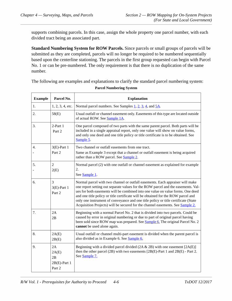
Standard Numbering System for ROW Parcels. Since parcels or small groups of parcels will be submitted as they are completed, parcels will no longer be required to be numbered sequentially based upon the centerline stationing. The parcels in the first group requested can begin with Parcel No. 1 or can be pre-numbered. The only requirement is that there is no duplication of the same number.
The following are examples and explanations to clarify the standard parcel numbering system:
Parcel Numbering System
Example Parcel No. Explanation
1. 1, 2, 3, 4, etc. Normal parcel numbers. See Samples 1, 2, 3, 4, and 5A.
2. 58(E) Usual outfall or channel easement only. Easements of this type are located outside of actual ROW. See Sample 1A.
3. 2-Part 1
Part 2
One parcel composed of two parts with the same parent parcel. Both parts will be included in a single appraisal report, only one value will show on value forms, and only one deed and one title policy or title certificate is to be obtained. See Sample 5.
4.
-
3(E)-Part 1
Part 2
Two channel or outfall easements from one tract.
Same as Example 3 except that a channel or outfall easement is being acquired rather than a ROW parcel. See Sample 2.
5.
-
2
2(E)
Normal parcel (2) with one outfall or channel easement as explained for example 2.
See Sample 1.
6. 3
3(E)-Part 1
Part 2
Normal parcel with two channel or outfall easements. Each appraiser will make one report setting out separate values for the ROW parcel and the easements. Val-ues for both easements will be combined into one value on value forms. One deed and one title policy or title certificate will be obtained for the ROW parcel and only one instrument of conveyance and one title policy or title certificate (State Acquisition Projects) will be secured for the channel easements. See Sample 2.
7. 2A
2B
Beginning with a normal Parcel No. 2 that is divided into two parcels. Could be caused by error in original numbering or due to part of original parcel having been sold since ROW map was prepared. See Sample 6. The original Parcel No. 2 cannot be used alone again.
8. 2A(E)
2B(E)
Usual outfall or channel multi-part easement is divided when the parent parcel is also divided as in Example 6. See Sample 6.
9. 2A
2A(E)
2B
2B(E)-Part 1
Part 2
Beginning with a divided parcel divided (2A & 2B) with one easement [2A(E)] then the other parcel (2B) with two easements [2B(E)-Part 1 and 2B(E) - Part 2. See Sample 7.
R/W Vol. 1 - Prerequisites for Authority to Proceed 4-6 TxDOT 12/2017

Chapter 4 — Surveying, Maps, and Parcels Section 2 — ROW Mapping for On-System Projects (For State and Local Government)
Project Information
All the information previously found on the ROW Map Title Sheet will be submitted in the form of a Word document template. The information will include:
Highway numbers
County or counties
Federal project number (if applicable)
10. 26-Part 1
Part 2
Sample 8 is when a parent tract resides in two counties with one parcel number divided into parts at the county line. Only one appraisal but division of values. This is applicable to both State and Local Government (LG) acquisition projects and also to a combination involving both State and LG acquisition on a project.
11. 33(RR) Railroad crossings held in joint use with a railroad (operating railroad ROW) by joint use agreement, license, or permit should be numbered in the same manner as a regular parcel of land with the addition of the designator "RR" (e.g., parcel 1RR). To be used for crossings only!
12. 34(JUA) Joint Use Agreement – Joint use of TxDOT right of way with others.
13. 57(W) Wetlands - used for property that is acquired for wetland mitigation.
14. 30(X) Overlooked Improvement - used when a parcel has been acquired and an over-looked improvement (e.g., private water, water well, root cellar, etc.) found on the parcel that still needs to be removed).
15. 16(TE) Temporary easements acquired through the normal acquisition process.
16. 28(M) Mitigation: Environmental mitigation except wetlands.
17. 1(AC) Access rights only. NO ROW TO BE ACQUIRED! See Sample 9.
18. 71(OAS) Outdoor Advertising Sign Only – NO LAND ACQUISITION!
19. 1AAQ Advance Acquisition Parcel – acquired in advance of ROW project authority to proceed. Option parcels can also be designated this way.
20. Tract 4UR An uneconomic remainder parcel.
21. U10000 A number assigned (by ROW Division) to uniquely identify a utility facility; may not involve property interest.
22. ROWAPS A number assigned for payments to be tracked to a Right of Way Professional Service Provider.
23. SPOLY A number assigned for appraisal payments to be tracked on a project basis.
Parcel Numbering System
Example Parcel No. Explanation
R/W Vol. 1 - Prerequisites for Authority to Proceed 4-7 TxDOT 12/2017
Chapter 4 — Surveying, Maps, and Parcels Section 2 — ROW Mapping for On-System Projects (For State and Local Government)
Construction CSJ number(s). If there is more than one CSJ, tabulate the numbers in the head-ing with the lowest number shown first, and show CSJ and station numbers at break points with arrow indicators.
ROW CSJ number(s) corresponding to each CCSJ
Authorized ROW project limits as setup in DCIS
Project length (shall match DCIS)
Station numbers for the beginning and ending of the project, and station equations.
Reference to previous ROW projects in the same location if applicable.
A listing of all known utility facilities, including U numbers.
Datum Statement including metadata, the state plane zone in which the project resides, basis of bearings and coordinates, adjustment factor used for converting from grid coordinates to sur-face coordinates including the origin for the scale, rotation angle (if applicable), and original monument description.
Signatures of appropriate signing authorities.
For initial submission: The District Surveyor or Right of Way Project Delivery Manager will recommend acquisition after a technical review for compliance with TxDOT proce-dures and Texas Board of Professional Land Surveying rules and regulations is completed.
For initial submission: The Area Engineer or Design Engineer will recommend acquisi-tion after a review for conformance with the design schematic and verifying the proposed acquisition is adequate to build the proposed transportation facility.
For final ROW map submission in PDF via EDMS: The District Engineer or designee will sign for final approval verifying ROW activities are complete as shown on the final ROW map.
ROW Projects for Utility Accommodations Exclusively
Projects that require only utility relocations without parcel or easement acquisition may be submit-ted with only the Word document template that contains all the information previously found on the ROW Map Title Sheet and should include the following:
ROW CSJ Number
A distinct label stating “For Utilities Only”
Project limits with beginning and ending stationing.
Plan sheets showing utility facilities (optional)
All known utility facilities listed by name and U number.
R/W Vol. 1 - Prerequisites for Authority to Proceed 4-8 TxDOT 12/2017
Chapter 4 — Surveying, Maps, and Parcels Section 3 — Property Descriptions
Section 3 — Property Descriptions
Overview
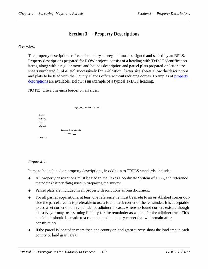
The property descriptions reflect a boundary survey and must be signed and sealed by an RPLS. Property descriptions prepared for ROW projects consist of a heading with TxDOT identification items, along with a regular metes and bounds description and parcel plats prepared on letter size sheets numbered (1 of 4, etc) successively for unification. Letter size sheets allow the descriptions and plats to be filed with the County Clerk's office without reducing copies. Examples of property descriptions are available. Below is an example of a typical TxDOT heading.
NOTE: Use a one-inch border on all sides.
Figure 4-1.
Items to be included on property descriptions, in addition to TBPLS standards, include:
All property descriptions must be tied to the Texas Coordinate System of 1983, and reference metadata (history data) used in preparing the survey.
Parcel plats are included in all property descriptions as one document.
For all partial acquisitions, at least one reference tie must be made to an established corner out-side the parcel area. It is preferable to use a found back corner of the remainder. It is acceptable to use a set corner on the remainder or adjoiner in cases where no found corners exist, although the surveyor may be assuming liability for the remainder as well as for the adjoiner tract. This outside tie should be made to a monumented boundary corner that will remain after construction.
If the parcel is located in more than one county or land grant survey, show the land area in each county or land grant area.
R/W Vol. 1 - Prerequisites for Authority to Proceed 4-9 TxDOT 12/2017
Chapter 4 — Surveying, Maps, and Parcels Section 3 — Property Descriptions
Access denial lines shown on the right of way/property line to designate the property interest being conveyed. See parcel example 9 for a visual depiction.
Existing Information.
existing ROW monuments;
existing access control areas;
record ownership data of adjacent properties;
ROW PCs, PTs, and PIs (show and label);
existing centerline information including incremental stationing, PC, PT and PI data;
existing utility lines and easements (deed reference, if available);
existing improvements such as buildings and fences, etc.;
potential obstructions and/or encroachments. (Locate any improvements bisected by or within 50 feet of the new ROW line. This will assist appraisers in determining damages to the remain-ders of properties.)
survey lines (show and label);
city limit lines (show and label);
county lines (show and label);
existing public roads, streets and alleyways (include recorded plat or deed reference);
existing drainage or channel easements (include recorded plat or deed reference);
on a separate page of the parcel plat, show the whole property relative to existing and proposed ROW.
Proposed Information.
new ROW lines;
new ROW markers;
proposed centerline information including incremental stationing, PC, PT and PI data;
portions of the proposed design. Although a ROW map is not to be used to construct a high-way, you should show, by a single line, the following proposed items or additional topography information:
frontage roads;
main lanes;
connecting ramps.
When control of access is used, it should be described in a recorded deed, and shown on the par-cel plat and described in the field note portions of the property
R/W Vol. 1 - Prerequisites for Authority to Proceed 4-10 TxDOT 12/2017
Chapter 4 — Surveying, Maps, and Parcels Section 3 — Property Descriptions
descriptions. Limits of denied access should be staked on the ground, and shown or described in the property description using the terms 'Denial of Access’ or ‘Access Denial Line'. Access control descriptions must be signed and sealed by an RPLS.
Parcel Information.
property owner name;
parcel number;
parent tract;
surface coordinates of the point of beginning (POB);
station to station limits and offset to project centerline;
area in acres and/or square feet;
area of remainder in relation to right and left of project centerline (calculated from deed refer-ence only);
property lines, (show and define by bearing and distance relative to existing and new ROW lines);
a bearing and distance to a monumented controlling corner outside the area to be acquired. If the corner is defined as a point of commencement (POC) in a property description, show the letters P.O.C. on the map with reference of the parcel to which it is tied.
Parcels consisting of more than one part must include a summary at the end of the property descrip-tion as follows:
Summary
Part 1 = 4.333 Acres (188745 ± square feet)
Part 2 = 2.667 Acres (116174 ± square feet)
Total = 7.000 Acres (304919 ± square feet)
Property descriptions covering more than one page should read "Page___of____." Include the par-cel plats as part of the entire document. For example, when there are three pages of a property description and three pages of a parcel plat, identify each as being one of six pages, and read "Page __ of 6."
At the end of each property description, add a sentence stating "This property description is accom-panied by a separate plat." All property descriptions must be signed and sealed by an RPLS, and must include a statement that the survey was performed on the ground under his supervision and must include the day, month and year of the survey.
R/W Vol. 1 - Prerequisites for Authority to Proceed 4-11 TxDOT 12/2017
Chapter 4 — Surveying, Maps, and Parcels Section 3 — Property Descriptions
Sequentially number each call on a property description beginning with Number 1. Calls are num-bered for clarity and reference. Numbered calls also make it easier on a reviewer to designate problem areas. An example of this would be: "The bearing in call number 4 should read N 89° 59'00" E."
Certification
Refer to §663.18 of the General Rules of Procedures and Practices of the Texas Board of Professional Land Surveying on the certifica-tion of surveys. The use of an electronic seal and signature will be the preferred method of certification, with the property description being submitted in a locked PDF format created by an electronic signature service or other secure method(s).
Monuments
Refer to §663.17 of the General Rules of Procedures and Practices of the Texas Board of Profes-sional Land Surveying for information on the monumentation of surveys.
Each parcel corner on a ROW project must have a survey marker on the ground to represent that particular corner. A Type II (Brass Disk) should be placed in concrete flush with the ground at all PCs, PTs, angle points and at 1500 foot intervals along tangent sections, or at closer intervals. A 1/2" or 5/8" iron rod with aluminum cap stamped "TxDOT ROW" should be placed at the intersec-tions of the new ROW line and individual property lines. If Type II monumentation is set after highway construction, the following optional phrase shall be included in the relevant property description and noted on the ROW map:
“The monument described and set in this call shall be replaced with a TxDOT Type II Right of Way Marker upon the completion of the highway construction project under the supervision of a Registered Professional Land Surveyor, either employed or retained by TxDOT.”
All monumentation must be completed under the supervision of a TxDOT contracted RPLS.
Public Roads and Alleys
Existing public roads or alleys that abut or pass through a ROW parcel need to be examined closely to determine the record of title. Record title should be shown on the ROW map and parcel plats. If no record can be located, a note should be added stating the existing ROW shown was determined by occupation. If included in the adjacent landowner's deed, the existing ROW should be included in the parcel area but cannot be included for payment. For existing roadway areas which do not appear in any conveyance to a public entity or adjacent property owner, a quitclaim deed or a Dis-
R/W Vol. 1 - Prerequisites for Authority to Proceed 4-12 TxDOT 12/2017
Chapter 4 — Surveying, Maps, and Parcels Section 3 — Property Descriptions
trict Engineer affidavit from the public entity occupying the facility should be obtained and filed with the County Clerk.
R/W Vol. 1 - Prerequisites for Authority to Proceed 4-13 TxDOT 12/2017
Chapter 4 — Surveying, Maps, and Parcels Section 4 — Submission and Approval of ROW Mapping
Section 4 — Submission and Approval of ROW Mapping
Original Submission to Division
The surveyor should complete and submit electronic files, property descriptions, surveyor reports, closure sheets that include precision and GIS mapping, to the District for review. The District Sur-veyor or appropriate personnel must review the submission for compliance with TxDOT policy and TBPLS standards. The Design Engineer or appropriate personnel must review the mapping for compliance with the design schematic and to verify that the area to be acquired and all easements are adequate to build the transportation facility.
Requirements for Right of Way Mapping Deliverables
The following is an outline in chronological order of the ROW Division’s requirements for map-ping deliverables.
ROW (ArcGIS) geo-database template populated with the schematic ROW footprint parcels and schematic alignment. (See Section 8 - Requirements for Submission of ArcGIS Files). The current submission standards and current geo-database template can be found on the ROW Division's webpages on txdot.gov.
Spreadsheets and/or Word documents containing the information on the cover map sheet (project limits, beginning and ending stationing, utility stations, etc.) and control/alignment map sheets (coordinates/descriptions of control monuments and coordinates/stationing/curve data of alignment);
Preliminary property descriptions in PDF format to facilitate the early stages of the acquisition process (title and appraisal). See the General Rules of Procedures and Practices of the Texas Board of Professional Land Surveying §663.18(d) Certification for requirements for preliminary documents.
Concurrent with preliminary property descriptions, ROW (ArcGIS) geo-database template populated with the current surveyed and/ or preliminary parcels for each submission, current alignment and project control points.
Signed and sealed property descriptions (See Section 3 - Property Descriptions) and their associated electronic files (signed and sealed copy in PDF format; Word documents; MicroStation parcel plat files; and MicroStation master reference [MRF] files);
Concurrent with signed and sealed property descriptions, ROW (ArcGIS) geo-database tem-plate populated with the current final (signed and sealed) parcels for each submission and final alignment.
Spreadsheets and/or Word documents containing the information on the acquisition (owner-ship tabulation) map sheets.
R/W Vol. 1 - Prerequisites for Authority to Proceed 4-14 TxDOT 12/2017

Chapter 4 — Surveying, Maps, and Parcels Section 5 — Requirements for Final ROW Maps
Section 5 — Requirements for Final ROW Maps
Overview for Traditional ROW Maps
Once ROW map revisions are complete, all new ROW is acquired, and all documents are recorded, send an original PDF of the ROW map marked "FINAL MAP" to ROW Division via EDMS with appropriate notification. A disk with complete electronic files, including all revised map sheets shall also be submitted to the ROW Division for the permanent file. For the final map to be com-plete, it must contain:
all project numbers;
grantors' names;
areas of acquired parcels;
recording information;
a "U" number assigned for utility adjustments/accommodations;
names of the utility owner(s) and recording data for recorded documents, when applicable;
all signature blocks completed; and
DGN graphics files including all revisions;
Shape files, if available.
Completing this process will minimize district’s time spent researching ROW maps.
Overview for Online ROW Mapping
Since all the information will already be in the ROWIS database, the online geo-database, and EDMS, the closeout can be done electronically.
R/W Vol. 1 - Prerequisites for Authority to Proceed 4-15 TxDOT 12/2017

Chapter 4 — Surveying, Maps, and Parcels Section 6 — ROW Mapping for Off-System Projects
Section 6 — ROW Mapping for Off-System Projects
Overview
The only requirement for ROW mapping on off-system projects will be that the property descrip-tions are based on the Texas Coordinate System of 1983 and as described in Section 3, Property Descriptions of this Chapter. The use of graphics software other than Micro-Station is permitted and the only required deliverable will be signed and sealed property descriptions in PDF format.
Off-System projects do not have to meet any other software, file format or other deliverable requirements in Chapter 4.
R/W Vol. 1 - Prerequisites for Authority to Proceed 4-16 TxDOT 12/2017
Chapter 4 — Surveying, Maps, and Parcels Section 7 — Requirements for Submission of Graphics Files for On-System Projects
Section 7 — Requirements for Submission of Graphics Files for On-System Projects
Overview
The purpose of this section is to provide requirements for the graphics standards, and file manage-ment (structure and naming conventions) of ROW mapping electronic deliverables submitted to the ROW Division as an integral part of the ROW mapping package.
The software, file types and file formats must be compatible with those used by the district/division design for schematics and PS&E, example: native current version MicroStation for graphics, Mic-rosoft Word and Adobe PDF for descriptions, etc.
MicroStation
All graphic files for map sheet and parcel plats must be native DGN files created by the current ver-sion of MicroStation using the current TxDOT seed files in the TxDOT workspace environment, settings, and resource files.
All files shall contain at minimum, company name, company logo, company phone number, firm number, surveyors name, RCSJ#, date of survey, state plane zone, surface adjustment factor, and revision information.
MicroStation Level Library Files
The current TxDOT level library files for ROW mapping will be provided by TxDOT. The file(s) contains all the predefined levels that will normally be needed for ROW mapping and to show existing utilities.
DGN File Properties and Naming Convention of the Parcel Plat Pages
Each DGN file shall be spatially correct (snapping on elements gives correct coordinate values), and there should be one (1) DGN file for each parcel plat page. All the parcel plat pages will utilize the same master reference files.
The parcel plat sheet and/or naming convention is "ROWCSJ_ParcelNumber_PgNumber.dgn", with an example as follows: "212104065_01_P01.dgn".
The format for the PDF of the Property Description is slightly different, since the PDF will contain the ROWIS parcel ID to link the PDF to the online parcel in the Real Property Asset Map. The naming convention is "District Aberration_ROWCSJ_ParcelNumber_ParcelID.pdf", with an example as follows: "ELP_212104065_01_43569.pdf".
R/W Vol. 1 - Prerequisites for Authority to Proceed 4-17 TxDOT 12/2017

Chapter 4 — Surveying, Maps, and Parcels Section 7 — Requirements for Submission of Graphics Files for On-System Projects
Naming Convention of the Master ROW Files (MRF) in DGN Format
The master ROW file naming convention is “MRF ROW CSJ_Logical Name.dgn", with examples as follows:
MRF212104065_Schematic100.dgn (schematic layout 100% submittal);
MRF212104065_SchemApprov.dgn (final approved [TxDOT & FHWA] schematic);
MRF212104065_PSEDesign.dgn (final PS&E design);
MRF212104065_ExROW.dgn (existing ROW determined by RPLS);
MRF212104065_PropROW.dgn (proposed ROW of final design);
MRF212104065_PropRW_Parcel_Polygons.dgn (proposed ROW parcels to be acquired);
MRF212104065_DeedPlot.dgn (deed record);
MRF212104065_Planimetric.dgn (aerial mapping topography);
MRF212104065_ROWTopo.dgn (improvements data collection);
MRF212104065_DesignTopo.dgn (design level data collection topography);
MRF212104065_ExUtil.dgn (existing utilities, etc.);
MRF212104065_Schematic90.dgn (schematic layout 90% submittal);
MRF212104065_PropROW_Lines.dgn (proposed ROW lines of final design);
MRF212104065_ExROW_Centerline.dgn (as determined by RPLS).
All similar features must be on separate levels for easy separation from text.
Proposed ROW parcels shall be comprised of complex lines or as complex shapes.
All MRF dgn files shall be provided in surface and grid coordinate systems.
All sheet files with a plan view will have the MRF referenced to sheet files to allow more than one sheet file to be worked on at the same time.
File Structure of Master and Reference DGNs
Use few or no subfolders to allow better transfer of data to different PCs, server drive names, or CDs/DVDs without path problems to reference files when the sheet files are opened.
R/W Vol. 1 - Prerequisites for Authority to Proceed 4-18 TxDOT 12/2017

Chapter 4 — Surveying, Maps, and Parcels Section 7 — Requirements for Submission of Graphics Files for On-System Projects
Line Weights, Line Styles, Colors, Text Size, Text Fonts, Scale, and Annotations
Legibility is the primary concern when choosing the scale, line weights and text size. Parcel pages shall be legible at full scale sheet size (8-1/2" x 11") and the reproductions (copies) must also be legible.
The scales will be one of the standard engineering scales. The choice of the scale will be determined by the legibility of the parcel plate pages.
Use "MicroStation Packager" for the submission of electronic deliverables. This will capture any non TxDOT standard rsc, cel, text, etc. files that were used in the mapping that look and plot differ-ently in the TxDOT MicroStation workspace.
Text and Line Colors when Using Color Digital Orthos in the Background
The predominate colors of the digital orthos (greens, browns, etc) will dictate the line and text col-ors that stand out and are legible. Use trial and error, as needed, to select legible text and line colors.
Required Data in the Geopak ROW GPK File
The following are required data in the Geopak ROW GPK File (start with Schematic or Design GPK file):
alignments;
chains of proposed ROW lines;
chains of existing ROW lines;
shapes of whole tract parcels;
taking parcels;
all points collected in the field and all calculated points.
Surface Coordinates
Surface adjustment factors and basis of datum shall be well documented in all electronic delivera-bles "file structure/deliverables read me" file.
R/W Vol. 1 - Prerequisites for Authority to Proceed 4-19 TxDOT 12/2017

Chapter 4 — Surveying, Maps, and Parcels Section 8 — Requirements for Submission of ArcGIS Files
Section 8 — Requirements for Submission of ArcGIS Files
Overview
The purpose of this section is to provide requirements for ArcGIS standards as an integral part of the ROW mapping package.
All current and future ROW mapping projects will be subject to these submission standards, elimi-nating the requirement for the submission of traditional paper ROW maps under the old standards.
The paper ROW maps are being replaced with geo-referenced parcel data in GIS format to be used in TxDOT's Online Real Property Asset Map (virtual ROW map).
The software, file types and file formats must be compatible with those used by the State. An exam-ple is the current version of ArcGIS used by the State.
ROW Geo-Database Template
All ArcGIS data will be submitted in ArcGIS 10.2.2/10.3.1 format or the current version in use by the State and in the format of the ROW geo-database template.
The current TxDOT ROW geo-database template "ROW_Parcels_Edits" for the delineation of the right of way will be provided by the State. The template will also be available to download from the ROW Division's webpage on TxDOT's internet site (txdot.gov).
Coordinate System of Template
The template's XY coordinate system is geographic coordinates (longitude and latitude), North American Datum of 1983 in Decimal Degrees (8 or more places after the decimal point).
Features in the Template
The template contains a feature dataset named 'ROW_Parcels_Edits', and that dataset contains the following features:
EXIST_RT_OF_WAY_PRCL_PNT_Edits (Existing Right of Way Monument/Points)
EXIST_RT_OF_WAY_PRCL_LN_Edits (Existing Right of Way Lines)
EXIST_RT_OF_WAY_PRCL_POLY_Edits (Existing Right of Way Parcel Polygons)
RT_OF_WAY_PROP_DSPN_POLY_Edits (Property Disposition/Surplus Tract Polygons)
RT_OF_WAY_SCHEM_POLY_Edits (Schematic Footprint Proposed Parcel Polygons)
R/W Vol. 1 - Prerequisites for Authority to Proceed 4-20 TxDOT 12/2017

Chapter 4 — Surveying, Maps, and Parcels Section 8 — Requirements for Submission of ArcGIS Files
RT_OF_WAY_CL_LN_Edits (Schematic or Right of Way Centerline/Baseline)
RT_OF_WAY_CNTL_PNT_Edits (Primary GPS Control Points or Monuments)
RT_OF_WAY_WHL_PRP_POLY_Edits (Whole Property prior to taking Polygons)
UTIL_PRCL_LN_Edits (Utility Lines)
ACES_CTRL_PRCL_LN_Edits (Proposed and/or Existing Access Control Lines)
RT_OF_WAY_PRCL_POLY_Edits (Proposed Acquisition Parcel Polygons)
Feature Attributes or Fields
Each feature has a table comprised of common attributes or fields. The fields for each record (point, line, or polygon) will be populated as follows:
PRCL_ID (Parcel ID Number) Unique identifier created by the ROWIS database for each fea-ture. Populated by TxDOT ROW Division.
PRCL_NM (Parcel Name) Name of feature part (1, 1 Part 1, 1 Part 2, etc.) Populated by user and/or consultant.
PRCL_NBR (Parcel Number) Number of feature unit (1, 2, etc.) Populated by user and/or consultant.
PROP_DSCR (Link to PDF of Property Description or Deed) Populated by TxDOT ROW Division.
RT_OF_WAY_MAP (Link to PDF of R/W Map) Populated by TxDOT ROW Division.
CREATE_DT (Create Date) Populated by user and/or consultant.
CREATE_USER_NM (Create User Name) Populated by user and/or consultant. Consultant should use firm name.
EDIT_DT (Edit Date) Populated by user and/or consultant.
EDIT_USER_NM (Edit User Name) Populated by user and/or consultant. Consultant should use firm name.
CMNT (Comment) Populated by user and/or consultant.
SRC_CMNT (Source Document) Populated by user and/or consultant.
SHAPE_AREA (Shape Area for polygons only) Auto populated.
SHAPE_LEN (Shape Length) Auto populated.
OBJECTID (Shape ID Number) Auto populated.
R/W Vol. 1 - Prerequisites for Authority to Proceed 4-21 TxDOT 12/2017
Chapter 4 — Surveying, Maps, and Parcels Section 8 — Requirements for Submission of ArcGIS Files
Rename Geo-Database Template to ROW CSJ Prior to Submission
Use ArcCatalog to rename the 'ROW_Parcels_Edits.gdb' template to the ROW CSJ (RCSJ) proj-ect number prior to submission.
For example: If RCSJ is 2552-04-041, rename the template 'ROW_Parcels_255204041.gdb'.
For revised or additional submissions of the same project, rename the template: 'ROW_Parcels_255204041a.gdb' for the 2nd submission, 'ROW_Parcels_255204041b.gdb' for the 3rd submis-sion, etc.
After geo-database template is renamed, create a .zip file for submission. Example: 'ROW_Par-cels_255204041.zip'.
Conversion of Survey Data to ArcGIS and Template Format
The attribute table of geo-referenced features created outside the template must be exactly the same as those in the template before you can append them into the features in the template.
The conversion from the native survey data, Geopak, MicroStation or CAD files used in the prepa-ration of the property descriptions and parcel plats to the coordinate system and format of the geo-database template can be accomplished in a number of different ways in different programs and in ArcGIS depending on the origin and format of the survey data.
Since no one set of instructions will fit all the different variables of data collection, data processing, and/or data conversion software, the only requirement will be that the feature data is geospatially correct and submitted to the State in the exact format of the template.
Requirements for ArcGIS Deliverables
ROW geo-database template shall be populated with all required ROW features of each stage of submission.
The following is an outline in chronological order of the requirements for ArcGIS mapping deliverables:
ROW (ArcGIS) geo-database template populated with the schematic ROW footprint parcels and schematic alignment.
ROW (ArcGIS) geo-database template populated with the current surveyed and/or preliminary parcels for each submission, current alignment and project control points. An updated geo-database will be submitted as the parcel submissions progress.
Geo-database template populated with the current final (signed and sealed) parcels for each submission and final alignment.
R/W Vol. 1 - Prerequisites for Authority to Proceed 4-22 TxDOT 12/2017