Embed Size (px)
Citation preview

KLS GOGTE INSTITUTE OF TECHNOLOGY, BELAGAVI
Department of Electronics and Communication Engineering
AICTE sponsored Two-week National Level Technical
Faculty Development Programme on
“Emerging Trends of Geoinformatics in Agriculture”
from 11th to 23rd December 2017
Day-wise Report on FDP
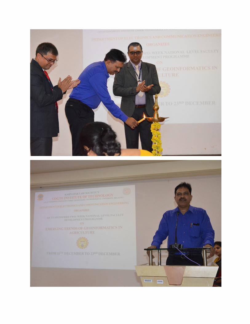
Day 1 – 11/12/2017
Session 1: Inauguration was done by Dr. K Ganesh Raj, General Manager, RRC-ISRO,
Bengaluru with a Keynote Address. Dr. A.S. Deshpande, Principal, briefed about the importance
of Agriculture and applications of Geoinformatics in Agriculture. Prof. A. B. Gavade, FDP
coordinator briefed about the plans for all the days of the FDP.
Session 2: Dr. K Ganesh Raj, General Manager, RRC-ISRO, Bengaluru, briefed about various
space programs and forthcoming Indian Space Programs by ISRO. Also, the applications of
Geospatial with various fields were discussed.
Session 3 and Session 4: Dr. Jagadeesh Pujari, Professor, SDMCET, Dharwad, gave a brief
Introduction on various Image processing Techniques and their applications with respect to
agriculture. The session briefed about different techniques for detecting the crop damage due to
various reasons due to excessive use of insecticides, insects, etc.
Day 2 - 12/12/2017
Session 1: Mr. Anand. B. Deshpande, Assoc. Prof, AITM, Belagavi, briefed about various image
super-resolution techniques and its clarity in viewing with reference to the images of Geospatial
applications. The session also briefed about the applications of Super-Resolution in Agriculture.
Session 2, 3 and 4: Dr. Kumar Rajamani, Manager, Robert Bosch, Engineering gave an
introduction to Machine Learning and its algorithms, Deep Learning algorithms and its various
applications in Agriculture. He briefed about embedding the Machine Learning and Deep
Learning Algorithms in the system so as it could automate itself in decision making in the field
of Agriculture.
Day 3 - 13/12/2017
Session 1, 3 and 4: Dr Ramachandra Hebbar, Scientist, RRC-ISRO, Bengaluru, briefed about
the Basics of Remote Sensing such as its definition, various principles and concepts and
applications. He also briefed about the rotation of satellites around the same place at the same
time of the day using which the boundaries and other parameters of the fields can be found. Day
by Day changes can be monitored. Various Image Processing techniques with reference to the
Geospatial techniques were discussed and various Research and Development projects and also
the scope and opportunities in ISRO were briefed upon.

Session 2: Dr. Suresh. R, Asst. Professor, KUD, Dharwad, briefed about the various day-wise,
month-wise and year-wise statistics with reference to the agricultural fields and crops. He also
briefed about the agricultural parameters with reference to the various quantities, etc.
Day 4 - 14/12/2017
Session 1: Dr. V.S. Rajpurohit, Professor, KLSGIT, Belagavi, briefed about various Big-data
techniques with reference to agriculture. He discussed on how large quantities of data of
agriculture can be stored, searched and sorted.
Session 2 and 3: Mr. Ravi. Singh, Indrones India Pvt. Ltd, briefed about how drones can be used
with reference to agriculture. He also discussed about image/video capturing, transmitting and
receiving by the use of the camera fixed on the drone. A demo using a drone was demonstrated
within the premises with a camera fixed on it so that the participants can view the video live.
Session 4: Dr. Nagaraj Patil, Professor, VTU, Belagavi, briefed about the different formats used
to transmit and receive the geospatial data to and fro to earth. The different sources of the
Geoinformatics information collection and categorization was briefed.
Day 5 - 15/12/2017
Session 1: Aditya Killekar, Graduate Student, University of Southern California & Computer
Vision Researcher, LA, USA, briefed about Computer Vision, Intelligence and its application
with reference to the fields of agriculture as to how processes like weeding, etc. can be
automated using various image processing techniques in the Computer.
Session 2, 3 and 4: Dr. B.S. Dayasagar, ISI, Bengaluru, briefed about various morphology with
reference to agriculture. The fractional geometry of the fields with reference to the shapes, sizes
and other parameters of the fields and storage and prediction of the Geospatial data on the server
and its interpretation was being discussed.
Day 6 - 16/12/2017
Session 1 and 2: Dr. P. P. Nageswara Rao, Faculty Member, VTU-EC, Outstanding Scientist,
ISRO, briefed about smart agriculture based on climatic changes. The role of geoinformatics
plays an important role in acquiring information using various satellite imagery at different
intervals in a year. Based on the information acquired, type of crop, etc. is decided to be
cultivated.
Session 3 and 4: Dr. Ramana. V. Kothapalli, Vice-Chairman, AP Space Application Center,
Vijaywada, discussed about spectral applications in Agriculture. Highly dense and less dense
spectral analysis using Microwave and Remote Sensing was discussed.
Day 7- 17/12/2017 Sunday
Day 8 - 18/12/2017

Session 1, 2, 3 and 4: A visit to University of Agricultural Sciences, Dharwad, was done.
Different methods of cultivating and yielding the crops were gone through. New automation
methods and machines for automating the processes were explained by the faculties at the visit.
Day 9 - 19/12/2017
Session 1 and 2: Dr. Venkatesh, NIH, Belagavi, briefed about the Remote Sensing applications
in Hydrology using various methods. The demonstration of modeling the tools using GIS was
briefly discussed about.
Session 3 and 4: Dr. Purandar, NIH, Belagavi, briefed about the applications of information
obtained from Geospatial satellites in Agriculture and hydrological data as to how much water
can be utilized, estimation of the water beneath the earth surface at place of cultivation,
estimation of water in the water bodies at regular intervals of time. Estimation of water resources
using Applications of Remote Sensing was briefed.
Day 10 - 20/12/2017
Session 1 and 2: Dr. Paresh Chandra Deka, Associate Professor, Department of Applied
Mechanics, NITK, Suratkal, briefed about the determination of land suitability for various crops
and yields using Remote Sensing and GIS. Also the inclusion of Artificial Intelligence into
Geoinformatics promotes the automation of the agricultural processes such as a specific time to
yield, crop, etc was briefed.
Session 3 and 4: Mr. Sanganabasayya, Lead Architect, Wipro Limited, Bengaluru, briefly
discussed about the Remote Sensing Concepts and its applications in Agriculture. The rotation
and revolution of satellites around the same place at the same time of the day using which the
boundaries and other parameters of the fields was discussed. Also the application of Remote
Sensing in Precision agriculture was briefly discussed.
Day 11 - 21/12/2017
Session 1 and 2: Dr. Sanjeev Gadad, ACS College of Engineering, Bangalore, discussed various
atmospheric details and the suitability of various crops according to the changes of the climate.
The concept of yield of the crops and their relative scalability models were discussed.
Session 3 and 4: Dr. Kumar Raju B. C, ACS College of Engineering, Bangalore, provided a
clear understanding of all the components of the water balance and is essential to analyze
possible measures of water savings in irrigated agriculture. He also briefed about
Evapotranspiration, a process by which water is transferred from the land to the atmosphere by
evaporation from the soil and other surfaces and by transpiration from plants.
Day 12 - 22/12/2017
Session 1 and 2: Dr. Kumar Raju B. C, ACS College of Engineering, Bangalore, briefed about
the uncertainty in the analysis occurred in the hydrological modelling of various waterbodies
when analyzing the data from the Geostationary satellites. Also the information acquired from

the geostationary satellites provides the lakes that are to be rejuvenated based on the mud, sand
and other materials deposited in the lake.
Session 3 and 4: Dr. Sanjeev Gadad, ACS College of Engineering, Bangalore, discussed about
the data acquisition/ generation and modelling of the information of the agriculture in various
aspects. Also the wind distribution and suitability of it to the crops and their modelling with the
information obtained from the Geostationary satellites. The wind flow, speed and other details
are notes from the satellites and accordingly mapping and modelling was discussed.
Day 13 - 23/12/2017
Session 1, 2 and 3: Dr. Girish Pujar, Scientist, NRSC, Hyderabad, briefly discussed about
acquisition of rural population data and the employment opportunities generation using
Geospatial technique. Also high resolution image analysis for Woody Component in Ecosystem
using various methods was briefly discussed.
Session 4: The 2 Week FDP was concluded with the experiences and the feedbacks of the
participants and valedictory. The attendance certificates and the Participation certificates were
provided to all the participants by the Committee Head.
Photos of the programme