Embed Size (px)
Citation preview

Main river passage, El Tunel de Pili, Darien; Photo Dig Hastilow
Report of the 2018 Anglo-Irish Expedition

CAVING IN PANAMA 2018
2
Map of the Republic of Panamá, Central America
The above map illustrates principle towns and cities of the Republic. La Palma, the Capital of Darién, is located in the east of the country, near Colombia.
Cave map of the Republic of Panama showing the location of all known and
reported caves. (Map by James Cobbett).

CAVING IN PANAMA 2018
3
Contents Contents ........................................................................................... 3
Acknowledgements: an appreciation .................................................. 5
Research design: Are there caves in Darién? ...................................... 8
Introduction .................................................................................... 10
Geology and Geography ................................................................... 16
Topographical and Geographical observations and considerations ... 18
Lidar Survey................................................................................. 18
Observations of limestone occurrences ............................................ 21
Observations in Darién ................................................................. 21
Topographic summary of cave entrance locations ......................... 23
Observations on cave grouping alignment throughout Panamá ........ 28
Panamá City ................................................................................ 28
Azuero Peninsula ......................................................................... 29
Isla Bastimentos .......................................................................... 30
Isla Colon ..................................................................................... 30
Lago Bayano ................................................................................ 31
Darien .......................................................................................... 32
Chiriquí Province.......................................................................... 33
Coclé Province .............................................................................. 34
Almirante, Bocas del Toro............................................................. 35
El Tunel de Pili ................................................................................ 36
Overview ...................................................................................... 36
Description .................................................................................. 36
Explanation ................................................................................. 37
Cueva José Garrido ......................................................................... 41
Overview ...................................................................................... 42
Description .................................................................................. 42
Pozo Lin, Lago Bayano ..................................................................... 47
Overview ...................................................................................... 48
Description .................................................................................. 48
Cueva del Agua Sombreada ............................................................. 50
Overview ...................................................................................... 51
Description .................................................................................. 51
Cueva Quebrada Seca, Lago Bayano ................................................ 53
Conclusions .................................................................................... 54

CAVING IN PANAMA 2018
4
Appendix A: Logistics ...................................................................... 56
Security ....................................................................................... 56
Weather ....................................................................................... 57
Seasons ....................................................................................... 58
Health .......................................................................................... 58
Hydration ..................................................................................... 58
G.P.S.R. use ................................................................................. 59
Accommodation............................................................................ 59
Fatigue / Heat exhaustion ............................................................ 59
Flights.......................................................................................... 60
Guides ......................................................................................... 60
Landowners ................................................................................. 60
Boat hire ...................................................................................... 60
Vehicle hire .................................................................................. 60
Communications - Language ........................................................ 60
Appendix B: Cárdenas; a survey of the visible features .................... 61
Appendix C: Trip Report, Description of the Spanish Colonial Ruins of Cardenas, Camino de Cruces National Park, Panama ...................... 65
Summary ..................................................................................... 65
Introduction ................................................................................. 65
Location and Access ..................................................................... 65
Description of the Ruins ............................................................... 68
History ......................................................................................... 74
Conclusion ................................................................................... 80
Acknowledgements .......................................................................... 81
References ....................................................................................... 81
Appendix D: Fort San Lorenzo ......................................................... 88
Appendix E: Murals demonstrating increasing ecological/conservation awareness. ...................................................................................... 93

CAVING IN PANAMA 2018
5
Acknowledgements: an appreciation I begin this report with what I feel are rather inadequate words of thanks to the organizations and individuals who have kindly assisted this modest endeavour with little or no thought of personal benefit or reward; they too are part of this success. To the men and women of Central Battalion, SENAFRONT, (Panamánian Border Police); in particular Commandant, Subcomison, Edwin Cedëno whose cordiality and assistance was overwhelming. It must also be said that at each and every security checkpoint encountered throughout the Darién, manned by personnel of SENAFRONT, we were politely treated and accorded every courtesy, followed by a genuine concern for our welfare and safety when realized the Team intended to search the jungle in areas known as hostile, being regularly traversed by traffickers. Pursuant to our research, enquiries were conducted personally by Subcomison Cedeño, on our behalf; further reports of cave near Yaviza were obtained. Davide of “Restaurante Nayelis”, La Palma, Darién, who, when encountered by sheer good fortune, (a massive factor in any trip), became pivotal to the expeditions success acting as liaison between team members, driver and landowners. Farmers José Garrido and Pili Bridgo for their kind permission to access their land to explore and record any caves found within. The Speleological Union of Ireland for their continued commitment toward the pursuit of original cave and karst research, and maintaining the expedition reports on line for public use, http://www.caving.ie. To the Rangers of Parque Nacional Camino de Cruces Panamá who assisted the team to locate the ruins of Cárdenas, reputedly the site of a 16th / 17th century caravanserai, now totally concealed by jungle, though so close to Panamá City. https://caminorealdecruces.wordpress.com/breve-historia-del-camino-de-cruces/ Dr. Richard Cooke for arranging researchers Nicole Smith-Guzman and Ashley Sharpe archaeologists at the Smithsonian Tropical Research Institute, to meet the team to discuss a possible future archaeological study of Cueva del Cementario, Lago Bayano and further research by the S.T.R.I. The staff of Canopy Camp, a prestigious EcoResort, who, though initially surprized at our arrival, very kindly assisted our enquiries for caves and limestone.

CAVING IN PANAMA 2018
6
Dr. Stewart Redwood: for his patient explanations of matters geological and his constant support of the team’s research; particularly so for his thorough research on the curious Cárdenas archaeological site project and his welcome guidance of matters geological within this report. Marilyn Cobbett: for her boundless good humour, patience and overwhelming hospitality. To The Pegasus Club Nottingham, (A.K.A. Pegasus Caving Club), for hosting the forthcoming Panamá Cave Database available free to public access, https://www.pegasuscavingclub.org To The Panamá 2018 Team, James, Roger and Dig in sincere appreciation of their ever present good humour and determination in the face of what each would agree were the worst conditions yet experienced pursuing cave in Panamá: boy’s, I can honestly say it was both a privilege and enormous fun; and for their assistance composing this report; thanks a million, I really mean it. I would single out Roger Day and Dig Hastilow, who were zealous recording these events as digital images, without which, this report would be all the poorer. Last, but never least, to my wife, Pauline Cronin, for her tireless unwavering support for my consuming passion to explore the underground realm. Pat Cronin Doolin, County Clare, Ireland February 2018
CAVING IN PANAMA 2018
7
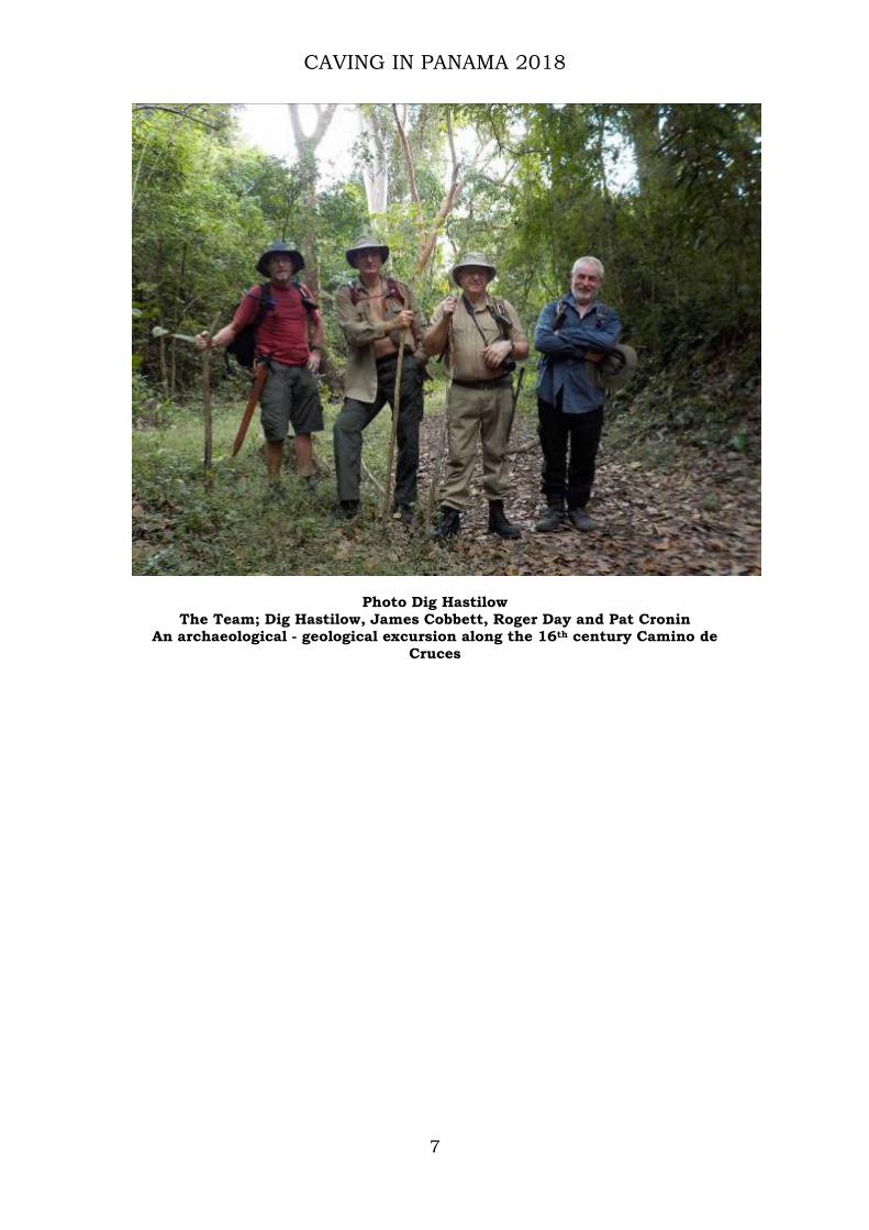
Photo Dig Hastilow The Team; Dig Hastilow, James Cobbett, Roger Day and Pat Cronin
An archaeological - geological excursion along the 16th century Camino de Cruces

CAVING IN PANAMA 2018
8
Research design: Are there caves in Darién?
La Palma, the Capital of Darién province, was used as base for the 2018 Expedition
Since 2005 a series of Anglo-Irish Caving Expeditions has located, explored and recorded caves previously unknown to speleology in Panamá. These caves are distributed widely throughout the country: the end 2017 proved the province of Darién, Terra Incognita. The brief reconnaissance in January 2017 observed exposed rock formations on the eastern river bank in the town of Yaviza; seemingly limestone. Much of Panamá remains pristine rainforest, Darién more so; its reputation for remoteness justified. Aerial imagery indicated minor tracks may radiate from La Palma, although no vehicular access connects La Palma to what may be termed mainland Panamá, (Fig 1); numerous rivers assure its isolation though allow boat access into the interior. Geological maps depict Darién as wholly volcanic. Using personal contacts James Cobbett made extensive enquiries regarding the proposed project area, obtaining precious little data in response. No useful detailed information was forthcoming other than there being few motor vehicles in La Palma and fewer places available as accommodation. Studying the landscape, shape and extent of the
CAVING IN PANAMA 2018
9
Tuira estuary, its waters augmented by numerous large rivers, it was decided that at the very least, if no caves were found, the expedition could conduct an accurate geological survey along the extensive river networks. Darién Therefore, the primary aim of the expedition would be to get to La Palma, set up base in a secure area and make forays on a daily basis employing guides and drivers to facilitate exploration. Lago Bayano Plan B became to return to outstanding leads along the southern shores of Lago Bayano. Several requests for the detailed location of the second reported bone cave has attracted no response from the “discoverer”: some doubt surrounds its actual existence. Ailigandi Previous discussions with Kuna Indian guides in Ailigandi, San Blas, assured them of our earnest intent to return should other cave entrances be reported to James. En-route the trip was abandoned following engine failure from dirty fuel oil, whilst in heavy seas negotiating an approach through am intricate series of reefs.

CAVING IN PANAMA 2018
10
Introduction This report records the seventh Anglo-Irish Caving Expedition Panama 2018 conducted by a small group of determined Irish and British cavers; previous expedition reports are available from The Pegasus Club, Nottingham and Speleological Union of Ireland websites. Though small in number, and one in height, each team member enjoys a significant breadth of experience. Long held skills, and deep reserves of good humour, dramatically reduced the severity of the challenges encountered during this particular trip. Nonetheless, unseasonal rain, deteriorating conditions, (particularly underfoot), elevated levels of humidity, density of undergrowth and difficult undulating terrain each took their physical toll.
Photo Roger Day
Strategic planning at base camp: La Palma The remoteness of Darién and associated lack of detailed information meant the team conducted careful planning of the expedition. Such attention to detail evolved following lessons learnt from the 2011 expedition. The results of 2011 were up to a point disappointing. However, the team learnt one particular lesson how to carefully assess the veracity of the numerous enthusiastically reported cave entrances that followed media reporting on these caving expeditions. Though little cave passage length was actually found during 2011, (120 metres), the positive side acknowledged that the areas investigated were indeed absent of limestone. That said, Cueva las Huacas I, II and III were found within sedimentary geology. If limestone, its form is one not easily recognized by any of the team.

CAVING IN PANAMA 2018
11
Following such disappointment, the team decided to restructure its entire approach when pursuing the myriad optimistic reports of vast caves concealing family treasure hidden by indigenous tribes from advancing Conquistadors: (Oh and, by the way, when you find it we’d like it back please!). And so, the Panamá Cave Project research design evolved, focusing investigations on one specific area per trip, whilst, always having a practicable back up plan, (“Plan B”), to swiftly deploy involving little or no loss of time or limited resources. The reconnaissance of Yaviza, (Feb 2017), convinced the team that Darién was worthy of further investigation, even though geological and geographical information appeared somewhat broad and vague in its detail. The 2018 expedition found a good hard top road from Panamá City into Yaviza; significantly reducing the detrimental effects of rough track driving on both vehicle and occupants. The Pan American highway runs 12,600km’s from Prudhoe Bay, Alaska to Yaviza w here begins the problematic land traverse of the Darién Gap. Beyond this flooded section of the world the highway recommences continuing to Buenos Aires, Argentina, and unofficially it may be followed to Ushuaia, Tierra del Fuego; (a total distance of some 30,000km).
Photo Dig Hastilow
Puerto Quimba: registration at the SENAFRONT security checkpoint, prior to embarkation.
The dearth of detailed information available is due in part to almost the entire topography of Darién, as indeed much of the rest of

CAVING IN PANAMA 2018
12
Panamá, consisting of rainforest whose dense canopy often appears to undulate in sympathy with the landscape beneath. Areas cleared for agricultural development offer vistas of landscape; but much remains obscure. As expedition plans focused on Darién the choice of the backup plan area remained fluid. Should Darién prove disappointing “Plan B” would be either the upper reaches of the Rio Teribe or Lago Bayano. Lago Bayano being relatively close, whilst Rio Teribe, close to the Costa Rican border would require a road journey of some eleven hours; the choice wholly dependent upon available remaining time.
Figure 1. Location map of the Darien caves relative to La Palma, Puerto
Quimba and Yaviza. To the west of Yaviza the river port of Puerto Quimba, on the Rio Sabanas, is where the team arranged a boat to convey equipment and personnel to La Palma, Capital of Darién. The Panamánian Border Police, SENAFRONT, maintain an immigration and security post at the dock; each officer extending courtesy and genuine concern for the safety and welfare of visitors. An hour’s journey across the estuary is La Palma, situated at the northern tip of a peninsula divided into three by two linear mountain ridges. Both peninsula and ridges are aligned northwesterly - southeasterly dividing the Gulf of San Miguel, (Pacific Ocean), from the greater portion of the estuary of the Tuira River; the confluence of Rio’s Tuira, Sabanas, Marea, Uruganti and Blasas, these primary rivers are further augmented by Rio’s Paca and Arusa to name but a few of the numerous water courses draining these mountain ranges. A significant proportion of the peninsula

CAVING IN PANAMA 2018
13
reaching to the Colombian border is designated as National Park, its borders clearly segregated from farmland. A well fenced boundary surrounds the farmland undergoing extensive agricultural development predominantly for grazing a breed of Brahman cattle. Further south, toward the Darién Gap, and Colombian border, are reservations settled by indigenous Emberá and Wounaan Indian tribes, (their number likely swollen by refugees evicted during construction of the Lago Bayano hydroelectric reservoir in the 1970s). The unbroken rainforest extends up to and beyond the Colombian border, indeed far into South America; human and drug traffickers operate regularly throughout this area. Therefore, the potential for armed aggression upon encountering these naughty people is a prime concern for both team and SENAFRONT personnel.
Photo Dig Hastilow
Approaching La Palma, Capital of Darién Within twenty-four hours of the team’s arrival at La Palma contacts were established, land access permissions were swiftly granted and contracts agreed with Hilux owner - drivers, farmers and landowners and guides. That night, cold beers and Panamánian rum celebrated the surprisingly good start to the trip. True to their word drivers and guides appeared next morning at the appointed early hour: avoiding the heat of the day. It was during the next twenty-four hours that the reputation of Darién inaccessibility became painfully manifest. It’s true to say the physical demands on the team were the worst experienced of all Panamánian exploration trips. Elevated humidity dramatically sapped strength and energy reserves whilst underfoot unseasonal rain reduced even minor slopes and mud tracks to

CAVING IN PANAMA 2018
14
exhausting, often knee deep obstacles, each requiring an ascent laden with equipment. The ability to function centred upon hydration; large quantities of water, (extra weight), were carried and consumed. Such discomfort however swiftly evaporated as the team were rewarded with recording and exploring the first caves to be found in Darién province and the further potential that the extensive linear sedimentary rock features observed throughout the area may possibly extend to Lago Bayano and, perhaps, beyond to the Boca del Toro archipelago near the Costa Rican Border, to far west of Panamá (Appendix E).
Photo Roger Day
The street, La Palma

CAVING IN PANAMA 2018
15
Photo Dig Hastilow
Davide’s modest restaurant; Davide was our liaison with guides, farmers and trucks

CAVING IN PANAMA 2018
16
Geology and Geography The geology of Panamá is predominantly volcanic. Panamá’s tectonic driven emergence was caused by collision of Panama with South America which closed the ocean gap between North and South America resulting in the Great American Biotic Interchange, and, it has been hypothesized, changing ocean circulation to create the Gulf Stream current which gives the temperate climate enjoyed today by European coasts. The junction of these tectonic plates is the cause of the buckling of today’s Panamánian land mass; in doing so forming the series of ridges visible from the Pan-American Highway. Among the rarely visible geology, along the southern shores of Lago Bayano, is at least one limestone ridge, estimated 200-300 metres wide, through which active stream caves develop. Along the shores of Lago Bayano, and the lower slopes of the ridge, the limestone surface is extensively fractured and loose, much eroded from weathering which has in places dissolved the surface to expose cave passages; Pozo Lin being one example.
Figure 2. interpretive geological map of Panamá
Geological interpretive map of Panama: Volcanic arcs (islands built from volcanic material, similar to Japan today) are coloured in yellow and purple
(distinguished by age). Source: Montes et al. 2012. https://pcppire.wordpress.com

CAVING IN PANAMA 2018
17
Figure 3 Location and relationship of Panamánian tectonic plates
After Coates, et al. http://earthjay.com The above image offers an overview of the Central American & Panamanian tectonic plates. Darién is right of the image: Note the curvilinear shape of the tectonic - geological record. The image of Panamá demonstrates its curvilinear nature the result of tectonic activity, and the part this may play in distributing limestone throughout the country.

CAVING IN PANAMA 2018
18
Topographical and Geographical observations and considerations Panamá continues to undergo significant changes where tracts of land suffer clearance by loggers and farmers who remove the remaining vegetation to develop extensive grazing for cattle. The initial removal of larger trees by heavy machinery offer some settlers a chance of a farmstead to carve out a future for their families. Such clearance improves access to the interior enormously when conducting cave/field research; however, though the much reduced effort accessing remote areas is welcome, the encroachment of rainforest margins by pastureland is to be regretted.
Photo; Dig Hastilow
Exposed topography; the area shown above is some fifteen minutes flying time west of Panamá City.
Lidar Survey A significant amount of Panamánian topography remains obscured by dense rainforest canopy, the dilemma, how to reconcile the nature of the topographical area under research? Even when viewed from ground level much of the upper slopes of ridges remain obscured by dense vegetation. Satellite views from such software as Google Earth provide no improvement. Only implementation of a national Lidar survey program, such as recently conducted in Belize and Guatemala, would enable accurate feature imagery to be achieved. In the

CAVING IN PANAMA 2018
19
meantime, research conducted by exhausting fieldwork remains the only method to obtain accurate information.
Utilizing Lidar to illustrate obscured topography
An example of how Lidar exposes obscured landscapes.
Meanwhile…… somewhere beneath the canopy
CAVING IN PANAMA 2018
20
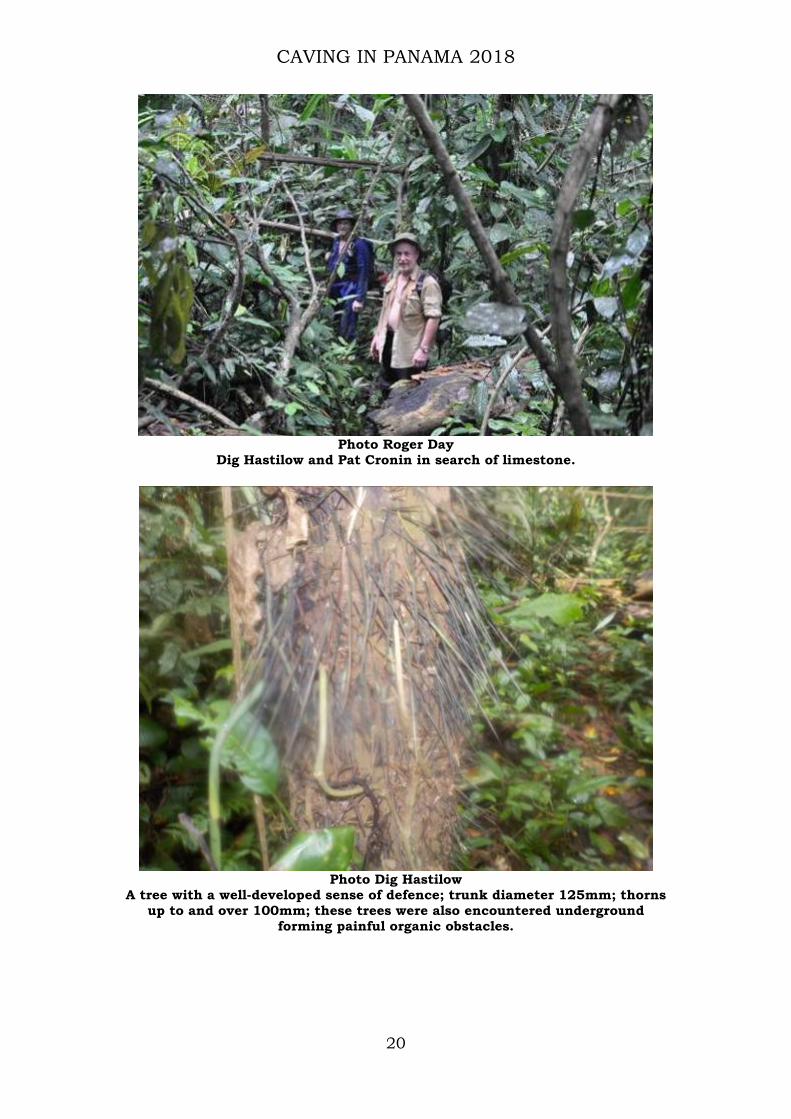
Photo Roger Day
Dig Hastilow and Pat Cronin in search of limestone.
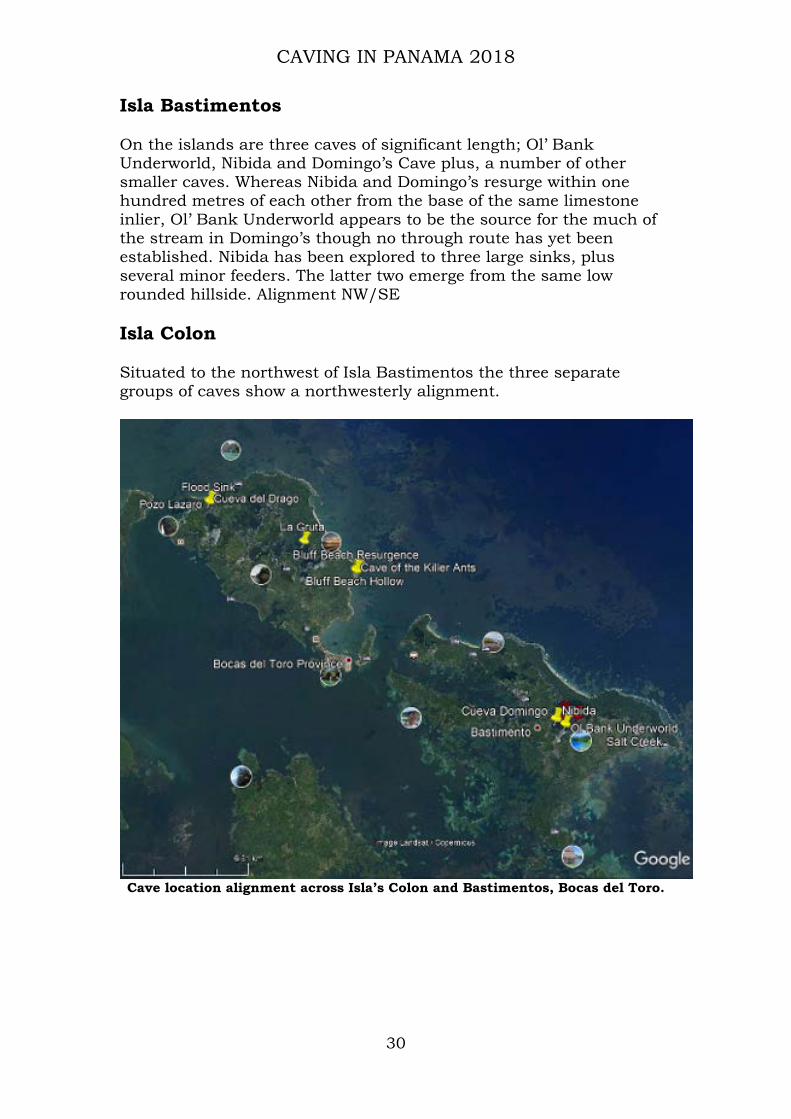
Photo Dig Hastilow
A tree with a well-developed sense of defence; trunk diameter 125mm; thorns up to and over 100mm; these trees were also encountered underground
forming painful organic obstacles.

CAVING IN PANAMA 2018
21
Observations of limestone occurrences Pat Cronin Over the years the team has identified a significant number of caves in the Republic of Panamá, occurring in, and passing through, previously regarded isolated ridges of limestone. Armed with only the most basic level of geological understanding, myriad questions arose. Not least, that many of the areas between these ridges were observed as volcanic, or rather not limestone. One particular question repeatedly arose, how did limestone form between areas of volcanic origin? The geology of Panama is built up of a series of linear volcanic island arcs of different ages, with marine sedimentary basins in between. Limestone formed in three different settings in these environments: 1) as reefs and carbonate shelves fringing volcanic islands (e.g. Ailigandi caves, San Blas), 2) as limestone beds within sedimentary rocks deposited on the sea floor, which generally form thicker and more continuous limestones (e.g. Lake Bayano caves and probably the newly discovered Darien caves), and 3) as earthquake-uplifted, young coral reefs which fringed the coast of Panama (e.g. Isla Colon and Bastimentos caves, Bocas del Toro). The tectonic collision of Panama with South America formed the curved shape of the isthmus and resulted in the folding, inclination and faulting of the sedimentary strata to give the limestone ridges observed today. Observations in Darién The walk to El Tunel de Pili starts after alighting the Hilux at UTM 825657x902392, adjacent a farm near a stream, located an hour’s drive south of La Palma, along very rough tracks. The route initially meanders along a good, almost drivable track, through pasture grazed by a tough bellicose breed of Brahman cattle. From the start of the walk geological features in the shape of fish fins or saw-teeth, formed by inclined sedimentary beds and stream bed exposures are visible either side of the track. These linear features were noted as being roughly parallel to the track; (NNW/SSE). As the topographic elevation increased, on approaching a farm, these “fin” type features diminished and stopped. Closer the farm the track passes directly over an exposure of what appears to be granite; judged by its granular appearance similar to that seen in County Wicklow, Ireland and Cornwall, UK. From the elevated location of the farmhouse observation of the rainforest canopy shows increased undulation of the obscured landscape.

CAVING IN PANAMA 2018
22
Photo Dog Hastilow
View west northwest, examples of fin like rock among immature trees.
Photo Dig Hastilow
View west southwest, examples of linear geological features along farm track to El Tunel de Pili.

CAVING IN PANAMA 2018
23
At the main sink, and resurgence, of El Tunel de Pili exposed limestone exhibits steep bedding; examination estimates an average dip >60º. Compass bearings taken repeatedly along the exposed bedding averaged 344° magnetic. Reconciling the locations of Cueva José Garrido and El Tunel de Pili, the NNW/SSE alignment closely matches the compass bearings taken along the limestone formation at El Tunel de Pili, (page 26). During the return to Puerto Quimba the helmsman was instructed to alter course to observe a rock like exposure on the estuary bank and investigate the rugged appearance of a small islet thirty metres off the headland, Punta Sabana, located east southeast of La Palma. This headland is at the southeastern tip of an elongated hill, aligned NW/SE, averaging one hundred and fifty metres in height and some five kilometres long; dividing Puerto Quimba on the Rio Sabana from the approaches to La Palma. Low lying geology was found among the silt bank for a distance of some two hundred metres. As the narrow gap between Punta Sabana and the islet is approached both sides of the passage exhibit further exposures of an apparent sedimentary nature; closer inspection was inhibited due to extant tidal conditions. From some fifteen metres off shore the observations were cursory yet the texture of the rock appeared similar to that seen earlier on the farm of Senor Pili. Both riverine sites appeared similar and possibly limestone; though are both somewhat discoloured and eroded due to the prevailing marine environment. The tidal range noted at La Palma pier was in excess of five metres. Later, a study of the tide tables based on the standard port of Bahia Piñas show this observation somewhat incorrect by anything up to another ten metres: https://www.tidetime.org/central-america/panama/la-palma.htm Topographic summary of cave entrance locations As project data has accumulated, particularly in the Lago Bayano area, it has become apparent that many caves in eastern Panamá share similarities of entrance location and passage development. The data below proffers a brief description of cave locations to illustrate the most common similarity that of a cliff face at both sink and resurgence, several such caves offer through trips. Cave development from within depressions appears scarce. Accurate heights of ridges are difficult to ascertain; conservatively estimated between fifteen and thirty metres. Once such cave systems were traversed their surface water courses were investigated often with no further limestone identified as forming stream banks or stream bed debris/ Much of the stream debris appears volcanic, or rather non-limestone in origin. Six differing geological specimens were noted in streambeds principally sorted by colour; dark grey, light grey, red and light browns, the textures varied from a very fine sandstone to what appeared to be large crystalline granite; (Real geologist needed!) The landscapes

CAVING IN PANAMA 2018
24
immediately upstream of these sinks vary; some being narrow steep sided valleys’, others slightly broader in width. A clear view of the profile of these shallow stream valleys remains obscure by foliage. Traveling to El Tunel de Pili and Cueva José Garrido the team were guided by Sres Pili and Garrido farmers on whose land these caves are located and from whom it is essential to obtain permission for access. NB: Though a description of routes to locate the caves are given below, employment of a guide is highly recommended, in both time and effort saved. More importantly it means that such news of employment is swiftly promulgated, so those engaged in illegal activities may avoid unwanted confrontation with gringos and ultimately intervention from SENAFRONT personnel. Cueva del Rio Ailigandi, San Blas From where it enters the Atlantic the Rio Ailigandi meanders through rainforest and a sequence of ridges, and tower like karst. Approaching the cave area several eroded limestone ridges are met requiring a mixture of scrambling and climbing to traverse from one shallow valley to the next. Here limestone becomes exposed as vegetation is unable to establish itself densely as little humus is present on the steeper slopes. Further upstream a minor stream gulley is followed along the base of a ridge wherein is located the cave entrance; the ridge has an estimated height of twenty metres. From this location a narrow track leads to Lago Bayano some twelve hours walk away. Cueva del Búho, Lago Bayano From the village of Pueblo Nuevo a track is followed that runs parallel to a ridge. At one of the many almost imperceptible junctions it enters the rainforest, further in many other tracks are encountered, (guide definitely required!). Eventually, an isolated farmhouse confirms the cave is quite near, another one hundred metres on through tall foliage, (Elephant grass?) At the base of the steep ridge a streambed is encountered, upstream leads to the entrance, downstream leads back to the main track to Cueva del Corazón; avoid taking this route! This resurgence has a low small opening above which is a larger one which immediately enters a large chamber with a wide upper entrance; from here the chamber morphs into a high rift passage which ascends steeply meandering upward to its sink in a cliff face over twenty metres high, (Image used on cover of 2017 report). Cueva del Corazón also appears to have formed in this same ridgeline. Cueva del Corazón, Lago Bayano Same directions as Cueva del Corazón; passing by the Cueva del Búho junction. Continue along the track which now travels between fenced seemingly abandoned farmland until a small stream ford is

CAVING IN PANAMA 2018
25
encountered, this is the stream from Cueva del Búho, cross this oft dry course and continue until another stream course is met, often active. The resurgence is less than fifty metres upstream, which emerges from a ridge likely the same as Cueva del Búho, its actual height here obscured. The cave is entered by climbing over huge boulders that partly block the entrance, having fallen from the cliff face. A small rift like opening among the boulders accesses the narrow stream passage, which meanders until a stalagmite obstruction is met. Ascending this two metre climb rejoins the streamway. Above the stream passage is a solutional development that runs parallel with the stream passage for some eleven metres. As the main stream passage is followed toward the present end it bifurcates, the left passage becoming low, eventually choked with boulders, among which are found items of domestic refuse, the restricted right hand passage was explored until the air space became too small to guarantee survival. Both passages have active streams issuing, though likely from the same surface source. The length of the cave and presence of domestic refuse suggests the cave may have almost traversed the ridge. Occurrences of accreted stream debris throughout the cave illustrate differing periods of its development. Cueva Piladores, Lago Bayano From the landing for Cueva Pueblo Nuevo, a kilometre west of Pueblo Nuevo village, follow the canyon upstream until it passes into farmland. At the obvious path junction, the only one with a barbed wire gate, pass through and bear left. Follow the barely visible track across undulating pasture until it drops into a broad, shallow, bowl like cultivated depression; cross this, bearing to the right, to locate the track to enter the rainforest. Within metres it ascends the ridge passing through a defile, keep to the right. With the ridge still on the right a gentle descent meets a dry streambed; immediately upstream, (to the right), is the large resurgence entrance emerging from a cliff face over fifteen metres in height. This streambed was investigated downstream for fifty metres to where it sinks at the base of a second limestone cliff; this site is presently choked with organic flood debris; a return to remove this substantial choke is intended. The sink for Cueva Piladores is at the base of a cliff fifteen some metres high. This stream may contribute to the Cueva Quebrada Seca catchment area. Cueva del Cementario, Lago Bayano Follow the same directions as Cueva Piladores, but only to where the barbed wire gate is met. From here pass through the gate and keep right along the track. After some fifteen metres; stop. Look up the steep slope on the right. The original entry via this small low entrance is directly above on the right of the limestone buttress. Cemeterio is a short, fossil cave, which passes through this narrow section of the

CAVING IN PANAMA 2018
26
ridge. Its large entrance overlooks abandoned farmland from an elevation of eight metres. Sleepy Snake Sink, Lago Bayano Same directions as to Cueva del Cementerio, but continue to follow the track uphill and around the ridge to the right, until a small stream, possibly dry, crosses the path. This surface stream drains a substantial area entering a cliff face of some fifteen metres high. Though originally explored for over twenty metres, (JSC), the entrance has become blocked by organic flood debris. The opposite, north side, of the ridge has not been fully explored; this stream may drain into the canyon of Cueva Pueblo Nuevo. Cueva José Garrido, Darién Guide required! Two hours rough driving by Hilux, from La Palma then one and a half hours walk through grim conditions, (much liquid mud and cattle excrement). Eventually to leave this testing “track” to enter the rainforest. A large entrance is located obscured beneath an estimated fifteen-metre-high ridge; almost invisible among several converging steep densely foliated ridges. From the entrance a walk along a lofty rift enters a well decorated chamber. Large chunks of fallen speleothems suggest possible collapse from earthquake activity. A low opening between the base of one collapsed speleothem and the cave wall leads up a short three metre climb onto a balcony area. At this level another pitch descends to a less developed passage which leads back to the main entrance chamber. At the balcony level an entrance opens onto the cliff. Also, from the balcony, a steep ascent accesses the topmost, weathered entrance; likely formed by rain induced erosion, leading to roof collapse; this area is of loose, broken, sharply sculpted rock. From the entrance chamber, the right hand rift passage leads to the base of the balcony pitch, just before this, on the right, at floor level, a small hole descends a mud climb to a lower active streamway, to the left, upstream, are the active sink and also a high level fossil sink. The fossil sink is a small steeply ascending constricted passage; its actual location in relation to the ridge summit indiscernible. The active sink is at the base of a cliff face estimated some fifteen metres high. The cave may be followed downstream to a junction, behind and above this junction is another steeply ascending passage, (an attempt to scale resulted in failure; climber fell off), which likely leads to another upper entrance. Ten metres further the stream enters a sump. A search of adjacent surface streams may locate the resurgence for this cave. Returning to the main passage, passing beneath the pitch up to the balcony a short descent of five metres accesses an immature area of solutional development, further exploratory prospects nil.

CAVING IN PANAMA 2018
27
El Tunel de Pili, Darién Guide required! An hour’s drive and an hour’s walk from La Palma: situated 2.0 km northwest of Cueva José Garrido. These entrances are also set amongst steep sided ridges. The main, middle, entrance, is in a high cliff face, just inside of which is the confluence of its three streams, north, south and main. The main entrance is formed at the base of a ridge cautiously estimated around thirty metres. In the main streamway the height of the skylight pitch is estimated as >24 metres. The resurgence emerges from a large entrance at the base of a twenty metre cliff.

CAVING IN PANAMA 2018
28
Observations on cave grouping alignment throughout Panamá Cave alignment often reflects the trend of limestone beds; it can also be due to regional structures, faults and fractures cross-cutting the limestones. What warrants consideration from the accumulated data is the similar alignment of cave groupings across the country. Panamá City North of Panamá City are several groups of caves; plotted onto Google Earth they present an alignment along a west-northwesterly axis toward the coastal port of Colon, the Atlantic entrance to the Panamá Canal.
Cave location alignment from Panamá City to the Port of Colon

CAVING IN PANAMA 2018
29
Azuero Peninsula Cave locations in the mid and southeastern areas of the peninsula form a northwest-southeasterly alignment.
Cave location alignment across the Azuero Peninsula.
CAVING IN PANAMA 2018
30
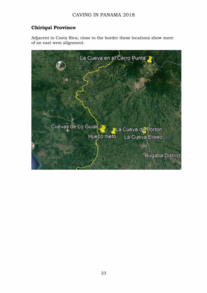
Isla Bastimentos On the islands are three caves of significant length; Ol’ Bank Underworld, Nibida and Domingo’s Cave plus, a number of other smaller caves. Whereas Nibida and Domingo’s resurge within one hundred metres of each other from the base of the same limestone inlier, Ol’ Bank Underworld appears to be the source for the much of the stream in Domingo’s though no through route has yet been established. Nibida has been explored to three large sinks, plus several minor feeders. The latter two emerge from the same low rounded hillside. Alignment NW/SE Isla Colon Situated to the northwest of Isla Bastimentos the three separate groups of caves show a northwesterly alignment.
Cave location alignment across Isla’s Colon and Bastimentos, Bocas del Toro.

CAVING IN PANAMA 2018
31
Lago Bayano The image below illustrates the southern shoreline of Lago Bayano adjacent Pueblo Nuevo.
Cave location alignment along southern shore of Lago Bayano

CAVING IN PANAMA 2018
32
Darien The two images below illustrate both local alignment and relationship to Lago Bayano and San Blas.
Cave and limestone exposure alignment Darién
Alignment of Lago Bayano, San Blas and Darién cave locations
CAVING IN PANAMA 2018
33
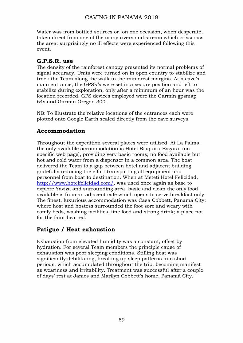
Chiriquí Province Adjacent to Costa Rica; close to the border these locations show more of an east west alignment.

CAVING IN PANAMA 2018
34
Coclé Province As with Chiriquí province there are few caves recorded however three broadly suggest an east – west alignment.

CAVING IN PANAMA 2018
35
Almirante, Bocas del Toro A solitary cave, Cueva la Taverna presents no clue to any alignment; however, its development at an elevation of 100 metres is significant.

CAVING IN PANAMA 2018
36
El Tunel de Pili
Photo Roger Day
Main entrance sink, El Tunel de Pili, obscured by a cliff (Pat used as scale to make the cliff look higher).
U.T.M 17P 0825828 x 0900708, (NAD 27, Canal Zone) Latitude 8º 8.370’ north Longitude 78º 2.639’ west Depth 24 metres Length 411 metres Overview As previously described the topography explored is rainforest accessed through land under agricultural development. Traversing this landscape, cleared for grazing, offers some idea of that which remains obscured. Once within the jungle, quite part from foliage, steep ridges and shallow steep sided valleys conspire to hamper progress and observations; streambeds promise an alternate pedestrian access but only where available. Description The main entrance is the sink for a sinuous stream course. A short distance inside, three streams amalgamate, two flow from a northerly direction, the other the south. Followed upstream, in either direction, each underground route passes obstructions of organic flood debris,

CAVING IN PANAMA 2018
37
among which are tree trunks covered with long viciously sharp spikes. Larger diameter tree trunks, (>400mm), are also jammed above the extant water levels illustrating the volume and power of floodwaters entering these sinks. Downstream from the confluence an opening in the roof of the main passage offers an alternate entrance pitch estimated at 24 metres. Sunlight entering the resurgence illuminates most of the remaining downstream passage.
Figure 4. Relationship of El Tunel de Pili entrances, beneath the rainforest
canopy. After Google Earth
Scale: 0______________________60 metres
Explanation Once underground the stream from the southern sink flows north joining the two other streams just inside the main entrance. The fossil entrance, above and to the east of the Main entrance, descends via a climbable three metre pot to a gentle guano covered slope that descends to meet the northern stream close to the main entrance. The northern stream has been followed to its sink northeast of the Main entrance, progress was slow avoiding of hundreds of airborne bats. From the confluence of the three streams the river meanders

CAVING IN PANAMA 2018
38
downstream passing beneath the skylight entrance before turning sharply southeast, passing an elevated balcony with another entrance up on the right, finally emerging from the large resurgence entrance.

CAVING IN PANAMA 2018
39
Photo Roger Day
A welcome break; a hospitable beer stop at a farmhouse en-route: note a rare image of Photographer Dig Hastilow
Photos Dig Hastilow
Roger Day: images of the collapsed beginning of the southern stream passage flow toward camera

CAVING IN PANAMA 2018
40
Photo Dig Hastilow
James Cobbett in main stream passage opposite columns.
Photo Dig Hastilow
James Cobbett and Pat Cronin; resurgence of El Tunel de Pili.

CAVING IN PANAMA 2018
41
Cueva José Garrido
Photo Roger Day
Dig Hastilow in Main entrance. U.T.M 17P 0826414 x 0898798 (NAD 27, Canal Zone) Latitude 8º 7.335’ north Longitude 78º 2.290’ west Depth 20 metres Length 257 metres

CAVING IN PANAMA 2018
42
Overview Cueva José Garrido is within a landscape similar to that surrounding El Tunel de Pili; amongst densely covered steep sided shallow valleys. Description A large entrance and passage passes into and up through the ridge to two smaller upper entrances. A short distance from the main entrance a small opening on the right, at floor level, descends via a short crawl and slippery mud climb, (handline useful), to a lower active streamway. Upstream leads to two other entrances, one an elevated, steeply inclined fossil sink, the other the present active sink. Downstream from the base of the mud climb a narrow sinuous streamway joins with a 60°ascending passage, (attempted, fell off, so unclimbed): the draught and volume of bats present strongly suggest an upper entrance. Continuing downstream a sump pool is encountered, feeling around confirmed the passage continues beneath water level. A search of adjacent surface streams may locate an active resurgence.
After Google Earth
Scale: 0___________40 Metres Relationship of entrances, beneath rainforest canopy; north up.

CAVING IN PANAMA 2018
43
Photo Roger Day
James in main passage Cueva José Garrido admiring “Cobbett’s Column”

CAVING IN PANAMA 2018
44
Photo Dig Hastilow
Lower streamway, 1.5 metres high, terminating in sump pool.
Photo Dig Hastilow
Terminal sump pool; organic debris on surface; the way on open below water level

CAVING IN PANAMA 2018
45
Photo Roger Day
Viewed at an upward angle of some 40º to topmost entrance and small bat colony
Photo Roger Day
Collapsed formation near end of main chamber route to upper balcony via small hole on right at floor level

CAVING IN PANAMA 2018
46

CAVING IN PANAMA 2018
47
Pozo Lin, Lago Bayano
Photo Dig Hastilow
Laddering the entrance pitch into Pozo Lin U.T.M 17P 742070 x 1004233 (NAD 27, Canal Zone) Latitude 9º 4.693’ north Longitude 78º47.861’ west Depth 5 metres Length 23 metres

CAVING IN PANAMA 2018
48
Overview Pozo Lin is located on the southern shoreline of Lago Bayano, east of the boat landing for Cueva Pueblo Nuevo. On the north side of what might be called a path. There are many minor sites in the area of these lower slopes, most choked with organic matter. Underfoot the surface consists of loose and broken limestone; clints and grykes are superbly camouflaged by a layer of humus and vegetation. Hazards abound, caution required traversing the area. Description Weathering of the landscape surface has exposed a small chamber some five metres deep. To the north and south narrow openings lead off. The cave is short, joint controlled and beautifully decorated. Pozo Lin is so named following the loss of a good friend’s wife.
Photos Dig Hastilow
North chamber Pozo Lin Speleothems Pozo Lin

CAVING IN PANAMA 2018
49

CAVING IN PANAMA 2018
50
Cueva del Agua Sombreada
Photo Dig Hastilow
View east, where the submerged bedding is located NB: credit to Dig Hastilow for the above photo, accomplished in difficult
circumstances. U.T.M 17P 0741867 x 1004117 (NAD 27, Canal Zone) Latitude 9º 4.744’ north Long 78º47.961’ west Depth 4 metres (collapse) Length 27 metres (collapse) Width 6 metres (collapse)

CAVING IN PANAMA 2018
51
Overview The site is in the undergrowth on the west side of a track as it approaches the water’s edge, Feb 2018, of Lago Bayano, some 140 metres west-north-west of Pozo Lin. Dodgy conditions underfoot, thorn covered, inter-woven lianas, of varying diameters present an awkward approach across a loose surface to an unstable edge. Description The site consists of a sub-rectangular sunken area, most likely a collapse, aligned almost east-west, (277º- 097º). Sloping from the west down to water level, this water may only present due to the elevated level of the adjacent lake. Before loss of visibility a submerged bedding was thought to head eastward. Entry to this bedding may be possible during lower water levels.

CAVING IN PANAMA 2018
52
Cueva del Agua Sombreada Pueblo Nuevo Lago Bayano January/February 2018 Surveyed & drawn Pat Cronin

CAVING IN PANAMA 2018
53
Cueva Quebrada Seca, Lago Bayano During embarkation concern was expressed as the lake water level was noted as somewhat higher than last year. Expectations of entering the submerged inlet noted previously plummeted on arrival at the landing place, the flooded area beneath the building showed a water level increase of around two metres therefore forced to abandon trip for another time.

CAVING IN PANAMA 2018
54
Conclusions The discovery of cave and limestone in Darién province supports the Teams long held hypothesis that a wider occurrence of Limestone actually exists throughout the country than hitherto suspected. Limestone features observed extending across open pastureland share a similar alignment with that of other cave locations across the country; suggesting cave groups considered formed in isolation actually occur as linear limestone formations which may possibly extend the length of the country; further field research is required. When known cave locations were plotted onto Google Earth and compared with geological and tectonic maps, their locations and a common alignment suggest a close relationship with recorded curvilinear volcanic geology. The use of modern technology has allowed cave data, accumulated over the last decade, to be displayed as computer imagery for further analysis. The karst of Lago Bayano warrants further detailed examination. Exploration of this area has found a range of cave development forms. Many of the surface eroded openings appear immature developments. Pozo Lin and many similar eroded sites are close by the present lake margin on the lower slopes of the hills that ascend to the south. Adjacent to Pozo Lin are many other small, narrow rift openings choked with organic debris. The larger cave sinks on the south side of the ridge successfully pass through, their resurgences draining toward the lake. From its location the stream of Cueva Piladores may possibly augment Cueva Quebrada Seca. Lago Bayano water levels were found high likely the response to the unseasonal heavy rainfall. Approaching the lakeside along the flooded track from the direction of Pueblo Nuevo James cautiously entered the undergrowth on the west side of the track to encounter a large interesting collapse. Inspection found it to be a rectangular area twenty-seven metres long by seven metres wide by five metres deep; flooded at its base. The slope at the west end led to a pool of water that occupied some 50% of the collapse. Underwater, at the east end, the low bedding appears to lead off. This collapse is close to where surface topography begins to level to form the plain to the north. This collapse is also near to, and on west side, of Cueva Quebrada Seca main passage, the same side as the possible submerged inlet joins the flow. The streams draining the southern mountain range would have significantly contributed to the development of the plain settlements flooded in the 1970s. Prior to the hydroelectric construction some four thousand people were settled hereabouts. The inability to locate and access flooded archaeology means the only available evidence to ascertain a date of settlement in the area may be the communal burial

CAVING IN PANAMA 2018
55
remains within Cueva del Cementerio. A verbal report regarding a second burial cave containing several intact inhumations has yet to be confirmed. The rainforest canopy significantly inhibits GPSr signal reception. If patience is exercised a greater accuracy may be achieved; ideally leaving the GPSr in position for as long as practicable (Cobbett JS, Panamá report 2017). The rainforest provides a pristine environment for flora and fauna, its dense shroud of foliage however obscures all beneath. Scientific disciplines would benefit enormously from a nationwide Lidar survey, The rainforest remains under pressure from the logging industry and the drive toward agricultural development of pasture for grazing. Despite extensive encouragement there yet remains no detectable desire among Panamánians young or old to explore their natural surroundings or indeed caves. There is an increasing ecological and conservation movement among the inhabitants of La Palma; evidenced by many hand painted murals creating awareness of irresponsible dumping of refuse and pollution, (Appendix E). Potential financial benefits following the teams work promoting the rainforest environment is evident as demonstrated by mural advertisements, (appendix E). Even before expedition members departed Panamá a company had begun to conduct trips to El Tunel de Pili. Security implications exploring of Darién should be clearly understood. It is a place where one should not wander around without a guide which provides local awareness of your presence. Arch Cave was surveyed upon its discovery in 2006. Since which difficulties were encountered “interpreting” the data. The data was reviewed and plotted as originally recorded it is reproduced herein. There are no rescue organizations whatsoever; therefore, expeditions need be truly self-reliant. A Panamánian Cave Index is under construction; hosted by The Pegasus.

CAVING IN PANAMA 2018
56
Appendix A: Logistics Security
The provinces of San Blas and Darién form the border between the Republic of Panamá and Colombia. Be fully aware that drug and human traffickers may regularly convey contraband between these countries on foot and by boat. A chance encounter with naughty people when exploring the rainforest is not recommended. The Panamánian Police Force, SENAFRONT, patrols the border maintaining law and order. Drug seizures are common place. SENAFRONT also provide guidance and register visitors. Ensure a passport is carried at all times.

CAVING IN PANAMA 2018
57
Photo Roger Day
Darién is an area where individuals do go missing. Visiting a bar in Metetí the customers’ present appeared as characters that would sport names like “bruiser” and “scarface”. Drawing on extensive experience, it was not a place in which to linger, so the Team watched a little football, drank up and sidled out. Weather Time and again comments regarding unseasonal weather were received, with particular reference to increased rainfall during this period; the dry season. Heavy rain showers lasted between four and twenty-seven minutes. Cloud cover varied between 20% and 100%; at

CAVING IN PANAMA 2018
58
no time was the sky observed as cloudless. Humidity was elevated proportional to unseasonal volume of rainfall and daytime temperatures. Seasons Panamá has two seasons, wet and dry. The dry season, summer, begins typically in early November, normally extends until late April. The remainder of the year is considered the wet season, winter. Note, however, that climate varies with elevation in contrast to hot humid Darién, a significant amount of the border with Costa Rica is less so. Two important points to bear in mind when planning travel by vehicle, on routes other than hard-top; carefully consider a means of vehicle recovery from a remote morass the vehicle is guaranteed to sink into. Better still review the use of horses, or mules, as an option. Health The World Health Organization advises that occurrences of Malaria and Dengue fever are on the increase in the Darién region and offers practical guidance on avoidance contracting these illnesses and appropriate medicine. Malarone was prescribed, however unless strictly taken with food one side effect is a debilitating nausea resulting in the casualty incapacitated for six hours. Daily consumption of vitamin B12, (brewer’s yeast), or garlic, taken weeks up to and during a trip such as this, is considered to have significant repellent effect to bugs, and humans. Within the jungle puncture wounds occasionally resulted from the array of tree defence mechanisms. These may be short stubby prickles on a tree trunk, or one inch long slender thorns on very thin, yet tough lianas to long, thin angled spikes. Seventy-five percent of the Team suffered severe bouts of diarrhoea over a maximum of three days; Imodium, when administered proved successful. Drinking water, the obvious suspect, was not the source of this debilitating illness. Negotiating a log jam, in the northern passage of El Tunel de Pili, a four-inch tree thorn punctured clothing and knee of an explorer. Though medicated the point of entry remained visible for five weeks with accompanying itch. Hydration Daily water consumption was noted as at least twice previous expeditions, daytime temperature being in the low thirties with accompanying elevated humidity.
CAVING IN PANAMA 2018
59
Water was from bottled sources or, on one occasion, when desperate, taken direct from one of the many rivers and stream which crisscross the area: surprisingly no ill effects were experienced following this event. G.P.S.R. use The density of the rainforest canopy presented its normal problems of signal accuracy. Units were turned on in open country to stabilize and track the Team along the walk to the rainforest margins. At a cave’s main entrance, the GPSR’s were set in a secure position and left to stabilize during exploration, only after a minimum of an hour was the location recorded. GPS devices employed were the Garmin gpsmap 64s and Garmin Oregon 300. NB: To illustrate the relative locations of the entrances each were plotted onto Google Earth scaled directly from the cave surveys. Accommodation Throughout the expedition several places were utilized. At La Palma the only available accommodation is Hotel Biaquiru Bagara, (no specific web page), providing very basic rooms; no food available but hot and cold water from a dispenser in a common area. The boat delivered the Team to a gap between hotel and adjacent building gratefully reducing the effort transporting all equipment and personnel from boat to destination. When at Metetí Hotel Felicidad, http://www.hotelfelicidad.com/, was used once again as base to explore Yaviza and surrounding area, basic and clean the only food available is from an adjacent café which opens to serve breakfast only. The finest, luxurious accommodation was Casa Cobbett, Panamá City; where host and hostess surrounded the foot sore and weary with comfy beds, washing facilities, fine food and strong drink; a place not for the faint hearted. Fatigue / Heat exhaustion Exhaustion from elevated humidity was a constant, offset by hydration. For several Team members the principle cause of exhaustion was poor sleeping conditions. Stifling heat was significantly debilitating, breaking up sleep patterns into short periods, which accumulated throughout the trip, becoming manifest as weariness and irritability. Treatment was successful after a couple of days’ rest at James and Marilyn Cobbett’s home, Panamá City.

CAVING IN PANAMA 2018
60
Flights The delay in finalizing dates meant a crazy increase for flights; more than double the average rates. Using Expedia recovered the normal fare structure. Guides In conditions such as these it is a basic need to employ guides; it is possible to do without if revisiting previous project sites but not for normal exploration. Unless experienced traversing rainforest can be problematic. Landowners Like all farmers worldwide they are proud of what they have built, therefore, respect, common courtesy, and a little goodwill fee goes a long way toward gaining some level of exchange and trust. Boat hire The journey to and from La Palma is an hour each way; agree a price before embarkation. If possible avail of a “public waterbus” rather than private hire. Vehicle hire The vehicles that exist are almost entirely Toyota Hilux; the only vehicle that will successfully return after traversing the landscape encountered. Unusually, during this expedition, no expensive damage was incurred, when using a vehicle of James. The robust Monte n. The 2018 expedition was unusual in that no expensive damage to our road vehicle was incurred, due to sticking to a robust 4 x 4, Mitsubishi Montero, and sticking mainly to hard-top, or at worst graded tracks. Communications - Language Spanish is the predominant language throughout Panamá; English, though the second language, is not in common use or understood. It is of the utmost import to have a Spanish speaking team member. The indigenous Indians use differing dialects but understand Spanish.

CAVING IN PANAMA 2018
61
Appendix B: Cárdenas; a survey of the visible features Pursuant to information received, and by way of rest and relaxation, the Team searched for and conducted a brief survey of the site to record the extant features. Whilst Roger Day and Pat Cronin surveyed the boundary walls, James Cobbett and Stewart Redwood investigated the surrounding forest for further evidence; (trip report by Stewart Redwood; Appendix C).
The buildings walls were drawn as profiles to attempt clarification of its shape from among the dense foliage. Mortar is used throughout its

CAVING IN PANAMA 2018
62
construction. There is no evidence of bonding courses tying the corners of walls together. The end walls have collapsed the northwest wall as a single entity, the southeast end tumble. The interior floor level is lower than the outside ground surface. Roof tiles and bricks are used within the construction for levelled and as arch support.

CAVING IN PANAMA 2018
63

CAVING IN PANAMA 2018
64
Plan View A compass bearing of 310º magnetic was recorded on the long axis of the building. Showing the building as northwest – southeast; Christian worship buildings are normally aligned east - west.

CAVING IN PANAMA 2018
65
Appendix C: Trip Report, Description of the Spanish Colonial Ruins of Cardenas, Camino de Cruces National Park, Panama Stewart D. Redwood 17 February 2018 Summary The ruins of Cardenas (aka La Palangana) consist of a small building which was probably a chapel (capilla), and the walls of another building with a well, both of which are located at the SE corner of long, low perimeter wall in an L-shape with ~130 m long sides. The walls may have been to shelter animals rather than defensive, although there is no evidence for other walls to form an enclosure. The ruins date from the Spanish colonial period. The ruins are located in the upper part of the Rio Cardenas, some 6.8 km northwest of Panama Viejo (Old Panama) and 8.5 km north of Panama La Nueva (San Felipe, New Panama). They are 1.2 to 1.8 km west of the Camino Real from Panama La Nueva to Portobello, and 3.9 km east of the Camino de Cruces (Las Cruces Trail) to the River Chagres. The site may have been a hacienda rather than a stopping point on one of the trails. There has been little archaeological or historical study of the ruins and there is very little documentation in the literature. The ruins were discovered in 1951, and described in a short study by Almanza (1986). Introduction The ruins of Cardenas (aka La Palangana) were visited on 5 February 2018 by explorers Stewart D. Redwood (Panama), James Cobbett (Panama), Roger Day (England) and Pat Cronin (Ireland), accompanied by three park ranger guides from the Camino de Cruces National Park: Dionel Ortega - Guardaparque (Park Ranger), Yaqueline Gonzalez – Licenciada (Manager), and Estefania Espinoza - Practicante (Student trainee). Waypoints (WP), distances and bearings were measured by hand-held GPS. Pat Cronin surveyed a sketch map of the ruins by GPS. Location and Access The ruins are located within the Camino de Cruces National Park on the northwest edge of Panama City. Access is from the Via Centenario on the south side of Altaplaza shopping mall (WP902, 17P 0661415 0998348, 72 m), taking a 4 WD service road for 1.3 km southwest which follows a power line and crosses the Corredor Norte by a service

CAVING IN PANAMA 2018
66
bridge. There is an indistinct entrance to a footpath into the jungle on the north side of the road (WP898, 17P 0660179 00997896, 65 m), and a short walk of 5 minutes uphill (140 m) leads to the ruins (WP899, 17P 0660189 0998052, 96 m), located on higher ground in dense rain forest with some very large diameter, tall trees. The ruins are located between the Corredor Norte and Centenario motorways. The ruins can also be accessed by a trail from the community of Mata Redonda to the north. The ruins are located in the upper part of the Rio Cardenas, which flows SW and enters the old channel of the Rio Grande at Miraflores Locks on the Panama Canal, between Clayton and Corozal-Cardenas. The ruins are marked on the IGNTG 1:50,000 topographic map, sheet 4243 II (Alcalde Díaz), updated in 1987, at 17P PV 602 978. The site was within the U.S. Army’s Fort Clayton in the Canal Zone, created in 1903, in an area that reverted to the Government of Panama in 1979. It is now in the Camino de Cruces National Park which was created in 1992.
Figure 1. Team photo (left to right): Pat Cronin, Estefania Espinoza, Yaqueline
Gonzalez, Roger Day, Dionel Ortega, Stewart Redwood, James Cobbett.

CAVING IN PANAMA 2018
67
Figure 2. Location of Cardenas in Panama City. The purple line is the Camino Real, and the blue line is the route as shown on the 1857 map. The red line is
the Camino de Cruces.
Figure 3. Location and access of Cardenas.

CAVING IN PANAMA 2018
68
Figure 4. Detailed access map of Cardenas.
Description of the Ruins The first ruin encountered at the south end of the site is a low wall that appears to be a building (WP899, 17P 0660189 0998052, 96 m). Inside or near to this is a stone-lined pit said to be a well. These are followed to the north by a small rectangular building described as a capilla or chapel, which about 6.0 m long by 4.0 m wide with walls 4.0 m high, oriented WNW (310°). The side walls are standing and have tall doors up to the roof. The SE end has collapsed in a heap of rubble. The NW end has fallen as a single slab, and has a tall window with the top appearing to form an arch. There is a curved niche in the inside NW end of the NE wall. The floor is uneven and appears to have been dug over. The building is constructed of rubble-stone blocks of dark grey basalt or andesite, with some courses of roof tiles, and some flat bricks, some of which are geometrically arranged in places such as around windows, cemented by mortar. The inside walls have remnants of mortar plaster. Starting from the chapel there is a long, low perimeter wall built of rubble-stone of a dark grey volcanic rock, either basalt or andesite, with small mafic phenocrysts. This forms irregular blocks and in some parts flat blocks. It weathers to a beige colour. The wall is up to about 1.0 m high and 1.0 m wide. This appears to be the original height of the wall. It runs north (170°) uphill from the chapel for about 130 m, with a path on the west side, to a corner at WP900 (17P 0660162 0998186). From here it runs to the west (285°) for 130 m downhill, and terminates on the slope of a steep valley (WP901, 17P 0660038 0998221). On the north side of the wall near the corner there is a small cleared depression surrounded by stones which may have been

CAVING IN PANAMA 2018
69
a small building. The wall forms an L-shape, but there is no evidence for other walls that may have formed a square enclosure.
Figure 5. Wall of the first building.
Figure 6. Stone lined pit or well.

CAVING IN PANAMA 2018
70
Figure 7. The chapel walls.
Figure 8. The chapel walls.

CAVING IN PANAMA 2018
71
Figure 9. Mortar coated niche in inner wall of the chapel.
Figure 10. Detail of geometrical brickwork in the chapel wall.

CAVING IN PANAMA 2018
72
Figure 11. Chapel wall construction of brick, rubble stone and mortar.
Figure 12. Pan tiles and rubble stone with mortar in the chapel wall.

CAVING IN PANAMA 2018
73
Figure 13. The boundary wall, west part.
Figure 14. The boundary wall, north part.

CAVING IN PANAMA 2018
74
Figure 15 Dry rubble stone construction of the boundary wall, west end of west
part History A Spanish map by Capitan Don Nicolas Rodriguez of 1735 of the roads from Panama to the Rio Chagres shows three settlements or house in the upper part of the Rio Cardenas, north of the Camino Real, named Guadalupe (east side of the river, near the site of Cardenas), La Ramona and Aispuru (west side). Guadalupe is near the head of a tributary of the Rio Cardenas named “afrenta Ruynes”. To the east is “Queb.[rada] De Asiento Viejo” (Old Settlement stream).

CAVING IN PANAMA 2018
75
Figure 16. 1735 map showing Guadalupe in the upper part of the Rio Cardenas. No places of habitation are shown in the upper Rio Cardenas on the 1857 Thomas Harrison map of the Panama Rail Road. Hacienda Guadalupe is shown in a different location on the lower part of the river.

CAVING IN PANAMA 2018
76
Figure 17. 1857 map showing the Rio Cardenas with no habitations or named
places in the area of the ruins in the upper part (Harrison, 1857).

CAVING IN PANAMA 2018
77
Figure 18. The 1857 map georeferenced in Google Earth showing the Cardenas ruins waypoints, Camino Real as marked on the 1857 map (blue), Camino Real
(purple), Camino de Cruces (red), and modern roads (yellow). A hand-drawn map of Las Cruces Trail, surveyed by Robert G. Rennie in 1948, shows the ruins some distance from the trail and closer to the “Old Porto Bello Trail” (Camino Real), and a short distance north of “Army Road C15” (now the power line access road). A note on the map reads: “Ruins of old church and buildings uncovered in the jungle Feb 1951 by Panama Canal while on logging operation. Also found some US silver coins marked 1849-50 and Spanish glass bottle parts near here. I think it was an old town. It might have been a large ranch. “A good hideout for robbers of both Cruces and Porto Bello Trails?””

CAVING IN PANAMA 2018
78
Figure 19. The ruins shown on a 1948 map of Las Cruces Trail (Rennie, 1948) In 1956, an American soldier armed with a metal detector, reportedly found a silver crucifix beneath the floor of the church (Pérez, 2002). The site was investigated in June 1985 by Panamanian archaeologist Luis Almanza (Department of History, University of Panama), the explorer Enrique Garcia, and the Comisión de Monumentos de la Sociedad Panameña de Ingenieros y Arquitectos (the Monuments Commission of the Panamanian Society of Engineers and Architects). They cleared the jungle from the site, surveyed it, and excavated four pits in the floor of the chapel. The results were described in La Estrella newspaper (Garcia, 1986) and in a short paper by Almanza (1991), which included a plan of the chapel. The story was later repeated in two articles in La Prensa newspaper (Pérez, 2002; Arcia, 2011). Almanza named the site La Palangana after a nearby creek. The chapel was surveyed as having dimensions of 6.10 m long by 4.0 m wide, oriented northwest, with walls 4.0 m high and 0.45 m thick. There were seven niches in the walls (La Estrella says nine) - three in the fallen back wall which were interpreted to form an altar, and the others beside the windows. The floor of the chapel was made of small fragments of igneous rock. The floor was completely dug up, probably by treasure hunters. The level was found by remains in the corners against the walls. Excavations of the floor encountered fragments of roof tiles, nails, floor tiles and glass from different

CAVING IN PANAMA 2018
79
periods. The roof was tile, as shown by excavations. The back wall was described as standing in 1977, but had fallen by 1985. The wall was described as running NW from the chapel then south for more than 100 m. It is made of igneous rocks piled upon each other. It has a maximum height of 75 cm and a width of 50 to 60 cm. Almanza concluded that the chapel belonged to a colonial period hacienda near the Camino de Cruces. Almanza (1986) made a historical place name study but it is fraught with errors. In 1735, he states, there was a Hacienda Guadalupe near the area, and nearby a creek called Afluente Ruinas (Ruins Creek) some distance from the road to the new city of Panama: but this is not shown on the version of the 1735 map cited above. He says that the road to old Panama City passed near to the ruins, but this lost importance in 1671 after the city was razed by Henry Morgan. In a map dated 1857, he says the area is shown as part of the hacienda Los Hurtados: this is the Harrison (1857) map described above, on which “Hurtado’s Ranchos” is marked in the lower part of the Cardenas River, far from the ruins, and Hacienda Guadalupe is shown south of the lower part of the river. The property was expropriated from the Hurtados in 1903 to form part of the Canal Zone and later part of the U.S. Army’s Fort Clayton (see the Panama Canal Record for 1915 and 1916 where the Joint Land Commission dealt with the case for compensation). It reverted to the Panamanian Government when the Canal Zone ceased to exist in 1979.

CAVING IN PANAMA 2018
80
Figure 20. Plan of Cardenas aka La Palangana chapel (Almanza, 1986).
According to archaeologist Tomás Mendizábal (pers. comm. 6 February 2018), the ceramics found on surface around the ruins are mostly industrially-produced china (loza) from the second half of the 18th century and the 19th century. He thinks it may have been one of the multiple cattle fincas or haciendas outside the city and near to the transisthmian roads. Omar Saenz, historical geographer, has found documents in the Bogota archives describing Cardenas as a Jesuit hacienda that was confiscated when they were expelled from the Spanish Empire in 1767 (O. Saenz, Panama, pers. comm. 5 February 2018). Conclusion The Cardenas ruins comprise a building which was probably a chapel, and remains of at least one other building. The two, 130 m long L-shaped low walls may have been to shelter animals rather than defensive, although they do not form a full enclosure. The site may have been a hacienda or a stopping point on the Camino Real, although it is not actually on the trail and it is too close to the city to be an overnight stop.

CAVING IN PANAMA 2018
81
Acknowledgements Tomás Mendizábal, Archaeologist in charge of the Caminos Real and de Cruces Documentation and Registry Project, is thanked for copies of references and maps.
References Arcia, O., 2011. La capilla de La Palangana. La Prensa, 30 May 2011. https://www.prensa.com/politica/capilla-Palangana_0_3124937663.html Almanza, L., 1991. La Capilla de La Palangana. 2da Época, Vol 1, No. 2, December 1991, p. 217-222. University of Panama, Panama. [Garcia, E.?], 1986. Explorando La Palangana. La Estrella de Panamá, Suplemento Istmo, Sunday 21 September 1986, p. 19-21. Harrison, Thomas, 1857. Map of the Isthmus of Panama representing the line of the Panama Rail Road As constructed under the Direction of George M. Totten, Chief Engineer &c. Reduced and compiled from the Original Surveys by Thos Harrison, Crown Surveyor, Jamaica. Scale 8,000 Feet to One Inch (1:96,000). Pérez, R., 2002. La Capilla de La Palangana. La Prensa, 15 February 2002. https://impresa.prensa.com/opinion/capilla-Palangana_0_581941908.html Rennie, Robert G., 1948. Las Cruces Trail. Map at scale 1600 Feet to One Inch (1:19,200) surveyed in 1948. Rodriguez, Capitan Don Nicolas, 1735. Plano Geográfico desde la Ciudad de Panama, hasta el Rio de Chagre. Archivo General de Indias, Sevilla. Rodriguez, Capitan Don Nicolas, 1735. Los Caminos que se Trafican a los Sitios de Cruzes, y la Gorgona. Informe Año de 1735. 29 p. Archivo General de Indias, Sevilla

CAVING IN PANAMA 2018
82
Photo Roger Day
James Cobbett among the Ruins of Cárdenas
Photo Roger Day
View south of north wall of principle building; Dionel Ortega in background

CAVING IN PANAMA 2018
83
Photo Roger Day
View south; Dionel Ortega with building structure
Photo Roger Day
Northeast wall illustrating use of roof tiles among mortared random stone

CAVING IN PANAMA 2018
84
Photo Roger Day
Northeast wall, detail of thrust area to receive arch for either door or window
Photo Roger Day
View north; possible door or gate pillar on approach to site
CAVING IN PANAMA 2018
85
Photo Pat Cronin
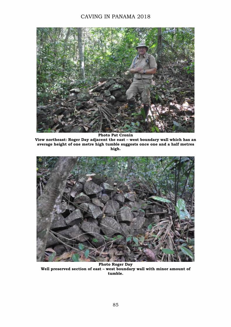
View northeast: Roger Day adjacent the east – west boundary wall which has an average height of one metre high tumble suggests once one and a half metres
high.
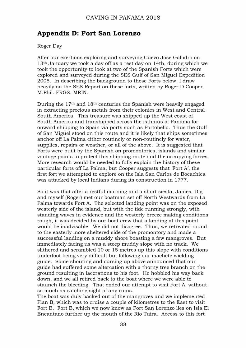
Photo Roger Day
Well preserved section of east – west boundary wall with minor amount of tumble.

CAVING IN PANAMA 2018
86
Photo Roger Day
View west: east –west boundary wall beginning its descent toward the river valley.
Photo Roger Day
View southwest; the terminal area of the east – west boundary wall; the ground begins to descend steeply into the river valley: image taken from end of wall.

CAVING IN PANAMA 2018
87
Photo Roger Day
View south along north – south boundary wall: two metres wide, one metre high.
Photo Roger Day
Stewart Redwood, Yaqueline Gonzalez & James Cobbett exiting Rainforest margin
CAVING IN PANAMA 2018
88
Appendix D: Fort San Lorenzo Roger Day After our exertions exploring and surveying Cuevo Jose Gallidro on 13th January we took a day off as a rest day on 14th, during which we took the opportunity to look at two of the Spanish Forts which were explored and surveyed during the SES Gulf of San Miguel Expedition 2005. In describing the background to these Forts below, I draw heavily on the SES Report on these forts, written by Roger D Cooper M.Phil. FRGS. MRIN. During the 17th and 18th centuries the Spanish were heavily engaged in extracting precious metals from their colonies in West and Central South America. This treasure was shipped up the West coast of South America and transhipped across the isthmus of Panama for onward shipping to Spain via ports such as Portobello. Thus the Gulf of San Miguel stood on this route and it is likely that ships sometimes anchor off La Palma either routinely or non-routinely for water, supplies, repairs or weather, or all of the above. It is suggested that Forts were built by the Spanish on promontories, islands and similar vantage points to protect this shipping route and the occupying forces. More research would be needed to fully explain the history of these particular forts off La Palma, but Cooper suggests that ‘Fort A’, the first fort we attempted to explore on the Isla San Carlos de Bocachica was attacked by local Indians during its construction in 1777. So it was that after a restful morning and a short siesta, James, Dig and myself (Roger) met our boatman set off North Westwards from La Palma towards Fort A. The selected landing point was on the exposed westerly side of the island, but with the tide running strongly, with standing waves in evidence and the westerly breeze making conditions rough, it was decided by our boat crew that a landing at this point would be inadvisable. We did not disagree. Thus, we retreated round to the easterly more sheltered side of the promontory and made a successful landing on a muddy shore boasting a few mangroves. But immediately facing us was a steep muddy slope with no track. We slithered and scrambled 10 or 15 metres up this slope with conditions underfoot being very difficult but following our machete wielding guide. Some shouting and cursing up above announced that our guide had suffered some altercation with a thorny tree branch on the ground resulting in lacerations to his foot. He hobbled his way back down, and we all retired back to the boat where we were able to staunch the bleeding. That ended our attempt to visit Fort A, without so much as catching sight of any ruins. The boat was duly backed out of the mangroves and we implemented Plan B, which was to cruise a couple of kilometres to the East to visit Fort B. Fort B, which we now know as Fort San Lorenzo lies on Isla El Encantano further up the mouth of the Rio Tuira. Access to this fort

CAVING IN PANAMA 2018
89
was much easier, with a sheltered landing among the mangroves leading onto an established path leading up from the shore to the ruins some 40m above sea level.
Photo Roger Day
Photo: Dig Hastilow
Emerging from the track from the landing point one is suddenly confronted with the remains of a large Fort, which the jungle has all but reclaimed The ruins are very much as observed and surveyed by the SES Expedition in 2005 and comprise the substantial remains of a rectangular building constructed from local stone and rock in a

CAVING IN PANAMA 2018
90
mortar aggregate which also contains other rubble within its matrix, such as reused engineering bricks and roofing tiles.
Typical wall composition
Photos: Roger Day The ruined walls have clear ‘loopholes’ for small arms fire but no evidence of larger openings for artillery, and indeed substantial as the remaining walls are they do not seem to be substantial enough to endure an artillery onslaught. This leads to the conclusion that the Fort was intended as a lookout point, barracks for troops and to subdue local native forces rather than take part in any heavy exchange of fire with European naval forces. A couple of centuries of secondary rain forest growth have robber the present day visitor of the sort of view that the original inhabitants of

CAVING IN PANAMA 2018
91
the Fort might have enjoyed, but the photo, above, of the boat at the landing point hints at what this vista might have looked like, with wide views over the Gulf of San Miguel.
Photo: Dig Hastilow
The above view shows the musket embrasures to good effect.
Photo: Roger Day
One of the larger ‘windows’ – note missing, presumably wooden, lintel. And so, after a couple of hours of exploring, we retired to the boat and were taken back across the Gulf to La Palma. This fort is reportedly one of many in this region, serving a similar purpose during Spain exploitation of the region, many of which remain to be rediscovered. It

CAVING IN PANAMA 2018
92
is typical of many of Panama’s historical sites, un- excavated, un-researched and largely unloved, decaying gently over the centuries. Unvisited except by the few intrepid explorers and backpackers. But a potentially rich treasure trove for future generations of interested researchers.

CAVING IN PANAMA 2018
93
Appendix E: Murals demonstrating increasing ecological/conservation awareness.
Photo Roger Day
Photo Roger Day

CAVING IN PANAMA 2018
94
Photo Roger Day
Photo Roger Day