Embed Size (px)
Citation preview
Report from CNSA
16th GSICS Executive Panel, Boulder, 15-16 May 2015
Peng Zhang, Jun Gao

Satellite Introdution
GF-1 satellite mission• GF-1 satellite is the first CHEOS constellation satellite launched on April 26, 2013 • Four Wide Field of View (WFV) sensors with the spatial resolution of 16m and 200km
swath each.• Two Panchromatic and Multi-Spectral (PMS) sensors with the spatial resolution of
8m(MS) and 2m(Pan). The swath is 60km by integrating two cameras.
HY-2A satellite mission• HY-2A satellite is the first ocean dynamics environment satellite in China• Dual-band radar Altimeter (working on Ku-band and C-band) – used to measure sea
levels, significant wave heights and wind speeds • Ku-band microwave Scatterometer for measuring sea surface wind field• Scanning microwave Radiometer (6.6,10.7, 18.7, 23.8 & 37GHz) for measuring Sea
surface temperature, atmospheric water vapor, et al.• The design lifetime of HY-2A satellite is 3 years. By far, HY-2A satellite has
been operating on orbit more than three years.
GSICS-EP-16, Boulder, 15-16 May 2015
Satellite calibration and validation facilities and activities
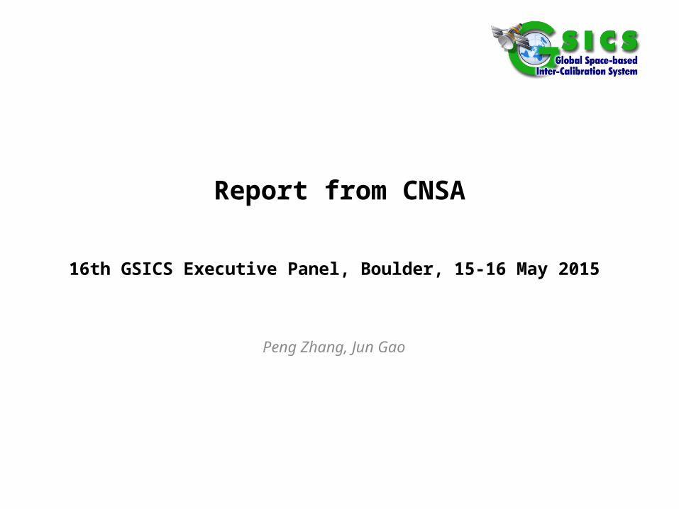
Land observing satellite-geometry
GSICS-EP-16, Boulder, 15-16 May 2015
Digital geometric calibration site in Yili, XinjiangArea:100km*20km, scale: 1:1000
Digital geometric calibration site in HebeiArea:500km*100km, scale: 1:5000
Satellite calibration and validation facilities and activities
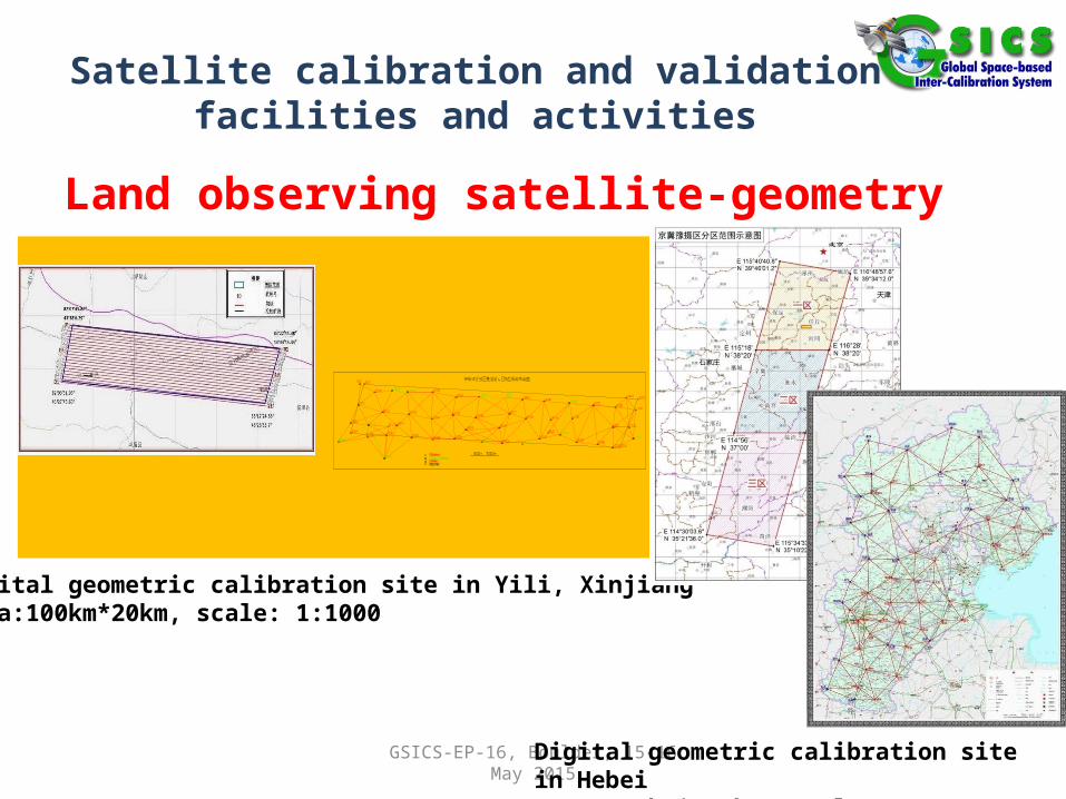
GF-1 Operation phase
GSICS-EP-16, Boulder, 15-16 May 2015
After compared with MODIS over the Dunhuang calibration site, the radiometric stability of WFV camera is investigated. Then the radiometric calibration of WFV camera is accomplished with the reference MODIS sensor by means of the radiometric cross-calibration method.

Satellite calibration and validation facilities and activities
GF-1 Operation phaseInter-cross calibration method is proposed to reduce the radiometric
inconsistency of adjacent GF-1 WFV camera. Statistical analysis and simulation
methods are adopted to build the correlation models of DN and TOA radiances
between adjacent WFVs according to the overlap region of different phase image.
WFV1 and WFV2 WFV2 and WFV3
WFV3 and WFV4
Before After Before After
Before After

Satellite calibration and validation facilities and activities
HY-2 Commissioning Phase • Examining the received telemetry of each instrument source packet for the
HY-2A satellite and confirm whether the instrument telemetry is within the expected ranges. This activity is ongoing in operational phase.
• The synchronous observation experiment in the South China Sea is used to validate the significant wave height, sea surface temperature, wind vectors, air temperature, relative humility,
air pressure, atmospheric sounding, et al.• The HY-2A satellite product was validated
by comparing with in-situ buoy (NDBC,
Chinese, et al) observations, Jason-2 data,
ASCAT, NCEP FNL Operational Global
Analysis data,et al.
GSICS-EP-16, Boulder, 15-16 May 2015

Satellite calibration and validation facilities and activities
HY-2 Operation Phase • Range absolute calibration: Based on the altimeter reconstructive transponder.
The HY-2A altimeter receives the responding signals from the transponder and generates ranges. Pertinent reference ranges are obtained from the POD data and the transponder’s coordinate. Using the ranges from the radar altimeter and the reference ranges, the time tag bias between the POD data and the HY-2A altimeter observations can be estimated. During the HY-2A altimeter calibration campaign from August 9, 2012, to July 20, 2014, 17
GSICS-EP-16, Boulder, 15-16 May 2015Fig. The HY-2A satellite altimeter transponderFig. Time tag bias and the standard deviation of each HY-2A altimeter transponder measurement
Satellite calibration and validation facilities and activities
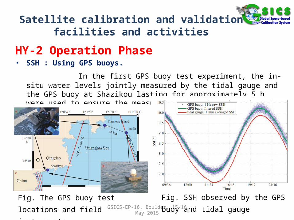
HY-2 Operation Phase • SSH : Using GPS buoys.
In the first GPS buoy test experiment, the in-situ water levels jointly measured by the tidal gauge and the GPS buoy at Shazikou lasting for approximately 5 h were used to ensure the measurement homogeneity
GSICS-EP-16, Boulder, 15-16 May 2015
Fig. The GPS buoy test locations and field
instruments
Fig. SSH observed by the GPS buoy and
tidal gauge
Satellite calibration and validation facilities and activities
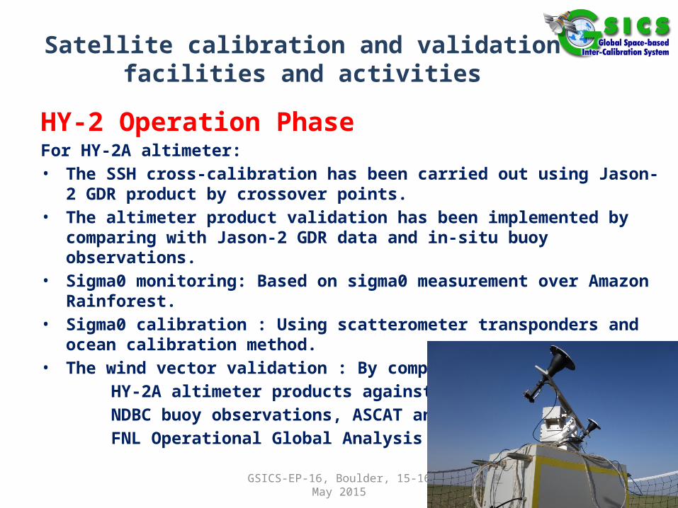
HY-2 Operation Phase For HY-2A altimeter:• The SSH cross-calibration has been carried out using Jason-2 GDR product by
crossover points.• The altimeter product validation has been implemented by comparing with
Jason-2 GDR data and in-situ buoy observations.• Sigma0 monitoring: Based on sigma0 measurement over Amazon Rainforest. • Sigma0 calibration : Using scatterometer transponders and ocean calibration
method. • The wind vector validation : By comparing
HY-2A altimeter products against in-situ
NDBC buoy observations, ASCAT and NCEP
FNL Operational Global Analysis data.
GSICS-EP-16, Boulder, 15-16 May 2015

The follow-up plans and ideas
• Focus on the radiometric calibration of high spatial resolution observing satellite sensor (<30m) and gradually form the cross-calibration system of high spatial resolution observing satellite sensor.
• Start cross-calibration of HY-2 and JASON• Start cross-calibration of thermal band of CERBS-04
with international sensors• Start cross-calibration of GF-4 with international
sensors
GSICS-EP-16, Boulder, 15-16 May 2015