Embed Size (px)
Citation preview
12 | Reporter 72
Renovating complexstructures with3D laser scanning
by Bruce Bowditch
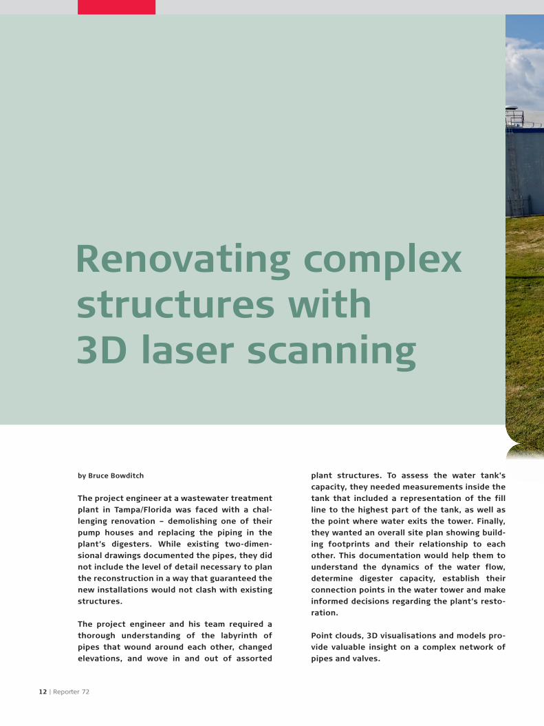
The project engineer at a wastewater treatment
plant in Tampa/Florida was faced with a chal-
lenging renovation – demolishing one of their
pump houses and replacing the piping in the
plant’s digesters. While existing two-dimen-
sional drawings documented the pipes, they did
not include the level of detail necessary to plan
the reconstruction in a way that guaranteed the
new installations would not clash with existing
structures.
The project engineer and his team required a
thorough understanding of the labyrinth of
pipes that wound around each other, changed
elevations, and wove in and out of assorted
plant structures. To assess the water tank’s
capacity, they needed measurements inside the
tank that included a representation of the fill
line to the highest part of the tank, as well as
the point where water exits the tower. Finally,
they wanted an overall site plan showing build-
ing footprints and their relationship to each
other. This documentation would help them to
understand the dynamics of the water flow,
determine digester capacity, establish their
connection points in the water tower and make
informed decisions regarding the plant’s resto-
ration.
Point clouds, 3D visualisations and models pro-
vide valuable insight on a complex network of
pipes and valves.

© i
Sto
ck.c
om
/De
nG
uy
The Global Magazine of Leica Geosystems | 13
>>
To complete the documentation manually would not
only be complex, but it could also be dangerous. First,
because the water tower was 53 metres (175 feet)
tall, it was difficult to access. In addition, there was
the ever-present risk of falling and drowning when
taking manual measurements of wastewater digest-
ers, open vats that are used to stabilise the solids
removed from the wastewater during treatment.
Manual documentation would also be time consum-
ing due to the complexity as well as the logistics
of manoeuvring around the plant and, for example,
negotiating catwalks that narrow to about 41 cm
(16 in) wide in some places. It probably would have
taken a team of four engineers around two weeks to
take measurements, and they still would have only
been able to gather a bare minimum of data.
From difficult and dangerous to simple and safe with laser scanningThe project engineer realised that laser scanning
could be the solution to their problem. After search-
ing for service providers, he contacted Ryan Hacker,
president of TruePoint Laser Scanning. Because
laser scanners methodically and quickly capture
data points that represent all objects within their
range, they could easily capture the complex pip-
ing and plant layout. In addition, since the True-
Point Laser Scanning team chose to use the Leica
ScanStation C10, they were able to document build-
ings and structures accurately within a 300 metre
(980 feet) range while capturing thousands of data
points in a second. This long-range capability meant
the technicians could safely scan the interior walls
of digesters from the catwalks and record the water
© T
rue
Po
int
Lase
r S
can
nin
g
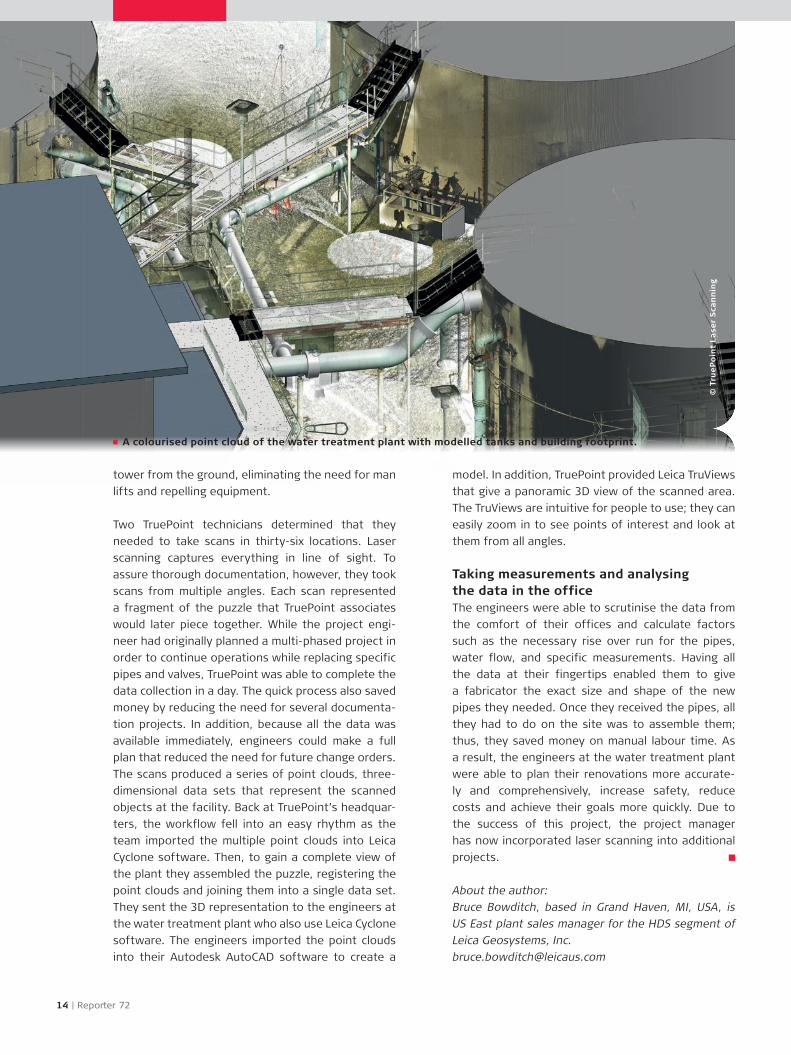
A colourised point cloud of the water treatment plant with modelled tanks and building footprint.
model. In addition, TruePoint provided Leica TruViews
that give a panoramic 3D view of the scanned area.
The TruViews are intuitive for people to use; they can
easily zoom in to see points of interest and look at
them from all angles.
Taking measurements and analysing the data in the officeThe engineers were able to scrutinise the data from
the comfort of their offices and calculate factors
such as the necessary rise over run for the pipes,
water flow, and specific measurements. Having all
the data at their fingertips enabled them to give
a fabricator the exact size and shape of the new
pipes they needed. Once they received the pipes, all
they had to do on the site was to assemble them;
thus, they saved money on manual labour time. As
a result, the engineers at the water treatment plant
were able to plan their renovations more accurate-
ly and comprehensively, increase safety, reduce
costs and achieve their goals more quickly. Due to
the success of this project, the project manager
has now incorporated laser scanning into additional
projects.
About the author:
Bruce Bowditch, based in Grand Haven, MI, USA, is
US East plant sales manager for the HDS segment of
Leica Geosystems, Inc.
14 | Reporter 72
tower from the ground, eliminating the need for man
lifts and repelling equipment.
Two TruePoint technicians determined that they
needed to take scans in thirty-six locations. Laser
scanning captures everything in line of sight. To
assure thorough documentation, however, they took
scans from multiple angles. Each scan represented
a fragment of the puzzle that TruePoint associates
would later piece together. While the project engi-
neer had originally planned a multi-phased project in
order to continue operations while replacing specific
pipes and valves, TruePoint was able to complete the
data collection in a day. The quick process also saved
money by reducing the need for several documenta-
tion projects. In addition, because all the data was
available immediately, engineers could make a full
plan that reduced the need for future change orders.
The scans produced a series of point clouds, three-
dimensional data sets that represent the scanned
objects at the facility. Back at TruePoint’s headquar-
ters, the workflow fell into an easy rhythm as the
team imported the multiple point clouds into Leica
Cyclone software. Then, to gain a complete view of
the plant they assembled the puzzle, registering the
point clouds and joining them into a single data set.
They sent the 3D representation to the engineers at
the water treatment plant who also use Leica Cyclone
software. The engineers imported the point clouds
into their Autodesk AutoCAD software to create a