Embed Size (px)
Citation preview
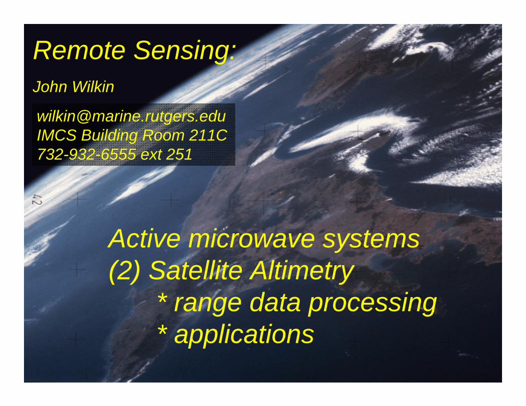
Remote Sensing:John Wilkin
Active microwave systems(2) Satellite Altimetry
* range data processing* applications
[email protected] Building Room 211C732-932-6555 ext 251
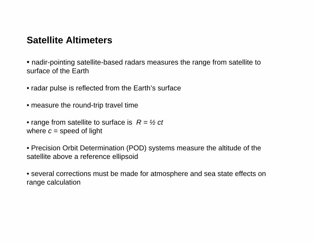
Satellite Altimeters
• nadir-pointing satellite-based radars measures the range from satellite to surface of the Earth
• radar pulse is reflected from the Earth’s surface
• measure the round-trip travel time
• range from satellite to surface is R = ½ ctwhere c = speed of light
• Precision Orbit Determination (POD) systems measure the altitude of the satellite above a reference ellipsoid
• several corrections must be made for atmosphere and sea state effects on range calculation

• Altimeters (nadir pointing radar)– sea surface height (long wavelengths ~50 km)
• mesoscale currents, eddies, fronts• thermal expansion
– significant wave height– wind speed– gravity and bathymetry– ice sheets

Sea surface HEIGHT (SSH)
• Sea Surface Height is satellite altitude minus range
• It comprises two contributions: geoid and dynamic topography
• Geoid:
– The sea surface height that would exist without any motion. This surface is due to gravity variations around the planet due to mass and density differences on the seafloor
– Major bathymetric features deform sea level by tens of meters and are visible as a hill on the geoid
• Dynamic topography
– The ocean circulation comprises a permanent mean component linked to Earth's rotation, mean winds, and density patterns…
– …and a highly variable component (wind variability, tides, seasonal heating, eddies)
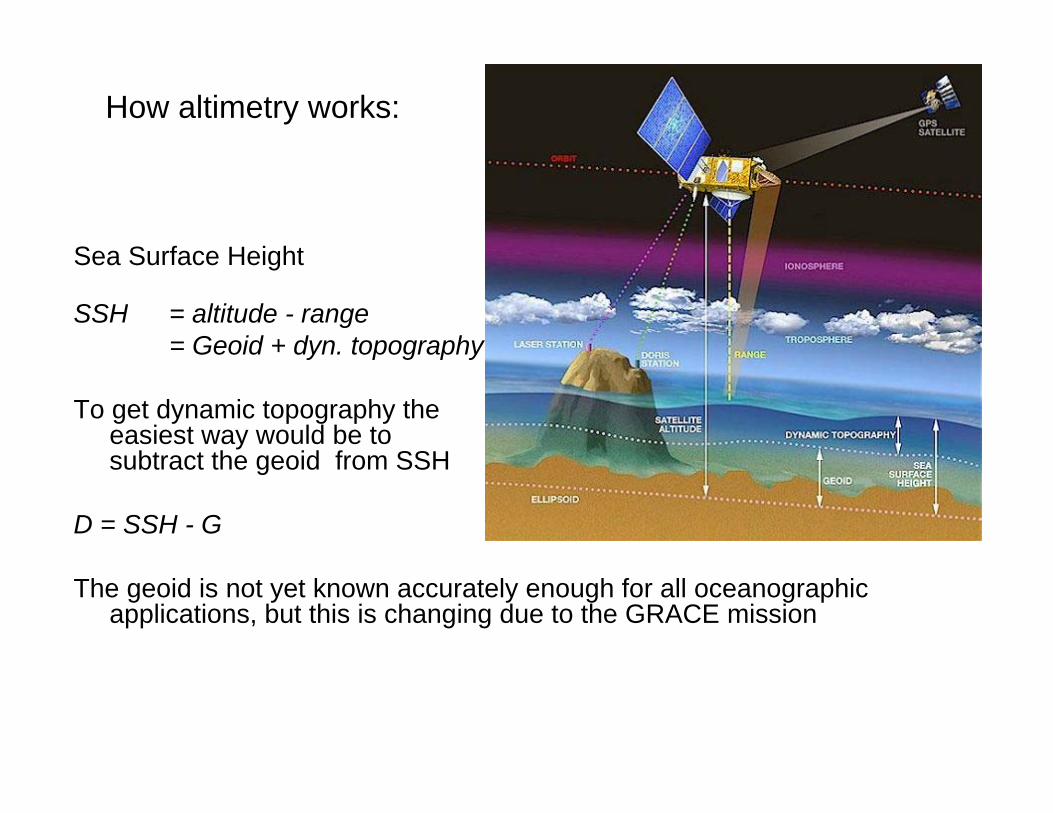
Sea Surface Height
SSH = altitude - range = Geoid + dyn. topography
To get dynamic topography the easiest way would be to subtract the geoid from SSH
D = SSH - G
The geoid is not yet known accurately enough for all oceanographic applications, but this is changing due to the GRACE mission
How altimetry works:
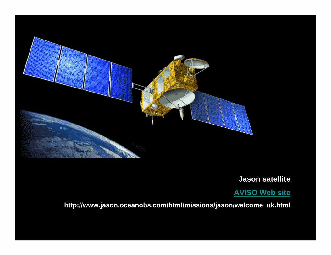
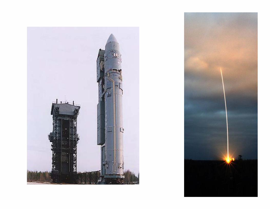
Jason satellite
AVISO Web sitehttp://www.jason.oceanobs.com/html/missions/jason/welcome_uk.html

Jason launch movieshttp://sealevel.jpl.nasa.gov/mission/jason-1-launch-footage.html
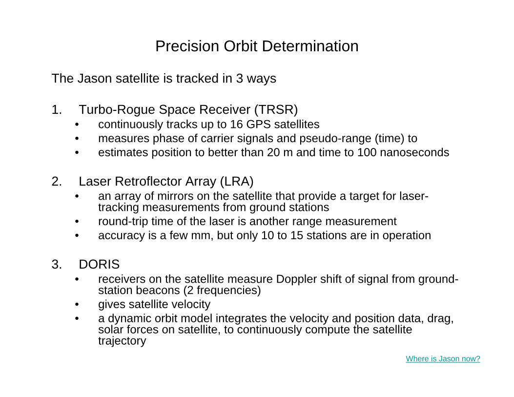
Precision Orbit Determination
The Jason satellite is tracked in 3 ways
1. Turbo-Rogue Space Receiver (TRSR)• continuously tracks up to 16 GPS satellites• measures phase of carrier signals and pseudo-range (time) to • estimates position to better than 20 m and time to 100 nanoseconds
2. Laser Retroflector Array (LRA)• an array of mirrors on the satellite that provide a target for laser-
tracking measurements from ground stations• round-trip time of the laser is another range measurement• accuracy is a few mm, but only 10 to 15 stations are in operation
3. DORIS• receivers on the satellite measure Doppler shift of signal from ground-
station beacons (2 frequencies) • gives satellite velocity• a dynamic orbit model integrates the velocity and position data, drag,
solar forces on satellite, to continuously compute the satellitetrajectory
Where is Jason now?

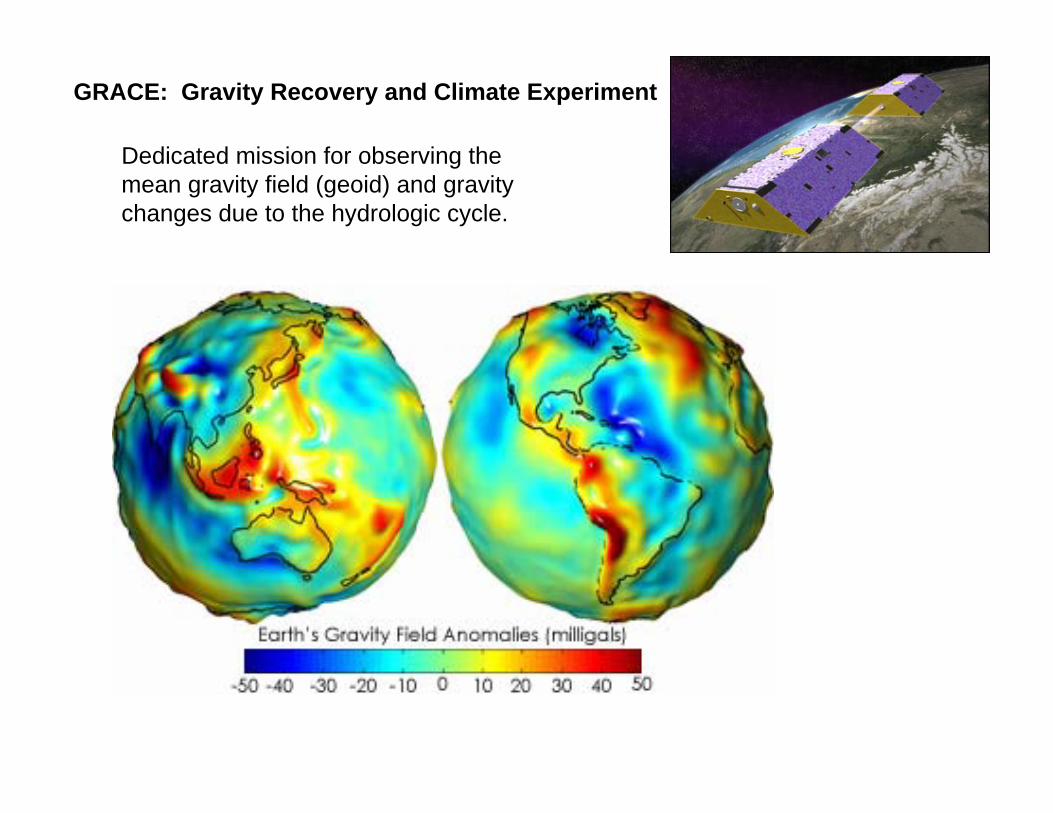
GRACE: Gravity Recovery and Climate Experiment
Dedicated mission for observing the mean gravity field (geoid) and gravity changes due to the hydrologic cycle.
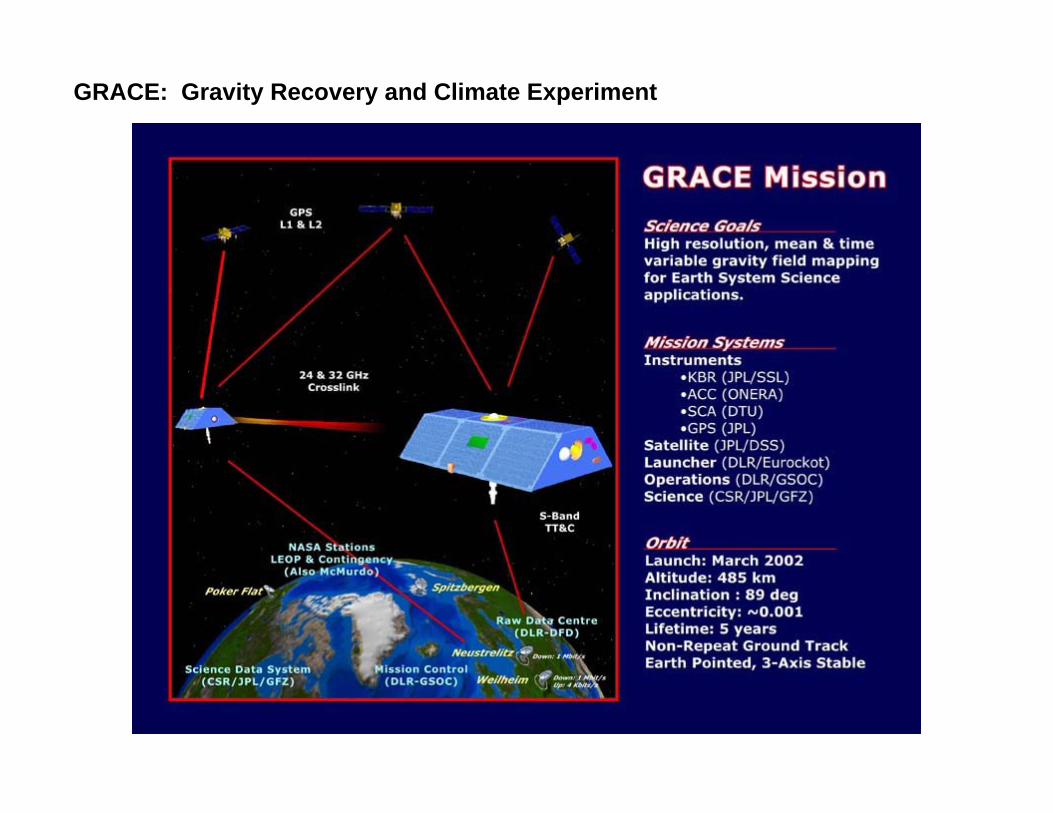
GRACE: Gravity Recovery and Climate Experiment

http://www.csr.utexas.edu/grace/gallery/animations/measurement/measurement_qt.html
GRACE: Gravity Recovery and Climate Experiment
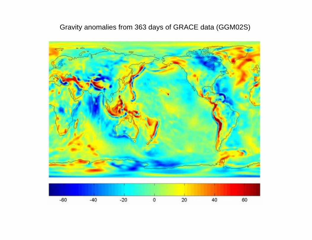
Gravity anomalies from 363 days of GRACE data (GGM02S)

(a) Circulation at 1000 m depth obtained from the GRACE geoid combined with satellite altimetry and ship measurements. Note that the flow direction in the Gulf Stream extension matches that measured by ship-deployed floats in (b)
(b) Ocean currents from direct measurement by floats deployed from ships. This can be compared to the panels above and below.
(c) Same as (a) except that the best gravity model prior to GRACE was used. In many areas the implied currents are flowing in the wrong direction.
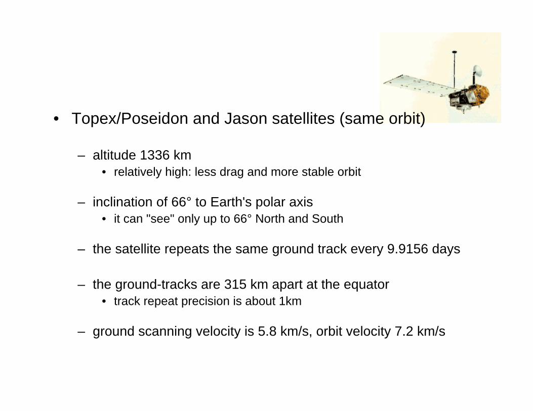
• Topex/Poseidon and Jason satellites (same orbit)
– altitude 1336 km• relatively high: less drag and more stable orbit
– inclination of 66° to Earth's polar axis• it can "see" only up to 66° North and South
– the satellite repeats the same ground track every 9.9156 days
– the ground-tracks are 315 km apart at the equator• track repeat precision is about 1km
– ground scanning velocity is 5.8 km/s, orbit velocity 7.2 km/s

Where is Jason now? http://www.heavens-above.com/orbitdisplay.asp?lat=34.148&lng=-118.144&alt=0&loc=Pasadena&TZ=PST&SatID=26997
Where is Topex now?

Tidal aliasing considerations
• Orbital parameters (inclination, altitude and precession rate which set orbital period) should be chosen so that the alias period of energetic tidal harmonic constituents is at least resolved by the duration of the altimeter mission, and preferably to frequencies of less than 2 cycles per year.
• Aliased tide variations (which appear to be low frequency signals) are phase shifted on adjacent ground-tracks by several days, and can appear to propagate westward or eastward

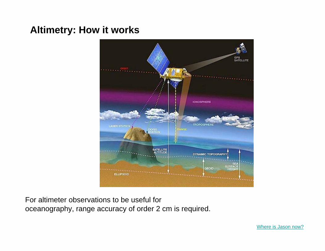
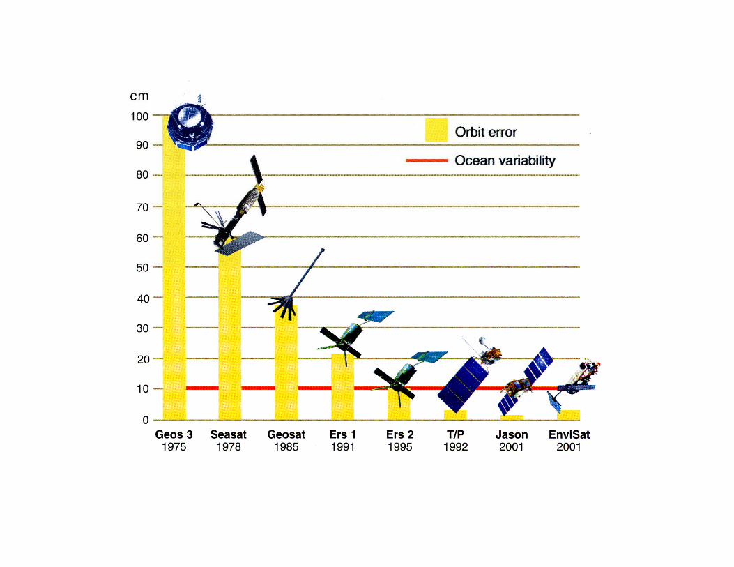
For altimeter observations to be useful for oceanography, range accuracy of order 2 cm is required.
Altimetry: How it works
Where is Jason now?
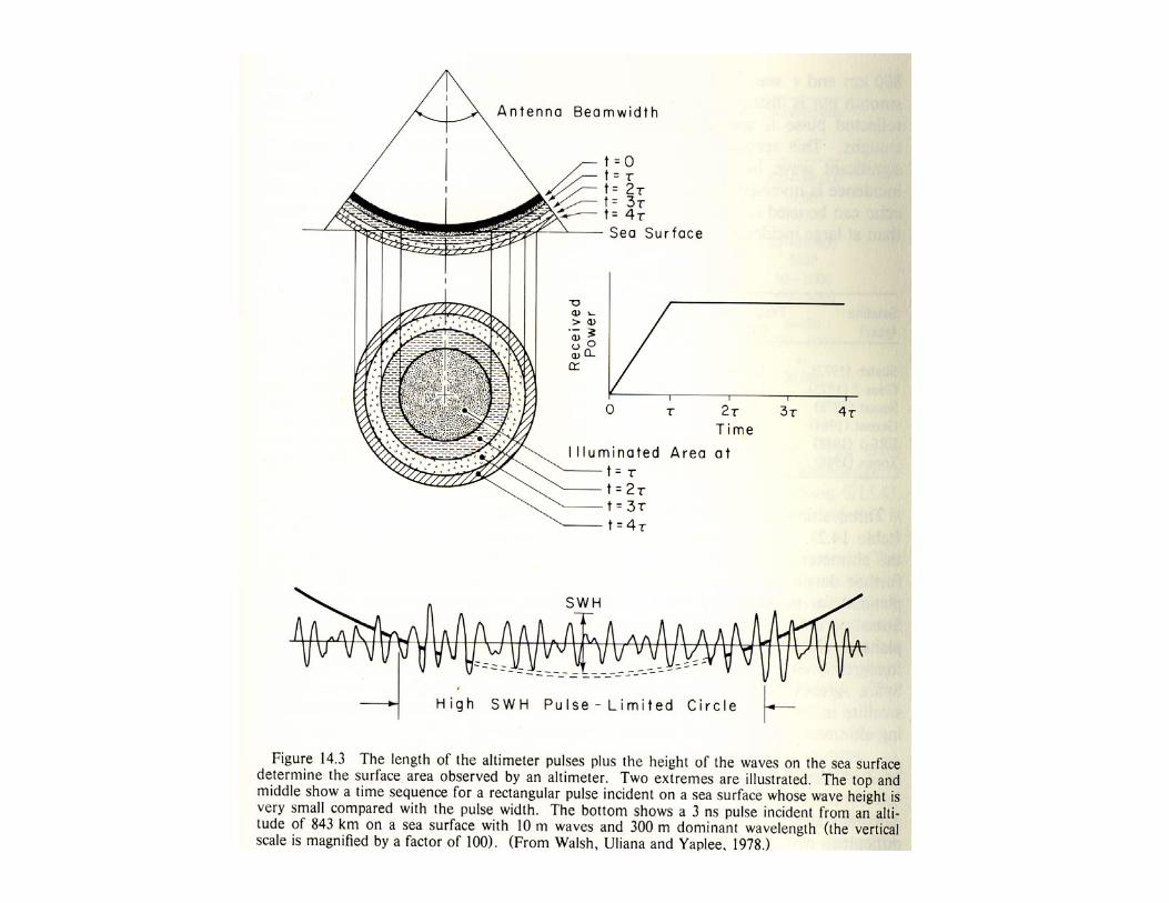

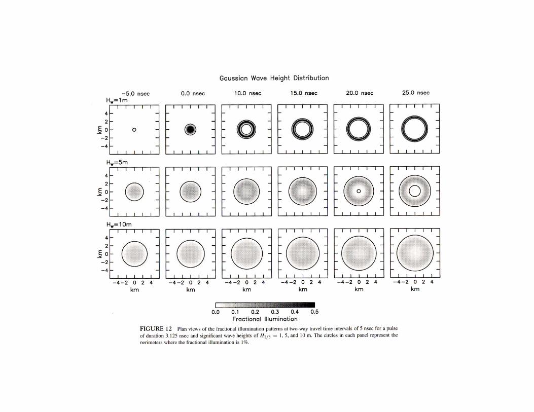
Pulse-limited altimetry
Foot-print size on the sea surface:
• large enough to filter out surface gravity waves
• small enough to resolve Rossby radius ~ 30 to 75 km
• wave field and roughness (radar cross-section) are homogeneous
• 1 – 10 km satisfies these criteria
Antenna beam width depends on:
• range and foot-print size => 0.21o for T/P
Antenna diameter depends on:
• EM wavelength and beam width => d = 7.7 m
Too big to fly, and beam-limited design is sensitive to pointing errors

Pulse-limited altimetry

Sea state affects the radar reflection


The onboard Adaptive Tracking Unit analyzes the returned pulses to estimate two-way travel time, wave height and radar cross-section.
Corrections that must be applied in the range calculation:(1) Sea state bias
• Electromagnetic bias
– ocean troughs have a larger radius of curvature than wave crests– greater reflection from wave troughs than wave crests
induces an EM sea level bias toward wave troughs– scatter at crests due to small scale roughness increases the effect– difference between height of mean sea level and mean scattering surface
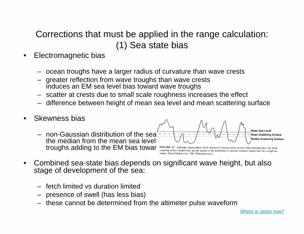
• Skewness bias
– non-Gaussian distribution of the sea surface shiftsthe median from the mean sea level toward wave troughs adding to the EM bias towards wave troughs
• Combined sea-state bias depends on significant wave height, but also stage of development of the sea:
– fetch limited vs duration limited– presence of swell (has less bias)– these cannot be determined from the altimeter pulse waveform
Where is Jason now?


Corrections that must be applied in the range calculation:(2) Index of refraction (speed of light through atmosphere)
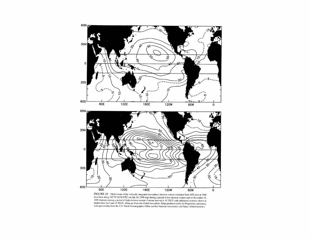
• Ionospheric correction
– variation in the number of free electrons present in the sub-satellite ionosphere
– electron content varies from day to night (fewer free electrons at night), from summer to winter (fewer during summer), and as a function of the solar cycle (fewer during the solar minimum)
– effect is inversely proportional to transmitter frequency– Poseidon is a dual-frequency altimeter so differential response
provides information on range correction– Atmospheric modeling and GPS (also dual frequency) can be
used to map ionosphere electron density
• Dry tropospheric correction
– by far the most significant adjustment to 2-way travel time– gases present in the sub-satellite troposphere– correction involves vertical integral of the air density and is thus
proportional to mean sea level pressure (MSLP)– MSLP analysis fields from ECMWF used in Jason processing– the dry correction includes the weight of the water molecules
• Wet troposphere correction – accounts for water vapor influence on the index of refraction – vertical integral of water vapor determined from an onboard
radiometer
Corrections that must be applied in the range calculation:(2) Index of refraction (speed of light through atmosphere)
The challenges to achieving 2 cm accuracy are:
– computing the satellite position accurately
– range corrections for the atmosphere
• density of atmosphere, water vapor
– range corrections for sea state
– accounting for the aliasing of tides
– knowing the shape of a reference gravitational potential surface, or “geoid”, that defines a surface along which gravity is constant(and therefore dynamically “level”)
Where is Jason now?
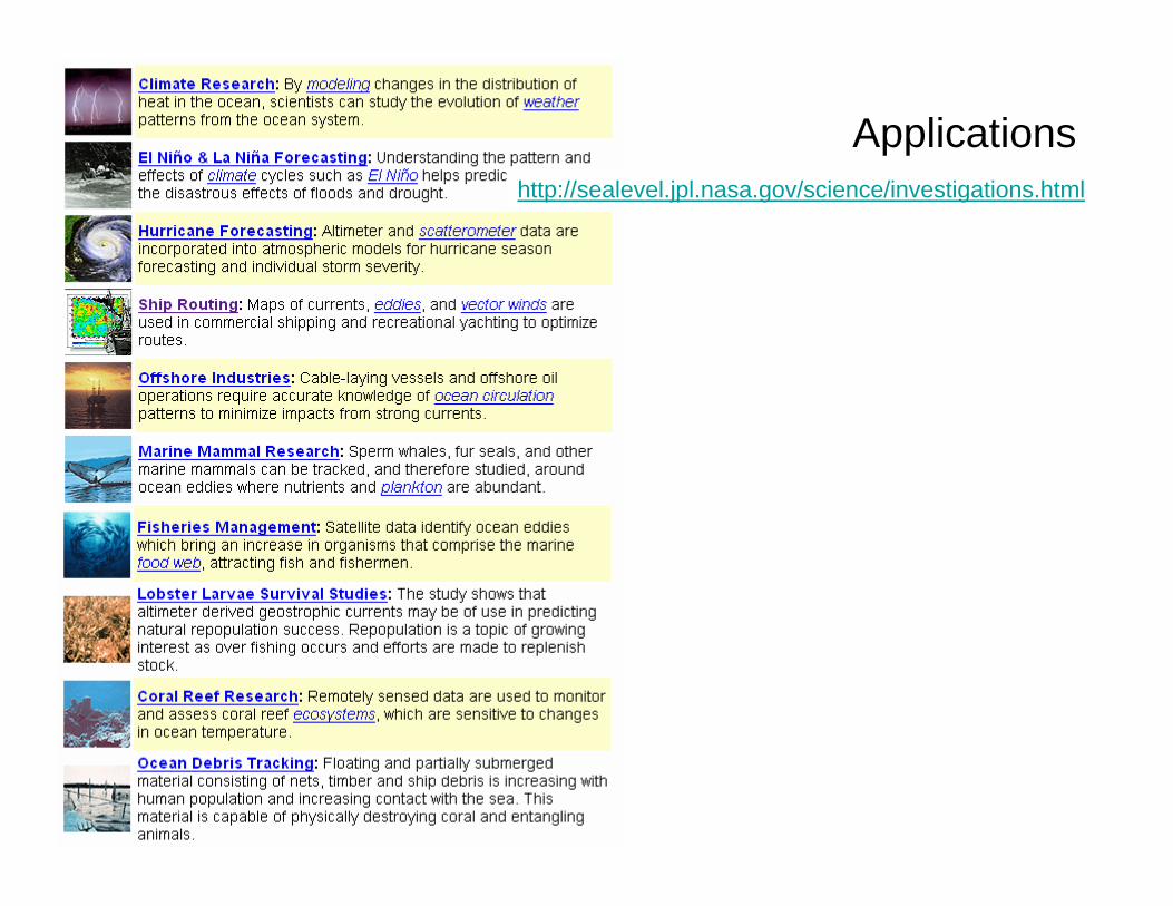
Applicationshttp://sealevel.jpl.nasa.gov/science/investigations.html

Applicationshttp://sealevel.jpl.nasa.gov/science/investigations.html

Applications
Large-scale ocean circulation


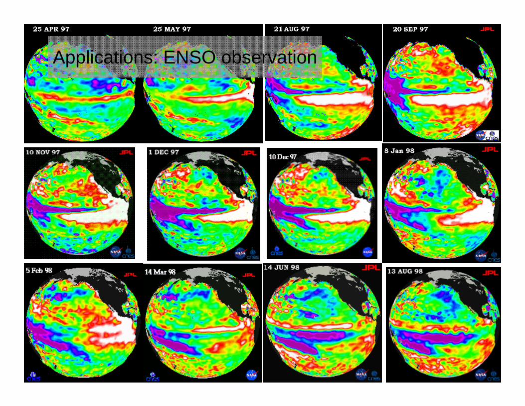
Applications: ENSO observation

Applications
Meso-scale vectors currents from ground-track cross-over points
CHAPTER 3, FIGURE 9. Velocity variance ellipses in the East Australian Currnet from Geosat observations at crossover points and long-term surface drifter data, plotted over bathymetry (From Wilkin, J. and Morrow, R.A. 1994. With permission)

Applications
Sea-level rise

Applications
Tidal dissipation
Applications
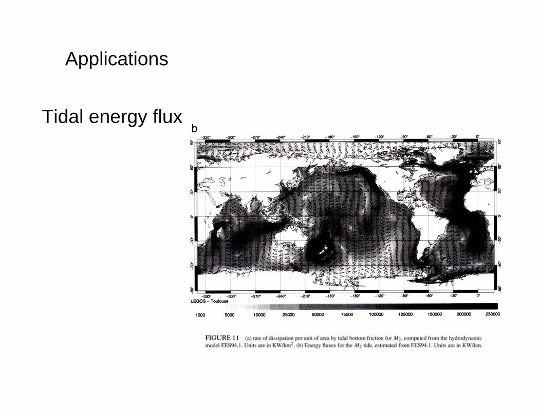
Tidal energy flux
Applications
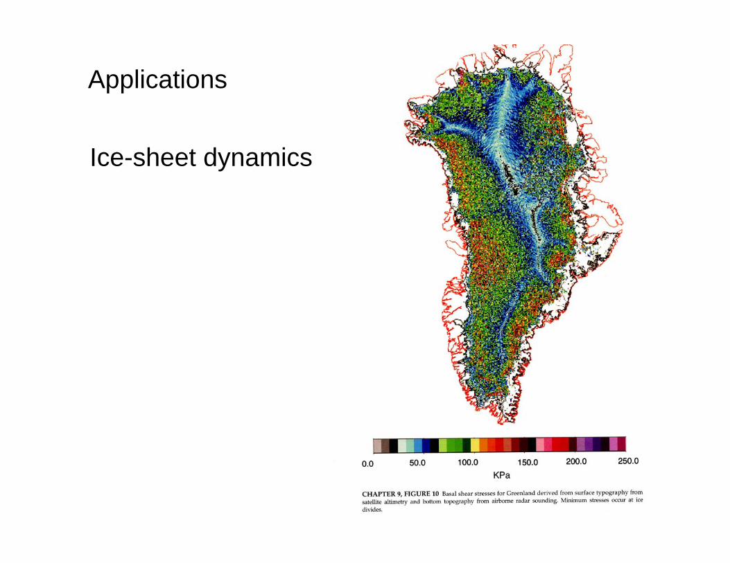
Ice-sheet dynamics

Applications
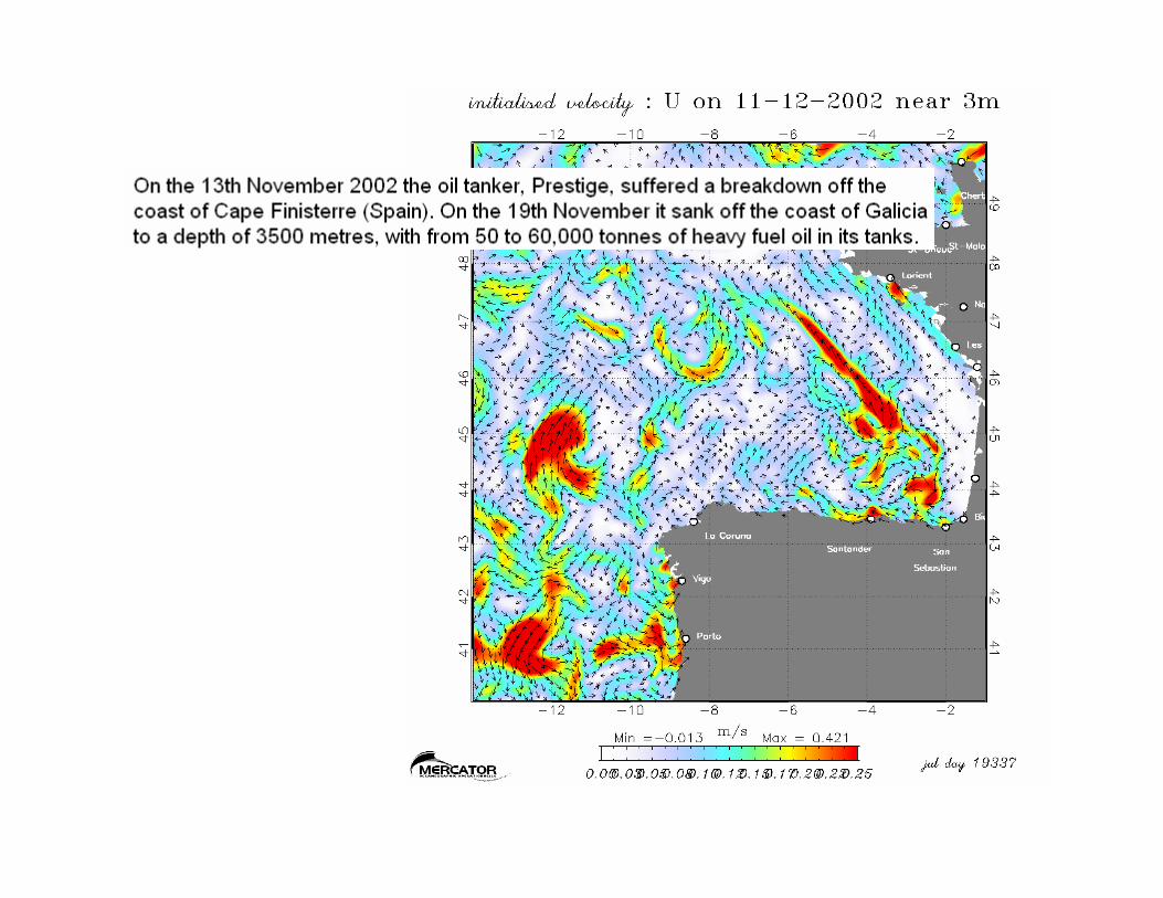
Operational oceanography
e.g. Mercator
Where is Jason now?
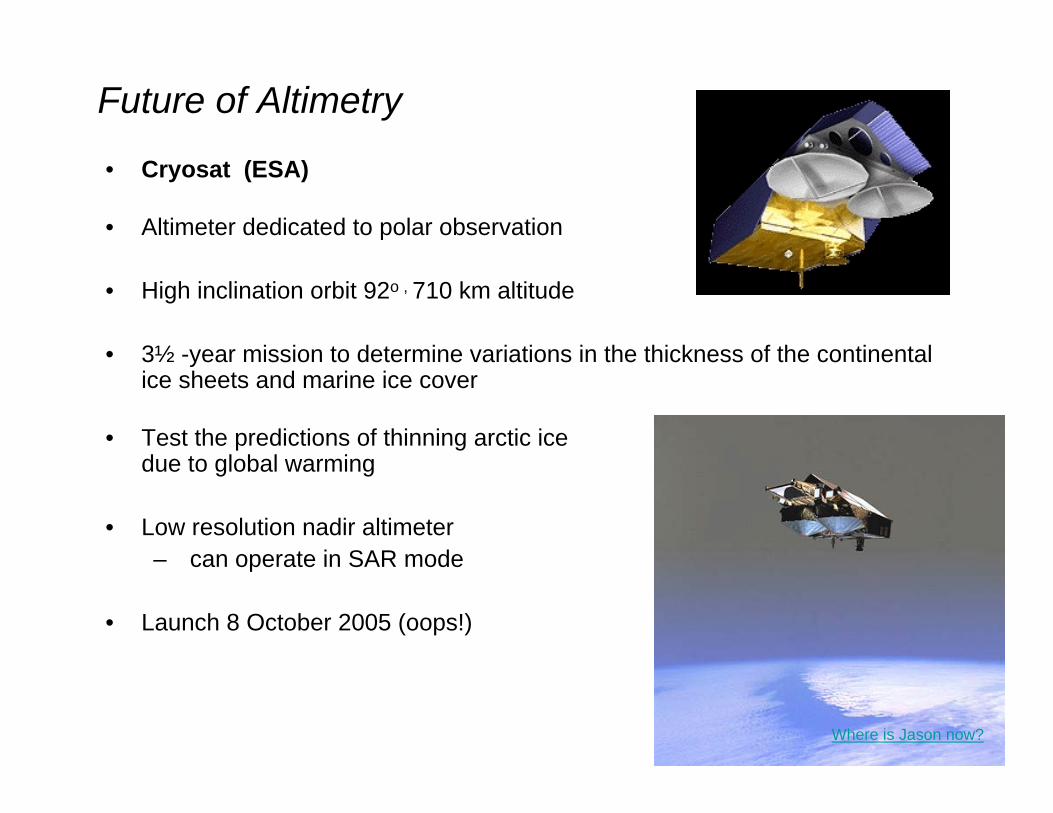
• Cryosat (ESA)
• Altimeter dedicated to polar observation
• High inclination orbit 92o , 710 km altitude
• 3½ -year mission to determine variations in the thickness of the continental ice sheets and marine ice cover
• Test the predictions of thinning arctic ice due to global warming
• Low resolution nadir altimeter– can operate in SAR mode
• Launch 8 October 2005 (oops!)
Future of Altimetry
Where is Jason now?

Future of Altimetry
The Ocean Surface Topography Mission (OSTM) will be a follow-on to the Jason mission. It is scheduled to launch in June of 2008.

• WSOA: the Wide Swath Ocean Altimeter
– An altimeter/interferometer project
• Several altimeters mounted on masts will acquire measurements simultaneously, providing continuous wide-area coverage.
• WSOA is based on a technique combining altimeter and interferometer measurements. It is a wide-field radar altimeter able to measure sea-surface height across a swath centered on the satellite ground track.
• The satellite payload will include:
– dual-frequency, nadir-looking radar altimeter in Ku and C bands– to provide ionospheric corrections– acquire measurements as accurate as Topex and the Jason– A three-channel radiometer – GPS, Doris and laser reflector precise orbit determination – WSOA, comprising two interferometers mounted on a mast, with a baseline of
6.4 m each covering a swath of 15 to 100 km
Future of Altimetry
Where is Jason now?

WSOA on “Jason-2”
Three factors underlying measurement uncertainty:
• Measurement noise, which depends on the antenna baseline (longer baseline = less noise). With an antenna baseline of 6.4 m the raw noise is 5.2 cm
• Ionospheric, tropospheric and sea-state bias effects (estimated at 1 to 2 cm)
• Errors from satellite roll and pitch steering which impact measurement geometry

Comparison of T/P+Jason-1 measurements and simulated WSOA data (with Topex/Poseidon shifted into an orbit parallel to Jason-1).
This mosaic offers a huge advantage in terms of describing the dynamic topography at high resolution:• It allows a measure of sea surface gradient between pixels and,therefore, geostrophic velocity• Simulations based on realistic model data yield an error of 4.7 cm/s rmson the zonal velocity and 5.9 cm/s on meridional velocity.


![[REMOTE SENSING] 3-PM Remote Sensing](https://img.dokumen.tips/doc/110x75/61f2bbb282fa78206228d9e2/remote-sensing-3-pm-remote-sensing.jpg)


