Embed Size (px)
Citation preview

REMAINS of Greenland REsearch and Management of Archaeological sites IN a changing environment and Society
The National Museum of Denmark The National Museum of Greenland The Center for Permafrost (CENPERM), University of Copenhagen Funded by VELUX FONDEN

REMAINS of Greenland
REMAINS is a co-operation between the National
Museums of Denmark and Greenland and Center for
Permafrost, University of Copenhagen. The project will
improve the understanding of processes controlling the
preservation of archaeological sites in Greenland and
provide research based tools that can be used for locating
and managing sites at risk.
Front cover: The Qajaa kitchen midden located at the Ilulissat Icefjord in Western Greenland.
This page: Some of the extraordinary archaeological finds from Greenland. From the left: Knives with
preserved wooden handles (Qajaa, Saqqaq culture), carved figures of bone (Thule, Dorset culture),
preserved textiles (Ikigaat, Norse settlers), and human remains (Qilakitsoq, Thule culture)
1
REMAINS of Greenland
Introduction and aims
Archaeological sites in Greenland represent an irreplaceable record of unusually well-preserved
material remains covering over 4000 years of human history. The cold climate has offered unique
preservation possibilities and several extraordinary finds of organic remains such as wood, bone,
textile, fur and ancient DNA have been made (Hart Hansen et al., 1991; Berglund, 2000; Østergaard,
2004; Rasmussen et al., 2010; Grønnow, 2012). Out of the more than 6000 archaeological sites
currently registered in the Greenland Heritage Database, only very few have been excavated and it is
anticipated that thousands of sites are awaiting discovery in the unexplored parts of the country. The
potential of archaeological sites in Greenland to provide further spectacular finds and thus novel
contributions to the understanding Greenland’s and Arctic history is therefore very high.
However, it is only a matter of time before this potential diminishes. Climate change is detrimentally
affecting preservation conditions, which is leading to an accelerated destruction of archaeological
sites. It is therefore urgent to identify and classify the different threats posed by climate change in
order to act in due time and safeguard important parts of Greenland’s history.
REMAINS is initiated as a direct response to these threats and to the enormous challenge the
National Museum of Greenland is currently facing. The aims of the project are:
To advance the basic understanding of how climate change influence the preservation of
archaeological sites and organic artefacts.
To develop research based cultural resource management tools for locating sites at risk.
To develop strategies for dealing with threatened sites in Greenland.
The scientific relevance of the project is linked to the lack of knowledge regarding the coupling
between climate, site stability and soil/artefact degradation. Through detailed site investigations and
degradation experiments, REMAINS will provide the fundamental knowledge needed to quantify the
short and long-term net effects of climate change on the preservation of archaeological sites and
artefacts. The obtained results will be combined with regional projections of environmental changes
in a desk-based Geographical Information System (GIS) model that can be used to perform a regional
assessment of threats to archaeological sites. At the end of the project this GIS model will constitute a
2
new management tool that can assist the Greenland National Museum to pin-point the most
vulnerable areas and thereby help to prioritize and optimize future archaeological investigations. In
this manner, the results of REMAINS will not only be of value to the scientific community but also
benefit the general management of archaeological sites in Greenland.
The REMAINS concept
REMAINS is a co-operation between The National Museum of Denmark (NM), The Greenland National
Museum and Archives (NKA) and Center for Permafrost (CENPERM) at University of Copenhagen and
is built on the experiences of several previous collaborative projects, including a pilot project of
REMAINS in 2012 (Knudsen et al, 2014). The project group consists of a team of experienced
researchers, young researchers and students. All people associated with the project are listed on page
25.
The project focuses on the Nuuk region in South West Greenland, which is the part of Greenland with
the highest density and variety of archaeological sites and where the effects of climatic change are
already visible. Furthermore, this is the most accessible part of Greenland providing clear advantages,
both in relation to logistical challenges and the involvement of the local population and students
which are considered important parts of project.
The project is structured in two integrated Work Packages (WPs):
Work package 1: Studies of site and artefact degradation
Work package 2: Regional risk assessment and development of guidelines
The project will begin 1 March 2016 and run for three years.
Background and state of the art
Climate change related processes are leading to an accelerated destruction of archaeological sites in
the Arctic, and all the information they contain (Blankholm, 2009). Changes in air temperatures cause
permafrost thaw (Hollesen et al., 2011; Schaefer et al., 2011) that may expose hitherto well preserved
archaeological layers and artefacts to accelerated chemical and physical degradation (Hollesen et al.,
2015). Warmer winters and increasingly favourable growing season conditions lead to more and

3
denser vegetation with deeper roots (Epstein et al., 2012; Henry et al., 2012) that causes physical
damage to buried artefacts and destruction of site layering/stratigraphy. Changes in precipitation
affect the water balance and thereby have a strong influence on the amounts of oxygen that diffuses
into the cultural layers. Finally rising sea level and storm surge impacts increase coastal erosion rates
and represent a great threat for the many archaeological sites located close to the sea.
Since 2009 the National Museums’ of Denmark and Greenland and the University of Copenhagen
have collaborated in order to investigate how climate change affects archaeological sites in
Greenland. Research on the Qajaa kitchen midden in the Disco Bay area in Greenland (seen on the
front page) documents that wooden artefacts preserved for more than 4,000 years in the permafrost
but exposed to summer thaw folowing an archaeological excavation in 1982, are markedly degraded
(Matthiesen et al., 2013). Laboratory experiments show that the oxic (in the presence of oxygen)
decay of both organic archaeological soil and wooden artefacts is temperature-dependent with rates
increasing 10-15% for each one degree of warming (Hollesen et al., 2012; Matthiesen et al., 2013,).
The decay of the organic and nutrient rich archaeological material produces great amounts of heat
which may act as an important positive-feedback mechanism that further enhances permafrost
thawing and the speed at which organic materials are lost (Elberling et al., 2011; Hollesen et al.,
2015). The measured decay rates have been combined with on-site monitoring data in a numerical
computer model in order to assess the future thawing and decay of the kitchen midden (Hollesen et
al., 2015). The model results show that great parts of the midden may be thawed within the next
century with significant negative effect on the preservation conditions. The results suggest a critical
shift from a first phase of relatively slow permafrost thaw, driven by climate changes and low heat
production, to a second phase of accelerated permafrost thaw when water is drained and increasing
oxygen availability markedly triggers a higher internal heat production. If this tipping point is reached
the heat production can accelerate the decomposition processes and cause the impact of climate
change to be significantly enhanced. A preliminary decay study on samples from two sites in the Nuuk
region (collected during the pilot project) indicates that archaeological sites without permafrost may
be highly vulnerable to changes in temperature and soil moisture and also hold the capacity to
produce significant amounts of heat. This suggests that organic archaeological materials may be at
great risk at archaeological sites all over Greenland and consequently calls for further investigations.

4
To date it is mainly the decay of archaeological soil that has been studied in Greenland. Consequently,
very little is known about the degradation of other types of organic archaeological materials. The
research at Qajaa revealed that the absence of specific lignin-degrading fungus (white rot and brown
rot) have helped the preservation of wood (Matthiesen et al., 2013). These microorganisms have
been identified in several buildings and constructions in the Arctic (Mattsson 2010). Climate change is
expected to improve growth conditions for white rot and brown rot and may therefore result in a
substantial and fast decay to the massive amount of archaeological wooden objects found in
Greenland. Furthermore, the degradation of the many buried bones found in the Greenlandic kitchen
middens needs to be studied. Bones recovered from archaeological sites contain significant amounts
of information that can be used within archaeological science and other biomolecular studies,
including dating (e.g. radiocarbon, amino acid racemization, age at death), genetic and dietary studies
(Child, 1995).
In 2012 a pilot project of REMAINS was carried out in the Nuuk region to find suitable study sites and
get a broader overview of the different climate induced threats to archaeological sites. A dramatic
increase in the natural vegetation cover was observed at several in-land sites with signs of roots
causing physical damage to ruins and buried artefacts and disturbing the site stratigraphy (Knudsen et
al, 2014). Human induced changes in vegetation were also observed as small allotments had been
established at some of the nutrient rich archaeological sites. The pilot project also demonstrated that
in the Nuuk region the threat from coastal erosion was limited as the coast mostly consists of solid
rock. Instead fluvial erosion by melt water and soil movement due to freeze-thaw processes was
much more actively causing physical damage to sites.
In the light of these results and the fact that global climate models predict an air temperature
increase of 3-7oC within the next century (IPCC, 2013) it is urgent that we act now in order to
document and manage the archaeological remains in Greenland. Improved knowledge on the nature
of feedback mechanisms and processes controlling preservation conditions are needed in order to
quantify the rate at which the different threats are causing degradation. At the moment it is
impossible to predict where and when preservation conditions may worsen. Individual point/site
observations of the net effect of climate change cannot be carried out at every site. Thus, methods to
upscale from local to regional scale are needed in order for the Greenland National Museum to
safeguard and optimally manage Greenland’s archaeological heritage.

5
The impact of climate change on cultural heritage sites is not only a problem in Greenland. In May
2014, the National Museums of Denmark and Greenland hosted the ICOMOS International Polar
Heritage Committee Conference - The future of Polar Heritage (IPHC, 2014). One of the main
statements of the conference was that cultural heritage sites are degrading all over the Arctic region
due to climate change and that very little has currently been done to address this fact. It was
concluded at the conference that adequate strategies and operational frameworks for coping with the
situation need to be developed or the result will be that too little is done too late.
Detailed research plan
Study areas and sites
In Greenland the climatic conditions may vary significantly within relatively small areas depending on
the distance to the ice sheet and the sea (Figure 1). Furthermore, local climatic conditions may have a
significant influence on both the surface conditions (vegetation and snow cover) and on the
conditions in the soil environment (soil temperatures and water content). Thus, selecting
representative sites is essential to provide a reliable and robust understanding of the interactions
between climate and preservation conditions.
Figure 1: The figure highlights the significant gradients found in the Nuuk region: from maritime to continental climate and from lowlands to highlands.
6
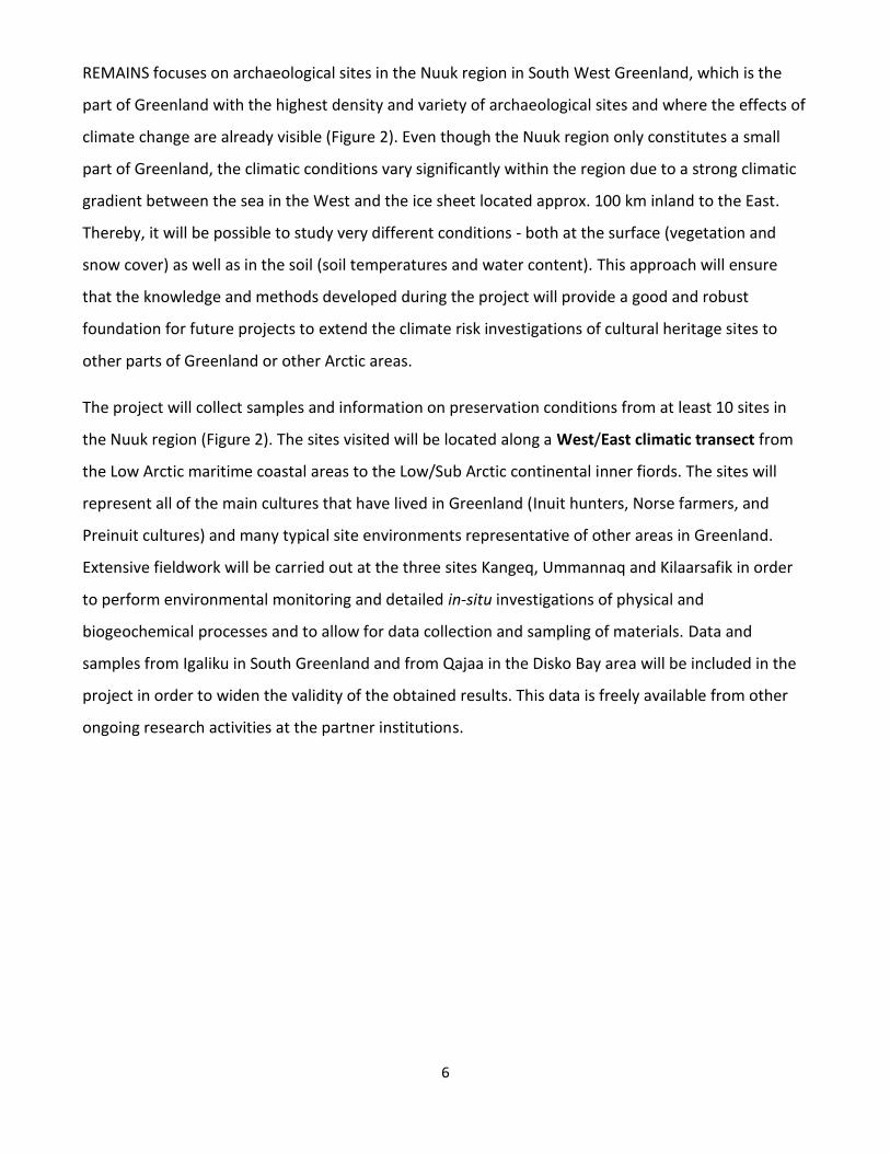
REMAINS focuses on archaeological sites in the Nuuk region in South West Greenland, which is the
part of Greenland with the highest density and variety of archaeological sites and where the effects of
climate change are already visible (Figure 2). Even though the Nuuk region only constitutes a small
part of Greenland, the climatic conditions vary significantly within the region due to a strong climatic
gradient between the sea in the West and the ice sheet located approx. 100 km inland to the East.
Thereby, it will be possible to study very different conditions - both at the surface (vegetation and
snow cover) as well as in the soil (soil temperatures and water content). This approach will ensure
that the knowledge and methods developed during the project will provide a good and robust
foundation for future projects to extend the climate risk investigations of cultural heritage sites to
other parts of Greenland or other Arctic areas.
The project will collect samples and information on preservation conditions from at least 10 sites in
the Nuuk region (Figure 2). The sites visited will be located along a West/East climatic transect from
the Low Arctic maritime coastal areas to the Low/Sub Arctic continental inner fiords. The sites will
represent all of the main cultures that have lived in Greenland (Inuit hunters, Norse farmers, and
Preinuit cultures) and many typical site environments representative of other areas in Greenland.
Extensive fieldwork will be carried out at the three sites Kangeq, Ummannaq and Kilaarsafik in order
to perform environmental monitoring and detailed in-situ investigations of physical and
biogeochemical processes and to allow for data collection and sampling of materials. Data and
samples from Igaliku in South Greenland and from Qajaa in the Disko Bay area will be included in the
project in order to widen the validity of the obtained results. This data is freely available from other
ongoing research activities at the partner institutions.

7
Figure 2: The map shows the study region forming a West/East climatic transect from the Low Arctic maritime coastal areas to the Low/Sub Arctic continental inner fiords. Sites will be visited in the region and detailed studies are carried out at three key sites. The Sandnes/Kilaarsarfik site in the Ameralik south-east of Nuuk is one of three church farms identified in the Norse Western Settlement and was the main chieftain’s seats in the area, functioning both as an economic and religious center. Because of the excellent preservation it constitutes one of the archaeological cornerstones in the understanding of Norse architecture and economic development (Roussell, 1936; McGovern, 1996); The Uummannaq site is an Inuit settlement and Moravian mission (1861-1951) overlaying remains from Pre-Inuit cultures, Saqqaq and Dorset (Toft, 2011). Previous visits show that the site is threatened by erosion (Gulløv et al., 1983; Toft & Gulløv, 2011). Its proximity to Nuuk makes it a good site for field schools and on-site dissemination; Kangeq is situated at the outer coast comprising up to two-meter thick kitchen middens with up to 4000 years old cultural layers which currently is being eroded by the sea. The site was partly excavated in 1968, where permafrost was observed (Gulløv, 1997). In addition data and samples are used from: The Qajaa site is a 3m thick permafrozen kitchen midden with well-preserved remains from the Saqqaq, Dorset and Thule cultures, and is part of the UNESCO World Heritage Site Ilulissat Icefjord (Meldgaard, 1983; Elberling, 2011); Igaliku was the residence of the Norse bishop in Greenland (Arneborg, 2000). The cultural layers of the site are now threatened by modern farming. It is on the tentative list for UNESCO World Heritage sites.

8
Work package 1: Studies of sites and artefact degradation
Introduction
Some of the most important factors influencing the preservation of archaeological sites and materials
therein will be investigated in order to understand the effect of climatic changes on the preservation
of archaeological remains and to predict future preservation conditions. The purpose of WP 1 is to
investigate processes that affect/controls the preservation of sites and the decay of buried artefacts.
The results of WP1 are essential for interpreting the effect of environmental changes predicted by the
regional modeling in WP 2.
Documenting the history of the key sites is a prerequisite for understanding their current state of
preservation. Site formation processes and recent changes will be identified by studying reports from
previous archaeological surveys and by using historical photos. Small archaeological excavations (test
profiles) will be made at each of the key sites in order to evaluate the present state of preservation
and to collect soil samples and artefacts to be used in decay studies. The current preservation
conditions will be evaluated at each site and potential threats will be identified. This will be achieved
through field investigations of erosion, vegetation cover, root penetration and measurements of
depth to permafrost, soil water content, soil oxygen content, soil porosity and soil chemistry.
Environmental monitoring will be established at each key site in order to understand the present
environment and to study seasonal and year to year variations. The monitoring will include
meteorological conditions, snow cover, vegetation cover, soil temperatures and water contents. The
data will be used to study site/material degradation and the gained know-how will be used to develop
a strategy for future environmental monitoring of selected sites.
Main objectives
To develop a field protocol for site description and risk assessment
To study degradation processes on a site specific scale
To study degradation of specific organic materials
To develop interpretative tools for estimating local degradation from regional climate data

9
Work package tasks
Task 1.1 Developing a protocol for site description and risk assessment
REMAINS will entail visits to a number of sites. To secure that the gathered data is comparable
between sites and over time it is necessary to develop a protocol for site description and sampling. A
standard site description form has been used at NKA for several years, but it needs to be updated and
expanded with systematic descriptions of state of preservation and threats to the continued
preservation. The new protocol will allow for a preliminary risk assessment to be made on-site even
during short visits. The protocol will also set standards for high precision GPS measurements and for
photo documentation of sites. The protocol will be developed at the beginning of the project, based
on the existing experiences from the REMAINS pilot project in 2012, and on experiences from other
studies (Dawson, 2008; English Heritage, 2011).
Task 1.2 Document history and recent degradation of sites
Site formation processes and recent changes at all field sites will be identified based on literature
search and compilation of existing published reports from previous archaeological surveys.
Furthermore, satellite images and historical photos will be used to assess changes in vegetation,
shoreline positions and erosion events at the sites.
Task 1.3 Assessment of threats to sites
The current preservation conditions will be evaluated at each site and potential threats will be
identified using the protocol developed in task 1.1. At each key site detailed field investigation of
erosion, vegetation cover, root penetration and measurements of environmental conditions will be
performed. Detailed visual inspections at the key sites will be used to identify/document signs of
coastal erosion, fluvial erosion by melt water and para-glacial erosion processes like soil cryoturbation
and solifluction (see Kroon et al., 2010). At each of the key sites a detailed mapping of the area will be
made using high precision GPS and low altitude high-resolution aerial photography’s will be produced
using unmanned aerial vehicles (UAV/Drones). The current site morphology will be compared with the

10
historical documentation from task 1.2 to identify changes in site morphology and to detect recent
erosion events.
The type of vegetation will be registered for all sites. The vegetation cover will be mapped and
evaluated at each of the key sites (vegetation type and density). Historical photos from task 1.2 will be
used to identify if there has been a recent shift in the vegetation cover. The root penetration will be
studied for the most important vegetation types in connection to small excavations at the key sites.
The effect from the roots on archaeological materials will be studied microscopically on sampled
material. At two sites the recent plant growth (above and below ground) will be studied in more detail
using dendrochronology (Hollesen et al., 2015). In this experiment plants will be collected at the
archaeological sites and in the surrounding areas. Thereby it will be possible to investigate the
difference in growth potential between natural soils and archaeological deposits.
The current environmental conditions within the soil environments will be investigated through on-
site measurements of oxygen content, soil temperatures, soil water contents, pH, thermal
conductivity, and heat capacity. Environmental monitoring will be established in order to understand
the present environment and to study seasonal and year to year variations. The data will also be used
to study site/material degradation. Monitoring will include: weather stations, measurement of soil
temperatures and soil water contents, and automatic cameras for monitoring snow and vegetation
cover. Monitoring has already been initiated at the key sites of Kilaarsafik (2012) and Kangeq (2012)
although supplemental equipment will be needed (Figure 3). During the monitoring period each site
will be visited 2-3 times to download data and maintain/replace equipment.
11
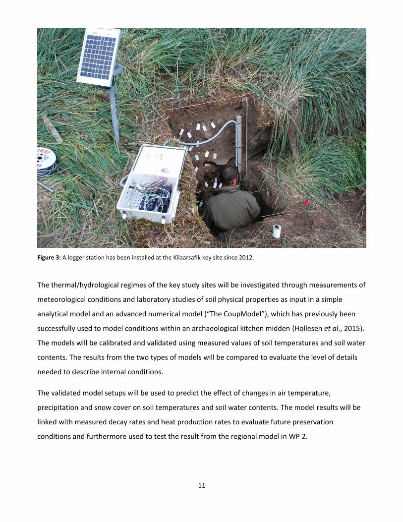
Figure 3: A logger station has been installed at the Kilaarsafik key site since 2012.
The thermal/hydrological regimes of the key study sites will be investigated through measurements of
meteorological conditions and laboratory studies of soil physical properties as input in a simple
analytical model and an advanced numerical model (“The CoupModel”), which has previously been
successfully used to model conditions within an archaeological kitchen midden (Hollesen et al., 2015).
The models will be calibrated and validated using measured values of soil temperatures and soil water
contents. The results from the two types of models will be compared to evaluate the level of details
needed to describe internal conditions.
The validated model setups will be used to predict the effect of changes in air temperature,
precipitation and snow cover on soil temperatures and soil water contents. The model results will be
linked with measured decay rates and heat production rates to evaluate future preservation
conditions and furthermore used to test the result from the regional model in WP 2.
12
Task 1.4 Assessing the deterioration of organic archaeological remains
The low temperatures and high soil water contents found in Greenland have provided unique
conditions for organic materials such as wood, bone, textile, skin and plant remains to be preserved
for millennia. However, the current increase in air temperatures cause longer periods of ground
thawing and altered precipitation patterns, which may result in drying of near-surface layers and
increasing oxygen availability. Both factors could accelerate the deterioration of buried organic
materials (Hollesen et al., 2012). In addition, a higher frequency of freeze-thaw cycles could
potentially lead to a relatively fast physical degradation of organic artefacts. The absence of specific
lignin-degrading fungus (white rot and brown rot) have until now helped the preservation of wood at
the permafrozen Qajaa key site (Matthiesen et al., 2013) and in other cold regions (Blanchette et al.,
2010). If these microorganisms spread throughout Greenland in a future warmer climate they may
cause a substantial decay to preserved wood. This task aims to advance our basic understanding of
how changes in soil temperature and water content influence the decay of archaeological soil, wood
and bone from the key sites. This will be achieved through the following steps:
Decay of the soil bulk material and archaeological wood and bone will be investigated through a
combination of laboratory experiments and in-situ experiments. The current state of preservation of
the material and presence/absence of different types of wood degrading fungi will be evaluated
through microscopy studies and density measurements (Jans, 2005; Gregory & Jensen, 2006),
Material specific decay rates will be investigated by measuring CO2 production and O2 consumption at
different temperatures and water contents, based on the assumption that the decay of organic
material in the presence of oxygen produce CO2.
Material specific heat production rates will be measured using microcalorimetry at different
temperatures and water contents. These data are a proxy for decay and will give new insight to the
effect of heat production as a positive feedback mechanism for soil thaw.
Samples of modern wood and fresh bone were buried at the study sites of Kangeq and Kilarsaarfik
during the pilot project in 2012. The samples were buried at different depths and in areas of different
solar exposure (North/South) and soil temperature and water content has been monitored since.
These samples will be collected and their state of preservation will be investigated in order to
document decay patterns. The observed In-situ decay will be compared to results from the laboratory
and provide information on how site-specific micro climate and regional climatic differences between

13
sites affect preservation conditions. Furthermore the collected bones will be used to investigate the
temperature-dependent breakdown of DNA using a thermoblock in the range from -5 to +25˚C.
Work package 2: Regional risk assessment and development of guidelines
Introduction
Assessments of threats to archaeological sites in the Nuuk region will be made using a desk-based
environmental model that analyses existing digital data-sets in a dynamic GIS environment (ArcGIS
10.3). The GIS model include the sensitivity for coastal erosion, fluvial erosion, periglacial processes,
changes in vegetation, soil temperatures and soil moisture content (Westley et al., 2011; Sharples,
2006; Kroon et al., 2010). The GIS model will be linked with an updated version of the Heritage
Database at NKA to locate vulnerable hotspots and to make risk assessments, which will be used as a
tool to prioritize future surveys and excavations. The impact of threats will be quantified and the likely
degree, pattern and rates at which climate change may impact particular areas/sites estimated.
Assessments will be made for current conditions and a selection of future climate scenarios according
to HIRHAM and data from DMI (2013-2100). The results will be tested/validated using the collected
data from the key sites and the detailed process modelling in WP 1 (task 1.3). The REMAINS concept
of studying sites located along an East-West transect secure a robust validation process because sites
located within very contrasting environments will be included (ex. from no to sporadic permafrost or
from sparse vegetation to meter high willow).
Main objectives
To develop a regional GIS model for assessing the vulnerability of archaeological sites in the
Nuuk region under current and future climatic conditions.
To update the Heritage Database at NKA with the information collected during REMAINS and
link it within the GIS model.
Work package tasks

14
Task 2.1 Management of input data
The management of input data is especially focused on obtaining and organizing existing data sets.
Base maps
The regional assessment model covering the Nuuk area will be based on existing quality digital maps
for Greenland which are available from CENPERM. These maps are subject to scale-limitations
(1:25000), which limits the resolution at which areas potentially vulnerable to climate change can be
identified. Therefore, when necessary, high resolution satellite images (Quick Bird/ WorldView2
satellite /GeoEye-1), orthophotos and existing Digital Terrain Models will be used to improve the
spatial and temporal resolution. This will be done using a combination of new images and images
that are already available to the project from CENPERM.
Coastal erosion and future sea level rise
The vulnerability of shorelines to coastal erosion will be classified in two ways. The coastal types and
their sedimentary features are identified and classified on the base maps (Kroon et al., 2010). The
intensity of coastal processes, especially the potential impact of wave energy on different parts of the
shore will be evaluated by investigating the fetch of waves on open water. Sea ice plays an important
part in this relation as sea ice prevents the waves from building up. Therefore, predictions of current
and future sea ice cover from the databases of DMI and NOAA will be included. The current sea-ice
cover and its seasonal and yearly variability will be derived from existing sea-ice observations at DMI
(CENPERM/DMI). Predictions of the sea level rise (SLR) in Greenland are made by DMI and are
available through CENPERM. These predictions will be adjusted with predictions of isostatic
uplift/subsidence from DTU-Space (Khan et al., 2010). This is necessary because parts of Greenland
are undergoing large glacio-isostatic adjustments. The adjusted predictions will be mapped by
flooding a digital elevation model (DEM). This is an upward adjustment of the zero contours with the
predicted values of SLR. The comparison of the pre- and post-flooding shorelines indicates the
potential amount of coastal retreat. The rate of inundation is dependent on many factors like the
intensity and duration of the flooding and the local topography. Low-sloping relatively small areas will
be more easily flooded than steeper areas, and topographic slope angles will be used to modify
predictions of coastal retreat.
15
Fluvial and periglacial processes
The impact of small creeks and rivers on archaeological sites can be positive or negative. An increase
of melt-water run-off from the glaciers due to warming could increase sediment transport through
the rivers to the coastal areas and have a protective impact on the stability of sites. Conversely, local
fluvial adjustments, like lobe- or channel-shifting in the lower parts of streams on deltas or alluvial
fans might locally erode sites (e.g. Kroon et al., 2011). The fluvial systems and their impact will be
included in the assessments by localizing potential local sources of sediments (mouth of rivers and
creeks) on the base maps. Periglacial processes alter the landscape in Western Greenland and may
have an impact on the archaeological sites. Slow processes like solifluction may modify the
stratigraphy of cultural layers and in some cases form lobes that ultimately cover sites. Faster
processes like permafrost thaw can destabilize sedimentary cliffs and increase the erosion rates.
Areas prone to solifluction (slopes) as well as sedimentary cliffs will be identified on the base maps in
order to predict the vulnerability of the landscape to periglacial erosion processes.
Changes in the soil environment
The climatic data used in the GIS model is output data from the regional climate model (RCM)
HIRHAM5 which is available to the project through CENPERMs cooperation with DMI. HIRHAM5
provides temperature and precipitation data in a ground resolution of 5x5 km for five 10-year periods
(1990-1999, 2046-2055, 2056-2065, 2080-2089 & 2090-99). The climatic data for each 25 km2 grid cell
will be adjusted according to the topography (lapse rate adjustments) and then used as input in the
numerical model CryoGRID 1.0 to predict soil temperatures for the whole region at 30x30 m ground
resolution (Gisnås et al., 2013). The definition of soil types in the regional assessment will be based on
soil and geological maps and the soil moisture levels will be classified according to vegetation types
and terrain analyses. Normalized Difference Vegetation Index (NDVI) (Rouse et al., 1974) will be used
to estimate the current surface greenness and soil moisture content based on a relationship between
NDVI and phytomass (Raynolds et al., 2012). The future vegetation measured as biomass will be
estimated from a relationship between the mean July temperature (MJT) and time integrated NDVI
(Raynolds et al., 2006; Westergaard-Nielsen et al., 2015). In figure 4 an example is given of how this
method has been used to estimate the current phytomass in the Nuuk area.

16
Figure 4: Downscaled satellite-based estimate of phytomass in the Nuuk area, 2014 (provided by Westergaard-Nielsen)
Task 2.2 Regional assessment of threats to preservation conditions
The data gathered in task 4.1 will be used to assess and map current and future erosion rates,
changes in biomass and vegetation composition, soil temperatures and soil moisture contents. The
spatial trends of current conditions will be validated using the regional and site specific data collected
in WP 1 and the predictions of future conditions will be tested using the detailed model results from
WP 1 (task 1.3). The results will be linked with the degradation studies task 1.4 in order to evaluate
how the predicted environmental changes may affect the preservation of the archaeological
materials/sites. The final result will be regional maps where the most vulnerable locations will be
marked as hot-spots.
Task 2.3 Linking the GIS model with an updated version of the Heritage Database at NKA
The existing Heritage Database at NKA includes 6500 sites. The database will be updated to allow the
site specific data from the preservation protocol (WP 1) to be implemented. The database will be
linked with the assessments of threats from task 2.2 in a GIS environment to make regional risk
assessments and evaluate/categorize the vulnerability of all the registered archaeological sites. This,
combined with the available information on archaeological and historical significance, will help The
17
Greenland National Museum to prioritize future surveys, monitoring programs and excavations based
upon possible environmental threats due to climatic changes.
Task 2.4 Development of guidelines for future monitoring and management of archaeological sites
Monitoring and managing archaeological sites in Greenland is difficult due to the large distances,
expensive logistics, and a short field season. This must be taken into account when developing
guidelines for monitoring and management. Based on the developed standard protocol (WP 1) and
the experience obtained during REMAINS a generica guideline will be produced that can be used by
archaeologists and locals for characterising the state of preservation and possible threats to
archaeological sites. Furthermore, this guideline will be used in future archaeological surveys in
Greenland, and the results will be incorporated in the existing database on cultural heritage sites at
NKA.
The Greenland National Museum does not have funding and capacity to excavate or protect all sites
that are threatened by climate change. Nevertheless, if the regional risk assessment or site specific
monitoring shows that a site is under active degradation, it is necessary to have procedures that can
be implemented to ensure its optimal management. A standardized procedure will be developed to
prioritize rescue excavations and externally funded research excavation projects in Greenland. Active
mitigation and protection of sites threatened by natural changes will only seldom be possible and is
beyond the scope of the current REMAINS application.

18
REMAINS associated persons
NM – The National Museum of Denmark
Jørgen Hollesen, PhD and senior researcher and 20% associated to Center for permafrost (CENPERM).
His expertise is in geochemistry, permafrost processes and environmental impact modelling and he
has experience from research projects in Svalbard and Greenland.
Henning Matthiesen, PhD and senior researcher, has fourteen years working experience with in-situ
preservation of archaeological remains in different environments.
David Gregory, PhD, Research Professor, 23 years work experience with degradation of archaeological
materials and in situ preservation of archaeological sites in land and marine environments.
Nanna Bjerregaard Pedersen, PhD and postdoc/conservator has research expertise within wood
science, microbiological decay processes, and micro-spectroscopic and dendrochronological
measurements. Her main focus is micro-chemical and ultrastructural material characterisation of
archaeological wood. In July 2015 Nanna will start a two year Post Doc funded by Carlsbergfondet
studying wood degrading fungi in Greenland. Her project will be closely linked to REMAINS.
NM/ Centre for Geogenetics, University of Copenhagen
Anne Marie Eriksen, PhD student and has an MSc in Conservation Science and Restoration. She has
worked with waterlogged organic material and bio-deterioration and degradation of marine cultural
heritage. She has also worked with genetics and DNA analyses in different aspects of conservation
research. In June 2015 Anne Marie will start her PhD (funded by Danish Council For Independent
Research) studying the degradation of archaeological bones (including samples from Greenland).
Centre for Geogenetics, University of Copenhagen
Morten Allentoft, PhD and Associate Professor, specialises in ancient DNA research with the main
focus of uncovering past population histories. However, of direct relevance to the proposed project,

19
Morten also has extensive experience in estimating DNA decay rates based on fragmentation patterns
in ancient genomic data.
NKA - The Greenland National Museum and Archives
Bo Albrechtsen, Deputy director at NKA
Mikkel Myrup, BA in social and cultural science and curator at NKA, has ten years experience with GIS
handling of archaeological sites.
NB: NKA is currently seeking two new archaeologists (application deadline 15 may 2015). Both
archaeologists will be part of REMAINS.
CENPERM - Center for Permafrost Dynamics in Greenland, University of Copenhagen
Bo Elberling, PhD and Dr. Scient, Professor at Department of Geosciences and Natural Resource
Management, University of Copenhagen & director of CENPERM, Center for Permafrost, a center of
Excellence funded by The Danish National Research Foundation (2012-2018). His expertise is
environmental biogeochemistry in general with a special interest in permafrost-affected aspects.
Aart Kroon, PhD and associated professor at Department of Geosciences and Natural Resource
Management, University of Copenhagen & CENPERM. His expertise is coastal and fluvial
geomorphology and has Arctic experience since 2007.
Andreas Westergaard Nielsen, Post Doc at CENPERM, University of Copenhagen. His expertise is
mainly within near-field and satellite based remote sensing and GIS, and Arctic ecology/climatology.
He has five years of experience with fieldwork in Arctic terrestrial ecosystems.

20
CENPERM/ Department of Biology, University of Copenhagen
Merian Skouw Haugwitz, post doc at Center for Permafrost and Department of Biology, University of
Copenhagen. She is a Biologist working with soil fungal communities and their role in decomposition
of organic matter in temperate and arctic ecosystems.
Ilisimatusarfik, University of Greenland
Michael Nielsen. Graduate Student, social and cultural science, University of Greenland,
Ilisimatusarfik. Have 6 years of excavation and survey experience in North Atlantic Archaeology in
Iceland and South Greenland. Focus area, Norse Greenland Archaeology.

21
References
Arneborg, J. (2000) Greenland and Europe. In Fitzhugh, W.W. & Ward E.I. (edt.), Vikings. The North Atlantic Saga. Smithsonian Institution Press.
Berglund, J. (2000) The Farm beneath the sand. In Fitzhugh, W.W. & Ward E.I. (edt.), Vikings. The North Atlantic Saga. Smithsonian Institution Press.
Blanchette, R.A., Held, BW, Arenz, BA et al. (2010) An Antarctic hot spot for fungi at Shackleton’s historic hut on Cape Royds. Microbial Ecology, 60: 29-38.
Blankholm, H.P. (2009) Long-Term Research and Cultural Resource Management Strategies in Light of Climate Change and Human Impact, Arct. Anthropol. 46, 17-24. Child, A. M. (1995). Towards an understanding of the microbial decomposition of archaeological bone in the burial environment. Journal of Archaeological Science 22. p. 165-174.
Dawson, T. (2008) A Review of the Coastal Zone Assessment Surveys of Scotland, 1996-2007: Methods and collected data (unpublished report for Historic Scotland).
Elberling, B., Matthiesen, H., Jorgensen, C.J., Hansen, B.U., Gronnow, B., Meldgaard, M., Andreasen, C., Khan, S.A. (2011) Paleo-Eskimo kitchen midden preservation in permafrost under future climate conditions at Qajaa, West Greenland, Journal of Archaeological Science 38, 1331-1339.
Epstein, H. E., Raynolds, M.K., Walker, D.A., Bhatt, U.S., Tucker, C.J., Pinzon, J.E. (2012) Dynamics of aboveground phytomass of the circumpolar Arctic tundra during the past three decades, Environmental Research Letters 7.
English Heritage (2011) The National Heritage Protection Plan Action Plan 2011-15: English Heritage. Available at http://www.english-heritage.org.uk/professional/protection/national-heritage-protection-plan/plan/
Gisnås, K., Etzelmuller, B., Farbrot, H. et al (2013) CryoGRID 1.0: Permafrost Distribution in Norway estimated by a Spatial Numerical Model. Permafrost and Periglacial Processes, 24, 2-19.
Gregory, D. & Jensen, P. (2006) The importance of analysing waterlogged wooden artefacts and environmental conditions when considering their in situ preservation. Journal of Wetland Archaeology, 6, 65-81
Grønnow, B. (2012) The Backbone of the Saqqaq Culture: A Study of the Nonmaterial Dimensions of the Early Arctic Small Tool Tradition. Arctic Anthropology, 49 (2), 58–71.
Gulløv, H.C., Kapel H., Clemmesen, N.C. et al. (1983) Bopladsen Uummannaq, Nuuk Kommune fredningsnummer 64V1-II- 28, Rapport fra besigtigelsen, juli 1983, Kalaallit Nunaata Katersugaasivia.
Gulløv, H.C. (1997) From Middle Ages to Colonial Times. Archaeological and Ethnohistorical Studies of the Thule Culture in South West Greenland 1300-1800 AD. Meddelser om Grønland, Copenhagen
22
Hart Hansen, J.P., Meldgaard, J., Nordkvist, J. (1991) The Greenland Mumies. The Greenland National Museum, Nuuk and Christian Ejlers’ Forlag, Copenhagen.
Henry, G.H.R., Harper, K.A., Chen, W.J., Deslippe, J.R., Grant, R.F., Lafleur, P.M., Levesque, E., Siciliano, S.D., Simard, S.W. (2012) Effects of observed and experimental climate change on terrestrial ecosystems in northern Canada: results from the Canadian IPY program, Climatic Change 115, 207-234. Hollesen, J., Elberling, B., Jansson, P.E. (2011) Future active layer dynamics and carbon dioxide production from thawing permafrost layers in Northeast Greenland, Global Change Biology 17, 911-926. Hollesen, J., Jensen, J.B., Matthiesen, H., Elberling, B., Lange, H., Meldgaard, M. (2012) The Future Preservation of a Permanently Frozen Kitchen Midden in Western Greenland, Conservation and mgmt of arch. sites 14, 159-168. Hollesen, J., Buchwal, A., Rachlewicz, G., Hansen, B.U., Hansen, M.O., Stecher, O., Elberling, B. (2015) Winter warming as an important co-driver for Betula nana growth in western Greenland during the past century, Global Change Biology 21, 2410-2423.
Hollesen, J., Matthiesen, H., Moller, A.B., Elberling, B. (2015) Permafrost thawing in organic Arctic soils accelerated by ground heat production, Nature Clim. Change advance online publication.
IPCC, (2013). The Physical Science Basis, Cambridge Univ. Press.
IPHC (2014) Extended abstracts of the 2014 Icomos International Polar Heritage Committee Conference – The Future of Polar Heritage.
Jans, M. (2005). Histological characterisation of diagenetic alteration of archaeological bone. PhD vrije universiteit, Amsterdam.
Khan, S.A., Liu, L., Wahr, J. et al (2010) GPS measurements of crustal uplift near Jakobshavn Isbræ due to glacial ice mass loss. J. Geophys. Res. 115 B09405.
Kroon, A., Jakobsen, B.H., Pedersen, J.B.T. (2010) Coastal environments around Thule settlements in Northeast Greenland. Danish Journal of Geography 110 (2), 143-154.
Kroon, A., Pedersen, J.B.T., Sigsgaard, C. (2011) Morphodynamic evolution of two deltas in arctic environments, East coast of Greenland. The Proceedings of the Coastal Sediments 2011, World Scientific, Singapore: 2299-2310.
Matthiesen, H., Jensen, J.B., Gregory, D., Hollesen, J., Elberling, B. (2014) Degradation of Archaeological Wood Under Freezing and Thawing Conditions—Effects of Permafrost and Climate Change, Archaeometry, 56, 3, 479–495.
Mattsson, J., Flyen, A.C. & Nunez, M. (2010). Wood-decaying fungi in protected buildings and structures on Svalbard. Agarica 29:5-14.

23
McGovern, T.H., Amorosi, T., Perdikaris, S. et al (1996) Vertebrate Zooarchaeology of Kilaarsafik V51: Economic Change at a Chieftain’s Farm in West Greenland, Arctic Anthropology, vol.33, No.2, pp.94-121
Meldgaard, J. (1983) Qajaa, en køkkenmødding i dybfrost. Feltrapport fra arbejdsmarken i Grønland. Nationalmuseets Arbejdsmark, 83-86.
Knudsen, P, Toft, P. A; Koch Madsen, C et al. (2014) People of All Times Field Report
Rasmussen, M., Li, Y.R., Lindgreen, S. et al. (2010) Ancient human genome sequence of an extinct Palaeo-Eskimo. Nature, 463, 757-762.
Raynolds, M.K., Walker, D.A., Maier, H.A. (2006) NDVI patterns and phytornass distribution in the circumpolar Arctic. Remote Sensing of Environment, 102, 271-281.
Raynolds, M.K., Walker, D.A., Epstein, H.E. et al (2012) A new estimate of tundra-biome phytomass from trans-Arctic field data and AVHRR NDVI. Remote Sensing Letters, 3, 403-411.
Rouse, J.W. (1974) Monitoring the vernal advancement of retrogradation of natural vegetation. NASA/GSFC, Type III, Final Report, Greenbelt, MD, pp. 371.
Roussell, Aa. (1936) Kilaarsafik and the Neighbouring Farms, Meddelelser om Grønland bd.88, nr.2, pp.1-232.
Schaefer, K., Zhang, T.J., Bruhwiler, L., Barrett, A.P. (2011) Amount and timing of permafrost carbon release in response to climate warming, Tellus Series B-Chemical and Physical Meteorology 63, 165-180.
Sharples C. (2006) Indicative Mapping of Tasmanian Coastal Vulnerability to Climate Change and Sea-Level Rise: Explanatory Report (Second Edition), Department of Primary Industries and Water, Hobart, Tasmania, pp. i-iv, 1-173. ISBN 0-7246-6385-1.
Toft, P.A. (2011) Uummannaq – fedtstenen og menneskene. Tidsskriftet Grønland, 59. årgang, no 4 / December, p. 284-295
Toft, P.A. & Gulløv, H.C. (2011) Fedstensudnyttelse på Uummannaq, Nuuk-fjorden og rekognoscering efter norrøne lokaliteter I Kapisiliit-fjorden. SOAP 2007, del 1. Feltrapport 32, SILA.
Westergaard-Nielsen, A., Bjørnsson, A.B., Jepsen, M.R., Stendel, M., Hansen, B.U., Elberling*, B. (2015) Greenlandic sheep farming controlled by vegetation response today and at the end of the 21st century. Science of the Total Environment 512–513, 672–681.
Westley, K., Bell, T., Renouf, M.A.P. et al (2011) Impact assessment of current and future sea-level change on coastal archaeological resource – illustrated examples from Northern Newfoundland. Journal of Island and Coastal Archaeology, 6, 351-374
Østergaard, E. (2004) Woven into the Earth: Textile finds in Norse Greenland. Aarhus University Press.


![World of Greenland [deutch]](https://img.dokumen.tips/doc/110x75/5572107a497959fc0b8d3b05/world-of-greenland-deutch.jpg)


