Embed Size (px)
Citation preview

Reasons for Decision and Report of Environmental Assessment for the DeBeers Gahcho Kué Diamond Mine, Kennady Lake, NT
June 28, 2006
Mackenzie Valley Environmental Impact Review Board P.O. Box 938, Yellowknife, NT X1A 2N7 Phone: (867) 766-7050 Fax: (867) 766-7074 E-mail: [email protected] Web: www.mveirb.nt.ca Street Location: Suite 200 Scotia Centre,
5102 – 52nd Avenue, Yellowknife, NT. Cover from “The National Atlas of Canada”.
ii
iii

Executive summary
This is the Mackenzie Valley Environmental Impact Review Board’s (MVEIRB or Review Board) Report of Environmental Assessment and Reasons for Decision for the proposed DeBeers Gahcho Kué diamond mine at Kennady Lake, NT. The scope of the development includes construction, operation, and eventual closure of a mine and processing plant to extract diamonds from three open pits, as well as all support activities, including transportation of material, supplies, equipment and personnel to and from the mine site.
Review Board staff conducted a three day technical issues scoping workshop in Yellowknife, NT. Federal and territorial government agencies as well as aboriginal groups participated in the workshop, together with the developer. During the workshop participants identified and classified issues related to the environmental impacts of the proposed development, including impacts on the human environment. Following the workshop, participating organizations ranked and prioritized the issues and presented these findings to the Review Board in a technical issues scoping hearing.
Review Board staff conducted four one day community issues scoping workshops in Dettah, Lutsel K’e, Fort Resolution, and Behchoko. Participants identified issues and were given an opportunity to express their concerns with the proposed development. Community representatives presented workshop results to the Review Board during a community issues scoping hearing. The Review Board also accepted written evidence.
The Review Board analyzed all the evidence received and identified seven key lines of inquiry and thirteen subjects of note. The former represent the highest priority issues to be assessed, while the latter are less critical, but nonetheless stand out as important from the many issues raised. Both key lines of inquiry and subjects of note incorporate more than one of the individual issues raised during scoping and cut across categories commonly used in environmental impact assessment, e.g wildlife issues and cultural or economic issues. This reflects the nature of concerns voiced by community issues scoping workshop participants.
The Review Board gauged the level of public concern using three indicators: participation rates; criteria provided in the MVEIRB’s Environmental Impact Assessment Guidelines, and an analysis of impacts on the environment that form the basis of public concerns. The Review Board found that participation rates in the scoping workshops were high, with up to 14 % of the total population of a community participating. The Review Board further found that the proposed development fits at least five out of six EIA Guideline criteria to estimate levels of public concern, possibly even all six. The Review Board found that concerns expressed over the proposed development were consistent between communities and with issues raised during technical issues scoping. Finally, the Review Board found that adverse environmental change would likely result from this development. In the Review Board’s opinion these changes are at the root of the public concern expressed in the hearings.
Considering all three indicators, the Review Board formed the opinion that the proposed development is likely to cause significant public concern
iv

The Review Board considered potential impacts on the Gahcho Kué development on the environment and their significance, including those from malfunctions or cumulative impacts. These matters will be considered again in the Environmental Impact Review conducted on the basis of significant public concern.
v

Table of Contents 1 INTRODUCTION 1
2 SCOPE AND METHODS 2 2.1 ENVIRONMENT DESCRIPTION 2 2.1.1 AQUATIC ENVIRONMENT 2 2.1.2 WILDLIFE 3 2.1.3 CULTURAL AND HERITAGE RESOURCES 3 2.2 DEVELOPMENT SCOPE 4 2.2.1 OVERVIEW 4 2.2.2 MINING OPERATIONS 5 2.2.3 WATER MANAGEMENT 6 2.2.4 TRANSPORT AND SURFACE STRUCTURES 7 2.3 ASSESSMENT APPROACH 7 2.4 TECHNICAL INPUT 8 2.4.1 TECHNICAL ISSUES SCOPING WORKSHOP 8 2.4.2 TECHNICAL ISSUES SCOPING HEARING 9 2.5 COMMUNITY INPUT 9 2.5.1 COMMUNITY ISSUES SCOPING WORKSHOPS 9 2.5.2 COMMUNITY ISSUES SCOPING HEARING 10 2.6 APPROACH TO EVIDENCE ANALYSIS 11 2.6.1 ISSUES IDENTIFICATION AND PRIORITIZATION 11 2.6.2 PUBLIC CONCERN 11
3 EVIDENCE SUMMARY 13 3.1 TECHNICAL ISSUES SCOPING EVIDENCE 13 3.1.1 TECHNICAL ISSUES SCOPING WORKSHOP 13 3.1.2 TECHNICAL ISSUES SCOPING HEARING 20 3.1.3 WRITTEN EVIDENCE 23 3.2 COMMUNITY ISSUES SCOPING EVIDENCE 23 3.2.1 COMMUNITY ISSUES SCOPING WORKSHOPS 23 3.2.2 COMMUNITY ISSUES SCOPING HEARING 35
4 ANALYSIS 37 4.1 KEY LINES OF INQUIRY AND SUBJECTS OF NOTE 37 4.2 PUBLIC CONCERN 44 4.2.1 PUBLIC PARTICIPATION: 44 4.2.2 EIA GUIDELINE CRITERIA 44 4.2.3 EVIDENCE OF ENVIRONMENTAL EFFECTS 46 4.2.4 CONCLUSION 47 4.3 IMPACTS ON THE ENVIRONMENT 47 4.4 MVRMA SECTION 117(2) AND 128(4) CONSIDERATIONS 48 4.4.1 MVRMA SECTION 117(2) 48 4.4.2 MVRMA SECTION 128(4) 49
5 CONCLUSION 50
PUBLIC RECORD 51

List of Figures and Tables MAP 2-1: DEVELOPMENT LOCATION [4] ........................................................................................ 4
TABLE 2-1: DEVELOPMENT OVERVIEW.......................................................................................... 5
TABLE 2-2: COMMUNITY ISSUES SCOPING WORKSHOP LOCATIONS AND DATES ........................ 10
FIGURE 3-1: TECHNICAL ISSUES SCOPING – WILDLIFE ISSUES..................................................... 14
FIGURE 3-2: TECHNICAL ISSUES SCOPING – WATER ISSUES......................................................... 15
FIGURE 3-3: TECHNICAL ISSUES SCOPING – FISH ISSUES ............................................................. 16
FIGURE 3-4: TECHNICAL ISSUES SCOPING – OTHER ISSUES.......................................................... 17
FIGURE 3-5: TECHNICAL ISSUES SCOPING – REGIONAL/TERRITORIAL SOCIO-ECONOMIC ISSUES18
FIGURE 3-6: TECHNICAL ISSUES SCOPING – COMMUNITY WELLNESS ISSUES ............................. 19
TABLE 3-1: ADDITIONAL ISSUES .................................................................................................. 20
TABLE 3-2: COMMUNITY ISSUES SCOPING WORKSHOP PARTICIPATION ...................................... 24
FIGURE 3-7: COMMUNITY ISSUES SCOPING - DETTAH.................................................................. 27
FIGURE 3-8: COMMUNITY ISSUES SCOPING – LUTSEL K’E (BIO-PHYSICAL ISSUES) .................... 28
FIGURE 3-9: COMMUNITY ISSUES SCOPING – LUTSEL K’E (SOCIO-ECONOMIC ISSUES)............... 29
FIGURE 3-10: COMMUNITY ISSUES SCOPING – FORT RESOLUTION (WATER ISSUES)................... 30
FIGURE 3-11: COMMUNITY ISSUES SCOPING – FORT RESOLUTION (SOCIO-ECONOMIC ISSUES).. 31
FIGURE 3-12: COMMUNITY ISSUES SCOPING – FORT RESOLUTION (AIR, CLIMATE, RECLAMATION, OTHER) ....................................................................................................... 32
FIGURE 3-13: COMMUNITY ISSUES SCOPING – FORT RESOLUTION (WILDLIFE, LAND) ............... 33
FIGURE 3-14: COMMUNITY ISSUES SCOPING – BEHCHOKO .......................................................... 34
TABLE 3-3: ADDITIONAL COMMUNITY ISSUES............................................................................. 35
TABLE 4-1: KEY LINES OF INQUIRY.............................................................................................. 38
TABLE 4-2: SUBJECTS OF NOTE .................................................................................................... 40
FIGURE 4-1: INTERCONNECTEDNESS OF KEY LINES OF INQUIRY ................................................. 46
vii

1 Introduction This document is the Mackenzie Valley Environmental Impact Review Board’s (MVEIRB or Review Board) Report of Environmental Assessment and Reasons for Decision for the environmental assessment (EA) of the proposed DeBeers Gahcho Kué diamond mine at Kennady Lake. The report summarizes the proceedings of the EA and presents the Review Board’s conclusions. This Report of Environmental Assessment was prepared to fulfill the reporting requirements of the Mackenzie Valley Resource Management Act (MVRMA) sections 121 and 128.
DeBeers Canada Inc. applied to the Mackenzie Valley Land and Water Board (MVLWB) for a type A Land Use Permit (MV2005C0032) and a type A Water Licence (MV2005L2-0015) on November 24, 2005. The MVLWB deemed the applications complete on December 1, 2005 and subsequently notified the MVEIRB that it had started a preliminary screening. On December 22, 2005, Environment Canada referred this development to environmental assessment. In Environment Canada’s opinion the proposed development might have significant adverse impacts on the environment.
The MVEIRB initiated the EA and notified the developer on January 4, 2006. Subsequently the MVEIRB notified the distribution list established by the MVLWB for the preliminary screening and placed an announcement in the News/North regional newspaper. The Review Board issued a draft work plan on January 26, 2006 and a call for interested organizations to request party status the following day. On February 3, 2006, MVEIRB staff presented and explained the draft work plan to all interested parties. In the same meeting MVEIRB staff solicited verbal and written feedback on the draft work plan.
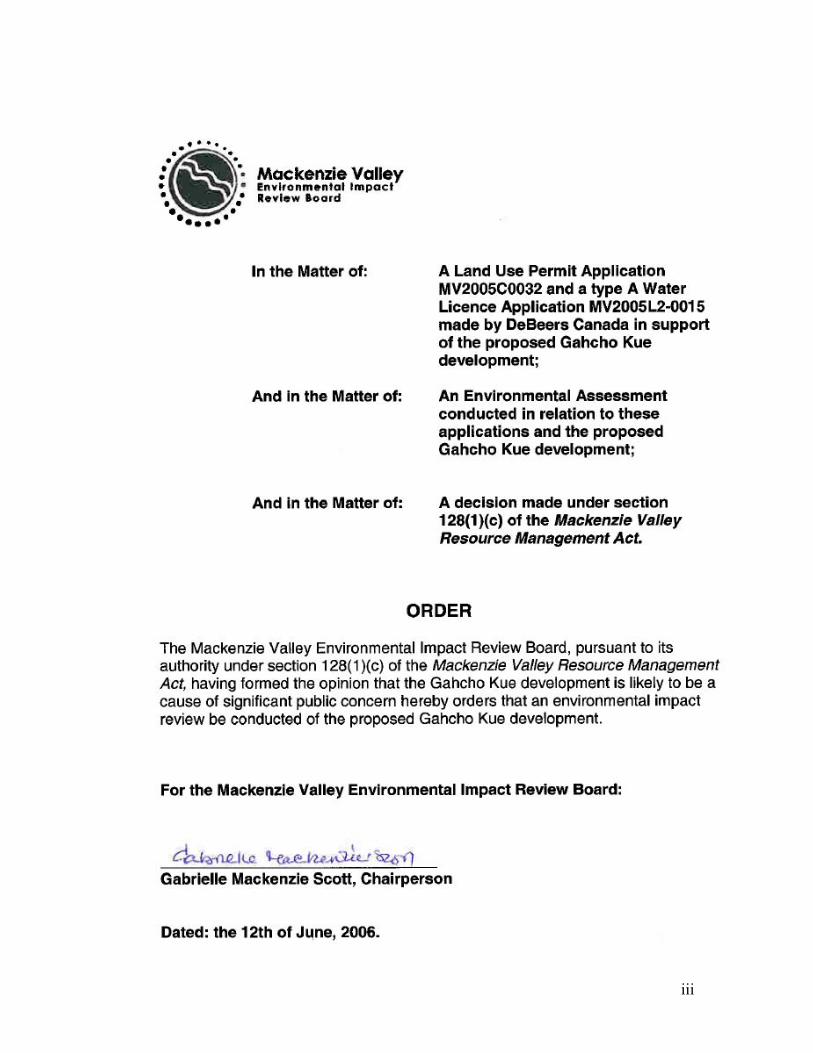
Following scoping workshops in Yellowknife, Dettah, Lutsel K’e, Fort Resolution, and Behchoko, as well as scoping hearings in Yellowknife during March and April of 2006, the Review Board determined that the proposed development is likely to be a cause of significant public concern. Consequently the Review Board ordered an environmental impact review (EIR) of the proposed Gahcho Kué project pursuant to MVRMA section 128(1)(c) on June 8, 2006.
Throughout this EA the Review Board was guided by the MVRMA and its own Rules of Procedure for Environmental Assessment and Environmental Impact Review Proceedings and Environmental Impact Assessment Guidelines. (All three documents can be accessed at the Review Board’s web site: http://www.mveirb.nt.ca/reference_lib/index.php.
Section 2 of the document defines the scope of the development and the environmental assessment. It also presents the methods used for this assessment. Section 3 summarizes the evidence heard by the Review Board. Section 4 presents the Review Board’s analysis and conclusions. Finally, section 5 provides a list of the documents on the public record of the EA proceeding. Numbers in brackets, e.g. [999] refer to the public registry number of a document being referenced.
1

2 Scope and Methods This section introduces the environmental setting and defines the scope of the proposed development as assessed. It also describes the methods used by the Review Board to collect and analyze information for the purpose of determining whether the proposed development is likely to cause significant adverse impacts on the environment or is likely to be a cause of significant public concern, as required by the MVRMA.
2.1 Environment Description The proposed Gahcho Kué development is situated at Kennady Lake, approximately three hundred kilometers northeast of Yellowknife and 140 km north of Lutsel K’e within the Slave Geological Province (see map 2-1). The information presented in this section is based on DeBeers’ Application Report [4].
The landscape is flat, with mainly bedrock, morainal, glaciofluvial and organic deposits present. Kennady Lake is situated within the Taiga Shield Ecozone in the High Subarctic Ecoclimactic region. Dominant vegetation types are heath tundra and peat bog. Gahcho Kué is located at the southern limit of continuous permafrost, 20 km north of the treeline. Permafrost extends over 90% to 95% of the on-land project area, causing processes such as piping, boiling, heaving of the active layer, thermokarst and thermo-erosion and pingo development. The mean annual temperature is approximately -9.6°C.
2.1.1 Aquatic Environment Near-surface groundwater flow in the project area is seasonal and restricted to the active layer. Shallow groundwater flows are isolated from deeper subpermafrost flows by the permafrost layer. There is limited interaction between shallow groundwater and subpermafrost groundwater within fully penetrating taliks, which are proximal to lakes. Shallow groundwater flows follow natural landscape contours and the subpermafrost groundwater flows in a generally easterly direction with some minor southeasterly and northeasterly flows.
Kennady Lake discharges to the north by a series of small lakes into Kirk Lake, and then into Aylmer Lake. Aylmer Lake drains into the northeastern arm of Great Slave Lake. Kennady Lake has long periods of ice cover (7 to 8 months per year) and a short-term open water period (4 to 5 months) occurring normally from early June to October.
The shoreline of Kennady Lake is characterized by a shallow gradient with boulder and cobble substrates, which experiences ice-scouring each winter. Kennady Lake, along with other smaller lakes in the immediate area, has been identified as having a low to moderate sensitivity to acidification, although most lakes in this watershed have a high sensitivity to acidification as is typical in the Canadian Shield and subarctic ecosystems. Metal concentrations are relatively low, with the most common metals exceeding Canadian Council of Ministers of the Environment guidelines being aluminum, copper and iron.
2

Kennady Lake is generally mixed throughout the open-water season, and only stratifies in its deepest basin during the summer. Oxygen depletion in winter months is not a significant factor in Kennady Lake. Kennady Lake has plankton and algal communities characteristic of northern tundra lakes at this latitude. Ten fish species inhabit Kennady Lake with the most abundant species being round whitefish, lake trout, lake chub, Arctic grayling, northern pike, and burbot. Common forage fish found in littoral areas and in streams are ninespine stickleback and slimy sculpin. Peamouth chub and longnose sucker have been captured incidentally in Kennady Lake. In spring, Arctic grayling and northern pike make extensive upstream and downstream spawning migrations into Kennady tributaries.
2.1.2 Wildlife The project is located within the range of the Bathurst caribou herd. Caribou migrate through the area during the spring and fall, usually traveling on frozen rivers and lakes, including Kennady Lake. Caribou tend to arrive in the Gahcho Kué area in late April and early May. A network of caribou trails indicates the narrows along the southeast arm of Kennady Lake are important water crossings. Calving grounds for caribou herds are located to the northeast of Kennady Lake..
Wolves occur seasonally in the project area from March through October; their presence correlates to seasonal caribou migration. Wolves north of the treeline prey almost exclusively on caribou and follow the migrating herds. Wolves are also known to den near Gahcho Kué and the project area has been identified as key denning location. Like wolves, the number and distribution of wolverines is influenced by the presence of the migratory caribou herds. Other carnivores present in the area include grizzly bears, Arctic fox, and red fox. All species den in the area and in the case of foxes, den site fidelity is high.
Other wildlife species in the project area include muskoxen, moose, porcupine, Arctic ground squirrels and tree squirrels, northern red-backed voles, lemmings, Arctic hare, and weasels. Passerines, shorebirds, raptors, and waterfowl bird species are all present in the project area in varying densities.
2.1.3 Cultural and Heritage Resources There are several key cultural sites that are in close proximity or may be directly affected by the Gahcho Kué project. The Mowhi Trail, the Waters of Desnedhe Che, Lake of the Enemy, Artillery Lake and Our Lady of the Falls have all been identified as culturally significant sites. The land in the region is extensively used by local peoples for traditional activities. A national park (East Arm National Park) is proposed approximately 100 km south of Kennady Lake.
3

Map 2-1: Development Location [4]
2.2 Development Scope
2.2.1 Overview This section briefly summarizes the development components. It is not intended as a detailed or complete development description. The information presented in this section is based on DeBeers’ Application Report [4], which should be referred to for a more detailed description. The scope of the development at Gahcho Kué includes the principal development and any activities or structures associated with the principal development. Table 2-1 provides a brief overview of the development components.
4

Phase Components/Activities
Construction of mine facilities and associated works; Construction
Construction of dikes for dewatering of lake and diversion structures to lessen inflows to the watershed;
Removal of waste rock, kimberlite and mine water from the open pits, including the use of explosives;
Processing of ore to extract diamonds;
Storage and handling of processed kimberlite;
Storage and handling of waste rock;
Mining Operations
Removal of diamonds from mine site;
Dewatering of Kennady Lake;
Handling of mine water;
Surface water management;
Removal of water from Kennady Lake for use at the mine site, both by mining personnel and for mining operations, including dust control;
Water Management
Water treatment and sewage disposal;
Use of the current Tibbitt-Contwoyto winter road;
Construction of an access road from Tibbitt-Contwoyto winter road to project site;
Construction/Upgrading of airstrip and air transport activities;
Solid waste management and containment areas;
Transport and Surface Structures
Surface structures, including power plant, sewage and water treatment plants, camp facilities, roads, and ore processing plant;
Closure and Reclamation
Closure and reclamation of the mine site.
Table 2-1: Development Overview
2.2.2 Mining Operations The Gahcho Kué project will have an estimated life span of 15 years. During the first phase of this development, the developer will install dikes at natural inflows to Kennady Lake to lower the lake water level. Over the lifespan of the project, the lake will be drawn down to 20% of its original volume. As the water is drained, kimberlite pipes on the lake
5

bed will be exposed and mined. Floating pump barges will accelerate the draining process and, during later project years, berms and ditches will divert flows the water levels in the surrounding watershed to lessen inflows to the project area.
The Gahcho Kué project will exploit three kimberlite pipes, namely the Tuzo, Hearne and 5034 pipes, for a total estimated resource of 30 million tons. The pipes will be excavated in the following order, 5034, Hearne and finally, Tuzo. As the pipes are mined, waste rock and processed kimberlite slurry from the Hearne and 5034 pipes will be used to backfill the Tuzo and Hearne pipes. This backfilling is designed to reduce the amount of waste rock left in on-land storage facilities at the end of mine life and to assist in the refilling of Kennady Lake post-closure.
An on-site processing plant will crush, size and refine kimberlite ore to extract rough diamonds. These diamonds will be transported to the Yellowknife diamond sorting and valuation facility where they will be added to the product from Snap Lake for sale to clients. The processing plant will produce both coarse and fine processed kimberlite. Ferrosilicon powder and flocculants will be used as additives in the ore processing; both substances are environmentally benign. Processed kimberlite (PK) not used in backfilling will be stored in one of two on-land processed kimberlite containment (PKC) facilities. Waste rock will be used to seal in the processed kimberlite. At the end of mine life, the waste rock pile and PKC facilities will be the most noticeable remainders of mining operations.
2.2.3 Water Management Water that comes into contact with the project will be treated and reused when possible. Exceptions to this will occur with runoff from roads and the airstrip, plant site area, waste rock piles and undisturbed areas. This water will be routed to the northern portion of Kennady Lake, which will not be drained.
Water will come into contact with the project through mine water inflows, freshwater intake (from Lake A1) for domestic potable water use, water used in the processing plant and precipitation from rainfall and snow. For the first half of the project life, mine water inflows will be pumped to the PKC storage facilities to replace water being reclaimed for process plant operations. When the PKC facilities are closed and PK is being used to backfill the exhausted pits, mine water inflows will be removed from the active pits and pumped to the backfilled pits to replace, thus rewatering the mined out pits.
Other key facilities include a water treatment plant, water management pond and sewage treatment plant. The sewage treatment plant will dewater sewage sludge and then treat the effluent and incinerate the solid material. This treated effluent will be discharged to Kennady Lake during the construction phase and directed to the processing plant during normal operations.
6

2.2.4 Transport and Surface Structures Gahcho Kué will make use of the Tibbitt-Contwoyto winter road, currently operated by the Joint Venture Partners who operate the Ekati, Diavik and Lupin mines. At Km 271 of this road, a winter access road extending 120 km to Gahcho Kué will be constructed in a manner that conforms to the terms of the operating license of the Tibbitt-Contwoyto road. Additional transportation structures will include the construction of a 45 m wide x 1620 m long airstrip at the mine site.
When possible, solid waste will be trucked to Yellowknife for recycling at the Yellowknife Solid Waste site. Materials not burnable on site will be transported to Yellowknife for incineration. Waste oil, glycol and batteries will be trucked out of the NWT for recycling. Toxic materials will be sealed in drums and transported to Yellowknife for incineration or recycling.
In addition to direct mining operations, the following key structures will be built at the Gahcho Kué site: power plant, warehouse/workshop complex, administration complex and camp/accommodations.
2.3 Assessment Approach The work plan for this EA, issued February 22, 2006, divided the assessment into the five phases:
1. The Start-up phase, which set the administrative structure;
2. The Scoping phase, which identified and prioritized key issues for the environmental assessment;
3. The Analytical phase, including the Developer’s Assessment Report and impact analysis in technical meetings, information requests and technical reports;
4. The Hearing phase, which allowed the Board further opportunity to hear evidence;
5. The Decision phase, including the Board’s decision and reporting.
The work plan focused on the first two of these phases as the Review Board’s intention was to use rigorous scoping to shape the remaining phases. In the scoping phase the Review Board sought to achieve:
• identification and prioritization of issues, with a view to establishing key lines of inquiry; and
• an evaluation of the level of public concern about the proposed development.
Similar to the approach taken in the environmental assessment of the Mackenzie Gas Project (EA03-007), the Review Board indicated in its work plan that if it were to find that the project is likely to be cause of significant public concern it would order an Environmental Impact Review (EIR) pursuant to MVRMA section 128(1)(c) without concluding all planned phases of the EA, subject to having received sufficient evidence to satisfy the MVRMA’s requirement for an EA, namely the factors listed in s. 117(2). The MVRMA does not prescribe process steps or components of an EA. To ensure the
7
scoping phase addressed both the level of public concern and the requirements of MVRMA section 117(2), the Review Board conducted separate technical issues scoping and community issues scoping processes.
The Review Board found evidence of significant public concern, as well as sufficient evidence to satisfy section 117(2) of the MVRMA. As a result, the Review Board decided that the EA should not enter phases three and four of the work plan and proceeded directly to the decision phase, concluding with an order for an EIR and the issuance of this Report of Environmental Assessment.
The remainder of this section explains how the technical and the community issues scoping processes were conducted and how the evidence collected was analyzed to reach the Review Board’s conclusions.
2.4 Technical Input Technical issues scoping involved a workshop, a hearing, and the submission of written evidence by parties.
2.4.1 Technical Issues Scoping Workshop Review Board staff facilitated a technical issues scoping workshop March 21-23, 2006 in Yellowknife with over 50 participants from various government agencies and aboriginal organizations, including:
• Department of Fisheries and Oceans (DFO),
• Indian and Northern Affairs Canada (INAC),
• Government of the Northwest Territories (GNWT) representing multiple departments including Environment and Natural Resources, Health and Social Services, Municipal and Community Affairs,
• Environment Canada,
• Yellowknives Dene First Nation (YKDFN),
• Lutsel K’e First Nation (LKFN),
• North Slave Metis Alliance (NSMA),
• Deninu Kué First Nation (DFFN),
• Northwest Territory Metis Nation (NWTMN), and
• DeBeers Canada Inc. (DeBeers) as the developer.
On the first day the developer presented a detailed description of the development, as well as its view of the main issues. Participants were then divided into six groups to identify technical issues, each with a MVEIRB staff as facilitator. Participants were encouraged to move between groups. The discussion continued in the morning of the second day. Next, participants were asked to sort the issues and edit them so all issues
8

were at a comparable level of detail. Issues were recorded and posted for all participants to see. Staff then transcribed the index cards into issues diagrams (see section 3). On day three, the groups reconvened to verify and, if necessary, edit the issues diagrams. Once again participants were encouraged to move between groups.
Following the workshop participating agencies (parties) were asked to identify their top 20 issues and prioritize them using a points system. The results of this prioritizing exercise were to be presented to the Review Board at the technical issues scoping hearing on April 10, 2006.
Several parties, including the GNWT and Deninu Kué also submitted additional written evidence.
2.4.2 Technical Issues Scoping Hearing On April 10, 2006, the Review Board heard presentations in Yellowknife from all parties that had participated in the technical issues scoping workshop. While the technical issues scoping workshop was designed to identify issues and initiate their prioritization, the actual prioritizing was done by each party individually, according to their own mandate, needs, views, and processes. The technical issues scoping hearing provided an opportunity for the Review Board members to directly hear evidence to help decide on which issues the proceeding should focus on.
With the exception of INAC, parties chose not to employ the method for prioritizing provided to them at the scoping workshop but devised their own. Consequently, no direct comparison between the priorities of various parties could be made. Nonetheless, all parties presented to the Review Board a number of key issues on which the proceeding should focus, without necessarily ignoring other issues completely. In addition to their oral presentation to the Review Board, parties were asked to submit written summaries for the public record. Audio tapes of the hearing were also placed on the public record. Transcription services, however, were not provided.
2.5 Community Input Community issues scoping consisted of one day workshops in the communities of Dettah, Lutsel K’e, Fort Resolution, and Behchoko, followed by a community issues scoping hearing in Yellowknife.
2.5.1 Community Issues Scoping Workshops Rather than a three day workshop at a central location, MVEIRB staff conducted separate one day workshops in four communities to allow broader participation. The purpose of the workshops was to identify issues and to obtain a sense of their importance. Instead of the rigorous prioritizing exercise employed for technical issues scoping, community issues scoping relied more on individuals expressing their views about how the Review Board should divide its attention during the proceeding. Community representatives
9

were then invited to present the workshop results to the Review Board at a community issues scoping hearing.
All workshops followed roughly the same outline, starting with an opening prayer and a short presentation by MVEIRB staff explaining the purpose of the workshop. Community members were told that the workshop’s main function was to help prepare community representatives for the community issues scoping hearing by identifying issues and determining which of those require the most attention. Also, community members were told that one purpose of the scoping process was to gauge the level of public concern.
Following the MVEIRB presentation, DeBeers provided an overview of the proposed development, including a video presentation in the appropriate local aboriginal language. The remainder of the workshop consisted mainly of community members expressing their views about the potential impacts of the proposed development. Community members also offered their observations on impacts from existing diamond mines in the area and the discrepancy between previous impact predictions and their observations. Additionally, community members used the opportunity to ask the developer as well as MVEIRB staff about the development and the assessment process.
As in the technical issues scoping workshop, issues were recorded and posted for all participants to see. MVEIRB staff transcribed the results immediately following the workshop and provided them to community representatives.
Representatives from INAC, DFO, EC, and GNWT participated in most workshops as observers and as resource persons, in case questions relevant to their mandate and jurisdiction were asked. Simultaneous translation between English and the appropriate aboriginal language was provided at all community issues scoping workshops. All workshops were scheduled from 1:30 p.m. to 5 p.m. and 6:30 p.m. onwards, as required. The following table presents the locations and dates for all four workshops.
Location Date
Dettah April 11, 2006
Lutsel K’e April 19, 2006
Fort Resolution April 24, 2006
Behchoko April 25, 2006
Table 2-2: Community issues scoping Workshop Locations and Dates
2.5.2 Community Issues Scoping Hearing Similar to the technical issues scoping, the Review Board held a community issues scoping hearing April 28, 2006 in Yellowknife. This hearing provided an opportunity for community workshop participants to present the most important highlights of their workshop directly to the Review Board. The Review Board assisted up to three
10

representatives from each community with travel costs. The Review Board heard presentations from the following delegations:
• Yellowknives Dene First Nation
• Deninu Kué First Nation
• Lutsel K’e First Nation
• North Slave Metis Alliance
• NWT Metis Nation
• Fort Resolution Metis Council
Simultaneous translations between English, Chipewyan, and Dogrib were provided. Audio recordings of the hearing were placed on the public record.
2.6 Approach to Evidence Analysis
2.6.1 Issues Identification and Prioritization The primary goal of the issues scoping process was to focus the EA and to narrow the scope to the most relevant issues. During the scoping exercise parties, provided MVEIRB with ‘priorities’ or ‘rankings’ but also insisted that no issues be taken off the table at this stage in the EA. Most parties did not use the method for prioritizing issues that was given to them during the technical scoping workshop but devised their own. The community workshops, and the prioritizing process that followed, differed from the technical workshop and its prioritizing effort. These differences made a direct comparison of priorities impossible. The Board, therefore, based all its determinations on a separate analysis of both.
Using the presentations given at the technical and community issues scoping hearings, written submissions, and notes from post hearing de-briefs, the Review Board established seven “key lines of inquiry” and thirteen “subjects of note”. Key lines of inquiry are the areas of the greatest concern that in the Review Board’s opinion require the most attention. They may be described as top priorities. Subjects of note are additional areas that stand out from the long list of issues and will require serious consideration. Any issues that do not fit in either of the two categories were tracked as “other issues”. The terms key lines of inquiry, subjects of note, and other issues were chosen to reflect the emphasis put on them in the assessment, without implying that one is considered generally more important than the other.
2.6.2 Public Concern To gauge the level of public concern the Review Board used three different indicators:
• Participation rates and efforts by participants to attend workshops and hearings.
11

• Criteria set out in the Review Board’s Environmental Impact Assessment Guidelines and in its Reference Bulletin on Operational Interpretation of Key Terminology in Part Five of the MVRMA.
• Evidence of adverse impacts on the environment that form the basis of expressed public concern.
These three indicators are consistent with past practice by the Review Board. The Review Board is unaware of any specific authorities on the measurement of public concern, outside the Review Board’s own guidelines and reference bulletin. Using the above listed indicators, the Review Board analyzed the public record and the hearing presentations and made its determination.
12

3 Evidence Summary
3.1 Technical Issues Scoping Evidence
3.1.1 Technical Issues Scoping Workshop Using the process outlined in section 2.4.1 the participants in the technical issues scoping workshop identified and classified issues into six broad categories, provided by MVEIRB based on experience with previous assessment proceedings. These are:
• wildlife issues;
• water issues;
• fish (and fish habitat) issues;
• other bio-physical issues (including air quality, permafrost, etc);
• regional/territorial socio-economic issues; and
• community wellness issues.
Issues diagrams
Figures 3-1 through 3-6 present the workshop results in the form of issues diagrams. These issues diagrams are essentially a transcription of the index cards as they were arranged on the wall during the workshop. The issues diagrams present the complete set of issues as identified and grouped during the workshop without any prioritization or ranking. The GNWT and Natural Resources Canada (NRCan) submitted additional information following the workshop, which is outlined in table 3-1.
13

Figure 3-1: Technical issues scoping – Wildlife Issues
14

Figure 3-2: Technical issues scoping – Water Issues
15

Figure 3-3: Technical issues scoping – Fish Issues
16

Figure 3-4: Technical issues scoping – Other Issues
17

Figure 3-5: Technical issues scoping – Regional/Territorial Socio-Economic Issues
18

Figure 3-6: Technical issues scoping – Community Wellness Issues
19

Title Organization
Dispersion modeling to assess air emissions GNWT Cumulative effects from other emission sources GNWT Increased air emissions for the NWT GNWT Handling of hydrocarbon contaminated materials GNWT Spill contingency planning for major spills GNWT Handling and disposal of hazardous materials GNWT Waste management and the resulting mine footprint GNWT Mine closure options GNWT Absence of volunteer personnel GNWT Cumulative impacts on site to individuals GNWT Cumulative impacts regionally acting on populations GNWT Impacts on the health and social well being of individuals, families and communities.
GNWT
Impacts on the demand for health and social services GNWT Sustainable Employment and Training. GNWT Employment and Training Opportunities for Women GNWT Sustainable Training GNWT Use and storage of explosives NRCan
Table 3-1: Additional Issues
3.1.2 Technical Issues Scoping Hearing This section provides a brief summary of the presentations made to the Review Board at the technical issues scoping hearing April 10, 2006. For complete coverage of the issues presented to the Review Board see the respective entries on the public record.
At the technical issues scoping hearing parties that participated in the technical issues scoping workshop presented the results of their in-house prioritization effort to the Review Board. Most parties agreed that while focusing the proceeding on key issues is a worthwhile pursuit, at this stage none of the issues identified in the technical issues scoping workshop should be excluded from further analysis. Similarly, parties generally worked on the premise that all issues they presented to the Board at the hearing are important issues and that any ranking is only relative to other important issues. An issue labeled “low priority” is thus only low priority in comparison to issues labelled “high priority”, but still a high priority in comparison to the many issues not labelled at all.
Indian and Northern Affairs Canada
INAC identified four aspects of the proposed development that “have not been previously dealt with in other diamond mine environmental assessments in the Northwest Territories”. INAC’s areas of concern are:
• the 80% dewatering of Kennady Lake,
20

• the re-watering of Kennady Lake during reclamation,
• the co-disposal of waste rock and processed kimberlite in the mined out open pits which are to be covered by the re-watered lake, and
• the cumulative effects associated with a fourth large diamond mine in this area of the NWT. [45]
In addition, INAC prioritized several issues such as: energy alternatives, acid-generating rock impacts, cumulative impacts on caribou, downstream water impacts, ground water impacts, and water contamination. Following the process the MVEIRB had suggested, INAC identified the following issues as having the highest priorities:
• cumulative impacts on caribou populations;
• impacts of the pits on movement and quality of groundwater;
• end of pipe contamination;
• downstream effects of large water releases; and
• reduced water flows as lake level is restored. [45]
North Slave Metis Alliance
The NSMA’s concerns were focused on socio-economic issues ranging from unresolved land claims to disparity between impacts and benefits for different aboriginal communities, from inflation pressures to shortages of goods and services. Human health, safety and wellbeing were also of great concern to the NSMA. Related issues ranged from increased substance abuse to housing shortages, from family and community cohesion and lifestyle changes to social stability. On the biophysical side, NSMA emphasized caribou and the cumulative effects of winter road traffic, as well as water quantity and quality issues. Increased human access and resulting increased hunting pressures were also of concern. [69]
Environment Canada
From the issues identified in the technical issues scoping workshop Environment Canada identified six areas requiring special attention. These are:
• migratory birds and species at risk;
• air issues;
• lake dewatering;
• contaminants;
• winter road; and
• permafrost and groundwater/hydrogeology. [48, 49]
21

Fisheries and Oceans
DFO identified impacts to fish, fish habitat compensation, and ecosystem recovery/reclamation as key areas for examination. In regards to impacts on fish, individual issues range from physical alterations to Kennady Lake to watershed impacts beyond Kennady Lake, end of pipe contamination, road effects, and the required “fish out” of Kennady Lake. In terms of ecosystem recovery, DFO is concerned about the feasibility of the lake, stream and watershed recovering from the development. [46]
Yellowknives Dene First Nation
The YKDFN listed 19 topics to be included in the terms of reference for the assessment, including:
• various socio-economic issues, e.g. economic disparity resulting from the development;
• loss of economic opportunity if the development is approved prior to settling land claims as well as over extension of human resources;
• transportation issues, e.g. the access road from Mackay Lake;
• alternative energy sources;
• a need to assess the development’s impacts in context of impacts from four other diamond mines operating in the north;
• caribou issues;
• water issues as well as impacts on fish; and
• long term feasibility of waste rock and processed kimberlite storage. [89]
Deninu Kué First Nation
Similarly the Deninu Kué raised 14 points of concern, including:
• respect for aboriginal treaty rights;
• need for consultation and accommodation;
• caribou migration and its importance to the Dene;
• cumulative effects of mining in the general area;
• impacts on traditional and current land users;
• respect for and appropriate use of traditional knowledge; and
• drainage of 80% of the lake surface. [54]
In the Deninu Kué’s view the technical issues scoping workshop and its results did not adequately represent the importance of caribou and of impacts on people. In the Deninu
22

Kué’s view both issues were diluted by numerous other issues that are not nearly as critical.
Government of the Northwest Territories
Like other parties, the GNWT expressed some concern over working within the confines of the prioritizing process that MVEIRB had set out. For the GNWT the problem was compounded by the fact that it, compared to individual federal departments, has a very broad mandate, which includes virtually all the areas touched on in the technical issues scoping workshop. Consequently, the GNWT identified issues of high priority in all six topic areas discussed at the technical workshop, including impacts on caribou. [52, 53]
De Beers
DeBeers listed a number of issues that from the point of view of the developer will be important areas to address in assessing the environmental impacts of the Gahcho Kué diamond mine. The human environment issue may be summarized as the contribution of the mine to long term economic and social sustainability of the region, communities, and individuals. Similarly DeBeers considers long term effects on the Kennady Lake ecosystem and successful reclamation of the site as one of the most pressing questions. Other issues include waste rock management, groundwater flow, and the sustainability of the Bathurst caribou herd. [86]
3.1.3 Written Evidence In addition to participating in the technical issues scoping workshop and hearing, the GNWT submitted documentation on the status and sensitivity of wildlife, particularly caribou. According to the GNWT’s barren ground caribou management strategy “Caribou Forever”, [66] the Bathurst caribou herd, which migrates through the Kennady Lake area, diminished from 472,000 animals in 1986 to 186,000 in 2003. Moreover, according to Johnson et al. (2005) caribou demonstrate a strong avoidance of major developments. [61]
3.2 Community Issues Scoping Evidence
3.2.1 Community Issues Scoping Workshops This section presents the results from the community workshops in the same issues diagram format (Figures 3-7 through 3-14) as for the technical workshop and without conveying priorities or rankings. Because the community issues scoping process put less emphasis on post workshop prioritizing by parties, this section also provides a very brief summary of the workshops themselves.
Table 3-2 presents the approximate numbers of participants, excluding government representatives, MVEIRB staff and representatives of the developer. The table also contains the percentage of the total population of the community participating in the workshop. The calculation of the percentage is based on residents of the community only and excludes out of town participants, e.g. Yellowknife residents participating in the
23

Behchoko workshop or Fort Smith residents participating in the Fort Resolution Workshop.
Location # of participants
(community members)
% population
Dettah 17 8
Lutsel K’e 48 12
Fort Resolution >100
(estimated 25 from Hay River and Fort Smith)
≥14
Behchoko <10
50% from Yellowknife
<1
Table 3-2: Community issues scoping Workshop Participation
The NSMA and the Deninu Kué submitted additional information, which is outlined in table 3-3.
Dettah:
In Dettah, the issues were mostly centered on changes to the land and to northern society. The elders spoke about their experiences pre-development, and how things have changed since the mines came to the north. Their concerns were often linked to their personal experiences of living close to the Yellowknife gold mines (Con and Giant) and they strongly expressed concerns regarding contaminants. Most of the people who spoke were not necessarily against development, but expressed great pessimism about any real benefit to their communities or to themselves from the proposed development.
There seemed to be a strong sense that promises made prior to previous diamond mine developments have not been kept. Elders spoke of a lack of investment in community infrastructure and programs. They also talked about the challenges of living in a rapidly growing more expensive market economy when they themselves were no longer able to participate in that economy and are dependent on fixed incomes.
Other topics raised at the Dettah workshop were concerns about wildlife, particularly caribou, the integrity of the watershed, the continuation of the winter road system, and the loss of fish during the dewatering of Kennady Lake. The community wanted monitoring programs to include aboriginal people, to ensure that these programs are as comprehensive as possible. They also pointed out the need for transferable training opportunities to ensure that their people enjoy the benefits of development beyond the lifespan of the mine.
24

Lutsel K’e Lutsel K’e pointed out that community members traditionally have used the land near the Gahcho Kué mine site and continue to do on a regular basis today. Lutsel K’e people do not have the same mining experience as the Yellowknives Dene but they expressed the same mistrust towards the mining industry. They were skeptical that the company would act as partners with the community and felt that the developers, while providing employment opportunities, would not keep promises that they made pre-approval. Several community members felt that government does not have the interests of aboriginal northerners at heart and that while industry is eager to consult with local people pre-approval, once they have their approval and the mine starts up, industry no longer communicates with the community.
Of greatest concern to Lutsel K’e were impacts on caribou. The elders in particular spoke very strongly about problems with the caribou that they are seeing today. They were very concerned that caribou they use as a main food source have been too thin to hunt in recent years, and they feel that increased development will only bring more stress to the herds. They spoke of caribou being unable to rest and eat, having leg injuries and the quality of meat being very poor. The elders were very dismissive of alternative explanations for the decline in the Bathurst herd quality and numbers. The suggestion that the caribou are in a natural population low or that disease or parasites are the cause of poor animal quality was dismissed by elders, who firmly believe that the development of three diamond mines is the root cause of the decline.
Other concerns regarding the biophysical environment included impacts to fish, other aquatic life, and changes to the Lockhart watershed, particularly due to the draining of Kennady Lake. There are two culturally/spiritually significant sites that may be impacted by the mine, one at Artillery Lake, where the original settlement for the people of Lutsel K’e is located, and Ts’ankui Theda (Our Lady of the Falls) on the Lockhart River. There were concerns that this development will affect water quality and quantity, fish resources and potentially impact upon the future use of these sites. Both sites are actively visited and used by the community at the present time.
While the community acknowledged the potential for employment and training opportunities, members repeatedly stated that their highest priority was maintaining their land. They also talked about barriers to employment, for example criminal records preventing people from accessing jobs at the mines. The social impacts of development due to a transient workforce are also a concern for Lutsel K’e.
Fort Resolution The community in Fort Resolution was very enthusiastic about the opportunity to voice its concerns. The people stated that both the Dene and the Metis of Fort Resolution have historically used this area for hunting trapping and traveling. Participants described in detail traditional use of the area over a long period of time. They felt overlooked in past EAs of diamond mines because they were deemed “too far away” from the development area. They pointed out, however, that they are signatory to various agreements with the
25

Tlicho and other Akaitcho peoples for shared land use. The people of Fort Resolution strongly felt they are as much land users of the project area as any other group, and entitled to the same rights and benefits.
The historical experience of this community with the lead-zinc mine at Pine Point was brought up frequently. Their experience with large scale mining has led to mistrust of industry and great pessimism regarding the future after mine closure. Concerns were expressed regarding the impacts of the proposed mine and other mines on caribou health and condition. Many people voiced concerns over the contribution of this mine to cumulative impacts on caribou numbers, particularly considering the current population decline of the Bathurst herd. Other caribou concerns included food chain disruption (including possible contamination) and potential impacts to caribou migration routes. People lack trust that impacts on caribou can be mitigated, and are worried about long-term impacts. In the view of many workshop participants the mitigation that was promised in the assessment of previous diamond mines either did not happened or did not work.
Water also was of great concern and one individual pointed out that the Great Slave system is one of the five remaining pristine water systems in the world, according to the UN. The protection of water quality is a very high priority for this community. There were several presentations that questioned DeBeers plan for water treatment at the Gahcho Kué site and also the planned use of ammonium nitrate for explosives and the potential contamination that could follow.
Community members were also very concerned about waterfowl and fish, two important food sources. They were very concerned about DeBeers plan to dewater Kennady Lake, and what impact this would have on the fish and other life in the watershed. Other concerns included impacts to the local geophysical environment because of rock crushing and dust generation, climate change, changes to the social structure, the impact of a transient work force and potential exclusion from benefits, such as people with criminal records being denied work. The leaders of Deninu Kué were instrumental in bringing about this scoping workshop, which was not part of the MVEIRB’s original work plan, and the community appears very committed to participating in the environmental assessment process.
Behchoko The workshop in Behchoko was not as well attended as the other workshops had been. Due to unfortunate scheduling conflicts, the Chief and council were unable to attend. Concerns were mostly focused on employment opportunities and protecting the land and resources for future generations.
The issues diagrams that follow are again essentially transcripts of the issues as they were identified and grouped at each community issues scoping workshop.
26

Figure 3-7: Community issues scoping - Dettah
27

Figure 3-8: Community issues scoping – Lutsel K’e (Bio-Physical Issues)
28

Figure 3-9: Community issues scoping – Lutsel K’e (Socio-Economic Issues)
29

Figure 3-10: Community issues scoping – Fort Resolution (Water Issues)
30

Figure 3-11: Community issues scoping – Fort Resolution (Socio-Economic Issues)
31

Figure 3-12: Community issues scoping – Fort Resolution (Air, Climate, Reclamation,
Other)
32
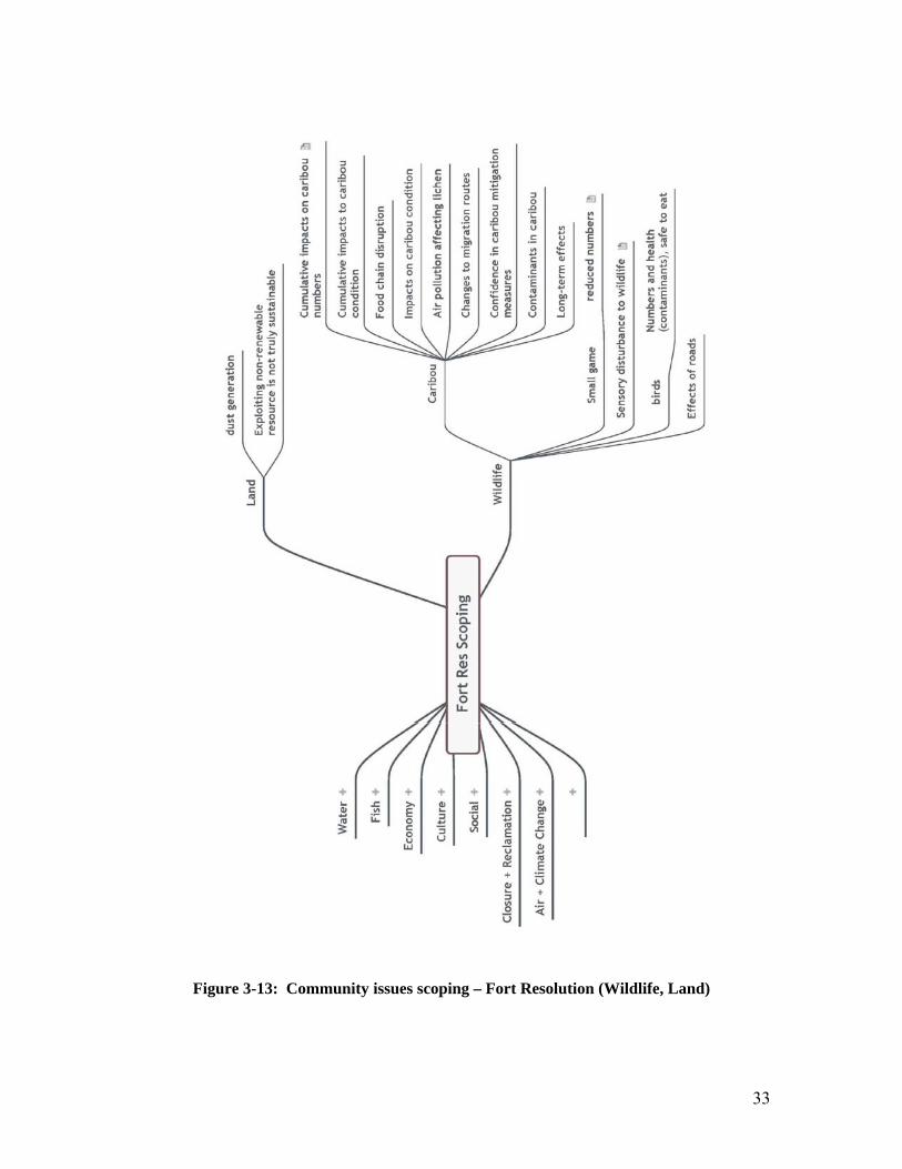
Figure 3-13: Community issues scoping – Fort Resolution (Wildlife, Land)
33

Figure 3-14: Community issues scoping – Behchoko
34

Title Community
North Slave Metis particularly vu e to social (and economic) lnerablimpacts
NSMA
Unresolved land claims introduce uncertainty NSMA
Depletion of non-renewable resources results in reduction of resources available for future generations in affected communities
NSMA
Unpaid work and increased cost due to worker absence NSMA
Post closure impacts NSMA
Cost of participation NSMA
Loss of traditional land based skills NSMA
Increase in accidental or crime related injuries NSMA
Increased access may result in loss of heritage resources NSMA
Increased access may result in loss of wilderness value NSMA
Increased access may introduce invasive species NSMA
Consultation and accommodation must meet tests set by Supreme De é Court of Canada
ninu Ku
Table 3-3: Additional Community Issues
.2.2 Community Issues Scoping Hearing 6 in Yellowknife, representatives
re
is Nation and the Fort Resolution Metis Council stressed six points in their
d use of the Kennady Lake area;
for the NWTMN to be a participant
•
The will be the only company at present that
3At the community issues scoping hearing April 28, 200of the YKDFN, Lutsel K’e FN, Deninu Kué FN, NSMA, NWTMN and Fort Resolution Metis Council presented their views to the Review Board. The main purpose of the hearing was to hear the results of the community issues scoping workshops from the point of view of the participants themselves. However, additional issues or views weheard as well.
The NWT Metpresentation to the Board, including:
• Metis traditional knowledge an
• the lack of consultation by DeBeers Canada;
• the need for an Impact Benefit Agreement andin the development of the mine through economic opportunities;
cumulative effects on water, wildlife, air and land; and
• reclamation of the three proposed pits.
NWTMN further pointed out that DeBeerswill potentially operate two diamond mines in close proximity and that this would be a good opportunity to study cumulative effects. [76]
35

The Lutsel K’e First Nation presented a summary of the community issues scoping workshop in their community. For the Lutsel K’e First Nation impacts on caribou are the highest priority. The elders and hunters of Lutsel K’e have observed changes in caribou abundance, behaviour (e.g. they do not come as close to the community as they used to), and health that they directly attribute to the existing diamond mines. They further pointed out that Kennady Lake is directly on an important caribou migration route. Water issues are next on the priority list for Lutsel K’e. Water issues range from contaminants to dewatering of the lake to downstream effects of flow fluctuations. They also include potential impacts on Ts’ankui Theda, ‘Our Lady of the Falls’, the most sacred site for the Dene of Lutsel K’e. [78]
In terms of socio-economic impacts, caribou once again played a big role because they are an important food source. In the opinion of workshop participants, diamond mines have so far provided Lutsel K’e with few economic opportunities. Nonetheless, increased economic activity is feared to lead to economic disparity and increasing social problems, including substance abuse and loss of family cohesion. Increased industrial activity will be detrimental to the tourism potential of the Great Slave Lake East Arm area. Tourists come to this area because of its pristine wilderness character. The wilderness character could be affected by as little as regular helicopter over flights. Finally, the development is upstream of the proposed Thaydene National Park around the East Arm. While the final park boundary still needs to be negotiated, there are plans to include the entire Lockhart watershed. [78]
In addition to these concerns about constructing and operating a diamond mine at Kennady Lake, the community of Lutsel K’e is also very concerned about the eventual closure and reclamation of the mine site. They said the legacy of the mining industry in the NWT does not instill any faith in its capability to restore the area to a level acceptable to the community [78]. Lutsel K’e also voiced concerns regarding increase substance abuse as result of increased industrial development and an increasingly transient population.
The NSMA largely re-iterated the issues it had stressed earlier at the technical issues scoping hearing. [77] Moreover, it pointed out that NSMA members face additional challenges in dealing with potential socio-economic impacts of the development. Unlike other aboriginal groups the members of the NSMA reside mostly in Yellowknife and do not have a settlement or village of their own. In the NSMA’s opinion the increased industrial development over the past decade has resulted in increased substance abuse and other social problemns.
Similarly, the Deninu Kué stressed their concerns over caribou and water, as well as their frustration at not being involved in the environmental impact assessment process or receiving benefits from the existing diamond mines.
36

37
4 Analysis
4.1 Key Lines of Inquiry and Subjects of Note As indicated in section 2.6, the Review Board reviewed the public record and identified seven key lines of inquiry and thirteen subjects of note, based on a qualitative analysis of written submissions and presentations at the technical and community issues scoping hearings. The key lines of inquiry, or top priorities, will require the most attention when assessing environmental impacts from the proposed development. Subjects of note are less critical but will still require careful consideration. As more information becomes available, key lines of inquiry or subjects of note may be altered.
Key lines of inquiry and subjects of note generally cover more than one issue raised during the scoping workshops and often overlap as well. This is a reflection of the interconnectedness of nature in general and of concerns raised during the scoping process in particular. For example, at community workshops participants repeatedly pointed out that impacts on caribou that affect abundance, distribution, or health of the animals have an effect on a major food source. This then creates an economic effect for aboriginal people. Because caribou are not only a food source but also play an important role in aboriginal culture, impacts on caribou also impact cultural well being. Economic and cultural impacts in turn are likely to affect the social well being of communities and individuals, e.g. through increased economic stress and loss of culture. See also Figure 4-1.
The following tables present the key lines of inquiry and the subjects of note. Each table contains the title of the key line or subject, a description, and the parties that submitted priorities contributing to the formulation of the key line or subject. It also contains an indication whether the key line or subject may have a major cumulative effects component. The numbers listed under the parties in both tables are the public registry document number of the submission containing relevant information. In essence, Tables 4-1 and 4-2 present the final results of the issues scoping without necessarily listing every individual issue (see the issues diagrams in section 3 for a listing of all issues).

Key Lines of Inquiry NOTE: numbers listed under the parties are the public registry document number of the submission containing relevant information.
Title Description GN
WT
INA
C
EC
DFO
NSM
A
Lutsel K
'e
Deninu K
ué
NW
TMN
YKD
FN
DeB
eers
Cum
ula-tive
Caribou Impacts to caribou are of great concern for most parties. With caribou numbers plummeting in recent years and with consensus among aboriginal groups that caribou are in poor health, any impacts on caribou are of greatest concern. Caribou are the main food source for traditional land users and play an extremely important role in aboriginal culture. Threats to caribou are seen not just from the proposed development alone but cumulatively from all the diamond mines, mineral exploration, and other activities within their range. Caribou can be impacted in many ways, from sensory disturbance to air quality impacting their food.
Roads are seen as a major impediment to caribou migration by some, especially given the heavy traffic in recent years. Roads pose a hazard to caribou attempting to cross them. Roads also open up access for hunters or recreational users. Road effects include on-site roads, the access winter road from Mackay Lake, and the Tibbitt to Contwoyto winter road.
53 42, 43, 73
78 54 7 89 46
Water quality & fish in Kennady Lake
Lowering the water level of 80% of the lake area and exposing the lake bottom for 15 or more years is of great concern to relevant government departments and aboriginal communities alike. The ability of the ecosystem to recover is questioned.
42, 73
48 47 78 54 76 89 46
Downstream water effects
The release of large quantities of water during the dewatering of Kennady Lake may have effects on downstream creeks and lakes. This short term massive increase in flow will later be replaced by a 75% decrease in flow over a very long period of time while the third pit and the lake are re-filling. In addition to these fluctuations in volume, aboriginal communities are worried about possible contamination. Their experience with older mines has been very negative. Like caribou, fish play an important role not only in their diet but also their culture.
73 48 47 78 54 76 89 46
38

Title Description GN
WT
INA
C
EC
DFO
NSM
A
Lutsel K
'e
Deninu K
ué
NW
TMN
YKD
FN
DeB
eers
Cum
ula-tive
Long term biophysical effects/Closure and Reclamation
There is great concern over the long term effects of this development. For example, there is uncertainty about the viability of encapsulating processed kimberlite and mine water in the mined out pits. There is great pessimism about the recovery of the lake ecosystem after mine closure.
73 78 54 76 89 46
Substance abuse and decrease in family and community cohesion
Increased substance abuse has been observed by communities since diamond mines started operating in the NWT. Communities are extremely concerned that an additional influx of money combined with rotational work schedules will take a heavy toll on families, communities and individuals.
53 78 54
Increasing social disparity
Communities raised the issue of increasing disparity between those participating and benefiting from mine development and those who will or in many cases cannot participate. Elders, traditional land users, women, and others who cannot participate in mining related activities not only are left behind but also have to contend with increased costs of living caused by development, causing an effective decrease in standard of living. Given their experience with previous mines and given the already existing skilled labour shortage in the NWT, aboriginal communities are concerned they will not benefit from this development.
77 78 54 89 46
Long term social, cultural, economic effects
There is great concern over an inevitable economic downturn after mine closure. In particular, there is concern that extracting this resource at a time when many aboriginal people cannot participate (or are already working at other mines) represents a lost opportunity for communities and one that will not be available in the future
77 54 89 46
Table 4-1: Key Lines of Inquiry
39

Subjects of Note
Title Description GN
WT
INA
C
EC
DFO
NSM
A
Lutsel K'e
Deninu K
ué
NW
TMN
YKD
FN
DeB
eers
Cum
ula-tive
Aboriginal rights and the interconnectedness of issues
Concerns about caribou expressed by aboriginals often are not about impacts on caribou themselves, but rather the impacts on aboriginal culture and impacts on aboriginal economy, both of which depend on caribou. The assessment should pay attention to the interconnectedness of various issues. The EIR should reflect that certain impacts on the environment are infringements on aboriginal rights. Removal of caribou, for example, infringes on aboriginal hunting rights. Related to this is the question of unsettled land claims
78 54 89
Training, education, and promotion
Aboriginal communities have been disappointed by existing mines in that employment targets not only have not been met in some cases, but that the aboriginal workforce continues to be employed largely in entry level jobs. Aboriginal communities see an urgent need for improving their educational opportunities, training that is transferable (and remains useful post mine closure) and promotion of aboriginals into higher level jobs, including management. Aboriginal communities are unanimous that the existing mines have not provided the benefits that were promised 10 years ago.
53 77
Impacts on tourism potential
Tourism is another viable economic option for aboriginal communities. Tourism in the NWT depends heavily on the wilderness character of the land. Increasing mine development and mineral exploration threatens that wilderness character. Industry related air traffic, for example, greatly diminishes the wilderness experience visitors are willing to pay for.
53 78
40

Title Description GN
WT
INA
C
EC
DFO
NSM
A
Lutsel K'e
Deninu K
ué
NW
TMN
YKD
FN
DeB
eers
Cum
ula-tive
Air quality Air quality will be impacted by diesel power generation, the extraction and hauling of rock using diesel powered heavy equipment, and the transportation of all materials, equipment, and supplies over a large distance by diesel powered trucks. This will be the fifth diamond mine in the general area contributing to air pollution. Dust generated by traffic, use of explosives and the exposed lake bottom is another source of air pollution
53 73 48 76
Species at Risk and migratory birds
Species at risk and migratory birds enjoy legislated protection and must be considered a subject of interest at least until more information is available and it can be shown that there are no important issues in this respect. This mine is closer to the tree line than the existing mines and there may be other species involved.
53 48 ?
Permafrost/Groundwater/Hydrogeology
Limited baseline information creates uncertainty about any impacts on permafrost or ground water movements. The dewatering of the lake, the excavation of large pits, and the re-filling of these pits with waste rock, processed kimberlite, and contaminated mine water has a great potential to disrupt or change permafrost distribution and ground water flow.
73 48 89 46
Carnivore mortality
Bear, wolverine, wolf, etc. 53 46
Alternative energy sources
This would be the fifth diamond mine generating its power from diesel generators, resulting in air quality issues, transportation issues, climate change issues, renewable resource use issues, etc. Most of these can have a direct or indirect impact on caribou and/or water and fish.
53 73 89
41

Title Description GN
WT
INA
C
EC
DFO
NSM
A
Lutsel K'e
Deninu K
ué
NW
TMN
YKD
FN
DeB
eers
Cum
ula-tive
Infrastructure demands (physical and social)
Increased development inevitably increases demands on infrastructure. Of particular concern is the NWT's road network that has to contend with heavy truck traffic it was never designed for. Similarly, municipal services, social services are all impacted. The concern is especially acute as this development may be going ahead in parallel with the Mackenzie Gas Project, which by itself will put extreme pressures on existing physical and human infrastructure. Moreover, competition for skilled labour will make it more difficult and expensive for government to maintain infrastructure.
5 3
Cultural sites and reduced cultural activities
There is concern over possible impacts on cultural sites in the Lockhart River system, including Our Lady of the Falls and Lutsel K'e's original settlement at Artillery Lake. Increased participation in wage economy may weaken traditional activities.
5 3
Waste rock and processed kimberlite storage
While closely connected to many other subjects or lines of inquiry, storage of waste rock and processed kimberlite has its own issues. For example, its geochemistry is important information for assessing the significance of any impacts. Also, the height of the waste rock pile is the causing of some caribou-related concerns. Alternative designs on the other hand may impact additional watersheds. An analysis of alternatives may be required.
53 73 89
Climate change impacts
Climate change may lead to changes in ice road availability or changes in permafrost. These changes can impact the development itself, but also other parts of the environment.
7 3
Impacts on Great Slave Lake
While this may be included in the key line of inquiry "Downstream Water Effects", it is important to note that several aboriginal communities are very concerned about possible impacts on Great Slave Lake. The developer and government generally seem to assume that impacts will not reach that far. The assessment should address the question how far downstream effects may reach.
78 54
42

Proposed Thaydene National Park
The proposed development is upstream of the proposed Thaydene National Park around the East Arm of Great Slave Lake
7 8
Table 4-2: Subjects of Note
43
4.2 Public Concern As outlined in section 2.6.2 the Review Board based its determination of the likelihood and significance of public concern on participation rates, EIA guideline criteria, and underlying environmental effects.
4.2.1 Public Participation: Advertising for community scoping workshops consisted of newspaper announcements, phone calls with contact persons in the communities, and posters in the communities. The resulting participation rates were 8 % of the population in Dettah, approximately 12 % in Lutsel K’e, and approximately 14 % in Fort Resolution. The latter value is based on the assumption that 25% of the participants in Fort Resolution travelled from either Fort Smith or Hay River. In reality, the participation rate may have been even higher.
Only Behchoko showed a low participation rate at less than 0.5%, not counting Yellowknife residents. Put into perspective, 0.5% of the population of Yellowknife would be 95 people, 14% of the population of Yellowknife would be over 2,600 people. In addition, representatives from Fort Resolution participated in all three days of the technical issues scoping workshop and paid their own way to get to Yellowknife. Similarly, several aboriginal organizations sent people to the community issues scoping hearing on their own costs, in addition to those funded by the MVEIRB. People drove for several hours to attend workshops in Fort Resolution and in Behchoko.
The participation rates indicate a high rate of interest, especially compared to the public participation rates for the Mackenzie Gas Project (MGP) environmental assessment (EA03-007). The MGP EA hearings drew at maximum approximately 10% of the population in Norman Wells, less elsewhere. This despite the fact that in the MGP case invitations were mailed to all households in the potentially affected communities and full page ads placed in local newspapers.
In short, the overall participation rate and level of effort by community members, at least south of Great Slave Lake, must be considered high. This indicator alone is evidence that considerable public concern may exist. The Review Board also notes that the concerns expressed by residents regarding caribou, water, and possible social issues were very much the same in all communities and overlapped to a large extent with the issues raised during technical issues scoping.
4.2.2 EIA Guideline Criteria MVEIRB’s EIA guidelines provide criteria for estimating the likelihood of public concern over a proposed development. The guidelines list six criteria for public concern which are:
• development scale,
• proximity to communities,
• new technology,
44

• severity of worst case scenario,
• proximity to protected or sensitive areas, and
• areas known for harvesting.
Gahcho Kué has an estimated initial investment of over $900,000,000 and will employ up to 700 persons during construction. With a long term work force of 400 persons it would provide almost 1 % of the NWT job market1. To do the same in British Columbia a development would have to create over 20,000 jobs. In comparison to the MGP, Gahcho Kué will provide more person years of employment.2 In other words, the proposed development is a large development by any standard and fits the first criteria.
The distance between Kennady Lake and Lutsel K’e is not more than a typical travel distance between two neighbouring Mackenzie Valley communities. Lutsel K’e residents regularly travel to the potentially affected area for harvesting activities. In the Review Board’s opinion, the development must be considered in close proximity to the community of Lutsel K’e.
Gahcho Kué would employ new technology, or at least development methods unproven in a northern environment. The disposal of processed kimberlite and mine water in the mined out pits underneath the lake is one example, as INAC pointed out (see section 3.1.2). Draining this headwater lake and exposing the lake bottom for over 15 years (while doubling the total lake volume), with the expectation that the lake ecosystem will recover may be seen as unproven “technology” in this environment.
The development is upstream of a proposed national park, as well as of culturally and spiritually important sites. The project area is a known harvesting area, both traditionally and contemporarily. As section 4.1 shows, potential impacts on caribou are of great concern to communities and government alike. The concern is based partially on declining caribou abundance and health, partially on their importance to aboriginal culture and economy. A worst case scenario that threatens the Bathurst caribou herd’s sustainability as a major food source would likely be considered severe by aboriginal communities. Worst case scenarios have not been explored to great length in the scoping process, however.
In the Review Board’s opinion, the proposed development fulfills at least five, possibly all six criteria for projects that might cause public concern. It is a large development that employs unproven technologies. It is located in proximity to community , upstream of sensitive areas, and within a known harvesting area.
1 Data based on information from NWT Bureau of Statistics www.stats.gov.nt.ca 2 At an estimated work force of 7,000 persons for a three month construction period over 3 years and estimated 50 long term employees over 20 years the MGP provides a total of 6250 person years of employment (with only 1000 person years of long term employment). Gahcho Kué, with an estimated 400 person workforce over 17 years, provides 6,800 person years of long term employment, not even counting construction.
45

4.2.3 Evidence of Environmental Effects As described in section 4.3 below, the Review Board heard scientific and traditional knowledge information of real, already existing, negative environmental change, particularly in regards to caribou numbers and health. While scientists have not directly attributed the observed decline in caribou numbers to diamond mining, they have determined that caribou avoid major industrial developments. It is thus not unreasonable to expect a diamond mine placed on an important migration route could further affect caribou. Traditional knowledge holders, on the other hand, have linked the decline of caribou numbers and health directly to diamond mining.
The Board heard from aboriginal communities how important caribou are to their livelihood and thus economic and cultural well being. The same is true for fish. Moreover the Review Board heard that, given the importance of caribou and fish to the economic and cultural well being of aboriginal individuals and communities, any impacts on caribou and fish would likely have effects well beyond the bio-physical environment. Figure 4-1 provides a simplified sketch of the connections between impacts on caribou and fish on one hand and other environmental components on the other.
Figure 4-1: Interconnectedness of Key Lines of Inquiry
46

4.2.4 Conclusion Scientific and traditional knowledge holders agree on an existing decline in caribou numbers, as well as on the likelihood of future impacts, at least to the extent of caribou avoiding major developments. Community and technical issues scoping both placed a very high priority on caribou issues (Tables 4-1 and 4-2).
Participation rates and efforts to attend scoping workshops and hearings point to considerable public concerns. The Review Board’s criteria for determining public concern indicate that the development is likely to raise concern. The Review Board heard evidence that the concerns expressed by communities, at least in regards to caribou, are not irrational but are concerns based on observation of existing negative environmental changes in an area that only recently started to undergo industrial development, and are backed by evidence [e.g. 61, 66] that the proposed Gacho Kué development may accelerate the environmental change.
Given all of the above, the Review Board finds that the proposed development is likely to be a cause of significant public concern.
4.3 Impacts on the Environment The scoping exercise revealed scientific and traditional knowledge evidence regarding impacts on the environment, particularly on caribou and aquatic environments. The proposed development is within the migratory range of the Bathurst caribou herd [4]. According to the GNWT’s Barren ground Caribou Management Strategy, the Bathurst herd declined from 472,000 animals in 1986 to 186,000 animals in 2003 [66], a decline of over 60%. The management strategy does not attribute this decline to any single reason, but a geographic and temporal link to the development of diamond mines exists. Moreover, another submission by the GNWT indicates that caribou demonstrate strong avoidance of major developments [61].
The Review Board heard from traditional knowledge holders in Lutsel K’e and Fort Resolution that the caribou populations are not only in decline but are in poor health. In addition, traditional knowledge holders linked the decline of the herd and its poor health status to the development of diamond mines in the area.
Adding a diamond mine and the associated increase in traffic on the ice road, to the already existing industrial development, including three diamond mines on the NWT side and one on the Nunavut side of the Slave geological province, is likely to further affect caribou. Given the observed decline and the importance of caribou to economy, culture and ecosystem, any appreciable impact on caribou may be considered significant. As figure 4-1 illustrates, impacts on caribou are likely to be accompanied by impacts on the cultural, social, and economic well-being of residents of the Mackenzie Valley.
Similarly, draining 80% of Kennady Lake and exposing the lake bottom for a long period of time is likely to affect the benthic environment of the lake. During both community and technical issues scoping the ecosystem’s ability to recover has been questioned by residents as well as DFO representatives. Moreover, the release of large quantities of water into a drainage system characterized by little relief, and therefore slow-flowing
47
streams, is likely to result in environmental change. This rapid release would later be followed by a flow reduction of 75%.
There are numerous other issues, e.g. the proposed development’s potential impacts on tourism or on family cohesion, for which the public record does not contain sufficient information for the Review Board to determine whether or not the development is likely to cause a significant adverse impact on the particular component of the environment.
Section 117(2) of the MVRMA lists the same factors to be considered in an EA and an EIR. The Review Board ordered an EIR based on its determination that the development is likely to be a cause for significant public concern. Consequently an EIR will be conducted regardless of any finding of significant adverse impacts on the environment. Therefore, and because the EIR will examine in more detail the same factors this EA examined, the Review Board defers the determination of the significance of impacts considered above, as well as the examination of other potential impacts, to the review panel.
4.4 MVRMA Section 117(2) and 128(4) Considerations MVRMA section 117(2) requires the Review Board to consider a number of factors in its EA. MVRMA section 128(4) requires the Review Board to identify areas in which the development is likely to cause significant adverse impacts on the environment.
As outlined above, the factors listed in section 117(2) apply equally to EA and EIR. The Review Board determined that the proposed development is likely to be a cause for significant public concern, and ordered that an EIR be conducted. The Review Board discharged its obligations under section 117(2) with the knowledge that a more detailed analysis of these factors will be conducted in the EIR. The following is not an exhaustive discussion of section 117(2) factors but a summary of the Review Board’s key considerations presented throughout this report.
4.4.1 MVRMA Section 117(2) (a) impacts on the environment: The Review Board considered impacts on the environment, including cumulative impacts and those from malfunctions, e.g. spills. Section 4.3 provided a summary of the key considerations, which include the likelihood of impacts on caribou and resulting impacts on the social, cultural, and economic well being of Mackenzie Valley residents, as well as impacts related to draining 80% of Kennady Lake. Section 4.1 discussed how issues identified in the scoping process are interrelated and how impacts on one environmental component may cause impacts on other components. Moreover, section 4.1 identified issues which, in the Review Board’s opinion, have a potential for cumulative effects.
(b) significance of impacts: The Review Board considered the significance of the potential impacts of the development on caribou and the aquatic environment and found some evidence for significant impacts on caribou, as outlined in section 4.3.
48
(c) comments from public: The EA was conducted as a public process and the Review Board considered statements made by members of the public at workshops and hearings. Section 3.2 provided a summary of public input received through the community issues scoping workshops. Section 4.2 discussed the likelihood of significant public concern based on, among other things, statements by community members regarding the importance of caribou to their economic and cultural well being.
(d) need for mitigation: The Review Board found that the public concern is based on actual adverse changes in the environment. Moreover, the Review Board heard evidence of possible significant impacts on the environment, for example caribou. In the Review Board’s opinion a need for mitigation measures is likely. However, the determination of whether the development is likely to cause significant adverse impacts on the environment was no longer required due to the EIR order. Since the review panel will now make this determination, the identification of necessary mitigation measures will also be in the review panel’s purview.
(e) other matters or alternatives: The Review Board considered a number of other matters in its formulation of key lines of inquiry and subjects of note as described in section 4.1. The use of alternative energy sources, for instance, is a subject of note in itself. Alternative energy and alternative transportation modes also played a role in defining the caribou key line of inquiry as transportation of fuel on the ice road is seen as a major contributing factor to impacts on caribou by some.
4.4.2 MVRMA Section 128(4) MVRMA s. 128(4) requires the Board to identify any area inside or outside the Mackenzie Valley in which the proposed development is likely to have a significant impact. Because a determination whether the development is likely to cause significant adverse impacts on the environment was not required due to the Board’s finding that the proposed development is likely to be a cause for significant public concern, a definitive identification of such areas is not possible. The evidence received during the scoping process, however, indicates areas in which the development is likely to have an impact that requires further study during the EIR. Similarly, the public concern expressed to the Review Board, indicates certain areas that require further study of impacts. These are:
• For impacts on caribou, the geographic area affected includes (but is not necessarily limited to) the vicinity of the mine site, the access road from Mackay Lake, and the Tibbitt to Contwoyto Road up to the start of the access road at Mackay Lake.
• For impacts on fish and other aquatic organisms, the area affected includes any water body crossed by the Tibbitt to Contwoyto Road, the Mackay Lake access road, Kennady Lake, and all water bodies downstream of Kennady Lake to Great Slave Lake. The latter is important to address public concerns.
• In terms of cultural and social impacts, the area to be studied further includes (but is not limited to) all communities in the Tlicho and Akaitcho regions.
49

5 Conclusion After reviewing the public record for this proceeding, the Review Board determined that the proposed Gahcho Kué diamond mine development is likely to be a cause of significant public concern, as outlined in section 4.2. Having made this determination, the Review Board ordered, pursuant to MVRMA section 128(1)(c), that an environmental impact review of the proposal be conducted.
50

Public Record
Registry Key
Document Title Originator Date
1 Gahcho Kué Referral to EA Environment Canada
12/22/2005
2 Gahcho Water License Application MVLWB 12/22/2005
3 Gahcho Kué Land Use Permit Application MVLWB 12/22/2005
4 DeBeers Application Report for the MVLWB DeBeers 12/22/2005
5 NewsNorth notice of referral – Gahcho Kué MVEIRB 12/23/2005
6 Notification of Referral of EA MVEIRB 1/4/2006
7 Referral notification fax cover MVEIRB 1/4/2006
8 Gahcho Kué Draft workplan MVEIRB 1/26/2006
9 Role identification letter for Gahcho Kué EA MVEIRB 3/7/2006
10 Parties Identification Letter_Gahcho Kué Project MVEIRB 1/27/2006
11 Parties Identification Form_Gahcho Kué Project MVEIRB 1/27/2006
12 Invitation to meeting on draft Gahcho Kué workplan
MVEIRB 1/30/2006
13 Notes on workplan overview meeting MVEIRB 2/10/2006
14 Workplan comments INAC MVEIRB 2/17/2006
15 Workplan comments DBCI DeBeers 2/17/2006
16 GNWT re: Draft Work Plan GNWT 2/17/2006
17 Notice of party standings MVEIRB 2/20/2006
18 Party standing notification (Gahcho Kué) MVEIRB 2/20/2006
19 Technical scoping workshop invitation MVEIRB 3/7/2006
20 Technical scoping workshop plan MVEIRB 3/7/2006
21 Gahcho Kué Diamond Project CD MVEIRB 3/23/2006
22 Wildlife MVEIRB 3/24/2006
23 Water MVEIRB 3/24/2006
24 Regional/Territorial Socio-Economic MVEIRB 3/24/2006
25 Regional MVEIRB 3/24/2006
26 Other MVEIRB 3/24/2006
27 Other MVEIRB 3/24/2006
51

Registry Key
Document Title Originator Date
28 Fish MVEIRB 3/24/2006
29 Fish MVEIRB 3/24/2006
30 Community Wellness MVEIRB 3/24/2006
31 Community Wellness MVEIRB 3/24/2006
32 Wildlife MVEIRB 3/24/2006
33 Water MVEIRB 3/24/2006
34 Technical Issues Tables MVEIRB 5/9/2006
35 Process and Methods mind map MVEIRB 3/25/2006
36 Technical Scoping Workshop follow-up letter MVEIRB 3/24/2006
37 Letter re: Schedule of Events Scoping Hearings MVEIRB 3/29/2006
38 Lutsel K’e Scoping Hearing Cancellation MVEIRB 3/29/2006
39 Participants technical scoping workshop MVEIRB 3/31/2006
40 Re: EA0506-008 Gahcho Kué – Technical Scoping Workshop follow up
MVEIRB 3/31/2006
41 INAC comments on work plan meeting INAC 4/4/2006
42 INAC letter technical scoping hearing INAC 4/12/2006
43 INAC Issues Table Technical Scoping Hearing INAC 4/12/2006
44 Letter – changes to scoping process Gahcho Kué
MVEIRB 4/12/2006
45 Technical Scoping Hearing agenda distribution MVEIRB 4/12/2006
46 Technical Scoping Hearing DeBeers presentation
DeBeers 4/12/2006
47 DFO Submission to Technical Scoping Hearing DFO 4/12/2006
48 EC Submission to Technical Scoping Hearing Environment Canada
4/12/2006
49 EC Submission Technical Scoping Hearing Environment Canada
4/12/2006
50 GNWT Issues Table Technical Scoping Hearing GNWT 4/12/2006
51 GNWT Additional Issues Technical Scoping Hearing
GNWT 4/12/2006
52 GNWT Letter Technical Scoping Hearing GNWT 4/12/2006
53 GNWT Presentation Technical Scoping Hearing GNWT 4/12/2006
54 Deninu Kué Submission Technical Scoping Hearing
DKFN 4/12/2006
52

Registry Key
Document Title Originator Date
55 NSMA Letter Location of Community Scoping Workshops
NSMA 4/12/2006
56 Reply to NSMA Letter Location of Community Scoping Workshops
MVEIRB 4/12/2006
57 Technical Scoping Hearing Tape Recording MVEIRB 4/12/2006
58 Scoping Workshop Tape Recording – Dettah MVEIRB 4/12/2006
59 Sign In Technical Scoping Hearing MVEIRB 4/12/2006
60 Sign In Dettah Workshop MVEIRB 4/12/2006
61 WM_Johnson_et_al_2005_Cumulative_effects GNWT 4/13/2006
62 Nwt_health_status_report_2005 GNWT 4/13/2006
63 Communities_and_diamonds_2005 GNWT 4/13/2006
64 NRCan – Gahcho Kué scoping submission NRCan 4/13/2006
65 Dettah mind map MVEIRB 4/13/2006
66 Caribou Mgmt Strategy – FINAL – 06 0130 GNWT 4/13/2006
67 Fort Resolution workshop sign in sheet MVEIRB 4/26/2006
68 Behchoko mind map MVEIRB 5/3/2006
69 NSMA Submission technical scoping hearing NSMA 5/3/2006
70 NSMA Letter #2 to MVEIRB re: workshop locations
NSMA 5/3/2006
71 Lutsel K’e mind maps MVEIRB 5/3/2006
72 Letter Chamber of Mines re: scoping process April 28th 2006
NWT Chamber of Mines
5/3/2006
73 INAC Gahcho Kué Issues Prioritization Speaking Notes
INAC 5/3/2006
74 Fort Resolution Mind Maps MVEIRB 5/3/2006
75 Dettah Mind Maps MVEIRB 5/3/2006
76 Community Scoping Hearing – Apr 28-06 NWTMN Presentation
NWTMN 5/3/2006
77 Community Scoping Hearing – Apr 28-06 NSMA Presentation
NSMA 5/3/2006
78 Community Scoping Hearing – Apr 28-06 Lutsel K’e presentation
Lutsel K’e
5/3/2006
53

Registry Key
Document Title Originator Date
79 Chamber of Mines Feb 17 Letter Re: Scoping NWT Chamber of Mines
5/3/2006
80 060321 DeBeers GK Pres TSW DeBeers 5/5/2006
81 060504 DBC April 28_06 CSH Remarks DeBeers 5/52006
82 060425 CSW Pres Behchoko DeBeers 5/5/2006
83 060424 CSW Pres Fort Resolution DeBeers 5/5/2006
84 060419 CSW Pres Lutsel K’e DeBeers 5/5/2006
85 060411 CSW Pres Dettah DeBeers 5/5/2006
86 060410 DBC TSH Pres DeBeers 5/5/2006
87 INAC Letter to RB May 8 Part Fund & EA vs. EIR
INAC 5/9/2006
88 Response to Chamber Letter of April 28 MVEIRB 5/9/2006
89 YKDFN Letter May 8-06 YKDFN 5/9/2006
90 Response to NSMA Letter of April 27-06 MVEIRB 5/19/2006
91 Letter DeBeers May 19-06 DeBeers 5/24/2006
92 Sign-In Lutsel K’e Workshop MVEIRB 6/16/2006
93 Sign-In Behchoko Workshop MVEIRB 6/16/2006
94 Sign-In Community Scoping Hearing MVEIRB 6/16/2006
54


![scan000 - Review Boardreviewboard.ca/upload/project_document/EA0506-007...Sharon Debler From: Adrian Paradis [adrian@mvlwb.com] Sent: Tuesday, October 11, 2005 3:24 PM To: MVLWB Permit](https://img.dokumen.tips/doc/110x75/5f10f9899d28364be2185259/scan000-review-sharon-debler-from-adrian-paradis-adrianmvlwbcom-sent.jpg)