Embed Size (px)
Citation preview
ESA UNCLASSIFIED – For Official Use
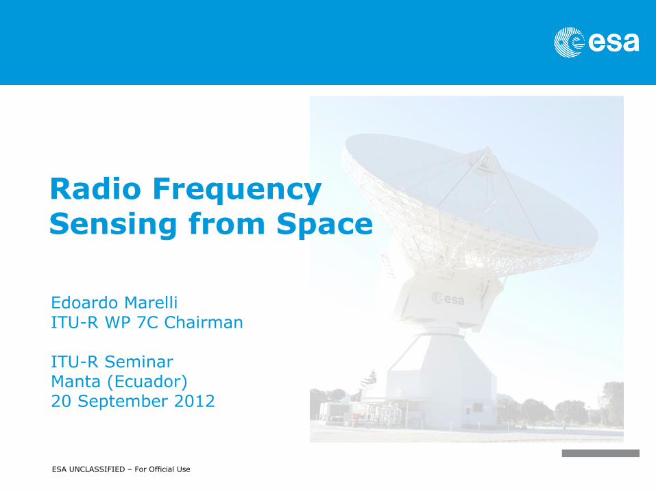
Radio Frequency Sensing from Space
Edoardo Marelli ITU-R WP 7C Chairman ITU-R Seminar Manta (Ecuador) 20 September 2012

Radio frequency sensing from space | Edoardo Marelli | ITU-R Seminar, Manta (Ecuador) | 20-9-2012 | Slide 2
ESA UNCLASSIFIED – For Official Use
Why observing the Earth from space?
Satellites orbiting around the Earth offer an excellent viewpoint from
where to sense the Earth surface (land and oceans) as well as the
components of the Earth atmosphere.
Geostationary satellites offer continuous monitoring of a large area,
while low orbiting polar satellites cover all the Earth at regular intervals
(as shown below)

Radio frequency sensing from space | Edoardo Marelli | ITU-R Seminar, Manta (Ecuador) | 20-9-2012 | Slide 3
ESA UNCLASSIFIED – For Official Use
Why RF sensing from space?
Sensing in radio frequency presents some important advantages wrt
optical sensing. While optical instruments are hindered by clouds and
can take images in the visible range only during the day, RF sensors
provide continuous coverage (day and night) irrespectively of the clouds
coverage. This is particularly important for sensing tropical areas,
where cloud coverage is often present.
RF passive sensing is performed by measuring natural emissions
produced by the Earth’s surface and its atmosphere. The strength of
these natural emissions and the frequency at which they are generated
characterize the type and status of many important geophysical, which
describe the status of the Earth/Atmosphere/Oceans System.
RF active sensing is performed by measuring radio waves transmitted
from the instrument itself and reflected by the object under
investigation.

Radio frequency sensing from space | Edoardo Marelli | ITU-R Seminar, Manta (Ecuador) | 20-9-2012 | Slide 4
ESA UNCLASSIFIED – For Official Use
Passive sensing from space
Multi-frequency passive measurement.

Radio frequency sensing from space | Edoardo Marelli | ITU-R Seminar, Manta (Ecuador) | 20-9-2012 | Slide 5
ESA UNCLASSIFIED – For Official Use
Active sensing from space
Sending pulses and reading the reflected signal

Radio frequency sensing from space | Edoardo Marelli | ITU-R Seminar, Manta (Ecuador) | 20-9-2012 | Slide 6
ESA UNCLASSIFIED – For Official Use
The main application areas.
Weather prediction and climate studies:
Sensing from meteorological satellites global and continuous coverage large improvement in the accuracy of weather predictions by meteorological offices.
Climate change studies can only be possible thanks to the large wealth of scientific parameters collected by the meteorological satellites over land, oceans and in the various layers of the atmosphere.
El Niño represents an interesting example that is of particular interest to South America. Better knowledge of ocean circulation is enabling us to better understand and predict climate, especially natural catastrophes such as El Niño. This phenomenon, caused by anomalous warm water arrivals on the coast of Peru, brings severe weather patterns, such as drought, flooding, and cyclones. It is now possible to predict El Niño from ocean data obtained by satellites.

Radio frequency sensing from space | Edoardo Marelli | ITU-R Seminar, Manta (Ecuador) | 20-9-2012 | Slide 7
ESA UNCLASSIFIED – For Official Use
The main application areas.
Three-dimensional representation of the fully developed 1997 El Niño

Radio frequency sensing from space | Edoardo Marelli | ITU-R Seminar, Manta (Ecuador) | 20-9-2012 | Slide 8
ESA UNCLASSIFIED – For Official Use
The main application areas.
Environmental studies
Environmental data from Earth observation satellites allow national, regional
and world authorities to take informed decisions on what to do about the environment. Examples:
Atmospheric chemistry (atmospheric pollution levels) Water temperature/salinity Coastal erosion Forest size and biomass evolution Soil moisture Polar ice extension and depth Land usage Etc…

Radio frequency sensing from space | Edoardo Marelli | ITU-R Seminar, Manta (Ecuador) | 20-9-2012 | Slide 9
ESA UNCLASSIFIED – For Official Use
The main application areas.
Soil moisture and ocean salinity map from the ESA satellite SMOS. RF sensor operating at 1.4 GHz

Radio frequency sensing from space | Edoardo Marelli | ITU-R Seminar, Manta (Ecuador) | 20-9-2012 | Slide 10
ESA UNCLASSIFIED – For Official Use
The main application areas.
Commercial and security applications
Satellite data are also used for application of commercial interest like:
Mining investigation Urban planning support High resolution mapping Fishing stocks localization Agricultural productivity Etc…
As well as security applications.

Radio frequency sensing from space | Edoardo Marelli | ITU-R Seminar, Manta (Ecuador) | 20-9-2012 | Slide 11
ESA UNCLASSIFIED – For Official Use
The main application areas.
Mexico City subsidence map. Interferometric image from Synthetic Aperture Radar on ERS-1 (ESA). This kind of information (with centimetres accuracy) allows the local authority to plan the urban developments.

Radio frequency sensing from space | Edoardo Marelli | ITU-R Seminar, Manta (Ecuador) | 20-9-2012 | Slide 12
ESA UNCLASSIFIED – For Official Use
The main application areas.
Disaster management:
Coastal hazards/tsunamis Drought Earthquakes Extreme weather/tornados Flooding Landslides Pollution (e.g. oil spills) Sea and lake ice Volcanoes eruptions Wild land fires.
In many cases the satellite observations can help detecting signs of the
incumbent disaster. In all these cases remote sensing can be used for the global monitoring
and evaluation of the effects/scale of the disaster (all-weather observations) and consequent planning of the rescue operations. (Disaster Management Charter: free satellite support in case of natural disaster: see http://www.disasterscharter.org/web/charter/home )

Radio frequency sensing from space | Edoardo Marelli | ITU-R Seminar, Manta (Ecuador) | 20-9-2012 | Slide 13
ESA UNCLASSIFIED – For Official Use
The main application areas.
Jocai (Ecuador) February 2012. Floodings Radarsat-2 image (Canadian Space Agency and Ecuadorian Remote Sensing Center (CLIRSEN)) By intersecting the water surface layer with other socioeconomic and infrastructure layers it was possible to map the impacts of floods on civil population, agriculture, education, health, energy, housing, road network and society.
This product shows crops affected

Radio frequency sensing from space | Edoardo Marelli | ITU-R Seminar, Manta (Ecuador) | 20-9-2012 | Slide 14
ESA UNCLASSIFIED – For Official Use
Applications of RF remote sensing from space
For more details about the various applications associated to sensing from space, please refer to: The ITU-R Handbook on : “Earth Exploration Satellite Service”(2011).
The ITU-R and WMO Handbook on : “Use of Radio Spectrum for Meteorology: Weather, Water and Climate Monitoring and Prediction”(2008).
The ITU-D Report on: “The Use of Remote Sensing for Disaster Prediction, Detection and Mitigation”(2008).

Radio frequency sensing from space | Edoardo Marelli | ITU-R Seminar, Manta (Ecuador) | 20-9-2012 | Slide 15
ESA UNCLASSIFIED – For Official Use
WRC recognition of the importance of remote sensing from space
Extracts from WRC-12 Resolution 673 (The importance of Earth observation radiocommunication applications)
“….
i) that, although meteorological and Earth observation satellites are
currently operated by only a limited number of countries, the data and/or related
analyses resulting from their operation are distributed and used globally, in
particular by national weather services in developed and developing
countries and by climate change-related organizations;
h) that Earth observations are performed for the benefit of the whole
international community and the data are generally made available at no
cost,
….”

Radio frequency sensing from space | Edoardo Marelli | ITU-R Seminar, Manta (Ecuador) | 20-9-2012 | Slide 16
ESA UNCLASSIFIED – For Official Use
ITU regulations for passive sensing from space
Two kinds of passive bands (allocated also to Radioastronomy):
1) Purely passive bands (footnote No 5.340) « All emissions are
prohibited in the following bands (only the main ones are shown) :
1400-1427 MHz
10.68-10.7 GHz
23.6-24 GHz
31.3-31.5 GHz
50.2-50.4 GHz
86-92 GHz …..»
2) Passive bands shared with other active services, in general
terrestrial services (Fixed and Mobile Service). In most of these passive bands
limits apply to the active services to allow sharing.

Radio frequency sensing from space | Edoardo Marelli | ITU-R Seminar, Manta (Ecuador) | 20-9-2012 | Slide 17
ESA UNCLASSIFIED – For Official Use
Protecting the passive sensors.
Relevant frequency bands are mainly determined by fixed physical properties (molecular resonance) that cannot be changed. These frequency bands are, therefore, an important natural resource.
Satellite remote sensors have instrumentation that is significantly more sensitive than that used by other active radiocommunication services. They measure naturally-occurring radiations at very low power levels.
Passive sensors cannot discriminate between natural and man-made radiation, so data errors often cannot be detected and/or corrected. Maintaining data integrity therefore depends upon the prevention of man-made interference. The imposition of strict limitations on such interference and maximum power on a global basis currently appears as the only solution.
Attention should be paid in particular to: the combined effect of multiple terrestrial transmitter whose
aggregate signal may result in severe interference to the sensor. Typical problem: high numbers of low-power devices (e.g. Short Range Devices)
the uncontrolled unwanted emissions from active transmitters operating in adjacent bands

Radio frequency sensing from space | Edoardo Marelli | ITU-R Seminar, Manta (Ecuador) | 20-9-2012 | Slide 18
ESA UNCLASSIFIED – For Official Use
Protecting the active RF space sensors.
The active sensors read the echo of their own signal. This allows some filtering of signals from other similar sources (e.g. terrestrial radars in the radiolocation service).
But in those bands shared with terrestrial active services problems may arise The aggregate effect of a large number of devices gives an increase of the noise floor that cannot be filtered by post-processing. This results in harmful interference with wrong data being obtained.
It is therefore important to avoid introducing high density outdoor terrestrial devices in the bands used by EESS (active), even when these devices are low-power (what matters is the aggregate power seen by the sensor).

Radio frequency sensing from space | Edoardo Marelli | ITU-R Seminar, Manta (Ecuador) | 20-9-2012 | Slide 19
ESA UNCLASSIFIED – For Official Use
Conclusions
Key elements
RF remote sensing from space is a service providing data of high societal and economical value (local data and global phenomena: weather forecast, climate change, disaster management, etc…).
Protection of these sensors needs to be ensured in the interest of all administrations.
No national decisions impacting these highly sensitive systems should be taken
independently from the ITU. Agreement with the other administrations in ITU is
necessary, since the data obtained from these systems serve international and
not simply national interest.
ITU Radio Regulations and Recommendations must be carefully followed!
Radio frequency sensing from space | Edoardo Marelli | ITU-R Seminar, Manta (Ecuador) | 20-9-2012 | Slide 20
ESA UNCLASSIFIED – For Official Use
Question time
Thanks for your attention. Question time.