Embed Size (px)
Citation preview
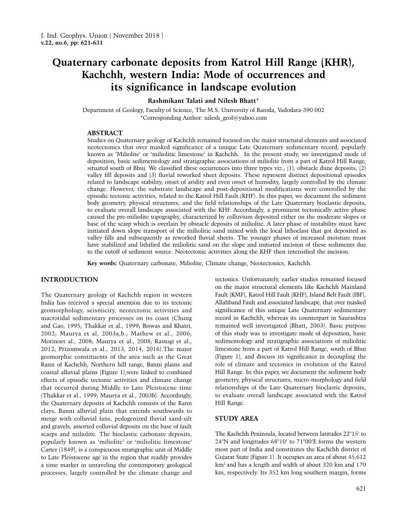
Quaternary carbonate deposits from Katrol Hill Range (KHR), Kachchh, western India: Mode of occurrences and its significance in landscape evolution
621
Quaternary carbonate deposits from Katrol Hill Range (KHR), Kachchh, western India: Mode of occurrences and
its significance in landscape evolutionRashmikant Talati and Nilesh Bhatt*
Department of Geology, Faculty of Science, The M.S. University of Baroda, Vadodara-390 002*Corresponding Author: [email protected]
ABSTRACTStudies on Quaternary geology of Kachchh remained focused on the major structural elements and associated neotectonics that over masked significance of a unique Late Quaternary sedimentary record, popularly known as ‘Miliolite’ or ‘miliolitic limestone’ in Kachchh. In the present study, we investigated mode of deposition, basic sedimentology and stratigraphic associations of miliolite from a part of Katrol Hill Range, situated south of Bhuj. We classified these occurrences into three types viz., (1), obstacle dune deposits, (2) valley fill deposits and (3) fluvial reworked sheet deposits. These represent distinct depositional episodes related to landscape stability, onset of aridity and even onset of humidity, largely controlled by the climate change. However, the substrate landscape and post-depositional modifications were controlled by the episodic tectonic activities, related to the Katrol Hill Fault (KHF). In this paper, we document the sediment body geometry, physical structures, and the field relationships of the Late Quaternary bioclastic deposits, to evaluate overall landscape associated with the KHF. Accordingly, a prominent tectonically active phase caused the pre-miliolite topography, characterized by colluvium deposited either on the moderate slopes or base of the scarp which is overlain by obstacle deposits of miliolite. A later phase of instability must have initiated down slope transport of the miliolitic sand mixed with the local lithoclast that got deposited as valley fills and subsequently as reworked fluvial sheets. The younger phases of increased moisture must have stabilized and lithified the miliolitic sand on the slope and initiated incision of these sediments due to the cutoff of sediment source. Neotectonic activities along the KHF then intensified the incision.
Key words: Quaternary carbonate, Miliolite, Climate change, Neotectonics, Kachchh.
INTRODUCTION
The Quaternary geology of Kachchh region in western India has received a special attention due to its tectonic geomorphology, seismicity, neotectonic activities and macrotidal sedimentary processes on its coast (Chung and Gao, 1995; Thakkar et al., 1999; Biswas and Khatri, 2002; Maurya et al, 2003a,b.; Mathew et al., 2006; Morinoet al., 2008; Maurya et al., 2008; Rastogi et al., 2012; Prizomwala et al., 2013, 2014, 2016).The major geomorphic constituents of the area such as the Great Rann of Kachchh, Northern hill range, Banni plains and coastal alluvial plains (Figure 1),were linked to combined effects of episodic tectonic activities and climate change that occurred during Middle to Late Pleistocene time (Thakkar et al., 1999; Maurya et al., 2003b). Accordingly, the Quaternary deposits of Kachchh consists of the Rann clays, Banni alluvial plain that extends southwards to merge with colluvial fans, pedogenized fluvial sand-silt and gravels, assorted colluvial deposits on the base of fault scarps and miliolite. The bioclastic carbonate deposits, popularly known as ‘miliolite’ or ‘miliolitic limestone’ Carter (1849), is a conspicuous stratigraphic unit of Middle to Late Pleistocene age in the region that readily provides a time marker in unraveling the contemporary geological processes, largely controlled by the climate change and
tectonics. Unfortunately, earlier studies remained focused on the major structural elements like Kachchh Mainland Fault (KMF), Katrol Hill Fault (KHF), Island Belt Fault (IBF), Allahband Fault and associated landscape, that over masked significance of this unique Late Quaternary sedimentary record in Kachchh, whereas its counterpart in Saurashtra remained well investigated (Bhatt, 2003). Basic purpose of this study was to investigate mode of deposition, basic sedimentology and stratigraphic associations of miliolitic limestone from a part of Katrol Hill Range, south of Bhuj (Figure 1), and discuss its significance in decoupling the role of climate and tectonics in evolution of the Katrol Hill Range. In this paper, we document the sediment body geometry, physical structures, micro-morphology and field relationships of the Late Quaternary bioclastic deposits, to evaluate overall landscape associated with the Katrol Hill Range.
STUDY AREA
The Kachchh Peninsula, located between latitudes 22°15’ to 24°N and longitudes 68°10’ to 71°00’E forms the western most part of India and constitutes the Kachchh district of Gujarat State (Figure 1). It occupies an area of about 45,612 km2 and has a length and width of about 320 km and 170 km, respectively. Its 352 km long southern margin, forms
J. Ind. Geophys. Union ( November 2018 )v.22, no.6, pp: 621-631

Rashmikant Talati and Nilesh Bhatt
622
the coast of the Gulf of Kachchh – a macro tidal gulf, that has a tidal range up to 8 m. Its northern margin makes the International border with Pakistan and the eastern abuts with Gujarat Mainland.
The Kachchh landmass is a central high plateau, which stands dissected in the north, west and east. Its physiographic features, comprising hill ranges, gently sloping peripheral coastal tract, dissected coastal erosional plain fringed successively by younger deltaic plains, tidal flats, spits and marginal accretionary zones, and can be broadly divided into four characteristic units, viz., Rann, Banni plains, hilly tracts and coastal plains.
Geologically the Kachchh basin consists records of Jurassic-Cretaceous sediments in the form of the Jhurio, Jumara, Jhuran and Bhuj Formations that are non-conformably overlain by the magmatic rocks of the Deccan Trap Formation (Biswas, 2016a). The Cenozoic record is also equally fascinating that occupies north-western and southern parts of the Kachchh and is represented by the Madh, Berwali, Bar Moti, Khari and Kankavati Series (Biswas, 2016b). The Quaternary history is recorded in the Miliolite Formation and other Late Pleistocene-Holocene records of the coastal areas. Although the miliolitic limestone of Kachchh was defined by Carter (1849), Biswas
(1971) was first to describe its field disposition and suggest that they were deposited by aeolian activities, almost at the same time when miliolite deposited in Saurashtra and the biogenic sands were derived from the southeastern coast of the Saurashtra. Baskaran et al., (1989) reported 230Th/234U ages of bulk miliolite samples from Kachchh that range from 167ka to 42.4ka. Recently, Bhattacharya et al., (2013, 2014) measured Optically Simulated Luminescence (OSL) ages of fluvial gravel and sand units, associated with miliolitic sand that range from 11.8ka to 7.1ka.
Further, the Katrol dome exists in eastern side from where the prominent hill range starts and extend westward up to Naira River. Katrol Hill Range (KHR) hosts Late Quaternary sediments in the form of colluvium, fluvial gravels and carbonate sand (miliolite). The Katrol Hill Fault (KHF) is one of the most significant faults in Kachchh, which show several evidences of active tectonics during the Quaternary time (Sohoni and Karanth, 2003; Thakkar and Goyal 2004; Patidar et al. 2008, 2007; Chauhan et al. 2016). In the Gangeshwar dome along the northern side of the Katrol Hill scarp, patches of shale belonging to the Jumara Formation were encountered. This is the oldest unit in the study area that contains ammonite fossils. On its northern side, the Bhuj Formation sandstone abuts
Figure 1. Location map of the study area in southern Kachchh region of Gujarat. KRA-Kotda-Roha Area; FA-Fakirwadi Area; GA-Gangeswar Area; VA-Varli Area. b-Bharasar; bo-Boha; d-Devpur (bp-BhopaDunger 237m; ch-Chiyasar (Basalt Hill 159m); ck-Chakar; f-Fakirwadi Hill 258m; g-Gadhsisa; ga-Gadoj; gd-Gangeswar Temple (Gangeswar Dome 225m); gs-Gangeswar Southern Plain; j-Jarok village (Conical Hill 281m); k-Kotda; ka-Katrol village (Katrol Hill 349m); ko-Kotdi; l-Ler Dam; m-Madhapar (DhrubioDunger 348m); ma-Mrutonk Dome 263m; mm-Mau Moti; n-Nagrecha; p-Poliyad; r-Ratiya Nana; ra-Raydhanjar; ro- Roha village (Roha Fort, Hill 266m); v-Varli; va-Varamsida village (Nana Dunger 433m).

Quaternary carbonate deposits from Katrol Hill Range (KHR), Kachchh, western India: Mode of occurrences and its significance in landscape evolution
623
against the KHF, indicating the up thrown nature of the southern side which largely exposes shale and sandstone of the Jhuran Formation.
MATERIAL AND METHODS
The study area was investigated using Survey of India topographic sheets No. 41E/3, 4, 7, 11 and 16 on 1:50,000 scale for the occurrences of Quaternary carbonate deposits. Detailed field documentation on substrate geology, sedimentary body geometry, physical structures, sedimentological details and basic petrography was prepared and analyzed from three windows viz., Gangeshwar, Fakirwadi Ghat and Roha-Kotada. In total 32 logs were prepared in the field and the lateral extent of miliolite sequences were traced. Based on this information, the miliolite occurrences were classified and evaluated in terms of its signatures in landscape evolution along the Katrol Hill Range.
Textural and compositional characteristics of the miliolite samples were studied using conventional mechanical sieving technique for friable samples and thin section study under petrological microscope. As the incision in miliolite sequence was used by earlier workers to indicate tectonic uplift rate, we attempted to study the erodibility of miliolite and substrate rocks. For this purpose,we measured the weight loss of the rock sample after subjecting it to abrasion with water and 120 grade polishing powder on Struers made Labopole-35 grinding and polishing machine, with iron plate rotating at speed of 50 rpm for 10 minutes applying 1kg weight.
RESULTS
The Late Quaternary carbonate deposits (miliolite) occupies various physiographic levels in the Katrol Hill Range, and occurs in a patchy manner lying over the substrate of either Mesozoic rocks or buried colluviums developed over it. Based on the sediment body geometry, physiographic level and nature of sediments, we recognize three distinct types
of mode of occurrences viz., (1) obstacle dune deposits, (2) valley fill deposits and (3) fluvial reworked sheet deposits (Figure 2). These were documented from various localities of the study area and are described in detail below.
Type-I deposits
In general, the obstacle deposits are found on the slopes of the KHR, both on southern and northern direction. However, the deposits on the southern slopes are relatively thicker and more prominent. Based on whether they occur on windward (southern) slope or leeward (northern) slope of the hill, these deposits are further classified as windward deposits and leeward deposits respectively (Patel and Allahabadi, 1988).They contain medium to fine grained, moderately to well sort grains of carbonate sand, exhibiting distinct large scale aeolian cross beddings and tear drop body geometry.
Type-II Deposits
The valley fill deposits are found occupying depressions in the hills and rocky amphitheaters. They occur at lower physiographic levels and are incised to some extent by first and second order streams. These are moderately sorted fine grained deposits that do not exhibit prominent sedimentary structures. At its base, they have either a sharp contact with the substrate or overlie the colluviums extending from the slopes towards the valley.
Type-III Deposits
The stratified sandy sheet of impure miliolite deposits containing gravels and pebbles pointing towards its fluvial deposition are recognized as the fluvial reworked sheet deposits. It include well-stratified sediments, presence of gravel rich layers, fluvial sedimentary structures such as small scour and fill, cross bedding and large clasts of Mesozoic rocks. Figure 3 depicts the general field characteristics of all above types of deposits. Detailed field documentation is presented in the following section.
Figure 2. A schematic diagram showing mode of occurrences of three types of miliolite and its relation with topography.

Rashmikant Talati and Nilesh Bhatt
624
Gangeshwar Area
The Gangeshwar area on the eastern part of the KHR, that lies between latitudes 23°.10’ to 23°.12’N and longitudes 69°.41’ to 69°.46’E, was investigated to document the field characteristics of the miliolites and its stratigraphic relationship with the other lithological constituents. Figure 4 summarizes the style of deposition and measured lithologs from various parts of the area. Accordingly, at six locations the obstacle dune deposits were examined, whereas at three locations, the valley fills and at seven locations, the reworked fluvial sheets were documented. The area constitute a part of Katrol hill scarp on its north, where it exposes ammonite bearing fossiliferous shale unit of the Jhuran Formation that abuts against the sandstone of the Bhuj Formation. On its southern part dissected hills of sandstone and shale are seen that are overlain by the miliolite obstacle dune deposits with erosional base. These are mainly windward dune deposits and attain thickness of maximum about six meters, as seen in abandoned quarries. Near to the Gangeshwar temple, such occurrence could be seen as 3 m thick planer cross-bedded unit of miliolite showing porous nature. Moving towards the south before entering in to the Gunavari river valley the dirty white coloured, nearly homogenous, friable deposits of miliolite occur filling the ancient valley that is being drained by the present Gunavari river. This valley fill deposit of friable miliolite has a thickness of about 10 m in the central part of the rocky amphitheatre, and thins out to 2 – 3 m towards the Gunavari river stream. The reworked fluvial sheets of impure miliolite occurs intercalated within a sequence of about 5 to 8 m that consists 1 to 2 m thick
layer of compact clay resting over weathered ferruginous sandstone of Mesozoic age. This is overlain by 1 m thick coarse sand and gravel mixed miliolitic layer, which in turn is overlain by 1.5 m thick silty clay layer which is capped by slope derived colluvium.
Towards southwest of Gangeshwar near Varli village on the road side, a conspicuous miliolite deposit is exposed on the northern slope of east-west trending hill. This is a typical leeward obstacle dune deposit of dirty white coloured, fine to very fine grained well sorted relatively friable miliolite dune deposit that exhibits thin paper laminations. The total thickness of this miliolite unit is about 8 meters.
Fakirwadi Ghat Area
On the Bhuj-Mandvi road after crossing the Katrol Hills near Fakirwadi, obstacle dune deposits of miliolite occurs on the southern slope of the east-west trending hill range (latitudes 23°10’ to 23°13’N and longitudes 69°35’ to 69°42’E). A seasonal river Khari drains northwestwards that has incised the river bank cliffs up to 12-15 m, and thus has exposed miliolite and associated colluvial deposits in these sections. Five obstacle dune sections in abandoned quarries, three valley fill sections incised by the stream, and eight river bank sections exposing fluvial reworked sheet deposits of miliolites were examined in this area (Figure 5). The obstacle dune deposits attain a thickness of about 10 m, exhibiting planer cross stratifications with most dip azimuths indicating southerly winds (Figure 3a). The unit is yellowish white coloured, medium grained, well sorted and of porous nature. These unconformably lie over the shale-sand intercalated sequence of the Jhuran
Figure 3. Field photographs of three types of Miliolite deposits. (a) abandoned quarry in a Type-I obstacle dune deposit, (b) Khari river bank showing a typical Type-II valley fill deposit unconformably resting on Jhuran Formation shale-sand, and (c) Chok river section showing pebbly and gravelly impure nature of Tyep-III reworked fluvial sheet deposit. Scale: Height of the person standing is 168 cm and length of the pen is 10 cm.

Quaternary carbonate deposits from Katrol Hill Range (KHR), Kachchh, western India: Mode of occurrences and its significance in landscape evolution
625
Formation. Towards its base, some lenses of angular and assorted locally derived clasts can also be seen which must have been incorporated from the steep slopes of the KHR. The thickness of miliolite unit reduces to about 1m towards lower part of the hill range, where it merges with the relatively flat ground with thin cover of colluviums. Near to the Khari river channel in rocky hollows valley fill deposits could also be seen that unconformably rest on the Mesozoic substrate with variable thickness from 2 to 8 m (Figure 3b). The valley fill deposits do not show peculiar sedimentary structures, but do contain scattered lenses of slope derived colluviums. The Khari river bank cliffs exhibit 10 to 12 m high sections that exhibit about 3m incision in the Mesozoic bed rocks (mostly shale and sandstone) that is overlain by the pebbles and gravels of the same lithology that constitutes the physiography of the KHR. This unit is overlain by coarse grained homogeneous sand, with occasional thin layers of sandy gravels. Dark coloured miliolite sheets of 2 to 5 m thickness occurs resting either directly on bedrock or on this sand unit. The reworked miliolite unit shows low angle cross-beddings, lenses of gravels and pebbles, oriented flat gravels defining coarse
stratifications, and also the sedimentary body geometry that follows Khari river valley geometry indicating its deposition by the stream water. Currently, this unit is overlain by 0.5 to 2 m thick unit of colluviums and/or coarse sand unit.
Kotda-Roha Area
About 40 km WSW of the Bhuj, in the westward extension of the KHR, Kotda-Roha area (latitudes 23°05’to 23°12’N and longitudes 69°05’ to 69°25’E) is largely comprises obstacle dune deposits of miliolites that rest on the southwestern and northeastern slopes of WNW-ESE trending hill ranges, that reach up to 400m above mean sea level (amsl). The hills are mainly composed of Deccan Trap Formation basalts, which nonconformably lie over the sandstones of Bhuj Formation. The miliolite dune deposits occur at the altitude of 200m amsl and above along with local reworked sheets and valley fills (Figure 6). At Dhrubya Dungar on the Bhuj-Roha road windward obstacle dune deposits attain thickness of about 2 to 5 m that extends southwards into a local stream with reduction in thickness to about 1m. In the adjacent areas the miliolites also occur as leeward
Figure 4. Lithologs of the miliolite sections examined in the Gangeshwar area. A topographic profile at the bottom gives an idea of their disposition in the area. (O1-O6 obstacle dune deposits, F1-F7 fluvial sheets, V1-V3 valley fill deposits).

Rashmikant Talati and Nilesh Bhatt
626
obstacle dunes, where the wind-borne sand could cross the low hills and spurs. One such outcrop was studied on the northern side of a conspicuous hill the Nana Dungar. Here in an abandoned quarry, about 6 m thick miliolite deposit exhibits planer tabular cross-beddings. The rock is dirty white coloured, fine to very fine grained and well sorted texture. Interestingly on the southern face of this quarry i.e. facing towards the obstacle, quite a few lenses of pebbles and cobbles of basalt are seen with miliolitic sand. These lenses have concave bottom and nearly flat top, and appear like scour and fills with assorted angular basalt fragments and miliolitic sand. The lenses are about 200cm in cross sectional length and maximum thickness of 25cm. The cross sectional length and thickness varies in different lenses on same stratigraphic level. It appeared that these lenses must have formed due to gravity flow from the basaltic hill obstacle due to a shower rain of very small time span in otherwise arid dune building environment. This is covered with a thickness of about 3 to 4 m of another miliolite dune. Another level of similar basalt lenses is seen towards the top of quarry face. Towards east, large boulders of the sandstone from Mesozoic substrate could also be seen captured in this miliolite deposit. Such occurrences could be indicative of either some episode of local precipitation events during the dune building phase or some syn-depositional seismic/tectonic activities in the area that could trigger a downward flow of substrate rock
fragments from the slopes upon which the obstacle dune deposition was active.
Further west at Roha fort about 4m thick windward obstacle dune deposits occurred that is medium to fine grained, moderately to well sorted dirty white coloured miliolite. Towards the base of the hill, the miliolite extends forming 1 to 2 m thick sheets in to the local valley. As this deposit is devoid of gravel and sand lenses and also fluvial sedimentary structures, it is considered as a valley fill deposit. Near Chiyasar about 159m high hill has provided obstacle to the miliolitic sand deposition. About 4m thick unit of dirty white coloured, medium to fine grained miliolite could also be seen on the northeastern slope of the hill, resting unconformably over the basalt. About 500m away on the roadside, 1m thick sheet of miliolite occurs. Allahabadi (1986) explained this occurrence at two different levels as a result of tectonic uplift of the hill. However, there occurs no evidence of any fault in between nor the rocks are showing any deformation. In our view, this occurrence at two levels is due to the pre-deposition topography that has regionally controlled the disposition of miliolites in the study area. A typical reworked fluvial sheet deposit of miliolite is encountered in this area in the third order of Chok river near village Raydhanjar. Here, a very compact 2 to 3 m thick sheet of miliolite containing significant amount of the gravels, pebbles and coarse sand derived from the country rocks could be seen constituting the river
Figure 5. Lithologs of the miliolite sections examined in the Khari river catchment near Fakirwadi area. A topographic profile at the bottom gives an idea of their disposition in the area. O7-O11 obstacle dune deposits, F8-F15 fluvial sheets, V4-V5 valley fill deposits).

Quaternary carbonate deposits from Katrol Hill Range (KHR), Kachchh, western India: Mode of occurrences and its significance in landscape evolution
627
Figure 6. Lithologs of the Miliolite sections examined in the Kotda-Roha area. A topographic profile at the bottom gives an idea of their disposition in the area. (O12-O16 obstacle dune deposits, F16 fluvial sheets, V6-V7 valley fill deposits).
bank cliffs of about 5m height (Figure 3c). This miliolite unit also exhibits trough cross-beddings, local thin lenses of clay and irregular lower contact with Mesozoic substrate.
Petrography
All the three types of miliolite deposits were analyzed for its petrographic details such as texture and composition, following standard techniques like mechanical sieving of
friable and loose samples and thin section examination of indurated samples. The petrographic analysis suggests that majority of the miliolite grains are of sand size ranging from 0.9 phi to 2.5 phi, moderately to poorly sorted, finely skewed and having platykurtic to mesokurtic distribution. The allochemical contents indicate its derivation from the shallow marine source whereas, the diagenetic imprints such as less compaction, moderate to high porosity, cement morphology and mineralogy etc. suggest meteoric
Table 1.Grain size, carbonate and non-carbonate contents and diagentic imprints of three types of Miliolite deposits in study area.
Type of deposit
Grain size range (phi)
Average grain size
(phi)
Carbonate content
(%)
Non-carbonate content
(%)
Diagenetic features Interpretation
Type-IN=15 1.2 to 1.6 1.4 59 41
Moderate to high porosity, low-Mg saprry calcite rim and meniscus cement, presence of vadoids.
Older phase; wind born Miliolite deposits in meteoric environment
Type-IIN=6 0.9 to 2.5 1.9 45 55 Moderate porosity, rim and void
filling low-Mg microsparite cement.
Instability phase; down slope transport of the Miliolite sand mixed with the local lithoclast to deposit as valley fills
Type-IIIN=10 1.4 to 2.5 1.9 32 68
Low to moderate porosity, much increased amount of detrital matrix, low-Mg microsparite cement at grain contacts and void filling blocky cement in secondary porosity.
The younger phases; increased moisture and flash flood like deposition of mixed sediments

Rashmikant Talati and Nilesh Bhatt
628
environment for the diagenesis of the miliolites (Figure 7; Bhatt and Patel, 1996). Detrital contents by weight are found in Type-I about 41% whereas it is 55% in Type-II and as high as 68% in Type-III miliolites. Table-1 summarizes the petrography of these deposits with gross interpretation. Accordingly, it is obvious that the Type-II and Type-III miliolites consists higher amount of locally derived detritus and reworking of the earlier deposited carbonate grains. The diagenesis of both, aeolian and fluvially reworked miliolites must have occurred in freshwater vadose and seasonally phreatic conditions as evident by the low magnesian micro-sparite cement and modifications in their porosity.
Table 2 presents the results of erodibility measurement experiment that indicate almost twice the erodibility of Miliolite in comparison with the substrate rocks like sandstone and compact sand-shale units.
DISCUSSION
The studies on Late Quaternary geological evolution of Kachchh region, has largely remained focused on tectonics and seismicity that manifests strong influence on its landscape. Two distinct physiographic highs viz., Katrol Hill
Range and Northern Hill Range are carved out primarily due to the activities along KHF and KMF, respectively. The miliolites of Kachchh were also studied earlier, but the emphasis remained on its marine vs. aeolian origin (Biswas, 1971; Chakrabarti et al., 1993; Allahabadi, 1986). In the present study, the miliolites of Katrol Hill Range (KHR) were addressed mainly to its geomorphological and sedimentological characteristics. Accordingly, prominent tectonic uplift phases prepared the pre-miliolite topography characterized by colluvium deposited either on the moderate slopes on southern side or base of the scarp on northern side of the KHR, which is overlain by obstacle deposits of miliolites. The available 230Th/234U ages of bulk miliolite samples, indicate a period of 167ka to 42.4ka for the deposition of miliolites in Kachchh (Baskaran et al., 1989). Sharma et al. (2017) suggested that the radiometric dating of bulk miliolite could give a range of ages; minimum being that of diagenesis to maximum being that of carbonate sediment generation, and hence advocated OSL chronology for reworked carbonate deposits like miliolites. The OSL ages of miliolites in the KHR of Kachchh range from 11ka to 3ka (Kundu et al., 2010; Bhattacharya et al., 2013, 2014), which is in conformity with Sharma et al. (2017) that
Figure 7. Photomicrographs of the typical miliolite thin sections showing (a) various allochems, meniscus cement (shown by arrow) and porosity, (b) foraminifera, detrital quartz and microsparite cement. Bar in each photo represents 200 microns. (BC-bioclast, PE-peloide, SF-shell fragment, F-foraminifera, V-vadoid, P-porosity, Q-quartz).
Table 2. Results of the abrasion experiment to evaluate erodibility of the Miliolite and substrate rocks.
Sample No Type of rock Initial weight (gm)
After abrasion weight (gm)
Loss of weigh (gm)
Loss of weigh in %
KR-62 Miliolite 250.07 200.1 87.60 30.44
FR-3 Mesozoic sandstone 198.16 190.80 37.70 16.49
GR-21 Mesozoic compact sand-shale 109.30 107.03 04.07 3.66
FR-4 Miliolite 103.17 92.16 15.84 14.66
FR-57 Miliolite 132.35 112.36 40.44 26.44

Quaternary carbonate deposits from Katrol Hill Range (KHR), Kachchh, western India: Mode of occurrences and its significance in landscape evolution
629
shows a prominent miliolite deposition episode extending from coastal plain of Una to inland areas like Bamanbor (18-11ka).This further suggest that the major tectonic uplift and formation of KHF scarp pre-dates the episode of obstacle dune deposits (Type-I) of miliolites in Kachchh i.e. >20ka. A later phase of instability must have initiated down slope transport of the miliolitic sand mixed with the local lithoclast to deposit in valley fills (Type-II) and then reworked fluvial sheets (Type-III). The younger phases of increased moisture must have stabilized and lithified the miliolitic sand on the slope and initiated incision of these sediments due to the cutoff of sediment source from the slope of the hills. Neotectonic activities along the KHF then must have intensified the incision (Patidar et al., 2007; Das et al., 2016), however their estimates of rate of uplift cannot be precise due to the fact that the erodibility of miliolitic units is almost twice than that of the substrate rocks (Table 2) and flash flood like events in seasonal dry land rivers can incise such a sequence, regardless of any change in the base level. Presently, the seasonal streams are adding pebbles and gravels derived from the pediment zone of the hills in its upstream area and coarse grained
sand as channel sediments, whereas the down-cutting of the cliffs due to flash flood events could be easily seen. An uplift of only up to 2m along the KHF at ca. 2ka has been documented by Kundu et al., (2010) in the Khari river section north of the KHR. Similarly, Sohoni et al., (1999) interpreted the deposition of Miliolite over the substrate in front of KHR as warping and related it with the tectonic uplift along KHF. These suggest that the tectonic uplift along the KHF is episodic and of low magnitude nature, and calculation of any uplift rate would be misleading. Figure 8 presents episodic evolution of the Katrol Hill Range in context with the miliolite units that recorded the variations in the climate and tectonic episodes in the study area. Accordingly, the following stages of evolution of the KHR can be envisaged.
Stage-I: Due to the onset of inversion tectonic the Kachchh basin was closed by the end of the Pliocene time and major structural elements such as Nagarparkar Fault, Kachchh Mainland Fault and Katrol Hill Fault started manifesting the uplift of the area that gave rise to prominent physigraphic highs mostly oriented along east-west (Maurya et al., 2017). These faults were dissected by the transverse
Figure 8. A conceptual model of Late Quaternary history of Katrol Hill Range with reference to the Miliolite deposition in Kachchh.

Rashmikant Talati and Nilesh Bhatt
630
fault system to accommodate the stresses built up along the major faults.
Stage-II: During the Middle to Late Pleistocene time the coastal areas of Saurashtra and Kachchh experienced relatively higher sea levels and warmer climate that could provide better habitat conditions for marine biological activities to generate bioclastic carbonate sand along its coast. The radiometric ages of the Miliolite (Baskaran et al., 1989) support this inference in context with the global sea level changes.
Stage-III: During Late Pleistocene time i.e. 60-20ka the sea level started dropping and lowered to about 110m from the present day level by the 20ka (Hashimi et al., 1995; Muhs, 2013). This made the carbonate sand available to the deflation process by onshore winds. These miliolitic sands must have been deposited on the slopes of the obstacles provided by the prevailing physiographic highs to form obstacle dune deposits on its windward and leeward sides. During this time the earth atmosphere was much drier and gusty dust storms were common (Muhs, 2013). A prolonged period of aridity provided ample time window for episodic long distance transport of the coastal biogenic carbonate sand that were on route mixed with detritals from local sources. Due to the gravity and also due to the seismicity/tectonic activities, the down slope movement of aeolian sand must have occurred that filled up the dry valleys. The Type-I and Type-II miliolite deposits therefore must have been deposited during this period.
Stage-IV: After the onset of Indian Summer Monsoon by about 13ka (Das et al., 2017) the availability of the carbonate sand was reduced and with increased moisture, it started stabilizing. Episodic surface runoff reworked the sediments from the slope and from the valley that got mixed with the locally derived gravels and pebbles to form fluvial sheets on the banks that contained miliolite pebbles and gravels also, along with carbonate sand that contributed to cement and consolidate these sheets (Type-III miliolite). The OSL ages of about 11.8-7.1ka of valley fill miliolite at Gunavari (Bhattacharya et al., 2014) supports this inference.
CONCLUSIONS
The mode of occurrences and sedimentological characteristics of the miliolite deposits of Katrol Hill Range permits following conclusions.
The Katrol Hill Range has hosted three distinct types of miliolite deposits viz., (1) obstacle dune deposits, (2) valley fill deposits and (3) fluvial reworked sheet deposits.
The deposition of three distinct types was largely controlled by the availability of carbonate sediments and obstacles provided by the physiographic set up. Later on due to the increase in slope angle and pulses of tectonic activities, the sediments were moved down slope which
were then modified by increased surface run off with shift in climate from drier to relatively wetter.
The available geochronology of miliolites in study area suggests its deposition during late Pleistocene and its reworking and incision in early to middle Holocene.
Although prominent tectonic episodes carved out the physiographic barrier i.e. the Katrol Hill Range, the miliolite deposits of the area have preserved signatures of low magnitude episodic uplifts only. Looking at the porous and friable nature of miliolites, it can be eroded easily in comparison with the substrate rocks, therefore arithmetic estimate of uplift rate using incision of miliolites could be misleading.
ACKNOWLEDGEMENTS
We thankfully acknowledge the Head, Department of Geology, Maharaja Sayajirao University of Baroda for making the analytical facilities procured under DST-FIST program available for this study. JIGU reviewers are gratefully acknowledged for critical reading and helpful suggestions towards the improvement of original manuscript. We also declare that we have no conflict of interest and adhere to the copyright norms.
Compliance with Ethical Standards
The authors declare that they have no conflict of interest and adhere to copyright norms.
REFERENCES
Allahabadi, B.B., 1986. Miliolite rocks of Kutch, their geology and
depositional significance. Ph.D. Thesis. The M.S. University
of Baroda.
Baskaran, M., Deshpande, S.V., Rajaguru, S.N. and Somayajulu,
B.L.K., 1989. Geochronology of miliolite rocks of Kutch,
Western India. J. Geol. Soc. India, 33, 588-593.
Bhatt, N. and Patel, M.P., 1996. Petrographic criteria for fresh
water diagenesis of Saurashtra miliolites. J. Geol. Soc. India,
48, 415-419.
Bhatt, N., 2003. The late quaternary bioclastic carbonate deposits
of Saurashtra and Kachchh, Gujarat, Western India: A
Review. Proc. Indian Nat. Sci. Acad., 69(2), 137-150.
Bhattacharya, F., Rastogi, B.K., Ngangomb, M., Thakkar, M.G. and
Patel, R.C., 2013. Late Quaternary climate and seismicity
in the Katrol hill range, Kachchh, western India. J. Asian
Earth Sci., 73, 114-120.
Bhattacharya, F., Rastogi, B.K., Thakkar, M.G., Patel, R.C. and Juyal,
N., 2014. Fluvial landforms and their implication towards
understanding the past climate and seismicity in the northern
Katrol Hill Range, Western India. Quat. Int., 30, 1-13.Biswas, S.K., 1971. The Miliolite rocks of Kutch and Kathiawar.
Sedimentary Geology, 5,147-164.

Quaternary carbonate deposits from Katrol Hill Range (KHR), Kachchh, western India: Mode of occurrences and its significance in landscape evolution
631
Biswas, S.K., 2016a. Tectonic framework, structure and tectonic evolution of Kutch Basin, western India. Spl. Publ. Geol. Soc. India, 6, 129-150.
Biswas, S.K., 2016b. Mesozoic and Tertiary stratigraphy of Kutch (Kachchh): A Review: Spl. Publ. Geol. Soc. India, 6, 1-24.
Biswas, S.K. and Khatri, K.N., 2002. A geological study of earthquakes in Kachchh, Gujarat, India. J. Geol. Soc. India, 60,131-142.
Carter, H.J., 1849. On foraminifera, their organization and their existence in fossilised state in Arabia, Sindh, Kutch, and Kathiawar. J. Roy. Asiatic Soc. Bombay, 3(1), 158-173.
Chauhan, G., Thakkar, M.G., Kothyari, G.C., Prizomwala, S.P, Bhandari, S. and Biswas, S.K., 2016. Neotectonic activity in Kachchh rift basin, western India: evidence by geomorphic marker and paleoseismic features. IESCJ, 2(5), 114-115.
Chakrabarti A., Somayajulu B. L. K., Baskaran M., and Kumar B. 1993. Quaternary Miliolites of Kutch and Saurashtra, Western India: Depositional environments in the l ight of physical sedimentary structures, biogenic structures and geochronological setting of the rocks. Senckenbergiana Maritima 23, 7-28.
Chung, W.P. and Gao, H., 1995. Source parameters of the Anjar earthquake of July 21, 1956, India, and its seismotectonic implications for the Kutch rift basin. Tectonophysics, 242, 281-292.
Das, A., Bhattacharya, F., Rastogi, B.K., Chauhan, G., Ngangom, M. and Thakkar, M.G., 2016. Response of dry land fluvial system to climate tectonic perturbation during the Late Quaternary: Evidence from Rukmavati River basin, Kachchh, western India. J. Earth Syst. Sci., 125(6), 1119–1138.
Das, A., Prizomwala, S.P., Makwana, N. and Thakkar M.G., 2017. Late Pleistocene-Holocene climate and sea level changes inferred based on tidal terrace sequence, Kachchh, western India. Palaeogeog. Plalaeoclimat. Plalaeoecol., 473, 82-93.
Hashimi, N.H., Nigam, R., Nair, R.R. and Rajagopalan, G., 1995. Holocene sea level fluctuations on western India continental margin: An update. J. Geol. Soc. India, 46, 157-162.
Kundu, H.K., Thakkar, M.G., Biswas, R.H. and Singhvi, A.K., 2010. Optical dating of sediments in Khari river basin and slip rate along Katrol Hill Fault (KHF), Kachchh, India. Geochronometria. 37, 21-28.
Mathew, G., Singhvi, A.K. and Karanth, R.V., 2006. Luminescence chronometry and geomorphic evidence of active fold growth along the Kachchh Mainland Fault (KMF), Kachchh, India: seismotectonic implications. Tectonophysics. 422, 71-87.
Maurya, D.M., Thakkar, M.G. and Chamyal, L.S., 2003a. Implications of transverse fault system on tectonic evolution of Mainland Kachchh, western India. Curr. Sci.,85, 661-667.
Maurya, D.M., Thakkar, M.G. and Chamyal, L.S., 2003b. Quaternary geology of the arid zone of Kachchh: Terra incognita. Proc. Indian Natl Sci. Acad., 69,125-135.
Maurya, D.M., Thakkar, M.G., Patidar, A.K., Bhandari, S., Goyal, B. and Chamyal, L.S., 2008. Late Quaternary geomorphic evolution of coastal zone of Kachchh, Western India. J. Coastal Res. 24(8), 746-758.
Maurya, D.M., Chowksey, V., Patidar A.K. and Chamyal, L.S., 2017. A review and new data on neotectonic evolution of active faults in the Kachchh Basin, Western India: legacy of post-Deccan Trap tectonic inversion: Tectonics of the Deccan Large Igneous Province. Geol. Soc., London, spl. Publ.. 445, 237-268.
Morino, M., Malik, J.N., Mishra, P., Bhuiyan, C. and Kaneko, F., 2008. Active fault traces along Bhuj Fault and Katrol Hill Fault, and trenching survey at Wandhay, Kachchh, and Gujarat, India. J. Earth Syst. Sci., 117(3), 181-188.
Muhs, D.R., 2013. The geologic records of dust in Quaternary. Aeolian Research, Elsevier. 9, 3-48.
Patel, M.P. and Allahabadi, B.B., 1988. The aeolianites of Kachchh with special reference to their diagenesis. Proc. Recent Quat. Stud. India. M.S. Uni. Baroda.37-63.
Patidar, A.K., Maurya, D.M., Thakkar. M.G. and Chamyal, L.S., 2007. Fluvial geomorphology and neotectonic activity based on field and GPR data, Katrol hill range. Quat. Int.,159, 74–92.
Patidar, A.K., Maurya, D.M., Thakkar, M.G.andChamyal, L.S. 2008. Evidence of neotectonic reactivation of the Katrol hill Fault during late Quaternary and its GPR characterization. Curr. Sci., 94(3), 338-346.
Prizomwala, S.P., Shukla, S.B., Basavaiah, N. and Bhatt, N., 2013. Provenance discrimination studies on sediments of the SW Kachchhcoast, western India: Insights from heavy mineral and mineral magnetic analysis. J. Coastal Res., 29(1), 52–60.
Prizomwala, S.P., Bhatt, N. and Basavaiah, N., 2014. Provenance discrimination and Source-to-Sink studies from a dry land fluvial regime: An example from Kachchh, western India. Int. J. Sediment. Res., 29, 99-109.
Prizomwala, S.P., Das, A., Chauhan, G., Solanki, T., Basavaiah, N., Bhatt, N.P., Thakkar, M.G. and Rastogi, B.K., 2016. Late Pleistocene–Holocene uplift driven terrace formation and climate-tectonic interplay from a seismically active intraplate setting: An example from Kachchh, western India. J. Asian Earth Sci., 124, 55-67.
Rastogi, B.K., Kumar, S. and Aggrawal, S.K., 2012. Seismicity of Gujarat. Nat. Hazards., 65(2), 102-1044.
Sharma, K., Bhatt, N., Shukla, A.D., Cheong, D.K. and Singhvi, A.K., 2017. Optical dating of late Quaternary carbonate sequences of Saurashtra, western India. Quat. Res., 87, 133-150.
Sohoni, P.S., Malik, J.N., Merh, S.S. and Karanth, R.V., 1999. Active tectonics astride Katrol hill zone, Kachchh, Western India. J. Geol. Soc. India, 53, 579-586.
Sohoni, P.S. and Karanth, R.V., 2003. Joining and fracturing characteristic of central Kachchh mainland, Kachchh, western India. J. Geol. Soc. India. 61, 673-684.
Thakkar, M.G. and Goyal, B., 2004. On relation between magnitude and liquefaction dimension at the epicentral zone of 2001 Bhuj earthquake. Curr. Sci., 87(6), 811-817.
Thakkar, M.G., Maurya, D.M., Rachna, Raj. and Chamyal, L.S., 1999. Quaternary tectonichistory and terrain evolution of the area around Bhuj, Mainland Kachchh, Western India. J. Geol. Soc. India. 53, 601-610.
Received on: 22.5.18; Revised on: 15.6.18; Accepted on: 26.7.18