Embed Size (px)
Citation preview
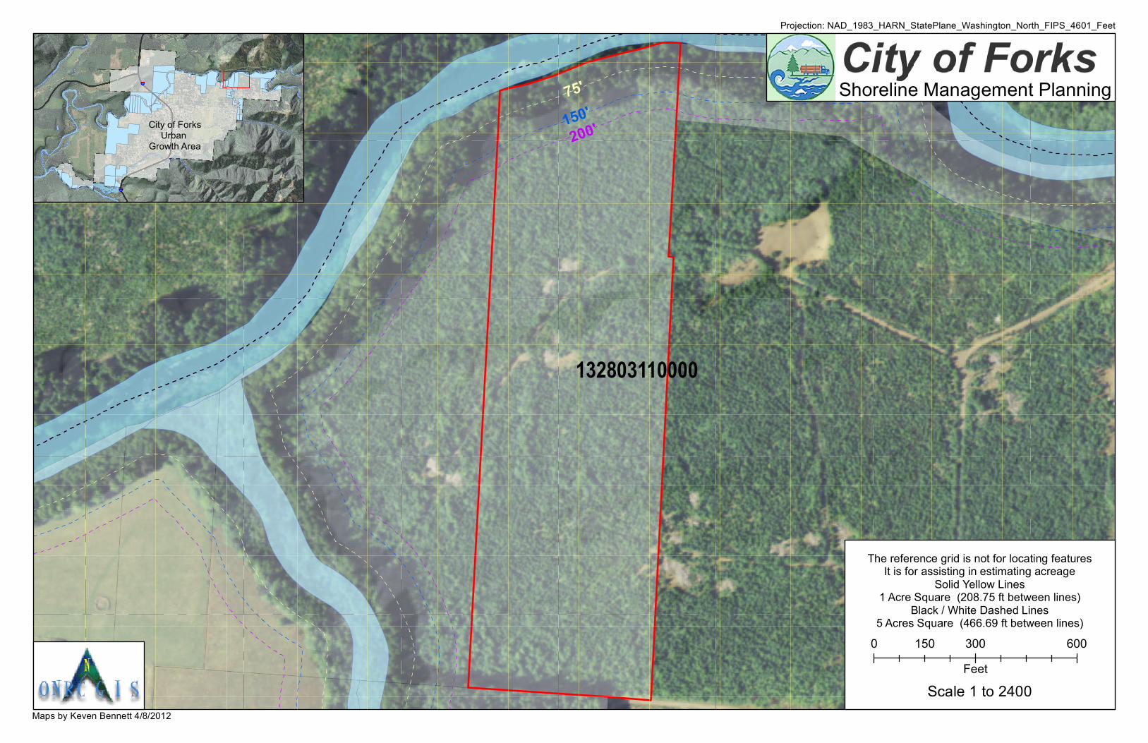
132803110000
Maps by Keven Bennett 4/8/2012
Projection: NAD_1983_HARN_StatePlane_Washington_North_FIPS_4601_Feet
75'150'200'
§̈¦101
§̈¦101
¬«110
City of ForksUrban
Growth Area
Shoreline Management Planning
The reference grid is not for locating featuresIt is for assisting in estimating acreage
Solid Yellow Lines1 Acre Square (208.75 ft between lines)
Black / White Dashed Lines5 Acres Square (466.69 ft between lines)
0 300 600150Feet
Scale 1 to 2400