Embed Size (px)
Citation preview

West Anglia Main Line
Non-Technical Summary
5138271-ES i
April 2016

West Anglia Main Line
Non-Technical Summary
5138271-ES i
Notice
This document and its contents have been prepared and are intended solely for VolkerFitzpatrick and Network Rails’ information and use in relation to a planning application for the WAML Capacity Improvements Project.
Atkins Ltd. assumes no responsibility to any other party in respect of or arising out of or in connection with this document and/or its contents.
Document History
JOB NUMBER: 5138271 DOCUMENT REF: 5138271-NTS
Revision Purpose description Originated Checked Reviewed Authorised Date
1.0 NTS AS DP DP DC 01.04.2016

West Anglia Main Line
Non-Technical Summary
5138271-ES ii
Contents
Section Page
Notice i
Contents ............................................................................................................................................................ ii
1. Introduction .......................................................................................................................................... 1
Background............................................................................................................................................ 1
Environmental Impact Assessment process ......................................................................................... 1
Report Authors ...................................................................................................................................... 3
2. Proposed Development ...................................................................................................................... 4
Site & Surrounding Environment ........................................................................................................... 4
Scheme Description .............................................................................................................................. 6
Construction Programme ....................................................................................................................... 6
Alternatives ............................................................................................................................................ 6
3. Environmental Effects ......................................................................................................................... 8
West Anglia Main Line
Non-Technical Summary
5132909 -NTS 1
1. Introduction
Background
1.1. Atkins has been appointed by VolkerFitzpatrick on behalf of Network Rail to undertake an
Environmental Impact Assessment (EIA) to assist with the delivery of the West Anglia Mainline
(WAML) development, located between Lea Valley and Stratford.
1.2. The London and South East Route Utilisation Strategy (L&SE RUS), 2011, identified future
overcrowding to be an issue on the West Anglia Route, with a capacity shortfall of 1,400
passengers per day north of Tottenham Hale/Seven Sisters in the busiest peak hour. To relieve
this overcrowding and absorb additional forecast growth on the WAML, this project aims to
increase the frequency of Lea Valley line services to Stratford by adding an additional third track
alongside the existing two tracks.
1.3. It will entail the installation of a new third track (with provision for a fourth track) from a junction
near Lea Bridge station, adjacent to the Up Temple Mills/ Up Cambridge line, as far as Angel
Road station. The third track would be approximately 5.6km in length. The project would involve
widening the existing platforms at Tottenham Hale and Northumberland Park station and closure
of the level crossing at Northumberland Park. At the northern end of the Scheme, the existing
Angel Road station will be decommissioned. A new station will be constructed to the south of the
A406 (North Circular) overbridge and will be part of the Meridian Water development either side
of the railway. The new station will form part of the planning permission and accompanying
Environmental Statement (ES) for the Meridian Water development and is not part of the
Scheme.
Environmental Impact Assessment process
1.4. The Proposed Development is classed as Environmental Impact Assessment (EIA) development,
which means that there is a potential for significant environmental effects to arise as a result of
construction or operation of the proposal. Planning applications for EIA developments are
required to be accompanied by an Environmental Statement (ES) which reports on the potential
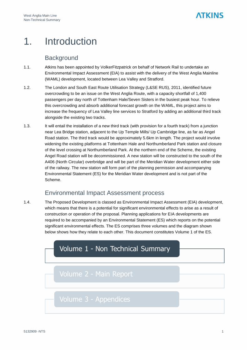
significant environmental effects. The ES comprises three volumes and the diagram shown
below shows how they relate to each other. This document constitutes Volume 1 of the ES.

West Anglia Main Line
Non-Technical Summary
5132909 -NTS 2

West Anglia Main Line
Non-Technical Summary
5132909 -NTS 3
Report Authors
1.5. Atkins Ltd was commissioned by Volker Fitzpatrick Ltd. to coordinate the Environmental Impact
Assessment for WAML. This includes the environmental assessments relating to ecology, air,
noise, landscape and visual impacts, built heritage, community, hydrology, ground and waste.
Headland Archaeology Ltd carried out the geoarchaeological assessment.

West Anglia Main Line
Non-Technical Summary
5132909 -NTS 4
2. Proposed Development
Site & Surrounding Environment
2.1. The Site comprises a stretch of the WAML railway from Angel Road in north London, to the south
of Coppermill Junction between Lea Bridge Station and Tottenham Hale Station. In total, the Site
is approximately 5.6km in length and sits entirely within the boundaries of the operational railway
and travels north to south through the London Boroughs of Enfield, Haringey and Waltham
Forest (Figure 2.1).
2.2. The northerly section of the site is set in a semi-derelict post-industrial townscape where the
surrounding land uses comprise a metal and waste recycling centre and disused gas works to
the west, and a large industrial and retail estate to the west which continues to border the site
until Northumberland Park Station. Beyond the industrial and retail estate are a series of large
reservoirs and watercourses which comprise the River Lea.
2.3. To the west, south of the former gas works site is a sports centre and pitches then residential
properties. Further west of these is the residential area of Edmonton. South of Northumberland
Park Station the surrounding land uses are a mix of residential, light industry and public open
spaces and amenity areas.
2.4. As the site curves to the south east it crosses the Lea Valley passing between two large
reservoirs, Warwick Reservoir East and Warwick Reservoir West. These reservoirs are part of a
large chain of reservoirs along the Lea Valley owned by Thames Water and managed to supply
London with potable water. Collectively these reservoirs are internationally important for wildfoul
and are designated as a Site of Special Scientific Interest (SSSI), Special Protection Area (SPA)
and Wetland of International Importance (Ramsar site).
2.5. Walthamstow Marshes are located south east of the reservoirs and directly south of the site at its
southerly extent. This area is designated as a SSSI and is also important for recreation providing
valuable publicly accessible open space. There are a number of designated walking and cycling
routes across the marshes including National Cycle Route 1 which link into an extensive wider
network of Public Rights of Way (PROW).

TM
Atkins Limited ©Consulting Engineers
The Hub,500 Park Ave,
Bristol,South Gloucestershire,
England,BS32 4RZ
Tel: +44(0)1454 662 000Fax: +44(0)1454 663 333
www.atkinsglobal.com
Project Title Drawing NumberClient
Study area boundary
Path: \\wsatkins.com\project\GBYOC\Rail - Projects\Project\5132909 WAML Capacity\60 Disciplines\68 Environmental\Mapping\GIS\WIP\5138271_WAML_SCH_03_GEO032.mxd
West Anglia Main Line Site Boundary Figure 2.1
Designed / DrawnRJS
RevDate 16/03/16
Original Scale1:18,000
CheckedAS
AuthorisedDP
Network Rail
Sheet Size
0.4 0 0.4 0.8 1.2 1.6 20.2Kilometres
Date 16/03/16 Date 16/03/16
±
03A3
Contains Ordnance Survey data © Crown copyright and database right 2015.

West Anglia Main Line
Non-Technical Summary
5132909 -NTS 6
Scheme Description
2.6. The main elements of the Scheme are as follows:
New track – A new third track to the east of the existing two tracks
Signalling – New signalling equipment to control trains operating on the new third track
Works to structures – Existing bridges crossing the River Lea, other minor water
courses, and underpasses will need to be extended, strengthened or re-built to
accommodate the new third track
Power – New power supply equipment will be required to provide power from the
National Grid for the trains running along the new third track
Overhead Line Electrification (OLE) – New overhead cables will be erected to deliver
power to the trains operating on the new third track.
Platform alterations – New platforms will be constructed at Tottenham Hale, and
Northumberland Park Stations to accommodate the new third track
Meridian Water Station – The existing Angel Road Station will be closed and a new
station called Meridian Water Station will be constructed to the south of the existing
station.
Closure of the Northumberland Park level crossing.
Construction Programme
2.7. A detailed construction programme has not yet been developed. Construction is due to
commence in May 2016 and to be completed by mid-2018.
2.8. Works which can be carried out offline and that enable the railway to operate normally will be
carried out between 7am and 7pm Monday to Friday. Works undertaken which require line
blockage, possession or have the potential to cause a safety risk to the operational railway will be
undertaken at nights and weekends.
Alternatives
Option Selection Workshop
2.9. An option selection workshop was held on 15th January 2015. This involved all design and
construction Contractor’s Responsible Engineers (CREs), Network Rail Project Engineers (PEs)
and the Designated Project Engineer (DPE). Also in attendance was the project sponsor, as well
as representatives from the Route Asset Management (RAM) organisation and the Network Rail
Operations organisation. The following options were considered.
Option 1 (Base Option)
2.10. Option 1 requires the installation of the new third track from a junction near Lea Bridge Station,
adjacent to the Up Temple Mills / Up Cambridge line, as far North as a new platform face at
Tottenham Hale Station, where the track will run up to a buffer stop. This is a CP5 commitment
as part of the CP5 delivery plan to the Office of Rail Regulator (ORR).

West Anglia Main Line
Non-Technical Summary
5132909 -NTS 7
Option 1A
2.11. Option 1A extends Option 1 by connecting the proposed third line back to the Up Cambridge
track north of Tottenham Hale station. This allows the third line to act as a loop. The addition of a
crossover between the main lines at this location also provides access to the Down Cambridge
track. Although not providing timetabled benefits for the services described in Section 1, this
additional signal and crossing would provide flexibility to the layout in times of amended or
degraded working, or during possessions.
Option 2 (Base Option)
2.12. This option extends Option 1 with the third track section running to Angel Road Station. It
includes widening of the existing platforms on the Up Cambridge track at Northumberland Park
and Angel Road stations. This option includes closure of the level crossing at Northumberland
Park.

West Anglia Main Line
Non-Technical Summary
5132909 -NTS 8
3. Environmental Effects 3.1. Table 3.1 provides a summary of the main environmental effects that will arise during the construction and operation of the Scheme.
Table 3.1 Summary of the environmental assessments
Environmental topic
Baseline summary Impact assessment summary Mitigation summary Environmental effects
Ecology There are 5 statutory designated sites within 1km, 4 of which are directly adjacent to the proposed Scheme.
There are 7 non-statutory designated sites within 1km of the proposed Scheme.
Habitat along the railway corridor is generally a mix of scrub, tall herb and neutral grassland with occasional small areas of woodland dominated by sycamore.
The habitats along the railway link up to form a wildlife corridor.
The working area will occupy approximately 3.8 ha, 80% of the area within one of the non-statutory designated sites. This includes the railway tracks and ballast where this is included in the SINC boundary.
Construction will result in approximately 2.4 ha of permanent habitat loss, 32% of the area within one of the non-statutory designated sites.
Construction will result in a permanent loss of approximately 4.8 ha of habitat through the Site, reducing and disturbing the wildlife corridor.
It is proposed to compensate the habitat loss but proposals are still to be agreed.
Night time lighting will be directional and focused on work parties to avoid overspill into adjacent habitats.
Habitats along the west of the railway corridor will be retained as far as possible during construction.
Habitat loss will result in an adverse effect on the conservation objectives of the non-statutory designated site in its capacity to act as an ecological corridor. The majority of the habitat along the eastern side of the existing railway tracks will be lost.
Habitat will remain along the western side of the existing tracks maintaining a corridor. However, overall the habitat cover will be reduced by approximately 50%.
The loss of habitat will result in a marked reduction in the functionality of the Site as an ecological corridor. After construction, habitat will grow back in time but the amount will be less due to the new third rail. This will be a long term adverse effect.

West Anglia Main Line
Non-Technical Summary
5132909 -NTS 9
Environmental topic
Baseline summary Impact assessment summary Mitigation summary Environmental effects
Historic environment
Archaeology: The site runs through the Lower Lea Valley Archaeological Priority Area for the entirety of its length.
Built Heritage: There are three nationally designated and ten locally designated built heritage assets within a 500m buffer of the site route.
The presence of construction plant, machinery, hoardings and the noise and dust associated with the construction process could affect the setting of built heritage assets.
Piling and excavations for foundations could impact geological strata with paleo-environmental interest.
Piling and excavations for foundations could impact geological strata with paleo-environmental interest. This is particularly the case with the construction of the Meridian Water Station.
Following completion of the Scheme the presence of OLE and large track footings may increase the presence of the railway, affecting the setting of built heritage assets.
Where engineering works provide suitable opportunities, sampling and analysis to be undertaken during excavation work to the depths of the recorded Kempton Park Gravels.
A palaeo-environmental and geo-morphological sampling strategy will be implemented where suitable in areas of identified organic rich deposits, to inform any further mitigation.
Construction to the depths of the Kempton Park Gravels has the potential to truncate or destroy any archaeological remains present at those depths.
The effect will be mitigated and this will allow for the remains to be properly documented and analysed.
No archaeology meriting preservation in situ is likely to be encountered.
During construction, construction activities would result in a significant adverse effect to the setting of Springfield Park Registered Park and Gards. Following the completion of the Scheme the railway will appear more prominent in views from the higher ground of Springfield Park but this would not result in a significant adverse effect.

West Anglia Main Line
Non-Technical Summary
5132909 -NTS 10
Environmental topic
Baseline summary Impact assessment summary Mitigation summary Environmental effects
Landscape and visual
The study area falls within National Character Areas (NCA) 111 – Northern Thames Basin & 112 – Inner London. As well as NCA, the baseline included regional and local character areas. Nine local landscape character areas were identified within the study area.
Ten key viewpoints were identified which represented visual receptors including local residents and people travelling through the study area
During construction, works activities could change the character of the local area.
Removal of vegetation from within the rail corridor will increase the visual prominence of construction plant and equipment including lighting and make the railway corridor more prominent in views.
New temporary site offices up to 3 storeys high will be a prominent new landscape feature at Hall Farm Curve.
The increased amount of associated
rail infrastructure including the OLE
gantries and changes to structures
would reinforce the rail corridor.
Operation of a clean and tidy construction site, including covering of stockpiles.
Minimise use of construction lighting following Institute of Lighting Engineers guidelines.
Retain boundary vegetation where possible.
Where practicable, Use of hoarding around worksites and equipment storage areas particularly against areas that contain sensitive receptors during the construction period would assist in reducing the potential impact;
Limit heights of stockpiled materials as far as possible.
Restore the Hall Farm Curve worksite to its original condition after construction.
Replant screening vegetation along the earth embankment at Jarrow Road.
Sensitive treatment of design and choice of materials relating to the proposed Meridian Water Station, would integrate it into the wider landscape.
The construction works will result in significant adverse effects to three representative viewpoints at Heybourne Road, Jarrow Road, and a footpath south of the Warwick Reservoir West. During operation two representative viewpoints at Jarrow Road and the footpath south of the Warwick Reservoir West will be significantly affected.
Three landscape character areas will be significantly affected during both construction and operation at Jarrow Road, Warwick Reservoirs, and Walthamstow Marshes.

West Anglia Main Line
Non-Technical Summary
5132909 -NTS 11
Environmental topic
Baseline summary Impact assessment summary Mitigation summary Environmental effects
Community There are a number of community assets and residential properties close to the Site whose residents have the potential to experience amenity effects from the proposed Scheme.
There are five Public Rights of Way and six public roads that either bisect or terminate at the rail corridor.
A number of PRoWs and cycle paths will be temporarily closed for parts of the construction phase.
The existing Angel Road Station will be closed and the new Meridian Water Station will be opened approximately 300m to the south.
Clear signage to show temporary diversion routes.
Notify regular footpath users of planned diversion with signs along the section of footpath to be closed at least one month prior to the footpath closure.
Construction works will need to be programmed so an alternative route is available for pedestrians and road users.
Consultation with Local Councils to agree diversion routes.
Users of some public rights of way will be significantly affected as there would be limited diversion routes available.
Users of the Angel Road Station will have to change their journey patterns to reach the new Meridian Water station. The exact distance of the route between the old and new stations is currently unknown as it depends on the layout of the final Meridian Water development, but it is envisaged to be approximately 600m. This would be a significant benefit to passengers living to the south of the station but a significant adverse effect for passengers living to the north.

West Anglia Main Line
Non-Technical Summary
5132909 -NTS 12
Environmental topic
Baseline summary Impact assessment summary Mitigation summary Environmental effects
Waste Data collected from the Greater London Authority shows that the amount of Construction Demolition & Excavation (CD&E) arisings are predicted to increase from a baseline of 1.69 million in 2010 to 1.72 million in 2015 and 1.82 million by 2031.
Municipal waste arisings in the local Boroughs which are steadily increasing from an estimated current value 427,000 tonnes per year to a projected 474,000 tonnes per year in 2031.
At present there is also insufficient capacity to manage the hazardous waste generated in London. Therefore 85% of hazardous waste is currently sent to other regions to be managed.
591 Tonnes of hazardous waste will be produced from demolition and excavation activities.
7,584 tonnes of non-hazardous waste are expected to be produced from demolition, construction and excavation activities.
During operation it is anticipated that 52 tonnes per year of waste will be generated including a nominal amount of hazardous waste
Ideally waste will be designed out at the early design phases to ensure materials used are recycled or reclaimed materials from other projects locally.
It is recommended that a Site Waste Management Plan is produced to detail the expected waste arisings and the proposed reuse / recycling quantities.
Source segregation of residual and recyclable waste. This can be achieved through provision of clearly marked and / or colour coded bins to enable easy identification of what materials should be placed inside (residual and recyclable waste) and provision of clear signage on the walls behind the bins;
Development of an ongoing site management plan incorporating waste or the development of an operational waste management plan;
A dedicated area for the storage of hazardous waste arisings; and
Provision of regular training for maintenance staff on recycling and waste reduction and the practices necessary to minimise waste and facilitate good practice waste management.
It is anticipated that there will not be any significant effects as a result of the operational phases of the proposed Scheme.
The construction phase will result in a major significant effect due to the large quantity of excavation and green waste generated by the Scheme. Mitigation will be implemented in accordance with best practice to minimise waste arisings as far as possible.

West Anglia Main Line
Non-Technical Summary
5132909 -NTS 13
Environmental topic
Baseline summary Impact assessment summary Mitigation summary Environmental effects
Air quality Due to the urbanised nature of the study area, there are a significant number of air quality sensitive receptors in close proximity to the proposed Scheme.
As well as human receptors, sensitive ecological habitats within the study area include Walthamstow Marshes SSSI/ Walthamstow Reservoirs SSSI/ Lee Valley SPA and Ramsar Site.
Risk of dust emissions during construction which could cause a nuisance through dust soiling and/or an increase in PM10 concentrations which could impact on human health.
Risk of dust deposition during construction which could affect vegetation
Change in pollutant concentrations as a result of additional traffic during construction.
Change in pollutant concentrations as a result of traffic changes resulting from the changes at Northumberland Park Avenue level crossing
A range of best practice construction methods will be implemented to minimise the generation of dust during construction.
With appropriate mitigation measures in place, any adverse impacts resulting from the construction works would be minimised such that there would not be any significant residual effect.
Changes in traffic flows during construction and from the closure of the Northumberland Park level crossing are not sufficiently large as to result in a change to air quality at local receptors.
Noise and vibration
Due to the urbanised nature of the study area, there are a significant number of noise and vibration sensitive receptors in close proximity to the Scheme. The separation distances between the Scheme and the nearest sensitive receptors typically range from 12m to 50m.
Noise from construction plant and activities.
Noise from construction traffic.
Vibration resulting from percussive and vibratory pilings, and vibratory compaction works.
Increased rail noise
Change in road traffic noise due to level crossing closure
A range of best practice construction methods will be implemented to minimise the generation of noise and vibration during construction. A new noise barrier will be constructed in the vicinity of Jarrow Road
Due to the limited setback distances to a number of residential properties situated in the vicinity of the proposed Scheme, construction noise could result in significant adverse effects to the occupants. The effect would be greater at night.
The potential for adverse effects from construction traffic is more likely to occur on local sections of road closest to the site compound or site access points where existing traffic flows are low.
Due to the proximity of certain properties adjacent to the Scheme, construction induced vibration has the potential to give rise to significant adverse effects.
The majority of construction works will be transient and therefore effects will typically be short term only.
The construction of a noise barrier to protect residents at Jarrow Road from train noise during operation will ensure adverse effects are not significant.

West Anglia Main Line
Non-Technical Summary
5132909 -NTS 14
Environmental topic
Baseline summary Impact assessment summary Mitigation summary Environmental effects
Water environment
Seven Water Framework Directive designated watercourses are located within 1km of the Scheme
There is groundwater underneath the Scheme classified as a Secondary Undifferentiated aquifer.
The Scheme is located within Flood Zones 2 and 3, which means that there is a probability of river flooding between 1% and 0.1% for Zone 2 and greater than 1% for Flood Zone 3.
Deterioration in water quality could result from runoff from working areas.
Increased suspended sediment affecting surface water bodies.
Damage to the bed and banks of watercourses.
Deterioration in groundwater quality as a result of piling.
Increased flood risk off site due to displacement of flood water and/or interruption/ diversion of flood flow paths.
Flooding of existing railway, damage to plant, equipment and materials.
A range of best practice measures as set out in Environment Agency and CIRIA guidance will be implemented.
Implementation of Environment Agency guidance for construction sites.
There is a small risk of contamination of underlying groundwater and surface water courses from construction activities. However, It is not anticipated that the Scheme will lead to the deterioration of the receptors identified.
Risk of flooding from extreme fluvial flood event that overtops existing defences
Land quality Geological mapping indicates that superficial deposits including Enfield Silt Member, Kempton Park Gravels and Alluvium are present along the length of the Proposed Scheme. The bedrock consists of London Clay and Lambeth Group. Most of the proposed Scheme is located within Source Protection Zones.
Previous ground investigations found the site for the proposed Meridian Water Station to be extensively contaminated.
There are 9 potential sources of contamination, 6 of which are located within the Site boundary with potential receptors including workers onsite, residents and commuters.
Construction workers could come into contact with hazardous substances when handling contaminated material.
Migration of contaminants to ground and surface waters.
Direct contact of existing structures with contaminants in soils and/or groundwater.
Migration of ground gases or vapours along preferential pathways.
Risk assessments will be undertaken to ensure construction workers are wearing appropriate Personal Protective Equipment and following appropriate construction methods.
Piling design and method will ensure that the underlying aquifer is not contaminated.
The design of new structures will specify suitable materials to resist corrosion.
Structures design will protect future occupants from ground vapours.
With mitigation in place, the risk to these receptors would be minimised any adverse effects would be temporary and minor in nature.
Any new contamination caused by the construction of the Proposed Scheme would be adequately dealt with during construction as part of the Construction Environment Management Plan. The potential for off-site property receptors to be exposed to contaminants during the operation of the Proposed Scheme is minimal and comparable to the baseline so no new mitigation will be required.