Embed Size (px)
Citation preview
Land Cover By District Land Cover Atlas of Pakistan The Sindh Province
DISTRIBUTION OF LAND COVER IN THE DISTRICT
Arabian Sea
P u n j a b
Balochistan
Punjab
I n d i a
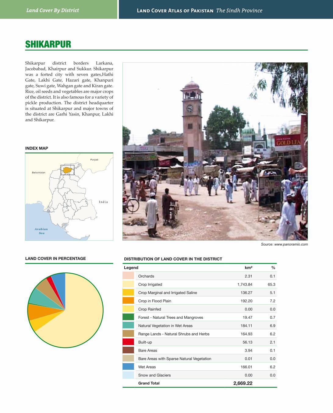
SHIkaRPuR
Legend km² %
Orchards 2.31 0.1
Crop Irrigated 1,743.84 65.3
Crop Marginal and Irrigated Saline 136.27 5.1
Crop in Flood Plain 192.20 7.2
Crop Rainfed 0.00 0.0
Forest - Natural Trees and Mangroves 19.47 0.7
Natural Vegetation in Wet Areas 184.11 6.9
Range Lands - Natural Shrubs and Herbs 164.93 6.2
Built-up 56.13 2.1
Bare Areas 3.94 0.1
Bare Areas with Sparse Natural Vegetation 0.01 0.0
Wet Areas 166.01 6.2
Snow and Glaciers 0.00 0.0
Grand Total 2,669.22
Shikarpur district borders Larkana, Jacobabad, Khairpur and Sukkur. Shikarpur was a forted city with seven gates,Hathi Gate, Lakhi Gate, Hazari gate, Khanpuri gate, Suwi gate, Wahgan gate and Kiran gate. Rice, oil seeds and vegetables are major crops of the district. It is also famous for a variety of pickle production. The district headquarter is situated at Shikarpur and major towns of the district are Garhi Yasin, Khanpur, Lakhi and Shikarpur.
Source: www.panoramio.com
INDEX MAP
LAND COVER IN PERCENTAGE

61
!(
!(
!(
!(
!P
Lakh
i
Khan
pur
Shi
karp
ur
Gar
hi Y
asin
Sukk
ur
Jaco
baba
d
Lark
ana
Kas
hmor
e
Kha
irpu
r
69°0' E
69°0' E
68°30
'E
68°30
'E
28°0' N
28°0' N
04
82
Km
ÜM
erca
tor P
roje
ctio
n W
GS
-84
Land Cover By District Land Cover Atlas of Pakistan The Sindh Province
DISTRIBUTION OF LAND COVER IN THE DISTRICT
Arabian Sea
P u n j a b
Balochistan
Punjab
I n d i a
SukkuR
Legend km² %
Orchards 81.21 1.7
Crop Irrigated 994.19 20.5
Crop Marginal and Irrigated Saline 217.78 4.5
Crop in Flood Plain 359.32 7.4
Crop Rainfed 0.00 0.0
Forest - Natural Trees and Mangroves 5.45 0.1
Natural Vegetation in Wet Areas 245.80 5.1
Range Lands - Natural Shrubs and Herbs 37.47 0.8
Built-up 96.31 2.0
Bare Areas 40.41 0.8
Bare Areas with Sparse Natural Vegetation 2,666.27 54.9
Wet Areas 112.72 2.3
Snow and Glaciers 0.00 0.0
Grand Total 4,856.93
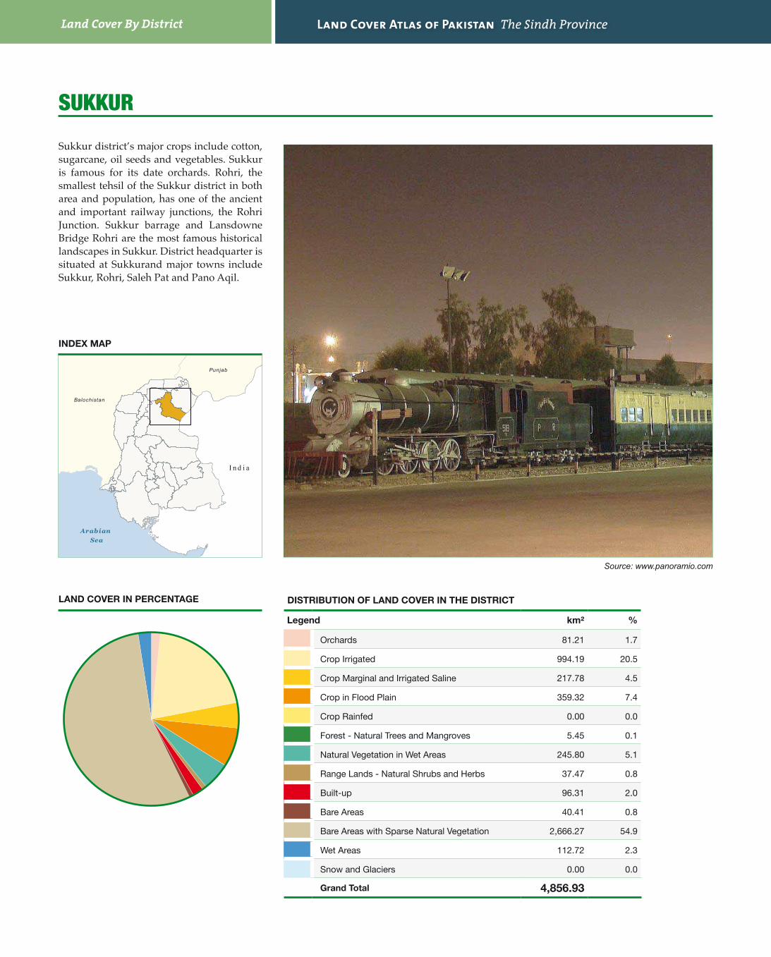
Sukkur district’s major crops include cotton, sugarcane, oil seeds and vegetables. Sukkur is famous for its date orchards. Rohri, the smallest tehsil of the Sukkur district in both area and population, has one of the ancient and important railway junctions, the Rohri Junction. Sukkur barrage and Lansdowne Bridge Rohri are the most famous historical landscapes in Sukkur. District headquarter is situated at Sukkurand major towns include Sukkur, Rohri, Saleh Pat and Pano Aqil.
Source: www.panoramio.com
INDEX MAP
LAND COVER IN PERCENTAGE

63
!(
!(
!(
!(
!PR
ohri
Suk
kur
Pano
Aqi
l
Sale
h pa
t
Punj
ab
Gho
tki
Kha
irpu
r
Shik
arpu
r
Kas
hmor
e
Lark
ana
Ind
ia
69°30
'E
69°30
'E
69°0' E
69°0' E
68°30
'E
68°30
'E
28°0' N
28°0' N
27°30
'N
27°30
'N
07.
515
3.75
Km
ÜM
erca
tor P
roje
ctio
n W
GS
-84
Land Cover By District Land Cover Atlas of Pakistan The Sindh Province
DISTRIBUTION OF LAND COVER IN THE DISTRICT
Arabian Sea
P u n j a b
Balochistan
Punjab
I n d i a
taNDO aLLaHyaR
Legend km² %
Orchards 167.98 10.9
Crop Irrigated 1,111.59 72.2
Crop Marginal and Irrigated Saline 94.81 6.2
Crop in Flood Plain 0.00 0.0
Crop Rainfed 0.00 0.0
Forest - Natural Trees and Mangroves 2.68 0.2
Natural Vegetation in Wet Areas 0.00 0.0
Range Lands - Natural Shrubs and Herbs 75.04 4.9
Built-up 52.16 3.4
Bare Areas 0.72 0.0
Bare Areas with Sparse Natural Vegetation 1.16 0.1
Wet Areas 33.46 2.2
Snow and Glaciers 0.00 0.0
Grand Total 1,539.60
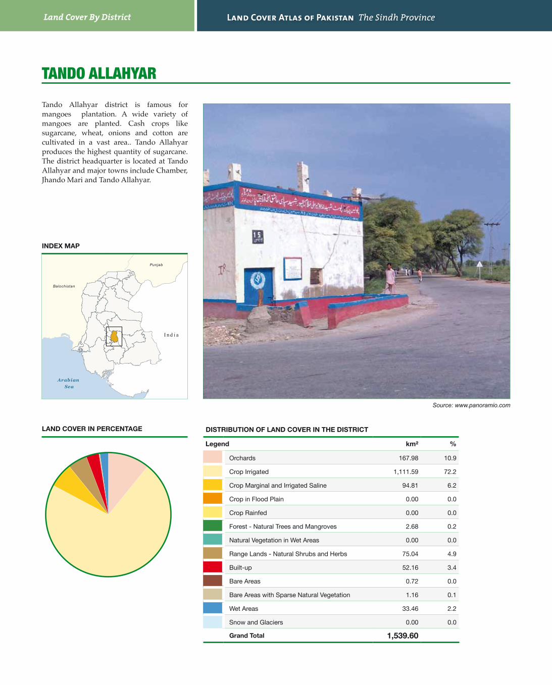
Tando Allahyar district is famous for mangoes plantation. A wide variety of mangoes are planted. Cash crops like sugarcane, wheat, onions and cotton are cultivated in a vast area.. Tando Allahyar produces the highest quantity of sugarcane. The district headquarter is located at Tando Allahyar and major towns include Chamber, Jhando Mari and Tando Allahyar.
Source: www.panoramio.com
INDEX MAP
LAND COVER IN PERCENTAGE

65
!(
!(
!(
!P
Chambar
Nasarpur
Tando Al lahya r
Matiari
Mirpurkhas
Sanghar
Badin
Hyderabad
Tando Muhammad Khan
69° 0'E
69° 0'E
25° 30'N 25° 30'
N
0 3 61.5 Km
Ü Mercator Projection WGS-84

Land Cover By District Land Cover Atlas of Pakistan The Sindh Province
DISTRIBUTION OF LAND COVER IN THE DISTRICT
Arabian Sea
P u n j a b
Balochistan
Punjab
I n d i a
taNDO muHammaD kHaN
Legend km² %
Orchards 16.48 1.1
Crop Irrigated 1,202.72 76.9
Crop Marginal and Irrigated Saline 116.01 7.4
Crop in Flood Plain 21.13 1.4
Crop Rainfed 0.00 0.0
Forest - Natural Trees and Mangroves 2.75 0.2
Natural Vegetation in Wet Areas 24.17 1.5
Range Lands - Natural Shrubs and Herbs 26.87 1.7
Built-up 38.29 2.4
Bare Areas 2.81 0.2
Bare Areas with Sparse Natural Vegetation 2.30 0.1
Wet Areas 110.22 7.0
Snow and Glaciers 0.00 0.0
Grand Total 1,563.77
Main crops grown in Tando Muhammad Khan district are sugarcane, rice, wheat and cotton. The major towns of the district are Tando Muhammad Khan, Bulri Shah Karim and Tando Ghulam Hyder. District headquarter is situated at Tando Muhammad Khan.
Source: www.panoramio.com
INDEX MAP
LAND COVER IN PERCENTAGE

67
!(
!(
!(!P
Bulri Shah Karim
Tando Ghulam Hyder
Tando Muhamm ad K han
Badin
Thatta
Hyderabad
Tando AllahyarJamshoro
68° 30'E
68° 30'E
25° 0'N 25° 0'
N
0 4 82 Km
Ü Mercator Projection WGS-84