Embed Size (px)
Citation preview
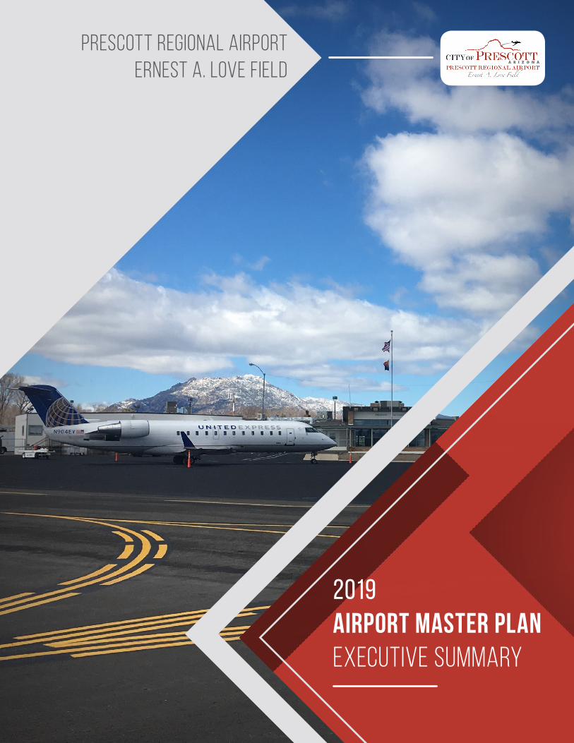
2019AIRPORT MASTER PLAN EXECUTIVE SUMMARY
PRESCOTT REGIONAL AIRPORTERNEST A. LOVE FIELD

2
INTRODUCTION Prescott Regional Airport - Ernest A. Love Field (PRC) is a dynamic aviation facility situated to the east of Prescott National Forest in Arizona. In recent years, the combination of changes in commercial air service, fluctuations in general aviation activity, completion of improvement projects, and updates to Federal Aviation Administration (FAA) design criteria have all contributed to changing conditions at the airport.
In order to provide guidance through these changing conditions and in anticipation of emerging trends, the City of Prescott, in conjunction with the FAA and the Arizona Department of Aviation (ADOT), completed this airport master planning effort. The outcome of this effort provides a 20-year outlook related to aviation demand and will provide guidance and recommendations for future developments and infrastructure needs for PRC.
The purpose of this executive summary is to provide an overview of the findings and subsequent recommendations from the Master Plan Update Study for Prescott Regional Airport – Ernest A. Love Field. The complete Master Plan Update Report should be referenced for further information on the assumptions and methodologies that support the findings and recommendations described herein.
PRC Airport Master Plan – Executive Summary 1
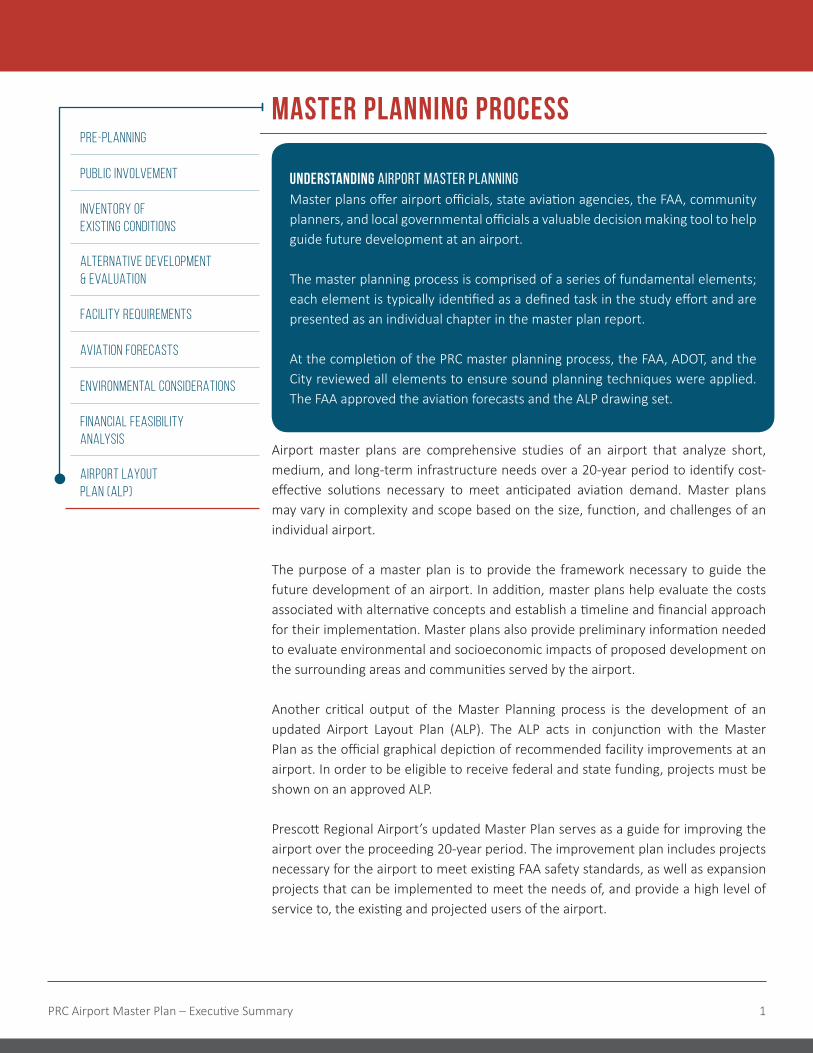
MASTER PLANNING PROCESS
UNDERSTANDING AIRPORT MASTER PLANNINGMaster plans offer airport officials, state aviation agencies, the FAA, community planners, and local governmental officials a valuable decision making tool to help guide future development at an airport.
The master planning process is comprised of a series of fundamental elements; each element is typically identified as a defined task in the study effort and are presented as an individual chapter in the master plan report.
At the completion of the PRC master planning process, the FAA, ADOT, and the City reviewed all elements to ensure sound planning techniques were applied. The FAA approved the aviation forecasts and the ALP drawing set.
Airport master plans are comprehensive studies of an airport that analyze short, medium, and long-term infrastructure needs over a 20-year period to identify cost-effective solutions necessary to meet anticipated aviation demand. Master plans may vary in complexity and scope based on the size, function, and challenges of an individual airport.
The purpose of a master plan is to provide the framework necessary to guide the future development of an airport. In addition, master plans help evaluate the costs associated with alternative concepts and establish a timeline and financial approach for their implementation. Master plans also provide preliminary information needed to evaluate environmental and socioeconomic impacts of proposed development on the surrounding areas and communities served by the airport.
Another critical output of the Master Planning process is the development of an updated Airport Layout Plan (ALP). The ALP acts in conjunction with the Master Plan as the official graphical depiction of recommended facility improvements at an airport. In order to be eligible to receive federal and state funding, projects must be shown on an approved ALP.
Prescott Regional Airport’s updated Master Plan serves as a guide for improving the airport over the proceeding 20-year period. The improvement plan includes projects necessary for the airport to meet existing FAA safety standards, as well as expansion projects that can be implemented to meet the needs of, and provide a high level of service to, the existing and projected users of the airport.
PRE-PLANNING
PUBLIC INVOLVEMENT
INVENTORY OF EXISTING CONDITIONS
ALTERNATIVE DEVELOPMENT & EVALUATION
FACILITY REQUIREMENTS
AVIATION FORECASTS
ENVIRONMENTAL CONSIDERATIONS
FINANCIAL FEASIBILITY ANALYSIS
AIRPORT LAYOUT PLAN (ALP)

2
HISTORYThe airport was founded as Prescott Municipal Airport in 1926, dedicated as Ernest A. Love Field two years later in 1928, and renamed to Prescott Regional Airport – Ernest A. Love Field in 2018. The airport saw little growth in its first few decades but began to grow exponentially in the 40’s and 50’s with the construction of several large airfield projects, the expansion of the airport property boundaries, founding of flight companies and other businesses on the airfield, and the establishment of commercial air service. Significant growth in general aviation at the airport occurred in the 60’s with based aircraft increasing tenfold in as many years. The 70’s saw the completion of the first Airport Master Plan and the addition of Embry-Riddle Aeronautical University’s western campus and flight school. The 80’s and 90’s ushered in another period of major change at the airport with the construction of the U.S. Forest Service facility, completion of the first update to the Airport Master Plan, construction of Runway 3L-21R, a fuel storage facility, and new hangars and safety improvements. During the early 2000’s, the focus at the airport was rehabilitation and maintenance of existing pavements, along with many safety and operational improvements. Since 2018, with the addition of 50-seat regional jet commercial service, the Airport is poised to encounter a robust growth period.
PRC Today
CLASSIFIED AS A PRIMARY COMMERCIAL
SERVICE AIRPORT
44TH BUSIEST AIRPORT IN THE US BY AIRCRAFT
OPERATIONS
SERVES THE COMMERCIAL AND GENERAL AVIATION (GA) NEEDS OF YAVAPAI COUNTY
AND MUCH OF NORTHERN ARIZONA
LINKS THE REGION WITH DUAL-HUB NON-STOP SERVICE TO MARKETS
BOTH DOMESTICALLY AND INTERNATIONALLY

PRC Airport Master Plan – Executive Summary 3
MAJOR EXISTING ELEMENTS
Three Runways � Runway 3R-21L:
> 7,619 feet long by 150 feet wide � Runway 3L-21R
> 4,846 feet long by 60 feet wide � Runway 12-30
> 4,408 feet long by 75 feet wide
Five Parallel Taxiways
Air Traffic Control Tower
Flight Schools � Embry-Riddle Aeronautical University � Guidance Aviation � North-Aire � Universal Helicopters
Hangars � 134 T-Hangars & Shade Hangars Units � 18 Clear Span Hangars � 54 Executive Hangars Units
US Forest Service
Full Service FBO � Legend Aviation
On-site ARFF Services
Commercial Airline Service � United Express
On-site Restaurant � Susie’s Skyway
On-site Rental Car and Valet

4
FORECASTS & AVIATION DEMANDForecast of aviation demand are a key element in airport planning as they form the basis for future demand-driven improvements, provide a basis for determining the type, size, and timing of aviation facility development, and provide data used to estimate futures off-airport impacts such as noise and traffic. Aviation activity forecast were generated for Prescott Regional Airport for a 20-year planning period, 2016-2036.
The current design aircraft is a Bombardier CRJ-200, which represents an Approach Category C and Design Group II. The design aircraft for the 20-year planning period was determined to be the Embraer E170/E175 family, which represents an Approach Category C and Design Group III.
Enplanements
3,5475,888
10,111
27,500(Estimated)
0
5,000
10,000
15,000
20,000
25,000
30,000
2016 2017 2018 2019
Summary OF FORECAST
BASED AIRCRAFT ANNUAL OPERATIONS
YearSingle Engine Piston
Multi Engine Piston
Turbo Prop
JetRotor Craft
Light Sport
TOTALGeneral Aviation
Air Carrier
TOTAL
2016 256 20 8 3 35 16 338 262,347 3,683 266,030
2021 249 20 9 4 40 20 340 264,232 3,120 267,352
2026 241 19 10 4 45 25 344 267,902 3,640 271,542
2031 234 19 12 5 51 31 350 273,702 3,640 277,342
2036 227 18 13 5 57 39 359 282,060 3,640 285,700
The last several years have seen a dramatic change in passenger enplanements at PRC. With the introduction of United Express service operated by Skywest Airlines in 2018, enplanements have grown 675% from 3,547 in 2016 to an estimated 27,500 by the end of 2019. The once daily service to Denver International Airport and Los Angles International Airport, both hubs for United Airlines, is expected to increase next year, providing additional opportunities for increased passenger enplanements.

PRC Airport Master Plan – Executive Summary 5
FACILITY REQUIREMENTS A review of existing infrastructure and its ability to accommodate projected levels of demand has identified areas that should be the focus of future planning and development. The major areas of focus include:
Rehabilitate Runway 3R-21L Pavement
Rehabilitate Runway 3R-21L Lighting
Construct Shade Hangars
Rehabilitate West Ramp
Construct New Commercial Service Terminal Building
Construct New Commercial Service Terminal Parking Lot
Rehabilitate New Commerical Service Terminal Ramp
Relocate Taxiway C/RIM Projects
Rehabilitate North Ramp
Improve Runway 12-30 Runway Safety Area
Rehabilitate Runway 12-30 Lighting
Expand FBO Automobile Parking Lot*
Expand FBO Ramp*
Upgrade Perimeter Fence and Security System
Construct Corporate Hangar*
Construct ARFF Facility
Acquire Land (Runway 3R-21L Extension)
Construct Runway 3R-21L Extension
Construct T-Hangar Taxilanes
Construct T-Hangar*
Environmental Assessment to Extend Runway 3L-21R
Relocate Taxiway F
Construct SRE/MXE Storage Building
Rehabilitate Runway 3L-21R PAPIs
Rehabilitate Runway 3L-21R Lighting & Install REILs
Rehabilitate Taxiways D & K & H
Rehabilitate MacCurdy Drive
Construct New Air Traffic Control Tower
Construct Corporate Hangar*
Expand FBO Terminal Building*
Expand Commercial Service Terminal Parking Lot
Conduct Airport Wayfinding Study and Improvements
Clubhouse Road Extension Study
Update Airport Property Map
Rehabilitate Runway 12-30 Pavement
Rehabilitate Taxiway A
Acquire Land (Runway 3L-21R Extension)
Construct Runway 3L-21R Extension
Rehabilitate Runway 3L-21R Pavement
Construct Corporate Hangar*
Construct T-Hangar Taxilanes
Construct T-Hangar*
Construct Rental Car Service Facility
Construct Aircraft Wash Facility
Construct GSE Building
Construct High-Speed Exit Taxiways
Expand Commercial Service Terminal
Expand Commercial Service Terminal Parking Lot
Environmental Assessment to Extend Runway 3L-21R
Expand FBO Building* Private Development
Phase I Development
0-5 Years
Phase II Development
6-10 Years
Phase III Development
11-20 Years

RPZ
RPZ
RPZ
RPZ
RPZ
RPZ
RPZ
RPZ
RPZ
X X X X X X X X X
XX
XX
XXXXXXXXX
XXXX
RPZ
RPZ
RPZ
RPZ
RPZ
RPZ
RPZ
RPZ
RPZ
RPZ
RPZ
9
13
8
13
10
11
1314
10
5
11 11
6
7
31
2
12
12
13
15
16
11
4
11
18
17
Facility Requirements
Extend Runway 3R-21L - 2,381'Extend Runway 3L-21R - 1,354'Relocate Taxiway CRIM MitigationNew Commercial Service TerminalNew Air Traffic Control TowerNew ARFF / SRE FacilityApron ExpansionFBO Expansion
Apron ExpansionHangar ConstructionLand AcquisitionTaxiway ImprovementsHigh Speed Exit TaxiwaysRental Car Service FacilityAircraft WashrackSelf-Service Fuel FacilityNew Auto Parking
Legend
1
2
3
4
5
6
7
8
9
10
11
12
13
14
15
16
17
18
Proposed Airport Property Boundary /Land Acquisition
Proposed Airfield Pavement
Property Airport Building
Proposed Road / Parking
Proposed Removal
Proposed Runway Protection Zone (RPZ)
Existing Airport Property Boundary
Existing Airfield Pavement
Existing Airport Building
Existing Runway Protection Zone (RPZ)
RPZ
PREFERRED ALTERNATIVE
Facility Requirements
RPZ
RPZ
RPZ
RPZ
RPZ
RPZ
RPZ
RPZ
RPZ
X X X X X X X X X
XX
XX
XXXXXXXXX
XXXX
RPZ
RPZ
RPZ
RPZ
RPZ
RPZ
RPZ
RPZ
RPZ
RPZ
RPZ
9
13
8
13
10
11
1314
10
5
11 11
6
7
31
2
12
12
13
15
16
11
4
11
18
17
Facility Requirements
Extend Runway 3R-21L - 2,381'Extend Runway 3L-21R - 1,354'Relocate Taxiway CRIM MitigationNew Commercial Service TerminalNew Air Traffic Control TowerNew ARFF / SRE FacilityApron ExpansionFBO Expansion
Apron ExpansionHangar ConstructionLand AcquisitionTaxiway ImprovementsHigh Speed Exit TaxiwaysRental Car Service FacilityAircraft WashrackSelf-Service Fuel FacilityNew Auto Parking
Legend
1
2
3
4
5
6
7
8
9
10
11
12
13
14
15
16
17
18
Proposed Airport Property Boundary /Land Acquisition
Proposed Airfield Pavement
Property Airport Building
Proposed Road / Parking
Proposed Removal
Proposed Runway Protection Zone (RPZ)
Existing Airport Property Boundary
Existing Airfield Pavement
Existing Airport Building
Existing Runway Protection Zone (RPZ)
RPZ

RPZ
RPZ
RPZ
RPZ
RPZ
RPZ
RPZ
RPZ
RPZ
X X X X X X X X X
XX
XX
XXXXXXXXX
XXXX
RPZ
RPZ
RPZ
RPZ
RPZ
RPZ
RPZ
RPZ
RPZ
RPZ
RPZ
9
13
8
13
10
11
1314
10
5
11 11
6
7
31
2
12
12
13
15
16
11
4
11
18
17
Facility Requirements
Extend Runway 3R-21L - 2,381'Extend Runway 3L-21R - 1,354'Relocate Taxiway CRIM MitigationNew Commercial Service TerminalNew Air Traffic Control TowerNew ARFF / SRE FacilityApron ExpansionFBO Expansion
Apron ExpansionHangar ConstructionLand AcquisitionTaxiway ImprovementsHigh Speed Exit TaxiwaysRental Car Service FacilityAircraft WashrackSelf-Service Fuel FacilityNew Auto Parking
Legend
1
2
3
4
5
6
7
8
9
10
11
12
13
14
15
16
17
18
Proposed Airport Property Boundary /Land Acquisition
Proposed Airfield Pavement
Property Airport Building
Proposed Road / Parking
Proposed Removal
Proposed Runway Protection Zone (RPZ)
Existing Airport Property Boundary
Existing Airfield Pavement
Existing Airport Building
Existing Runway Protection Zone (RPZ)
RPZ
RPZ
RPZ
RPZ
RPZ
RPZ
RPZ
RPZ
RPZ
RPZ
X X X X X X X X X
XX
XX
XXXXXXXXX
XXXX
RPZ
RPZ
RPZ
RPZ
RPZ
RPZ
RPZ
RPZ
RPZ
RPZ
RPZ
9
13
8
13
10
11
1314
10
5
11 11
6
7
31
2
12
12
13
15
16
11
4
11
18
17
Facility Requirements
Extend Runway 3R-21L - 2,381'Extend Runway 3L-21R - 1,354'Relocate Taxiway CRIM MitigationNew Commercial Service TerminalNew Air Traffic Control TowerNew ARFF / SRE FacilityApron ExpansionFBO Expansion
Apron ExpansionHangar ConstructionLand AcquisitionTaxiway ImprovementsHigh Speed Exit TaxiwaysRental Car Service FacilityAircraft WashrackSelf-Service Fuel FacilityNew Auto Parking
Legend
1
2
3
4
5
6
7
8
9
10
11
12
13
14
15
16
17
18
Proposed Airport Property Boundary /Land Acquisition
Proposed Airfield Pavement
Property Airport Building
Proposed Road / Parking
Proposed Removal
Proposed Runway Protection Zone (RPZ)
Existing Airport Property Boundary
Existing Airfield Pavement
Existing Airport Building
Existing Runway Protection Zone (RPZ)
RPZ
Legend

8
COST ESTIMATES AND SUMMARY OF FUNDING SOURCESCost were development for each individual project depicted on the Airport Layout Plan (ALP) drawing based on the recommended development plan for the airport. Once cost were developed for each project, the projects were grouped into phases by need. The recommended phasing layout should be evaluated periodically and adjusted to reflect changes in demand, local priorities, economic conditions, and/or availability of funding.
Current Estimated Costs of Each Phase
Source: Delta Airport Consultants, Inc.
It is anticipated that four primary sources of funding will be utilized to implement the Prescott Regional Airport CIP. These sources include the Federal Aviation Administration, Arizona Department of Transportation (ADOT), local funding, and private investment. The principal source of funding for PRC development will be through the Airport Improvement Program (AIP). This program is funded by users of airports, specifically, airport operators (taxes on aviation fuel) and passengers (ticket tax). These taxes are deposited in the federal aviation trust fund for the purpose of improving the nation’s aviation infrastructure. Another source of potential funding could be through the use of a Passenger Facility Charge (PFC). PFC funds can be used to pay the local portion to match FAA grants or fund a complete project.
FUNDING SOURCE CONTRIBUTION
FAA $146,525,000
ADOT $6,950,000
Local $8,925,000
Private $19,300,000
TOTAL $181,700,000
Phase II
Phase III Phase I
TOTAL$181,700,000
$114,400,000$28,100,000
$39,200,000

PRC Airport Master Plan – Executive Summary 9
PRC AIRPORT MASTER
PLAN
PUBLIC INFORMATION, EDUCATION, AND OUTREACHOne of the key elements of the preparing the PRC Master Plan was the public involvement throughout the entire process. The Airport welcomed public input and comments in the preparation of the Master Plan. Key elements of the public outreach inlcuded:
� Website dedicated to the master plan � User Surveys � A Master Plan Advisory Committee
(MPAC) � An Airport Manager’s Aviation Working
Group (AMAWG)
� Four Public Meetings � Tenant Meetings � City Council Meetings
The MPAC consisted of members of the local governments served by PRC, including; City of Prescott, City of Prescott Valley, City of Chino Valley, Yavapai County, and City of Dewey-Humbolt. The AMAWG consisted of Airport tenants, local homeowners’ associations, and the FAA. Meetings were held with these groups to solicit input and ideas during each step of the master plan process. Public meetings were held to inform the communities on the status of the master plan and to solicit feedback. The public meetings were held in different locations around the community to reach as many citizens as possible. These meetings included presentations as well as one-on-one time to discuss the master plan with the master plan project management team.
MPAC
AMAWGPublic Meetings
Surveys Tenants

Prepared by
In Association withDibble Engineering
Nicholas J. Pela & Associates
PRESCOTT REGIONAL AIRPORT6546 Crystal Lane
Prescott, AZ 86301P: (928) 777-1114