Embed Size (px)
Citation preview
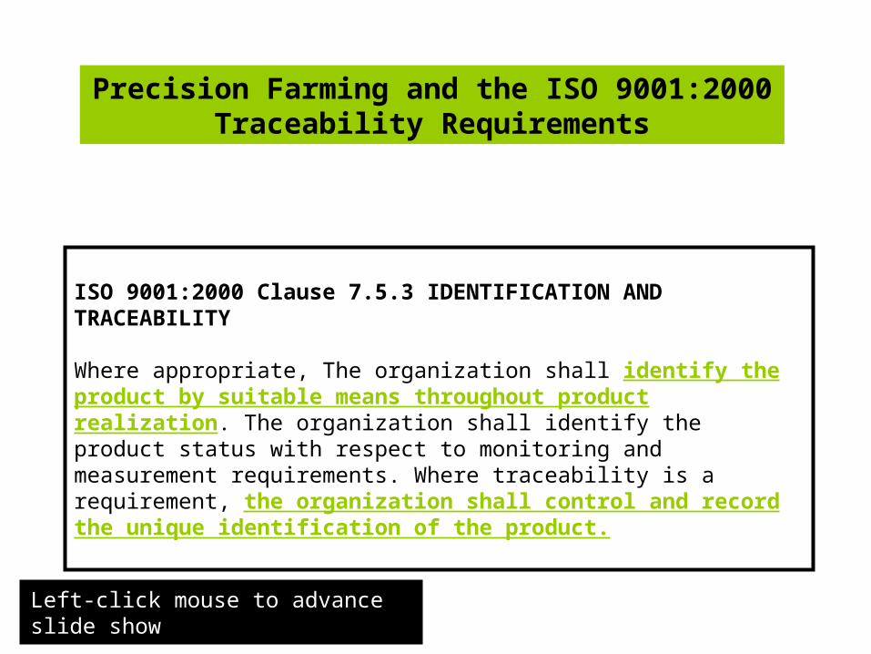
Precision Farming and the ISO 9001:2000 Traceability Requirements
ISO 9001:2000 Clause 7.5.3 IDENTIFICATION AND TRACEABILITY
Where appropriate, The organization shall identify the product by suitable means throughout product realization. The organization shall identify the product status with respect to monitoring and measurement requirements. Where traceability is a requirement, the organization shall control and record the unique identification of the product.
Left-click mouse to advance slide show
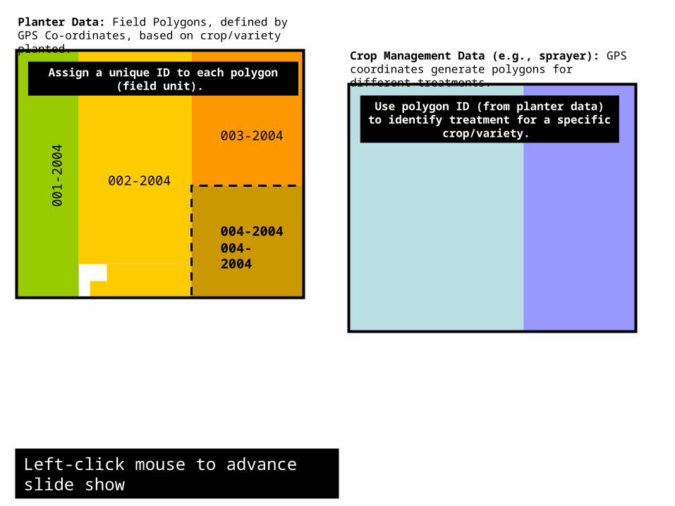
Planter Data: Field Polygons, defined by GPS Co-ordinates, based on crop/variety planted.
001
-200
4
002-2004
004-2004
003-2004
Assign a unique ID to each polygon (field unit).
Crop Management Data (e.g., sprayer): GPS coordinates generate polygons for different treatments.
004-2004
Use polygon ID (from planter data) to identify treatment for a specific crop/variety.
Left-click mouse to advance slide show
Left-click mouse to advance slide show
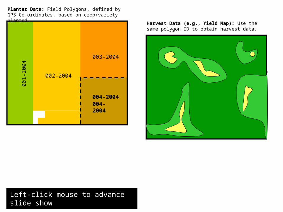
Planter Data: Field Polygons, defined by GPS Co-ordinates, based on crop/variety planted.
001
-200
4
002-2004
004-2004
003-2004
Harvest Data (e.g., Yield Map): Use the same polygon ID to obtain harvest data.
004-2004

1. Polygon IDs can be used to identify separate field units based on crop, variety, separate contracts, etc.
2. Use IDs that describe your fields in both space and time, as this will change from one cropping season to the next. For example, 004-2004 may be used to indicate polygon 004 from the planter map, while 2004 indicates the crop year.
3. Consistently use these IDs, and their GPS coordinates, to select crop management and harvest information from other precision farming data sets.
4. Hmmm… How will you continue to trace the product once it has left the field polygon???
Left-click mouse to advance slide show
00
1-2
00
4
002-2004
004-2004
003-2004
004-2004?
?
Truck A = 004-2004?
Silo #1 = 004-2004 + ?
Truck B =?
?
Customer’s contract
Match? Is it really from 004-2004?
To the customer
Traceability Trail
Left-click mouse to advance slide show
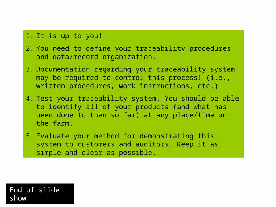
1. It is up to you!
2. You need to define your traceability procedures and data/record organization.
3. Documentation regarding your traceability system may be required to control this process! (i.e., written procedures, work instructions, etc.)
4. Test your traceability system. You should be able to identify all of your products (and what has been done to then so far) at any place/time on the farm.
5. Evaluate your method for demonstrating this system to customers and auditors. Keep it as simple and clear as possible.
End of slide show