Embed Size (px)
Citation preview
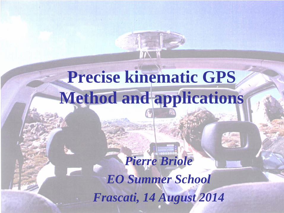
Precise kinematic GPS Method and applications
Pierre Briole EO Summer School
Frascati, 14 August 2014

Content
• GPS satellites and networks • Basics of the principles • Orbits (and their crucial role) • Static (and continuous) observations • Kinematic observations (not real-time) • Analysis of the observations of August 12, 2014

GPS – The space segment
• 24 satellites • 26000km from the Earth centre • 2 orbits/day • Six orbital planes:
– Inclination 55° – 4 satellites / orbite

GPS – The ground segment (control and users)

« Static » observations
• GPS antenna attached to the ground • The measurements can be
– continuous (permanent station) – repeated (campaign observations)

Basic principle of the GPS positioning
• The satellite have accurate clocks and each satellite transmits its time
• The positioning is based on the analysis of the difference of the arrival times of the signals at the receiver
• The satellites orbits must be known

Determination of the position of a receiver The absolute coordinate of an antenna is determined using the
following equations: (x1 - X)² + (y1 - Y)² + (z1 - Z)² = c²(T1 – T -dTr)² (x2 - X)² + (y2 - Y)² + (z2 - Z)² = c²(T2 – T -dTr)² (x3 - X)² + (y3 - Y)² + (z3 - Z)² = c²(T3 – T -dTr)² (x4 - X)² + (y4 - Y)² + (z4 - Z)² = c²(T4 – T -dTr)² etc..
Parameters to be estimated: • X,Y,Z: coordinates of the phase centre of the receiver antenna • dTr : shift between the satellites time and the receiver clock
Data: • xi,yi,zi: coordinates of the satellites as a function of the « system » time T
Observations made by the receiver: • Ti : arrival time (in the receiver time scale) of the signals transmitted by the
satellites at « system » time T

The propagation of the signal must be accurately modelled
Satellite orbits
Ionospheric delay
Tropospheric delay
Deformations of the solid earth (tides, …)
Receiver clock
Phase centre of the antenna and multipaths

Evolution of the accuracy of the GPS orbits (calculated with the data of a « core » GPS network)

Differential (relative) positioning
Eliminates (or reduces) the effect of error sources, like: - orbit and clock error; - tropospheric error (for short baselines)
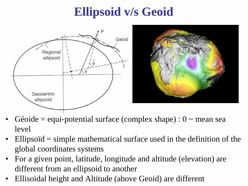
Ellipsoid v/s Geoid
• Géoide = equi-potential surface (complex shape) : 0 ~ mean sea level
• Ellipsoïd = simple mathematical surface used in the definition of the global coordinates systems
• For a given point, latitude, longitude and altitude (elevation) are different from an ellipsoid to another
• Ellisoidal height and Altitude (above Geoid) are different

Plate velocities determined with GPS
The available time series of coordinates at several thousands of permanent stations allow th map the global plate tectonics of Earth
Velocities plotted with respect to a « Earth mantle » reference frame (defined using the location and trajectory of the hot-spot volcanoes

There are velocity transients
Associated with earthquakes (here a subduction earthquake in Peru in 2001)

There are velocity transients
Showing the (previously unknown) existence of “silent” earthquakes
Velocities gradients measured by GPS in the Cascades (USA) (Miller et al., 2002)

There are coordinates transients
During earthquakes
Aysen earthquake, Chile (M=6.2), 21 April 2007, C. Vigny, ENS

During earthquakes
There are coordinates transients
GPS displacements during the Sumatra earthquake (2004)

Transient GPS displacement during the start of a volcanic eruption
Vendredi 15 Novembre 2002
36664.92
36664.94
36664.96
36664.98
36665
36665.02
36665.04
36665.06
36665.08
00:00:00 03:00:00 06:00:00 09:00:00 12:00:00 15:00:00 18:00:00 21:00:00 00:00:00
Heure
Met
res
Deformation associated with a dyke injection at Piton de la Fournaise volcano (France)
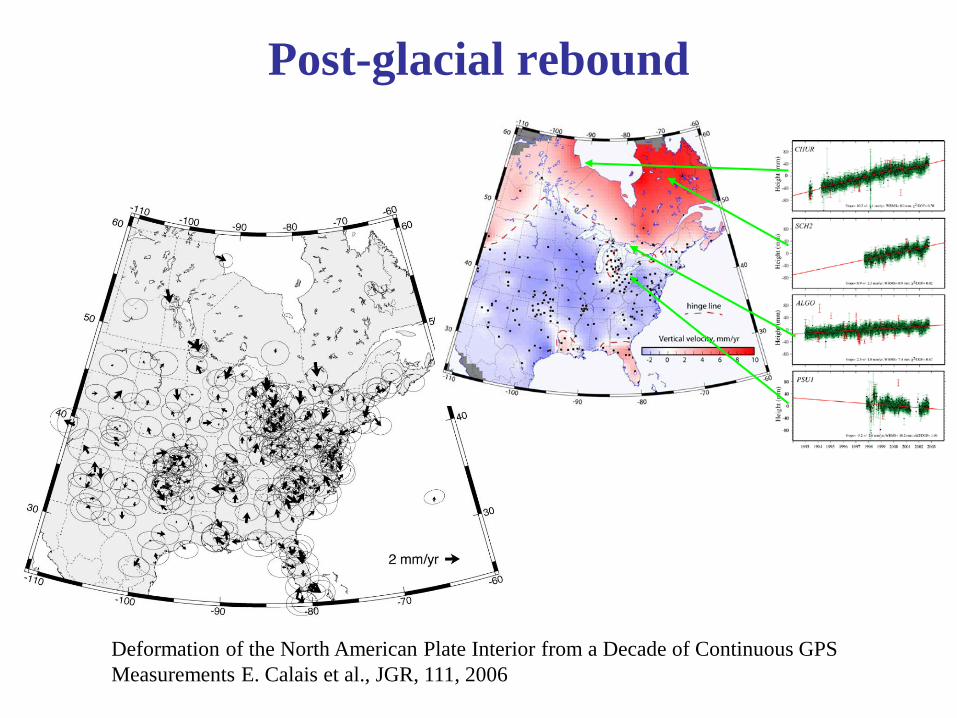
Post-glacial rebound
Deformation of the North American Plate Interior from a Decade of Continuous GPS Measurements E. Calais et al., JGR, 111, 2006

Variations of the Earth rotation
Lambert et al., GRL, 2006
IERS – Solution C04 The small loops are interpreted as due to the motion of large atmospheric masses (meteorological effect)
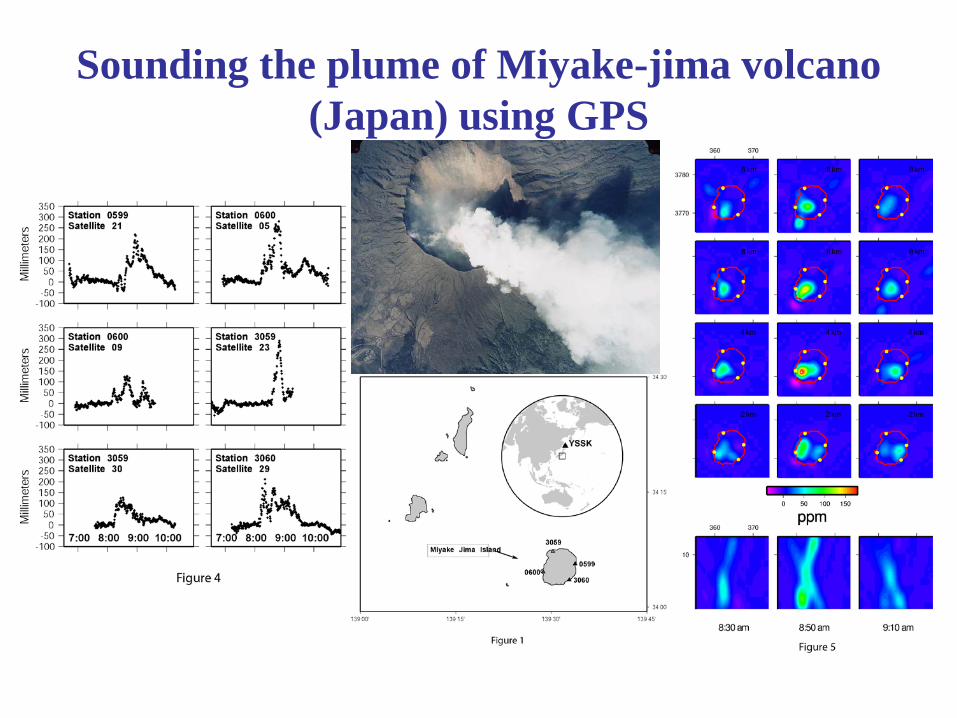
Sounding the plume of Miyake-jima volcano (Japan) using GPS

Kinematic GPS

Need to define a reference surface and an average antenna height with respect to it

« Road » kinematic
Repeatibility
0.2m

Kinematic GPS - Simulated displacement + noise 10cm r.m.s.
Kinematic GPS survey - 1/10/99
139
139.2
139.4
139.6
139.8
140
140.2
140.4
4243000 4243010 4243020 4243030 4243040 4243050 4243060 4243070 4243080 4243090 4243100
UTM_E (m)
Elev
atio
n (m
)

Topography measurements

Assessment of the repeatability and accuracy

GPS on buoy

GPS on board of Tara

GPS measurements on glaciers
Monitoring of the Lambert glacier, Antarctic (Australian National University)
Monitoring of alpine glaciers (Glaciologie Grenoble)

The August 12, 2014 experiment
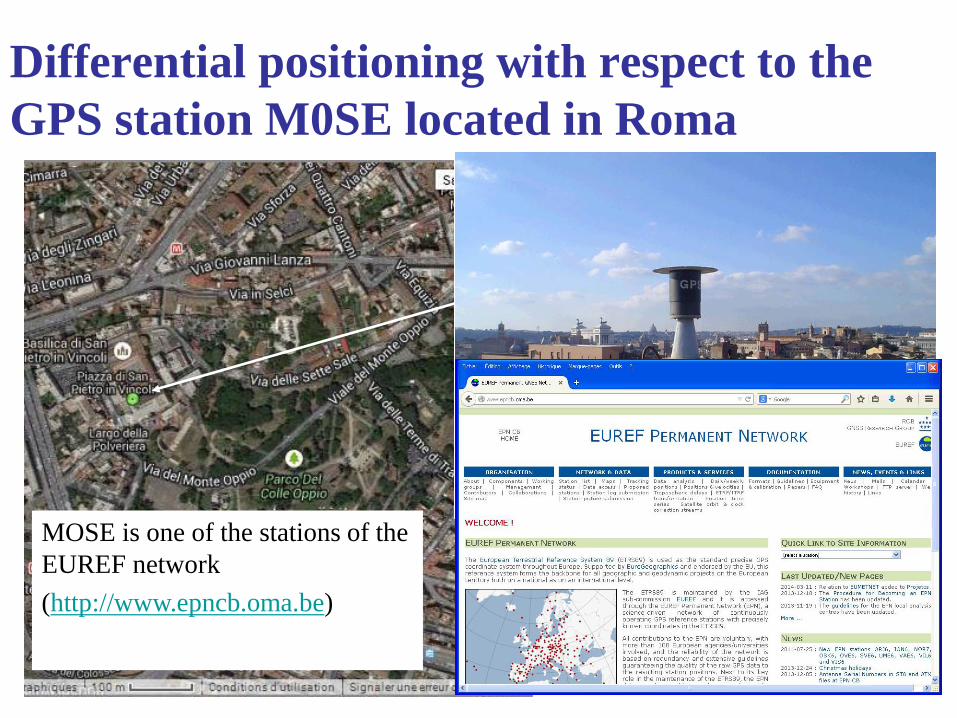
Differential positioning with respect to the GPS station M0SE located in Roma
MOSE is one of the stations of the EUREF network (http://www.epncb.oma.be)

Data available through the EUREF web site (30s) or the GDC web site (1s)
(http://igs.bkg.bund.de/)

Coordinates of M0SE
We use the ITRF2008 coordinates (http://itrf.ign.fr/ITRF_solutions/2008/) at the reference epoch (2005.0)

The entire 2 hours measurements

Positioning the fountain

The whole 12mn observations (~10 loops)

A zoom into the 3 best minutes (3 loops)
r.m.s. scatter to a 2.1m circle = 46 mm Circle centre determined with ~25mm accuracy
Antenna height decreases with time (operator?)
Slope of the terrain: 2.4% azimuth N51°W

UTM_33 coordinates of centre of the fountain
• East: 307999.990 ± 0.025 m • North: 4630546.390 ± 0.025 m

Comparison with PPP (single point positioning) (GIPSY apps.gdgps.net/ )
Horizontal fit: 26mm r.m.s.

Comparison with PPP (single point positioning) (GIPSY apps.gdgps.net/ )
Horizontal fit: 26mm r.m.s.