Embed Size (px)
Citation preview

1
Precinct 18Canning River – Nicholson Road Bridge to
Southern River Confluence

2
Summary Canning River – Nicholson Road Bridge to Southern River Confluence
The precinct includes the Canning River between Nicholson Road Bridgeand its confluence with the Southern River, as well as confluences withYule and Bickley Brooks. The Canning River in this section is a narrow andshallow Channel which seasonally inundates.
Some of the low lying areas become seasonally waterlogged and
form damplands and palusplains. Wetland areas, such as
Hersey Place, have attractive vegetation and waterforms;
however these are detracted from by the adjacent light industrial
and commercial areas which have their work yards abutting the
wetland. As with much of this area the land has evidence of soil
being dumped to form higher land for the commercial areas, the
result being a steep face of soil and weeds on the Albany
Highway side of the wetlands.
Other water features include Yule and Bickley Brooks which are
very narrow channels which due to the encroaching urban land
use and the degradation of their fringing vegetation are not
particularly attractive and appear like stormwater drains. In
contrast, the outward appearance of the fringing flooded gum
and melaleuca woodlands of the Canning River are particularly
attractive as there is a dense canopy of soft greens and a mixture
of tree forms. Unfortunately, weeds proliferate in the
understorey, particularly in the damplands and adjacent to the
channel.
One of the attractive land uses in the area is the old orchards at
Burslem Drive. This provides a link to the historic use of the area
and a break from the rather gaudy commercial and industrial
areas along Albany Highway and closer to the river. Much of the
land has been subdivided into residential blocks, such as
Langford and Thornlie. These two suburbs have quite modest
homes which are built in the fashions of the 1980s. At Kenwick
some of the old orchard sites have been redeveloped into
'villages' of duplexes and small houses. These have been
constructed by developers and therefore have been built in a
uniform style and materials.

3
Resource Information
Biophysical Processes
Geological Processes The Guildford Formation is alluvial and the geological unit occurs
around the river channel and the northern banks. The Guildford
Formation consists of lenticular interbeds and mixtures of sand,
clay and conglomerate, which are locally calcareous.
Behind the river channel on the southern bank is the
Bassendean Sand, which is a series of leached dunes of quartz
sand parallel to the coast laid down on the ancient shorelines of
the Holocene and Pleistocene high sea level events.
Swan alluvial terraces are red podsolic and undifferentiated
alluvial soils along the present stream terraces. They are of high
fertility and have a rich texture. South of the Canning River are
the Southern River grey sand dunes with intervening clayey
swamps. To the northern plains are the Guildford Soil
Associations which are yellow podsolic soils.
Topography The Canning River channel is situated within the Pinjarra Plain
landform which consists of unconsolidated fluviatile sediments.
These formed as alluvial fans as over time the small streams
which run over the Darling Scarp deposited their sediments. The
area is surrounded by the Bassendean Dune System which
represents a Pleistocene accumulation of beach sands along an
old coastline. The dunes today are low lying and within the
intervening swale sandy swamps have formed. The river channel
and associated flood plains are low lying and surrounded by a
higher sand plain. Much of this precinct is subject to seasonal
inundation. The southern bank was originally sandy swamp while
the northern banks were a low lying plain, however much of this
original landform has been infilled.
Hydrological Processes Water features The Canning River is characterised by a single phase sinuosity
and the channel is irregular in its width. The south eastern
boundary of Hester Park is the location of 'The Rapids', which
was an important crossing point on the Canning during the early
years of settlement. The low lying areas are seasonally
inundated during periods of high water levels. The flat lands and
basins become seasonally waterlogged and form palusplains
and damplands.
The river is fluvial and by definition there are no tidal influences
rather the fresh water flows from the catchment. However there
are historical records which suggest that prior to dam
construction the river was seasonally estuarine up to Hester
Park.
Bathymetry The Canning River water depth is very shallow and in places is
less than a metre deep, although in areas such as downstream
from Royal Road the channel is narrow and approximately 2
metres deep. The water volume held in the channel is most often
much lower than its total carrying capacity, such as during the
summer months when the flow is reduced to a trickle at the base
of the channel.
Flooding Much of the area lies within the floodway and most of the low
lying land is below the 100 year flood level. There is a wide flood
plain which is seasonally inundated and in areas becomes
waterlogged. The flood plain varies from 200 to 300 metres width
and up to 5 metres in depth.
Erosion and Accretion Erosion occurs where riparian vegetation has been removed or
degraded along the channel banks. For the most part,
vegetation, whether indigenous or exotic, is quite prolific along
this section of the river channel and erosion is not a serious
problem. Generally, people do not use this section of the river for
water activities and the dual use path encourages people to stay
away from the riparian vegetation. During periods of high water
erosion and accretion occur as part of the channel's natural
processes.
Vegetation Communities Native Swan Complex The indigenous flora of this precinct is classified as being part of
the Swan Complex.
The vegetation ranges from fringing woodland of flooded gum
(Eucalyptus rudis) and swamp paperbark (Melaleuca
rhaphiophylla) with localised occurrence of low open forest of
swamp sheoak (Casuarina obesa) and saltwater paperbark
(Melaleuca cuticularis). The various communities which make up
this complex are described below.
4
Precinct 17 – Canning River – Nicholson Road Bridge to Southern River Confluence
Juncus Community Sedges and rushes such as bare twig rush (Baumea juncea),
pale rush (Juncus pallidus) and shore rush (Juncus kraussii)
occur along the river's edge and also in seasonally inundated
damplands such as at Hester Park.
Melaleuca Community
The swamp paperbark (Melaleuca rhaphiophylla) communities
are found along the Canning River in swampy areas. These
communities have a dense canopy of the small paperbark (less
than 10 metres). It most commonly has an disturbed understorey
of arum lily (*Zantedeschia aethiopica) or ephemeral grasses.
Acacia Community
There are three stands of low closed forest of coojong (Acacia
saligna). These stands tend to be monospecific and are found
near Ellison Drive, Burslem Drive and the north side of the
railway crossing. The coojong is not indigenous to this area
although it is a native plant.
Eucalyptus-Melaleuca communities
The dominant vegetation along the river edges is the flooded
gum (Eucalyptus rudis) and swamp paperbark (Melaleuca
rhaphiophylla) complex. Within this precinct a number of
remnant understorey species exist. These include mohan
(Melaleuca viminea), swishbush (Viminaria juncea), a tall shrub
(Calycopeplus ephedroides) and spearwood (Kunzea sp).
Exotic There are several non indigenous eucalypts and casuarinas
planted in Hester Park and along the roadside reserves, while
exotics such as jacaranda (*Jacaranda mimosifolia) and
Queensland box tree (*Lophostemon conferta) have been
planted adjacent to the river reserve. Weeds which are a problem
include, veldtgrass (*Ehrharta sp), Paterson's curse (*Echium
sp), blackberry (*Rubus sp), docks (*Rumex crispus, *Rumex
conglomeratus) and cape tulip (*Homeria flaccida), pampas
grass (*Cortaderia selloana), arum lily (*Zantedeschia
aethiopica), bulrush, (*Typha orientalis), buffalo grass
(*Stenotaphrum secundatum) and kikuyu (*Pennisetum
claudestinum). In the Melaleuca closed woodland, the
understorey is invaded by wild oats (*Avena fatua) and watsonia
(*Watsonia bulbilifera). Other prominent exotic trees include the
cape lilac (*Melia azedarach), weeping willow (*Salix sp), castor
oil bush (*Ricinus communis) and fig (*Ficus carica).
Historical Land Use and Resulting Environmental Changes
The original grants in the area were made to the following W.
Knight (Lot 6), W. Owen, (Lot 7 & 9), C. Simmons (Lot 8), Bull &
Wood (Lot 10), G.Morrit (Lot 11), R. Dawson (Lot 12) A.H. Gilbert
& Nairne (Lot 13), T. Bannister (Lot 17), P. Pegus (Lot 18), T.
Hester (Lot 19) and H.Willet (Lot 21) (Carden, 1968).
The early settlers in the area floundered in the unfamiliar
environment. Both Peter Pegus and Thomas Hester planted
crops in November and December 1829 which failed to survive
the summer heat. They also planted crops of potatoes on the
flood plains in the winter of 1930 which became waterlogged or
entirely flooded. The Hester family and the Spencers both lost
children who were probably buried in the park (McQueen, 1963).
Peter Pegus and his servants arrived in late 1829 and
established 'Coleraine'. This property was burnt to the ground in
1834 due to a bush fire and he requested government assistant.
Pegus soon left the Canning property for a small government
post on the Swan River (McDonald and Cooper, 1988).
His neighbour Thomas Hester was soon to follow bringing with
him his family, a flour mill, ploughs, tools, clothing and a piano all
up river to his property 'Redcliffe'. The Hester family was plagued
with misfortune from the start. One servant died in his sleep while
the second wondered off soon after the family arrived. In
December 1830, Sophia Hester died in childbirth and the
newborn son died a few days later. By this time Thomas Hester's
eyesight was failing and he was almost blind. He and his five
remaining children struggled to survive often relying on
neighbours and the local Nyungar people for food (McDonald
and Cooper, 1988).
R. Dawson did little to his land and Location 12 became the
property of Wallace Bickley in August 1833 (McDonald and
Cooper, 1988). Despite an arrangement with his neighbour G.
Morrit to have half of Location 11, the government did not
recognise the exchange and Bickley left the colony. Almost 20
years later he returned from India with his second wife and five
daughters. Despite his long absences on return trips to India, his
property flourished due to the strong and capable management
of his wife. The property included Locations 3. 11, 12 and 18 and
produced hay, cattle and horses.
The syndicate Yule, Lewis and Houghton was on Location 8.
They called the property 'The Rapids' and bought large numbers
of stock (McDonald and Cooper, 1988). The water in the Canning
was salty up to The Rapids when the property was first taken up,
however by the 1830s weirs were built which controlled the flow
of salt water from 'The Rapids' and upstream of this location.

5

6
Precinct 18 – Canning River – Nicholson Road Bridge to Southern River Confluence
Raymond Houghton passed his share on for the more fertile
Swan Valley and set up the 'Houghton' vineyards.
Thomas Bannister was given a large property at location 17
which he named 'Woolcoombs'. Only a few weeks later the daily
grind of colonial life started to be unappealing to Bannister and
he spent most of his time in Albany and Fremantle instead
(Swartz, undated).
Dulton owned Location 15; however he had a house at Preston
Point and never took up his land on the Canning River probably
because of the personal misfortune which had so far plagued him
in the colony. The land was sold to William Habgood in 1835
(Carden, 1968).
At the turn of the Century W.G. Brookman (Mayor of Perth)
established the River View Estate on Location 21 which was 300
acres (McDonald and Cooper, 1988). There are remnants of the
vines and orchards at the north-western part of Hester Park.
These were watered using the river and Brookman's property in
particular was a model farm with a piggery, stables, poultry,
orchards and vineyard. The house was stately and contained a
ball room and had a uniformed footman. Eleven weatherboard
cottages were constructed for his labourers at his property near
Nicholson Rd Bridge.
John R. Phillips owned Location 13 as part of his grant and due
to financial difficulties sold the land to Major William Nairne in
1833 (McDonald and Cooper, 1988). Details of John R. Phillips
are discussed in Precinct 36. Nairne was enthusiastic and
enterprising and based his property on wool production. He built
a two storey home 'Maddington Park' which is at the end of Olga
Road (Carden, 1968). The homestead was one of the grandest in
the colony and Nairne's plans for the jarrah and limestone house
expanded as the home was constructed. Unfortunately, his
finances were less grand and the craftsmanship and materials on
the second floor are inferior to the lavish first floor. Nairne
borrowed a large sum of money from the Surveyor General J.S
Roe and in the end sold the park in 1840 as his debts were too
great. John Liddelow bought the land at Maddington Park but his
attempts at reviving the property failed and he bought land at
Cooper Road (Kenwick). In 1906 his grandson Beverley
Liddelow sold Kenwick Park to developers.
Due to the demand in the early years of the Canning Settlement
a ferry Service ran to Yules Rapids, however by 1835 this
Service was disbanded due to its unreliability and the dangerous
nature of the trip (Carden, 1968). Therefore the only remaining
communication was by crossing at Chenies farm to a dirt track
which led to Bull's Creek.
Location 18 eventually became the Canning Vale estate which
was sold as orchard, poultry farm, garden and dairy lots. It was
advertised as having rich moist soils all year round, however
these properties were not as fertile as the opposite river bank
and the area was too isolated for most buyers (McDonald and
Cooper, 1988).
Present Land Use and Social Patterns This section of the precinct is undergoing land use
redevelopment. Much of the area has in the past been the site of
intensive horticulture such as orchards and small dairy
properties. However due to the high cost of the land and new
generations taking over the properties, much of this land has
been given over to residential purposes. Some orchards remain
on Burslem Drive and within Kenwick. Examples of recent
developments are the Rivercrest and Canning Waters
subdivisions where developers have built a large node of small
houses and units all of similar design and materials on the one
block. These have neat landscaped gardens and common
driveways and front lawns. Other areas such as Thornlie and
Langford have been subdivided as individual residential areas
mainly during the 1980s and although the houses are all of a
similar fashion they are individual.
Much of the area in Kenwick and Maddington is commercial and
light industrial. There are several retail outlets, the closest to the
river being Maddington Metro Shopping complex on Burslem
Drive. Most of the retail is in ribbon development form along
Albany Highway, and the showrooms face onto the highway
rather than the river. The light industrial area includes such
businesses as car panel beating and clothing factories which
often have large work yards adjacent to the river reserve.
The Thornlie TAFE campus is located on the foreshore adjacent
to Burslem Drive.
Recreation nodes Hester Park is a 45 hectare area of open public space located on
the western banks of the Canning River, Langford. There are four
open drains. The area includes remnant fringing woodlands that
have remained despite the Clearing for agriculture, grazing,
timber cutting and fire. There is a irrigated oval and canoe slalom
course, the latter can only be used during periods of high water
level. There are also areas suitable for passive recreation such
as Walking, dog exercise, picnicking, and cycling.
7
Precinct 18 – Canning River – Nicholson Road Bridge to Southern River Confluence
The dual use path runs along the entire southern bank at this
section of the precinct; there is mainly a narrow belt of reserve,
however this is well used by local residents as there are many
young families in the area. Adjacent to Jacqueline Drive there is
a cement cricket pitch which allows for an informal game of
cricket by the river banks. The Thornlie Community centre
provides for organised recreation adjacent to the river and there
are play equipment structures along the southern banks.
Public access Public access to the southern banks of the river is well catered
for by the dual use path adjacent to the fringing vegetation.
However there is no parking in the area and due to the sensitive
nature of these wetlands easy public access would not be
suitable. Along the northern bank access is rather difficult due to
private properties, such as the orchards and residential blocks,
and very few people would bother to climb into the inundated
wetlands of the Canning River adjacent to the river crossings.
Sites of Nyungar & Wider Australian Community Significance Nyungar significance At the time of colonial settlement, the Canning River was the run
of two Nyungar groups. The Beeloo, lead by Munday, mainly
lived between the river and the Darling Ranges. The Beeliar, lead
by Midgegooroo, used the land between the Canning River and
the ocean. It is possible that the area of the 'Maddington Park'
property was a meeting ground for both groups (O'Connor et al,
1984).
The Canning River was one area where conflict between the
Nyungar and colonists was particularly heated. Nyungar relied
on the wild food resources in the various environments. Their
disciplined and ordered nomadic lifestyle required no domestic
animals or crops. This lifestyle was not understood by the new
colonists, who demarcated their properties with fences and were
not willing to share the land (Mc Donald and Cooper, 1988).
A serious incident occurred near Maddington Park in December
1833. Two of Major Nairne's young shepherds, Hokin (11 years
old) and Cleulow (9 years old), were Walking to the summer
pastures at the nearby foothills. Only a short distance from the
homestead they came across a Canning River Nyungar,
Buoyeen. A woman travelling with Buoyeen asked the boys for
bread. (The local Nyungar were often given food by the settlers,
mainly to prevent the loss of crops to the Nyungars who still
gathered food from their traditional grounds).
The boys refused and Buoyeen, offended by their manner,
began to threaten the children until Cleulow burst into tears.
Hokin turned to run, and was hit in the back by Buoyeen's spear.
The Nyungar woman who was by now enraged by the insulting
manner of the boys beat Hokin over the head with her wanna or
digging stick. Cleulow, terror stricken, turned to run and was
brought down by a second spear from Buoyeen. Both boys were
left for dead. However Hokin managed to get back to Maddington
Park and the boys were attended to by a surgeon and survived
the ordeal. Buoyeen was caught and executed within a few
weeks (McDonald and Cooper, 1988).
Other significance The 'River View' mansion at Nicholson Road Bridge was built by
a well-known Goldfields identity and later Mayor of Perth, William
Brookman, in the 1890s (McDonald and Cooper, 1988). It was a
lavish house with uniformed footmen and a ballroom. Adjacent to
the house were eleven weatherboard houses for his workers. In
the 1960s the home was used as a reception centre.
Woodlupine Brook joins Yule Brook at Mills Park, Beckenham.
Woodlupine is an English flower and was the original name for
the area, however after a murder of a 17 year old girl, Fairy
Compton, in the early 1900s, the name was changed due to
notoriety. It was named Queens Park after Queen Alexandra
(Carden, 1968).
In 1883 William Green, sold land in the Kenwick district to Walter
Padbury. The Padburys built a house for their niece and her
husband, Mr James. The name Thornlie homestead was from
the James' family residence in India. After the death of the James
the Canning property was subdivided in 1932 and again in 1974
(McDonald and Cooper, 1988).
Kenwick Pioneer Cemetery on Albany Highway was established
in 1865 and many of the early settlers are buried here.
Conservation Areas Wetlands The area has several areas of inundation which are listed as the
Canning River palusplain and flood plain in the Wetlands in the
City of Gosnells (WAWA 1993). These have been classified
according to management strategy and within this precinct are
areas of High Conservation such as the entire Canning River
flood plain; Conservation and Open Space Wetlands such as
Hester Park; and Resource Enhancement areas such as the
palusplain areas of the Canning River.

8

9
Precinct 18 – Canning River – Nicholson Road Bridge to Southern River Confluence
System 6
M75 Upper Canning and Southern Rivers
The recommended area comprises the Canning River and its
fringes from Nicholson Road Bridge to the boundary of State
Forest, together with those parts of the Southern and Wungong
Rivers within the City of Gosnells.
The Canning River is well fringed with flooded gums and
paperbark along the west bank between Nicholson Road Bridge
and Royal Street and the east bank is fairly thickly fringed near
where Yule and Bickley Brooks join the Canning River. Native
species have been almost entirely lost from the ground flora. At
the river's confluences with Bickley Brook and the Southern
River both banks are well covered, mainly with flooded gum and
paper barks. Grasses and weeds abound. The area constitutes
open space of regional significance because of its high
conservation and recreational values, its proximity to Perth's
residential areas and regional roads passing through the area.

10
Landscape Description
Precinct Description Waterform and natural riparian zone Upstream of the Nicholson Road Bridge, the Canning River
forms a small meander before branching into the Hersey Place
wetland. The area of inundation forms a three armed water body
which in periods of high inundation forms a small island of higher
land in the northern section of the wetland. The Hester Park
section of the river has a deep channel and shallower areas of
inundation where channels overflow in winter months. The main
Canning River channel curves in a northerly bend and then takes
a straighter form to Yule Brook. Yule Brook is a very narrow
shallow channel, which looks more like a drain than a creek due
to the adjacent land uses. The brook has small meanders before
forming a wetland and island prior to entering the Canning River.
The flooded banks of the Canning River give the water form an
informal shape as it extends into the fringing vegetation as of
shallow pools. Bickley Brook enters the Canning River upstream
of Royal Street Bridge. It is a narrow shallow channel and its
confluence with the main river appears like a small drain
entrance.
The narrow channel near the Beckenham railway crossing
broadens downstream after taking the tight meander before
Harris Street. The shallow form of the river channel can be seen
between the breaks in the paperbark stands adjacent to
Jacqueline Drive, where the river branches into a small wetland
on the northern bank. The wetland is surrounded by a small belt
of remnant paperbarks and a new residential area. The river
forms wide tight meanders upstream of the wetlands towards the
confluence of the Southern River. However for the most part this
section of the river is so shallow and the riparian vegetation so
dense it is difficult to view the river and its channel.
Landform At Hester Park the land takes the form of gently undulating
slopes with the depressions filling with water during winter
months. The present day landform has a rather clumpy soil
surface which is reminiscent of the past intensive horticultural
land use. From the residential area the land gently slopes
towards the flatter area of the flood plain. The flood plain at
Hester Park appears to be a wide bank in comparison with the
restricted nature of the opposite northern bank which has had its
flood plain infilled. The Langford area is quite flat due to infilling
for urban development and this is similar at Thornlie. The areas
of infilling have steep embankments which slope down to the
flood plain of the river. In many places, such as Summer Place
this is quite a steep embankment. The northern bank has mainly
a flatter more natural landform and the gradient between the
river flood plain and the urban areas is quite gentle.
Vegetation The precinct has been- mainly cleared of its natural vegetation
for residential and farming purposes; however the fringing
vegetation along the river banks is still present. The vegetation
complex along the river at Hester Park is a tall belt of paperbark
and flooded gum. The tall stand of Acacia saligna within the flood
plain adjacent to Ellison Drive, Langford is particularly attractive
as a form of bright green shiny leaves among the dense
paperbark communities which grow within the flooded banks.
There are several trees which emerge from the main canopy and
the contrast in height creates visual interest. The lower canopy is
much denser and there are contrasts in shades of green within
the fringing vegetation. The cleared area has an abundance of
weed species all of varying heights and foliage which during the
winter months appears lush. The vegetation around Hersey
Place wetland has an overstorey of paperbark and sheoak which
have an open light canopy and soft bark; however this is
detracted from by the weedy nature of the understorey and the
adjacent land use.
Unfortunately, the paperbark flooded gum stand near Latimer
Way, Langford, has been recently burnt so that the most evident
vegetation is the flourishing weeds. There is remnant banksia
woodland on the rise of the southern bank adjacent to the
Beckenham railway crossing. The understorey is predominantly
weeds and lawn; however these trees are a reminder to the river
user of the sandy woodland that once occurred in the now
cleared area.
The fringing vegetation at Summer Place is relatively narrow and
is separated from the road side mowed verge by the bike path.
There are several prominent weeds including a large stand of
bulrush and a coral tree at this section of the river. Near Mintern
Court there is a band of vegetation including a variety of mature
eucalypts. The fringing vegetation upstream continues to be
mainly dominated by flooded gum and paperbarks. The fringing
vegetation around Yule and Bickley Brooks is similar to the
flooded gum and paperbark communities along the Canning,
however they are infested with weeds and in parts the vegetation
has been entirely cleared. Similarly, the wetland at Canning
Waters is a thin band of paperbark and fringing reeds which is
surrounded by the new development and the trees are showing
signs of stress with wilted foliage and damaged branches.
The Burslem Road orchards are a rather attractive landscape
feature as they are becoming rarer as land prices increase. The
fruit provide a colourful element among the shiny green leaves
and the pruned tree forms. The understorey is mainly grasses
and ploughed land.

11
Precinct 18 – Canning River – Nicholson Road Bridge to Southern River Confluence
Riparian land use Hester Park is a large area adjacent to Spencer Road, Langford.
The park has a few amenities such as outdoor furniture and
signs; however the most patronised facility is the concrete dual
use path which runs parallel to the fringing vegetation. The rest of
the area is a large cleared area with grasses and weeds giving it
the appearance of an overgrown paddock. The pump Station at
Ellison Drive was originally painted sensitively using soft greens
and browns so that the Square building was not very
conspicuous, however the walls have been graffitied in vivid red,
blue and white, which has made the structure a most prominent
feature.
The Beckenham Railway Bridge required some infilling of the
flood plain creating a steep embankment beneath the steel
structure. The dual use path passes beneath the bridge on the
southern bank and the bridge is supported by limestone and
concrete which has been partly graffitied, as has the steel
superstructure of the railway bridge. The railway track passes
though a cut in the higher land and from O'Dell Road, Thornlie,
and the vegetation reduces the visual impact of the railway by
partly covering the line.
There is a bridge which crosses at Spring Road-Royal Street.
This has narrow white barriers and the road dips down to meet
the crossing. The adjacent flooded gum rises above the bridge
and gives an attractive backdrop on either side of the crossing.
At the end of Jacqueline Drive the residential area is set back
from the wide meander of the river and therefore there is a
wedge of cleared land adjacent to the fringing vegetation. A
cement cricket pitch has been constructed and the area is used
as an informal recreation area. The dual use path runs adjacent
to the houses near Jacqueline Parade.
The Harris Street Footbridge is a low white wooden bridge which
crosses Yule Brook before the brook forms a small wetland prior
to entering the Canning River. Burslem Drive crosses the
Canning River through a narrow band of fringing vegetation and
is a busy thoroughfare considering the small nature of the bridge.
Land use There is a mixture of land uses around this precinct, including
residential, commercial, farming and light industrial areas. The
White House reception centre (River View Homestead) adjacent
to Nicholson Road has been expanded in a style which is in
keeping with its original facade. The area has several exotic
trees and the lawn is well maintained. There is a low limestone
wall marking the boundary near the edge of the flood plain.
Next to Hersey Place wetland there are the frames of old wooden
sheds and commercial yards which are located on landfill. The
landfill is raised, however in places it has subsided giving a
lumpy effect. It has a steep gradient face leading to the flood
piain. The adjacent houses are modest homes of various ages
and there are several empty blocks which are overrun with
weeds and have plant clippings dumped on them.
The Thornlie and Langford residential areas which front onto the
foreshore reserves are generally well maintained and have
mainly eclectic gardens. Almost all have a front lawn. There is a
break in development at Thornlie which is the road reserve set
aside for the extension of Roe Highway.
The northern bank of the river adjacent to the Beckenham rail
bridge is pasture for cattle and is partly cleared with several
stands of river gum. The Beckenham railway runs past Packer
Park which has a particularly unattractive change room block
which is box shaped and graffitied. The trees along the reserve,
however are mature and improve what would otherwise be a
bland landscape. The residential area is quite modest and often
unkept.
Adjacent to the railway reserve on the southern bank is a group
of new units with tiled roof and pale bricks which nest into the cut.
The residential area fronts onto the reserve near Lester Drive.
On the eastern side of Jacqueline Drive the properties back onto
the foreshore and are fenced with various materials.
Along Jacqueline Drive there are several box trees planted along
the roadside reserve. These have been shaped into circular
forms which conflicts with the attractive irregular forms of the
native fringing vegetation. Along Glenbrook Road there is a
community centre building which is harmoniously coloured and is
built into the dip of the infilled land. Unfortunately, the toilet block
is stuck on top of the hill separate from the main building rather
than incorporated within the main building. The surrounding area
has been infilled; however it gives an attractive undulating and
dipping form to the landscape. Mainly native trees have been
planted and although they are not indigenous to the area the
general colours, textures and forms are concordant with the
fringing vegetation of the Canning River. The two man-made
lakes with islands have been shaped informally and the
vegetation is 'unkept' which is attractive and in keeping with the
adjacent river form. Due to a lack of foresight a row of gum trees
have been planted directly under powerlines. Consequently, they
have been cut, and their stumpy forms detract rather than
contribute to the landscape. Planting a few metres back could
have resulted in a fine row of eucalypts.
12
Precinct 18 – Canning River – Nicholson Road Bridge to Southern River Confluence
Thornlie TAFE centre is located on the southern bank adjacent to
Burslem Drive. It is built of pale brick and colourbond corrugated
iron. The grounds have been planted with native trees and lawn,
and the campus is relatively inconspicuous to the passerby.
There is a narrow band of fringing vegetation adjacent to the
edge of the campus property. Burslem Drive, Maddington,
crosses the river before the Canning River's confluence with the
Southern River. This road runs along the edge of a private
orchard which nests into the river meander bend. Maddington
Metro Commercial complex has a large car park and windowless
facade.
The northern bank of Kenwick until recently consisted of large
residential blocks and orchards, however within the last few
years many orchards have been redeveloped as small suburban
'villages', which consist of numerous duplexes and uniform
houses built by a developer in a uniform style. These homes
have very small landscaped gardens and are placed along
cul-de-sacs. The Canning Waters Development is very close to
the river reserve vegetation of paperbarks and rivergum.
The Liddlelow Homestead is at present closed to the public. It is
being sensitively renovated; however it is surrounded by light
industrial and commercial properties, so that the passerby would
hardly notice the homestead. The light industrial area is
unattractive due to gaudy signs and exposed work yards. The
Albany Highway commercial area is a ribbon of rather gaudy
buildings and car parks. Considering the unattractive
development, it is rather unfortunate that from Albany Highway
drivers would hardly know that the attractive remnant vegetation
of the Canning River still exists.

13
14
Landscape Interpretation
Dominant Landscape Character The original landscape character in the immediate vicinity of the
river would have been natural with predominantly melaleuca and
sedges fringing the flat alluvial terraces of the Canning River.
There may have been a greater presence of saline tolerant
species along the river prior to the construction of the Kent Street
Weir.
Today, the landscape of this precinct is very patchy with several
different landscape characters occupying small areas. There are
several small patches of relatively natural vegetation which
mainly consists of endemic trees and a weedy understorey.
These natural landscapes appear isolated and the surrounding
suburban and rural land uses infringe on the appearance of
these vegetation communities. In general, the urban landscape
is quite modest with small houses often on large blocks of land.
The orchards and fields for grazing are remnant land uses in the
precinct. The orchards are quite old and there is pressure to
develop these properties into residential areas. The grazing land
is adjacent to Beckenham railway and it will probably continue to
be used for this rural activity until the Roe Highway extension is
commenced. These rural landscapes are quite rare so close to
the city and river environment. The orchards in particular provide
pleasing and attractive viewscapes. They are important
characteristics of this precinct and their loss will result in a
change of character.
Significant Viewscapes Hester Park is an important section of this precinct as it provides
open space in an area which is becoming urbanised. The
vegetation in this area is quite degraded; however the line of
flooded gum and paperbark not only is attractive but provides an
important ecological corridor and also breaks up the urban
landscape.
Conforming and Non-Conforming Elements in the Landscape There are several instances where public buildings and
structures have been vandalised making them a detracting
element in the landscape.
There are several public toilet blocks and a water pump house
which have been placed in the centre of viewscapes. Their
impact could be mitigated by Screening with plants or if possible
relocating to a less prominent position.
Thornlie TAFE centre is located on the southern bank of Burslem
Drive. The campus has low visual impact on the landscape, as it
has low building forms and subtle colours. The gardens have
been landscaped with Australian species which are visually
sympathetic with the adjoining Canning River vegetation.
Adjacent to the narrow belt of fringing vegetation, tree
landscaping has resulted in non indigenous species being
planted. Although many of these species are attractive
specimens they detract from the subtle colours and form of the
indigenous vegetation.
Recommendations for Maintenance and Enhancement of the Present Landscape Character
• Regular maintenance of buildings and infrastructure would
assist in enhancing the environment. Unfortunately, it is
difficult to reduce vandalism and it is often necessary to
incorporate upkeep costs into planning.
• Areas of open space such as Hester Park are important as
buffers between the suburban areas and the Canning River.
The park provides opportunity to have areas of natural
riparian vegetation and also open grassy parklands for
recreation. At present the parkland has few trees and the
long weedy grasses make most of the area unattractive
visually and for recreation.
• Consider the retention of the remnant rural landscapes in the
form of orchards and turn of the Century houses.
15
Landscape InterpretationDames and Moore International. 1985. EnvironmentalOverview of Nicholson Road Crossing. For P & M Tooby Pty
Ltd. February
1985.
McDonald and Cooper, W. 1988. The Gosnells Story. City ofGosnells.
McQueen, J. 1963. Pioneers of the Canning District. Graylands Teachers College.
Water Authority of Western Australia. 1993. Wetlands in theCity of Gosnells. A report to the Water Authority of Western
Australia and the Environmental Protection Authority by Joan
Payne. Report No WP 160.

16
Precinct 18 – Canning River – Nicholson Road Bridge to Southern River Confluence
Canning River, Gosnells. 1915.
Battye Library, 209195P.
Hester Park, Spencer Road, Canning River, 1997.
Swan River Trust.
17
Precinct 18 – Canning River – Nicholson Road Bridge to Southern River Confluence
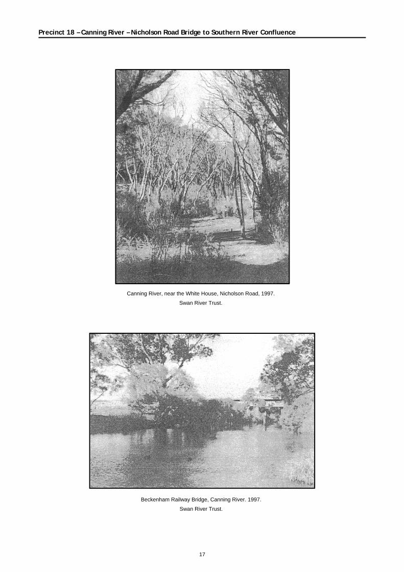
Canning River, near the White House, Nicholson Road, 1997.
Swan River Trust.
Beckenham Railway Bridge, Canning River. 1997.
Swan River Trust.