Embed Size (px)
Citation preview

PRE FEASIBILITY REPORT KULITHALAI SAND QUARRY
Under EIA Notification 2006 THE EXECUTIVE ENGINEER
PRE FEASIBILITY REPORT
OF
SAND QUARRY (Under the Guidelines of Ministry of Environment and Forest
in terms of the provisions of EIA notification 2006 and specifically in circular
No J-11013/41/2006-IA.II (I) dated 30th
December, 2010)
IN
S.F.No. 1 (P), Kulithalai Village,
Kulithalai Taluk, Karur District,
Extent: 11.00.0Ha -B2 Project
APPLICANT
The Executive Engineer,
Public Works Department,
River Conservation Division,
Tiruchirappalli-1
1. EXECUTIVE SUMMERY

PRE FEASIBILITY REPORT KULITHALAI SAND QUARRY
Under EIA Notification 2006 THE EXECUTIVE ENGINEER
The Executive Engineer has been obtained permission from District collector Karur to
quarry Sand over an extent of 11.00.0Ha in Survey No: 1 (P), Kulithalai Village,
Kulithalai Taluk, Karur District, Tamilnadu state by District Collector Karur Rc.No.
938/Mines/2016 dated 30.11.2016, for a period of two years subjected to submission of
Environmental clearance from MoEF / SEIAA, consent for Establishment and Consent
for operation from TNPCB.
SALIENT FEATURES OF THE PROJECT
S.NO PARTICULAR DETAILS
1. Name of the Proponent The Executive Engineer
2. Type of Project Sand quarry
3. Location Survey No. 1 (P)
Kulithalai Village,
Kulithalai Taluk,
Karur District,
Tamilnadu State.
4. Mining lease area 11.00.0 Ha
5. Type of land
Patta/forest/PWD
It is a Government poramboke land maintained by
Public Works Department, Karur District- Non
forest
6. Life of period Two years
7. Production capacity The Proposed quantity of sand (including shoals) is
401500m3
(or) 66917 Lorry Loads of Sand up to a
depth for 1m below the river bed for a period of two
years.
Description Sand (including
shoals) in m3
Geological Resources 621500
Available Mineable reserves 401500
proposed quantity of reserves 401500
8. Method of Mining Opencast method of shallow Quarrying is proposed,
Machineries like excavators are proposed for
quarrying this sand up to an average depth of 1m.
No drilling or blasting is proposed for this type of
sand quarrying, it is a conventional eco friendly
PRE FEASIBILITY REPORT KULITHALAI SAND QUARRY
Under EIA Notification 2006 THE EXECUTIVE ENGINEER
quarrying operation.
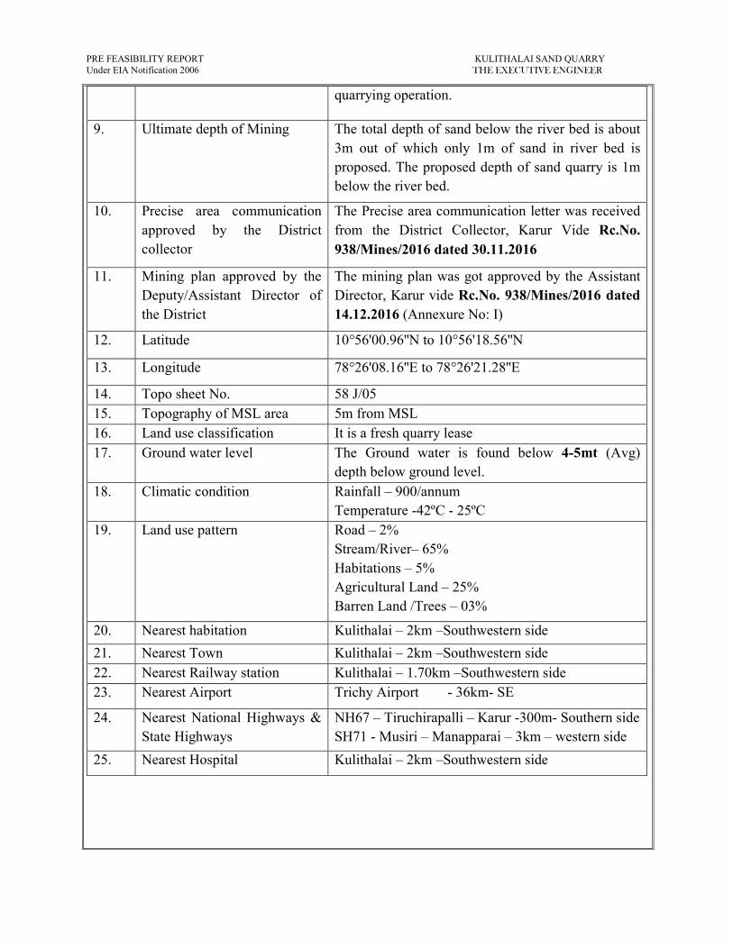
9. Ultimate depth of Mining The total depth of sand below the river bed is about
3m out of which only 1m of sand in river bed is
proposed. The proposed depth of sand quarry is 1m
below the river bed.
10. Precise area communication
approved by the District
collector
The Precise area communication letter was received
from the District Collector, Karur Vide Rc.No.
938/Mines/2016 dated 30.11.2016
11. Mining plan approved by the
Deputy/Assistant Director of
the District
The mining plan was got approved by the Assistant
Director, Karur vide Rc.No. 938/Mines/2016 dated
14.12.2016 (Annexure No: I)
12. Latitude 10°56'00.96''N to 10°56'18.56''N
13. Longitude 78°26'08.16''E to 78°26'21.28''E
14. Topo sheet No. 58 J/05
15. Topography of MSL area 5m from MSL
16. Land use classification It is a fresh quarry lease
17. Ground water level The Ground water is found below 4-5mt (Avg)
depth below ground level.
18. Climatic condition Rainfall – 900/annum
Temperature -42ºC - 25ºC
19. Land use pattern Road – 2%
Stream/River– 65%
Habitations – 5%
Agricultural Land – 25%
Barren Land /Trees – 03%
20. Nearest habitation Kulithalai – 2km –Southwestern side
21. Nearest Town Kulithalai – 2km –Southwestern side
22. Nearest Railway station Kulithalai – 1.70km –Southwestern side
23. Nearest Airport Trichy Airport - 36km- SE
24. Nearest National Highways &
State Highways
NH67 – Tiruchirapalli – Karur -300m- Southern side
SH71 - Musiri – Manapparai – 3km – western side
25. Nearest Hospital Kulithalai – 2km –Southwestern side

PRE FEASIBILITY REPORT KULITHALAI SAND QUARRY
Under EIA Notification 2006 THE EXECUTIVE ENGINEER
26. Aerial distance to the nearest
Eco sensitive areas, CRZ,
forest, wild life sanctuary,
Interstate boundary, critically
polluted area if the quarry site
is within 500m of these areas.
More than 500m from Eco sensitive areas, CRZ,
forest, wild life sanctuary, Interstate boundary,
critically polluted area.
27. Details of other quarries for a
radius of 500m around the
quarry site
No quarries within 500m radius.
28. Man power About 9 employees
29. Water requirement & source Total water requirement for 1.0KLD
Purpose Quantity
KLD
Source
Drinking 0.3KLD Water vendors
Domestic purpose 0.3KLD Nearby tank
Dust suppression
and afforestation
0.4KLD Nearby tank
30. Overburden/Waste There is no overburden or waste
31. Cost of the project The Project cost:
A. Cost of the Project = Rs. 27,68,000/-
B. EMP cost = Rs. 2,65,000/-
Total cost = Rs. 30,33,000/-
The Prefeasibility report preparing for following condition of Government of India Ministry of
Environment and Forests (No.L-11011/47/2011 –IA-II (M) Dated: 24th June, 2013)
The lease applied area lies in the Cauvery River.
There is no forest within the radius of 15km in the lease area.
The project area does not fall in ‘HACA’ region.
There is no interstate boundary within the radius of 15km
There is no Western Ghats within the radius of 15km
There is no CRZ within the radius of 15km.
There is no Bird sanctuary, wild life sanctuaries as per Wild Life Production Act 1972, within
the radius of 15km.
There is no quarry within the radius of 500m.

PRE FEASIBILITY REPORT KULITHALAI SAND QUARRY
Under EIA Notification 2006 THE EXECUTIVE ENGINEER
The following information provided by the applicant
We have applied for Environmental Clearance to SEIAA, Tamil Nadu for quarry lease
for quarrying of Sand quarry in S. F. No. 1 (Part) for over an extent of 11.00.0Hectares in
Kulithalai Village, Kulithalai Taluk and Karur District.
We swear to state and confirm that within 10km area of the quarry site, I have applied for
environmental clearance; none of the following is situated.
Protected areas notified under the wild life (protection) Act, 1972.
Critically polluted areas as notified by the central pollution control board constituted under water
(prevention and control of pollution) Act1974. Eco-Sensitive areas as notified.
Interstate boundaries and international boundaries within 5km radius from the boundary of the
proposed site.
No quarries are located within radius of 500m & 1km radius from the Periphery of proposed
quarry.
There will not be hindrance or disturbance to the people living no enroute / nearby our quarry
site while transporting the mineral our material and due to quarrying activities.
There is few habitations are located within 500m radius from the periphery of our quarry.
We swear that Afforestation will be carried out during the course of quarrying operation and
maintained.
The required insurance will be taken in the name of the laborers working in our quarry site.
Approach road belongs to local panchayat only and no other private patta roads encountered.
We will not engage any child labour in our quarry site and we aware that engaging child labour
is punishable under the law.
All type of safety/ protective equipment will be provided to all the Laborers working in our
quarry.
No permanent Structures, temple etc., are located within 500m radius from the periphery of our
quarry.
The quarry activity has not yet commenced and it will be carried out only after obtaining
environmental clearance.
PRE FEASIBILITY REPORT KULITHALAI SAND QUARRY
Under EIA Notification 2006 THE EXECUTIVE ENGINEER
2.0 INTRODUCTION OF THE PROJECT OR BACKGROUND INFORMATION
(i) Identification of project and project proponent: In case of mining project, a copy of mining
lease/letter of intent should be given
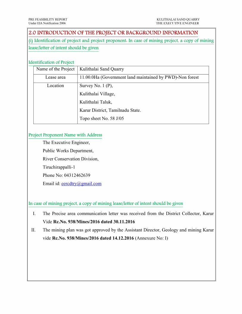
Identification of Project
Name of the Project Kulithalai Sand Quarry
Lease area 11.00.0Ha (Government land maintained by PWD)-Non forest
Location Survey No. 1 (P),
Kulithalai Village,
Kulithalai Taluk,
Karur District, Tamilnadu State.
Topo sheet No. 58 J/05
Project Proponent Name with Address
The Executive Engineer,
Public Works Department,
River Conservation Division,
Tiruchirappalli-1
Phone No: 04312462639
Email id: [email protected]
In case of mining project, a copy of mining lease/letter of intent should be given
I. The Precise area communication letter was received from the District Collector, Karur
Vide Rc.No. 938/Mines/2016 dated 30.11.2016
II. The mining plan was got approved by the Assistant Director, Geology and mining Karur
vide Rc.No. 938/Mines/2016 dated 14.12.2016 (Annexure No: I)
PRE FEASIBILITY REPORT KULITHALAI SAND QUARRY
Under EIA Notification 2006 THE EXECUTIVE ENGINEER
(ii) Brief description of nature of the project
The Sand quarrying is proposed to carry out by opencast Semi mechanized method. Sand
is composed of consolidated felsic compound Silica and Feldspar the sand is formed by the
action of water due to transportation and erosion of Rocks sand has become a very important
mineral for the expansion of society. Sand is a naturally occurring granular material composed of
finely divided rock and mineral particles. River sand is one of the world’s most plentiful
resources (perhaps as much as 20% of the Earth’s crust is sand) and has the ability to replenish
itself. River sand is vital for human well-being& for sustenance of rivers. The Sand is mainly
used for building construction purpose.
Machineries like excavator are proposed for quarrying for a short period of this Sand up
to 1m depth below the river bed. No drilling and blasting is proposed. There is no formation of
bench; the total depth of sand below the river bed is about 3m. Total depth of availability of sand
is about 3m below the river bed. The proposed depth of sand quarry: 1m below the river bed.
The entire Sand is excavated and utilized. It is proposed to exploit Sand (including shoals) is
about 401500m3
for a period of Two years only.
The sand is specifically used for construction purpose besides the Removal of the sand
may also called as desilting will increase the functional efficiencies of the river during the flood
season because protecting the Dwellers and vegetation on the bank of the river.
(iii) Need for the project and its importance to the country and or region
The Sand quarrying project falls in the area of Karur District, Tamilnadu where scanty
agricultural activities are been carried out and the new industries are springing up in the district.
Sand is an important commercial product, with a number of applications. The applicant intends
to use this Sand specifically used for construction work in and around Karur district.
This project will give employment opportunities to 9members directly. Mineral Industries
of the state of Tamilnadu provides employment opportunities for the people of the state as well
as in the specific project area. Mining and Quarrying is one among the major core sector
industries which plays a vital process of country’s economic development.

PRE FEASIBILITY REPORT KULITHALAI SAND QUARRY
Under EIA Notification 2006 THE EXECUTIVE ENGINEER
(iv) Demand and supply gap
There is a huge demand of Sand in and around the District for this a huge quantity of
Sand is required for building construction purpose. Besides there is also huge demand of Sand
for public and private sector projects also. This is significant for the development of the country
which enhances the Indian citizen.
(v) Imports vs indigenous production
There is no import of Sand at present in India. India especially the peninsular India
(southern India) has good resource of Sand.
(vi)Export Possibility
There is no possibility for export of this Sand.
(vii) Domestic/Export Markets
The sand is specifically used for construction purpose besides the Removal of the sand
may also called as desilting will increase the functional efficiencies of the river during the flood
season because protecting the Dwellers and vegetation on the bank of the river.
(viii) Employment Generation (Direct and Indirect) due to the project
About 9 employees labors directly and engaged in this proposed quarry project and the
tentative man power required for the proposed Sand quarry shall be as follows.
Skilled:
1. Mines foreman - 1
2. PWD Engineer - 1
Semi –skilled:
1. Excavators Operators - 2
2. Co-Operator - 2
Un-skilled:
1. Watchman - 1
2. Helper - 2
Total 9Nos
The above man power is adequate to meet out the production schedule and the machinery
strength envisaged in the mining plan and also to comply with the stationary provisions of mine
safety regulation.
It is been ensured that the labors will not be deployed less than 18 years, No Child
labors will engaged or entertained for any kind of quarrying operations. All the labors
engaged for quarrying operations will be insured till the end of life of quarry.

PRE FEASIBILITY REPORT KULITHALAI SAND QUARRY
Under EIA Notification 2006 THE EXECUTIVE ENGINEER
3.0. PROJECT DESCRIPTION
(i) Type of project including interlinked and interdependent projects, if any
The Kulithalai sand quarry, it is an opencast semi mechanized quarry. There is no
interlinked & interdependent project.
(ii) Location (map showing general location, specific location, and project boundary & project
site layout) with coordinates
� The project is proposed for the quarrying of Sand at proposed capacity (including
shoals) is about 401500m3
of Sand quarrying is about 11.00.0Ha in Kulithalai
Village, Kulithalai Taluk, Karur District.
� It is a Government poramboke land maintained by Public Works Department, Karur
District.
� The area is falls in GSI Topo sheet no. 58-J/05
� The Latitude between of 10°56'00.96''N to 10°56'18.56''N
� The Longitude between of 78°26'08.16''E to 78°26'21.28''E on WGS 1984
datum.

PRE FEASIBILITY REPORT KULITHALAI SAND QUARRY
Under EIA Notification 2006 THE EXECUTIVE ENGINEER
LOCATION MAP OF THE PROJECT AREA WITH CO ORDINATES
Location:
Village: Kulithalai
Taluk: Kulithalai
District: Karur
Topo sheet No: 58-J/05
Latitude: 10°56'00.96''N to 10°56'18.56''N
Longitude: 78°26'08.16''E to 78°26'21.28''E

PRE FEASIBILITY REPORT KULITHALAI SAND QUARRY
Under EIA Notification 2006 THE EXECUTIVE ENGINEER
(iii) Details of alternate sites considered and the basis of selecting the proposed site, particularly
the environmental considerations gone into should be highlighted
The conventional open cast quarrying is proposed in the area for excavation of Sand up to
depth 1m below the river bed and there is no topsoil in the lease area. The quarrying operation is
proposed in the Government land (Cauvery River) and there is no any alternative site for this
project is not considered, the project is site specific.
(iv) Size or magnitude of operation
The total area of Kulithalai Village project is about 11.00.0Ha. It is proposed to exploit
Sand is about 401500m3 by conventional open cast semi mechanized quarry by deploying
excavate directly for a period of Two years only.
(v) Project description with process details (a schematic diagram/flow chart showing the
project layout, components of the project etc. should be given)
Topography & General Geology
The Cauvery River has a gentle sloping towards eastern side, the area covered with sand, the
geology of the sand is very simple. The maximum altitude of the area is 5m (Maximum). The sand
is derived by erosion of weathered rocks and transported by the water stream and deposited on the
bed during the interface.
Details of Exploration
No exploration was carried out. The sand is found right from the surface of the River and
proposed to excavate up to depth of 1m below river bed.
Proposed Study to be carried out
As the quarrying operation is proposed to be carried out for a period of Two years only
to a depth of 1m below river bed further exploration or proposed study is redundant.
Method of Estimation of Reserves
The Geological plan demarcating the commercially viable sand has been prepared in
1:10,000 scale (Plate No. II).
The River Levels (RL) taken for the reserve calculation,
Totally ten sections have been drawn one along the length wise of the area (X-Y) and
another nine sections (A-B), (C-D), (E-F), (G-H) (I-J), (K-L), (M-N), (O-P) and (Q-R), section
along the width wise of the area in 100m grid interval to cover the area consider for lease in the
scale of Horizontal: 1:5000 & Vertical 1: 500 please refer (Plate No. II).

PRE FEASIBILITY REPORT KULITHALAI SAND QUARRY
Under EIA Notification 2006 THE EXECUTIVE ENGINEER
The cross sectional area for the proved depth persistence of 1.0m has been worked out for
the section. The cross sectional area multiplied by its length of influence on the longer axis gives the
volume (insitu) in the cross sectional area. The sum total of the insitu reserves available within the
individual cross sectional area gives the geological reserves of the lease applied area.
As the Mineable reserves of sand is in the terms of cubic meter. The geological resource,
mineable reserves are given only in terms of Cubic meter. The details of estimation of geological
resource and Mineable reserves with reference to the Topography, Geological Plan & Sections
(Plate No. II).
OPEN CAST WORKING
Opencast method of shallow mining is proposed, heavy Earth moving machineries like
excavator are proposed for quarrying this Sand up to a depth of 1m below the river bed. No
drilling and blasting is proposed, it is a Conventional Eco-Friendly quarrying operation.
The Sand will be loaded directly to the trucks/ Lorries for transportation to the needy
customers. The depth of quarry is proposed to be restricted up to 1.0m below the river bed only.
Mineable reserves of sand MINEABLE RESERVES
SL
NO CS @ m Area
Mean
Area
Distance
in m Qty in m
3
1 0 631.00 0 0
2 50 721.94 676.47 50 33823.44
3 100 732.94 727.44 50 36371.94
4 150 741.85 737.40 50 36869.75
5 200 753.13 747.49 50 37374.50
6 250 748.28 750.71 50 37535.25
7 300 781.25 764.77 50 38238.25
8 350 745.31 763.28 50 38164.00
9 400 576.50 660.91 50 33045.25
Shoals Over Bed Strata 2,91,422.38
Mineable Reserves of Sand - 400m X 275AvgX 1.0m 1,10,000
Add extra un covered by Levels 77.62
Total Quantity 4,01,500
PRE FEASIBILITY REPORT KULITHALAI SAND QUARRY
Under EIA Notification 2006 THE EXECUTIVE ENGINEER
Mineable Reserves of Shoals = 2,91,422.38m3
Mineable Reserves of Sand = 1,10,000m3
Extra sand quantity un covered by levels = 77.62m3
Mineable Reserves of sand including shoals = 4,01,500m3
Total Mineable Reserves of sand including shoals is about 4,01,500m3 of Sand up to an average
depth of 1m below the river bed for a period of two years only.
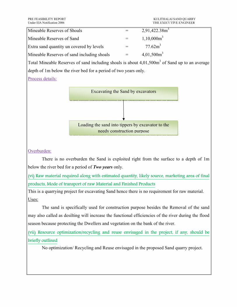
Process details:
Overburden:
There is no overburden the Sand is exploited right from the surface to a depth of 1m
below the river bed for a period of Two years only.
(vi) Raw material required along with estimated quantity, likely source, marketing area of final
products, Mode of transport of raw Material and Finished Products
This is a quarrying project for excavating Sand hence there is no requirement for raw material.
Uses:
The sand is specifically used for construction purpose besides the Removal of the sand
may also called as desilting will increase the functional efficiencies of the river during the flood
season because protecting the Dwellers and vegetation on the bank of the river.
(vii) Resource optimization/recycling and reuse envisaged in the project, if any, should be
briefly outlined
No optimization/ Recycling and Reuse envisaged in the proposed Sand quarry project.
Excavating the Sand by excavators
Loading the sand into tippers by excavator to the
needy construction purpose

PRE FEASIBILITY REPORT KULITHALAI SAND QUARRY
Under EIA Notification 2006 THE EXECUTIVE ENGINEER
(viii) Availability of water its source, Energy/power requirement and source should be given
This Sand quarry project does not require huge water for the project. The total water
requirement in the quarry will be around 1KLD for drinking, domestic usage and dust
suppression sprinkling. The water will be brought from local suppliers.
Purpose Quantity Sources
Drinking &
Domestic purpose 0.3 KLD
Water Purchase from Approved water vendors
available in Kulithalai (2km – SW)
Dust suppression 0.3 KLD Nearby tank after obtaining permission from local
Panchayat Authorities.
Green belt 0.4 KLD Nearby tank after obtaining permission from local
Panchayat Authorities.
Energy
No electricity is required for quarry operation; the quarry working is restricted on day
time only (between 9Am to 5Pm).
Diesel (HSD) will be used for quarrying machineries around 66920 liters of HSD will be used
for the entire projects. Diesel will be brought from nearby diesel pumps.
No power is required for the project. Lightings on the Night will be taken from nearby electric
poles after obtaining permission from concerned authorities.
Per hour Excavator will consume = 10 liters / hour
Per hour Excavator will excavate = 60m3
Per401500 = 401500/60
= 6692 hours
Diesel consume 6692 working hours = 6692 hours x 10 liters
= 66920 liters of HSD for entire project life
(ix) Quantity of wastes to be generated (liquid and solid) and scheme for their
management/disposal
There is no wastage is encountered during the quarrying operation the entire Sand is
utilized for construction purpose besides the Removal of the sand may also called as desilting
will increase the functional efficiencies of the river during the flood season because protecting
the Dwellers and vegetation on the bank of the river.
There is no toxic effluent expected to generate in the form of solid liquid and gases and
the no requirement of treatment of waste. There is no top soil available in the lease applied area.
PRE FEASIBILITY REPORT KULITHALAI SAND QUARRY
Under EIA Notification 2006 THE EXECUTIVE ENGINEER
(x) Schematic representations of the feasibility drawing which give information of EIA purpose
4.0 SITE ANALYSIS
(i) Connectivity
Mode Description
Road connectivity
1. There is an existing road from the area connecting in to
karur - Tiruchirapalli road is on the southern side.
2. Nearest National Highway (NH-67) Tiruchirapalli –
Karur - 300m -Southern side.
3. Nearest State Highway (SH-71) Musiri – Manapparai –
3km- Westren side.
Railway station &
Railway line
1. Kulithalai Railway station – 1.70km –SW side
2. Railway line is Karur – Tiruchirapalli – 1.20km-South
side
Air port 1. Trichy Airport - 36km- South eastern side
(ii) Land Form, Land use and Land ownership
The quarry lease applied area is 11.00.0Ha. The area falls in GSI topo sheet No. 58-J/05.
It is a Government poramboke land maintained by Public Works Department, Karur District.
The area covered mostly by Sand which does not sustain any type of vegetation. No agricultural
activities either seasonal or annual are inferred in and around the area.
To Submit SEIAA
Final Presentation
FORM-I
ALONG WITH PREFEASIBILITY REPORT &
APPROVED MINING PLAN

PRE FEASIBILITY REPORT KULITHALAI SAND QUARRY
Under EIA Notification 2006 THE EXECUTIVE ENGINEER
(iii) Topography (along with map)
The Cauvery River has a gentle sloping towards eastern side, the area covered with sand, the
geology of the sand is very simple. The maximum altitude of the area is 5m (Maximum). The sand
is derived by erosion of weathered rocks and transported by the water stream and deposited on the
bed during the interface.
Google image showing the Lease area
Lease area

PRE FEASIBILITY REPORT KULITHALAI SAND QUARRY
Under EIA Notification 2006 THE EXECUTIVE ENGINEER
GOOGLE IMAGE SHOWING THE LEASE BOUNDARY AREA
FOR KULITHALAI SAND QUARRY
Lease area
Location:
Village: Kulithalai
Taluk: Kulithalai
District: Karur
Topo sheet No: 58-J/05
Latitude: 10°56'00.96''N to 10°56'18.56''N
Longitude: 78°26'08.16''E to 78°26'21.28''E

PRE FEASIBILITY REPORT KULITHALAI SAND QUARRY
Under EIA Notification 2006 THE EXECUTIVE ENGINEER
(iv) Existing land use pattern (agriculture, non-agriculture, forest, water bodies (including area
under CRZ)), shortest distances from the periphery of the project to periphery of the forests,
national park, wild life sanctuary, eco sensitive areas, water bodies (distance from the HFL of
the river), CRZ. In case of notified industrial area, a copy of the Gazette notification should be
given.
� There is no forest within the radius of 15km in the lease area.
� The project area does not fall in ‘HACA’ region.
� There is no interstate boundary within the radius of 15km
� There is no Western Ghats within the radius of 15km
� There is no CRZ within the radius of 15km.
� There is no Bird sanctuary, wild life sanctuaries as per Wild Life Production Act 1972,
within the radius of 15km.
� There is no quarry within the radius of 500m.
(v) Existing Infrastructure
There is no existing infrastructure in the proposed quarry lease applied area.
(vi) Soil Classification
No top soil. The area is mostly covered with Sand formation; this land does not sustain
any type of vegetation or Agriculture.
(vii) Climatic data form secondary sources
Both the North East and South West monsoon occurs here and the summer are hot and
winter is cool. During April and May the temperature may shoot up to 42°C and during winter
the temperature does not fall below 25°C. The annual rainfall is around 900mm.
(viii) Social infrastructure available
There is no social infrastructures like Government Buildings, worship in the 1Km
vicinity of the quarry lease applied area.

PRE FEASIBILITY REPORT KULITHALAI SAND QUARRY
Under EIA Notification 2006 THE EXECUTIVE ENGINEER
5.0 PLANNING BRIEF
(i) Planning Concept (type of industries, facilities, transportation etc.) Town and Country
Planning/Development authority Classification.
The total area of the project is about 11.00.0 Ha. The proposed production of Sand is
about 401500m3
for a period of Two years only. This quarrying project is to excavate Sand by
conventional open cast semi mechanized method. Hydraulic excavator will be deployed for
production. Transportation of Sand shall be done by tippers on roads.
The project land is devoid of vegetation and lies in the backward town of Karur District.
There are no specific industries or factories in and around the project area.
Transportation
Hired Tippers of 10/20Ts capacity will be utilized for Transportation of Sand from the
quarry to needy to customer site by Tarpaulin cover to prevent spillage. During the transportation
along the village roads and populated areas the vehicle should not exceed the 20Km speed limit.
(ii) Population projection
There are few villages located in 5km radius from the lease applied area the details of the
areas are given below.
S.No Name of the Village Distance & Direction
from lease applied area
Approximate
population
1. Umaiyalpuram 2.0km – NE 400
2. Musiri 2.0km – NW 800
3. Kulithalai 2.0km – SW 1500
4. Rajendiram 2.0km – SE 700
(iii) Land use planning (breakup along with green belt etc.,)
The Sand quarrying operation is proposed for a period of Two years up to depth of 1m
below the river bed. The project area extent is 11.00.0 Ha. The entire area is proposed to be
quarried.

PRE FEASIBILITY REPORT KULITHALAI SAND QUARRY
Under EIA Notification 2006 THE EXECUTIVE ENGINEER
(iv) Assessment of Infrastructure Demand (Physical & Social)
The existing road facilities are already available which shall be used and maintained.
Medical facilities is available for the project sites, Government and private hospitals and other
basic infrastructure facilities like communication center, school supermarket, bus stand are also
available in Kulithalai which is at a distance of 2km on the South western side of the area. This
quarry project will provide employment for about 9persons directly.
(v) Amenities/Facilities
The simple methods adopted and the limited scale of activities involved in Sand
quarrying does not require High Tension Electric Power supply or huge worship facilities. The
quarrying work is restricted to one general shift during day time only. Major Machinery repair
works are attended at Kulithalai (2km–SW). Packaged drinking water will be brought from
approved water vendors.
All the facilities are available in Karur district which is at a distance about 39km on the Western
side of the area.
6.0. PROPOSED INFRASTRUCTURE
(i) Industrial Area (Processing area)
There is no processing area proposed within the lease applied area.
(ii) Residential area (Non processing area)
There is no residential area within 500mts of the lease applied area.
(iii) Green Belt
After completion of quarrying operation, the land will be facilitating the functional
efficiency of the river. The area applied is a Cauvery river hence Afforestation cannot be done
inside the lease area. The applicant ensures to carry out Afforestation by planting native species
like pungam, neem, causirina in the nearby villages and village roads after consultation with
Panchyat Authorities. The budget for Afforestation will be around Rs. 20,000/-
(iv) Social infrastructure
About 9 employees will be directly benefited and 5 persons will be indirectly benefited,
the lease ensure to share all responsible for special benefits like water, health care, Education
benefits, and promotion of socio cultural activities of the nearby villages.
PRE FEASIBILITY REPORT KULITHALAI SAND QUARRY
Under EIA Notification 2006 THE EXECUTIVE ENGINEER
(v) Connectivity (traffic and transportation road/ Rail/ Metro/ Water ways etc.)
Mode Description
Road connectivity
1. There is an existing road from the area connecting in to
karur - Tiruchirapalli road is on the southern side.
2. Nearest National Highway (NH-67) Tiruchirapalli –
Karur - 300m -Southern side.
3. Nearest State Highway (SH-71) Musiri – Manapparai –
3km- Westren side.
Railway station &
Railway line
1. Kulithalai Railway station – 1.70km –SW side
2. Railway line is Karur – Tiruchirapalli – 1.20km-South
side
Air port 1. Trichy Airport - 36km- South eastern side
(vi) Drinking Water management (Source & Supply of water)
This proposed Sand quarry project does not require huge water either for beneficiation or
processing. Drinking Water will be brought from approved water vendors in Kulithalai which is
about 2Km on the South western side of the area.
(vii) Sewerage System
Toilets will be constructed on semi-permanent structure and sewage will be discharged
once in two months. The sewage waste will be collected in soak pit and discharged as manure.
(viii) Industrial Waste Management
No industrial waste will be generated from the project.
(ix) Solid Waste Management
The Sand quarrying does not produce any waste. The entire Sand is excavated and
utilized. This waste may not produce any toxic effluent in the form of solid liquid or gas.
(x) Power Requirement & Supply / source
The proposed Sand quarrying does not required any power supply the quarrying
operation which is proposed to operate in day time only for 9 Am to 7Pm with 1 Hour lunch
interval between 1Pm to 2Pm.

PRE FEASIBILITY REPORT KULITHALAI SAND QUARRY
Under EIA Notification 2006 THE EXECUTIVE ENGINEER
7.0 REHABILITATION AND RESETTLEMENT (R & R PLAN)
(i) Policy to be adopted (Central/State) in respect of the project affectedpersons including home
oustees, land oustees and landless laborers(a brief outline to be given)
The project area lies in Cauvery River, the land is specifically used for collecting the
water during the rainy season, there is no habitation located within the radius of 500m hence
there is no rehabilitation and resettlement involved in this Sand quarrying project.
It is a Government poramboke land maintained by Public Works Department, Karur
District at Kulithalai village accounts, Kulithalai Taluk and Karur District. Hence there is no
Rehabilitation and resettlement is involved.
8.0 PROJECT SCHEDULE & COST ESTIMATES
(i) Likely date of start of construction and likely date of completion (Time schedule for the
project to be given)
The Sand quarrying project is likely to get commenced after the execution of quarrying
lease. The proposed quantity of sand (including shoals) is about 401500m3.
The life of the quarry
project is Two years only.

PRE FEASIBILITY REPORT KULITHALAI SAND QUARRY
Under EIA Notification 2006 THE EXECUTIVE ENGINEER
(ii) Estimated project cost along with analysis in terms of economic viability of the project
A. Cost of the project For Excavation = Rs.25, 00,000/-
Temporary rest shelter = Rs. 1, 00,000/-
Sanitary facilities = Rs. 1, 00,000/-
Drinking water = Rs. 24,000/-
Safety kits = Rs. 20,000/-
Sanitary maintenance = Rs. 24,000/-
Total Cost of the project = Rs. 27, 68,000/-
B. EMP cost:
Air Quality Sampling = Rs. 50,000/-
Water Quality Sampling = Rs. 25,000/-
Noise Monitoring = Rs. 25,000/-
Ground vibration test = Rs. 25,000/-
Water Sprinkling = Rs.1, 20,000/-
Afforestation = Rs. 20,000/-
Total EMP cost = Rs. 2,65,000/-
Cost towards CSR (Socio economic development for Panchayat)
The CSR cost is around 28.33% of the sand cost
The Project cost:
A. Cost of the Project = Rs. 27,68,000/-
B. EMP cost = Rs. 2,65,000/-
Total cost = Rs. 30,33,000/-
� The total project cost including EMP cost (A+B) is about Rs. 30,33,000/- (Rupees Thirty
lakhs thirty three thousand only).
� The EMP cost is about Rs. 2,65,000/- (Rupees Two lakhs sixty five thousand only).
Population Benefit
The applicant ensures to take social responsibilities like providing School Note books,
Uniforms to the Students below poverty level beside if the villages require any borehole for
public use the applicant ensure to do so. The applicant will also take part and contribute the
native cultural activities in the nearby villages. During summer seasons packaged drinking water
will be kept in the village for public and for tress passers.
The applicant will involve and contribute all the socio cultural allocation in and around
the area.
Government Revenue
The state Government will get revenue as Royalty, sale tax, surface rent, dead rent/ VAT/
income tax etc.

PRE FEASIBILITY REPORT KULITHALAI SAND QUARRY
Under EIA Notification 2006 THE EXECUTIVE ENGINEER
9.0 ANALYSIS OF PROPOSAL (FINAL RECOMMENDATIONS)
(i) Financial and social benefits with special emphasis on the benefit to the local people
including tribal population, if any, in the area
The end use of the sand is specifically used for construction purpose besides the Removal
of the sand may also called as desilting will increase the functional efficiencies of the river
during the flood season because protecting the Dwellers and vegetation on the bank of the river.
Due to this project many of the infrastructure development will be carried out in and around the
district on time, nearly 9employees directly get employment opportunity through this project.
The detail furnished in this mining plan is based on information provided by the state
Government and lessee. By considering the merit of the project the permission may be granted.
Place: Karur
Date: 21.02.2017
1. Signature of the Applicant
The Executive Engineer,
2. Signature of the Recognized qualified person
M. Ifthikhar Ahmed, M.Sc., F.G.S, M.B.A., M.M.E.A.,
RQP/MAS/183/2004/A

BASE LINE STUDIES
The base line study is prepared for Kulithalai Sand quarry project. Base line studies
provide a base data for regular Environmental Monitoring and Environmental Impact
Assessment (EIA).
The baseline study is provides bench mark for carrying out environmental Impact
assessment due to the course of quarrying and mining activities. The purpose of these studies is
to evaluate the benefited and adverse effect of developing activities on the neighborhood
environment and the area where the quarrying is proposed to carry out.
The Executive Engineer applied for Sand quarry project lease for over an extent of
11.00.0Ha located in S.F.No: 1 (P) of Kulithalai Village in Kulithalai Taluk, Karur District, and
Tamilnadu.
The comprehensive base line studies and standards constitute of collecting data on Flora
and Fauna list.
Flora and fauna in and around the area
A detail study related to flora and fauna was carefully observed physically by
environmental engineers, Botanist and zoologist. The following table shows the flora and Fauna
available at the region.
S.No Common Name Botanical name Pictures
1. Neem Azadirachata indica
2. Karuvelam Tree Acsia nilotica
3. Palm tree Borassus falabellifer
4. Morning Glory Ipomoea carnea
5. Naru netti Hemidesmus indicus

6. Kundumani Abrus precatorius
7. Mudakattan
Cardiospermum
halicacabum
8. Kovakka Coccinea grandis
9. Kanthal Gloriosa superba
10. Nuraipeerku Luffa cylindrica
11. Vaeliparuthi Pergularia daemia
12. Erukku Calotropis gigantea
List of Faunas
S.No Common Name Scientific name 1. Frog Ranal hexadactylus
2. Dog Canius familairis
3. Goat Capra hircus
4. Crow Corvus splenders
5. Rabbit Oryctolagus cuniculus
6. Squirrel Rodentia scrurus,
7. Ant Hymenopterous formicida,
8. Cat Felsis catus

Conclusion
The base line studies relents no hazardous levels of dust and noise and prevailing at the
project area. A well implemented environmental Management plan as discussed in the mining
plan will help in mitigation the adverse effects due to quarrying activities.
The movement of vehicles is very minimal. The entire vehicle used will be periodically
maintained by well experienced mechanic and kept under TNPCB standards, emission testing
will be carried out periodically and water will be sprinkled periodically to prevent dust into air.
Environmental care and attitude of preventing environment is inducted to the proponent and
advice to carry out and mitigate the minor impacts due to quarrying. Appropriate persons are
advice to get employed to protect the Environment and Ecology of the area.
Date : 21.02.2017
Place : Karur
1. Signature of the applicant
Executive Engineer
2. Signature of the Recognized qualified person
M. Ifthikhar Ahmed, M.Sc., F.G.S, M.B.A M.M.E.A.,
RQP/MAS/183/2004/A