Embed Size (px)
Citation preview

_____________________________________________________________________________________________________________________________________________Page 1
Flying Pig Adventures - Volume 36 - Poulsbo to Tucson, 2017 Copyright 2017 Wally Hampton, All Rights Reserved ~ [email protected] ~ www.WallyHampton.com
Poulsbo To Tucson - 2017Due to life’s circumstances we were not able to leave Poulsbo in August as planned and make our route Canada, Montana, Wyoming,
Colorado, New Mexico and then onto Tucson. As it turned out, we were not able to leave until the first part of October. The weather by then had already turned too cold in Canada, the cowboy roundup we planned to attend in Montana was over and weather along the northern Rockies through Colorado and into New Mexico was also already too cold for us. Due to that we headed south on Interstate 5, from Poulsbo into Oregon and then California.
A couple weeks before we left, we moved the MoHo (Motor Home) to a local RV park in Poulsbo where we could open it up and ready it for our trip south. We got a different toad (tow vehicle), the black Jeep, and needed more room than the city parking lot provided us to insure all the new connections and old pieces moved from the Mini Cooper were working. We could also open the slides, making it much easier to pack. There was room at the park to do some minor maintenance and generally insure all the systems were in working order. Plugging it into the electricity, we could charge up batteries as well, all six of them (two for the big diesel engine and four dedicated to all the other MoHo systems).
Our overall route ended up as shown to the right, with our stops shown as the green circles with a white tent in the center. In general; Interstate 5 from Poulsbo and south on that as far as Bakersfield, California; then back north into the Owens Valley; up, over and then down into Death Valley; onto Las Vegas; then south to Tucson.
This route took us most of October and half of November to do. We don’t cover a lot of miles in one day and try to find places interesting enough to stop at for more than one night.
On a day we travel, we generally get up about 7 AM and three hours later heave anchor, typically about 10 AM. Our extensive check lists take us about an hour to complete before launch. We stop every hour or so and will typically have a quick lunch in the MoHo while stopped somewhere, usually a rest stop. We try to stop for the day in early afternoon after about four hours of driving or about 200 miles.
Our re-entry docking procedure and check lists do not take as long as the pre-launch ones, maybe a half an hour. If we are going to unhook the toad (the Jeep we tow), it will take another half hour.
So, for us, almost half of the day’s effort and time on a day we move the MoHo is our pre-launch and landing efforts. From watching other RVers we are an exception and spend more time with our check lists and preparation than most.

_____________________________________________________________________________________________________________________________________________Page 2
Flying Pig Adventures - Volume 36 - Poulsbo to Tucson, 2017 Copyright 2017 Wally Hampton, All Rights Reserved ~ [email protected] ~ www.WallyHampton.com
Mostly for my own amusement, I enjoy data logging our travel. One of the devices I use is an iPad 0 (an original iPad) with a battery that no longer holds a charge for any reasonable amount of time, thus requiring it to be plugged into some kind power source. I have an APP on that iPad 0 that would (rather than ‘will’ at the time of writing this... but more on that in the next Flying Pig Adventures Travelogue)... anyway, the APP would not work on my newer iPad Air because it did not have the cellular feature, only WiFi. Even though the cellular coverage plan on the original iPad 0 was cancelled years ago, there seem to be some electronics in it that the APP requires that is not on an iPad that just has WiFi... even though there is no active plan.
So... I am including the data logging information in this issue of Flying Pig Adventures.
Poulsbo, WA to Salem, OR
Salem, OR - Medford, OR
Two days south of Poulsbo, I got a few minutes to explore around the RV park with my camera. The foliage had a definite fall motif going on. Something we could expect from here on out we felt. The weather was definitely fall like, but not difficult to drive in.

_____________________________________________________________________________________________________________________________________________Page 3
Flying Pig Adventures - Volume 36 - Poulsbo to Tucson, 2017 Copyright 2017 Wally Hampton, All Rights Reserved ~ [email protected] ~ www.WallyHampton.com
Medford, OR to Red Bluff, CA
When we got as far south as Mt. Shasta the smoke from the fires in California, in particular the Santa Rosa area, was thick in the air.
My son Scot and our future daughter Karen live in Graton, on the outskirts of Santa Rosa and the fires were still advancing towards them. While they were safe but ready to evacuate, hosing down their own roof in protection of burning embers, they were housing others that had already been evacuated.
We decided to stay in Red Bluff until they were out of danger from the fires and not venture any further towards them in support of whatever we could. Already, housing and resources in the Santa Rosa area were strained and us being there would just take up resources needed by others.
As it was, we met people in the Red Bluff RV park that were there because of the circumstances related to the Santa Rosa fires.
We have a favorite RV park we like to stay at in Red Bluff. It is a nice RV park, plenty of places, fountains, nearby restaurants, next to a river, interesting walks around the park, lots of new RVs coming in and out (which we enjoy ), and it is an RV park that allows me to wash the RV myself (which is usually not the case). Oh... and there is a rock, gem and jewelry store just outside the park that Wendy enjoys going to.
While we were there, we took a day and went up for a fast tour of the Mt. Lassen area.

_____________________________________________________________________________________________________________________________________________Page 4
Flying Pig Adventures - Volume 36 - Poulsbo to Tucson, 2017 Copyright 2017 Wally Hampton, All Rights Reserved ~ [email protected] ~ www.WallyHampton.com
_____________________________________________________________________________________________________________________________________________Page 5
Flying Pig Adventures - Volume 36 - Poulsbo to Tucson, 2017 Copyright 2017 Wally Hampton, All Rights Reserved ~ [email protected] ~ www.WallyHampton.com
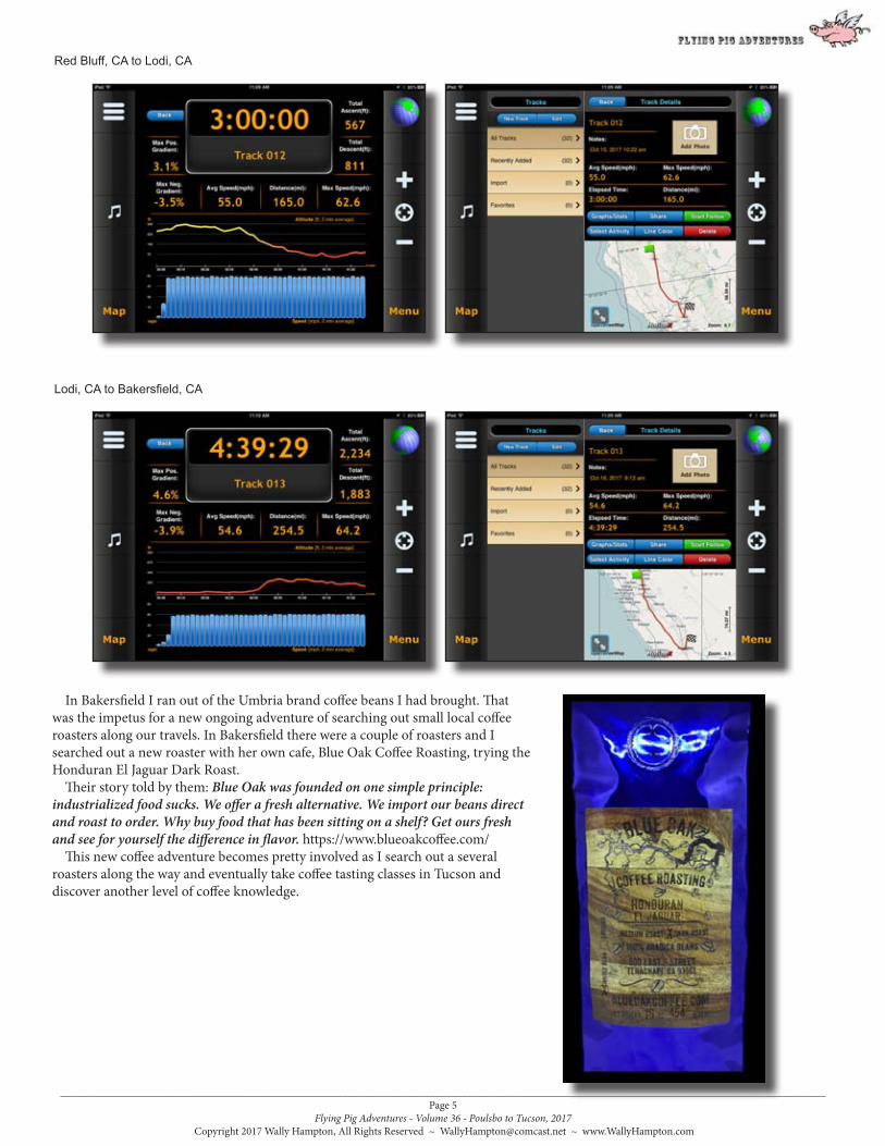
Red Bluff, CA to Lodi, CA
Lodi, CA to Bakersfield, CA
In Bakersfield I ran out of the Umbria brand coffee beans I had brought. That was the impetus for a new ongoing adventure of searching out small local coffee roasters along our travels. In Bakersfield there were a couple of roasters and I searched out a new roaster with her own cafe, Blue Oak Coffee Roasting, trying the Honduran El Jaguar Dark Roast.
Their story told by them: Blue Oak was founded on one simple principle: industrialized food sucks. We offer a fresh alternative. We import our beans direct and roast to order. Why buy food that has been sitting on a shelf? Get ours fresh and see for yourself the difference in flavor. https://www.blueoakcoffee.com/
This new coffee adventure becomes pretty involved as I search out a several roasters along the way and eventually take coffee tasting classes in Tucson and discover another level of coffee knowledge.

_____________________________________________________________________________________________________________________________________________Page 6
Flying Pig Adventures - Volume 36 - Poulsbo to Tucson, 2017 Copyright 2017 Wally Hampton, All Rights Reserved ~ [email protected] ~ www.WallyHampton.com
Bakersfield, CA to Lone Pine, CA
From Bakersfield we departed from our Interstate 5 route, taking an easterly track over the Tehachapi Pass on California Highway 58 where we once nearly ran out of fuel in our other MoHo trying to improve gas mileage by not taking on a full load of fuel. The ‘we’ really needs to be corrected to ‘I’, as Wendy was pretty much against the idea from the start. Needless to say, having narrowly escaped that experience whole, I no longer do that!
Over the Tehachapi pass and at Mojave, we turned north on California Highway 14 which in a few miles north, connects up with one of our favorite highways in the USA, California Highway 395 through Owens Valley.
Out first stop was at an RV park just outside Lone Pine which we find gives us good access to the southern portion of Owens Valley, and even down into Death Valley via California Highway 190... if one does not mind the excitement of the narrow steep road and with curves so narrow and sharp a MoHo can not pass another vehicle coming the other way. ‘I’ have taken Highway 190 to/from Lone Pine to/from Death valley a couple times before with our other MoHo. I have even lead our friends Tim & Evi Halpin up that route with their MoHo. This route was always fun for me and, so far, I’ve always found it survivable, but Wendy (as well as Evi Halpin) have since banned my choosing that route. This time though our plans were to exit out north end of Owens Valley, come back down south and enter Death Valley from the eastern side on a less precarious (yet still banned to commercial trucks) route.
We stayed about a week in Lone Pine exploring the southern parts of Owens Valley, some places we had been before as well as new places having a 4x4 Jeep allowed us access to that our other toads did not.
Needing more coffee beans, I searched out and found a very small roaster called Indy Coffee Roasting Company in an very small town called Independence just north of Lone Pine. Their beans are available in the Owens Valley Growers Cooperative in Independence and north up in Bishop, the Blue Lupine.
I purchased the El Camino Sierra at the suggestion of the store keep and it turned out to be my favorite until we reached Tucson. They have this to say about that particular roast: El Camino Sierra Roast - Ethiopian Blend - Full City +(Dark) Chocolatey Goodness only the Gods could create such a cherry (Coffee Bean) FC+ tones down fruits and acidity, and builds chocolate roast tones, remaining quite sweet. El Camino Sierra Roast is a tribute is to Highway 395 that runs along the eastern Sierras in Inyo County as part of the Inyo Good Road Club, est 1910. ICRC is proud to participate in and promote the beautiful destinations of the Eastern Sierras and our local businesses here in Inyo County.
From the web site (http://www.indycoffeeroastingcompany.com/) they have this to say: Supporting Farm Gate producers, collectives, biodynamic, bird friendly & Organic Farms, Indy Coffee Roasting Company brings European Style coffee roasting to the Eastern Sierra town of Independence, California. Roasted and processed in the Owens Valley, ICRC favors small batch roasting delivering a smooth, full bodied micro-crafted coffee from roast to cup whether using a French press or filter drip. Experience uniquely selected seasonal roasts specifically named after some of our favorite Eastern Sierra destinations within Inyo County.

_____________________________________________________________________________________________________________________________________________Page 7
Flying Pig Adventures - Volume 36 - Poulsbo to Tucson, 2017 Copyright 2017 Wally Hampton, All Rights Reserved ~ [email protected] ~ www.WallyHampton.com
This above view is looking east from the road up to Horseshoe Meadows at just over 10,000’ altitude, a popular portal into the Inyo National Forest and Sequoia National Park. To the left (north) and up Owens Valley it was pretty smoky from all the California fires. Center left (east) is the
town of Lone Pine and to the right (south) what is left of Owens Lake.
This is a view of the road up to Horseshoe Meadows from the RV park we stayed in and from where the above photograph was taken.
Horseshoe Meadows offers good photography of trees and one of the places I try to go every trip through the Owens Valley. If it is hot down on the valley floor it is also a good place to escape from the heat.

_____________________________________________________________________________________________________________________________________________Page 8
Flying Pig Adventures - Volume 36 - Poulsbo to Tucson, 2017 Copyright 2017 Wally Hampton, All Rights Reserved ~ [email protected] ~ www.WallyHampton.com
I am always on the look out for interesting cloud formations and the Southwest always provides plenty of possibilities.
The view of Mt. Whitney above Lone Pine from the RV park has always provided grand views. Here, with early morning light on it.
There was some fall color left on the valley floor, but most of the best was over. There was very little color left up the valleys and at higher elevations

_____________________________________________________________________________________________________________________________________________Page 9
Flying Pig Adventures - Volume 36 - Poulsbo to Tucson, 2017 Copyright 2017 Wally Hampton, All Rights Reserved ~ [email protected] ~ www.WallyHampton.com

_____________________________________________________________________________________________________________________________________________Page 10
Flying Pig Adventures - Volume 36 - Poulsbo to Tucson, 2017 Copyright 2017 Wally Hampton, All Rights Reserved ~ [email protected] ~ www.WallyHampton.com
Most days the smoke haze from the California fires could be seen as in these photographs. Some days were better and at higher altitudes it was better too.
With the 4x4 Jeep it was the first time in the Owens Valley that we could explore some of the more rugged ‘off-road’ areas, in particular the old mines on the east side of the valley. In this photograph we are up a short distance into the east side of the valley, looking west back across Owens Valley across the Alabama Hills where a lot of movies were made and to the Sierra Nevada Mountains in the background.

_____________________________________________________________________________________________________________________________________________Page 11
Flying Pig Adventures - Volume 36 - Poulsbo to Tucson, 2017 Copyright 2017 Wally Hampton, All Rights Reserved ~ [email protected] ~ www.WallyHampton.com
During our off-roading we would run across many unexplainable things and this is one. All these rusty cans, cans that did not look like they had ever been used. Hundreds, thousands of them. Near an old mine, but it did not seem like a old garbage dump, more like someone brought out a semi-truck load of unused cans and just dumped them there.
This is old California Highway 23, the precursor to the current Highway 395 through Owens Valley. In 1921 part of it was paved. The two lane paved portion here was fifteen feet wide, adequate for the traffic and speed of that time. While much of the original Highway 23 ran along the base of the mountains, this section can be seen in the center of the valley alongside the current Highway 395, between Lone Pine and Bishop.

_____________________________________________________________________________________________________________________________________________Page 12
Flying Pig Adventures - Volume 36 - Poulsbo to Tucson, 2017 Copyright 2017 Wally Hampton, All Rights Reserved ~ [email protected] ~ www.WallyHampton.com
One day on our way back from 4x4 off-roading on the east side of Owens Valley the road took us across an abandoned runway of some sort.
The RV park we stayed at was in the trees with great views of the Sierras and Mt. Whitney.

_____________________________________________________________________________________________________________________________________________Page 13
Flying Pig Adventures - Volume 36 - Poulsbo to Tucson, 2017 Copyright 2017 Wally Hampton, All Rights Reserved ~ [email protected] ~ www.WallyHampton.com
Moon Over The Sierras
One Of The Many Sunsets We Saw Over The Sierras
Pet Cemetery At The RV Park
Popular Situation Room In Lone Pine. Good Baguettes Too!
Mt. Whitney From The Road Up To The Whitney Portal

_____________________________________________________________________________________________________________________________________________Page 14
Flying Pig Adventures - Volume 36 - Poulsbo to Tucson, 2017 Copyright 2017 Wally Hampton, All Rights Reserved ~ [email protected] ~ www.WallyHampton.com
From Wikipedia: The rounded contours of the Alabamas contrast with the sharp ridges of the Sierra Nevada to the west. Though this might suggest that they formed from a different orogeny, the Alabamas are the same age as the nearby Sierras. The difference in wear can be accounted for by different patterns of erosion.
Mount Whitney, the tallest mountain in the contiguous United States, towers several thousand feet above this low range, which itself is 1,500 feet (460 m) above the floor of Owens Valley. However, gravity surveys indicate that the Owens Valley is filled with about 10,000 feet (3,000 m) of sediment and that the Alabamas are the tip of a very steep escarpment. This feature may have been created by many earthquakes similar to the 1872 Lone Pine earthquake which, in a single event, caused a vertical displacement of 15–20 feet.
The Alabama Hills are a popular filming location for television and movie productions, especially Westerns set in an archetypical “rugged” environment. Since the early 1920s, 150 movies and about a dozen television shows have been filmed here, including Tom Mix films, Hopalong Cassidy films, The Gene Autry Show, The Lone Ranger and Bonanza. Meanwhile Classics such as Gunga Din, The Walking Hills, Yellow Sky, Springfield Rifle, The Violent Men, Bad Day at Black Rock (1955), the Budd Boetticher/Randolph Scott “Ranown” westerns, part of How the West Was Won, and Joe Kidd. In the late 1940s and early 50s the area was also a popular location for the films of B-western actor Tim Holt.
More recent productions such as Tremors and Joshua Tree, were filmed at “movie ranch” sites known as Movie Flats and Movie Flat Road. In Gladiator, actor Russell Crowe rides a horse in front of the Alabamas, with Mount Whitney in the background, for a scene presumably set in Spain. Star Trek Generations was filmed here in addition to Overton, Nevada and Paramount Studios. This range was one of the filming locations for Disney’s Dinosaur. More recently, many parts of the films Iron Man, Transformers: Revenge of the Fallen, and the independent, experimental film 3.14... were filmed here.
When visiting the Lone Pine area we always make a few trips into the Alabama Hills. While the main attraction for most is the interesting and beautiful smooth rock formations and exploring all the places movies have been made, it is becoming a very popular rock climbing destination as well.
The Alabama Hills have always been one of my favorite places in to visit and photograph, but it has always been a difficult place for me to come back with images I’ve been happy with. This time it was no different, but I will keep trying.

_____________________________________________________________________________________________________________________________________________Page 15
Flying Pig Adventures - Volume 36 - Poulsbo to Tucson, 2017 Copyright 2017 Wally Hampton, All Rights Reserved ~ [email protected] ~ www.WallyHampton.com
From Wikipedi: The California Water Wars were a series of conflicts between the city of Los Angeles and farmers and ranchers in the Owens Valley of Eastern California.
As Los Angeles grew in the late 19th century, it started to outgrow its water supply. Fred Eaton, mayor of Los Angeles, realized that water could flow from Owens Valley to Los Angeles via an aqueduct. The aqueduct construction was overseen by William Mulholland and was finished in 1913. The water rights were acquired through political fighting and, as described by one author, “chicanery, subterfuge ... and a strategy of lies”.
Since 1913, the Owens River had been diverted to Los Angeles, causing the ruin of the valley’s economy. By the 1920s, so much water was diverted from the Owens Valley that agriculture became difficult. This led to the farmers trying to destroy the aqueduct in 1924. Los Angeles prevailed and kept the water flowing. By 1926, Owens Lake at the bottom of Owens Valley was completely dry due to water diversion.
The water needs of Los Angeles kept growing. In 1941, Los Angeles diverted water that previously fed Mono Lake, north of Owens Valley, into the aqueduct. Mono Lake’s ecosystem for migrating birds was threatened by dropping water levels. Between 1979 and 1994, David Gaines and the Mono Lake Committee engaged in litigation with Los Angeles. The litigation forced Los Angeles to stop diverting water from around Mono Lake, which has started to rise back to a level that can support its ecosystem.
Today, some of the flow of the river has been restored, and the lake now contains some water. Nevertheless, as of 2013, it is the largest single source of dust pollution in the United States.
Before the diversion of the Owens River, Owens Lake was up to 12 miles long and 8 miles wide, covering an area of up to 108 square miles. In the last few hundred years the lake had an average depth of 23 to 50 feet, and sometimes overflowed to the south after which the water would flow into the Mojave Desert. In 1905, the lake’s water was thought to be “excessively saline.”
The lake is currently a large salt flat whose surface is made of a mixture of clay, sand, and a variety of minerals including halite, burkeite, mirabilite, thenardite, and trona. In wet years, these minerals form a chemical soup in the form of a small brine pond within the dry lake. When conditions are right, bright pink halophilic (salt-loving) archaea spread across the salty lakebed. Also, on especially hot summer days when ground temperatures exceed 150° F, water is driven out of the hydrates on the lakebed creating a muddy brine. More commonly, periodic winds stir up noxious alkali dust storms that carry away as much as four million tons of dust from the lakebed each year, causing respiratory problems in nearby residents. The dust includes carcinogens such as cadmium, nickel and arsenic.
The LADWP (Los Angeles Department of Water and Power) and the California State Lands Commission own most of the Owens Lake bed, though a few small parcels along the historic western shoreline are privately owned. In 2004, the CDFW (California Department of Fish and Wildlife) acquired a 218-acre parcel at the foot of Owens Lake. Designated the Cartago Wildlife Area in 2007, it is one of the few remaining spring and wetland areas on the shore of Owens Lake. The CDFW is using mitigation funds from CalTrans to enhance habitat. We saw lots of heavy equipment work going on, building dikes and enhancing the habitat for birds (as well as addressing the dust issue for us humans). Along the dikes we stopped and chatted about birding with a wildlife biologist that was employed full-time by the LAPWD to keep track of the birds and their habitat here.
As part of an air quality mitigation settlement, LADWP is currently shallow flooding 27 square miles (69.9 km2) of the salt pan to try to help minimize alkali dust storms and further adverse health effects. There is also about 3.5 square miles (9.1 km2) of managed vegetation being used as a dust control measure. The vegetation consists of saltgrass, which is a native perennial grass highly tolerant of the salt and boron levels in the lake sediments. Gravel covers are also used.
There is also an Owens Lake Bird Festival. More information here: https://friendsoftheinyo.org/owens-lake-bird-festival/
From the RV park we stayed at near Lone Pine it was an easy drive out onto the dikes of what is the modern day Owens Lake. Owens Lake is a mostly dry lake. It is about 5 miles south of Lone Pine. Unlike most dry lakes in the Basin and Range Province that have been dry for thousands of years, Owens Lake held significant water until 1913, when much of the Owens River was diverted into the Los Angeles Aqueduct, causing Owens Lake to desiccate by 1926.

_____________________________________________________________________________________________________________________________________________Page 16
Flying Pig Adventures - Volume 36 - Poulsbo to Tucson, 2017 Copyright 2017 Wally Hampton, All Rights Reserved ~ [email protected] ~ www.WallyHampton.com
Lone Pine, CA to Bishop, CA
After a week in Lone Pine, we headed north on 395 to Bishop. We stayed at the same RV park we have stayed at other times. We had always found it adequate for our needs and convenient to most services and restaurants.
The views of the mountains were not as spectacular as in Lone Pine from this RV park, but it still offered some great sunsets.
We enjoy walking around and checking out other RVs in the parks, seeing how others travel and their amenities. The animals in this RV have it pretty good, a couple cats and a couple dogs from what we could tell. This RV was only there one night, giving a bit more appreciation of just how much effort the owners put out just for their pets and one night’s stay!

_____________________________________________________________________________________________________________________________________________Page 17
Flying Pig Adventures - Volume 36 - Poulsbo to Tucson, 2017 Copyright 2017 Wally Hampton, All Rights Reserved ~ [email protected] ~ www.WallyHampton.com
A major draw for me in the Bishop area is the Bristlecone Pines located in the White Mountains above and to the east of Bishop. The bristlecone pine forests are another of those places, like the Alabama Hills, where over the years it has been difficult for me to come away with great photographic images... but I keep trying...
From Wikipedia: The term bristlecone pine covers three species of pine tree (family Pinaceae, genus Pinus, subsection Balfourianae). All three species are long-lived and highly resilient to harsh weather and bad soils. One of the three species, Pinus longaeva, is among the longest-lived life forms on Earth and are the one found here. The oldest Pinus longaeva is more than 5,000 years old, making it the oldest known individual of any species. A specimen of Pinus longaeva located in the White Mountains is reported to be 5,067 years old. This is the oldest known individual tree in the world. The identity of the specimen is being kept secret. Another well-known bristlecone in the White Mountains is Methuselah which is 4,849 years old. Its specific location is also being kept secret.
Despite their potential age and low reproductive rate, bristlecone pines, particularly Pinus longaeva, are usually a first-succession species, tending to occupy new open ground. They generally compete poorly in less-than-harsh environments, making them hard to cultivate. In gardens, they succumb quickly to root rot. They do very well, however, where most other plants cannot even grow, such as in rocky dolomitic soils in areas with virtually no rainfall.
Bristlecone pines grow in scattered subalpine groves at high altitude in arid regions of the Western United States. The name comes from the prickles on the female cones.
There are generally two places I photograph here, the first is around the Schulman Grove Visitor Center. This place can be reached by a paved road to the visitors center. The Schulman Grove Visitor Center is easily reached by going south from Bishop on Highway 395 to Big Pine, take Highway 168 west to the White Mountain Road and then north on that to the visitors center. From Big Pine it is 23 miles and a 6,000 foot elevation gain from the Owens Valley floor, to about a 10,000 foot elevation, but it is a two lane paved road.
The second and my favorite place is to continue on past the visitor center on the same White Mountain Road another 13 miles and to an elevation of about 11,300 in elevation and the Patriarch Grove. This road is not paved and while a 4x4 such as a jeep is more appropriate for this rough road, a typical road car can make it too. If the car has low ground clearance like a Mini Cooper, it is not a good idea to continue past the visitors center.
Along the roads at this altitude there will generally be two types of pines trees, the Bristle Cone Pine and the White Bark Pine. They are easily distinguishable by their needles.
Bristlecone Pine White Bark Pine

_____________________________________________________________________________________________________________________________________________Page 18
Flying Pig Adventures - Volume 36 - Poulsbo to Tucson, 2017 Copyright 2017 Wally Hampton, All Rights Reserved ~ [email protected] ~ www.WallyHampton.com

_____________________________________________________________________________________________________________________________________________Page 19
Flying Pig Adventures - Volume 36 - Poulsbo to Tucson, 2017 Copyright 2017 Wally Hampton, All Rights Reserved ~ [email protected] ~ www.WallyHampton.com

_____________________________________________________________________________________________________________________________________________Page 20
Flying Pig Adventures - Volume 36 - Poulsbo to Tucson, 2017 Copyright 2017 Wally Hampton, All Rights Reserved ~ [email protected] ~ www.WallyHampton.com

_____________________________________________________________________________________________________________________________________________Page 21
Flying Pig Adventures - Volume 36 - Poulsbo to Tucson, 2017 Copyright 2017 Wally Hampton, All Rights Reserved ~ [email protected] ~ www.WallyHampton.com
We went up valleys and into the Sierras several times, having a picnic lunch with a great view became standard affair.
There are a lot of small lakes with great picnic spots all long Owens Valley and the Sierra Mountain foothills, (fishing is a big deal).
_____________________________________________________________________________________________________________________________________________Page 22
Flying Pig Adventures - Volume 36 - Poulsbo to Tucson, 2017 Copyright 2017 Wally Hampton, All Rights Reserved ~ [email protected] ~ www.WallyHampton.com
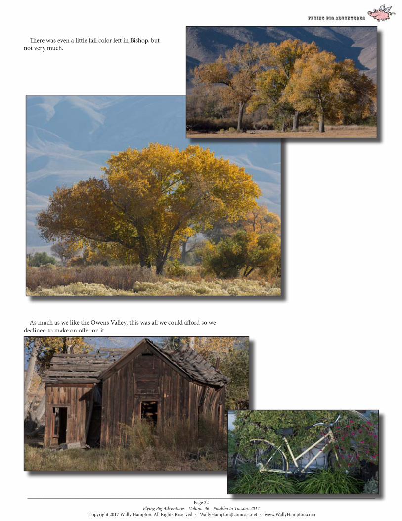
There was even a little fall color left in Bishop, but not very much.
As much as we like the Owens Valley, this was all we could afford so we declined to make on offer on it.

_____________________________________________________________________________________________________________________________________________Page 23
Flying Pig Adventures - Volume 36 - Poulsbo to Tucson, 2017 Copyright 2017 Wally Hampton, All Rights Reserved ~ [email protected] ~ www.WallyHampton.com
Laws Railroad Museum is an outdoor / indoor museum, junk yard, and full sized diorama of sorts. It is on the outskirts of Bishop and I like to go here when the light is not very good for landscape photography. There is all kinds of still life potential in this place, and when the sun is high and harsh in the sky one can pull out interesting textures from all the vertical surfaces. There is also plenty of indoor displays and potential photographs too.
Located on the site of the Laws Railroad station and rail yard, the land, 1883 depot and other buildings, and the last train, were donated to Inyo County and the City of Bishop by the Southern Pacific Railroad in 1960. At the time the railroad shut down its operations, the village of Laws that grew up around the rail yard had disappeared. That village has been recreated by moving in historic buildings from around the Owens Valley and they now contain many artifacts and exhibits illustrating early life in the Owens Valley.
You can find out more about it here: http://lawsmuseum.org/

_____________________________________________________________________________________________________________________________________________Page 24
Flying Pig Adventures - Volume 36 - Poulsbo to Tucson, 2017 Copyright 2017 Wally Hampton, All Rights Reserved ~ [email protected] ~ www.WallyHampton.com

_____________________________________________________________________________________________________________________________________________Page 25
Flying Pig Adventures - Volume 36 - Poulsbo to Tucson, 2017 Copyright 2017 Wally Hampton, All Rights Reserved ~ [email protected] ~ www.WallyHampton.com

_____________________________________________________________________________________________________________________________________________Page 26
Flying Pig Adventures - Volume 36 - Poulsbo to Tucson, 2017 Copyright 2017 Wally Hampton, All Rights Reserved ~ [email protected] ~ www.WallyHampton.com

_____________________________________________________________________________________________________________________________________________Page 27
Flying Pig Adventures - Volume 36 - Poulsbo to Tucson, 2017 Copyright 2017 Wally Hampton, All Rights Reserved ~ [email protected] ~ www.WallyHampton.com

_____________________________________________________________________________________________________________________________________________Page 28
Flying Pig Adventures - Volume 36 - Poulsbo to Tucson, 2017 Copyright 2017 Wally Hampton, All Rights Reserved ~ [email protected] ~ www.WallyHampton.com

_____________________________________________________________________________________________________________________________________________Page 29
Flying Pig Adventures - Volume 36 - Poulsbo to Tucson, 2017 Copyright 2017 Wally Hampton, All Rights Reserved ~ [email protected] ~ www.WallyHampton.com
Bishop has it’s own favorite son coffee roaster, Black Sheep Coffee Roasters. While the name fits me quite well and the coffee beans were okay, I still preferred the Indy Coffee from down the road in Independence. Non-the-less, I picked up a pound of Black Sheep Coffee (I do not remember the particular roast). I tried to find someplace in Bishop that carried the Indy Coffee, failed and have found out later it could have been acquired in Bishop at the Blue Lupine. The sad part was that Wendy and I went into this cool specialty food store and purchased some things, but did not see the coffee, go figure!
This is what Black Sheep Coffee Roasters have to say about themselves: From Seed to Cup: Our coffees are sourced from all over the world! At Black Sheep we hand select our coffees via a rigorous cupping process.
Bishop, CA to Beatty, NV
It involves a combination of cupping for flavor and taking into account the practices of each farm where the coffee is grown. Once a coffee is selected to be part of our roast program, we design a roast profile to accentuate the characteristics of the coffee that are most desirable.
The end result of this selection process is to provide our customers with coffees that highlight each origins finest qualities and support human and environmentally sensitive practices. We hope you enjoy our efforts!
If you are in Bishop they have their own cafe on North Main Street (Highway 395) and a nice web site at:https://www.blacksheepcoffeeroasters.com/
We made our way north on California Highway 6 from Bishop, California into Nevada, then south on Nevada Highway 95 to Beatty, Nevada for one night, before heading down into Death Valley and the Stovepipe Wells RV Campground.
We encountered some traffic...

_____________________________________________________________________________________________________________________________________________Page 30
Flying Pig Adventures - Volume 36 - Poulsbo to Tucson, 2017 Copyright 2017 Wally Hampton, All Rights Reserved ~ [email protected] ~ www.WallyHampton.com
While the RV park we anchored at was nicer than some we have stayed at in Beatty, it was slightly below the standards we prefer.
As I’ve lamented before, I am no longer allowed to take this quicker route, CA 190, from Lone Pine into Death Valley due to it’s overly perceived dangerous, tenuously, bendy and steep path.
I did have Wendy convinced it was just her perception that made it that way, but when I led our friends Tim & Evi Halpin along this path, a certain individual of that couple turned on me declaring it was actually worse than Wendy had imagined and should I have been Evi’s spouse it would have been curtains and certain divorce! Well... Wendy THEN decided she felt the same.
I am pretty sure it is my fault that Tim has never had chocolate again after that trip (As a matter of course, Evi would withhold chocolate from Tim’s diet whenever he edges off the main part of the tarmac in their MoHo).
When they referred to ‘High-Speed Internet’ it was relative to the days of 300 baud audio coupled devices, the ones where you punched your telephone into a small shoe sized box.
There were other places a bit less desirable in Beatty though. The one below had a highly placed guard dog.
_____________________________________________________________________________________________________________________________________________Page 31
Flying Pig Adventures - Volume 36 - Poulsbo to Tucson, 2017 Copyright 2017 Wally Hampton, All Rights Reserved ~ [email protected] ~ www.WallyHampton.com
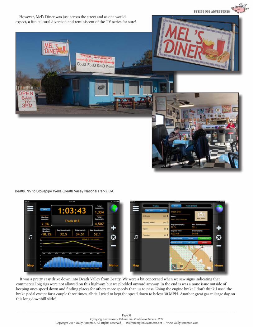
However, Mel’s Diner was just across the street and as one would expect, a fun cultural diversion and reminiscent of the TV series for sure!
Beatty, NV to Stovepipe Wells (Death Valley National Park), CA
It was a pretty easy drive down into Death Valley from Beatty. We were a bit concerned when we saw signs indicating that commercial big rigs were not allowed on this highway, but we plodded onward anyway. In the end is was a none issue outside of keeping ones speed down and finding places for others more speedy than us to pass. Using the engine brake I don’t think I used the brake pedal except for a couple three times, albeit I tried to kept the speed down to below 30 MPH. Another great gas mileage day on this long downhill slide!

_____________________________________________________________________________________________________________________________________________Page 32
Flying Pig Adventures - Volume 36 - Poulsbo to Tucson, 2017 Copyright 2017 Wally Hampton, All Rights Reserved ~ [email protected] ~ www.WallyHampton.com
Photographing the dunes is often bittersweet for me. As much as I feel that when I am there all others should stay off the sand dunes so I can photograph them in their pristine (no footprints) condition, that usually is not the case unless the weather is very foul, I am there in the off season or I am there at first light and there has been strong winds to ease the day before’s footprints (even then I am never the only one out on the dunes before sunrise).
This trip was no different; prime tourist season, moderate weather, and no wind for days. None-the-less, I was out on
We arrived at the Stovepipe Wells campground, elevation zero, set up camp, (which generally means we extended our MoHo slides; put down the leveling jacks; hooked up the water, sewer and electrical; and unhooked the toad), then sat outside looking at the nearby dunes with a cool beer and anticipated photographing the nearby sand dunes for the next few days.
I took this photograph of our campground from one of my trips out onto the dunes.
the dunes every sunrise and sunset. I found it a fun challenge to find images in spite of all the footprints and people all over the dunes. Some successes, but mostly a lot of fun, exciting and enjoyable hikes in the dunes. These few photographs give an idea of how things were.

_____________________________________________________________________________________________________________________________________________Page 33
Flying Pig Adventures - Volume 36 - Poulsbo to Tucson, 2017 Copyright 2017 Wally Hampton, All Rights Reserved ~ [email protected] ~ www.WallyHampton.com
And these photographs are where I tried to avoid footprints, people, and human altered sand dunes. Sometimes I focused on something entirely different and away from the dunes themselves. It was all good exercise, fun and enjoyment in finding imagery...

_____________________________________________________________________________________________________________________________________________Page 34
Flying Pig Adventures - Volume 36 - Poulsbo to Tucson, 2017 Copyright 2017 Wally Hampton, All Rights Reserved ~ [email protected] ~ www.WallyHampton.com

_____________________________________________________________________________________________________________________________________________Page 35
Flying Pig Adventures - Volume 36 - Poulsbo to Tucson, 2017 Copyright 2017 Wally Hampton, All Rights Reserved ~ [email protected] ~ www.WallyHampton.com
There was a full moon during our stay in Death Valley, but I choose not to go out and work the dunes during the full moon based on a single warning I read... WATCH OUT FOR SIDEWINDERS AT NIGHT! (A Sidewinder is a snake that travels sideways)
These photographs are of the Sidewinder tracks I found on the side of a dune one morning. They intersected with the tracks of what kind of pry I do not know. To me it is a story of a Sidewinder hunting ‘something’ down. I could not tell if the Sidewinder was successful or not (and still very hungry). I did NOT get close, but photographed the tracks with the longest combination of lenses I could muster.

_____________________________________________________________________________________________________________________________________________Page 36
Flying Pig Adventures - Volume 36 - Poulsbo to Tucson, 2017 Copyright 2017 Wally Hampton, All Rights Reserved ~ [email protected] ~ www.WallyHampton.com
Mosaic Canyon Trail
Artist’s Palette. Colors will vary in intensity depending upon weather and light conditions. Try low sunlight after rain. Good luck with your timing!

_____________________________________________________________________________________________________________________________________________Page 37
Flying Pig Adventures - Volume 36 - Poulsbo to Tucson, 2017 Copyright 2017 Wally Hampton, All Rights Reserved ~ [email protected] ~ www.WallyHampton.com

_____________________________________________________________________________________________________________________________________________Page 38
Flying Pig Adventures - Volume 36 - Poulsbo to Tucson, 2017 Copyright 2017 Wally Hampton, All Rights Reserved ~ [email protected] ~ www.WallyHampton.com
Stovepipe Wells (Death Valley National Park), CA to Las Vegas, NV
We exited Death Valley via the easiest access for RVs, south via CA 190, connecting with CA 127 at the Amargosa Opera House. I have written about the Amargosa Opera House and Marta Becket before so I won’t repeat myself here except to say that although Marta Becket has recently passed away, the Amargosa Opera House and Hotel was still open and in business as we passed by. We drove on south CA 127 to Shoshone, California then took highway 372 to Pahrump, Nevada. From Pahrump we took Nevada Highway 162 which took us right into Las Vegas on the very street our RV park was on. Sort of a new route for us from Shoshone onward and an easy route.
We spent a few days in Las Vegas, celebrating Wendy’s birthday. After a great dinner we saw the Michael Jackson show. It was good but we still like the Beatles “Love” show best of all the shows we have seen there in recent years.
We saw Pete Rose signing autographs in one of the casino malls. It seemed sad to see him doing that, in particular because there was hardly anyone except a young boy there. While not too hot while we were in Las Vegas,
there was evidence that it had been and this palm tree had succumbed to it.

_____________________________________________________________________________________________________________________________________________Page 39
Flying Pig Adventures - Volume 36 - Poulsbo to Tucson, 2017 Copyright 2017 Wally Hampton, All Rights Reserved ~ [email protected] ~ www.WallyHampton.com
Las Vegas, NV to Lake Havasu City, AZ
I tried five different coffee beans over three different coffee roasters in Las Vegas and none were to my liking. They all had a burnt and overly bitter aftertaste to me, like the old Starbucks. So I had a whole lot of beans that I was hoping I would not have to finish. It was only going to be a couple more stops until we were in Tucson where there would be more choices. I did find a coffee roaster in Lake Havasu City so I searched her out. She has a drive through coffee stand and that was the only place one could find them. I purchased an Americano coffee to taste them, liked it and the best I could do was buy a huge coffee cup full of beans. That would have to hold me over until we reached Tucson.
We stayed in Lake Havasu City for a couple nice sunsets.

_____________________________________________________________________________________________________________________________________________Page 40
Flying Pig Adventures - Volume 36 - Poulsbo to Tucson, 2017 Copyright 2017 Wally Hampton, All Rights Reserved ~ [email protected] ~ www.WallyHampton.com
Lake Havasu City, AZ to Gila Bend, AZ
Gila Bend, AZ to Tucson, AZ
So, we rolled in to Tucson on November 16 and anchored at the RV park we had stayed at for several winters before, (Far Horizons Tucson Village). We plan to stay at this park until January 1st, then move to a different RV park on the opposite side of Tucson.
I’ll write about the next few months Tucson adventures in the next Flying Pig Adventures.
.END