Embed Size (px)
DESCRIPTION
A brief syopsis of the gen to date on this artefact.
Citation preview

POSSIBLE OLD ROUND HOUSE OUTLINEIN PASTURE ABOVE CODLEY GATE, NORTHUMERLAND, NE47
We wonder if you can answer our five questions at the end of this brief document which I have prepared on 26/10/2011.
Whilst looking from the Long Stone on Barcombe Down at NY 778664 towards the Vindolanda site on 7 October 2011, my wife and I noticed a circular outline in the pasture meadow on west bank of Bradleys Burn at approx NY 772668. We were unable to take an adequate photograph as the wind was blowing very briskly!
We visited the site on 16 October 2011 and confirmed the grid reference as NY7725 6675 (or thereabouts, we are old folk) and took 3 photographs.
The circular outline can be seen as a darker green arc in middle foreground looking from about 30 yards and to the ENE at some 60 degrees.
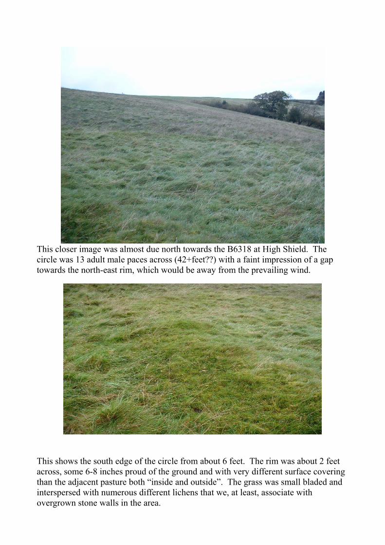
This closer image was almost due north towards the B6318 at High Shield. The circle was 13 adult male paces across (42+feet??) with a faint impression of a gap towards the north-east rim, which would be away from the prevailing wind.
This shows the south edge of the circle from about 6 feet. The rim was about 2 feet across, some 6-8 inches proud of the ground and with very different surface covering than the adjacent pasture both “inside and outside”. The grass was small bladed and interspersed with numerous different lichens that we, at least, associate with overgrown stone walls in the area.

A corresponding sized object is visible on google earth at;
http://preview.tinyurl.com/6dftecm
some 600 feet NNW of the Codley Gate pin.
A possible match is also on in the image on page 22 of “Following the Eagle” by Robin and Andrew Birley, ISBN 1873136 08 0 at the extreme left and top edge. (Image not copied by me to honour copyright).
Using this database http://archaeologydataservice.ac.uk/archsearch/ with postcode NE47 and slight jiggling with the image finds only 2 registered locations in this immediate area.
1. The mound at 380metres north of Codley Gate at NY 7708 6681 is WNW of the images I have detailed above, about 150 yards
2. The milestone adjacent to Stanegate at NY 7718 6650 is SSW of our images and about 300 yards.
I could find no other reference at;
http://www.english-heritage.org.uk/professional/protection/process/national-heritage-list-for-england/
other than the two detailed above.
CONCLUSION AND QUESTIONSNeither my wife or I are trained archaeologists or field walkers; we just roam the countryside when we can. Allowing for our total inexperience on this matter;
1. Is it possible that this circle is the now buried footings of an old round house?2. If it isn't, can you tell us what it might be as it driving me potty!3. If it might be an old round house, what if anything could/should/ought to be
done?4. If some action seems appropriate, should it be Northumberland County
Council or The National Trust who own the farm land?5. If it might be and no action is called for, please tell me to go away...
Many thanks for reading thus far;
Dr Dave Hambidge [email protected]