Embed Size (px)
Citation preview
Platform Data Extension APIDeveloper's Guide
Version 1.6.4
Platform Data Extension API Developer's Guide 2► Notices
Important Information
NoticesTopics:
• Legal Notices
• Document Information
This section contains document notices.
Platform Data Extension API Developer's Guide 3► Notices
Legal Notices© 2016 HERE Global B.V. and its Affiliate(s). All rights reserved.
This material, including documentation and any related computer programs, is protected by
copyright controlled by HERE. All rights are reserved. Copying, including reproducing, storing,
adapting or translating, any or all of this material requires the prior written consent of HERE. This
material also contains confidential information, which may not be disclosed to others without the
prior written consent of HERE.
Trademark Acknowledgements
HERE is trademark or registered trademark of HERE Global B.V.
Other product and company names mentioned herein may be trademarks or trade names of their
respective owners.
Disclaimer
This content is provided "as-is" and without warranties of any kind, either express or implied,
including, but not limited to, the implied warranties of merchantability, fitness for a particular
purpose, satisfactory quality and non-infringement. HERE does not warrant that the content is error
free and HERE does not warrant or make any representations regarding the quality, correctness,
accuracy, or reliability of the content. You should therefore verify any information contained in the
content before acting on it.
To the furthest extent permitted by law, under no circumstances, including without limitation the
negligence of HERE, shall HERE be liable for any damages, including, without limitation, direct, special,
indirect, punitive, consequential, exemplary and/ or incidental damages that result from the use or
application of this content, even if HERE or an authorized representative has been advised of the
possibility of such damages.
Platform Data Extension API Developer's Guide 4► Notices
Document Information
Product
Name: Platform Data Extension API
Version: Version 1.6.4
Document
Name: Platform Data Extension API Developer's Guide
ID: 92cbb75-1477665642-578aaa18
Status: FINAL
Date: 2016-Oct-28, 14:42 (GMT)
Digital Signature
Signatory: O=HERE, CN=here.com, ST=Berlin, C=DE
Issuer-Certificate: O=HERE, CN=here.com, ST=Berlin, C=DE
Serial-Number.: 17391143833054135595
Method: urn:adobe.com:Adobe.PPKLite:adbe.pkcs7.sha1 (Adobe
Signature)
Platform Data Extension API Developer's Guide 5► Contents
Contents
Notices....................................................................................................................................................................2Legal Notices............................................................................................................................................................ 3
Document Information........................................................................................................................................... 4
Chapter 1: Overview................................................................................................................................. 7What is the Platform Data Extension API?........................................................................................................ 8
Why use the Platform Data Extension API?...................................................................................................... 9
Chapter 2: Quick Start........................................................................................................................11Making your first Requests.................................................................................................................................12
Chapter 3: User Guide......................................................................................................................... 16Acquiring Credentials............................................................................................................................................17
Constructing a Request....................................................................................................................................... 17
HERE Server Environments.............................................................................................................................. 18
Key Concepts..........................................................................................................................................................19
Examples..................................................................................................................................................................23
Maps...................................................................................................................................................................... 23
Layers....................................................................................................................................................................24
Attributes............................................................................................................................................................. 26
Layer......................................................................................................................................................................27
Tile......................................................................................................................................................................... 28
Tiles....................................................................................................................................................................... 30
Static..................................................................................................................................................................... 32
Indexes..................................................................................................................................................................33
Index...................................................................................................................................................................... 33
File..........................................................................................................................................................................34
Platform Data Extension API Developer's Guide 6► Contents
ServiceConfiguration......................................................................................................................................... 36
Service Support..................................................................................................................................................... 36
Chapter 4: API Reference................................................................................................................. 37Resources................................................................................................................................................................ 38
Maps...................................................................................................................................................................... 38
Layers....................................................................................................................................................................38
Attributes............................................................................................................................................................. 39
Layer......................................................................................................................................................................40
Tile......................................................................................................................................................................... 41
Tiles....................................................................................................................................................................... 42
Static content..................................................................................................................................................... 44
Indexes..................................................................................................................................................................45
Index...................................................................................................................................................................... 45
File..........................................................................................................................................................................46
ServiceConfiguration......................................................................................................................................... 47
Bounding Box Search........................................................................................................................................ 48
Corridor Search...................................................................................................................................................49
Proximity Search................................................................................................................................................ 50
Quad Key Search................................................................................................................................................51
HTTP Status Codes............................................................................................................................................... 52
Chapter 5: Coverage Information............................................................................................ 54
Platform Data Extension API Developer's Guide 7► Overview
Chapter
1
OverviewTopics:
• What is the Platform Data ...
• Why use the Platform Data ...
This document introduces the Platform Data Extension API and:
• explains key concepts
• provides examples
• documents resources and query parameters
• documents response structures and data types
Platform Data Extension API Developer's Guide 8► Overview
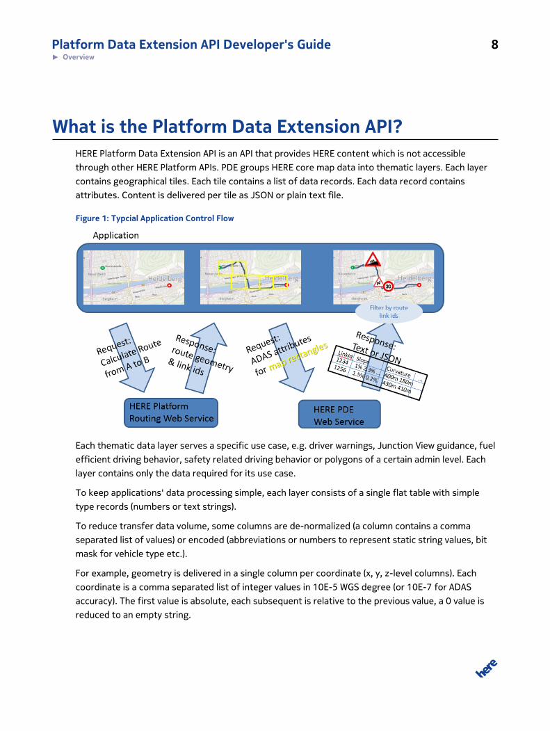
What is the Platform Data Extension API?HERE Platform Data Extension API is an API that provides HERE content which is not accessible
through other HERE Platform APIs. PDE groups HERE core map data into thematic layers. Each layer
contains geographical tiles. Each tile contains a list of data records. Each data record contains
attributes. Content is delivered per tile as JSON or plain text file.
Figure 1: Typcial Application Control Flow
Each thematic data layer serves a specific use case, e.g. driver warnings, Junction View guidance, fuel
efficient driving behavior, safety related driving behavior or polygons of a certain admin level. Each
layer contains only the data required for its use case.
To keep applications' data processing simple, each layer consists of a single flat table with simple
type records (numbers or text strings).
To reduce transfer data volume, some columns are de-normalized (a column contains a comma
separated list of values) or encoded (abbreviations or numbers to represent static string values, bit
mask for vehicle type etc.).
For example, geometry is delivered in a single column per coordinate (x, y, z-level columns). Each
coordinate is a comma separated list of integer values in 10E-5 WGS degree (or 10E-7 for ADAS
accuracy). The first value is absolute, each subsequent is relative to the previous value, a 0 value is
reduced to an empty string.
Platform Data Extension API Developer's Guide 9► Overview
Geographical tiles are requested using a standardized level/tiling system, allowing applications to
request data in an appropriate level of detail / tile size for the area of interest.
• The world is recursively divided into halves, where level 0 contains 2 x1 tiles (East and West of
Greenwich) and each tile comprises 180 x 180 degree.
• Level 1 contains 4 x 2 tiles (each of the 2 level 0 tiles subdivided into 4 parts).
• On Level N, each tile comprises 180.0 / (2 level) degrees into each direction.
Platform Data Extension API delivers data only in standard tiles, not along a route or within an
administrative area. Applications have to map the locations / areas of interest to tiles, request these
tiles from PDE, and extract the required objects from those tiles, e.g. those links that are on the
route or within the area of interest. Clients shall accept zipped transfer encoding to reduce the
network transfer volume.
Most HERE Platform APIs use one single snapshot of the HERE core map: the latest available release.
However, the underlying core map release can slightly differ between the different Platform APIs.
Hence, PDE offers all recent map releases. So the customer can retrieve additional map data from
the map release that corresponds to other HERE Platform APIs.
Why use the Platform Data Extension API?Platform Data Extension API is designed for following usage:
• Customers don't have to download complete core map content in a format like RDF, compile itinto application-ready structure and host it in a Web service. Instead, customer applications candirectly consume the data from this API without a complex access library (decoder), specifyingthe required attributes (thematic layers) and geographical scope. This allows for customerapplications with limited network bandwidth and limited storage and processing capabilities todirectly access HERE core map content.
• HERE customers can enrich their applications by adding additional map attributes through PDE.The API enables new applications that require certain map attributes which are currently notprovided through existing HERE Platform APIs.
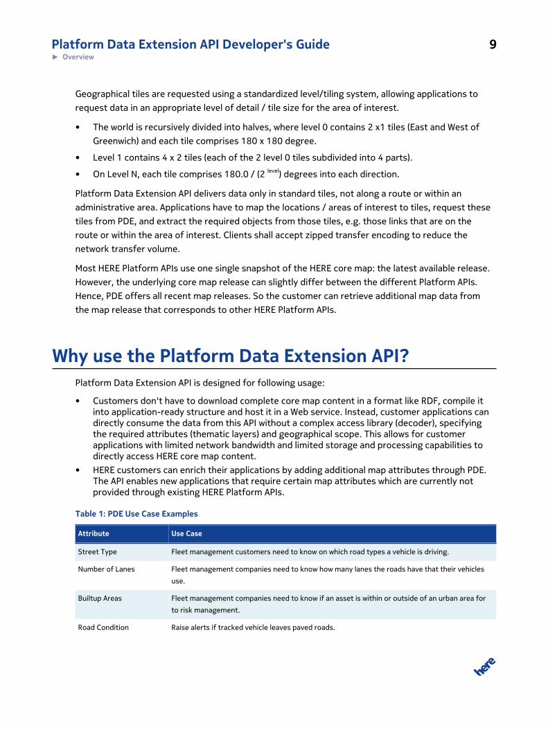
Table 1: PDE Use Case Examples
Attribute Use Case
Street Type Fleet management customers need to know on which road types a vehicle is driving.
Number of Lanes Fleet management companies need to know how many lanes the roads have that their vehicles
use.
Builtup Areas Fleet management companies need to know if an asset is within or outside of an urban area for
to risk management.
Road Condition Raise alerts if tracked vehicle leaves paved roads.
Platform Data Extension API Developer's Guide 10► Overview
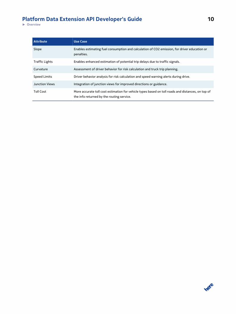
Attribute Use Case
Slope Enables estimating fuel consumption and calculation of CO2 emission, for driver education or
penalties.
Traffic Lights Enables enhanced estimation of potential trip delays due to traffic signals.
Curvature Assessment of driver behavior for risk calculation and truck trip planning.
Speed Limits Driver behavior analysis for risk calculation and speed warning alerts during drive.
Junction Views Integration of junction views for improved directions or guidance.
Toll Cost More accurate toll cost estimation for vehicle types based on toll roads and distances, on top of
the info returned by the routing service.
Platform Data Extension API Developer's Guide 11► Quick Start
Chapter
2
Quick StartTopics:
• Making your first Requests
This article helps you start using the Platform Data Extension API.
Platform Data Extension API Developer's Guide 12► Quick Start
Making your first RequestsSometimes the easiest way to start using new software is to run simple working examples.
app_id and app_code are authentication credentials. This document uses {YOUR_APP_CODE} and
{YOUR_APP_ID} as placeholders for access and authorization credentials. Please replace these
placeholders with your own unique application-specific credentials to access the API resources.
For more information about the access and authorization credentials credentials, see Acquiring
Credentials.
The examples in this guide use the Customer Integration Testing (CIT) environment. This environment
allows you to test your software. For production please use the production environment. See
Constructing a Request on page 17 for the base URLs of both environments.
Note that most example URLs in this guide are broken up into multiple lines for better readability.
Remove these line breaks and spaces when copying and pasting the examples to make sure URLs are
still well formed.
Prerequisites
The only thing you need to start using the Platform Data Extension API is an HTTP client. Choose any
HTTP client application you are familiar with. A command line tool like curl will do the job, as will any
modern web browser.
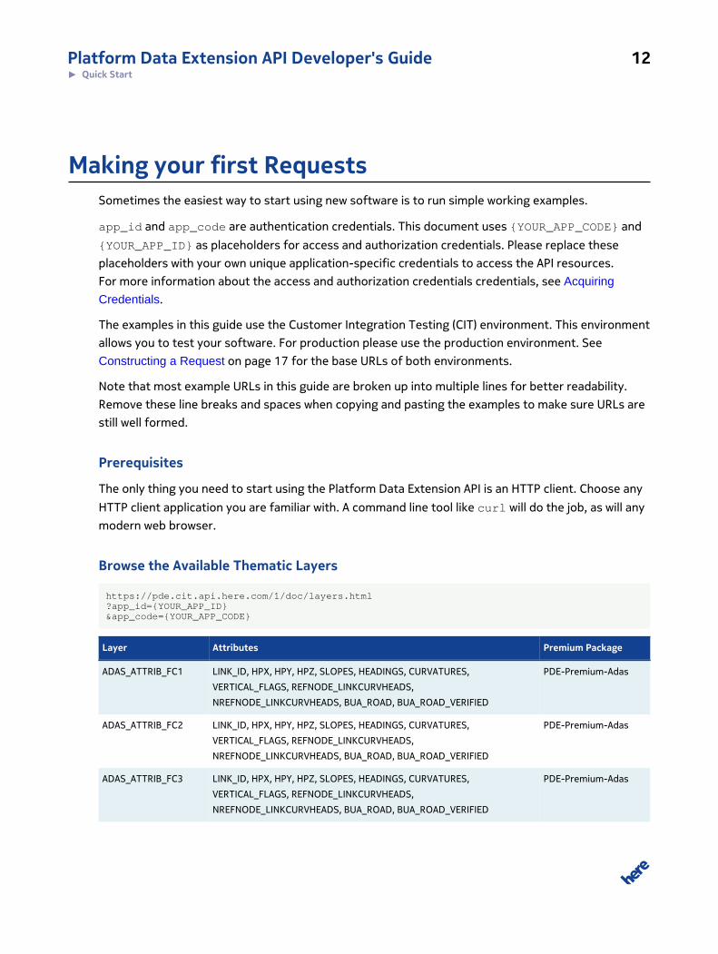
Browse the Available Thematic Layers
https://pde.cit.api.here.com/1/doc/layers.html?app_id={YOUR_APP_ID}&app_code={YOUR_APP_CODE}
Layer Attributes Premium Package
ADAS_ATTRIB_FC1 LINK_ID, HPX, HPY, HPZ, SLOPES, HEADINGS, CURVATURES,
VERTICAL_FLAGS, REFNODE_LINKCURVHEADS,
NREFNODE_LINKCURVHEADS, BUA_ROAD, BUA_ROAD_VERIFIED
PDE-Premium-Adas
ADAS_ATTRIB_FC2 LINK_ID, HPX, HPY, HPZ, SLOPES, HEADINGS, CURVATURES,
VERTICAL_FLAGS, REFNODE_LINKCURVHEADS,
NREFNODE_LINKCURVHEADS, BUA_ROAD, BUA_ROAD_VERIFIED
PDE-Premium-Adas
ADAS_ATTRIB_FC3 LINK_ID, HPX, HPY, HPZ, SLOPES, HEADINGS, CURVATURES,
VERTICAL_FLAGS, REFNODE_LINKCURVHEADS,
NREFNODE_LINKCURVHEADS, BUA_ROAD, BUA_ROAD_VERIFIED
PDE-Premium-Adas
Platform Data Extension API Developer's Guide 13► Quick Start
Layer Attributes Premium Package
ADAS_ATTRIB_FC4 LINK_ID, HPX, HPY, HPZ, SLOPES, HEADINGS, CURVATURES,
VERTICAL_FLAGS, REFNODE_LINKCURVHEADS,
NREFNODE_LINKCURVHEADS, BUA_ROAD, BUA_ROAD_VERIFIED
PDE-Premium-Adas
ADAS_ATTRIB_FC5 LINK_ID, HPX, HPY, HPZ, SLOPES, HEADINGS, CURVATURES,
VERTICAL_FLAGS, REFNODE_LINKCURVHEADS,
NREFNODE_LINKCURVHEADS, BUA_ROAD, BUA_ROAD_VERIFIED
PDE-Premium-Adas
ADMIN_PLACE_0 ADMIN_PLACE_ID, ADMIN_ORDER, ADMIN_LEVEL, ADMIN_TYPE,
ISO_COUNTRY_CODE, COUNTRY_ID, ORDER1_ID, ORDER2_ID,
ORDER8_ID, BUILTUP_ID, GOVERNMENT_CODE, TIME_ZONE, DST,
MOTORCYCLE_MIN_REQ, UTURN_AT_INTERSECTION, NAMES
PDE-Base
ADMIN_PLACE_1 ADMIN_PLACE_ID, ADMIN_ORDER, ADMIN_LEVEL, ADMIN_TYPE,
ISO_COUNTRY_CODE, COUNTRY_ID, ORDER1_ID, ORDER2_ID,
ORDER8_ID, BUILTUP_ID, GOVERNMENT_CODE, TIME_ZONE, DST,
MOTORCYCLE_MIN_REQ, UTURN_AT_INTERSECTION, NAMES
PDE-Base
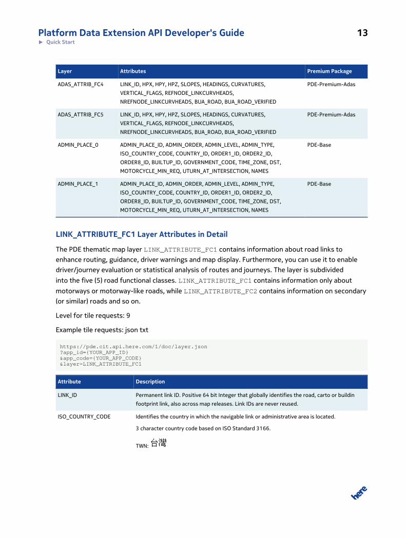
LINK_ATTRIBUTE_FC1 Layer Attributes in Detail
The PDE thematic map layer LINK_ATTRIBUTE_FC1 contains information about road links to
enhance routing, guidance, driver warnings and map display. Furthermore, you can use it to enable
driver/journey evaluation or statistical analysis of routes and journeys. The layer is subdivided
into the five (5) road functional classes. LINK_ATTRIBUTE_FC1 contains information only about
motorways or motorway-like roads, while LINK_ATTRIBUTE_FC2 contains information on secondary
(or similar) roads and so on.
Level for tile requests: 9
Example tile requests: json txt
https://pde.cit.api.here.com/1/doc/layer.json?app_id={YOUR_APP_ID}&app_code={YOUR_APP_CODE}&layer=LINK_ATTRIBUTE_FC1
Attribute Description
LINK_ID Permanent link ID. Positive 64 bit Integer that globally identifies the road, carto or buildin
footprint link, also across map releases. Link IDs are never reused.
ISO_COUNTRY_CODE Identifies the country in which the navigable link or administrative area is located.
3 character country code based on ISO Standard 3166.
TWN:
Platform Data Extension API Developer's Guide 14► Quick Start
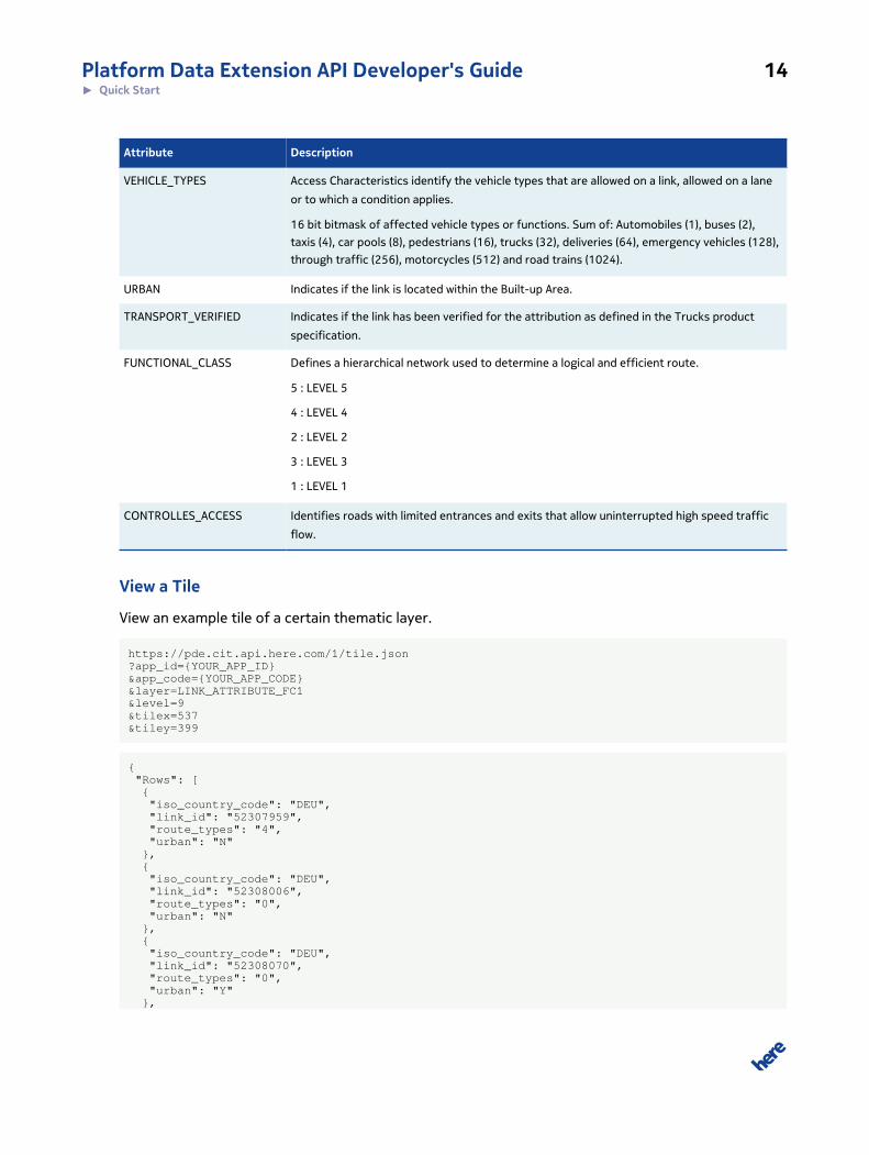
Attribute Description
VEHICLE_TYPES Access Characteristics identify the vehicle types that are allowed on a link, allowed on a lane
or to which a condition applies.
16 bit bitmask of affected vehicle types or functions. Sum of: Automobiles (1), buses (2),
taxis (4), car pools (8), pedestrians (16), trucks (32), deliveries (64), emergency vehicles (128),
through traffic (256), motorcycles (512) and road trains (1024).
URBAN Indicates if the link is located within the Built-up Area.
TRANSPORT_VERIFIED Indicates if the link has been verified for the attribution as defined in the Trucks product
specification.
FUNCTIONAL_CLASS Defines a hierarchical network used to determine a logical and efficient route.
5 : LEVEL 5
4 : LEVEL 4
2 : LEVEL 2
3 : LEVEL 3
1 : LEVEL 1
CONTROLLES_ACCESS Identifies roads with limited entrances and exits that allow uninterrupted high speed traffic
flow.
View a Tile
View an example tile of a certain thematic layer.
https://pde.cit.api.here.com/1/tile.json?app_id={YOUR_APP_ID}&app_code={YOUR_APP_CODE}&layer=LINK_ATTRIBUTE_FC1&level=9&tilex=537&tiley=399
{ "Rows": [ { "iso_country_code": "DEU", "link_id": "52307959", "route_types": "4", "urban": "N" }, { "iso_country_code": "DEU", "link_id": "52308006", "route_types": "0", "urban": "N" }, { "iso_country_code": "DEU", "link_id": "52308070", "route_types": "0", "urban": "Y" },
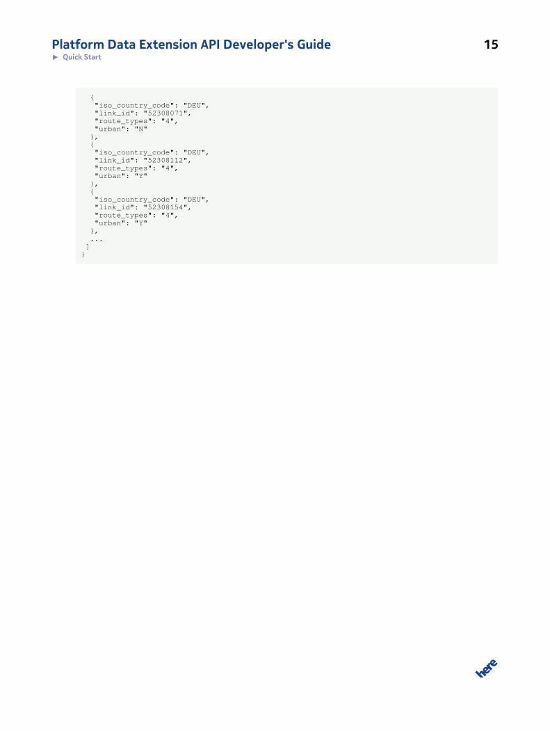
Platform Data Extension API Developer's Guide 15► Quick Start
{ "iso_country_code": "DEU", "link_id": "52308071", "route_types": "4", "urban": "N" }, { "iso_country_code": "DEU", "link_id": "52308112", "route_types": "4", "urban": "Y" }, { "iso_country_code": "DEU", "link_id": "52308154", "route_types": "4", "urban": "Y" }, ... ]}
Platform Data Extension API Developer's Guide 16► User Guide
Chapter
3
User GuideTopics:
• Acquiring Credentials
• Constructing a Request
• Key Concepts
• Examples
• Service Support
The articles in this section provide a guide to using the Platform
Data Extension API.
Platform Data Extension API Developer's Guide 17► User Guide
Acquiring CredentialsAll users of HERE Extension APIs must obtain authentication and authorization credentials and
provide them as values for the parameters app_id and app_code. The credentials are assigned per
application.
This document uses the placeholder text {YOUR_APP_CODE} and {YOUR_APP_ID} as placeholders
for access and authorization credentials. Please replace these placeholders with your own unique
application-specific credentials to access the API resources.
To obtain the credentials for an application, please contact us.
If you wish to explore the API, use the API Explorer at https://developer.here.com/api-explorer.
Constructing a RequestA request to the Platform Data Extension API includes the basic elements shown in the following table
and, in addition, it may contain resource-specific parameters or data.
Table 2: Basic request elements
Element Value/Example Description
Base URL https://pde.api.here.com
https://pde.cit.api.here.com
https://maps.gfe.api.here.com
https://maps.gfe.cit.api.here.com
Production environment
CIT environment: see HERE Server
Environments on page 18. Note
that the CIT environment allows only
Platform Data Extension API Developer's Guide 18► User Guide
Element Value/Example Description
100 requests per hour and 1000
requests per calendar day.
Path /1/
Resource doc/maps
doc/layers
doc/layer
tile
tiles
static
index
file
serviceconfiguration
search/bbox
search/corridor
search/proximity
search/quadkey
GET only, specify request details via
query parameters
Application Code &app_code={YOUR_APP_CODE} Substitute your own unique
app_code
Application Id &app_id={YOUR_APP_ID} Substitute your own unique app_id
HERE Server EnvironmentsHERE provides two server environments for handling your requests: a Production environment and a
Customer Integration Testing (CIT) environment.
You are required to use the CIT Environment when evaluating our products via our 90-day free trial.
To access CIT for REST APIs, amend the base URL to include an additional cit segment. For example,
the CIT URL for this API is https://pde.cit.api.here.com.
HERE examples and demos use this CIT environment only to provide an illustration of how the service
operates.
You are required to use the Production environment for general production use. The CIT environment
must not be used for production.
Platform Data Extension API Developer's Guide 19► User Guide
High Loads and Performance Testing
Neither standard server environment (CIT and Production) is designed to support high loads or
performance testing. You must not conduct performance tests against the CIT or Production
environments. If you need to do performance testing, contact HERE to discuss options.
Key ConceptsThis section provides insights into the key concepts used throughout the Platform Data Extension
API.
Layers
The map content is distributed across many thematic layers, allowing applications to request only
relevant data and hence reduce the data transfer. The available layers and their content keeps
evolving. Hence, the service offers specific resources where application developers can lookup the
layers and their content. Applications have to take into account, that the order of the columns might
change, and new columns might be introduced.
A typical use case is retrieving information along a route. A route typically starts on smaller roads,
climbs to bigger roads and stays on motorway like roads for the main part, and finally steps down
into smaller roads when approaching the destination. Retrieving all information about smaller roads
along the whole route would result in overwhelming data transfer. Hence, road link related layers are
split into 5 layers each, corresponding to the functional road classes in the HERE map. Functional
class 1 roads are roughly motorways, while functional class 5 roads are small roads that are used only
to reach a destination. If applications know the functional class of the road links along the route, then
they only have to request the corresponding layer instead of all 5 layers.
Levels
Geographical tiles are requested using a standardized level/tiling system, allowing applications to
request data in an appropriate level of detail / tile size for the area of interest.
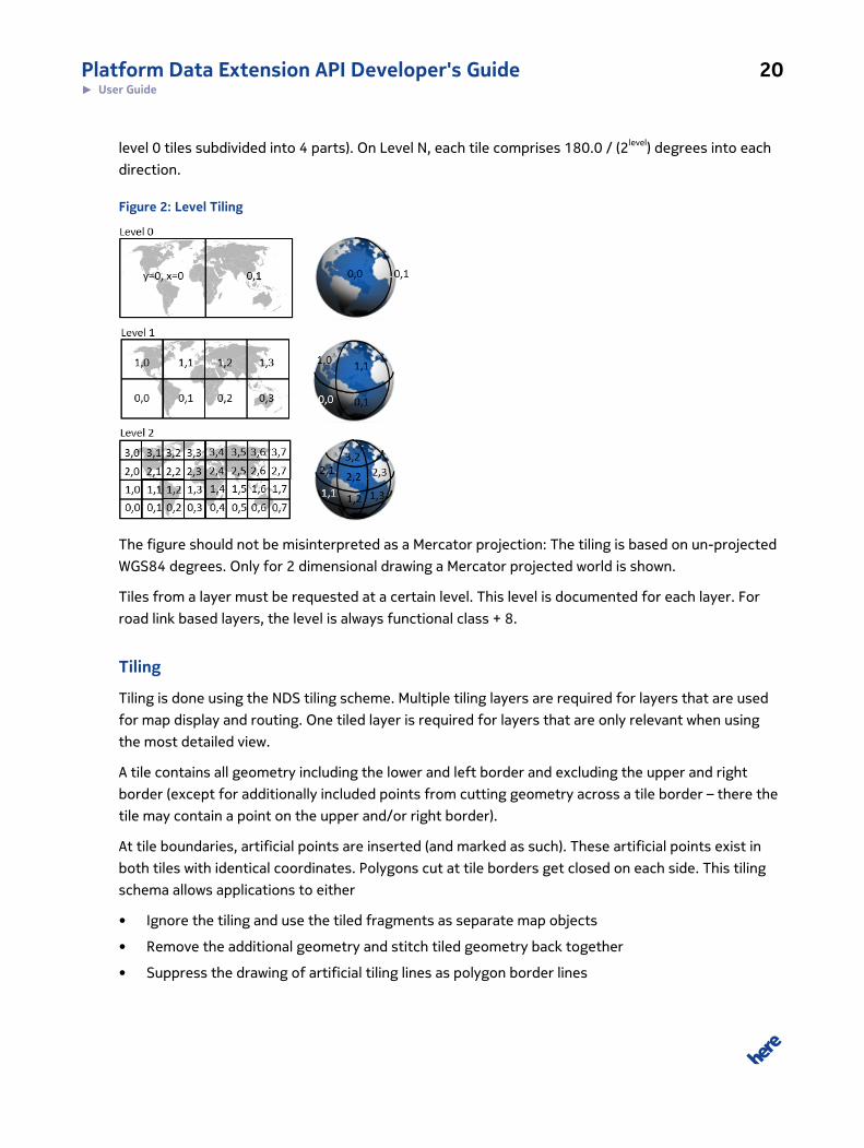
The world is recursively divided into halves, where level 0 contains 2 x 1 tiles (East an and West of
Greenwich) and each tile comprises 180 x 180 degree. Level 1 contains 4 x 2 tiles (each of the 2
Platform Data Extension API Developer's Guide 20► User Guide
level 0 tiles subdivided into 4 parts). On Level N, each tile comprises 180.0 / (2level) degrees into each
direction.
Figure 2: Level Tiling
The figure should not be misinterpreted as a Mercator projection: The tiling is based on un-projected
WGS84 degrees. Only for 2 dimensional drawing a Mercator projected world is shown.
Tiles from a layer must be requested at a certain level. This level is documented for each layer. For
road link based layers, the level is always functional class + 8.
Tiling
Tiling is done using the NDS tiling scheme. Multiple tiling layers are required for layers that are used
for map display and routing. One tiled layer is required for layers that are only relevant when using
the most detailed view.
A tile contains all geometry including the lower and left border and excluding the upper and right
border (except for additionally included points from cutting geometry across a tile border – there the
tile may contain a point on the upper and/or right border).
At tile boundaries, artificial points are inserted (and marked as such). These artificial points exist in
both tiles with identical coordinates. Polygons cut at tile borders get closed on each side. This tiling
schema allows applications to either
• Ignore the tiling and use the tiled fragments as separate map objects
• Remove the additional geometry and stitch tiled geometry back together
• Suppress the drawing of artificial tiling lines as polygon border lines
Platform Data Extension API Developer's Guide 21► User Guide
Pieces of a tiled geometry can be identified as belonging to each other, because they have the same
permanent ids, e.g. link id or carto / face id.
Some layers do not cut the geometry into tile pieces, but copy the whole geometry of an object into
each of the tiles it covers. This is described in the respective layers' documentation.
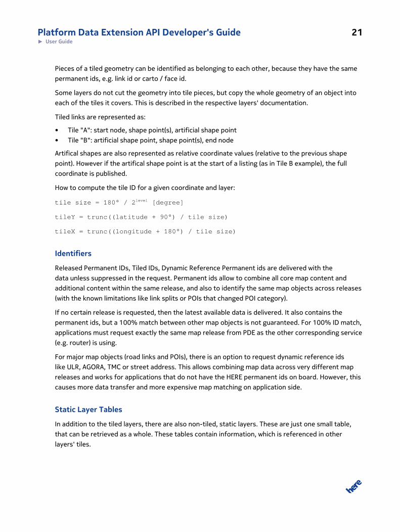
Tiled links are represented as:
• Tile "A": start node, shape point(s), artificial shape point
• Tile "B": artificial shape point, shape point(s), end node
Artifical shapes are also represented as relative coordinate values (relative to the previous shape
point). However if the artifical shape point is at the start of a listing (as in Tile B example), the full
coordinate is published.
How to compute the tile ID for a given coordinate and layer:
tile size = 180° / 2level [degree]
tileY = trunc((latitude + 90°) / tile size)
tileX = trunc((longitude + 180°) / tile size)
Identifiers
Released Permanent IDs, Tiled IDs, Dynamic Reference Permanent ids are delivered with the
data unless suppressed in the request. Permanent ids allow to combine all core map content and
additional content within the same release, and also to identify the same map objects across releases
(with the known limitations like link splits or POIs that changed POI category).
If no certain release is requested, then the latest available data is delivered. It also contains the
permanent ids, but a 100% match between other map objects is not guaranteed. For 100% ID match,
applications must request exactly the same map release from PDE as the other corresponding service
(e.g. router) is using.
For major map objects (road links and POIs), there is an option to request dynamic reference ids
like ULR, AGORA, TMC or street address. This allows combining map data across very different map
releases and works for applications that do not have the HERE permanent ids on board. However, this
causes more data transfer and more expensive map matching on application side.
Static Layer Tables
In addition to the tiled layers, there are also non-tiled, static layers. These are just one small table,
that can be retrieved as a whole. These tables contain information, which is referenced in other
layers' tiles.
Platform Data Extension API Developer's Guide 22► User Guide
For example, records in the Traffic Pattern layer contain a PATTERN_ID. A static layer table contains
the full specification for each PATTERN_ID.
File References
The flat text file format makes sense for core map data, but not for pixel images like Junction Views.
For this kind of map content, the flat file data contains a file path. The content itself can then be
retrieved through PDE with query parameter path=... next to the layer=... . Tiled or static layers
will publish the path information if they can be enhanced with external file data, for example with
Junction View SVGs.
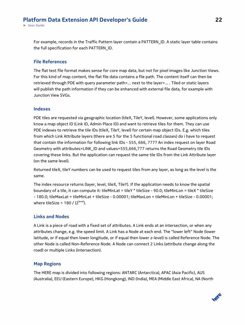
Indexes
PDE tiles are requested via geographic location (tileX, TileY, level). However, some applications only
know a map object ID (Link ID, Admin Place ID) and want to retrieve tiles for them. They can use
PDE indexes to retrieve the tile IDs (tileX, TileY, level) for certain map object IDs. E.g. which tiles
from which Link Attribute layers (there are 5 for the 5 functional road classes) do i have to request
that contain the information for following link IDs - 555, 666, 777? An index request on layer Road
Geometry with attributes=LINK_ID and values=555,666,777 returns the Road Geometry tile IDs
covering these links. But the application can request the same tile IDs from the Link Attribute layer
(on the same level).
Returned tileX, tileY numbers can be used to request tiles from any layer, as long as the level is the
same.
The index resource returns (layer, level, tileX, TileY). If the application needs to know the spatial
boundary of a tile, it can compute it: tileMinLat = tileY * tileSize - 90.0; tileMinLon = tileX * tileSize
- 180.0; tileMaxLat = tileMinLat + tileSize - 0.00001; tileMaxLon = tileMinLon + tileSize - 0.00001;
where tileSize = 180 / (2level).
Links and Nodes
A Link is a piece of road with a fixed set of attributes. A Link ends at an intersection, or when any
attributes change, e.g. the speed limit. A Link has a Node at each end. The "lower left" Node (lower
latitude, or if equal then lower longitude, or if equal then lower z-level) is called Reference Node. The
other Node is called Non-Reference Node. A Node can connect 2 Links (attribute change along the
road) or multiple Links (intersection).
Map Regions
The HERE map is divided into following regions: ANTARC (Antarctica), APAC (Asia Pacific), AUS
(Australia), EEU (Eastern Europe), HKG (Hongkong), IND (India), MEA (Middle East Africa), NA (North
Platform Data Extension API Developer's Guide 23► User Guide
America), SAM (South America), TWN (Taiwan), WEU (Western Europe). PDE requests can refer to one
or multiple regions by using the "region" parameter. Except for the documentation resources, the
"region" parameter is optional. If omitted, PDE finds out the applicable region(s).
Some layers contain content which does not match exactly one of above regions, or is not available
for each quarterly map release. These layers can be addressed through specific "region" names, like
PCBEU (European Postal Code Boundaries, not released regularly) or DTM_WORLD (Digital Terrain
Model of the World, also not released regularly).
Map Releases
The HERE map is released quarterly and weekly. Per default, PDE delivers the latest available map
release, for each map region. But PDE also offers older map releases on demand, selectable via the
"region" parameter. Until end of 2015, quarterly map releases are named like 2015Q4, where the
4 tells that the map was released in the fourth quarter. Starting 2016, quarterly map releases are
named like 161J0, 161 telling the underlying base release is 2016Q1 and letter J incrementing with
the quarterly releases since then, last digit incrementing with repair reshipments. Weekly releases
are named like 16133, 161 telling the base release and 33 incrementing with the weekly releases
since then. For availability of certain older map releases please contact your sales representative or
technical customer support.
ExamplesThis section provides examples of requests along with the responding results.
More examples are provided by the Technical Customer Support.
Example Maps
User Story
The user wants to lookup, which maps are available. This resource should be used by an application
developer during development, not within the application at runtime.
Request Summary
The following list summarizes the elements required to create a request matching the user story and
shows, in square brackets, how those elements are used in the request example below. Note that the
request example also uses the authentication parameters.
Platform Data Extension API Developer's Guide 24► User Guide
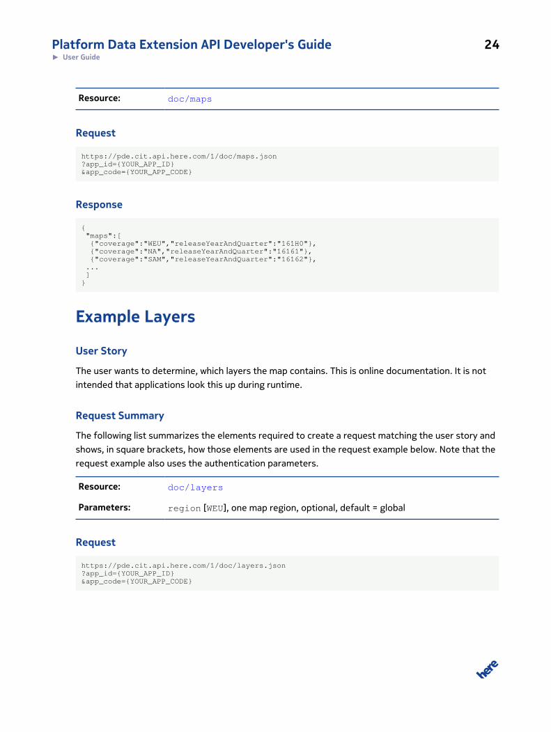
Resource: doc/maps
Request
https://pde.cit.api.here.com/1/doc/maps.json?app_id={YOUR_APP_ID}&app_code={YOUR_APP_CODE}
Response
{ "maps":[ {"coverage":"WEU","releaseYearAndQuarter":"161H0"}, {"coverage":"NA","releaseYearAndQuarter":"16161"}, {"coverage":"SAM","releaseYearAndQuarter":"16162"}, ... ]}
Example Layers
User Story
The user wants to determine, which layers the map contains. This is online documentation. It is not
intended that applications look this up during runtime.
Request Summary
The following list summarizes the elements required to create a request matching the user story and
shows, in square brackets, how those elements are used in the request example below. Note that the
request example also uses the authentication parameters.
Resource: doc/layers
Parameters: region [WEU], one map region, optional, default = global
Request
https://pde.cit.api.here.com/1/doc/layers.json?app_id={YOUR_APP_ID}&app_code={YOUR_APP_CODE}
Platform Data Extension API Developer's Guide 25► User Guide
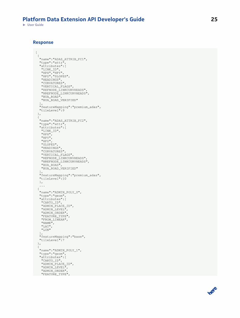
Response
[ { "name":"ADAS_ATTRIB_FC1", "type":"attr", "attributes":[ "LINK_ID", "HPX","HPY", "HPZ","SLOPES", "HEADINGS", "CURVATURES", "VERTICAL_FLAGS", "REFNODE_LINKCURVHEADS", "NREFNODE_LINKCURVHEADS", "BUA_ROAD", "BUA_ROAD_VERIFIED" ], "featureMapping":"premium_adas", "tileLevel":9 }, { "name":"ADAS_ATTRIB_FC2", "type":"attr", "attributes":[ "LINK_ID", "HPX", "HPY", "HPZ", "SLOPES", "HEADINGS", "CURVATURES", "VERTICAL_FLAGS", "REFNODE_LINKCURVHEADS", "NREFNODE_LINKCURVHEADS", "BUA_ROAD", "BUA_ROAD_VERIFIED" ], "featureMapping":"premium_adas", "tileLevel":10 }, ... { "name":"ADMIN_POLY_0", "type":"geom", "attributes":[ "CARTO_ID", "ADMIN_PLACE_ID", "ADMIN_LEVEL", "ADMIN_ORDER", "FEATURE_TYPE", "FROM_LINEAR", "NAME", "LAT", "LON" ], "featureMapping":"base", "tileLevel":7 }, { "name":"ADMIN_POLY_1", "type":"geom", "attributes":[ "CARTO_ID", "ADMIN_PLACE_ID", "ADMIN_LEVEL", "ADMIN_ORDER", "FEATURE_TYPE",
Platform Data Extension API Developer's Guide 26► User Guide
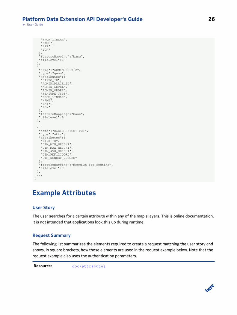
"FROM_LINEAR", "NAME", "LAT", "LON" ], "featureMapping":"base", "tileLevel":8 }, { "name":"ADMIN_POLY_2", "type":"geom", "attributes":[ "CARTO_ID", "ADMIN_PLACE_ID", "ADMIN_LEVEL", "ADMIN_ORDER", "FEATURE_TYPE", "FROM_LINEAR", "NAME", "LAT", "LON" ], "featureMapping":"base", "tileLevel":9 }, ... { "name":"BASIC_HEIGHT_FC1", "type":"attr", "attributes":[ "LINK_ID", "DTM_MIN_HEIGHT", "DTM_MAX_HEIGHT", "DTM_AVG_HEIGHT", "DTM_REF_ZCOORD", "DTM_NONREF_ZCOORD" ], "featureMapping":"premium_eco_routing", "tileLevel":9 }, ...]
Example Attributes
User Story
The user searches for a certain attribute within any of the map's layers. This is online documentation.
It is not intended that applications look this up during runtime.
Request Summary
The following list summarizes the elements required to create a request matching the user story and
shows, in square brackets, how those elements are used in the request example below. Note that the
request example also uses the authentication parameters.
Resource: doc/attributes
Platform Data Extension API Developer's Guide 27► User Guide
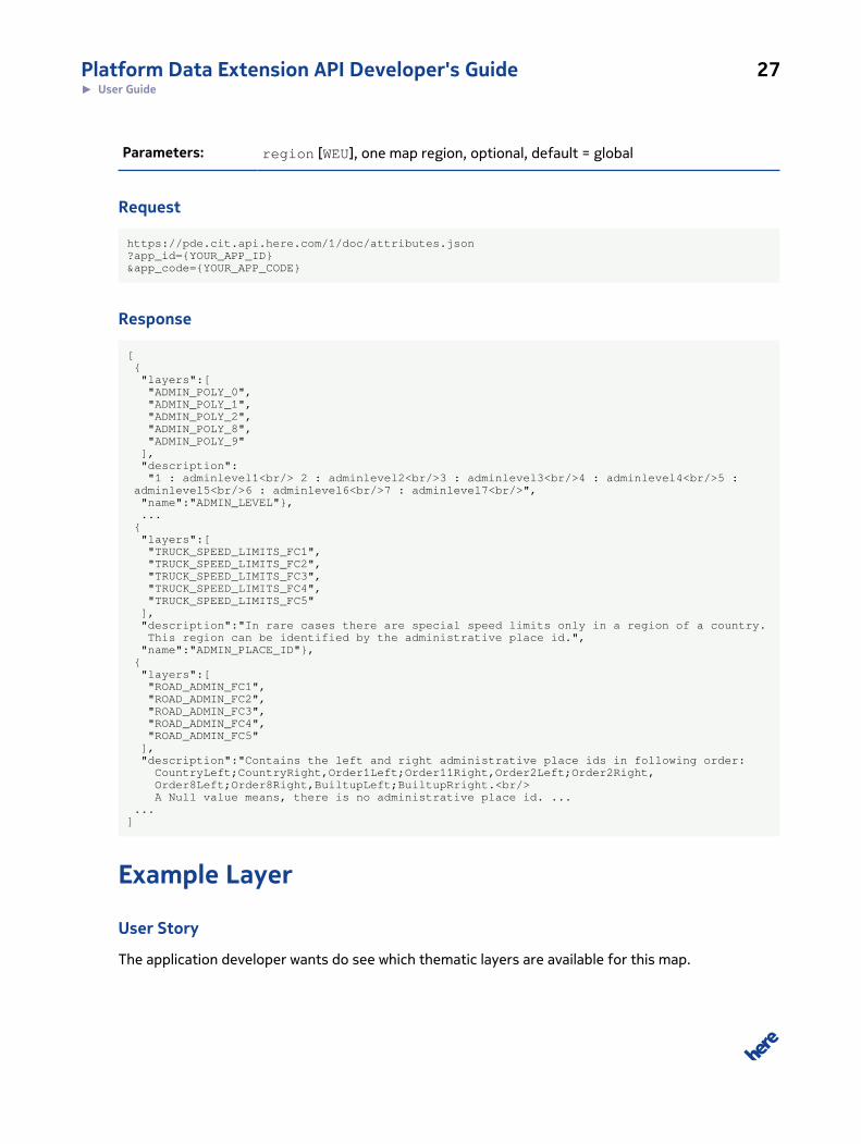
Parameters: region [WEU], one map region, optional, default = global
Request
https://pde.cit.api.here.com/1/doc/attributes.json?app_id={YOUR_APP_ID}&app_code={YOUR_APP_CODE}
Response
[ { "layers":[ "ADMIN_POLY_0", "ADMIN_POLY_1", "ADMIN_POLY_2", "ADMIN_POLY_8", "ADMIN_POLY_9" ], "description": "1 : adminlevel1<br/> 2 : adminlevel2<br/>3 : adminlevel3<br/>4 : adminlevel4<br/>5 : adminlevel5<br/>6 : adminlevel6<br/>7 : adminlevel7<br/>", "name":"ADMIN_LEVEL"}, ... { "layers":[ "TRUCK_SPEED_LIMITS_FC1", "TRUCK_SPEED_LIMITS_FC2", "TRUCK_SPEED_LIMITS_FC3", "TRUCK_SPEED_LIMITS_FC4", "TRUCK_SPEED_LIMITS_FC5" ], "description":"In rare cases there are special speed limits only in a region of a country. This region can be identified by the administrative place id.", "name":"ADMIN_PLACE_ID"}, { "layers":[ "ROAD_ADMIN_FC1", "ROAD_ADMIN_FC2", "ROAD_ADMIN_FC3", "ROAD_ADMIN_FC4", "ROAD_ADMIN_FC5" ], "description":"Contains the left and right administrative place ids in following order: CountryLeft;CountryRight,Order1Left;Order11Right,Order2Left;Order2Right, Order8Left;Order8Right,BuiltupLeft;BuiltupRright.<br/> A Null value means, there is no administrative place id. ... ...]
Example Layer
User Story
The application developer wants do see which thematic layers are available for this map.
Platform Data Extension API Developer's Guide 28► User Guide
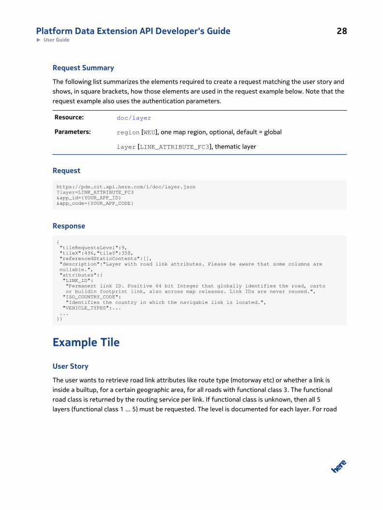
Request Summary
The following list summarizes the elements required to create a request matching the user story and
shows, in square brackets, how those elements are used in the request example below. Note that the
request example also uses the authentication parameters.
Resource: doc/layer
Parameters: region [WEU], one map region, optional, default = global
layer [LINK_ATTRIBUTE_FC3], thematic layer
Request
https://pde.cit.api.here.com/1/doc/layer.json?layer=LINK_ATTRIBUTE_FC3&app_id={YOUR_APP_ID}&app_code={YOUR_APP_CODE}
Response
{ "tileRequestsLevel":9, "tileX":496,"tileY":358, "referencedStaticContents":[], "description":"Layer with road link attributes. Please be aware that some columns are nullable.", "attributes":{ "LINK_ID": "Permanent link ID. Positive 64 bit Integer that globally identifies the road, carto or buildin footprint link, also across map releases. Link IDs are never reused.", "ISO_COUNTRY_CODE": "Identifies the country in which the navigable link is located.", "VEHICLE_TYPES":... ...}}
Example Tile
User Story
The user wants to retrieve road link attributes like route type (motorway etc) or whether a link is
inside a builtup, for a certain geographic area, for all roads with functional class 3. The functional
road class is returned by the routing service per link. If functional class is unknown, then all 5
layers (functional class 1 ... 5) must be requested. The level is documented for each layer. For road
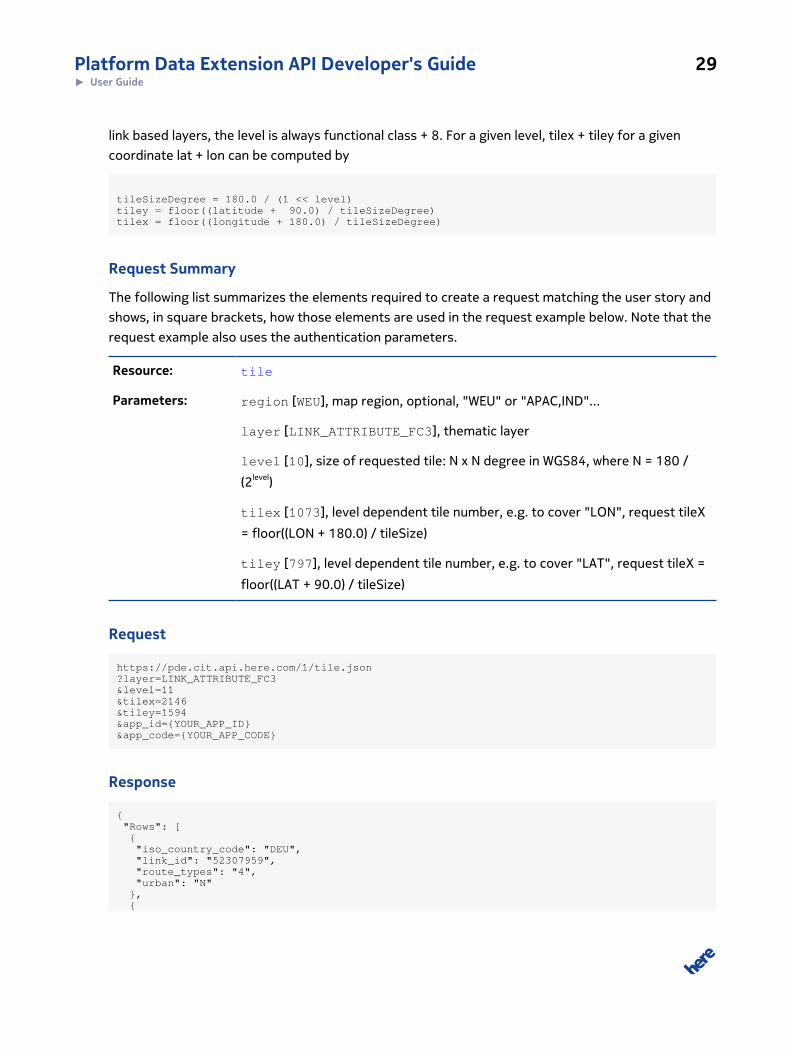
Platform Data Extension API Developer's Guide 29► User Guide
link based layers, the level is always functional class + 8. For a given level, tilex + tiley for a given
coordinate lat + lon can be computed by
tileSizeDegree = 180.0 / (1 << level)tiley = floor((latitude + 90.0) / tileSizeDegree)tilex = floor((longitude + 180.0) / tileSizeDegree)
Request Summary
The following list summarizes the elements required to create a request matching the user story and
shows, in square brackets, how those elements are used in the request example below. Note that the
request example also uses the authentication parameters.
Resource: tile
Parameters: region [WEU], map region, optional, "WEU" or "APAC,IND"...
layer [LINK_ATTRIBUTE_FC3], thematic layer
level [10], size of requested tile: N x N degree in WGS84, where N = 180 /
(2level)
tilex [1073], level dependent tile number, e.g. to cover "LON", request tileX
= floor((LON + 180.0) / tileSize)
tiley [797], level dependent tile number, e.g. to cover "LAT", request tileX =
floor((LAT + 90.0) / tileSize)
Request
https://pde.cit.api.here.com/1/tile.json?layer=LINK_ATTRIBUTE_FC3&level=11&tilex=2146&tiley=1594&app_id={YOUR_APP_ID}&app_code={YOUR_APP_CODE}
Response
{ "Rows": [ { "iso_country_code": "DEU", "link_id": "52307959", "route_types": "4", "urban": "N" }, {
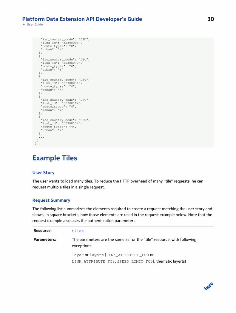
Platform Data Extension API Developer's Guide 30► User Guide
"iso_country_code": "DEU", "link_id": "52308006", "route_types": "0", "urban": "N" }, { "iso_country_code": "DEU", "link_id": "52308070", "route_types": "0", "urban": "Y" }, { "iso_country_code": "DEU", "link_id": "52308071", "route_types": "4", "urban": "N" }, { "iso_country_code": "DEU", "link_id": "52308112", "route_types": "4", "urban": "Y" }, { "iso_country_code": "DEU", "link_id": "52308154", "route_types": "4", "urban": "Y" }, ... ]}
Example Tiles
User Story
The user wants to load many tiles. To reduce the HTTP overhead of many "tile" requests, he can
request multiple tiles in a single request.
Request Summary
The following list summarizes the elements required to create a request matching the user story and
shows, in square brackets, how those elements are used in the request example below. Note that the
request example also uses the authentication parameters.
Resource: tiles
Parameters: The parameters are the same as for the "tile" resource, with following
exceptions:
layer or layers [LINK_ATTRIBUTE_FC3 or
LINK_ATTRIBUTE_FC3,SPEED_LIMIT_FC5], thematic layer(s)
Platform Data Extension API Developer's Guide 31► User Guide
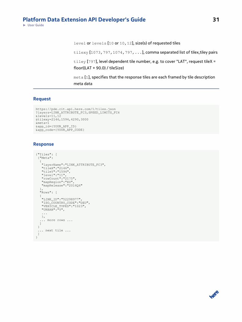
level or levels [10 or 10,12], size(s) of requested tiles
tilexy [1073,797,1074,797,...], comma separated list of tilex,tiley pairs
tiley [797], level dependent tile number, e.g. to cover "LAT", request tileX =
floor((LAT + 90.0) / tileSize)
meta [1], specifies that the response tiles are each framed by tile description
meta data
Request
https://pde.cit.api.here.com/1/tiles.json?layers=LINK_ATTRIBUTE_FC3,SPEED_LIMITS_FC4&levels=11,12&tilexy=2146,1594,4290,3000&meta=1&app_id={YOUR_APP_ID}&app_code={YOUR_APP_CODE}
Response
{"Tiles": [ {"Meta": { "layerName":"LINK_ATTRIBUTE_FC3", "tileX":"2146", "tileY":"1594", "level":"11", "rowCount":"2175", "mapRegion":"EU", "mapRelease":"2014Q4" }, "Rows": [ { "LINK_ID":"52298977", "ISO_COUNTRY_CODE":"DEU", "VEHICLE_TYPES":"1023", "URBAN":"Y", ... }, ... more rows ... ] } ... next tile ... ]}
Platform Data Extension API Developer's Guide 32► User Guide
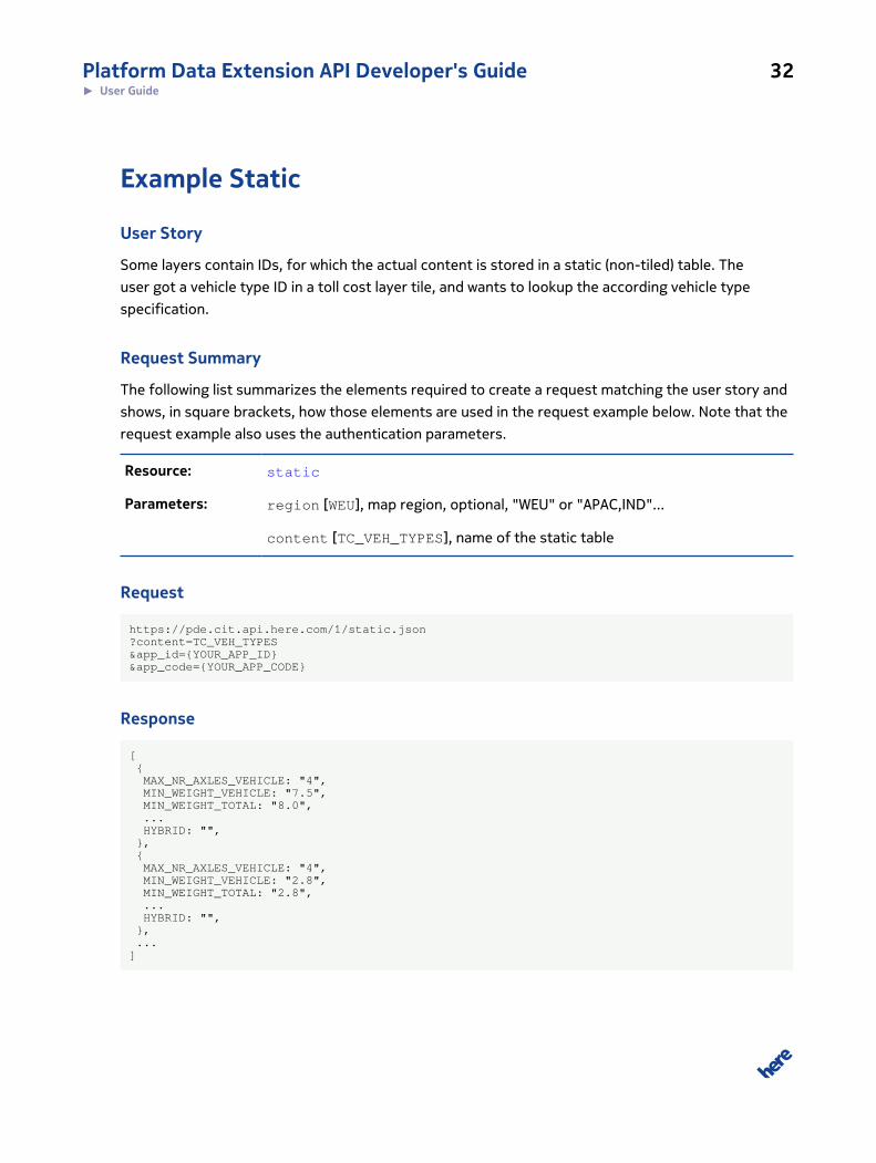
Example Static
User Story
Some layers contain IDs, for which the actual content is stored in a static (non-tiled) table. The
user got a vehicle type ID in a toll cost layer tile, and wants to lookup the according vehicle type
specification.
Request Summary
The following list summarizes the elements required to create a request matching the user story and
shows, in square brackets, how those elements are used in the request example below. Note that the
request example also uses the authentication parameters.
Resource: static
Parameters: region [WEU], map region, optional, "WEU" or "APAC,IND"...
content [TC_VEH_TYPES], name of the static table
Request
https://pde.cit.api.here.com/1/static.json?content=TC_VEH_TYPES&app_id={YOUR_APP_ID}&app_code={YOUR_APP_CODE}
Response
[ { MAX_NR_AXLES_VEHICLE: "4", MIN_WEIGHT_VEHICLE: "7.5", MIN_WEIGHT_TOTAL: "8.0", ... HYBRID: "", }, { MAX_NR_AXLES_VEHICLE: "4", MIN_WEIGHT_VEHICLE: "2.8", MIN_WEIGHT_TOTAL: "2.8", ... HYBRID: "", }, ...]
Platform Data Extension API Developer's Guide 33► User Guide
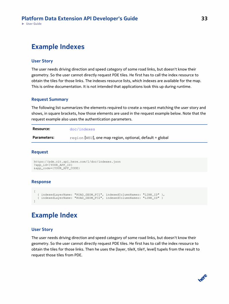
Example Indexes
User Story
The user needs driving direction and speed category of some road links, but doesn't know their
geometry. So the user cannot directly request PDE tiles. He first has to call the index resource to
obtain the tiles for those links. The indexes resource lists, which indexes are available for the map.
This is online documentation. It is not intended that applications look this up during runtime.
Request Summary
The following list summarizes the elements required to create a request matching the user story and
shows, in square brackets, how those elements are used in the request example below. Note that the
request example also uses the authentication parameters.
Resource: doc/indexes
Parameters: region [WEU], one map region, optional, default = global
Request
https://pde.cit.api.here.com/1/doc/indexes.json?app_id={YOUR_APP_ID}&app_code={YOUR_APP_CODE}
Response
[ { indexedLayerName: "ROAD_GEOM_FC1", indexedColumnNames: "LINK_ID" }, { indexedLayerName: "ROAD_GEOM_FC2", indexedColumnNames: "LINK_ID" }]
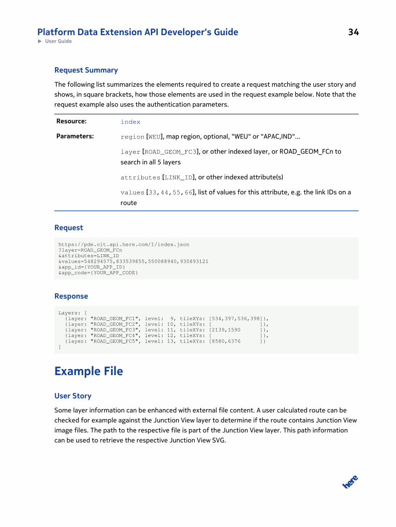
Example Index
User Story
The user needs driving direction and speed category of some road links, but doesn't know their
geometry. So the user cannot directly request PDE tiles. He first has to call the index resource to
obtain the tiles for those links. Then he uses the [layer, tileX, tileY, level] tupels from the result to
request those tiles from PDE.
Platform Data Extension API Developer's Guide 34► User Guide
Request Summary
The following list summarizes the elements required to create a request matching the user story and
shows, in square brackets, how those elements are used in the request example below. Note that the
request example also uses the authentication parameters.
Resource: index
Parameters: region [WEU], map region, optional, "WEU" or "APAC,IND"...
layer [ROAD_GEOM_FC3], or other indexed layer, or ROAD_GEOM_FCn to
search in all 5 layers
attributes [LINK_ID], or other indexed attribute(s)
values [33,44,55,66], list of values for this attribute, e.g. the link IDs on a
route
Request
https://pde.cit.api.here.com/1/index.json?layer=ROAD_GEOM_FCn&attributes=LINK_ID&values=548294575,833539855,550088940,930893121&app_id={YOUR_APP_ID}&app_code={YOUR_APP_CODE}
Response
Layers: [ {layer: "ROAD_GEOM_FC1", level: 9, tileXYs: [534,397,536,398]}, {layer: "ROAD_GEOM_FC2", level: 10, tileXYs: [ ]}, {layer: "ROAD_GEOM_FC3", level: 11, tileXYs: [2139,1590 ]}, {layer: "ROAD_GEOM_FC4", level: 12, tileXYs: [ ]}, {layer: "ROAD_GEOM_FC5", level: 13, tileXYs: [8580,6376 ]}]
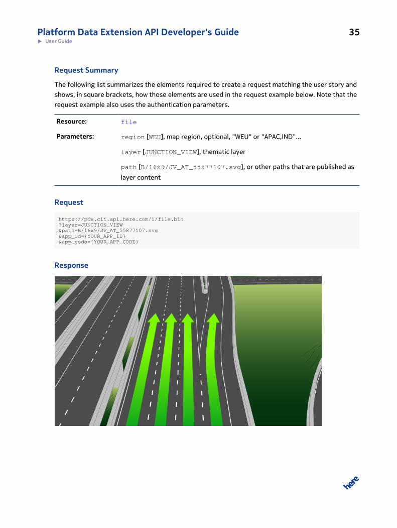
Example File
User Story
Some layer information can be enhanced with external file content. A user calculated route can be
checked for example against the Junction View layer to determine if the route contains Junction View
image files. The path to the respective file is part of the Junction View layer. This path information
can be used to retrieve the respective Junction View SVG.
Platform Data Extension API Developer's Guide 35► User Guide
Request Summary
The following list summarizes the elements required to create a request matching the user story and
shows, in square brackets, how those elements are used in the request example below. Note that the
request example also uses the authentication parameters.
Resource: file
Parameters: region [WEU], map region, optional, "WEU" or "APAC,IND"...
layer [JUNCTION_VIEW], thematic layer
path [B/16x9/JV_AT_55877107.svg], or other paths that are published as
layer content
Request
https://pde.cit.api.here.com/1/file.bin?layer=JUNCTION_VIEW&path=B/16x9/JV_AT_55877107.svg&app_id={YOUR_APP_ID}&app_code={YOUR_APP_CODE}
Response
Platform Data Extension API Developer's Guide 36► User Guide
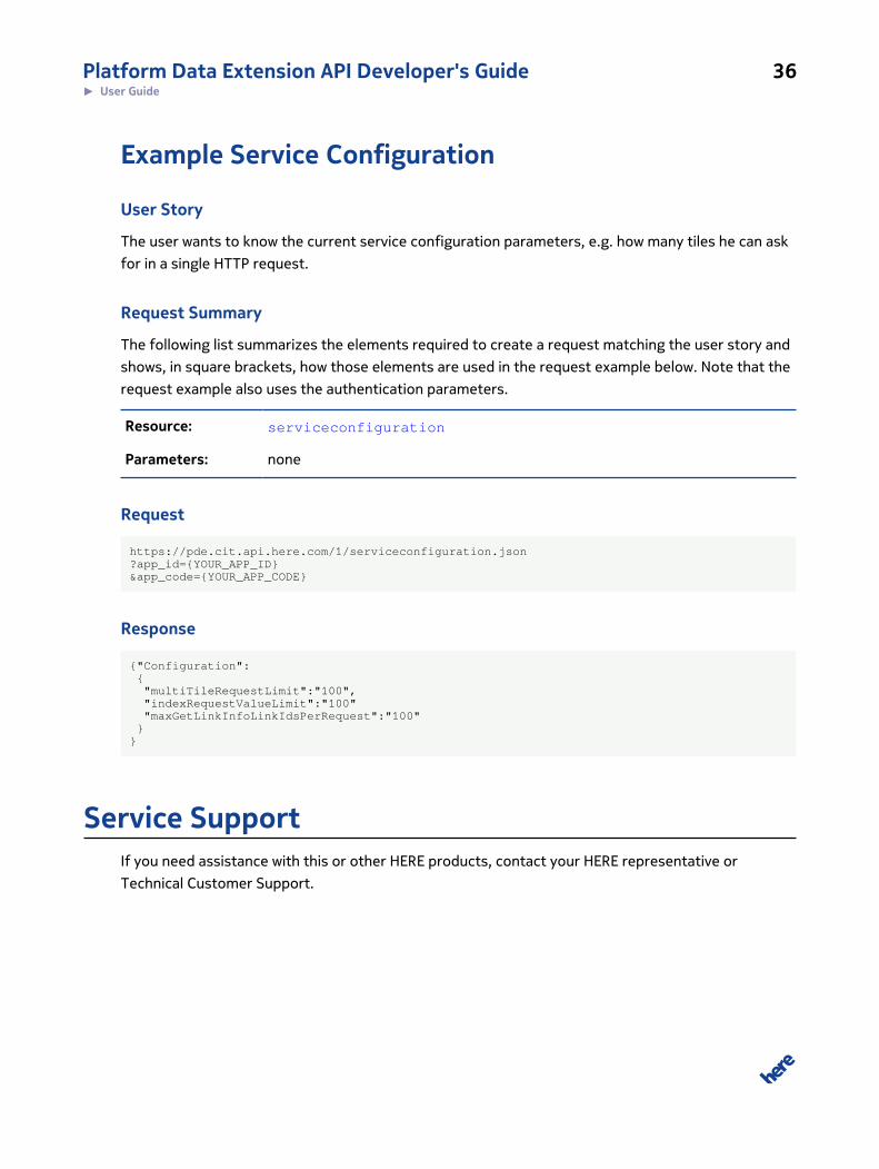
Example Service Configuration
User Story
The user wants to know the current service configuration parameters, e.g. how many tiles he can ask
for in a single HTTP request.
Request Summary
The following list summarizes the elements required to create a request matching the user story and
shows, in square brackets, how those elements are used in the request example below. Note that the
request example also uses the authentication parameters.
Resource: serviceconfiguration
Parameters: none
Request
https://pde.cit.api.here.com/1/serviceconfiguration.json?app_id={YOUR_APP_ID}&app_code={YOUR_APP_CODE}
Response
{"Configuration": { "multiTileRequestLimit":"100", "indexRequestValueLimit":"100" "maxGetLinkInfoLinkIdsPerRequest":"100" }}
Service SupportIf you need assistance with this or other HERE products, contact your HERE representative or
Technical Customer Support.
Platform Data Extension API Developer's Guide 37► API Reference
Chapter
4
API ReferenceTopics:
• Resources
• HTTP Status Codes
This section provides descriptions of the resources, parameters,
return types and error codes of the HERE Platform Data Extension
API.
Platform Data Extension API Developer's Guide 38► API Reference
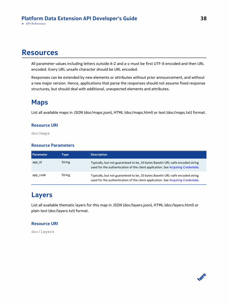
ResourcesAll parameter values including letters outside A-Z and a-z must be first UTF-8 encoded and then URL
encoded. Every URL unsafe character should be URL encoded.
Responses can be extended by new elements or attributes without prior announcement, and without
a new major version. Hence, applications that parse the responses should not assume fixed response
structures, but should deal with additional, unexpected elements and attributes.
MapsList all available maps in JSON (doc/maps.json), HTML (doc/maps.html) or text (doc/maps.txt) format.
Resource URI
doc/maps
Resource Parameters
Parameter Type Description
app_id String Typically, but not guaranteed to be, 20 bytes Base64 URL-safe encoded string
used for the authentication of the client application. See Acquiring Credentials.
app_code String Typically, but not guaranteed to be, 20 bytes Base64 URL-safe encoded string
used for the authentication of the client application. See Acquiring Credentials.
LayersList all available thematic layers for this map in JSON (doc/layers.json), HTML (doc/layers.html) or
plain text (doc/layers.txt) format.
Resource URI
doc/layers
Platform Data Extension API Developer's Guide 39► API Reference
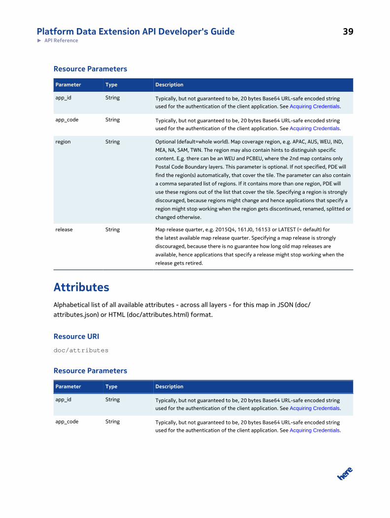
Resource Parameters
Parameter Type Description
app_id String Typically, but not guaranteed to be, 20 bytes Base64 URL-safe encoded string
used for the authentication of the client application. See Acquiring Credentials.
app_code String Typically, but not guaranteed to be, 20 bytes Base64 URL-safe encoded string
used for the authentication of the client application. See Acquiring Credentials.
region String Optional (default=whole world). Map coverage region, e.g. APAC, AUS, WEU, IND,
MEA, NA, SAM, TWN. The region may also contain hints to distinguish specific
content. E.g. there can be an WEU and PCBEU, where the 2nd map contains only
Postal Code Boundary layers. This parameter is optional. If not specified, PDE will
find the region(s) automatically, that cover the tile. The parameter can also contain
a comma separated list of regions. If it contains more than one region, PDE will
use these regions out of the list that cover the tile. Specifying a region is strongly
discouraged, because regions might change and hence applications that specify a
region might stop working when the region gets discontinued, renamed, splitted or
changed otherwise.
release String Map release quarter, e.g. 2015Q4, 161J0, 16153 or LATEST (= default) for
the latest available map release quarter. Specifying a map release is strongly
discouraged, because there is no guarantee how long old map releases are
available, hence applications that specify a release might stop working when the
release gets retired.
AttributesAlphabetical list of all available attributes - across all layers - for this map in JSON (doc/
attributes.json) or HTML (doc/attributes.html) format.
Resource URI
doc/attributes
Resource Parameters
Parameter Type Description
app_id String Typically, but not guaranteed to be, 20 bytes Base64 URL-safe encoded string
used for the authentication of the client application. See Acquiring Credentials.
app_code String Typically, but not guaranteed to be, 20 bytes Base64 URL-safe encoded string
used for the authentication of the client application. See Acquiring Credentials.
Platform Data Extension API Developer's Guide 40► API Reference
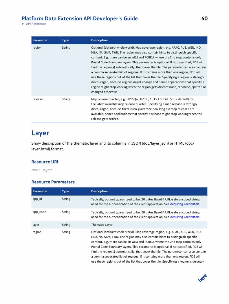
Parameter Type Description
region String Optional (default=whole world). Map coverage region, e.g. APAC, AUS, WEU, IND,
MEA, NA, SAM, TWN. The region may also contain hints to distinguish specific
content. E.g. there can be an WEU and PCBEU, where the 2nd map contains only
Postal Code Boundary layers. This parameter is optional. If not specified, PDE will
find the region(s) automatically, that cover the tile. The parameter can also contain
a comma separated list of regions. If it contains more than one region, PDE will
use these regions out of the list that cover the tile. Specifying a region is strongly
discouraged, because regions might change and hence applications that specify a
region might stop working when the region gets discontinued, renamed, splitted or
changed otherwise.
release String Map release quarter, e.g. 2015Q4, 161J0, 16153 or LATEST (= default) for
the latest available map release quarter. Specifying a map release is strongly
discouraged, because there is no guarantee how long old map releases are
available, hence applications that specify a release might stop working when the
release gets retired.
LayerShow description of the thematic layer and its columns in JSON (doc/layer.json) or HTML (doc/
layer.html) format.
Resource URI
doc/layer
Resource Parameters
Parameter Type Description
app_id String Typically, but not guaranteed to be, 20 bytes Base64 URL-safe encoded string
used for the authentication of the client application. See Acquiring Credentials.
app_code String Typically, but not guaranteed to be, 20 bytes Base64 URL-safe encoded string
used for the authentication of the client application. See Acquiring Credentials.
layer String Thematic Layer
region String Optional (default=whole world). Map coverage region, e.g. APAC, AUS, WEU, IND,
MEA, NA, SAM, TWN. The region may also contain hints to distinguish specific
content. E.g. there can be an WEU and PCBEU, where the 2nd map contains only
Postal Code Boundary layers. This parameter is optional. If not specified, PDE will
find the region(s) automatically, that cover the tile. The parameter can also contain
a comma separated list of regions. If it contains more than one region, PDE will
use these regions out of the list that cover the tile. Specifying a region is strongly
Platform Data Extension API Developer's Guide 41► API Reference
Parameter Type Description
discouraged, because regions might change and hence applications that specify a
region might stop working when the region gets discontinued, renamed, splitted or
changed otherwise.
release String Map release quarter, e.g. 2015Q4, 161J0, 16153 or LATEST (= default) for
the latest available map release quarter. Specifying a map release is strongly
discouraged, because there is no guarantee how long old map releases are
available, hence applications that specify a release might stop working when the
release gets retired.
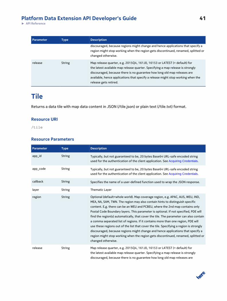
TileReturns a data tile with map data content in JSON (/tile.json) or plain text (/tile.txt) format.
Resource URI
/tile
Resource Parameters
Parameter Type Description
app_id String Typically, but not guaranteed to be, 20 bytes Base64 URL-safe encoded string
used for the authentication of the client application. See Acquiring Credentials.
app_code String Typically, but not guaranteed to be, 20 bytes Base64 URL-safe encoded string
used for the authentication of the client application. See Acquiring Credentials.
callback String Specifies the name of a user-defined function used to wrap the JSON response.
layer String Thematic Layer
region String Optional (default=whole world). Map coverage region, e.g. APAC, AUS, WEU, IND,
MEA, NA, SAM, TWN. The region may also contain hints to distinguish specific
content. E.g. there can be an WEU and PCBEU, where the 2nd map contains only
Postal Code Boundary layers. This parameter is optional. If not specified, PDE will
find the region(s) automatically, that cover the tile. The parameter can also contain
a comma separated list of regions. If it contains more than one region, PDE will
use these regions out of the list that cover the tile. Specifying a region is strongly
discouraged, because regions might change and hence applications that specify a
region might stop working when the region gets discontinued, renamed, splitted or
changed otherwise.
release String Map release quarter, e.g. 2015Q4, 161J0, 16153 or LATEST (= default) for
the latest available map release quarter. Specifying a map release is strongly
discouraged, because there is no guarantee how long old map releases are
Platform Data Extension API Developer's Guide 42► API Reference
Parameter Type Description
available, hence applications that specify a release might stop working when the
release gets retired.
level Number Specifies the size of the requested tile: N x N degree in WGS84, where N = 180 /
(2level)
tilex Number Specifies the tile number in West-East direction. This depends on the level. The
tile covering the longitude LON [WGS84 degree] has tileX = floor((LON + 180.0) /
tileSize), where tileSize = 180 / 2level. The tile with a given tileX value covers the
longitude range [ tileX * tileSize - 180.0 ... (tileX + 1) * tileSize - 180.0 ].
tiley Number Specifies the tile number in South-North direction. This depends on the level.
The tile covering the latitude LAT [WGS84 degree] has tileY = floor((LAT + 90.0) /
tileSize), where tileSize = 180 / (2level). The tile with a given tileY value covers the
latitude range [ tileY * tileSize - 90.0 ... (tileY + 1) * tileSize - 90.0 [.
meta String Request that the response tile(s) get(s) framed with meta information (layer,
level, tilex, tiley, region, release). Currently the parameter value must be 1. In the
future, other format variants of meta data might be supported through other
meta values. The tile(s) can consist of multiple regions and/or releases. Therefore
the response fields are a comma separated list of regions/releases.
cols String Specifies the tile columns to be retained or removed from result. To have only
certain columns in the resulting tile, value can be specified as semi-colon-
separated column names. As an example, the parameter value cols=LAT;LON
will make the resulting tile include only LAT and LON columns. Columns can
be removed from results using the syntax cols=-LAT;-LON. This will make the
resulting tile exclude LAT and LON columns. If cols parameter is specified, all
columns must be retaining (only column name) or removed (minus sign before
column name). Non existing column names are simply ignored in both cases.
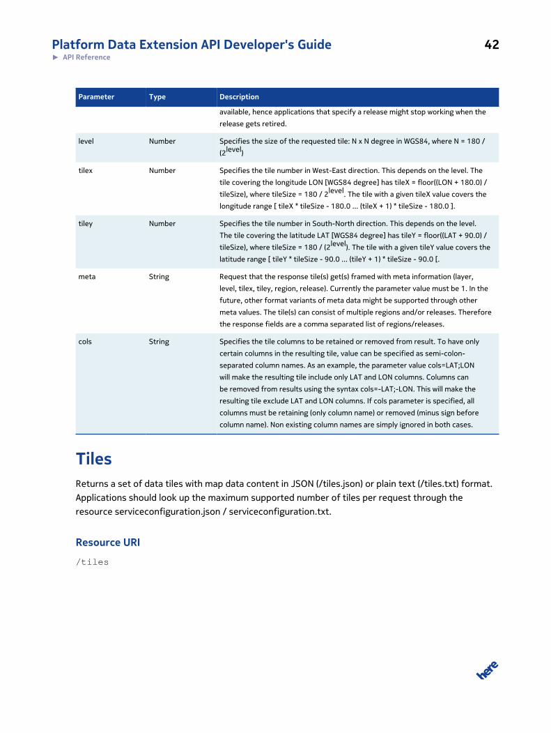
TilesReturns a set of data tiles with map data content in JSON (/tiles.json) or plain text (/tiles.txt) format.
Applications should look up the maximum supported number of tiles per request through the
resource serviceconfiguration.json / serviceconfiguration.txt.
Resource URI
/tiles
Platform Data Extension API Developer's Guide 43► API Reference
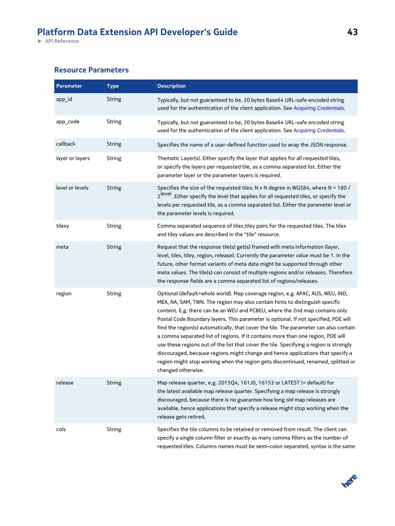
Resource Parameters
Parameter Type Description
app_id String Typically, but not guaranteed to be, 20 bytes Base64 URL-safe encoded string
used for the authentication of the client application. See Acquiring Credentials.
app_code String Typically, but not guaranteed to be, 20 bytes Base64 URL-safe encoded string
used for the authentication of the client application. See Acquiring Credentials.
callback String Specifies the name of a user-defined function used to wrap the JSON response.
layer or layers String Thematic Layer(s). Either specify the layer that applies for all requested tiles,
or specify the layers per requested tile, as a comma separated list. Either the
parameter layer or the parameter layers is required.
level or levels String Specifies the size of the requested tiles: N x N degree in WGS84, where N = 180 /
2level. Either specify the level that applies for all requested tiles, or specify the
levels per requested tile, as a comma separated list. Either the parameter level or
the parameter levels is required.
tilexy String Comma separated sequence of tilex,tiley pairs for the requested tiles. The tilex
and tiley values are described in the "tile" resource.
meta String Request that the response tile(s) get(s) framed with meta information (layer,
level, tilex, tiley, region, release). Currently the parameter value must be 1. In the
future, other format variants of meta data might be supported through other
meta values. The tile(s) can consist of multiple regions and/or releases. Therefore
the response fields are a comma separated list of regions/releases.
region String Optional (default=whole world). Map coverage region, e.g. APAC, AUS, WEU, IND,
MEA, NA, SAM, TWN. The region may also contain hints to distinguish specific
content. E.g. there can be an WEU and PCBEU, where the 2nd map contains only
Postal Code Boundary layers. This parameter is optional. If not specified, PDE will
find the region(s) automatically, that cover the tile. The parameter can also contain
a comma separated list of regions. If it contains more than one region, PDE will
use these regions out of the list that cover the tile. Specifying a region is strongly
discouraged, because regions might change and hence applications that specify a
region might stop working when the region gets discontinued, renamed, splitted or
changed otherwise.
release String Map release quarter, e.g. 2015Q4, 161J0, 16153 or LATEST (= default) for
the latest available map release quarter. Specifying a map release is strongly
discouraged, because there is no guarantee how long old map releases are
available, hence applications that specify a release might stop working when the
release gets retired.
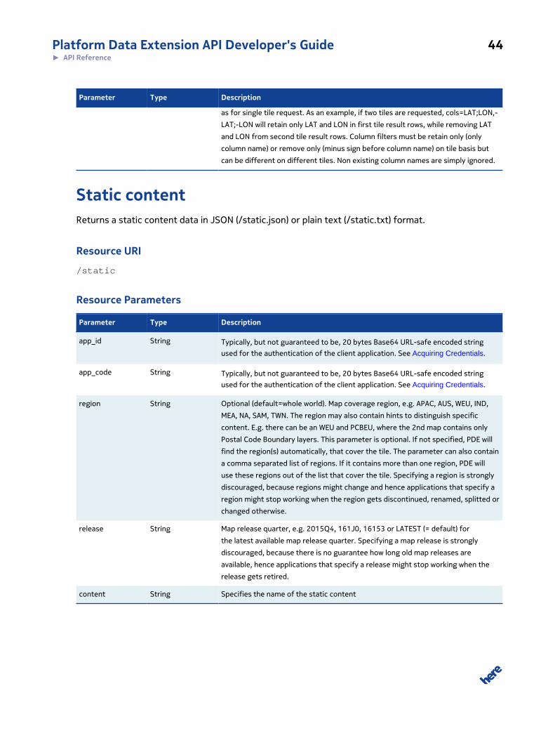
cols String Specifies the tile columns to be retained or removed from result. The client can
specify a single column filter or exactly as many comma filters as the number of
requested tiles. Columns names must be semi-colon separated, syntax is the same
Platform Data Extension API Developer's Guide 44► API Reference
Parameter Type Description
as for single tile request. As an example, if two tiles are requested, cols=LAT;LON,-
LAT;-LON will retain only LAT and LON in first tile result rows, while removing LAT
and LON from second tile result rows. Column filters must be retain only (only
column name) or remove only (minus sign before column name) on tile basis but
can be different on different tiles. Non existing column names are simply ignored.
Static contentReturns a static content data in JSON (/static.json) or plain text (/static.txt) format.
Resource URI
/static
Resource Parameters
Parameter Type Description
app_id String Typically, but not guaranteed to be, 20 bytes Base64 URL-safe encoded string
used for the authentication of the client application. See Acquiring Credentials.
app_code String Typically, but not guaranteed to be, 20 bytes Base64 URL-safe encoded string
used for the authentication of the client application. See Acquiring Credentials.
region String Optional (default=whole world). Map coverage region, e.g. APAC, AUS, WEU, IND,
MEA, NA, SAM, TWN. The region may also contain hints to distinguish specific
content. E.g. there can be an WEU and PCBEU, where the 2nd map contains only
Postal Code Boundary layers. This parameter is optional. If not specified, PDE will
find the region(s) automatically, that cover the tile. The parameter can also contain
a comma separated list of regions. If it contains more than one region, PDE will
use these regions out of the list that cover the tile. Specifying a region is strongly
discouraged, because regions might change and hence applications that specify a
region might stop working when the region gets discontinued, renamed, splitted or
changed otherwise.
release String Map release quarter, e.g. 2015Q4, 161J0, 16153 or LATEST (= default) for
the latest available map release quarter. Specifying a map release is strongly
discouraged, because there is no guarantee how long old map releases are
available, hence applications that specify a release might stop working when the
release gets retired.
content String Specifies the name of the static content
Platform Data Extension API Developer's Guide 45► API Reference
IndexesList all available indexes for this map in JSON (doc/indexes.json) or HTML (doc/indexes.html) format.
Resource URI
doc/indexes
Resource Parameters
Parameter Type Description
app_id String Typically, but not guaranteed to be, 20 bytes Base64 URL-safe encoded string
used for the authentication of the client application. See Acquiring Credentials.
app_code String Typically, but not guaranteed to be, 20 bytes Base64 URL-safe encoded string
used for the authentication of the client application. See Acquiring Credentials.
region String Optional (default=whole world). Map coverage region, e.g. APAC, AUS, WEU, IND,
MEA, NA, SAM, TWN. The region may also contain hints to distinguish specific
content. E.g. there can be an WEU and PCBEU, where the 2nd map contains only
Postal Code Boundary layers. This parameter is optional. If not specified, PDE will
find the region(s) automatically, that cover the tile. The parameter can also contain
a comma separated list of regions. If it contains more than one region, PDE will
use these regions out of the list that cover the tile. Specifying a region is strongly
discouraged, because regions might change and hence applications that specify a
region might stop working when the region gets discontinued, renamed, splitted or
changed otherwise.
release String Map release quarter, e.g. 2015Q4, 161J0, 16153 or LATEST (= default) for
the latest available map release quarter. Specifying a map release is strongly
discouraged, because there is no guarantee how long old map releases are
available, hence applications that specify a release might stop working when the
release gets retired.
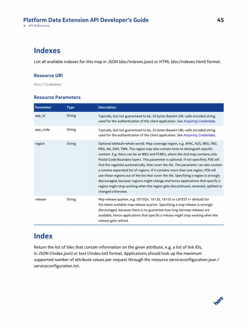
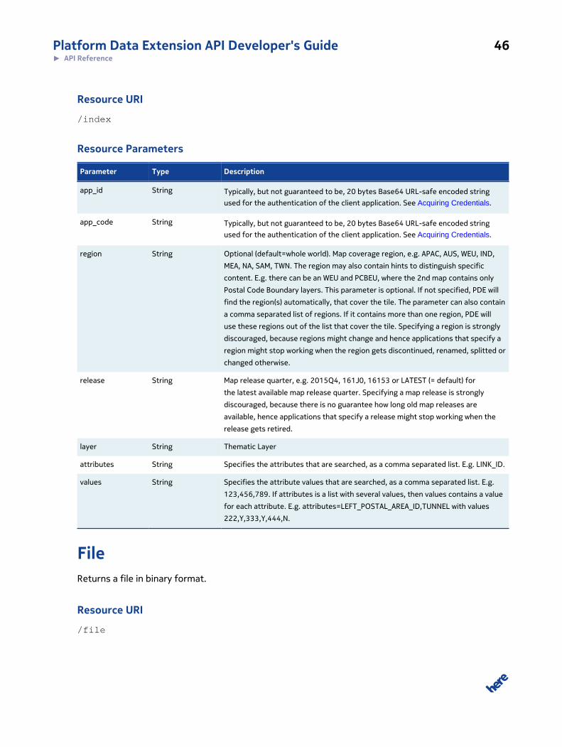
IndexReturn the list of tiles that contain information on the given attribute, e.g. a list of link IDs,
in JSON (/index.json) or text (/index.txt) format. Applications should look up the maximum
supported number of attribute values per request through the resource serviceconfiguration.json /
serviceconfiguration.txt.
Platform Data Extension API Developer's Guide 46► API Reference
Resource URI
/index
Resource Parameters
Parameter Type Description
app_id String Typically, but not guaranteed to be, 20 bytes Base64 URL-safe encoded string
used for the authentication of the client application. See Acquiring Credentials.
app_code String Typically, but not guaranteed to be, 20 bytes Base64 URL-safe encoded string
used for the authentication of the client application. See Acquiring Credentials.
region String Optional (default=whole world). Map coverage region, e.g. APAC, AUS, WEU, IND,
MEA, NA, SAM, TWN. The region may also contain hints to distinguish specific
content. E.g. there can be an WEU and PCBEU, where the 2nd map contains only
Postal Code Boundary layers. This parameter is optional. If not specified, PDE will
find the region(s) automatically, that cover the tile. The parameter can also contain
a comma separated list of regions. If it contains more than one region, PDE will
use these regions out of the list that cover the tile. Specifying a region is strongly
discouraged, because regions might change and hence applications that specify a
region might stop working when the region gets discontinued, renamed, splitted or
changed otherwise.
release String Map release quarter, e.g. 2015Q4, 161J0, 16153 or LATEST (= default) for
the latest available map release quarter. Specifying a map release is strongly
discouraged, because there is no guarantee how long old map releases are
available, hence applications that specify a release might stop working when the
release gets retired.
layer String Thematic Layer
attributes String Specifies the attributes that are searched, as a comma separated list. E.g. LINK_ID.
values String Specifies the attribute values that are searched, as a comma separated list. E.g.
123,456,789. If attributes is a list with several values, then values contains a value
for each attribute. E.g. attributes=LEFT_POSTAL_AREA_ID,TUNNEL with values
222,Y,333,Y,444,N.
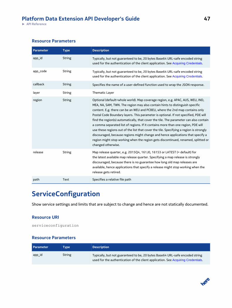
FileReturns a file in binary format.
Resource URI
/file
Platform Data Extension API Developer's Guide 47► API Reference
Resource Parameters
Parameter Type Description
app_id String Typically, but not guaranteed to be, 20 bytes Base64 URL-safe encoded string
used for the authentication of the client application. See Acquiring Credentials.
app_code String Typically, but not guaranteed to be, 20 bytes Base64 URL-safe encoded string
used for the authentication of the client application. See Acquiring Credentials.
callback String Specifies the name of a user-defined function used to wrap the JSON response.
layer String Thematic Layer
region String Optional (default=whole world). Map coverage region, e.g. APAC, AUS, WEU, IND,
MEA, NA, SAM, TWN. The region may also contain hints to distinguish specific
content. E.g. there can be an WEU and PCBEU, where the 2nd map contains only
Postal Code Boundary layers. This parameter is optional. If not specified, PDE will
find the region(s) automatically, that cover the tile. The parameter can also contain
a comma separated list of regions. If it contains more than one region, PDE will
use these regions out of the list that cover the tile. Specifying a region is strongly
discouraged, because regions might change and hence applications that specify a
region might stop working when the region gets discontinued, renamed, splitted or
changed otherwise.
release String Map release quarter, e.g. 2015Q4, 161J0, 16153 or LATEST (= default) for
the latest available map release quarter. Specifying a map release is strongly
discouraged, because there is no guarantee how long old map releases are
available, hence applications that specify a release might stop working when the
release gets retired.
path Text Specifies a relative file path
ServiceConfigurationShow service settings and limits that are subject to change and hence are not statically documented.
Resource URI
serviceconfiguration
Resource Parameters
Parameter Type Description
app_id String Typically, but not guaranteed to be, 20 bytes Base64 URL-safe encoded string
used for the authentication of the client application. See Acquiring Credentials.
Platform Data Extension API Developer's Guide 48► API Reference
Parameter Type Description
app_code String Typically, but not guaranteed to be, 20 bytes Base64 URL-safe encoded string
used for the authentication of the client application. See Acquiring Credentials.
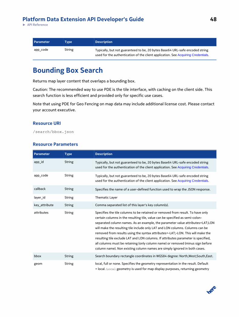
Bounding Box SearchReturns map layer content that overlaps a bounding box.
Caution: The recommended way to use PDE is the tile interface, with caching on the client side. This
search function is less efficient and provided only for specific use cases.
Note that using PDE for Geo Fencing on map data may include additional license cost. Please contact
your account executive.
Resource URI
/search/bbox.json
Resource Parameters
Parameter Type Description
app_id String Typically, but not guaranteed to be, 20 bytes Base64 URL-safe encoded string
used for the authentication of the client application. See Acquiring Credentials.
app_code String Typically, but not guaranteed to be, 20 bytes Base64 URL-safe encoded string
used for the authentication of the client application. See Acquiring Credentials.
callback String Specifies the name of a user-defined function used to wrap the JSON response.
layer_id String Thematic Layer
key_attribute String Comma separated list of this layer's key column(s).
attributes String Specifies the tile columns to be retained or removed from result. To have only
certain columns in the resulting tile, value can be specified as semi-colon-
separated column names. As an example, the parameter value attributes=LAT;LON
will make the resulting tile include only LAT and LON columns. Columns can be
removed from results using the syntax attributes=-LAT;-LON. This will make the
resulting tile exclude LAT and LON columns. If attributes parameter is specified,
all columns must be retaining (only column name) or removed (minus sign before
column name). Non existing column names are simply ignored in both cases.
bbox String Search boundary rectangle coordinates in WGS84 degree: North,West;South,East.
geom String local, full or none. Specifies the geometry representation in the result. Default
= local. Local geometry is used for map display purposes, returning geometry
Platform Data Extension API Developer's Guide 49► API Reference
Parameter Type Description
pieces that cover the given search radius, bounding box or corridor polygon. Full
geometry is used for interactive editing, where the original geometry is required.
None is used for applications like geofencing, which most of the time want to know
only the ids of the geofence points/lines polygones they are in or near. Note: Not
all geometry options are supported in all resources.
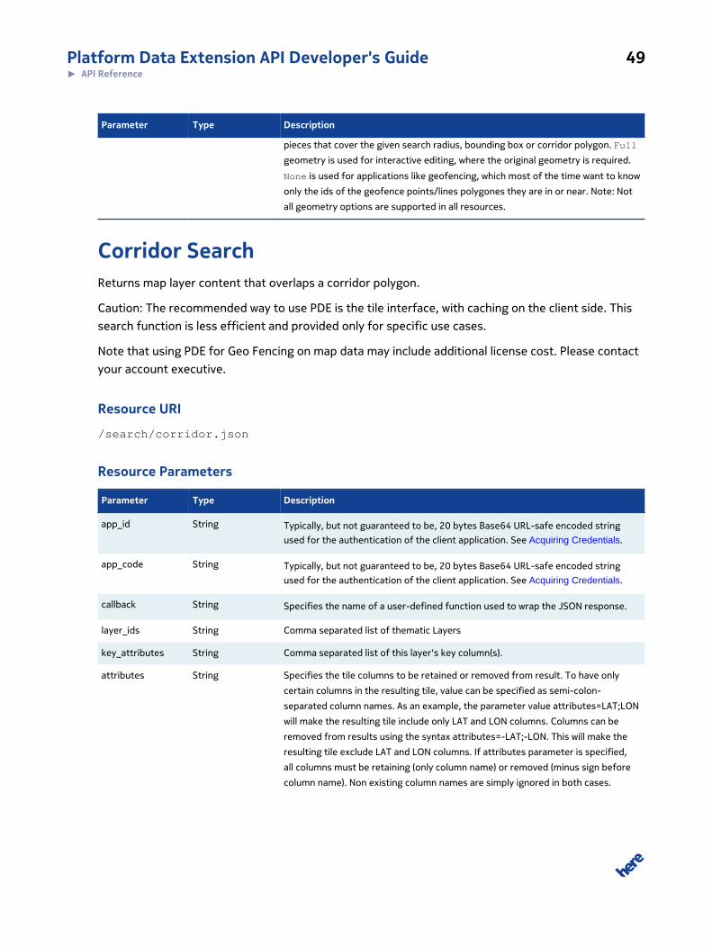
Corridor SearchReturns map layer content that overlaps a corridor polygon.
Caution: The recommended way to use PDE is the tile interface, with caching on the client side. This
search function is less efficient and provided only for specific use cases.
Note that using PDE for Geo Fencing on map data may include additional license cost. Please contact
your account executive.
Resource URI
/search/corridor.json
Resource Parameters
Parameter Type Description
app_id String Typically, but not guaranteed to be, 20 bytes Base64 URL-safe encoded string
used for the authentication of the client application. See Acquiring Credentials.
app_code String Typically, but not guaranteed to be, 20 bytes Base64 URL-safe encoded string
used for the authentication of the client application. See Acquiring Credentials.
callback String Specifies the name of a user-defined function used to wrap the JSON response.
layer_ids String Comma separated list of thematic Layers
key_attributes String Comma separated list of this layer's key column(s).
attributes String Specifies the tile columns to be retained or removed from result. To have only
certain columns in the resulting tile, value can be specified as semi-colon-
separated column names. As an example, the parameter value attributes=LAT;LON
will make the resulting tile include only LAT and LON columns. Columns can be
removed from results using the syntax attributes=-LAT;-LON. This will make the
resulting tile exclude LAT and LON columns. If attributes parameter is specified,
all columns must be retaining (only column name) or removed (minus sign before
column name). Non existing column names are simply ignored in both cases.
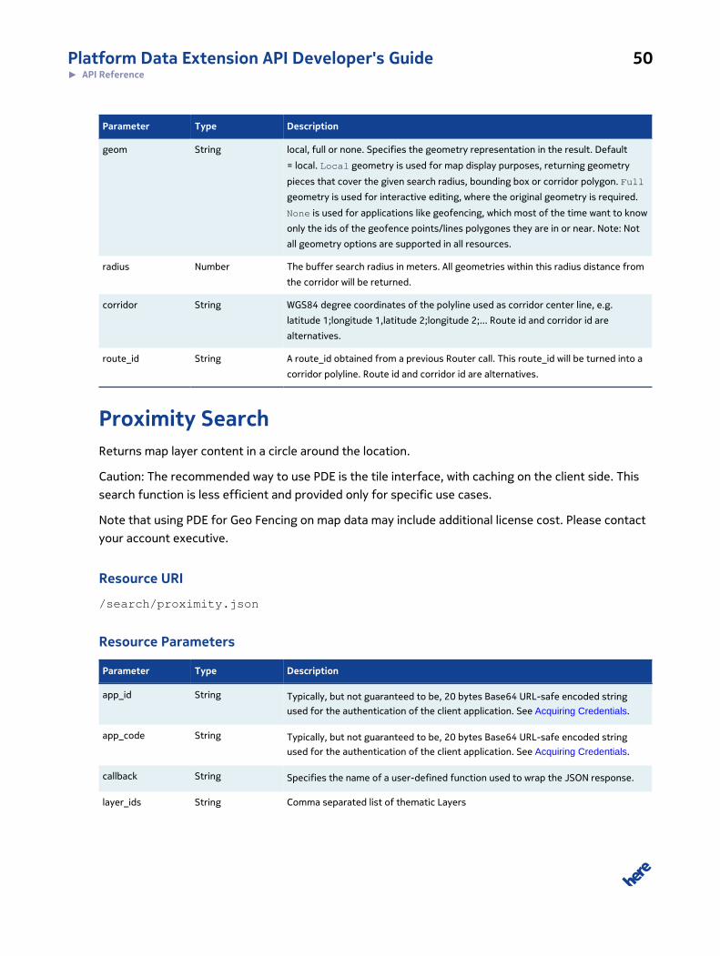
Platform Data Extension API Developer's Guide 50► API Reference
Parameter Type Description
geom String local, full or none. Specifies the geometry representation in the result. Default
= local. Local geometry is used for map display purposes, returning geometry
pieces that cover the given search radius, bounding box or corridor polygon. Full
geometry is used for interactive editing, where the original geometry is required.
None is used for applications like geofencing, which most of the time want to know
only the ids of the geofence points/lines polygones they are in or near. Note: Not
all geometry options are supported in all resources.
radius Number The buffer search radius in meters. All geometries within this radius distance from
the corridor will be returned.
corridor String WGS84 degree coordinates of the polyline used as corridor center line, e.g.
latitude 1;longitude 1,latitude 2;longitude 2;... Route id and corridor id are
alternatives.
route_id String A route_id obtained from a previous Router call. This route_id will be turned into a
corridor polyline. Route id and corridor id are alternatives.
Proximity SearchReturns map layer content in a circle around the location.
Caution: The recommended way to use PDE is the tile interface, with caching on the client side. This
search function is less efficient and provided only for specific use cases.
Note that using PDE for Geo Fencing on map data may include additional license cost. Please contact
your account executive.
Resource URI
/search/proximity.json
Resource Parameters
Parameter Type Description
app_id String Typically, but not guaranteed to be, 20 bytes Base64 URL-safe encoded string
used for the authentication of the client application. See Acquiring Credentials.
app_code String Typically, but not guaranteed to be, 20 bytes Base64 URL-safe encoded string
used for the authentication of the client application. See Acquiring Credentials.
callback String Specifies the name of a user-defined function used to wrap the JSON response.
layer_ids String Comma separated list of thematic Layers
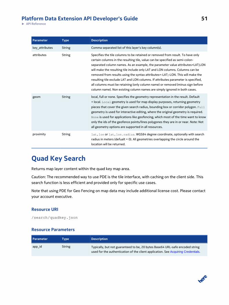
Platform Data Extension API Developer's Guide 51► API Reference
Parameter Type Description
key_attributes String Comma separated list of this layer's key column(s).
attributes String Specifies the tile columns to be retained or removed from result. To have only
certain columns in the resulting tile, value can be specified as semi-colon-
separated column names. As an example, the parameter value attributes=LAT;LON
will make the resulting tile include only LAT and LON columns. Columns can be
removed from results using the syntax attributes=-LAT;-LON. This will make the
resulting tile exclude LAT and LON columns. If attributes parameter is specified,
all columns must be retaining (only column name) or removed (minus sign before
column name). Non existing column names are simply ignored in both cases.
geom String local, full or none. Specifies the geometry representation in the result. Default
= local. Local geometry is used for map display purposes, returning geometry
pieces that cover the given search radius, bounding box or corridor polygon. Full
geometry is used for interactive editing, where the original geometry is required.
None is used for applications like geofencing, which most of the time want to know
only the ids of the geofence points/lines polygones they are in or near. Note: Not
all geometry options are supported in all resources.
proximity String lat,lon or lat,lon.radius. WGS84 degree coordinate, optionally with search
radius in meters (defualt = 0). All geometries overlapping the circle around the
location will be returned.
Quad Key SearchReturns map layer content within the quad key map area.
Caution: The recommended way to use PDE is the tile interface, with caching on the client side. This
search function is less efficient and provided only for specific use cases.
Note that using PDE for Geo Fencing on map data may include additional license cost. Please contact
your account executive.
Resource URI
/search/quadkey.json
Resource Parameters
Parameter Type Description
app_id String Typically, but not guaranteed to be, 20 bytes Base64 URL-safe encoded string
used for the authentication of the client application. See Acquiring Credentials.
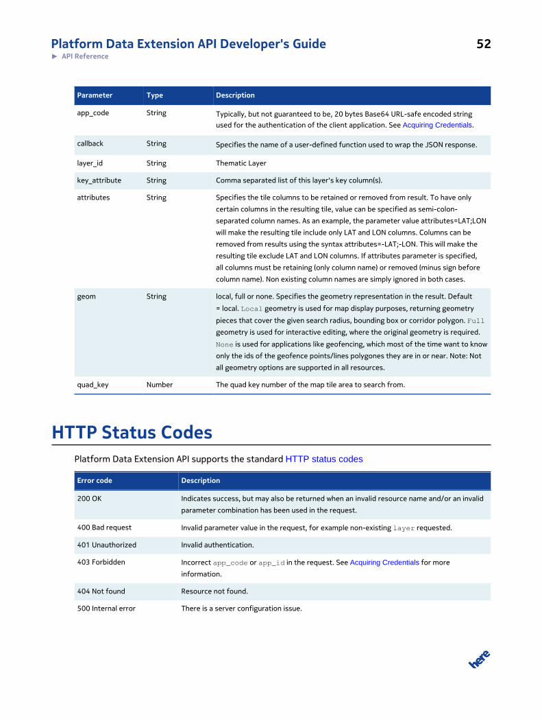
Platform Data Extension API Developer's Guide 52► API Reference
Parameter Type Description
app_code String Typically, but not guaranteed to be, 20 bytes Base64 URL-safe encoded string
used for the authentication of the client application. See Acquiring Credentials.
callback String Specifies the name of a user-defined function used to wrap the JSON response.
layer_id String Thematic Layer
key_attribute String Comma separated list of this layer's key column(s).
attributes String Specifies the tile columns to be retained or removed from result. To have only
certain columns in the resulting tile, value can be specified as semi-colon-
separated column names. As an example, the parameter value attributes=LAT;LON
will make the resulting tile include only LAT and LON columns. Columns can be
removed from results using the syntax attributes=-LAT;-LON. This will make the
resulting tile exclude LAT and LON columns. If attributes parameter is specified,
all columns must be retaining (only column name) or removed (minus sign before
column name). Non existing column names are simply ignored in both cases.
geom String local, full or none. Specifies the geometry representation in the result. Default
= local. Local geometry is used for map display purposes, returning geometry
pieces that cover the given search radius, bounding box or corridor polygon. Full
geometry is used for interactive editing, where the original geometry is required.
None is used for applications like geofencing, which most of the time want to know
only the ids of the geofence points/lines polygones they are in or near. Note: Not
all geometry options are supported in all resources.
quad_key Number The quad key number of the map tile area to search from.
HTTP Status CodesPlatform Data Extension API supports the standard HTTP status codes
Error code Description
200 OK Indicates success, but may also be returned when an invalid resource name and/or an invalid
parameter combination has been used in the request.
400 Bad request Invalid parameter value in the request, for example non-existing layer requested.
401 Unauthorized Invalid authentication.
403 Forbidden Incorrect app_code or app_id in the request. See Acquiring Credentials for more
information.
404 Not found Resource not found.
500 Internal error There is a server configuration issue.
Platform Data Extension API Developer's Guide 53► API Reference
Error code Description
503 Service Unavailable Indicates that the service is temporarily unavailable due to system overload or maintenance
or the resource is currently disabled.
Platform Data Extension API Developer's Guide 54► Coverage Information
Chapter
5
Coverage InformationThe currently available maps can be looked up on
https://pde.cit.api.here.com/1/doc/maps.json?
app_id={YOUR_APP_ID}&app_code={YOUR_APP_CODE} (CIT)
or
https://pde.api.here.com/1/doc/maps.json?
app_id={YOUR_APP_ID}&app_code={YOUR_APP_CODE}
(PRD) respectively.