Embed Size (px)
Citation preview

1 of 4
Planning & Building Department 3675 Mt. Diablo Boulevard, Suite 210
Lafayette, CA 94549 Tel. (925) 284-1976
www.lovelafayette.org
DESIGN REVIEW INSTRUCTIONS
GENERAL Design Review is the consideration of the design and aesthetic elements of a project. It applies to new construction, exterior remodeling, or any change to a structure or facility which affects the exterior appearance of a property. Development within a multiple-family or commercial land use district, on a hillside or ridgeline lot, and projects that are conditioned by prior approval are each subject to design review approval. PROCEDURES Step 1: Pre-Application Prior to application for a Design Review approval, the applicant should discuss the proposed project with the Planning Services Division staff to determine what regulations may apply. Once it is clear that a Design Review approval is required, the applicant should carefully assess the aesthetic and environmental impacts and public service demands of the proposed project. Are there likely to be problems with utilities, street improvements, drainage, visibility, privacy or other identifiable issues? The applicant should discuss any potential problems with the appropriate governmental agency, as well as those neighboring property owners that may be affected by the proposed project. Step 2: Study Session (Optional) The Design Review Commission (“DRC”) may conduct study sessions on the aesthetic aspects and possible issues related to a proposed project, at the request of the applicant. A study session can be particularly useful for a project involving new construction or significant reconstruction or additions as it allows the applicant to get feedback from the DRC early on in the design process, before becoming overly invested in a given design. Ideally, study sessions take place around 30% design, with significant background information, but without hard-line design drawings or finished presentation graphics. To schedule a Study Session, submit a letter of request, indicating the location of the project and its general scope along with the required fee to the Planning Services Division. A schedule of planning and development fees is available from staff or at www.lovelafayette.org > Permits Forms Fees > Fee Schedule > Planning & Development Fees.

2 of 4
Step 3: Filing the Application The applicant should carefully complete the application form (to be signed by the applicant and the current property owner) and ensure that all submittal requirements and fees are included. The application will be assigned to a staff planner who will check the application for completeness. Once staff has reviewed the plans (within 30-days), the applicant will be notified that the application is complete and told the size and number of plans needed for the review process. If the application is incomplete, the applicant will be notified of any necessary alterations to the plans or additional information and submittals required. Once an application is deemed complete, it will be reviewed for compliance with the California Environmental Quality Act (CEQA). Step 4: Environmental Review The staff planner will notify the applicant (within 30-days after the application is deemed complete) whether the proposed project is exempt from CEQA or requires an additional level of environmental review such as a negative declaration, mitigated negative declaration, or environmental impact report (EIR). If the project is not exempt, requests for supplementary information, further fees, and additional processing time are to be expected. Step 5: Public Notification and Project Determination Design Review applications may be subject to a public notification and hearing process depending on the scope of the project and whether project determination is rendered by the Zoning Administrator (“ZA”), Design Review Commission (“DRC”), or Planning Commission (“PC”). Once an application is deemed complete, staff will confirm the public notification and hearing process and decision-making authority. Project determination is based on information contained in the application, site visits, staff analyses and reports, conformance with applicable ordinances, regulations, development criteria, policies and findings, and all correspondence and testimony presented by the public. Project determination can consist of approval, approval with amendments and/or conditions, or denial. The DRC or PC may continue an application to a future date if additional information or staff review is required or project revisions requested. Project determination becomes effective upon expiration of a 14-day appeal period. Public Notification and Hearing. If an application requires a public hearing, written notice of the hearing is mailed at least 10-days in advance to the applicant and all properties within 300-feet of the project site. Notified parties may provide written and/or oral comment. Zoning Administrator. The Planning and Building Service’s Manager acts as the Zoning Administrator. The ZA may act on minor projects such as changes in exterior colors and materials, landscaping and paving improvements, ground-level additions and accessory buildings. The ZA also has the discretion to refer an application to the Design Review Commission. Design Review Commission. The DRC is the decision-making authority for exterior changes or additions to an existing building or parking lot, single-family residential construction exceeding 6,000 square feet in gross floor area or 17 ft. in height, and projects for which design review is required as a condition of approval.

3 of 4
Planning Commission. The PC is the decision-making authority for all other design review applications not listed above. APPEAL OF DETERMINATION The applicant or other aggrieved party may appeal the action of the decision-making authority within 14-calendar days following the determination to the next level of decision-making authority. The decision-making hierarchy is Zoning Administrator, Design Review Commission, Planning Commission, and City Council. The appeal must be in writing and explain the grounds for the appeal. The fee to file an appeal is 50-percent of the original application fee. If an appeal has been timely filed, a de novo public hearing before the appropriate Commission or the City Council will be scheduled. The applicant should be present and any interested person(s) may submit testimony. After close of testimony, the hearing authority for the appeal will make a decision on the appeal, or if necessary, continue the matter to a date certain for future action. Action taken by the City Council is final. TIME REQUIRED FOR PROCESSING The total time for processing a Design Review application varies depending on the complexity and magnitude of the project. After an application has been deemed complete, it usually takes five to six weeks for action by the ZA or initial DRC or PC meeting. The requirement for a negative declaration or environmental impact report could add six to twelve months to the processing time, respectively. TIME AND PLACE OF MEETINGS NOTE: Design Review Commission and Planning Commission hearings occur on MONDAYS. Zoning Administrator hearings occur on Thursdays.
• Zoning Administrator hearings: first and third Thursdays of each month, commencing at 2:00 p.m. at the City Offices, 3675 Mt. Diablo Boulevard, Suite 210.
• Design Review Commission hearings: second and fourth Mondays of each month, commencing at 7:00 p.m. at the Lafayette Library and Learning Center, 3491 Mt. Diablo Boulevard in the Arts and Science Discovery Center.
• Planning Commission hearings: first and third Mondays of each month, commencing at 7:00 p.m. at the Lafayette Library and Learning Center, 3491 Mt. Diablo Boulevard in the Community Hall.
A calendar of adopted meeting dates is available at www.lovelafayette.org. Rev. 2013-07-17

4 of 4
This Page Intentionally Left Blank
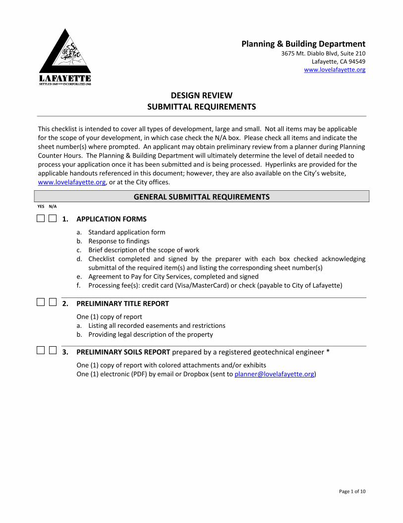
Page 1 of 10
Planning & Building Department 3675 Mt. Diablo Blvd, Suite 210
Lafayette, CA 94549 www.lovelafayette.org
DESIGN REVIEW SUBMITTAL REQUIREMENTS
This checklist is intended to cover all types of development, large and small. Not all items may be applicable for the scope of your development, in which case check the N/A box. Please check all items and indicate the sheet number(s) where prompted. An applicant may obtain preliminary review from a planner during Planning Counter Hours. The Planning & Building Department will ultimately determine the level of detail needed to process your application once it has been submitted and is being processed. Hyperlinks are provided for the applicable handouts referenced in this document; however, they are also available on the City’s website, www.lovelafayette.org, or at the City offices.
GENERAL SUBMITTAL REQUIREMENTS YES N/A
1. APPLICATION FORMS
a. Standard application form b. Response to findings c. Brief description of the scope of work d. Checklist completed and signed by the preparer with each box checked acknowledging
submittal of the required item(s) and listing the corresponding sheet number(s) e. Agreement to Pay for City Services, completed and signed f. Processing fee(s): credit card (Visa/MasterCard) or check (payable to City of Lafayette)
2. PRELIMINARY TITLE REPORT
One (1) copy of report a. Listing all recorded easements and restrictions b. Providing legal description of the property
3. PRELIMINARY SOILS REPORT prepared by a registered geotechnical engineer *
One (1) copy of report with colored attachments and/or exhibits One (1) electronic (PDF) by email or Dropbox (sent to [email protected])

Page 2 of 10
YES N/A
4. ARBORIST REPORT prepared by a certified or consulting arborist 1 One (1) copy of report (which may include colored attachments and/or exhibits), including:
a. Tree location, genus, species, diameter, dripline, and elevation at trunk base b. Health and condition of the tree, including existing hazards to the tree c. Potential impact of development on the tree or existing tree condition d. Evaluation of preservation potential based on the tree’s existing condition and in relation to
any potential development e. Recommendations for protection, preservation, and requirements to maintain and improve
tree health and assure survival f. Tree inventory table listing the tree number (as numerically tagged in the field), species, trunk
diameter, health of tree, potential impact of proposal, and indicate whether tree is to be saved or removed
g. Site plan showing: numbered trees, accurate driplines, and proposed location of tree protection fencing
h. Photos as applicable i. Post construction recommendations as applicable
5. COLORS AND MATERIALS BOARD 8.5” x 11” board size and 3/4” maximum thickness 2 with a colored elevation of the proposal and referencing the color chips and manufacturers’ specifications of the following: a. Body/Siding b. Trim c. Windows d. Roof e. Exterior light fixtures, residential and landscaping f. Fences g. Walls and retaining walls h. Hardscape
6. PHOTO AND VISUAL ANALYSIS a. Site and neighborhood photos affixed to 8.5” x 11” cardstock3 b. Field markers identifying the following:
i. Green ribbon tied around all trees to be maintained ii. Red ribbon tied around all trees proposed to be removed.
iii. Yellow ribbon outlining all property lines iv. Yellow ribbon outlining proposed addition(s)
c. Story pole or ground staking* i. Submit a story pole or ground staking plan (certified by a California Licensed Surveyor
or a California Licensed Civil Engineer, showing its layout, height and location), no later than 14-days before the scheduled hearing date or the matter will be postponed 4
ii. Submit photographs of the story poles from most prominent public vantage points and surrounding residences
1 Required if the proposal entails development within the dripline of an existing protected tree > 4” in diameter. 2 Colors and materials board exceeding this thickness will be rejected. 3 Loose photos will be rejected. 4 See separate handout entitled “Ground Staking & Story Poles”

Page 3 of 10
YES N/A
d. Photo montage* i. Outline the project or graphically set it into the photos
ii. Submit photos from most prominent public vantage points and existing surrounding residences
PLAN SET SUBMITTAL REQUIREMENTS 5 YES N/A
7. NUMBER OF PLAN SETS Initial submittal for 30-day completeness review6: One (1) reduced-size (11” x 17”) One (1) electronic (PDF) by email or Dropbox (sent to [email protected])
8. LAYOUT All sheets shall be the same size, oriented in the same direction, and include the following: a. North arrow b. Scale c. Graphic (bar) scale d. Date of preparation e. Revision date(s) f. Changes or modifications clearly identified g. Title block including:
i. Site address ii. Assessor’s parcel number (APN) or name of subdivision and lot number
9. COVER SHEET with the following:
a. Sheet index b. Contact information for the following:
i. Owner ii. Architect/Landscape Architect
iii. Arborist iv. Engineer
5 Example Submittals are available online. 6 Larger size plan sets may be requested by your project planner during the completeness review.

Page 4 of 10
YES N/A
10. MAPS Sheet Number(s)________
a. Vicinity map (minimum 1” = 600’) showing the approximate location of the subject property within the vicinity of Lafayette
b. Context map (minimum 1" = 50') showing the location of the subject property within the context of the neighborhood 7
i. Show and label the following:8 1. All parcels immediately adjacent to and around the site 2. Distance of the addition (upper & lower story) to structures on adjacent lots 3. Footprints of all structures 4. Vacant parcels or open space 5. Property ownership 6. Property address 7. Finished floor elevations 8. Number of stories 9. Approximate square footage 10. Significant landscaping 11. Significant topographic or man-made landforms and features
11. SURVEY – wet stamped and signed 9 Sheet Number(s)________
a. All property lines b. Building footprint of all structures with dimensions to property line c. Easements, fully dimensioned, as reflected on a current title report including:
i. All public and private roads (labeled accordingly) ii. Rights-of-way
iii. Easements, within and to the parcel d. Street improvements - (curb, gutter, sidewalk, edge of paving) e. Topography – (2’ contour intervals in area to be developed) f. Drainage features including:
i. Swales ii. Creeks (with required creek setbacks shown in both plan and sectional view) 10
iii. Wetlands iv. Riparian habitat
g. Trees - show all trees > 4” in diameter at 4.5’ above grade within 100’ of proposed development, with the following labeled:
i. Tree species ii. Diameter of trunk
iii. Elevation at trunk base iv. Field surveyed accurate driplines (generic symbols are not accepted) v. Tree identification number, provided by the arborist
vi. Trees proposed to be removed with a prominent "X"
7 An aerial can be used to create the context map; however, it does not replace the context map. 8 Show buildings outlined in black, background in white, and vegetation/trees in gray. 9 Required if proposal encroaches within 5’ of required setbacks 10 See separate handout entitled “Creek Setback Determination Guide”

Page 5 of 10
YES N/A
12. SITE PLAN – based on the aforementioned survey Sheet Number(s)________
a. Property and zoning information, including: i. Property lines, dimensioned
ii. Setbacks (front, side, and rear), dashed iii. Sewage disposal and public utilities iv. Recorded easements (utility, drainage, access, etc.), labeled v. Total and net 11 parcel square footage
b. Building site(s) and footprint(s) i. Existing and proposed structures with dimensions to property lines
ii. Changes or additions to existing structures shown as hatched, shaded or otherwise highlighted
c. Parking and circulation i. Location, dimensions, and quantity of existing and proposed covered and uncovered
parking facilities 12 ii. Circulation plans for each vehicular and pedestrian way
iii. For multi-family residential and commercial buildings: 1. Incorporate individually mounted Swerve bike racks for visitors, equal to 5% of
parking (2 minimum) within 200’ of the visitors’ entrance and readily visible to passers-by
2. Incorporate bike lockers for employees, equal to 5% of parking (1 minimum) when there are over 10 "tenant-occupants" that will occupy the building. Acceptable facilities shall be convenient from the street and may include: • Covered, lockable enclosures with permanently anchored bike racks; • Lockable rooms with permanently anchored bike racks; and • Lockable, permanently anchored bike lockers.
3. Provide a parking plan with the following information: • Number each parking space • Comply with ADA standards (ramps, path of access, van/standard spaces, etc.) • Comply with parking ordinance standards pertaining to dimensions,
landscaping, siting, lighting, etc. v. Fire District turnarounds (such as the shunt, t-turn, or circle), road width, slope, and
vertical clearance shall be overlaid or highlighted on the circulation plans d. Impervious surface, existing and proposed
i. Include a table calculating the square footage, including building footprint, driveway, patios, walkways, pools, etc.
ii. Shade or hatch changes and additions e. Structures - existing and proposed fences and retaining walls
i. Label top-of-wall (TW) and bottom of wall (BW) spot elevations ii. Shade or hatch changes and additions
f. Existing trees - show all trees > 4” in diameter at 4.5’ above grade within 100’ of proposed development and label:
i. Tree species ii. Diameter of trunk
iii. Elevation at base of trunk
11 Excludes the area within vehicular rights-of-way and vehicular easements 12 Parking space minimum dimensions are 10’ by 20’ per space

Page 6 of 10
YES N/A iv. Field surveyed accurate driplines (generic symbols are not accepted) v. Tree identification number, provided by the arborist
vi. Trees proposed to be removed with a prominent "X" g. Trails - general location of each hiking, riding and bicycle trail and recreational facility h. Open space that will remain upon completion of development
i. Designate a development boundary line that limits the area of development i. Public Art
i. Preferred Location(s)
13. SITE-SECTIONS Sheet Number(s)________ Site section(s) showing the relationship of the proposal with the neighboring properties to demonstrate massing, neighborhood context, and privacy impacts
14. FLOOR PLANS Sheet Number(s)________
a. Scale – drawn at the largest architectural scale that can fill the sheet (1/8”=1’ or larger) b. Gross floor area –Table calculating existing and proposed 13
i. Include all existing and proposed structures having three walls and a roof, such as attached/detached accessory structures, garages, carports, basements, second stories, and area capable of being developed as habitable space
c. Rooms - label all existing and proposed rooms for each floor level including: i. All usable or potentially usable areas or spaces (including basements, attics, crawl
spaces with significant headroom, lofts, accessory buildings, etc.) ii. All decks, balconies, porches, garages/carports, etc.
iii. Exterior and interior building dimensions iv. Existing and proposed square footage of all usable or potentially usable areas v. Doors, windows, bay windows, chimneys, stairways, other architectural features.
d. Demolitions, changes, and additions shown as dashed, highlighted, or otherwise called out e. Existing and proposed floor plans shown with (2) two separate plan view drawings, done at
the same scale and shown on the same sheet. i. For example, on one sheet, side-by-side or one-above-the-other, show existing and
proposed conditions for the same floor plan, labeled accordingly “existing lower floor” “proposed lower floor”
f. Lighting (exterior residential): i. List and label existing and proposed lighting
ii. Provide a legend and indicate quantity of each lighting type
15. ELEVATIONS Sheet Number(s)________
a. Scale – drawn at the largest architectural scale that can fill a sheet (1/8”=1’ or larger)
13 Total horizontal area in sq. ft. of each floor level within the exterior walls of all buildings on a parcel, as measured at the exterior face of the enclosing walls

Page 7 of 10
YES N/A b. Dimensions
c. Building height as defined by the Lafayette Municipal Code Section 6-31314 d. Finished grade indicating existing and proposed e. Demolitions, changes, and additions shown as dashed, highlighted, or otherwise called out f. Existing elevations with dashed lines over proposed elevations g. Existing and proposed elevations shown with two separate plan view drawings, done at the
same scale and shown on the same sheet i. For example, on one sheet, side-by-side or one-above-the-other, show existing and
proposed conditions for the same elevation, labeled accordingly “existing west elevation”, “proposed west elevation”
h. Indicate roof, doors, windows, trim, down spouts, and all other architectural features i. Call out manufacturers’ specifications for exterior walls, trim, and roofing
i. Retaining wall and fence elevations/profiles indicating heights, colors, and materials j. Perspective, colored elevations to indicate shadow and visual relief. Renderings shall include
site development, accurate topography, and vegetation*
16. BUILDING SECTIONS Sheet Number(s)________
a. Scale – drawn at the largest architectural scale that can fill a sheet (1/8”=1’ or larger) b. Coincident with critical roof ridges or site conditions c. Locate where cross sections are taken on the site plan and/or floor plans d. Indicate foundation, finished floor, and roof ridge elevations (above established datum)
17. GRADING AND DRAINAGE PLANS 15 Sheet Number(s)________
a. Contours, existing and proposed i. 2’ contour intervals in the area to be developed
ii. Extend contours a minimum of 50’ beyond property lines b. Calculate the amount of cut, fill, import, and export in cubic yards c. Drainage facilities 16 - existing and proposed drainage facilities within and adjacent to the site,
including but not limited to: i. Swales
ii. Creeks iii. Drainage ditches iv. Discharge facilities v. Catch basins
vi. Subsurface drainage pipes (closed and open) d. Sanitary sewers and storm drain facilities, existing and proposed e. Incorporate appropriate pollutant source control and design measures,17 to treat runoff f. Existing trees - show all trees > 4” in diameter at 4.5’ above grade within 100’ of proposed
development and label: i. Tree species
ii. Diameter of trunk at chest height iii. Elevation at trunk base iv. Field surveyed accurate driplines (generic symbols are not accepted)
14 See separate handout entitled “Building Height” 15 Required if project involves > 500 sq. ft. of new or replacement impervious surface or > 50 cubic yards of grading. 16 See separate handout entitled “Drainage Plan Guidelines” 17 See separate handout entitled “Stormwater Quality Control Guidelines”

Page 8 of 10
YES N/A v. Tree identification number, provided by the arborist
vi. Trees proposed to be removed with a prominent "X" g. Open space - areas of natural open space that will remain upon completion of development
i. Designate a development boundary line that limits the area of development h. Roof plan – elevation of each roof ridge above established datum shall be noted
i. Changes or additions to existing structures shall be hatched, shaded, or otherwise highlighted
i. Prepare a Stormwater Control Plan 18 if: i. Your project creates > 10,000 sq. ft. of impervious surface; OR
ii. Your project results in addition or replacement, which combined, total > 10,000 sq. ft. of impervious surface
18. LANDSCAPE AND IRRIGATION PLANS Sheet Number(s)________
a. Topography - show existing topography with a light line weight and proposed topography with a darker or heavier line weight
b. Existing trees - show all trees > 4” in diameter at 4.5’ above grade within 100’ of proposed development and label:
i. Tree species ii. Diameter of trunk
iii. Elevation at trunk base iv. Field surveyed accurate driplines (generic symbols are not accepted) v. Tree identification number, provided by the arborist
vi. Trees proposed to be removed with a prominent "X" c. Plant list table – list proposed planting as follows:
i. Trees – species (common and botanical name), quantity, size to be planted, and whether species is native
ii. Shrubs - species, quantity, size to be planted, and whether species is native iii. Groundcover - species, size and spacing, and whether species is native iv. All other plants may be shown and referred to in general terms v. Only list those plants shown in the plan
d. Irrigation - submit a preliminary plan showing: i. Watering zones (drip/spray) with corresponding legend and table 19
e. Lighting (landscape): i. List and label existing and proposed lighting
ii. Provide a legend and indicate quantity of each lighting type
19. PUBLIC ART PLANS Sheet Number(s)________ (Public art is required for creation or alteration of 5,000 sq. ft. or more with a commercial or MFR zone) a. Narrative – provide a written description of proposed art and include answers to the
following: i. What type of art is proposed?
ii. Where will the art be placed? iii. Will it be incorporated into the building design? iv. Which artists are being considered from the preferred artist list?
18 See separate handout entitled “Stormwater Control Plan Submittal Requirements” (PDF pg. 11) 19 No spray irrigation or lawn shall be within 15’ of oak trees (existing or proposed)

Page 9 of 10
YES N/A v. How would the art, at this site, add to the existing collection of public art, the
diversity of the collection, and enrich and enhance the City? b. Site Plan - show and label the location of proposed art; if more than one option for location or
type of art is being considered, label in order of preference. c. Elevation – if the art is proposed to be incorporated into the building, show and label the
location on the elevations. d. Water Feature – if the art proposed is a water feature, show and label:
i. Pumps ii. Water level
iii. Flow switches iv. Maintenance
e. Signage: i. An identifying plaque of an approved material (stainless steel, bronze, etc)
ii. The plaque should contain, at minimum: iii. Title iv. Date v. Medium
vi. Artist vii. Dedication, optional
f. Lighting: i. List and label any proposed lighting to highlight the art piece
ii. Provide a legend and indicate style and quantity of each lighting type
PLEASE NOTE: There may be additional requirements after initial review by the city landscape consultant, city staff or the hearing authority. SIGNATURE OF PREPARER: _______________________________________ DATE: _________________ PRINT FULL NAME: _________________________________________________
Rev. 2011-02-11
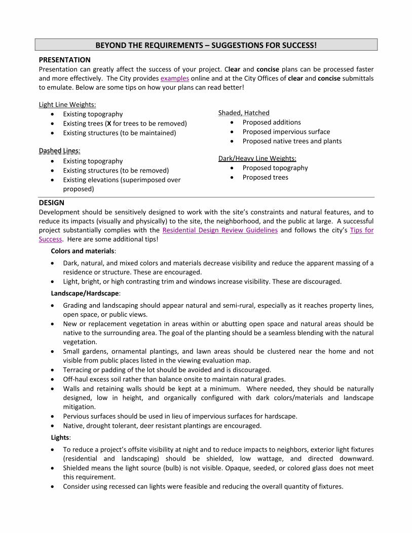
BEYOND THE REQUIREMENTS – SUGGESTIONS FOR SUCCESS!
PRESENTATION Presentation can greatly affect the success of your project. Clear and concise plans can be processed faster and more effectively. The City provides examples online and at the City Offices of clear and concise submittals to emulate. Below are some tips on how your plans can read better! Light Line Weights:
• Existing topography • Existing trees (X for trees to be removed) • Existing structures (to be maintained)
Dashed Lines:
• Existing topography • Existing structures (to be removed) • Existing elevations (superimposed over
proposed)
Shaded, Hatched
• Proposed additions • Proposed impervious surface • Proposed native trees and plants
Dark/Heavy Line Weights:
• Proposed topography • Proposed trees
DESIGN Development should be sensitively designed to work with the site’s constraints and natural features, and to reduce its impacts (visually and physically) to the site, the neighborhood, and the public at large. A successful project substantially complies with the Residential Design Review Guidelines and follows the city’s Tips for Success. Here are some additional tips!
Colors and materials:
• Dark, natural, and mixed colors and materials decrease visibility and reduce the apparent massing of a residence or structure. These are encouraged.
• Light, bright, or high contrasting trim and windows increase visibility. These are discouraged.
Landscape/Hardscape:
• Grading and landscaping should appear natural and semi-rural, especially as it reaches property lines, open space, or public views.
• New or replacement vegetation in areas within or abutting open space and natural areas should be native to the surrounding area. The goal of the planting should be a seamless blending with the natural vegetation.
• Small gardens, ornamental plantings, and lawn areas should be clustered near the home and not visible from public places listed in the viewing evaluation map.
• Terracing or padding of the lot should be avoided and is discouraged. • Off-haul excess soil rather than balance onsite to maintain natural grades. • Walls and retaining walls should be kept at a minimum. Where needed, they should be naturally
designed, low in height, and organically configured with dark colors/materials and landscape mitigation.
• Pervious surfaces should be used in lieu of impervious surfaces for hardscape. • Native, drought tolerant, deer resistant plantings are encouraged.
Lights:
• To reduce a project’s offsite visibility at night and to reduce impacts to neighbors, exterior light fixtures (residential and landscaping) should be shielded, low wattage, and directed downward.
• Shielded means the light source (bulb) is not visible. Opaque, seeded, or colored glass does not meet this requirement.
• Consider using recessed can lights were feasible and reducing the overall quantity of fixtures.

Planning & Building Department 3675 Mt. Diablo Boulevard, Suite 210
Lafayette, CA 94549-1968 Tel. (925) 284-1976
www.lovelafayette.org
STANDARD APPLICATION FORM PROJECT INFORMATION
Project Address / Location Assessor’s Parcel Number (APN) Zoning District Flood Zone
General Plan Designation Parcel Size (sq.ft.) Grading: Cut (cu.yds.) Grading: Fill (cu.yds.)
Existing Gross Floor Area (sq.ft.) Existing Building Footprint (sq.ft.) Existing Impervious Surface (sq.ft.) Existing # Parking Spaces (sq.ft.)
Proposed Gross Floor Area (sq.ft.) Proposed Building Footprint (sq.ft.) Proposed Impervious Surface (sq.ft.) Proposed # Parking Spaces (sq.ft.)
Existing Land Use Single-Family Residential Multi-Family Residential Commercial Office Vacant Other (specify)
Proposed Land Use Single-Family Residential Multi-Family Residential Commercial Office Vacant Other (specify)
APPLICANT INFORMATION OWNER INFORMATION Applicant Name Owner Name
Applicant Address Owner Address
City State Zip City State Zip
Phone ( ) -
Cell ( ) -
Phone ( ) -
Cell ( ) -
Email (for official use only) Email (for official use only)
CHECK ALL APPLICABLE REQUESTS
15-Degree Declination Exception Address Assignment / Change Appeal (App. # _______) Certificate of Compliance Change of Conditions Design Review Family Day Care General Plan Amendment Grading Permit (> 50 cu. yds.) Hillside Development Permit
Land Use Permit Lot Line Revision Major Subdivision / Tract (> 5 lots) Minor Subdivision (4 lots or fewer) Public Art Permit Reasonable Accommodation Reconsideration (App. # _______) Re-Zone Property Ridgeline Setback Exception Right-of-Way Abandonment
Second Unit Permit Senior Housing Permit Sign Permit Study Session Temporary Land Use Permit Tree Removal Permit Variance / Exception Wireless Communications Facilities Permit Zoning Text Amendment Other _____________________
OWNER / AGENT STATEMENT
Property Owner Consent – I am the legal owner of record of the land specified in this application or am authorized and empowered to act as an agent on behalf of the owner of record on all matters relating to this application. I declare that the foregoing is true and correct and accept that false or inaccurate owner authorization may invalidate or delay action on this application. I hereby grant permission to access the property to individuals involved in the processing of the subject application(s). I agree to defend, indemnify and hold harmless the City, its agents, officers, officials, and employees from all claims, demands, lawsuits, writs of mandamus, and other actions or proceedings (collectively “Actions”) brought against the City or its departments, commissions, agents, officers, officials, or employees to challenge, attack seek to modify, set aside, void or annul any City decision made in connection with this application. In the event the City becomes aware of any such Actions, the City shall promptly notify me and shall cooperate fully in the defense. It is expressly agreed that the City shall have the right to approve, which approval shall not be unreasonably withheld, the legal counsel providing the City’s defense, and I shall reimburse City for any attorney’s fees, costs and expenses, including any plaintiff’s or other third party’s attorneys’ fees, costs and expenses, directly and necessarily incurred by the City in the course of the defense.
Print Name Signature Date
Rev. 2021.09.01

This Page Intentionally Left Blank

1 of 4
Planning & Building Department 3675 Mt. Diablo Boulevard, Suite 210
Lafayette, CA 94549 Tel. (925) 284-1976
www.lovelafayette.org
DESIGN REVIEW RESPONSE TO FINDINGS
Project Description - On a separate sheet, please briefly describe the scope of the project you are proposing. Include the reasons for the request and the reasons why you believe the design review permit can be granted. Response to Findings - Repeat and respond to each of the findings listed below which must be made for the hearing body to approve your design. Your responses should address each design element that you are requesting. Print or type using blue or black ink. These findings can be found on the City of Lafayette web site to facilitate copy/paste into word processing software.
In order to approve an application for design review, the approval body must make the findings listed below. On a separate sheet, please copy and respond in writing describing how the project meets with each of the required finding.
§6-275(A) Residential Design Review Findings In granting approval for projects which occur in single-family and multiple-family residential zoning districts as outlined in Section 6-271(A)(1 and 3-6), the hearing authority shall make all the following findings:
(1) The approval of the plan is in the best interest of the public health, safety and general welfare;
(2) General site considerations, including site layout, open space and topography, orientation
and location of buildings, vehicular access, circulation and parking, setbacks, height, walls, fences, public safety and similar elements have been designed to provide a desirable environment for the development;
(3) General architectural considerations, including the character, scale and quality of the
design, the architectural relationship with the site and other buildings, building materials, colors, screening of exterior appurtenances, exterior lighting and signing and similar elements have been incorporated in order to ensure the compatibility of this development with its design concept and the character of adjacent buildings; and

2 of 4
(4) General landscape considerations, including the location, type, size, color, texture and coverage of plant materials, provisions for irrigation, maintenance and protection of landscaped areas and similar elements have been considered to ensure visual relief, to complement buildings and structures and to provide an attractive environment for the enjoyment of the public.
§6-275(B) Single-Family Residential Findings – Exceeding 6,000 Square Feet In addition to the findings required in Section 6-275(A), the hearing authority shall make the following findings for projects which occur in single-family residential zoning districts and exceeds 6,000 square feet in gross floor area as outlined in Section 6-272(A)(3):
(1) The house substantially complies with the Residential Design Guidelines; (2) The house is so designed that its mass will not appear significantly out of scale with the
existing neighborhood; (3) The house does not, because of its size, unduly impact, restrict or block significant views;
and (4) The house does not, because of its size, require removal of natural features, require
excessive grading or cause the unnecessary removal of a healthy tree(s).
§6-275(C) Single-Family Residential Findings – Exceeding 17-Feet in Height In addition to the findings required in Section 6-275(A), the hearing authority shall make the following findings for projects which occur in single-family residential zoning districts and exceeds 17 feet in height as outlined in Section 6-272(A)(4):
(1) The structure substantially complies with the Residential Design Guidelines;
(2) The structure is so designed that it will appear compatible with the scale and style of the existing neighborhood and will not significantly detract from the established character of the neighborhood;
(3) The structure is so designed that it does not appear too tall or massive in relation to surrounding structures or topography when viewed from off-site; and
(4) The structure is so designed that it does not unreasonably reduce the privacy or views of adjacent properties.

3 of 4
6-275(D) Downtown Design Review Findings The hearing authority shall make the following findings for projects which occurs within the four downtown commercial zoning districts as outlined in Section 6-272(A)(2): (1) The project substantially complies with the Downtown Design Guidelines. (2) The site design, including building placement, parking & circulation, landscape, and outdoor
space, enhances the pedestrian experience, embraces and preserves creeks and natural features, promotes connections, creates visual interest, and relates to the character of the surrounding development.
(3) The building design, including height and scale, architectural details, and amenities,
provides diversity in building form, preserves views of surrounding hillsides and ridges as seen from Mt. Diablo Boulevard, creates an inviting environment for pedestrians, and relates to the character of the surrounding development.
(4) The project promotes a character relating to Lafayette that is informal with variations in
architectural styles, massing, setbacks, and upper story step-backs. (5) The project, when adjacent to existing residential dwelling units, is designed to minimize
impacts, including noise, privacy, light and glare.
*New multi-family and multi-family mixed use development must explain how it meets the Downtown Specific Plan Objective Design Standards.
6-275(E) Height Exception Findings In addition to the findings required in Section 6-275(D), the City Council shall make the following findings to grant a building height exception to allow up to 45 feet in height for rare and exceptional projects which occur within the four downtown commercial zoning districts, excluding the Brown Avenue and the Plaza Way character areas. There is no exception to the three-story limit. The City Council will scrutinize the justifications on a project and site specific basis, considering the unique characteristics surrounding the project. Granting a height exception shall not be considered precedent setting. (1) Site opportunities or project necessity:
a) The site has unique circumstances, such as topography, setbacks, or backdrops, that
mitigate the apparent height when viewed from Mt. Diablo Boulevard without compromising the site’s natural features; or
4 of 4
b) The project is rare and exceptional, designed to mitigate the apparent height, and requires a height exception based on compelling reasons, other than solely economics, as to why the project cannot comply with the 35-foot height requirement.
AND
(2) The project provides significant public benefits and amenities over and above nexus-based City requirements.
Additional Comments - Provide any additional comments on a separate sheet
Rev. 2021.09.01

City of Lafayette Planning & Building Department
AGREEMENT TO PAY FOR CITY SERVICES
Complete and submit this form with the development application.
In consideration for the City providing the services described in this Agreement, the undersigned agrees as follows:
1. The City services requested relate to development application number ________________, property in the City of Lafayette
located at ___________________________________, assessor’s parcel number __________________.
2. This Agreement is for services and fees that are in addition to the planning fees paid upon the filing of the referenced development application. I agree to pay for the additional charges imposed by the City for staff time spent processing the application based upon an hourly rate established by resolution of the City Council. These services include but are not limited to City staff time spent for engineering and other City administrative services regarding the application. In addition, I agree to pay for services of consultants retained by the City and required by it in connection with the development application at the hourly rate charged by each consultant to the City. These services include but are not limited to legal, landscaping, traffic engineering and environmental services.
3. The City will bill for the services performed under this Agreement upon a monthly or other periodic basis. If at any time the balance due exceeds $500.00, the City may cease processing the application, prepare a recommendation for taking action on the application and present the application to the appropriate hearing body for final action.
4. The development application account will remain open until it is paid in full. Final payment in full is due as follows:
a. In the case of a subdivision, upon release of the final improvement bond or when conditions of approval are satisfied, which ever is later in time;
b. In the case of all other applications, when the City authorizes Contra Costa County to issue final building inspection clearance or when work for which a permit is issued is completed;
c. If an application is denied, upon expiration of the appeal period or upon a final decision on appeal;
d. If an application is withdrawn, when all remaining staff work on the application is completed;
e. Upon the expiration of 12 consecutive months during which there was no activity on the application.
5. The undersigned is responsible for the payment of the costs and charges involved with the application even though the property or project is sold or assigned to another party. If the undersigned desires to transfer payment responsibility to another, it is the undersigned’s responsibility to have this Agreement replaced by a new agreement with the responsible party. Any outstanding balance must be paid before the City will accept a replacement agreement.
6. The undersigned agrees to advise the City in writing of any change to their billing address and represents that (s)he is the party responsible for payment of the costs or any other obligations incurred under this Agreement.
7. The undersigned agrees to defend, indemnify and hold harmless the City, its agents, officers, officials, and employees from all claims, demands, lawsuits, writs of mandamus, and other actions or proceedings (collectively “Actions”) brought against the City or its departments, commissions, agents, officers, officials, or employees to challenge, attack seek to modify, set aside, void or annul any City decision made in connection with this application or Agreement. In the event the City becomes aware of any such Actions, the City shall promptly notify the undersigned and shall cooperate fully in the defense. It is expressly agreed that the City shall have the right to approve, which approval shall not be unreasonably withheld, the legal counsel providing the City’s defense, and the undersigned shall reimburse City for any attorney’s fees, costs and expenses, including any plaintiff’s or other third party’s attorneys’ fees, costs and expenses, directly and necessarily incurred by the City in the course of the defense.
PRINT NAME: TELEPHONE: MAILING ADDRESS: SIGNATURE: CITY, STATE, ZIP: DATE
L:\Planning\Originals (Documents & Forms)\Revised Agreement for City Services (ACS).docx (2013.07.17)
NOTE: THIS DOCUMENT IS NOT TRANSFERABLE • ORIGINAL TO FINANCE • COPY TO APPLICANT • COPY TO APPLICATION FILE
APPLICATION NO.____________________ FOR OFFICIAL USE ONLY ACCOUNT NO.____________________

This Page Intentionally Left Blank