Embed Size (px)
Citation preview
� The ProjectIndian Railway have embarked upon
this important project of connecting
Udhampur-Quazigund-Srinagar-
Baramulla with the Broad Gauge rail
link Jammu – Kashmir Railway Line.
Under the first phase of the project
implementation, the Kashmir Valley
portion of the project (Quazigund-
Srinagar-Baramulla) has been taken up
and is under final stages of construc-
tion. The Udhampur to Quazigund sec-
tion is the more difficult portion and
has been taken up under the second
phase and is presently in the early
stage of construction. – The 10,960 m
long tunnel through the mighty Pir
Panjal range of the Himalayas is the
longest tunnel and one of the key
structures of the new railway line. It is
located between the proposed railway
stations Banihal in the south and
Quazigund in the north and the gate-
way to the Kashmir valley.
The main tunnel is a single track rail-
way tunnel for operation of passenger
and freight trains and runs almost par-
allel to north – south direction. On the
left side of the track, looking towards
increasing chainage, is a motorable
path of 3 m width which will be used
� Main Tunnel
for emergency and maintenance. This
road is directly accessible from both
portals and the access tunnel. – The tun-
nel is a mountain tunnel with an aver-
age elevation of approximately 1750 m
and a maximal overburden of approxi-
mately 1100 m.
The alignment of the new railway tun-
nel crosses the National Highway No 1,
which is the only road connection
between Banihal and Quazigund. The
crossing is near the south portal of the
existing twin single lane highway tun-
nels which extend in direction from
southwest to northeast. The elevation of
these tunnels is more than 450 m
higher at about 2200 m and their
length is approximately 2500 m.
The vertical alignment of the tunnel has
been designed to suite heavy haul
trains to pass through and at the same
time to facilitate the construction activi-
ties as well.
For an intermediate driving access an
approx. 800 m long access tunnel with
a downward gradient of 10% will be
constructed, intersecting the main tun-
nel at approx. 2.75 km from the south
portal. The access tunnel shall be used
�
�
Alignment
Access Tunnel
I N D I A
to shorten construction period of the
main tunnel. During operation the
access tunnel shall be used for emer-
gency and maintenance entrance and
exit. If required it can be used also for
additional ventilation.
Another intermediate access is pro-
vided by a 55 m deep access shaft and
an approximate 35 m long cross pas-
sage. With a second start of the main
tunnel drive from the cross passage,
driving of the main tunnel towards
south will be independent from the
approx. 600 m long soft ground por-
tion at the north portal and the effect of
delays in this section to the overall pro-
gram.
The tunnel alignment traverses through
the mountainous Pir Panjal Range,
which is part of the young Himayalas.
The Geology of the Pir Panjal moun-
tain range includes a mixture of very
hard and soft to moderatly hard rock
strata (Cambro-Trias). Hard rock types
include andesite / basalt (Panjal Traps),
quartzite, silicified limestone and
agglomerates while the soft to moder-
ately hard rock types include shale,
limestone, agglomeratic shale and tuff.
The portal areas are situated in fluvio-
glacial sediments (soft ground) which
cover at both portals a length of more
than 500 m. The basic tectonic setting
of Pir Panjal range in the area of tunnel
alignment is dominated by a folding
structure leading to different dipping
directions on both sides of the range.
Contacts between rock units are often
faulted. Folding is also common espe-
cially in central areas. Bedding of rock
is striking sub perpendicular to Pir
Panjal tunnel axis. –
Variable water conditions are
�
�
Access Shaft andCross Passage
Geological & Geo-technical Conditions
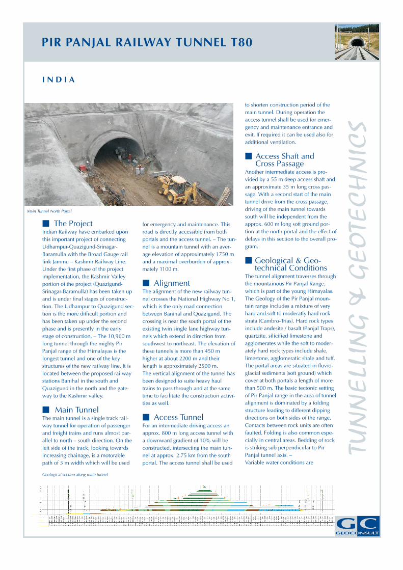
Main Tunnel North Portal
Geological section along main tunnel
PIR PANJAL RAILWAY TUNNEL T80
TUN
NE
LLIN
G&
GE
OTE
CH
NIC
S
�
�
�
�
�
PROJECT:
TYPE OF PROJECT:
LOCATION:
CLIENT:
PARTNER:
TIME OF SERVICES:
PIR PANJAL RAILWAY TUNNEL T80
Railway tunnel
Jammu & Kashmir, India
IRCON International Ltd.
RITES Ltd
2004 – 2011
�
�
�
CONSTRUCTION COSTS:
PROJECT DATA:
approx 100 mill.
Single tracked, one tube;
Length: 10,960 m,
Cross section radius: 4,140 mm;
excavation cross section: 70 m ,
Access tunnel: approx. 800 m
Access shaft: 50 m deep;
Cross passage; NATM
. €
2
Geoconsult’s Services�
�
�
�
Geological-geotechnical services
during preliminary, tender & de-
tailed design and construction phase
Tender design
Detailed design
Construction supervision
expected. Joint aquifer, which will pro-
vide continuous water inflow to the tun-
nel is expected in the hard rock types
and with minor amount in the shale.
High water inflow is expected in the
fault zones, of which some could be
mapped and are predictable. Extreme
water inflow may occur in karstic lime
stone on northern side of the tunnel
where cavities could not be predicted
and water encounter could be at any
place. Particular problems are expected
for the shale section at the highest over-
burden of 1100 m were heavily squeez-
ing rock and large deformations might
occur.
In accordance with NATM design two
separate tunnel linings will be installed
� Tunnel Cross Section
(primary or outer lining and secondary
or inner lining). Thickness and layout of
the outer and the inner lining depend
on the geotechnical conditions. As such
the dimensions of the theoretical exca-
vation section are developed from the
minimum clearance of the tunnel cross
section, the dimensions of the primary
and secondary lining and the space
requirements for drainage and E&M
installation. – Enlargements are pro-
vided for five electrical niches for
medium voltage substations, mainte-
nance niches at every 250 m and trol-
ley refuge niches at every 100 m.
The geotechnical design uses a rock
classification system of the Austrian
Standard. The result is the development
of a rock mass model (geo-technical
masterplan): Step 1: Determination of
Rock Mass Types; Step 2: Establishment
of the Rock Mass Behavior Types; Step
3: Excavation sequence and support is
determined and described in different
Rock Class Types; Step 4: Based on the
results of steps 1 – 3 the alignment is
divided into sections with similar exca-
vation and support requirements and
the respective rock class is allocated.
The estimated distribution provides the
basis for the cost and time estimate.
As per contract requirement a “semi-
dry” tunnel shall be designed where
local wet patches and dripping of water
can be accepted.
The drainage system includes two side
drainage pipes which can be omitted at
dry tunnel sections, and a main collec-
tor, which runs all along the tunnel.
Seepage water collected in the side
drainage pipes and surface water from
spill off or from dripping seepage water
�
�
Geotechnical Design
Tunnel Drainage &Waterproofing
or similar and collected throughout the
tunnel in shallow ditches, will be con-
veyed at regular distance to the main
collector. Where required an areal
waterproofing system is installed
between the primary (outer) and sec-
ondary lining (inner) in the tunnel roof
and the tunnel sidewalls. This will be
the case where water ingress over large
areas occurs e.g. at karst sections and
heavily faulted and/or thinly bedded
rock sections with seepage water. In
addition continuous water proofing will
be installed along the soft ground sec-
tions at the tunnel portals.
All tunnel construction will be carried
out in accordance with the principles of
the New Austrian Tunnelling Method
(NATM) using a cyclic sequence of exca-
vation with subsequent installation of a
primary support (outer lining) followed
by the delayed installation of a second-
ary lining (inner lining).
Tunnel excavation will generally be car-
ried out by means of drill & blast or by
road header. For the soft ground sec-
tions at both portals (total length approx.
1 km), tunnel excavators or hydraulic
breakers will be used. A subdivision of
the tunnel cross-section into top head-
ing and bench will be used in unfavour-
able geotechnical conditions. Along the
soft ground sections at the portals as
well as in tunnel sections of unfavour-
able geotechnical conditions, an invert
� Construction Method
50 km
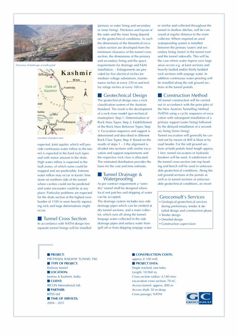
Overview of landscape at south portal
Location of project area