Embed Size (px)
Citation preview

13
Produced by Donald R. Privett, Ph.D.- P.G.
Environmental and Engineering Geologist
Lower Catawba River Valley of Southern Chester and Lancaster Counties,
S.C. - Geology - Archeology and History
Part 3.
7/26/05 DRP ver. 77/26/05 DRP ver. 7

23
Rock Jointing
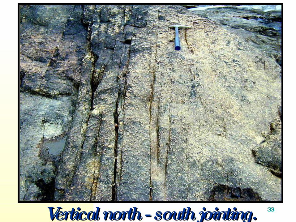
33Vertical north - south jointing.Vertical north - south jointing.
43
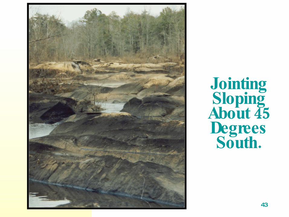
Jointing Sloping
45 About Degrees
.South

53
Unusual jointing.
63
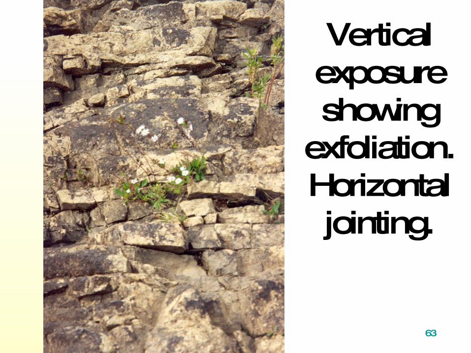
Vertical exposure showing
exfoliation.Horizontal jointing.

73
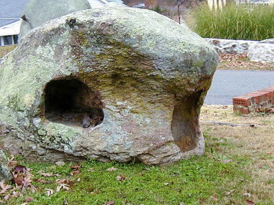
Other interesting features.

83
cavernous weathering
93

103
Large thin exfoliation granite slab moved by flood waters.

Same SlabLaterBroken by an Ignorant.Person

123
Archeology
North Americans - projectile points and pottery.

133
.Native AmericanArtifacts
Points picked up at the surface.

143
More Points.
153
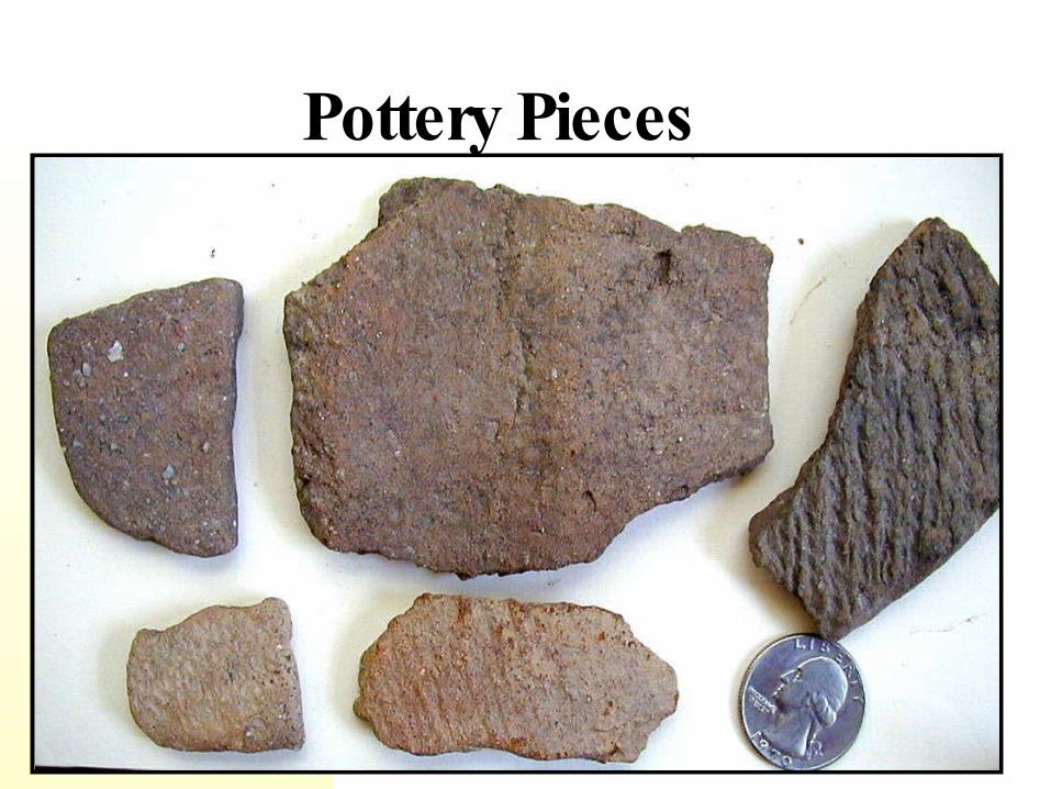
Pottery Pieces

163
?Petroglyph

173
.More RecentHistory
Arsenal and armory
Canal
Dams

183
1825 mapshowing
Catawba River natural
flownear Great.Falls

193
Duke Power drawing for area circa Duke Power drawing for area circa 1912.1912.

203
A tradition grew up around Rocky Mount that Dearborn Island had once been considered as site for establishment of a national military academy, perhaps even the military academy, tradition has become slightly exaggerated, but it is by no means groundless.

213
7/20/2005 633
President Madison's annual message toCongress in December 1815 speciallyrecommended an enlargement of the
existing Military Academy at West Point and"the establishment of others in other
sections of the country. Richardson (comp.), Messages and Papers
of the Presidents, 1, 566. Wade, p.332

223
1816 ABillWas Debated January
forthe ProposedLocation at
MountDearborn a Bill inDifficulties Fromthe Start

233
1/6/2005 643
sentiment grew to limit the addition to one
academy, a vote passed with 91 votes. The House had 182 members, giving rise tothe legend that Mount Dearborn waseliminated by one vote, but in fact only 126members were voting. from Wade. p. 332
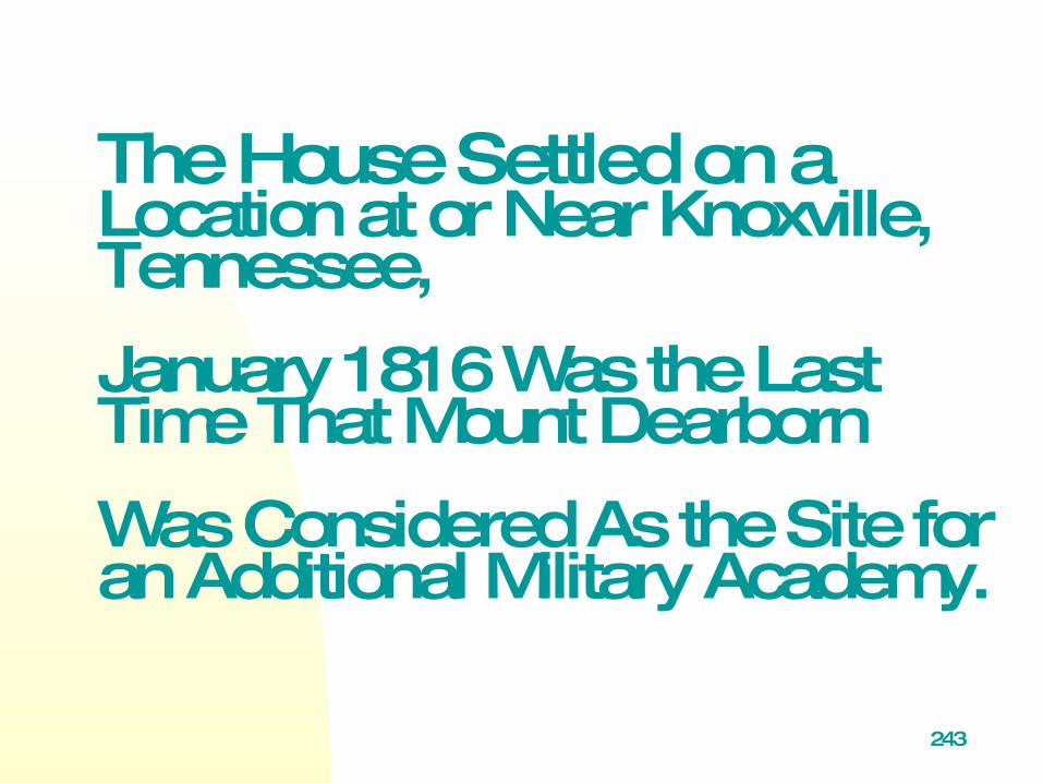
243
The House Settled on a Location at or Near Knoxville, Tennessee,
January 1816 Was the Last Time That Mount Dearborn
Was Considered As the Site for an Additional Military Academy.
253
9 /28 /20 0 46 53
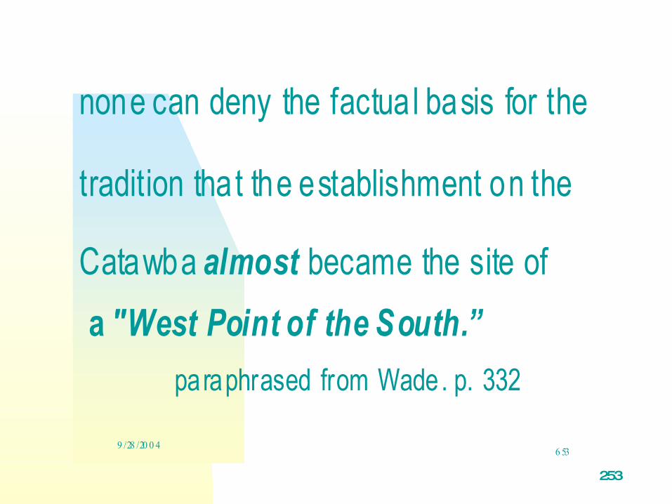
none can deny the factua l basis for the
tradition that the establishment on the
Catawba almost became the site of
a "West Point of the South.”
paraphrased from Wade. p. 332

263
273
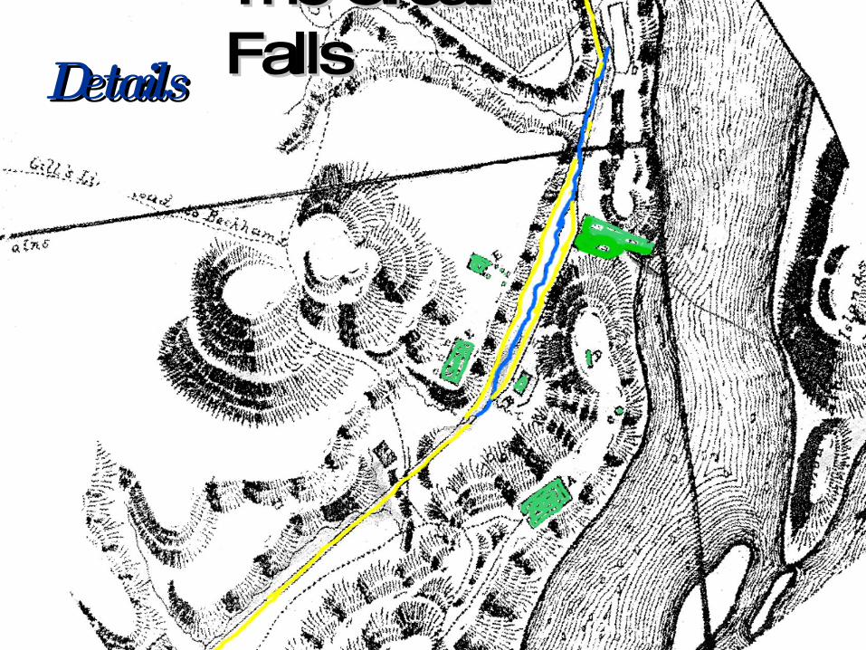
The Great The Great FallsFallsDetailsDetails

283
Arsenal at Fort Dearborn

293

303
Canal ruins onDearborn Island
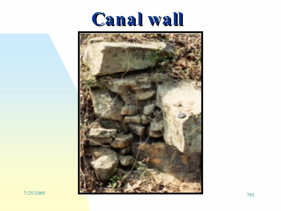
3137/25/2 005 783
Canal wall Canal wall
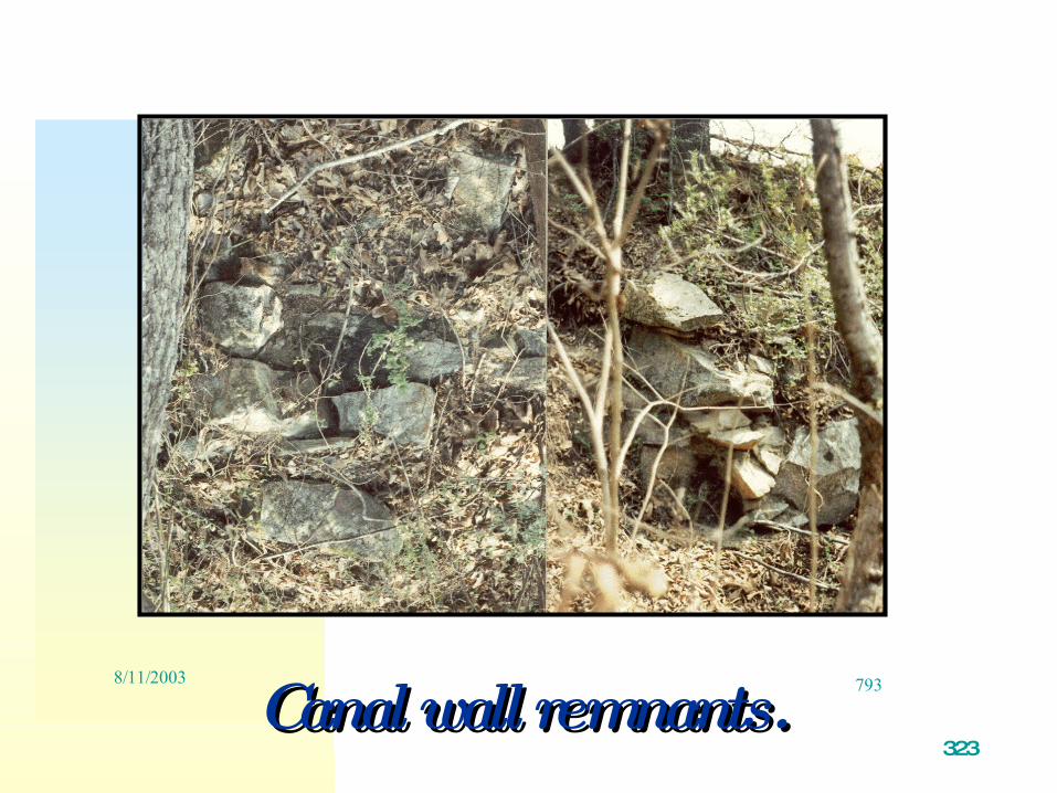
323
8/11/2003 793Canal wall remnants.Canal wall remnants.

333
.Canal Ruins on South End ofDearborn Island

343
Keystone for canal keepers house

353
.LockKeeperHouse

363

House moved to and reconstructed at
Landsford Canal State Park.

383
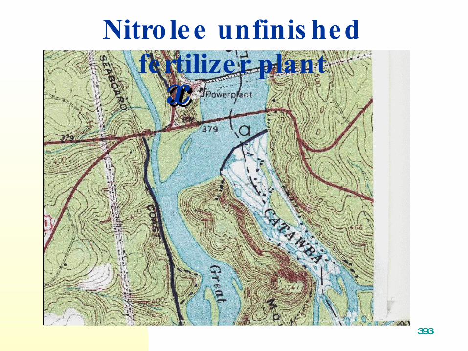
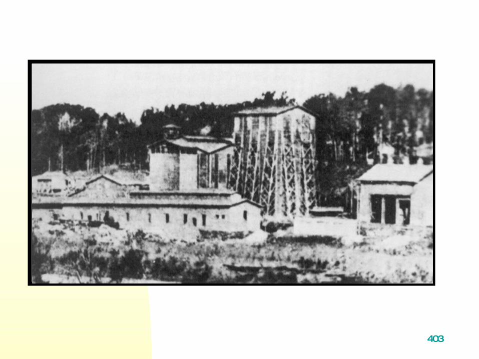
Nitrolee - an unfinished
fertilizer plant.
393
8/11/2003 813
Topographic map of areaarea. Nitrolee unfinis hed fertilizer plant
xx
403

413
Nitrolee
Main arc, building
transformers .in roof

423
8/6/2003843
433
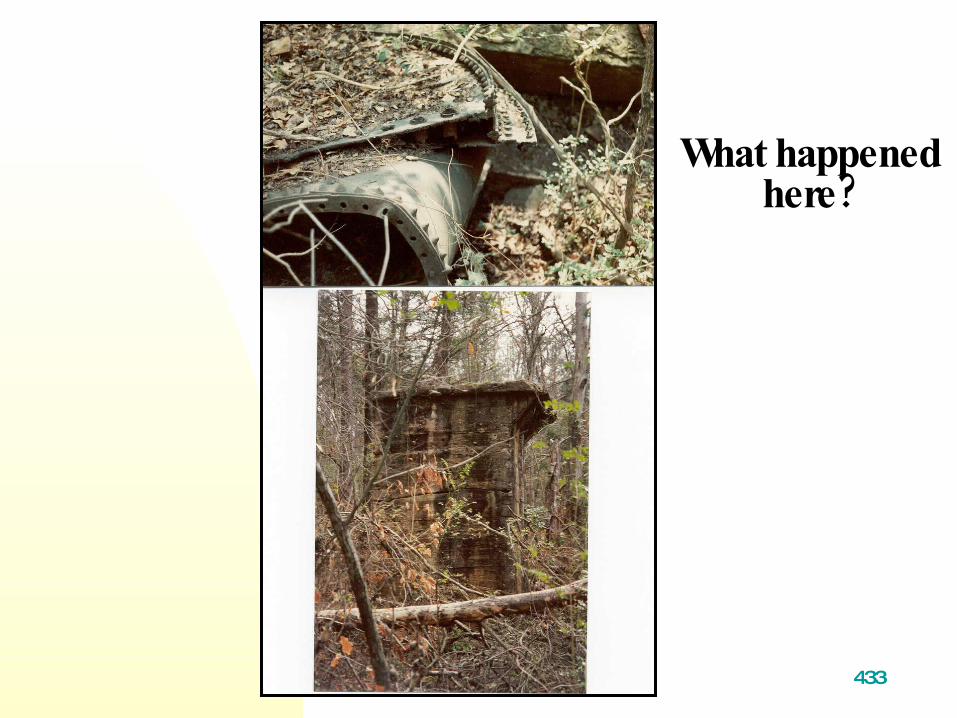
What happened?here

443
Dams
1900’ In the early s duke power ( ) company then southern power built
three dams and five powerplants along , this area of the river they left
- construction artifacts fill orborrow, pits quarry and reservoirexcavations .and alterations

453
Dam Construction
. Relict Crane.?Support
463
9/2/2005 873
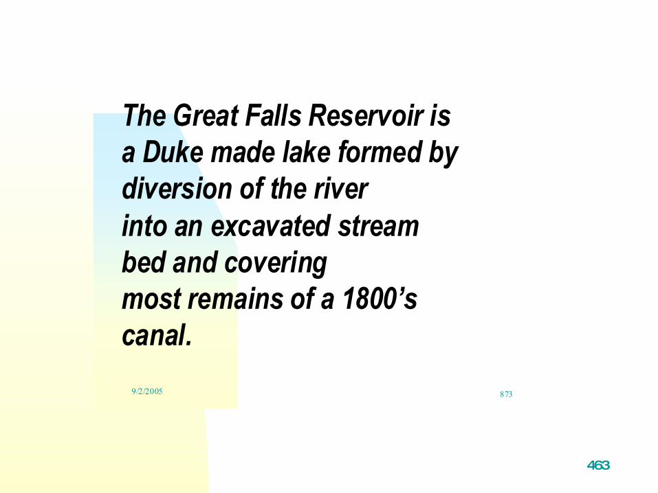
The Great Falls Reservoir isa Duke made lake formed bydiversion of the riverinto an excavated streambed and coveringmost remains of a 1800’scanal.

473
8/6/2003883
CreekCreekbed thatbed thatwill bewill be
the Greatthe GreatFallsFalls
ReservoirReservoir

483
Construction Construction artifact. artifact.
CableCablegrooving of grooving of
granite.granite.

493
1/15/2004 923
SkipSkippan?pan?

503
Overgrown quarry. Stone excavated for
dam along old railroad grade.?

513
Flood

523
12/7/2003 963
The Flood of 1916 BroughtThe Flood of 1916 BroughtEntire Pieces of Rail andEntire Pieces of Rail and
Deposited Them on the RocksDeposited Them on the Rocks

533
.Afterheavy rain the spillway floods

543
Apopulation ofCatawba lilies were present in riverbed of
.Nitrolee diversion

553
Hiking TrailsHiking Trails

563
ProposedProposedtrail along trail along old railroad old railroad grade grade (black line).(black line).

573
Large tors Large tors along the along the trail are trail are nice for nice for quite quite
contemplaticontemplationon
or a picnic.or a picnic.

583
The area in and around The area in and around Great Falls is Great Falls is
economically depressed. economically depressed. Closing of three textile Closing of three textile mills in the 1970’s was mills in the 1970’s was
an economic death an economic death warrant. warrant.
Population continues to Population continues to decline and poverty is decline and poverty is
wide spread. wide spread.
593
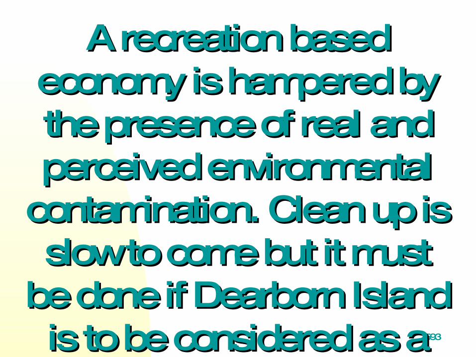
A recreation based A recreation based economy is hampered by economy is hampered by the presence of real and the presence of real and perceived environmental perceived environmental
contamination. Clean up is contamination. Clean up is slow to come but it must slow to come but it must
be done if Dearborn Island be done if Dearborn Island is to be considered as a is to be considered as a possible State park. possible State park.

603
. .2.Brownfields Will Be Eradicated BackNo

613
Number 2 BrownfieldNumber 2 Brownfield

623
7/25/2005 1063
, .2, Spill of dies e l o il at No , .2, Spill of dies e l o il at No environmental environmental
management by county management by county s hould have dis covered s hould have dis covered . problem before acc ident . problem before acc ident

633

643
The beginning -- a The beginning -- a rebirth of downtown.rebirth of downtown.

653 DowntownGreat Falls

663
7/23/2005 1083
News treets
.cape
673
Appendices
1. Geologic Time Scale
2. .Geologic map of area

683
693
7/25/2005 133
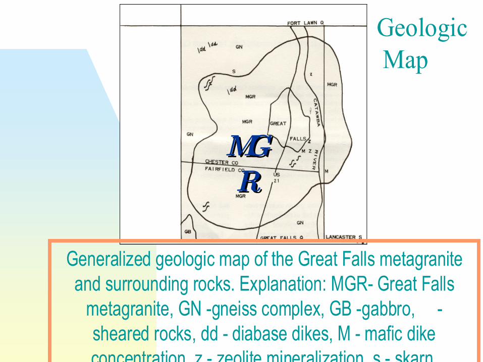
Generalized geologic map of the Great Falls metagraniteand surrounding rocks. Explanation: MGR- Great Falls
metagranite, GN -gneiss complex, GB -gabbro, -sheared rocks, dd - diabase dikes, M - mafic dikeconcentration, z - zeolite mineralization, s - skarn.
Privett, 1984
Geologic Map
MGMGRR

7037/26/2005 1113
Acknowledgements Acknowledgements
Duke Enegry map from online site.Chris Ey, DTA, a consultant to Duke Power, provided the profile graphic and aerial photographs.
ReferencesLinton, D. L., 1955, The problem of tors. Geograph. Jour., v. 121, 470.Lossing, B., 1850, Pictoral Field Book of the Revolution V.2. Privett, D. R., 2005, Geomorphic Features in the Catawba River, Great Falls, Southeastern Chester and Southwestern Lancaster Counties, South Carolina:, in press, South Carolina Geology, v. 48 , p. Privett, D. R.,1997, Catawba River Bed Geology, Near Great Falls Southeastern Chester and Lancaster Counties, South Carolina: Abstracts with program; Southeast G.S.A. v. 29, no.3, p.63-64.Privett, D. R., 1998, Tor Fields in the Great Falls Metagranite And their Influence On The Catawba River Sub-Grade, Chester County, South Carolina: Abstracts with program; Southeast G.S.A .v. 30, no.4, p.55.Privett,D.R., 1985, The Great Falls metagranite, north central S.C.: South Carolina Geology, v. 28, p. 1 -5.Thomas, M. F., 1965, Some aspects of the geomorphology of domes and tors in Nigeria: Zeit. Geomorph., NF 9, 63-81.Wade, A.P., 1977, Mount Dearborn: The National Armory at Rocky Mount, SC, 1802 - 1829, Wade, A.P., 1977, Mount Dearborn: The National Armory at Rocky Mount, SC, 1802 - 1829, South Carolina Historical Magazine v.78 , p. 207 - 225 and 316 -341.South Carolina Historical Magazine v.78 , p. 207 - 225 and 316 -341.


![Part 3 Handout Applications of DemProj...Slides Slide Content . Slide Captions Part 3: Applications of DemProj ... 12 . Part 3 Handout: Applications of DemProj [Image of computer screen]](https://img.dokumen.tips/doc/110x75/611a5f7f39d82901eb0ad0f4/part-3-handout-applications-of-demproj-slides-slide-content-slide-captions.jpg)


![CAN Part 3 of 3[1]](https://img.dokumen.tips/doc/110x75/5571ff7349795991699d4349/can-part-3-of-31.jpg)