Embed Size (px)
DESCRIPTION
Presentation based on San Anard, San Niklaw and Tal-Bidni Rural Lanscape proposal prepared by members of NIFS - National Independent Forum for Sustainability.
Citation preview
San Anard, San Niklaw and Tal-Bidni Rural Landscape Area
A Framework proposal for the rehabilitation and improvement
of the area
National Independent Forum for SustainabilityJune 2015


Contents
• NIFS: A History of the Proposal• Principles• Planning Policy• Site Description• Desirable Uses• Scope of the Proposal• Proposal Framework• Financing• Summary

National Independent Forum for Sustainability (NIFS): A History of the Proposal
• This proposal for a San Anard, San Niklaw and Bidni Rural Landscape area has been compiled by volunteers from various fields of life during the past few months.
• The prompt was a response to the proposal of the Privatisation Unit to develop the area between Ta’ Barkat in Xgħajra and Żonqor in Marsaskala: the first step was reported to be the construction of 3 hotels and a lido linked by a road, to be followed by high-end bungalows and villas from the hilltop down to the coast. This proposal was reported in the media during November 2014.
• The team behind the San Anard, San Niklaw and Bidni Rural Landscape Area proposal took additional food for thought from the proceedings of a civil society initiative “Forum on a Vision for the South” that took place within Global College Malta of Smart City, Kalkara in March 2015.
• In April 2015 Government proposed the construction of a 90 tumoli University Campus by developers from Jordan. Concurrently Government proposed a 450 tumoli natural park from Żonqor Point in Marsaskala to Ta’ Barkat area in Xgħajra. The combined area proposed is less than that scheduled for a park area by the 2006 Local Plan for the South-East.
• Within the above mentioned scenarios the team continued to work on a proposal for the San Anard, San Niklaw and Bidni Rural Landscape Area; this is larger in size than the park area scheduled by the 2006 Local Plan for the South-East, to maintain the congruity of the areas.

Contributors• Veronica Barbara - Archeology, Heritage • Jason Bonnici – Family Doctor • Charlot Cassar - Finance • George Cassar - Tourism • John Paul Cauchi - Environmental Health • Michela Fenech - Law • Reuben Grima - Archeology and History • Edwin Lanfranco - Botany • Mark Mifsud - Environmental Education • Edward Said - Architecture and Conservation • Mark Anthony Sammut - Accessibility • Rio Sammut - Marine biology, fishing • Giorgio Schembri - Accessibility, Architecture, Sustainability • Marie-Louise Schembri - Sustainable Development • Joerg Sicot - Graphics and Design • Anna Spiteri - Environmental conservation • Jos Willemsen - Fringe farming and ecological farming • Anna Zammit - Sociology

Principles• Every present and future citizen has an inalienable right to the enjoyment
of his or her cultural heritage, stemming from the Universal Declaration of Human Rights
• Our natural and built environment shapes our health and wellbeing• The area between Xgħajra, Żonqor and Bidni shall continue to be
recognized and protected as an Area of High Landscape Value, for public enjoyment
• There is an extraordinarily high density of existing urban development in Malta, while unbuilt areas of countryside are a dwindling and non-renewable resource.
• Visual integrity of the landscape is an important asset for our quality of life, and that of our visitors
• Historic military buildings present an extraordinary opportunity to create a distinctive and authentic visitor experience
• The economic models applied must be carefully designed to guarantee the delicate balance and synergy between the sustainable enjoyment of this cultural resource, and the enjoyment of the surrounding landscape.
Planning Policy
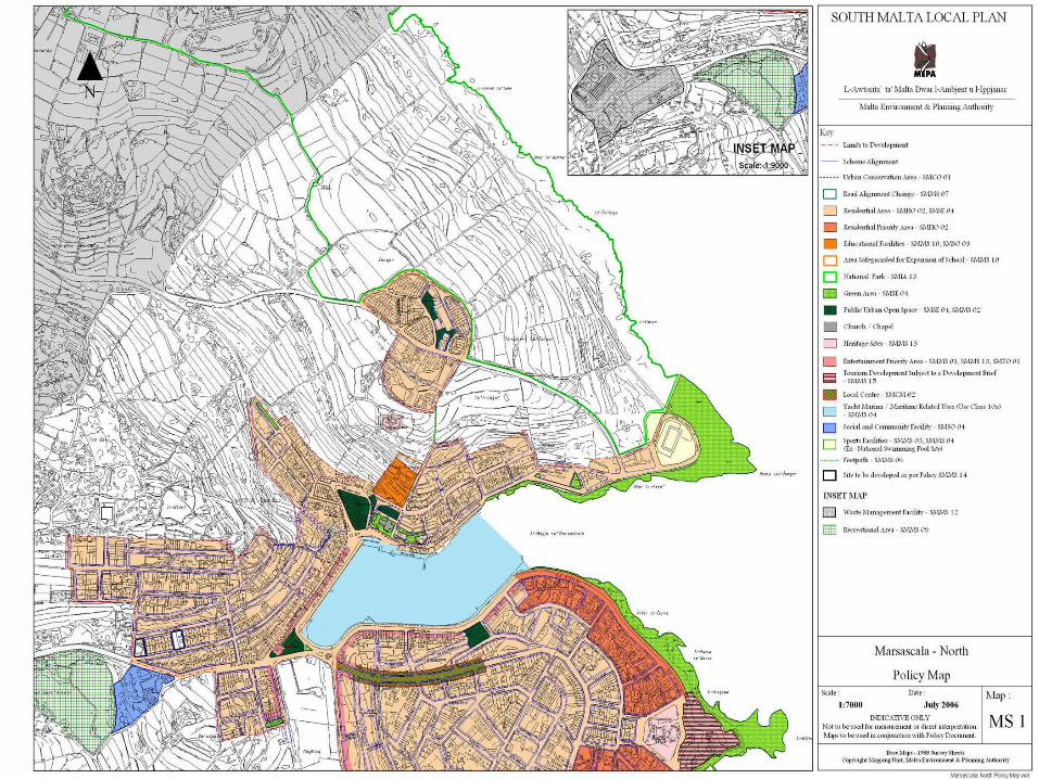
1. South Malta Local Plan
“This local plan designates the area known as L-Għassa tal-Munxar (Marsascala) and the coastal stretch between Il-Ponta taz-Zonqor (Marsascala) and Blata l-Bajda (Xgħajra), as indicated in Policy Maps MS1, MS2, XA1 and ZA1, as National Parks primarily for informal recreation (e.g. walking, cycling) and the appreciation of the ecological, geological, archaeological as well as cultural-historical features of these areas” (SMIA 13 National Parks, South Malta Local Plan, 2006, MEPA)

1. South Malta Local Plan
The South Malta Local Plan emphasizes that the Management Plan for each of the areas should include the following:a. A land-use survey of the areas;b. Identification of permitted uses;c. Visitor management facilities, including interpretation provisions;d. Any environmental improvements required” (SMIA 13 National Parks, South Malta Local Plan, 2006, MEPA)
SMIA 13 National parks “The Management Plan for each area is important since it will provide the basis for the setting up of the national parks and identifies the permitted activities and developments. A number of features require immediate attention e.g. Ducluseaux Battery….” (SMIA 13 National Parks, South Malta Local Plan, 2006, MEPA)
Planning Policy
2. Rural Policy Design Guidance, 2014
Policy 1.2F: Protected Species and their habitats- Does not permit proposals which would "damage and/or disturb directly or indirectly any protected species of wild flora or fauna, and any habitat of protected species of wild flora or fauna, whether man-made or natural."
2. Rural Policy Design Guidance, 2014
Policy 1.2G: Protected Areas, Special Areas of Conservation and Special Protected Areas
- Does not permit "proposed developments which would have an unacceptable adverse environment, landscape, cultural or archeological impact".
Policy 1.2H: Protection of Landscape Features- Does not permit "proposals which would have an adverse impact on landscape features, including their integrity or character, unless the adverse impact is avoided or mitigated". Through this policy the Authority seeks "to conserve, maintain and enhance important landscape features that contribute to the connectivity, appearance and/or integrity of protected areas, sites and/or features, and the character, scenic or ecological value of the rural area"- Landscape features mentioned in the policy, amongst others, include rubble walls and terracing following the natural contour of the site, which are present throughout the site.

Approximate area outlined for the purposes of this proposal. Note Żonqor Housing Estate (Red), Fort Saint Leonard (deep blue), Delle Grazie Batteria (light
blue), Dar tal-Barunessa (green)
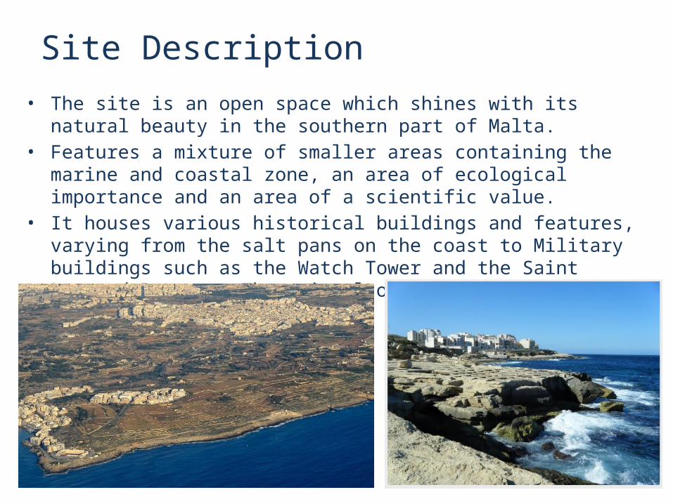
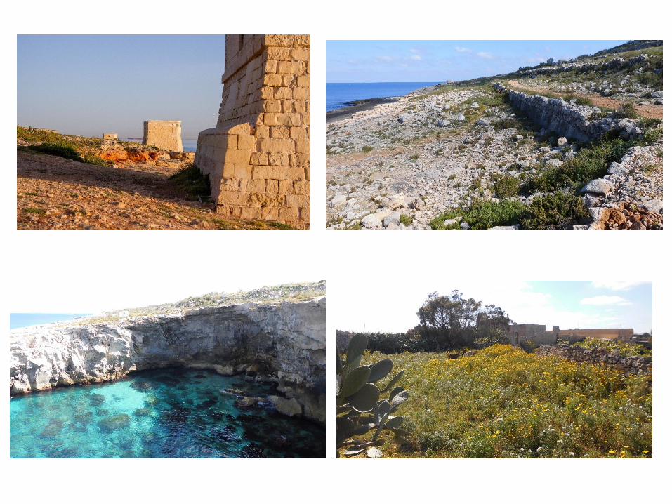
Site Description• The site is an open space which shines with its natural beauty in the southern
part of Malta.• Features a mixture of smaller areas containing the marine and coastal zone,
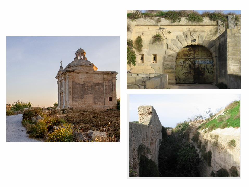
an area of ecological importance and an area of a scientific value.• It houses various historical buildings and features, varying from the salt pans
on the coast to Military buildings such as the Watch Tower and the Saint Leonard Battery. There is also a concrete Military defence post.

Site Description
• The area between Marsaskala and Xgħajra is a zone where its strategic location demands attention to its natural environment.
• Enhancement and the regeneration of this particular spot should be focused on an environmentally friendly approach such that any activity done over there should not create any tension on the natural environment and the community living in Marsascala and Xgħajra.
• This location has the potential to attract a new niche of visitors if the appreciation of its natural beauty is promoted, preserved and rehabilitated as need be. This could be a sustainable alternative of new wealth creation in the area.

Site Inspection• The following characteristics were identified:– Historical Value sites– Cultural Value sites– Agricultural Value– Marine Ecology – Coastal Ecology– Archeological Value sites
Existing Opportunities• Agriculture and Farmland Area• Coastal Towers and Entrenchment Lines• Coast Artillery Forts• Anti-Aircraft Defences• Wartime Beach Defences and Reserve Lines• id-Dar tal-Barunessa (Il-Kunvent ta’ San Leonardu)• Site of the San Leonardo P. F. Station• Wayside Shrine of 3 Crosses (Triq il-Bidni, Marsaskala)• Kappella tal-Madonna tad-Dawl (Triq il-Bidni, Marsaskala)• Kappella ta’ Sant’Antnin ta’ Padova (Triq il-Wied, Marsaskala) – Under
Marsaskala Parish • Kappella ta’ San Nikola (Marsaskala) – Under Żabbar Parish• Possible Roman Feature – Cistern? • Dolmen and megalithic remains at Xgħara tal-Bidni, Marsaskala • Circular field called iċ-Ċirku, Triq il-Bidni, Zabbar • The Maritime Fringe between Żonqor Point and Xgħajra• Area from Swali Caves to reef• Salt Pans


Desirable Uses• Agritourism • Marine Reserve • Diving Tourism• The Swali Caves • Community Archaeology Projects • Military and historical re-enactments • Fishing Museum • Salt industry • Conferencing Potential • Premises of Co-operatives • An Intercultural Centre • Niche Culinary Restaurant • Religious Tourism • Organ and Choir concerts • Sports and exercise area • Boutique Hotel

1
Vehicular roadsVehicular pathwaysFoot pathsHistoric landmarksSaint Leonard Battery
Military Defence
De Redin Watch Tower
Saint Leonard Chapel
Junction improvement
Junction improvement

Scope• Create a holistic management and conservation MASTERPLAN for the Site
and its immediate surroundings;
Junction improvement
Landmarks
Access for all
Vehicular junction improvement

Scope• To conserve the historical buildings and their cultural features, the
archaeological, ecological, hydrological, coastal, marine, and scientific zones and their surrounding environment;
• To mitigate any potential conservation threats to the site;• To improve the earning model for the farming community.

Soft Surfaces – Gravel lanes, dirt tracks and wooden platforms
ScopeAccessibility

Use of: water courses, water culverts and French drains
ScopeAccessibility

• To present an organized, pleasant and sustainable experience to visitors throughout the site.
Before After
Scope

• To present an organized, pleasant and sustainable experience to visitors throughout the site.
Before After
Scope

• To facilitate circulation for both pedestrian and vehicular movement outside the site; and
• To facilitate visitor circulation within the site.
Before After
Scope

• To highlight and improve the landscape value of the area
Before After
Scope

• To remove and/or mitigate past interventions which have a negative impact on the setting.
Before After
Scope

• To preserve the 100m coastal set-back for the public;
• To serve as an educational and recreational platform.
Marine and Coastal Ecology
Scope
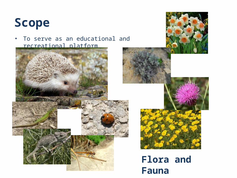
• To serve as an educational and recreational platform
Flora and Fauna
Scope
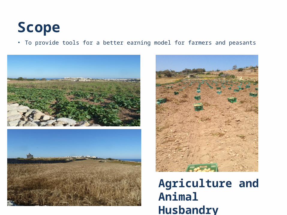
• To provide tools for a better earning model for farmers and peasants
Agriculture and Animal Husbandry
Scope

• To serve as an educational platform for residents and visitors.
History and Culture
Scope

Proposal FrameworkAims:• Rehabilitation of all the zones which fall under
the Marsascala/ Xgħajra Area;• Inclusion of accessibility for all and
enhancement/rehabilitation of the existing footpaths and pathways;
• Enhancement of all the agricultural activities, historical landmarks, ecological areas and scientific zones;
• Integration of all the different zones;• Provide the Island with an sustainable alternative
tourist attraction in the south.

Studies required• Ecological assessment• Geological assessment • Hydrological assessment• Agricultural assessment • Archaeological assessment• Cultural and Historical assessment • Marine ecological assessment
Consultation with stakeholders• Governmental Agencies, Departments and Ministries • Local Councils• Non-Governmental Organisations (NGOs)• Political Parties • Farmers• Residents of Marsascala, Xgħajra, Żabbar, Żejtun and other areas in
the vicinities• Other potential stakeholders
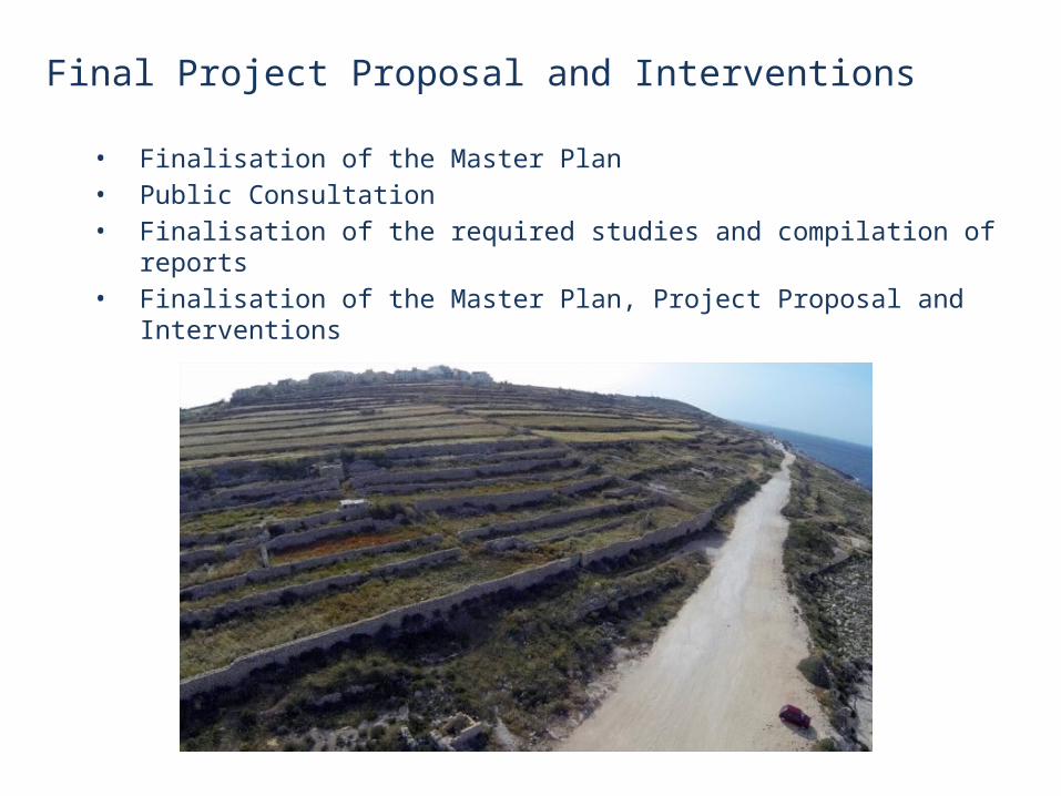
Final Project Proposal and Interventions
• Finalisation of the Master Plan• Public Consultation• Finalisation of the required studies and compilation of reports• Finalisation of the Master Plan, Project Proposal and Interventions
Financing
• The proposal identified the current EU Funds programming period as an ideal timeframe for this project.
• The new Structural Fund Programming has directed funds to areas of enhancing the island’s natural and cultural hertage as well as sustainable urban development.
• The project could be considered under both Priority Axis 5 and 6 since the rehabilitation of the Marsaskala – Xgħajra area will both rehabilitate an area of natural heritage as well as help improve sustainable urban development in the south of the island.
41

Financing (cont.)
• Priority axis 5 directs funding to projects that revalorize natural heritage with the intent of creating a tourism attraction and which ultimately enhances the tourism product.
• This project will add value to tourists that come during the low season, hence enhancing tourism seasonality.
42

Financing (cont.)
• Priority Axis 6 aims to develop and enhance the urban fabric of the Island, giving particular focus to the south of Malta.
• The rehabilitation and revalorization of the Marsaskala – Xgħajra area will enhance the quality of life for the citizens living in Marsaskala and Xgħajra, and also those living in the surrounding localities.
43
Summary• NIFS is putting forward this document for consultation on the San Anard,
San Niklaw and Bidni Rural Landscape Area as a basis for discussion and consensus-building among stakeholders, and to share their views and their vision with planners and policy-makers.
• There is an extraordinarily high density of existing urban development in Malta, while un-built areas of countryside are fast decreasing.
• NIFS therefore considers that the area of southeast Malta between Xgħajra, Żonqor and Bidni should continue to be recognised and protected as an Area of High Landscape Value, and safeguarded as a National Park, consolidating and expanding on the protective designations in the South Malta Local Plan, both for its intrinsic value and also for the enjoyment of the surrounding communities and their visitors.
• NIFS recognises that the hard-working farmers with their fields and farmland are an asset to the area and to the country and while fully respecting that, proposes to take the opportunity to have a far better earning model for them.
• Building development in and around the area of the proposed park should be contained within existing Development Zone Boundaries, which should not be extended.